Sometime next year, three residential streets in Arlington without sidewalks could get upgrades to allow for safer pedestrian and cyclist use.

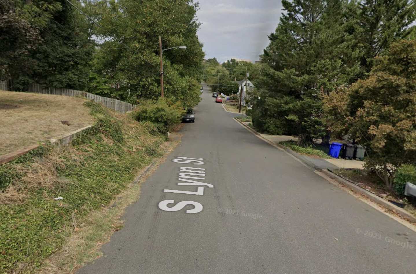
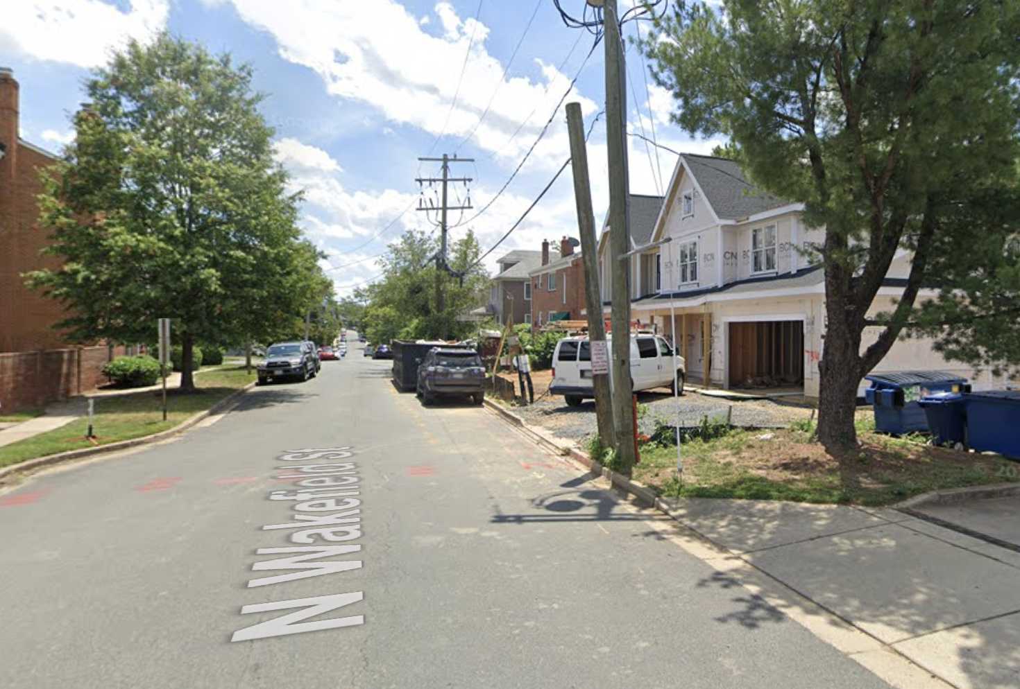
To help address demonstrated safety and access issues on S. Lynn Street, N. Wakefield Street and 12th Street S., Arlington County’s Neighborhood Complete Streets Program is considering piloting “shared streets.”

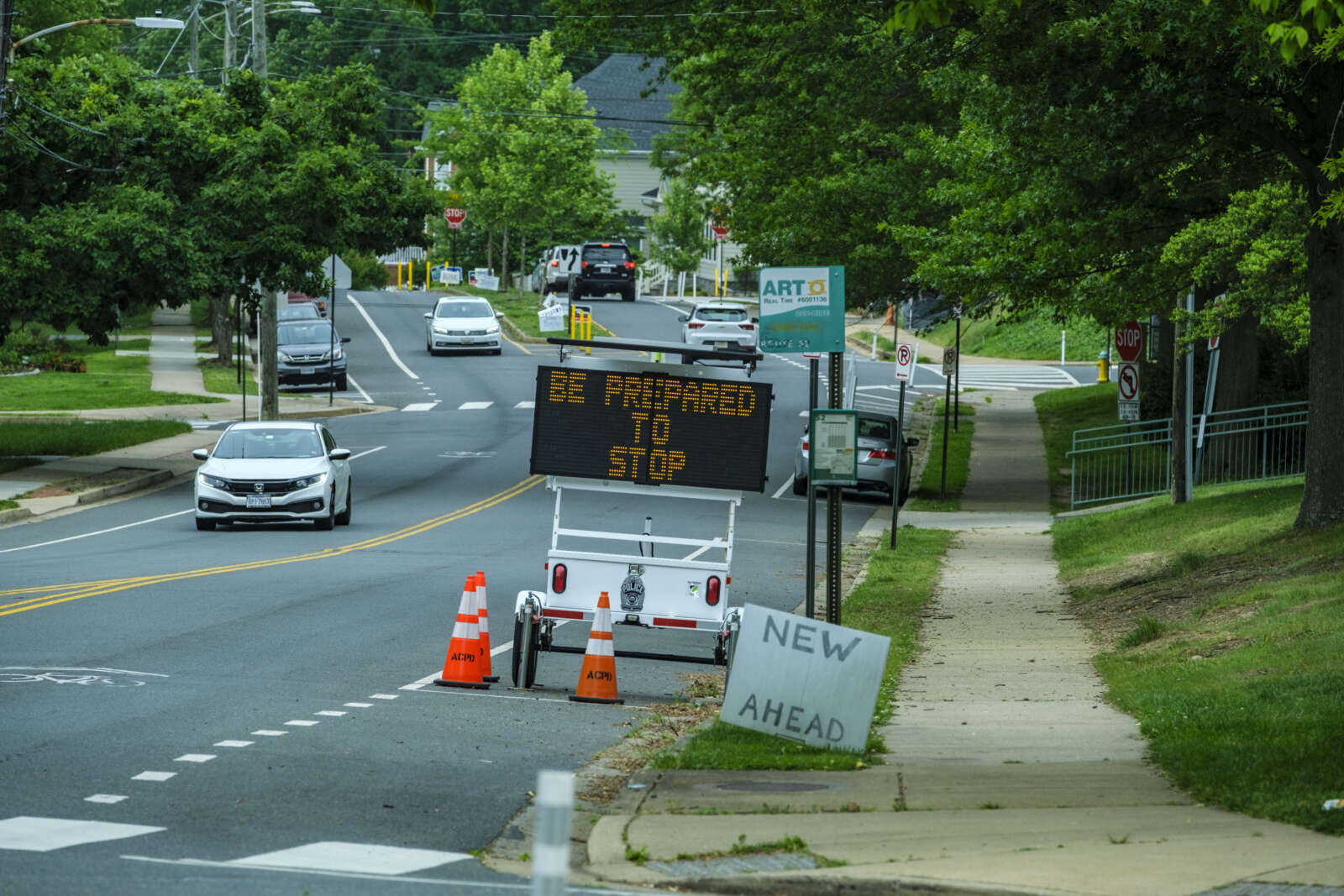
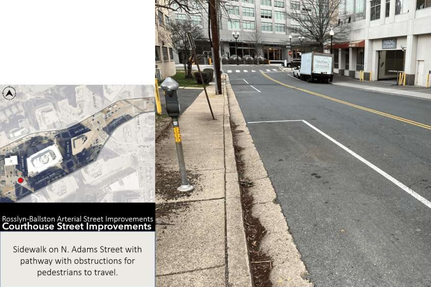
On these streets, the county would slow down traffic and give cyclists and pedestrians more space through signs, barriers and other features, rather than building a sidewalk.

County staff picked these streets because they have incomplete sidewalks and characteristics “that make adding a sidewalk prohibitively difficult,” says Neighborhood Complete Streets Program Manager Michelle Stafford.

These characteristics include limited public right-of-way, difficult terrain and high parking demand. The streets also ranked above other streets nominated for the pilot program because of their crash histories as well as their proximity to schools, commercial corridors and transit.

“People currently drive, bike and walk in the street in these locations, but we can add features to the street to make that shared street conditions safer and more comfortable for all,” Stafford said in a recent presentation.

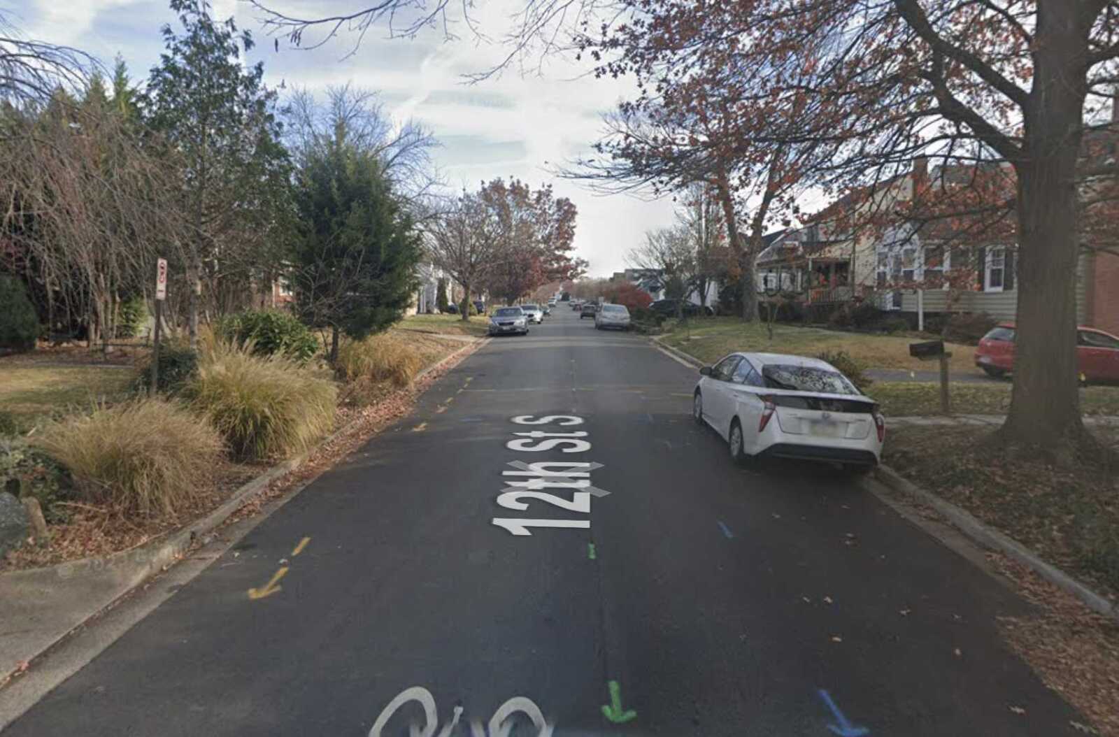
The identified streets in the Arlington Ridge, Douglas Park and Bluemont neighborhoods, and the challenges they pose for adding sidewalks, are as follows:

Shared streets can surmount these challenges, according to pilot project manager Brian Shelton.

“Shared streets can meet the desires of adjacent residents and function foremost as a public space for recreation, socializing and leisure,” Shelton said. “Many streets in Arlington already function as a shared street, however, we are missing some of the treatments which would enhance pedestrian comfort on these roadways.”

Shelton said staff have looked at recommended shared street tools from the National Association of City Transportation Officials, or NATCO, and opted to pursue a handful of strategies that make use of temporary materials and do not require significant construction.

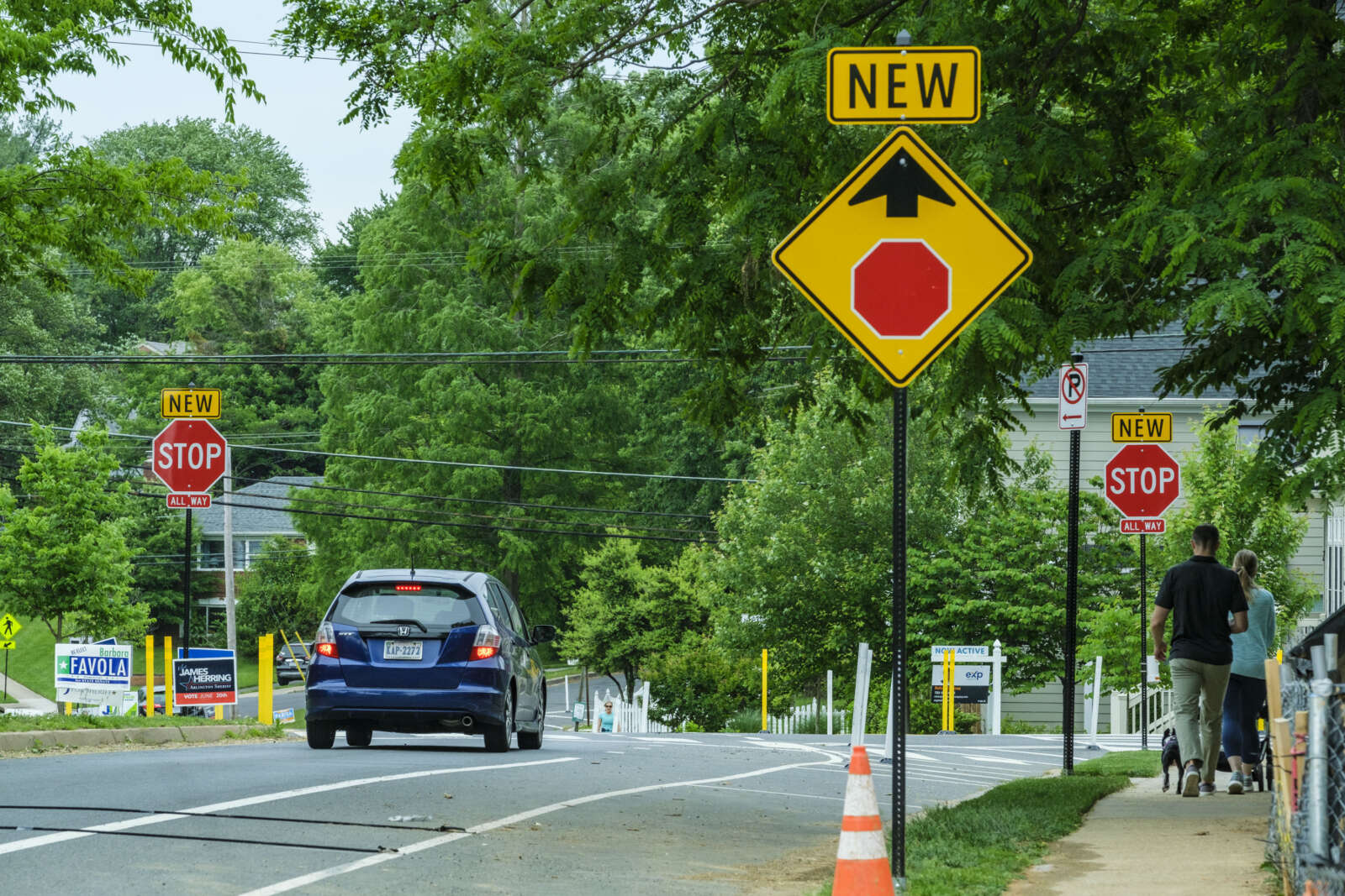
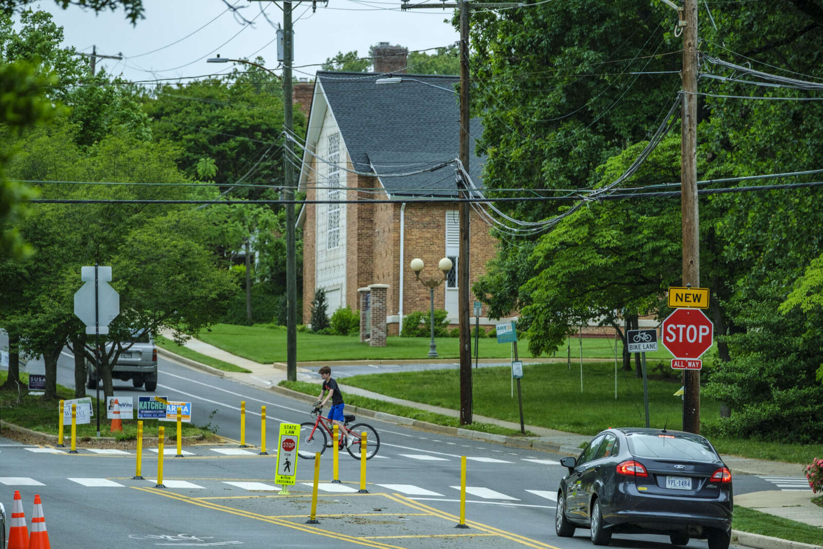
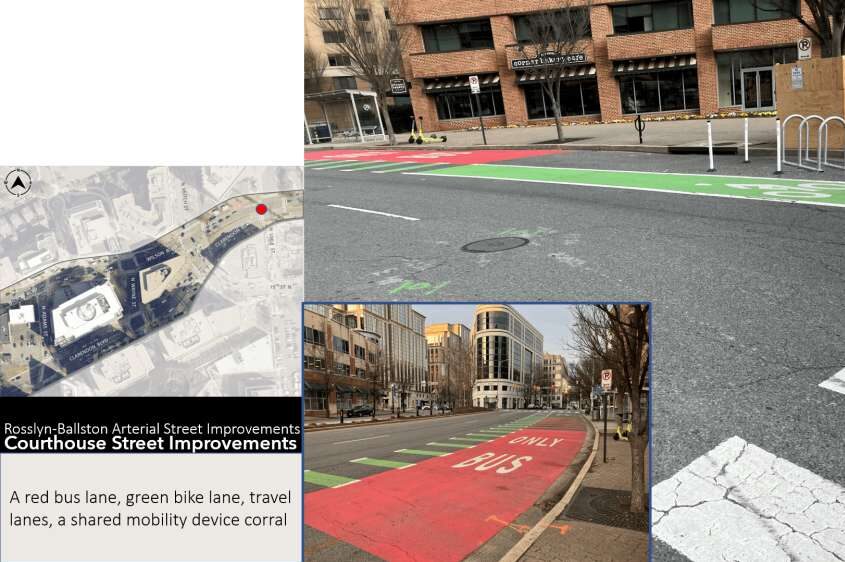
These include midblock treatment options, such as chicanes — which narrow the road such that drivers are forced to slow down — and street entrance changes, including curb extensions.

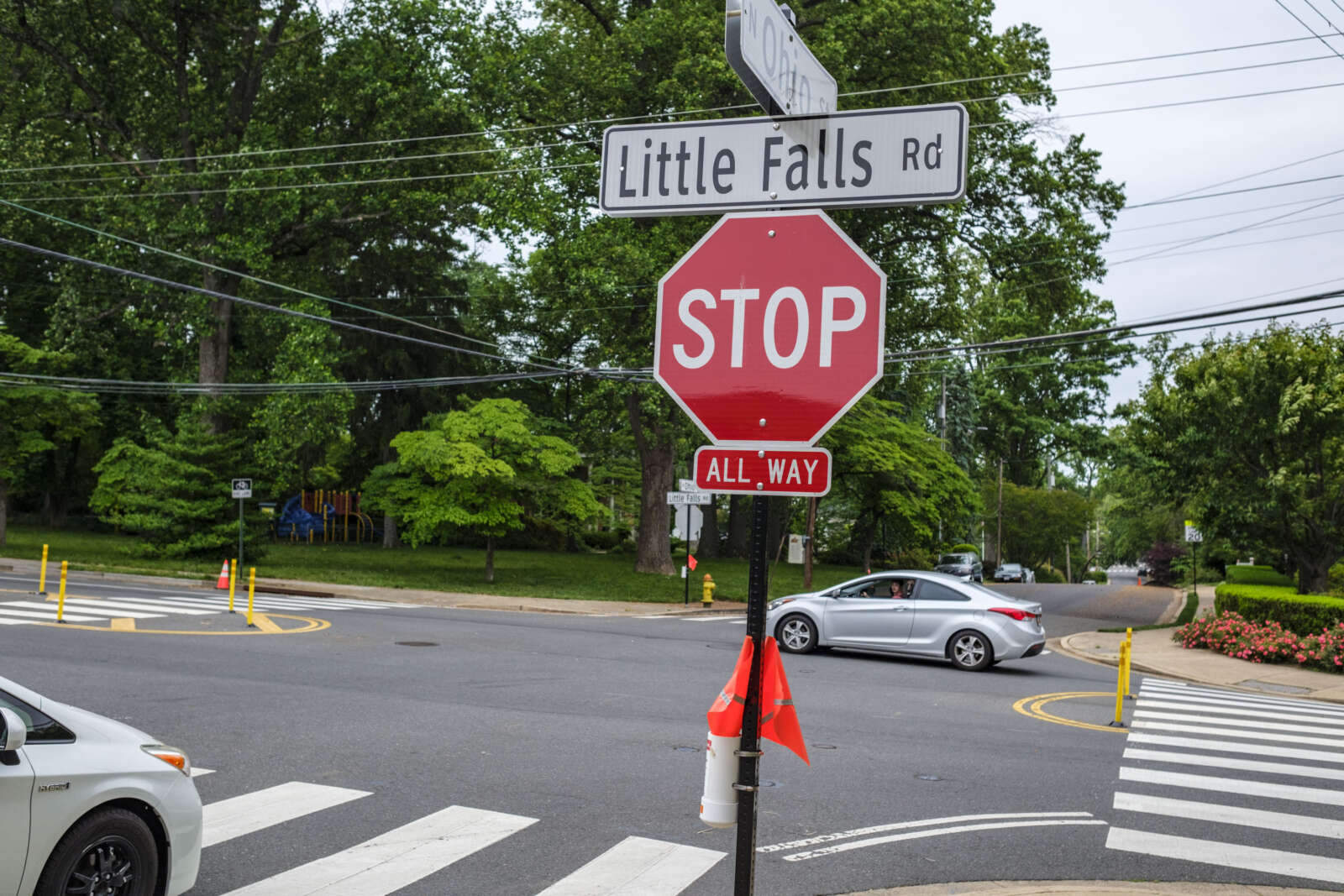
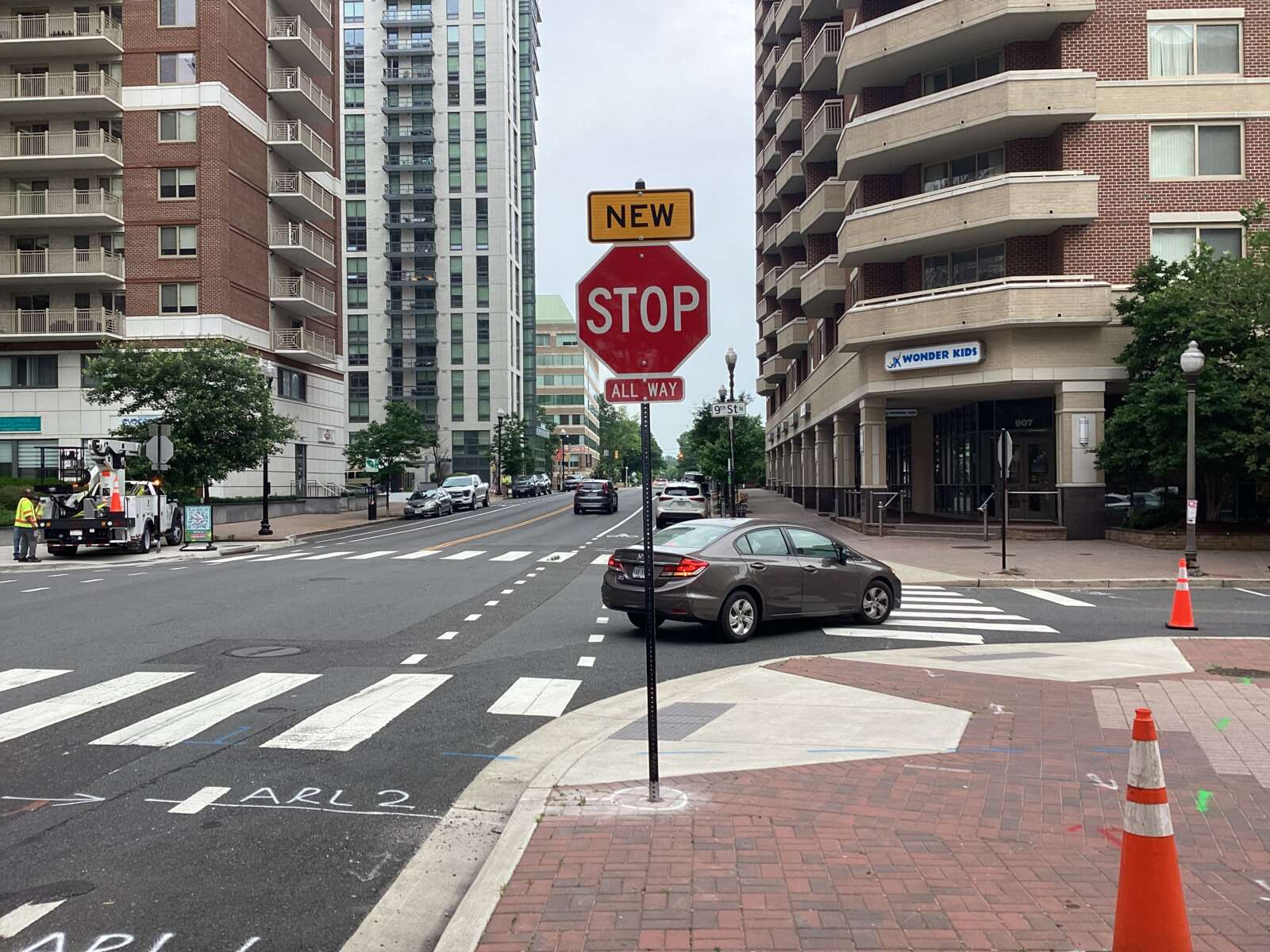
Entrances to shared streets also typically have advisory signs and pavement markings to “eliminate the confusion of how the street is intended to be used,” Shelton said.

This fall, the county solicited feedback from residents on how the projects might change how they feel travelling these roads. This input will be used to refine designs, which are set to be finalized for funding hearings in early spring of next year.

Later this coming spring, the county expects to start implementing these shared streets. County staff will monitor these streets to ensure each corridor is functioning as intended, per the county website.


Bluemont Junction Trail (staff photo by Jay Westcott)

This weekend, the Arlington County Board is set to consider a proposal to funnel nearly $400,000 into the second phase of the Bluemont Junction Trail safety project.

Phase 2 includes moving and updating three trail connectors to be accessible to people with disabilities and improving cyclist and pedestrian intersections between the W&OD Trail and the Four Mile Run Trail on both sides of Wilson Blvd, per a county report.

The plan also calls for resurfacing a 480-foot segment of Four Mile Run Trail and repairing a nearby pedestrian bridge.

The project is part of a multi-year county effort to address poor visibility between trail users and drivers along the Bluemont Junction Trail, which crosses the Bluemont neighborhood and connects Ballston to the W&OD Trail at Bluemont Park. Plans were developed by the county with input from the public and the Bluemont Civic Association, the Bicycle Advisory Committee and the Pedestrian Advisory Committee

In the project’s first phase, which spanned the fall of 2021 to last summer, the county and the Virginia Dept. of Transportation made upgrades to roughly 4,500 linear feet and 13 connector trails, the report said. This included reconfiguring the trail’s intersections with N. Emerson Street and N. Kensington Street.

The second phase, however, demands more “in-depth engineering” than the milling and repaving carried out in the first phase, the report said.

Rep. Don Beyer has earmarked $325,000 in federal funds for the second phase of the project, which has an estimated total cost of $711,662.

The community will have an opportunity to provide input on the designs and proposed improvements if the funds are allocated, a county staff report notes.


A runner uses a rapid flashing beacon to cross N. Park Drive (staff photo)

The Arlington County Board is set to update the rules of the road to align with a new state law aimed at improving pedestrian safety.

This weekend, the Board is set to enact changes to local ordinances requiring drivers to stop for pedestrians in crosswalks. These changes were advertised this summer.

Currently, county code only requires drivers to yield to those crossing the street on foot, according to a county report. This conflicts with state code, which was amended this March to require drivers to “stop for” pedestrians.

In addition to being consistent with state law, the proposed changes support Arlington’s Vision Zero effort to eliminate traffic deaths and serious injuries by 2030, the report says.

“Pedestrians are one of our most vulnerable road users because their bodies are not surrounded with a metal frame and airbags,” the report says. “This law encourages drivers to look for, be aware of, and stop for pedestrians to help get to Arlington’s goal of Vision Zero transportation deaths or serious injuries by 2030.”

The report notes that, from 2018-2022, a third of all severe or fatal crashes in Arlington County involved a pedestrian.

A county data dashboard shows there were 82 pedestrian crashes in those years, spread fairly evenly over those years and located all throughout the county. The number of fatal pedestrian crashes reached a high of four in 2019.

Serious and fatal pedestrian crashes versus overall serious and fatal crashes, between 2018 and 2022 (via Arlington County)

Any driver who does not stop is guilty of a traffic infraction and can face a $100-$500 fine, according to the new law.

The county intends to notify residents of the change via a press release, emails and social media posts, per the report.

There will also be new signage, the Dept. of Environmental Services previously told ARLnow.


Plans to build the future pedestrian bridge from Crystal City to National Airport are firming up.

A new report outlines the impact the bridge could have on the environment. It also details how the project will relate to separate plans to redo roadways and add more parking, new car rental facility and office space.

The environmental assessment says the impact on scenic views for drivers on the GW Parkway, as well as vegetation removal, is expected to be relatively minimal. Up to 146 trees could be removed for construction and the area would later be replanted.

Now through Oct. 3, community members can comment online on the report, Arlington Dept. of Environmental Services spokeswoman Erin Potter tells ARLnow. They can also attend a public hearing on Sept. 19 at the Aurora Hills Recreation Center (735 18th Street S.).

Even with the pedestrian bridge, the Metropolitan Washington Airports Authority (MWAA), which governs DCA and Dulles International Airport, says it does not project reduced vehicle traffic to and from the airport. As such, it is designing significant upgrades for drivers.

“The overall number of passengers and employees shifting to the multi-modal access would not have a notable effect on the forecast traffic demand on the Airport roadway network or the demand for on-Airport passenger and employee parking,” a report for the MWAA project says.

While MWAA is not leading the bridge project, it did have input on where the pedestrian bridge could go, the report says. It notes that where the bridge goes and what angle it is at will not alter the project’s environmental impacts.

MWAA asked Arlington County and the Virginia Dept. of Transportation to move the bridge to reduce impacts on existing parking and accommodate a proposed elevated ramp west of the West Entrance Road, the report says.

“Arlington County and the CC2DCA project team have been working closely with MWAA staff to coordinate delivery of the safety and access improvements provided by both projects,” says Potter.

Construction on the CC2DCA bridge is expected to begin construction in late 2027 and last for two years, Potter said. Since MWAA is still finalizing a timeline for its road improvements, VDOT and Arlington are blocking off an area where the bridge could go and deciding on a final alignment later.

The new report describes how the preferred option marries two other alternatives: one that crossed the GW Parkway and Mount Vernon Trail at a significant angle and another that provided a straight shot. The new renderings also show that, of the two Mount Vernon Trail link options, a more curved path was chosen.

CC2DCA pedestrian bridge alternatives (by ARLnow)

As planning efforts continue for projects at DCA, the surrounding area is set to see changes, too.

An airport access road is set to be removed to make way for a redevelopment project proposed by JBG Smith. Near the Crystal City-side of the bridge, a second entrance to the Crystal City Metro station and a new Virginia Railway Express station and Amtrak platform are being built.

Meanwhile, the Mount Vernon Trail is set to be widened to 11 feet, a planned Crystal City bicycle network could be completed next year and the bus rapid transit network will be extended to Pentagon City.


Portion of S. Irving Street set for sidewalk improvements (via Google Maps)

The pedestrian experience is set to improve in nearly a dozen spots across the county.

The Arlington County Board this weekend is expected to approve two projects for accessibility improvements, along the Rosslyn-Ballston corridor and in three residential neighborhoods.

The Metro corridor contract, for up to nearly $1.4 million, is the second phase of an existing effort to bring the streetscape up to Americans with Disabilities Act standards. The planned improvements include “new sidewalks, curb and gutter, curb extensions, handicap accessible ramps, storm sewer pipes and inlets, paving, pavement markings and signage.”

From a county staff report:

The Rosslyn – Ballston Corridor ADA Improvements Project – Phase 2 sites are located along the Rosslyn – Ballston Corridor. This project reconstructs multiple intersections within the Rosslyn-Ballston Corridor where existing sidewalks, curb ramps or street intersections do not comply with standards of the ADA.

The project undertakes redesign and construction in batches with the highest priority problem areas reconstructed to achieve ADA compliance. The project incorporates a “second set” of improvements previously designated under P14D. It spans multiple neighborhoods, including Buckingham, Ballston-Virginia Square, Clarendon, Courthouse, Rosslyn.

The other project is part of another ongoing effort, the county’s Neighborhood Complete Streets (NCS) program.

It would bring improvements to three residential neighborhoods, including curb extensions to resolve several blocks of sidewalk obstructed by decorative streetlights.

From a staff report, the project would:

Construct one block of missing sidewalk on 14th Street North from North McKinley Road to North Ohio Street, in the Highland Park Overlee Knolls neighborhood;

Construct two improved intersections, with updated curb ramps and reduction of pedestrian crossing distances, on 8th Road South in the Arlington Mill neighborhood;

Construct eight curb extensions to relocate existing Carlyle Streetlights currently obstructing the sidewalk and provide an accessible path along three blocks of existing sidewalk on South Irving Street, in the Arlington Heights neighborhood

“The Neighborhood Complete Streets program was approved by the Arlington County Board at its January 2016 meeting,” says the report. “The program was intended as a replacement to and evolution of the prior Neighborhood Traffic Calming (NTC) program, which built approximately 175 projects designed to slow vehicle speed. The NCS program was designed to holistically address inadequacies in the complete streets paradigm, outlined in the Master Transportation Plan.”

“A complete street is one that provides facilities for pedestrians, cyclists, transit riders and motorists to each move comfortably and safely through the community,” the report notes. “Project requests were to be solicited from community members, prioritized based on objective data, and selected with consultation and oversight from the [Neighborhood Complete Streets Commission], following a public engagement period.”

Photo via Google Maps


A runner uses a rapid flashing beacon to cross N. Park Drive (staff photo)

In a bid to increase pedestrian safety, Arlington County may require drivers stay stopped for longer at crosswalks.

The Arlington County Board is set to consider on Saturday changing its code so that drivers will have to stop when a pedestrian enters an adjacent travel lane and heads their way. Currently, drivers need only yield right of way when a pedestrian enters their lane.

The change follows on a revision to state law that went into effect on July 1. The local change is another way Arlington aims to eliminate serious and fatal crashes — particularly for pedestrians, who made up one-third of serious or fatal crashes between 2018 and 2022.

“Pedestrians are one of our most vulnerable road users because their bodies are not surrounded with a metal frame and airbags,” a county report said. “It is critical for drivers to look for, be aware of, and stop for pedestrians to help get to Arlington’s goal of Vision Zero transportation deaths or serious injuries by 2030.”

In Arlington, the change would apply to local and state roads, says Dept. of Environmental Services spokeswoman Katie O’Brien. This includes major arterials that see the county’s highest concentration of serious crashes, such as Arlington, Langston and Washington boulevards and Glebe Road.

The county says the intent of its ordinance change is to reflect wording changes in state law.

This March, the state put a finer point on what drivers are required to do when they see a pedestrian looking to cross.

Before, drivers were required to “yield right-of-way to pedestrians by stopping” when pedestrians are crossing in front of the drivers.

Now, state code says drivers “shall stop” when a pedestrian is within the driver’s lane or within an adjacent lane and approaching the driver’s lane. Drivers are required to stay stopped until the pedestrian has passed their lane.

Any driver who does not stop is guilty of a traffic infraction and can face a $100-$500 fine, according to the new law.

Staff intends to inform the public of the new law via a press release, emails, and social media posts on NextDoor, Twitter and Facebook, per the report.

O’Brien says new signage will be also added.

“We are working on plans to make signage and marking changes to be in compliance with the new code,” she said.

The law also lets localities require pedestrians and cyclists to stop before crossing a highway at crosswalks without signals or face a fine of up to $100.


Redevelopment plans for a Holiday Inn and office building in Ballston are headed to the Arlington County Board for approval.

The developers, Hoffman & Associates and Snell Properties, intend to replace the hotel (4600 Fairfax Drive) and Arlington Center Building (4610 Fairfax Drive) with a seven-story, 432-unit apartment building and two five-story, 15-unit buildings.

The development duo also propose building a new private road and alley for parking and loading activity, as well as new sidewalks and streetscapes along them.

The site is located west of N. Glebe Road, along N. Fairfax Drive, just before it becomes an on- and off-ramp to I-66. It is five blocks from the Ballston Metro station and two blocks from a proposed western entrance, currently in an early design phase.

“This site has a lot of surface parking, structured parking, an office building, the Holiday Inn, and a disconnected relationship to our neighbors to the south,” Cathy Puskar, a land use attorney for the developers, told the Planning Commission last week. “It’s been here quite a long time… so we are very eager to move forward with that.”

Hoffman and Snell have cleared nearly every step in the public review process. On Saturday, the Arlington County Board is set to review their request for easements in order to build on the site.

Much has changed since the initial submission more than a year ago.

“This project went through a substantial evolution as we went through the [Site Plan Review Committee] process,” Arlington County planner Adam Watson said during the Planning Commission meeting.

In response to public feedback, the layout changed and a bicycle and pedestrian path was widened to 12 feet and moved.

The 5-story buildings are now to the west of the 7-story building, rather than to its south. Watson says this creates a better height transition from the tall George Washington University building at 950 N. Glebe Road to the single-family homes west of the 4600 Fairfax Drive site.

Now, the proposed path separates the 7-story and 5-story buildings. Watson says this furthers county plans to add a “West Ballston Connection” linking with the Bluemont Junction, Custis and Ballston Pond trails at Fairfax Drive.

The evolution of the site layout for 4600 Fairfax Drive, by Jo DeVoe (via Arlington County)

Watson said the project now delivers “a much improved streetscape, especially along Fairfax Drive” and less impervious surface area. It preserves more trees to increase the buffer between the development and the single-family homes nearby, he said.

“We really loved that first version… but we are very proud of where we are today,” Puskar said. “Despite some painful cuts and changes, we listened, and this is why we have such a good plan in front of you today.”

While the developers directed the bulk of residential traffix to Fairfax Drive — as opposed to the smaller private road south of the site, to allay concerns about traffic flow — some residents still have misgivings, Planning Commissioner Jim Lantelme said.

Climate Change, Energy and Environment Commission representative Mark Greenwood praised the project’s use of electricity rather than gas, but suggested the developers replace the gas stoves with induction ones, while adding more parking for electric vehicles.


Arlington County is working on a replacement for the two bridges over Lubber Run destroyed in severe flash flooding four years ago.

The Arlington County Board is set to discuss a $360,000 construction contract for a new pedestrian bridge at its meeting this weekend.

Flash flooding in 2019 washed away six pedestrian bridges in Arlington, including two in Lubber Run Park and four in Glencarlyn Park. The overall damage to county property was estimated at $6 million at the time.

On Saturday, the Board will consider approving the new bridge in Lubber Run, in place of the two that were destroyed. The contract — of about $329,000 with a $33,000 contingency — is expected to go to Fairfax-based Bright Masonry.

A lower bidder — by just over $30,000 — was “deemed nonresponsive” by county staff, according to a report to the Board.

The project’s goal is to “design one new bridge in the most suitable location for enhancing accessibility around the park,” the staff report said.

One of the bridges in Glencarlyn Park that was washed away was replaced in February of last year.

The proposed construction for Lubber Run involves building one new bridge in the southwest portion of the park to replace the previous two, as explained in the county’s project webpage.

“Through our community engagement and engineers’ analysis, we have found that this location will provide a significant, positive impact on park users and supports the community’s interest,” the webpage noted.

For parkgoers, the proposed bridge will provide access from Lubber Run to Edison Park, staff said. The bridge would also provide a connection between the southwest portion of the park and its east side.

Construction is estimated by staff to take around 12 months and seeks to minimize environmental harm.

“One tree, with exposed roots on the bank, will need to be removed. It already has a very low chance of survival due to its current condition,” the project webpage said. “We will plant healthy trees in the same general areas, which will better support our tree canopy in the long term.”


Arlington County has converted two intersections near Nottingham Elementary to four-way stops, in the wake of last year’s fatal crash on Little Falls Road.

In October, a driver struck and killed a woman at the intersection of Little Falls and John Marshall Drive. She was the third pedestrian killed along a two-block stretch of Little Falls Road near the school over the past eight years.

In the aftermath, the county began investigating the appropriateness of an all-way stop at the intersection.

Two such traffic patterns were installed along Little Falls Road in mid-March, Dept. of Environmental Services spokeswoman Katie O’Brien says: one at the intersection with John Marshall Drive and the other with N. Ohio Street.

“The two new all-way stop locations are located on both sides of the Nottingham Elementary School and help facilitate crossing opportunities for pedestrians and traffic control on this section of roadway,” O’Brien said. “Additional pavement markings and tactical improvements were made at the intersection of Little Falls Road and N. Nottingham Street.”

Last winter, as part of a traffic safety campaign, the county temporarily ramped up traffic enforcement on Little Falls Road, which saw two previous fatal crashes in 2014 and 2019.

Then, with the urging of the County Board to make safety improvements faster, it made some other short-term updates to the two intersections, says O’Brien.

The all-way stops were deemed necessary after multiple observations and on-site reviews to “assess the operations and effectiveness of the recent short-term improvements,” the spokeswoman said.

Updates to Little Falls Road and John Marshall Drive (via Arlington County)

In another step to increase safety, last week the county reduced speeds near Nottingham. It made the area around the school a “School Slow Zone,” where there is a permanent 20 mile-per-hour speed limit on a neighborhood street within 600 feet of a key access point to a school.

Earlier this week, meanwhile, at the intersection of N. Quincy Street and 9th Street N. in Ballston, an all-way stop was added in response to an extensive study and data collection effort. Pavement markings will follow soon, says O’Brien.

Safety concerns at this intersection date back more than a decade. The county has added upgrades incrementally to the originally sign-free intersection, Google Maps shows.

By 2010, ARLnow previously reported, a crosswalk and “yield to pedestrians” flags were added. Then, the county added neon yellow pedestrian signs and a repainted crosswalk.

O’Brien says the county studied whether to add stop signs given the limited impact of previous upgrades and repeated safety concerns from residents who cited the high volume of traffic at the intersection.

“This most recent study’s conclusion at this location reflects further consideration of the travel volumes and crash history at this location,” O’Brien said. “It also is part of our Vision Zero approach to safety intervention that calls for a progressive method on implementing safety measures when past efforts do not result in the desired outcomes.”


A plan for a pedestrian bridge between Crystal City and Reagan National Airport is headed to the Arlington County Board for endorsement this weekend.

Specifically, the Board is set to bless a girder-style bridge that will connect a future southern entrance to the Virginia Railway Express station at 2011 Crystal Drive to the airport’s Terminal 2. It is also slated to approve more funding for an engineering firm to further develop designs for the bridge, dubbed the CC2DCA multimodal connection.

“The goal of the project is to create an intermodal connection designed to meet the needs of a broad range of pedestrians, bicyclists, and micro-mobility users of all ages and abilities between the core of Crystal City, the Mount Vernon Trail, and DCA,” per a county report.

Currently, getting from Crystal City to DCA on foot or bike involves navigating a series of trails and crossings the county has previously described as “circuitous.”

“Once completed, the journey from the foot of the bridge to the newly constructed security checkpoint at DCA would be about 1,300 feet,” the National Landing Business Improvement District said in a pamphlet published last winter. “Once completed, the new CC2DCA Multimodal Connector would make National Landing the only downtown in the country with its main street within a comfortable 5-minute walk from a major airport.”

After endorsing the project on Saturday, the Board is set to approve a new $4.2 million contract with Boston-based civil engineering firm Vanasse Hangen Brustlin, Inc. (VHB) so it can begin drafting preliminary designs. This includes nearly $386,000 in contingency.

CC2DCA preferred alternative and limits of land disturbance (via Arlington County)

Although it may seem incremental, the county says these signs of progress are important milestones in the years-long project, which the county projects could be completed in 2028.

First, this step forward means that a conceptual design phase and environmental review process led by the civil engineering firm VHB are wrapping up.

The County Board approved its first contract with the engineering firm in the spring of 2021 for design work.

Since then, the county, VHB and state and federal agencies winnowed down 16 initial bridge and tunnel connections to a “preferred alternative” and a runner-up bridge proposal, both unveiled last October.

The county says the U.S. Army Corps of Engineers, the Environmental Protection Agency and the National Parks Service signed off on the “preferred alternative” this February.

(more…)


Arlington County is looking to make a three-block stretch in Courthouse safer for pedestrians, cyclists and motorists.

Specifically, it is looking for ways to improve conditions along a three-block stretch of Wilson Blvd and Clarendon Blvd between N. Uhle Street and N. Adams Street.

The county says the overall project goal is to “create a safe and consistent travel experience for people walking, taking transit, biking, and driving through the Courthouse section of the Rosslyn-Ballston corridor,” which has a lot of pedestrian, transit and micro-mobility activity.

Through this Sunday, the county is asking people to share their current experiences as road users and what upgrades matter to them.

When it comes to government priorities, safety is a top concern. The county says Clarendon and Wilson Blvd have seen a higher concentration of critical crashes in recent years.

They are included in a “High Injury Network,” a designation the county uses to prioritize adding transportation safety features to its least-safe roads. This is part of Arlington’s Vision Zero initiative to eliminate fatal and severe-injury crashes by 2030.

Within the project’s boundaries, there was a pedestrian crash with severe injuries on Clarendon Blvd in 2015, per a dashboard of crashes with severe and fatal injuries. One block east of the intersection with N. Uhle Street, there was a fatal pedestrian crash in 2014.

Another aim is to fill a “missing link” in bicycling facilities. Clarendon and Wilson Blvd are identified as “primary bicycling corridors” in the county’s Master Transportation Plan, as is N. Veitch Street, which connects cyclists to Langston Blvd, the Custis Trail and the Arlington Blvd Trail.

The county says it aims to realize community visions for better walking, cycling and transit experiences in Courthouse with new curbs and ramps for people with disabilities and improved bus stops and facilities near the Courthouse Metro station.

To encourage (proper) use of shared e-bikes and scooters, the county will review and provide “adequate end of trip facilities.” That could look like the corrals it has installed elsewhere in the Rosslyn-Ballston corridor and in Crystal City and Pentagon City.

Whatever improvements are selected would link to upcoming road resurfacing work. The county previously incorporated small upgrades when it resurfaced Clarendon Blvd from Courthouse Road and N. Scott Street and from N. Garfield Street to N. Adams Street.

The improvements would also link to street upgrades developer Greystar is delivering via its under-construction Landmark development (2050 Wilson Blvd), set to wrap up this fall, and its redevelopment on the former Wendy’s site (2025 Clarendon Blvd).

Those projects will bring about:

  • A “bike island” at the intersection of 15th Street N. and Clarendon Blvd, as well as more and wider protected and dedicated bike lanes
  • Wider sidewalks
  • Improving pedestrian crossings of Wilson Blvd and Clarendon Blvd
  • Two new “floating” bus stops
  • A pedestrian promenade along N. Uhle Street from Clarendon Blvd and 15th Street N.
  • Relocated and newly installed traffic signals

View More Stories