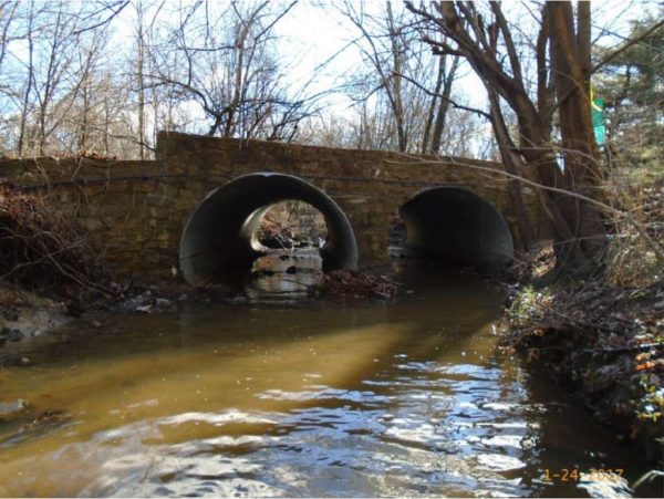
The Van Buren Bridge near the East Falls Church Metro station is back open after months of renovation work, complete with a new walkway for cyclists and pedestrians.

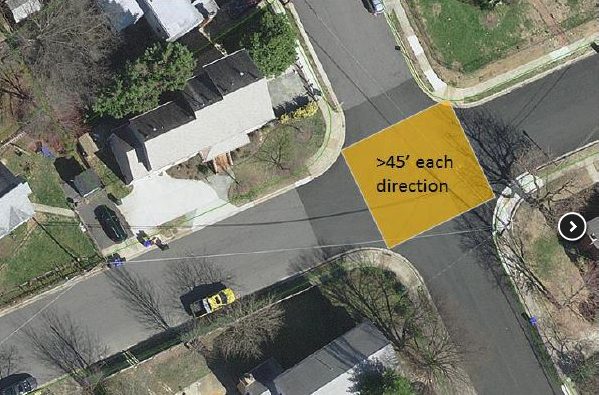
The city of Falls Church had been working since last fall to repair and widen the bridge, located near where N. Van Buren Street intersects with 18th Street N. and running over Benjamin Banneker Park.

The bridge previously lacked a sidewalk of any kind, forcing pedestrians into the roadway. Accordingly, the $300,000 construction project won some regional transportation funding for its potential to provide a smoother connection for people looking to reach the nearby Metro station with the new 12-f00t walkway.

With the W&OD Trail close by as well, planners also envision the bridge improving conditions for cyclists in the area.

The project’s conclusion also marks the end to detours on N. Van Buren Street, which previously routed drivers onto nearby roads like 19th Street N. and N. Sycamore Street.

File photo


County officials seem to have found some money to speed up design work on an access road to link the Arlington View neighborhood to Army Navy Drive.

County Manager Mark Schwartz initially proposed some hefty delays for the project, which is set to stretch across a section of the Army Navy Country Club, in his proposed 10-year plan for county construction efforts. Under his proposal, design work on the effort wouldn’t even start until fiscal year 2027, with construction set for 2029.

The county’s budget challenges have ensured that Arlington officials haven’t suddenly found enough money to build the road, and its accompanying bike and pedestrian trails, right away. But county staff did manage to track down about $230,000 to pay for design and engineering work starting in fiscal year 2020, officials told the County Board during a work session Tuesday (July 10).

That news is quite welcome for Board members and residents alike, considering that the county has been working to build the 30-foot-wide road since 2010, in order to better connect Columbia Pike to Crystal City.

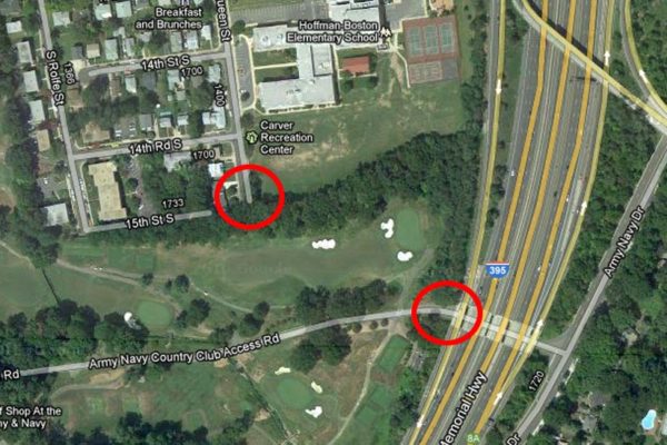
The road would run from S. Queen Street, near Hoffman-Boston Elementary, to the I-395 underpass, where a country club access road meets up with Army Navy Drive. The process of securing an easement to even cross the country club in the first place was a challenging one for the county, but the two sides ultimately struck a deal after the county agreed to allow the club to build a larger clubhouse than county zoning rules would ordinarily permit.

Staff cautioned the Board that reallocating this money for design work won’t do anything to change when the project gets built, at least for the time being. But members supported the change all the same as a way to provide some more detailed plans for the Board to consider a few years from now, when the county’s fiscal picture could improve.

“At least it’s getting us somewhere,” said Board member Erik Gutshall. “We’ve got to move the ball forward.”

In order to get that design work moving, the Board would need to pull $105,000 away from some minor arterial road projects over the next two fiscal years, and another $125,000 away from the “Walk Arlington” program for pedestrian-centric projects. The latter move will leave just $50,000 available for the program in 2020 and 2021.

But Board members seem to believe the funding shake-up is well worth it, particularly as bicycling advocates stress the importance of the project.

“There is a compelling case to be made that this will allow one of our largest growing population centers, Columbia Pike, to have more access to one of our major commercial and office centers of Crystal City,” Board Chair Katie Cristol said. “The most important thing is we get the scope of this proiect to the point where we can have those conversations about feasibility.”

County transportation director Dennis Leach cautioned that additional examinations of the project could reveal that it’s too challenging for the county to pursue. He noted that the “steep grades” in the area, combined with its proximity to woodlands and I-395, could all combine to make the effort “extremely expensive.”

Initial estimates pegged construction costs around $5.2 million, but the county hasn’t updated that figure in years.

Cristol added that there are also “big questions” about whether the county can afford to bring the project into compliance with federal accessibility laws. However, she did suggest that one avenue for addressing those cost concerns might be redirecting some revenue generated by the commercial and industrial property tax on Crystal City businesses, as the area would potentially stand to benefit from the project.

“I look forward to the prospect of a taking a better scoped project and having a conversation with the business community about whether it’s a proper use of that tax money,” Cristol said.

The Board will make the reallocation of money for the access road official when it votes to approve a final Capital Improvement Plan on Saturday (July 14).

Photo via Google Maps


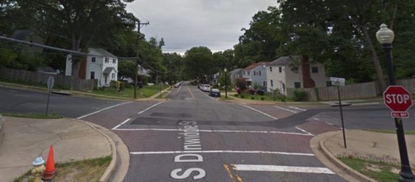
Brick crosswalks in Arlington are a thing of the past — as the county works to make crossings easier to maintain and to see.

The county said today, via press release, that it plans to start replacing any crosswalks featuring brick or “street print,” an asphalt pavement designed to look like brick, as it kicks off a new paving effort over the coming weeks.

Workers will now install reflective, “high-visibility white thermoplastic markings” instead at crosswalks. The county found that the cost of maintaining brick crosswalks was “prohibitive,” particularly considering that they weren’t especially effective.

“Paver and street-print markings — often in dark, clay-like hues — also failed to generate significant reductions in traffic speeds and demonstrated poor visibility in low light and during precipitation,” the county wrote in the release. “They also often lost their quaint appearance when street and underground repairs were necessary.”

A full map of county paving projects getting underway this year is available on the county’s website.


Three troublesome intersections across Arlington are now set for some improvements, as part of the county’s “Neighborhood Complete Streets” program.

The county revealed yesterday (Wednesday) that it has chosen a trio of intersections for “pilot projects” of the program, which is designed to fund a whole host of local road projects in areas plagued by frequent accidents. In the coming months, workers will start construction at:

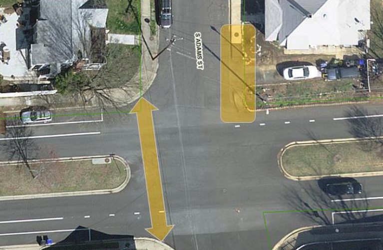
  • 6th Street S. at S. Adams Street in Penrose
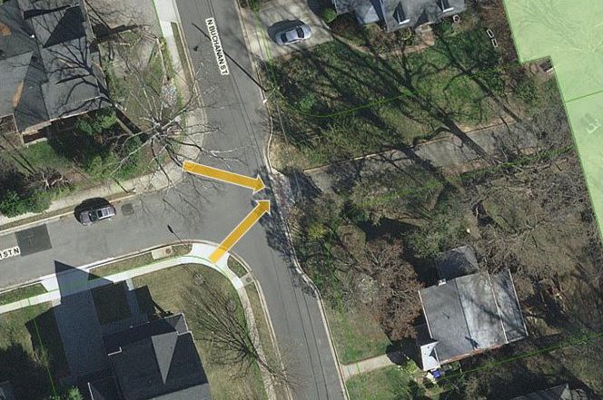
  • N. Buchanan Street at 13th Street N. and 14th Street N. in Waycroft-Woodlawn
  • 6th Street N. at N. Edison Street and N. Emerson Street in Bluemont

At 6th Street S., officials chose the intersection due to its “extremely wide pedestrian crossing,” according to the county’s website.

“Though there is a center median, it doesn’t provide a refuge for pedestrians crossing 6th Street South, which is both a bicycle and transit route,” staff wrote.

Similarly, county staff note that the “intersection of 6th Street N. and N. Emerson Street has a sharp bend that leads to the intersection of 6th Street N. and N. Edison Street, which is extremely wide.”

“The large width of this neighborhood intersection makes it easy for cars to travel quickly through this area, even while turning, and makes for a longer pedestrian crossing,” staff wrote.

Finally, the county is aiming for improvements at N. Buchanan Street in order to make it easier for pedestrians and cyclists to gain access to nearby Woodlawn Park.

Officials have yet to decide on the exact details of the construction at these intersections, and will hold a series of public meetings to collect community input:

  • 6th Street S.: Trinity Episcopal Church Children’s Center, Tuesday (June 19) at 7:30 p.m.
  • N. Buchanan Street: Entrance of Woodlawn Park at N. Buchanan Street and 14th Street N., June 23 from 9:30 to 11:30 am and June 25 from 8:30 to 10:30 am.
  • 6th Street N.: Arlington Traditional School, June 27 at 7:30 p.m.

The county is planning to add “tactical/interim improvements” at each intersection this fall, as it works on more extensive plans.

Arlington officials picked these three projects after asking for public submissions of tricky intersections around the county and reviewed 169 potential projects in all. The county is currently studying all of those intersections, and will eventually score and rank each one for potential funding going forward.

However, transportation officials warn that the county’s recent budget squeeze has forced staff to trim funding for the program a bit, though they have not eliminated it entirely.


(Updated at 1:55 p.m.) Transportation planners have nearly finalized designs for a long-awaited effort to overhaul Virginia’s only railroad connection to D.C.

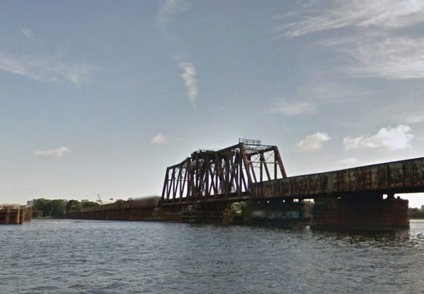
Officials from Virginia, D.C. and an alphabet soup’s worth of federal agencies have spent years working on plans to replace the Long Bridge — which runs roughly parallel to the 14th Street Bridge — and improve rail capacity over the Potomac River.

Officials say they are almost ready to commit to more concrete plans to guide the redesign. The project still needs millions of dollars in funding to move ahead, and construction wouldn’t start until 2020 at the earliest, yet planners are pushing to have engineering and environmental analyses drawn up by summer 2019.

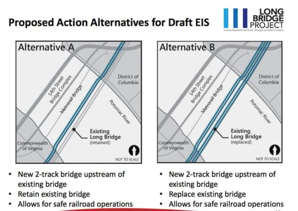
State rail officials told the Northern Virginia Transportation Commission at a meeting last night (June 7) that they’ve managed to narrow down a long list of alternatives for replacing the bridge, which stretches from near the Pentagon in Arlington to Southwest D.C., to two final possibilities.

Both plans involve building a new, two-track bridge alongside the existing structure, which was first built back in 1904. One alternative calls for the current bridge to stay in place; the other would involve fully replacing it.

Either way, officials believe the project is critical for initiatives like ramping up Virginia Railway Express and Amtrak service between Virginia and the District.

“It is really a bridge of national significance,” Jennifer Mitchell, the director of the state’s Department of Rail and Public Transportation, told the commission. “It carries a tremendous amount of traffic with commuters that would otherwise be on I-66 or 395.”

Doug Allen, the CEO of VRE, stressed that increasing rail capacity across the Potomac will be particularly critical for his trains. Commercial freight trains from the company CSX, which owns the bridge, often have to compete with commuter trains for space on the tracks, and Mitchell suggested that running a second bridge alongside the Long Bridge would help avoid that sort of conflict.

“For us to be able to add more service to our trains, we need to add more tracks there,” Allen said.

But even with so many people invested in seeing the project finished, Mitchell was sure to note that the whole effort is “very complex.” The bridge stretches just past historic resources like the Thomas Jefferson Memorial, not to mention other, “sensitive areas dealing with security” in D.C. itself, Allen said.

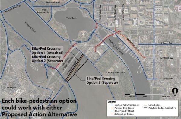
The project will also require extensive conversations about how exactly officials can include bike and pedestrian options alongside the new bridge, a key point of concern for Arlington’s representatives on the commission.

Allen noted that officials are considering two options for bike and pedestrian crossings that would not be attached to the Long Bridge, running closer to the bridge for Metro trains nearby, but still included in the overall project. But he said planners could decide to add bike and pedestrian options on the new bridge itself, though he did note that could prompt some “security concerns.”

Whichever option officials choose, Arlington County Board Chair Katie Cristol urged Allen to keep bicyclists, walkers and runners in mind throughout the planning process, given the unique opportunity this project presents. After all, she noted, the current crossing along the 14th Street Bridge does not offer a connection to the regional trail network on the D.C. side.

(more…)


Construction work on an access road crossing a portion of Army Navy Country Club could be pushed back by nearly a decade, as Arlington grapples with a funding squeeze impacting transportation projects.

County Manager Mark Schwartz’s proposed Capital Improvement Plan calls for engineering work on the project, which is designed to link the Arlington View neighborhood to Army Navy Drive, to start by fiscal year 2027 with construction kicking off two years later. The county has long expected to start design work for the project by fiscal year 2020, with work to begin in 2022.

Since 2010, county officials have aimed to build the new road, which would be reserved for emergency vehicles looking to more easily cross I-395, as well as bicyclists and pedestrians. The 30-foot-wide road would run from S. Queen Street, near Hoffman-Boston Elementary, to the I-395 underpass, where a country club access road meets up with Army Navy Drive.

The process has required a good bit of back-and-forth with the country club — the county only secured an easement on the club’s property as part of a deal to allow Army Navy’s owners to build a larger clubhouse than county zoning rules would ordinarily permit. Some members of the country club even sued the county to block the arrangement, over concerns that cyclists and pedestrians on the proposed trail would be disruptive to golfers.

Yet Arlington leaders have pressed ahead with the project all the same, with the County Board approving two different updates to the county’s Capital Improvement Plan, known as the CIP, including funding for the project.

Schwartz hasn’t gone so far as to ask the Board to abandon the project — his proposed CIP calls for the county to spend $837,000 on engineering work in fiscal years 2027 and 2028 — but the delay does reflect Arlington’s new challenges paying for transportation projects.

As he’s unveiled the new CIP, Schwartz has frequently warned that the deal hammered out by state lawmakers to send the Metro system hundreds of millions of dollars in annual funding has hammered localities like Arlington. Not only does the deal increase the county’s annual contribution to Metro, but it sucks away money from the Northern Virginia Transportation Authority, a regional body that would ordinarily help localities fund transportation projects.

With the county having to shift money around to compensate for those changes, officials say smaller projects like the Army Navy access road will necessarily suffer.

“Overall, the transportation CIP has fewer resources for smaller, neighborhood-scale improvements due to reduced funding resulting from legislation,” Jessica Baxter, a spokeswoman for the county’s Department of Environmental Services, told ARLnow via email.

(more…)


Arlington County may be known as a generally pedestrian-friendly place, but you can get ticketed for jaywalking here.

At least 18 citations were issued in 2017 for common pedestrian code violations, according to the Arlington County Police Department.

Nine citations were issued for “pedestrian disobey walk/don’t walk,” and another nine were issued for “pedestrian walk in street when sidewalk is available,” according to ACPD spokeswoman Ashley Savage.

(The term jaywalking, while colloquially used to describe those crimes, is technically not an offense code in Virginia.)

“As part of a police officer’s routine duties, they enforce various traffic laws for pedestrians, bicyclists and motorists,” Savage told ARLnow.com. “Officers utilize their discretion and take enforcement action when there is a clear danger to the safety of travelers.”

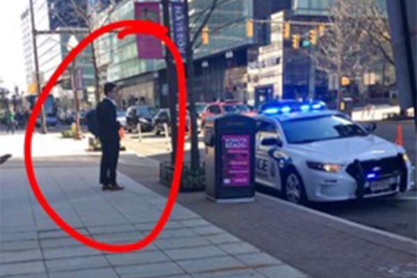
At least one of these enforcement actions occurred yesterday outside of the Deloitte offices in Rosslyn (1919 N. Lynn Street), according to a tipster, who sent a photo of a man waiting near a police cruiser as an officer wrote up a citation.

Pedestrian-related citations, dependent on the exact nature of the offense, can result in fines of $66 (including processing fee).

Recent pedestrian-related fines, including fines for paying attention to a mobile device while crossing the street, have drawn attention from D.C. to Honolulu.

The annual Street Smart regional traffic safety campaign kicks off soon, running from April 16-May 13. The law enforcement effort attempts to encourage safe behavior among pedestrians, drivers, and bicyclists “through high visibility traffic enforcement and education while reducing the number of traffic related crashes and injuries.”


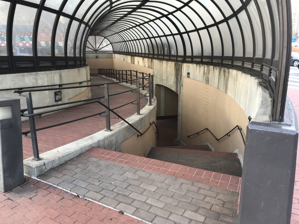
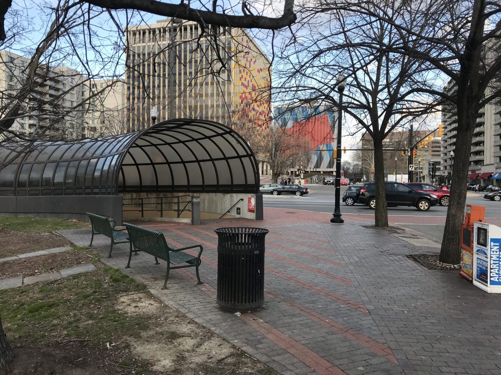
The pedestrian tunnel that crosses Route 1 in Crystal City will eventually be removed as part of the 23rd Street alignment project, though a scheduled closing has not been set.

The project, which is several years out, will “accommodate redevelopment on the east and west intersections of 23rd Street S. between Crystal Drive and S. Clark-Bell Street” in two phases. (Clark and Bell streets are also being realigned and merged into one.)

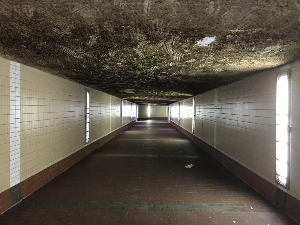
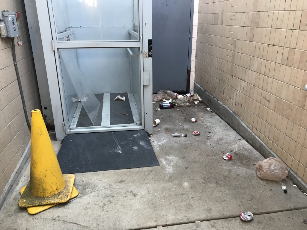
The tunnel may be closed before the project begins, “because it is underutilized” and because of upkeep costs, according to a county spokesperson. The tunnel was intended as a safety improvement, though many locals take their chances at street level due to the tunnel being dark and smelling like urine.

Robert Mandle, Crystal City Business Improvement District’s chief operating officer, cited several reasons for the change, including increased visibility for the row of restaurants along 23rd Street S. and what he called the “surprisingly common misconception that the tunnel will take you to Metro.”

“The interest in closing the tunnel really arises from the fact that most people use the surface crossing because the tunnel is longer, indirect, and uncomfortable,” Mandle wrote in an email to ARLnow. “Recent safety enhancements completed by Arlington County have further improved the existing signalized crossings.”


Crews are starting construction this week on changes to an intersection in Courthouse.

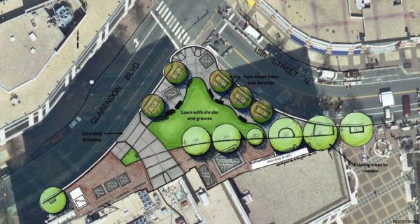
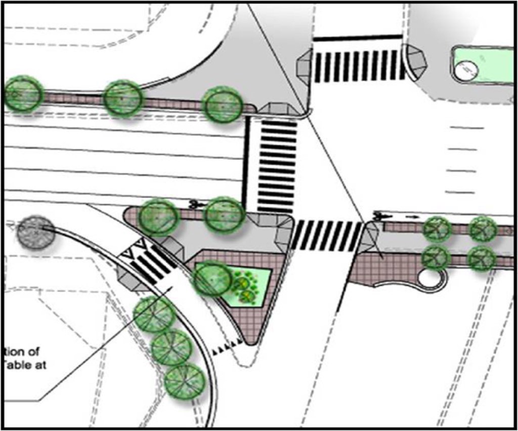
The $640,000 project is intended to provide pedestrian safety improvements at the intersection of Clarendon Blvd and 15th Street N. One major change is the removal of a slip lane.

The plan is to remove a one-way portion of roadway that serves as a shortcut to 15th Street N. in front of county government headquarters, and instead have Clarendon Blvd traffic access 15th Street via a 90 degree turn at the traffic signal-equipped intersection a bit farther down the road.

As currently configured the triangle of roadway leads to conflicts between cars and pedestrians, county staff says. The goal of the project is to improve “pedestrian safety, circulation and access in and around Courthouse Plaza.”

The new intersection will include additional trees, green space and other amenities for pedestrians and bicyclists.

Construction hours are 9 a.m.-4 p.m., Monday through Friday, according to the county website.


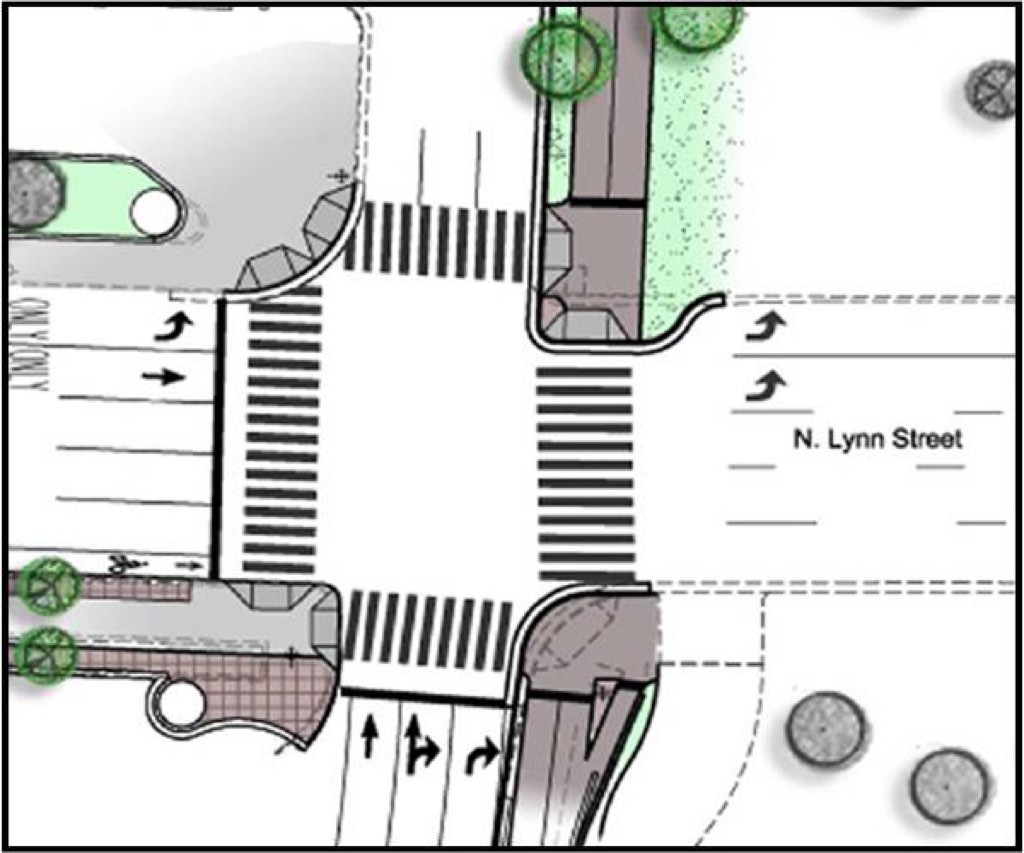
The Arlington County Board approved $1.4 million in additional funding for the N. Lynn Street and Lee Highway esplanade and safety enhancement project.

The Virginia Department of Transportation came to county officials with a cost estimate significantly higher than the initial $7.95 million price tag, which was approved by the Board in December 2016.

The increase is due to lengthened construction time, increased materials and labor costs since the 2016 estimate and design changes relating to traffic plans, according to the county manager’s report. Initially, the call for construction bids in March 2017 only received one bidder, which was rejected “due to previous established restriction on the bidder by VDOT,” according to the manager’s recommendation.

The project will bring pedestrian and bicycle safety improvements, such as wider sidewalks and on-street bike lanes, as well as traffic management and street beautification to the N. Lynn Street and Custis Trail area. A public arts project, the long-delayed Corridor of Light project, will also be installed, but only at the four corners of the I-66 bridge.

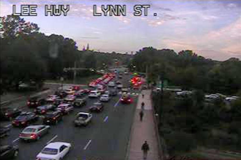
Safety is a significant component of the project. The intersection of Lynn Street and Lee Highway, once dubbed the “Intersection of Doom,” has been the scene of numerous vehicle vs. pedestrian crashes over the past few years, though collisions are down since interim safety improvements have been installed

The Board unanimously approved the increase in budget at its Tuesday meeting. Project construction should wrap up by May 2020.

File photos


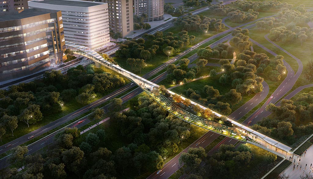
A Crystal City to Reagan National Airport pedestrian connection is feasible, according to a study conducted by the Crystal City Business Improvement District.

The study, released today (Thursday), determined that the connection would allow most Crystal City residents and employees to walk to the airport within approximately 15 minutes. The connection would link the airport’s terminal B/C parking garage with a JBG Smith private office building complex on Crystal Drive near 20th Street S.

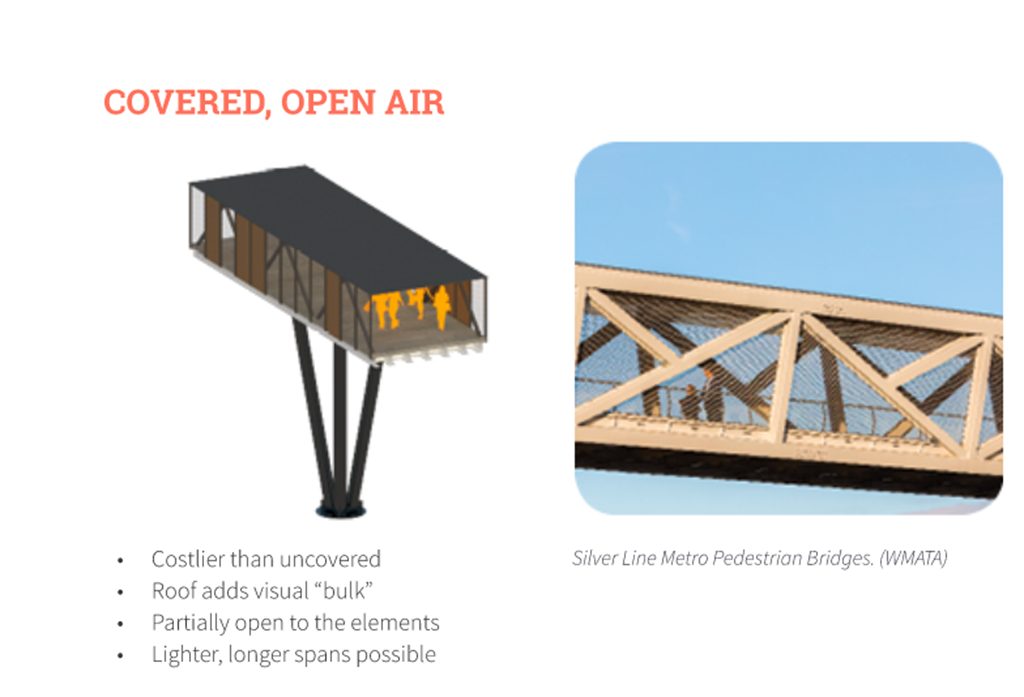
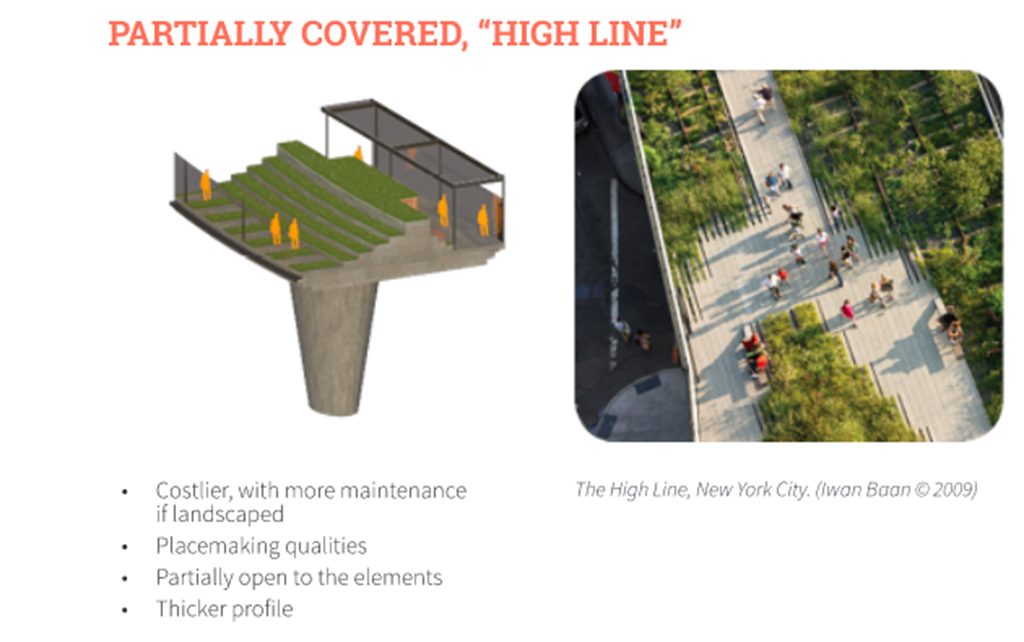
Construction is estimated to cost approximately $38 million, with annual maintenance fees of $100,000. Various possible pedestrian connection configurations, including both open air and enclosed setups, were illustrated in the study. One configuration envisions the pedestrian bridge as a park-like destination, akin to New York City’s High Line.

The majority of airport arrivals are via either private car or taxi. Only 12 percent of arrivals are via Metro, according to the study.


View More Stories