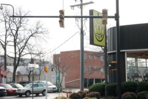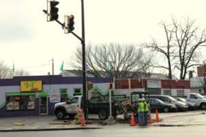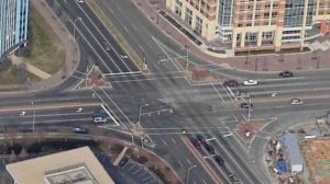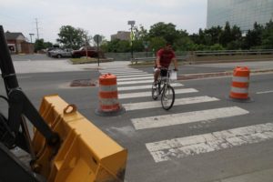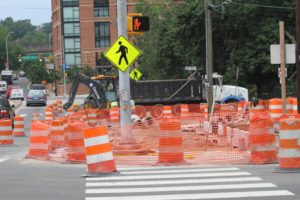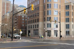
(Updated at 1:50 p.m.) The long-awaited unveiling of the new traffic signals on Wilson Boulevard at N. Pollard Street should be happening soon. In fact, they should be working before the start of the weekend.

The lights were installed a couple of months ago, but have remained covered up. Concerned about pedestrian safety, some residents have been emailing ARLnow.com to ask when the lights would begin functioning. One reader compared crossing the intersection to maneuvering through a video game.

“Too many people play ‘Frogger’ at night trying to go to and from the Gold’s Gym,” the reader wrote.

Arlington Department of Environmental Services spokeswoman Shannon Whalen McDaniel said the county’s installation of the lights has been completed, and Dominion Virginia Power just needs to supply electricity. Dominion tells us the lights should be turned on either today or tomorrow, barring any unforeseen circumstances.

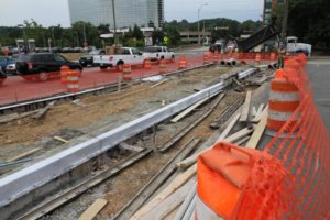
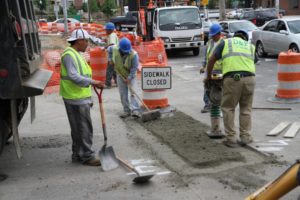
Today a crew was at the intersection repairing the sidewalk that had been torn up to install the lights.


Rehabbed Bridge to Be More Ped-Friendly — Arlington County is preparing to rehabilitate the Carlin Springs Road bridge over George Mason Drive, and the bridge’s chosen design will make it much more pedestrian-friendly. Currently, the bridge only has a pair of 5 foot sidewalks. The new bridge will have 8 foot sidewalks and 5 foot bike lanes on either side, but with narrower lanes for cars and no center divider. [Greater Greater Washington]

Arlington HQ’d Firm Gets New Name — The security contractor formerly known as Blackwater — now headquartered in Arlington — has a new name. The company’s name was changed to ‘Xe’ about three years ago, amid controversy over Blackwater’s role in civilian deaths in Iraq. On Monday the name was changed again, to ‘Academi.’ [Washington Post]

Wakefield Grad Dies in Crash — Casey Noriega, a 2000 graduate of Wakefield High School, was killed in a single-vehicle crash on Saturday in Fairfax County. Noriega, 29, was the mother of a 7-year-old son. [Kingstowne Patch]

Flickr pool photo by wfyurasko


The Columbia Pike Implementation Team is holding a meeting tonight, and anyone interested in the Pike’s future is welcome to attend.

The focus will be on the progress of the Columbia Pike Multimodal Street Improvements Project and what should be done next to reach its goals. The county started the project to analyze transportation along the 3.5 mile Columbia Pike corridor, and suggest improvements for pedestrians, bicycles and vehicles.

Residents are encouraged to attend the meeting and offer feedback on the recommended design. It’s tonight from 7:00-9:00 p.m. at the Walter Reed Community Center (2909 S. 16th St.).

More information on the Columbia Pike Multimodal Street Improvements Project can be found here.


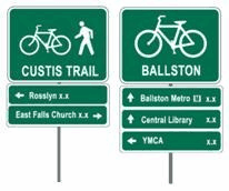
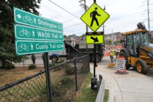
Arlington County is planning to install more than 250 wayfinding signs along the R-B corridor, starting this fall.

The signs will be placed “along bicycle and pedestrian routes throughout the Rosslyn-Ballston corridor.” The first phase of the multi-phase project will include the installation of about 50 signs.

“These wayfinding, or directional, signs will help cyclists and pedestrians more easily navigate Arlington’s 100 miles of multi-use trails, on-street bike lines and designated bike routes, and its commercial districts,” the county said on the project’s web page.

While “frequent spacing of signs” is expected to “increase cyclist and pedestrian confidence” along the busy corridor, the county is being careful to no “over-sign” the area.

“To minimize sign clutter and maintenance costs, only the most popular or useful destinations have been chosen as to not ‘over-sign’ or contribute to sign clutter,” according to the county.


The Neighborhood Conservation Advisory Committee is recommending that the County Board approve five new street improvement projects when it meets this weekend.

The total cost of the projects — which are expected to improve the appearance and safety of the streetscape — is estimated at $2.8 million. Of the five projects, all but one are in North Arlington.

The Neighborhood Conservation program allows neighborhoods to compete with one another to receive funding for public improvements requested by residents. The five projects expected to receive funding over the weekend include:

  • Beautification plus pedestrian safety improvements with raised medians on Yorktown Blvd between Little Falls Road and 30th Street N., near Yorktown High School. ($202,599)
  • Street improvements including sidewalk, curb, gutter and street lighting in Glencarlyn, on 4th Street S. between Lexington and Kensington Streets and on Lexington Street between 3rd and 4th Streets. ($653,033)
  • Street improvements including sidewalk, curb, gutter and street lighting in Ashton Heights, on N. Piedmont Street from 5th to 6th Streets. ($519,345)
  • Beautification plus pedestrian safety improvements with curb and median extensions in Tara Leeway Heights, on N. Patrick Henry Drive from 18th to 20th Streets. ($717,897)
  • Street improvements including sidewalk, curb, and gutter in Leeway, on N. Illinois Street from 22nd Street to Lee Highway. ($716,692)

The last round of Neighborhood Conservation projects included street, park and sign improvements in six different neighborhoods. This time around, the committee passed over proposed park projects in Penrose, Arlington Forest and Boulevard Manor; pedestrian safety projects in Westover Village, Waverly Hills and Claremont; and street improvement projects in Williamsburg and Maywood.


Arlington County is planning improvements designed to make three N. Glebe Road intersections safer for pedestrians. The improvements are expected to be implemented by the end of next year.

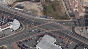
The intersections — Glebe and Carlin Springs Road, Glebe and Wilson Boulevard, and Glebe and Fairfax Drive — involve long crosswalks across numerous lanes of fast-moving traffic, as well as the occasional slip lane. The improvements are intended to make crossing the intersections safer by reducing crosswalk distances and “conflict points.”

At Glebe and Fairfax, crews will “regularize intersection geometry” — i.e. convert “suburban” slip lanes into “urban” 90-degree turns controlled by the stop light. Crews will also widen the mid-intersection pedestrian refuge.

At Glebe and Wilson, the plan is to eliminate and square up the existing slip lane at the southwest corner of the intersection, as well as to widen the median refuge, reduce crosswalk distances and to install a speed table on the northwest slip lane.

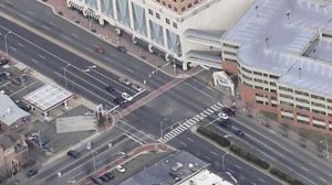
At Glebe and Carlin Springs, intersection corners will be rebuilt, median refuges will be enhanced, higher-visibility crosswalks will be installed and the driveway to and from the Ballston parking garage will be modified for safety.

The changes are being paid for primarily with federal funds, according to Arlington County Director of Transportation Dennis Leach. Even though Glebe Road is a state route, Virginia is not chipping in for the changes.

“They view this as an Arlington-requested betterment,” Leach said.

Leach expects bids for the project to come in this fall, with construction to start in the spring and to wrap up by the end of next year.


The issue is presented as a set of two mutually-exclusive options: either continue to support transportation policies that make it easy to own and drive a car, at the expense of bike and pedestrian safety; or support policies that make it easier and safer to walk and bike, at the expense of drivers.

Yesterday on the Arlington’s Commuter Page Blog, county Commuter Services Transportation Bureau Chief Chris Hamilton lauded Europe’s pro-pedestrian and anti-car policies, which have “reduced traffic and the number of cars in cities… re-conquering space for pedestrians.”

The policies, outlined in a New York Times article, include “making it harder and more costly to park… capping the number of parking spaces in new buildings rather than providing minimums… slowing cars down and closing streets to cars altogether and creating pedestrian plazas… synchronizing signal priority for people and transit, not cars… and giving people on foot the right to cross a street anywhere they like.”

“By following these examples we can make the Washington, DC region an even greater place to live,” Hamilton concluded.

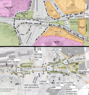
Arlington’s stated transportation policy is to focus future street improvements on facilities for pedestrians, bicyclists and transit riders. One example of this in action is the the proposed improvements to the Meade Street Bridge in Rosslyn. The current plan, as outlined at a public meeting last week, calls for the addition of dedicated bicycle lanes, the conversion of a free-flowing off ramp from westbound Route 50 to a square intersection and the addition of two traffic signals on either side of the bridge

If the choice is limited to pro-car or pro-bike-and-pedestrian policies — as opposed to policies that attempt to benefit both cars and alternative transportation choices — which would you support?


Work is underway on a series of pedestrian improvements on Shirlington Road.

The sidewalk in front of the Weenie Beenie, between Four Mile Run Drive and 27th Street S., is being expanded from 5.5 feet to 12 feet. In addition, the traffic signal at Shirlington Road and Four Mile Run Drive is being upgraded, LED street lights are being added and other aspects of the streetscape are being improved.

The improvements are intended to make bike and foot travel safer in an area of high pedestrian and vehicle traffic.  The sidewalk serves pedestrians heading between Nauck and Shirlington, as well as cyclists and joggers heading between the W&OD Trail and the two sections of the Four Mile Run Trail.

“We’re trying to greatly upgrade that pedestrian/bicycle connectivity,” said Arlington County Director of Transportation Dennis Leach. He added that the upgrades were made necessary, among other reasons, due to the narrowness of the preexisting sidewalk.

“We’ve had some real concerns,” Leach said. “The existing condition is poor.”

In addition to safety enhancements, the $196,000 project will also improve the landscaping along Shirlington Road, upgrade the bus stop at the intersection with Four Mile Run Drive, and bolster the handling of storm water to prevent runoff into Four Mile Run.

Leach said the project is the “first phase” of a larger pedestrian improvement initiative that will see the widening of the Shirlington Road bridge over Four Mile Run. Widening the bridge and the corresponding sidewalk will allow more than one cyclist to cross at a time on the busy stretch. The Four Mile Run Trail alone, Leach said, handled 1,300 people per day during the month of May.


Changes are coming to the steep stretch of Walter Reed Drive where a bicyclist was killed over the weekend.

Arlington County plans to begin work this summer to add a number of safety improvements to Walter Reed between S. Pollard Street and Four Mile Run Drive. The changes, which were in the works before the accident, include:

  • Replacing the painted asphalt medians with planted, landscaped medians
  • Curb extensions, or “nubs,” and raised pedestrian islands at Quincy, Quebec and Pollard Streets
  • Six foot curb extension on the east side of Walter Reed Drive at the W&OD Trail crosswalk
  • Additional signage for drivers approaching the W&OD Trail crosswalk
  • A parking lane stripe and “sharrow” markings to the downhill lanes (the uphill lanes already have a dedicated bike lane and a parking stripe)
  • Bus shelters at Four Mile Run Drive and Randolph Street

The 45-60 day construction project will also eliminate the right turn lane from southbound Walter Reed Drive to the Four Mile Run Drive access road. (The bicyclist, who had been heading downhill on Walter Reed Drive, struck a car heading east on the access road just after the turn lane, according to police.)

Arlington Traffic Engineering and Operations Chief Wayne Wentz says that eliminating the turn lane and replacing it with landscaping will help slow down cars — which will now have to make a 90 degree right run at the intersection — and will make it easier for pedestrians to cross.

“People treat [such lanes] very much like ramps rather than just intersections,” Wentz said. “It just reinforces that you’re turning onto a neighborhood street, not on to some major arterial.”

Wentz said the overall goal of the project — which he says will cost about $180,000 — is to reduce the number of potential “conflict points” between pedestrians and vehicles. The project, he said, will not explicitly attempt to reduce the speed of cars or bicycles heading downhill on Walter Reed Drive.

The travel lanes on Walter Reed Drive will not be narrowed, Wentz said. The county also has no plans to add a speed limit sign to the downhill lane, even though the nearest speed limit sign for southbound drivers is at 19th Street, well before the hill.

(more…)


Did Arlington “Fare Well” in General Assembly? — Despite the failure of Arlington’s two top legislative priorities, the Washington Post thinks the county did okay. In related news, County Board Chairman Chris Zimmerman told the paper that the county will probably not replace the $1 million in tourism funding lost by the expiration of Arlington’s hotel tax surcharge. [Washington Post]

AP Scores Rise in Arlington — Arlington students are taking Advanced Placement exams in record numbers. Meanwhile, the average score on AP exams rose last year. [Sun Gazette]

Local Cyclists, Pedestrians Look to Europe — “Wouldn’t it be great to have the kind of bike facilities that can be found in many parts of Europe right here in the DC area?” asks the CommuterPageBlog. To that end, the Arlington County Bicycle Advisory Committee will be screening a film on Monday that explores the bike and pedestrian infrastructure in Europe. [CommuterPageBlog]

Flickr pool photo by Christaki


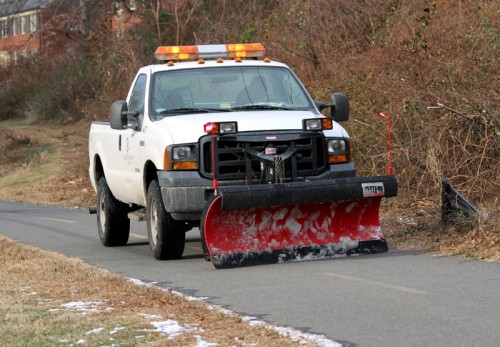
Here’s one way that Arlington County is making sure that pedestrian routes like the W&OD Trail are clear for cyclists, runners and walkers during the winter.

This pickup-mounted snow plow was spotted near today’s fire on Four Mile Run Drive.

Update on 12/23/10 — Since there was some confusion in the comments, we asked Department of Environmental Services spokesperson Myllisa Kennedy to clarify the county’s trail plowing policy.

“The County does a limited amount of snow clearing on trail sections where they provide the greatest community benefit including access to schools, metro rail stations, hospitals, or other areas frequented by the public,” Kennedy said. “Other county priorities include streets, bridges, and sidewalks on school routes, around county buildings and other operational needs.”


View More Stories