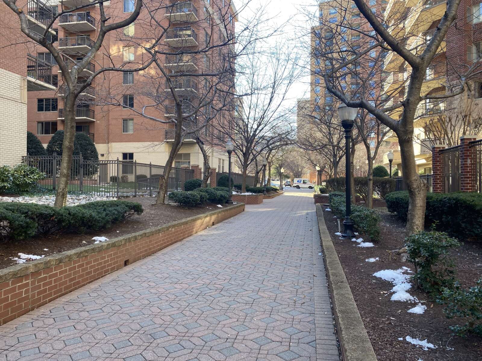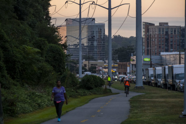
The W&OD Trail in Green Valley on Tuesday, Sept. 10, 2019 (staff photo by Jay Westcott)

The Northern Virginia Regional Park Authority is looking to expand the W&OD Trail in Arlington, potentially by 2027.

The organization, also known as NOVA Parks, released its five-year strategic plan on Tuesday. The plan includes proposed upgrades to Arlington’s section of the Washington & Old Dominion (W&OD) Trail, including the addition of a dual-use trail.

Sometimes called “the skinniest park in Virginia,” the old railroad-turned-trail actually starts in Arlington, with mile marker zero in Green Valley near the intersection of S. Four Mile Run Drive and Shirlington Road. It extends about five miles running northwest through the county to Benjamin Banneker Park, continuing into Falls Church, and beyond.

About 2 to 3 million people use the trail each year.

NOVA Parks says it is aiming to “design and expand the capacity of the W&OD Trail in congested urban areas” including the Arlington section of the trail. That could mean a widening of the trail.

The design work for this expansion is expected to be completed within the next two years, per the plan. The work will be done in collaboration with the Northern Virginia Transportation Authority.

Plans will also be developed for sections of dual trail along the W&OD in Arlington, like what was completed in Falls Church last fall. Dual trails allow for separate pathways for bicyclists and pedestrians.

The idea was first brought up at the Falls Church ribbon-cutting in October 2021 and was embraced by many who bike, run and walk on the trail, which can get crowded during peak usage times.

There was some opposition to expanding the trail, however, including from current County Board candidate Audrey Clement, who decried a “massive uprooting of vegetation” and runoff from additional paved surfaces.
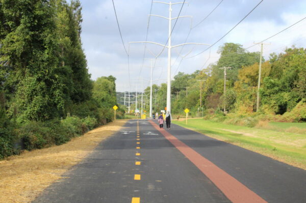
The expanded W&OD Trail, with separate cycling and walking paths, in Falls Church (courtesy of NOVA Parks)

NOVA Parks Executive Director Paul Gilbert told ARLnow in an email that there’s grant money available to design something in Arlington that is similar to what’s now in Falls Church.

“The goal would be to do like we did in Falls Church and, where possible separate cyclists from walkers with parallel paths,” Gilbert said. “There may be areas where we just have room to make the single existing trail a little wider and other areas where users can have separate paths.”

In terms of when this might be built, that’s not clear with design work still needing to be completed. The hope is to bring those designs back to the community for feedback by 2024 and begin construction “when permits are approved.”

Overall, NOVA Parks is pledging to spend more than $6 million on creating and improving trails across the region over the next 5 years.

As the only regional park authority in Virginia, NOVA Parks encompasses 34 parks and manages 12,335 acres of land in six Northern Virginia jurisdictions, including Alexandria, the City of Fairfax, Falls Church, Fairfax County, Loudoun, and Arlington.

The strategic plan also promises a number of improvements, big-ticket projects, and expansion of Northern Virginia parkland over the next half-decade.

NOVA Parks is committing to planting 50,000 more trees, restoring native plantings to at least ten new areas, reducing parks’ carbon footprint by 2%, and expanding solar energy to three additional parks, all by 2027. The plan is also to start introducing electrical vehicles and mowers into its fleet by 2024.

Additionally, there are several big money items on the agenda. NOVA Parks is looking to acquire at least five new properties by 2027, as well as build a W&OD Trail Visitors Center.

The center is likely to be built in Loudoun County, Gilbert told ARLnow, near where a trail maintenance facility is currently located.


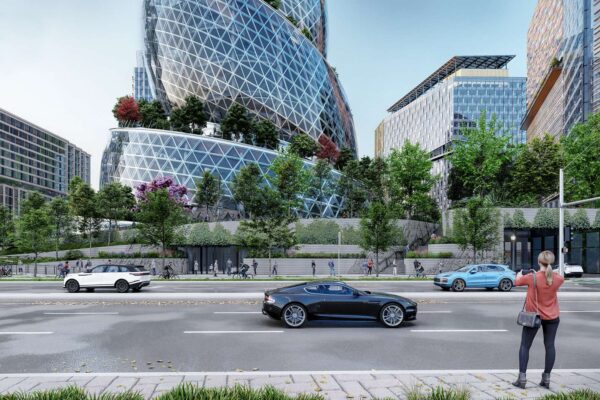
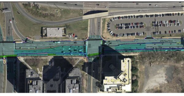
Bike lanes on Army Navy Drive are visible in this 2021 rendering of Amazon’s HQ2 Phase 2 campus (via NBBJ/Amazon)

A major project to make Army Navy Drive in Pentagon City more bike- and pedestrian-friendly is expected to kick off later this year.

The Arlington County Board approved a $10.6 million construction contract for the long-plannedComplete Streetsproject at its meeting this past Saturday.

“The project will rebuild Army Navy Drive within the existing right-of-way as a multimodal complete street featuring enhanced bicycle, transit, and pedestrian facilities and street trees,” said a Board report. “The goal of the project is to create a safer, multimodal system of connections between commercial, residential and retail services of the Pentagon City and Crystal City.”

Currently, Army Navy Drive is a 5-6 lane vehicle thoroughfare mostly serving those driving to the Pentagon, the Pentagon City mall, and nearby apartments, offices and hotels. The project seeks a more balanced mix of transportation modes while giving the corridor a more pedestrian-oriented feel.

“The reconstruction will provide a physically separated two-way protected bicycle lane facility along the south side of Army Navy Drive, in addition to shorter and safer pedestrian crossings, and will accommodate future dedicated transit lanes,” says the project website. “Vehicle travel lanes will be reduced in number where appropriate and will be narrowed to dimensions appropriate for a slower urban context.”

Plans show at least two vehicle lanes in each direction, though some intersections may be configured with two turn lanes and only one through lane.

“Complete Streets” project plan for portion of Army Navy Drive (via Arlington County)

The project’s impending kickoff comes amid the continued construction of Amazon’s HQ2, the northern edge of which — including the iconic “Helix” building that’s part of HQ2’s recently-approved second phase — will border Army Navy Drive. It will also help facilitate the planned expansion of the Crystal City Potomac Yard Transitway and will serve a burgeoning residential population in the neighborhood, including a potentially expanded RiverHouse apartment complex.

More from the Board report:

This project will provide a key missing link in the County’s bicycle network by providing an east-west protected bicycle facility that will link up with the Mount Vernon Trail via the existing bike facilities along Long Bridge Drive and the proposed connection to be constructed by the adjacent Boundary Channel Drive/I-395 Interchange project. Furthermore, the project will link to the future two-way bicycle lane facility planned for South Clark Street between 12th Street South and 15th Street South, in addition to the future South Eads Street protected bike lanes.

This project will also complete the extended Crystal City Potomac Yard Transitway by adding one dedicated transit lane in each direction along Army Navy Drive between South Joyce Street and South Hayes Street. Finally, the Army Navy Drive Complete Street project supports multimodal connectivity goals of major planned and approved commercial and residential development in Pentagon City, including the Amazon HQ2, Met Park, and River House projects.

(more…)


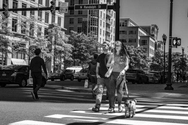
Walking a dog in Ballston (staff photo by Jay Westcott)

New York City. Portland. San Francisco. Seattle. And now Arlington.

Arlington County just joined the highest level “Walk Friendly Communities.” After previously becoming one of 15 U.S. communities to reach the program’s gold level, Arlington is now one of five at the platinum level.

More from a county press release:

According to WFC, the designation reflects Arlington’s success “in transit-oriented planning, remarkable promotion and outreach, and educational offerings for staff and residents.” It’s the first time the County has achieved platinum-level status from WFC after receiving a gold-level rating in 2010 and once again in 2015.

“Being recognized with a platinum rating by Walk Friendly Communities highlights Arlington’s ongoing commitment to increasing walkability throughout our neighborhoods,” said Arlington County Board Chair Katie Cristol. “We are committed, through many infrastructure projects and County-wide initiatives, to continuing to make walking a viable, enjoyable and safe way for both residents and visitors to get around Arlington.”

Arlington has 527 miles of sidewalks, more than 50 miles of paved, multi-use trails and 14.5 miles of hiking/natural trails. The County’s acclaimed multimodal Master Transportation Plan makes its Pedestrian Element a key feature in integrating growth around public transit lines, with special emphasis on sidewalks and multi-use trails.

Among its transportation outreach services, the County’s WalkArlington program offers abundant resources and events to encourage foot travel as a sustainable, healthy way to commute around and explore Arlington. One such effort is the more than two dozen highly detailed Walkabout map tours developed for discovering Arlington’s mix of neighborhoods as well as their unique features and histories.

In addition, an all-volunteer Pedestrian Advisory Committee helps County leadership and transportation planners visualize and achieve a more walkable Arlington through policy and infrastructure changes–from the busiest urban corridors to charming residential greenways.

An examination of the continued challenges faced by pedestrians is among the key components of Vision Zero, the County’s major transportation safety initiative to ensure that everyone traveling across Arlington arrives safely to their destination. In the first year of Vision Zero, almost 240 crosswalks were updated to display high visibility markings while speed limit zones around 13 schools were reduced to 20 miles per hour to protect walkers.

Four people died in crashes in 2021, the first year of Vision Zero. None of the fatal crashes involved a bicyclist or pedestrian.

While apples-to-apples comparisons are difficult given changes in driving and commuting patterns during the pandemic, Arlington has seen a decline in crashes — including those involving pedestrians and cyclists — from pre-pandemic levels.

The Walk Friendly Communities program is run out of the University of North Carolina and recognizes places that have “shown a commitment to improving and sustaining walkability and pedestrian safety through comprehensive programs, plans, and policies.”

“Managed by the University of North Carolina Highway Safety Research Center (HSRC), the program distinguishes communities leading the way in walkability and seeks to share their stories to inspire other communities to move toward their own innovative solutions,” the program website notes.


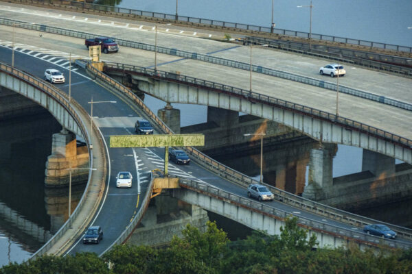
Traffic on the Theodore Roosevelt Bridge at the exits for Route 50 and the GW Parkway in 2021 (staff photo by Jay Westcott)

(Updated on 6/2) Wider sidewalks may be coming to a major Potomac River crossing.

The long-awaited rehabbing of the Theodore Roosevelt Bridge, one of the main thoroughfares connecting Arlington to D.C., will result in a new paint job, updated overhead lights, and significant widening of sidewalks, a new D.C. Department of Transportation report says.

Later this week, the National Capital Planning Commission will meet to approve a new report that focuses on much-needed repairs and rehabilitation of 58-year-old bridge that carries I-66 traffic over the river.

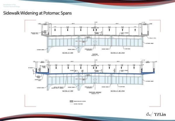
Plan for expanded sidewalks on the Roosevelt Bridge (via National Capital Planning Commission)

The report calls for the bridge to be repainted to its original white color, as well as for updating the overhead lighting and doubling the sidewalk width for pedestrians on both sides of the bridge. It notes that the current sidewalk widths, varying between four and six feet, “do not meet safety standards.”

Neither do the current barriers separating pedestrians from traffic, which are steel columns that are only a few feet high.

“The existing traffic barriers between the sidewalk and traffic lanes provide minimal protection from pedestrians and do not meet current safety standards,” says the report.

While the bridge is owned, operated, and maintained by DDOT, Arlington County has a significant stake in this rehab project considering that it’s one of the main connectors to D.C.

“TR Bridge has been a subject of discussion between our staff and DDOT for over a decade. Arlington has always strongly advocated for improving pedestrian and bicycle facilities on the TR Bridge,” Arlington County Director of Transportation Dennis Leach told ARLnow. “The existing conditions, both on the north side and south side, are pretty meager and really not up to current standards.”

There are also “long term goals” to further connect the sidewalks to more pedestrian-friendly thoroughfares.

On the north side, the walkway connects the Mount Vernon trail in Rosslyn to the Kennedy Center Reach ramp. However, on the south side, the sidewalk currently does not connect to any trail or pedestrian-accessible walkway. Leach acknowledges that taking the south side walkway from D.C. to Rosslyn the entire way currently ends in a dangerous place.

You end up in the middle of the ramp system between Arlington Boulevard, Route 50, 110, and the Parkway,” he says.

The National Park Service, Arlington County, and the Virginia Department of Transportation are working together to look into the possibility of connecting the south side of the Roosevelt Bridge sidewalk to the Marine Corps War Memorial near Rosslyn, Leach notes.

He also brought up that beyond day-to-day traffic, the Roosevelt Bridge is a particularly important connection between Rosslyn and the National Mall, be it for emergency response or for special events like the Fourth of July. The entire bridge length is about 3,200 feet or about .7 miles, so it is short enough to walk and bike across.

“Currently, the sidewalk infrastructure is insufficient to provide good, safe connections between the National Mall and Rosslyn,” Leach says.

Despite it being unsafe, DDOT tells ARLnow that they are “not aware”of any pedestrian-related incidents or accidents within the bridge sidewalk.

In terms of repainting work that also will be done, that has more to do with “a cohesive aesthetic” than safety.

“Staff recommends that the Commission note that DDOT would repaint all structural steel on the Theodore Roosevelt Bridge to match its original white color designed to create a cohesive aesthetic between the bridge and nearby monuments and the Arlington Memorial Bridge,” reads the report.

Work isn’t expected to start for awhile, though. The project’s final design phase won’t completed for another year, a DDOT spokesperson writes to ARLnow in an email, until early summer 2023.  At this point, it’s anticipated that construction will begin at the end of 2023 or early 2024 and will take four to five years to complete, the spokesperson said.

However, the sidewalk widening will be among the first elements of the project to be completed and could happen by the end of 2024.

Currently, DDOT is in the midst of “emergency repairs” that has shut down three lanes of traffic through at least June.

Nonetheless, Leach is confident that when the project does happen, the widening of sidewalks and adding better barriers separating pedestrians from traffic on the Roosevelt Bridge will make Arlington a more pedestrian-friendly place.

“We’ve talked about this project for over a decade,” he says. “These long term collaborations actually yield results. And I think this bridge rehab will bring a really good result for the District, Arlington and the region.”


A slide from a county presentation showing where a trail would connect Arlington View to Army Navy Drive (via Arlington County)

Nearly 30 years in the making, the Army Navy Country Club Trail Connector is closer to becoming a reality.

Construction on the long-proposed trail, a design for which has not yet been finalized, is expected to begin in spring 2024, officials say. Work could be completed the following spring, according to a recent county presentation.

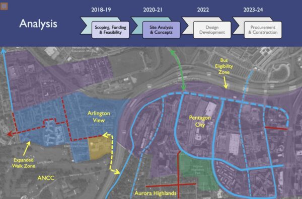
The path for cyclists and pedestrians would run from a point near Hoffman-Boston Elementary and 13th Road S., in the Arlington View neighborhood, to Army Navy Drive near the I-395 overpass and the entrance to the club. It would provide a new way to get from Columbia Pike to Pentagon City.

The county is seeking community feedback on two preliminary concepts for the trail, which can be provided through the project’s website.

Final design will be completed in spring 2023, then there will be another opportunity for public feedback. By winter 2023, a contract should be awarded and an official construction timeline will be released, Project Manager Mark Dennis said.

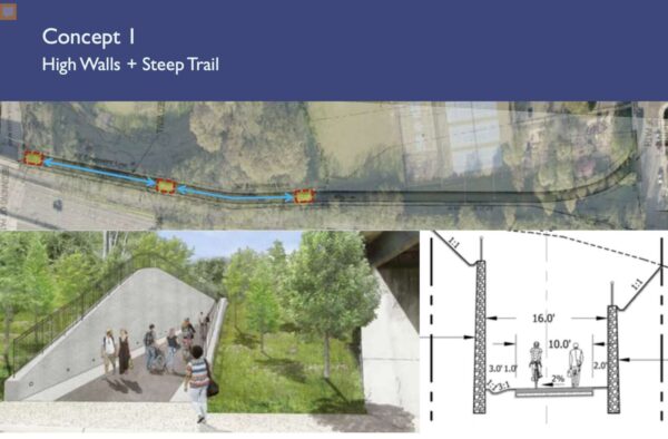
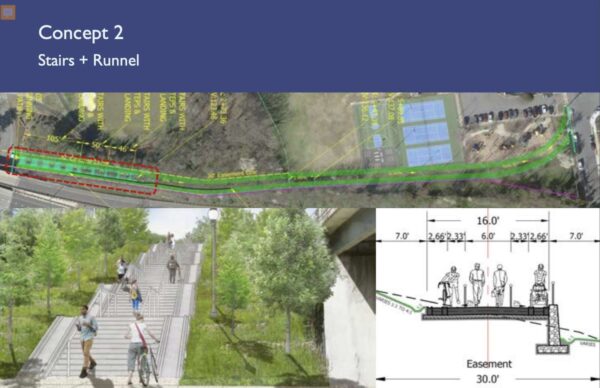
Two preliminary concepts are being considered. One features high walls and a steep trail, which could cost $11 million. The other is defined by stairs and a runnel, and could cost $5 million.

A slide depicting one Army Navy Country Club connector trail concept under consideration, featuring high walls and a steep trail (via Arlington County)

This first concept includes a 10-foot-wide, multi-use trail with a steep, 12% slope centered between retaining walls. The walls would run approximately 16 feet apart, and could be up to 16 feet in height.

Further design of Concept 1 would have to address the transition at Memorial Drive — the connector road leading to the club — where cyclists would have limited visibility to react to vehicular traffic.

Dennis compared the high walls and steep trail concept to the Custis Trail, which also has a 12% slope in some sections, he said.

“Any users out there who have taken the Custis Trail, you know what this feels like, it’s a great workout for those who are up to it,” he said. “It can be a little bit of a challenge for people who are just out for a simple walk or just want to get from A to B and not have such a vigorous bike ride.”

The second concept is a series of stairs and landings to manage the steep slope, and would feature a runnel, or wheel channel, for bicycles that could also accommodate strollers or carts.

A slide showing the concept for the Army Navy Country Club trail that features stairs and a runnel (via Arlington County)

Several people raised concerns about accessibility for both concepts. Neither design features a winding, gradual slope, but the county has to work with what it’s got, Dennis said.

“The country club has very carefully considered our previous requests to expand the easement to grant more easement and they have respectfully declined,” Dennis said. “We are limited by the easement that we have and we have sufficient easement to accommodate concepts like the two I’ve presented.”

Those who have followed the project’s iterations may notice the easement’s shape has changed. After Arlington public safety officials rejected the emergency access road idea that was originally part of the project, the path’s endpoint near Hoffman-Boston shifted from S. Queen Street to the other side of the school, near the tennis and basketball courts, Dennis said.

Dennis said the project won’t be “all things to all people,” but the narrow, steep property will probably draw a “sort of self-selecting group of users,” he said.

“We hope it’ll be accessible for anyone who can climb stairs, we hope to be accessible for anyone who rides most kinds of bikes,” he said. “But we’re going to look at that very carefully in design and try our best to accommodate the broadest range of potential users.”

The project has been discussed since the early 90s and overcome many hurdles, including obtaining an easement from the country club, a resulting lawsuit from club members, the elimination of the emergency service road, and delays due to funding constraints.


A police traffic stop in Rosslyn in 2021 (staff photo by Jay Westcott)

Arlington County police are kicking off the annual spring Street Smart safety campaign tomorrow with targeted traffic enforcement in Rosslyn.

The region-wide road safety campaign “focuses on educating drivers, pedestrians and bicyclists about traffic laws and how to safely share our roadway.” The campaign includes the personal testimonials of crash survivors, including two from Arlington.

The campaign will kick off tomorrow with a media event in Rosslyn, followed by “high-visibility traffic enforcement” at two nearby intersections: Fort Myer Drive at Fairfax Drive and Langston Blvd at N. Moore Street.

The enforcement will start after the 10:30 a.m. media event concludes.

More from an ACPD press release, below.

As part of the Arlington County Police Department’s key initiative of transportation safety, the department is again participating in the Metropolitan Washington Council of Governments’ Spring Street Smart campaign. This region-wide public safety campaign, which runs until May 22, 2022, focuses on educating drivers, pedestrians and bicyclists about traffic laws and how to safely share our roadways. Through a two-pronged approach of education and enforcement, the campaign aims to reduce the number of traffic related crashes and injuries on our roadways by identifying and changing unsafe behavior patterns among travelers.

Street Smart Campaign Kickoff

The Spring 2022 Street Smart Campaign Kickoff media event will take place on Tuesday, April 26 at 10:30 a.m. at 1560 Wilson Boulevard. Directly following the event, officers will conduct high-visibility traffic enforcement at the following locations in Rosslyn:

  • Fort Myer Dr. at Fairfax Dr.
  • Langston Blvd. at N. Moore St.

Transportation Safety Tips for Travelers

Whether you travel on foot, two wheels or four wheels, share our roadways safely be being a PAL – predictable, alert and lawful.

If you’re driving . . .

  • Slow down, drive the speed limit and obey all posted traffic signs and signals.
  • Stop for pedestrians in crosswalks.
  • Be careful when passing buses or stopped vehicles.
  • When turning, yield to people walking and biking.
  • Look for bicyclists before opening your door.
  • Allow at least 3 feet when passing bikes.
  • Avoid using your cell phone and never text while driving.

If you’re walking . . .

  • Cross the street at the corner and use marked crosswalks when they’re available.
  • Use the pushbuttons and wait for the walk signal to cross the street.
  • Watch for turning vehicles.
  • Look both ways before crossing the street.
  • Stay visible after dark and in bad weather with light-colored clothing, reflective gear and/or lights.

If you’re biking . . .

  • Obey posted traffic signs and signals.
  • Ride in the same direction as traffic.
  • Communicate your intentions by using hand signals.
  • Wear a helmet (required for riders 14 years of age or younger, and recommended for all).
  • Use headlights and taillights, especially when riding between sunset and sunrise.

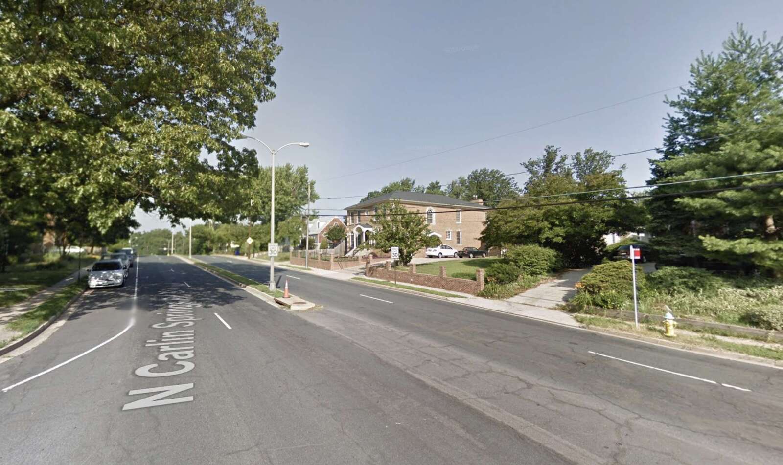
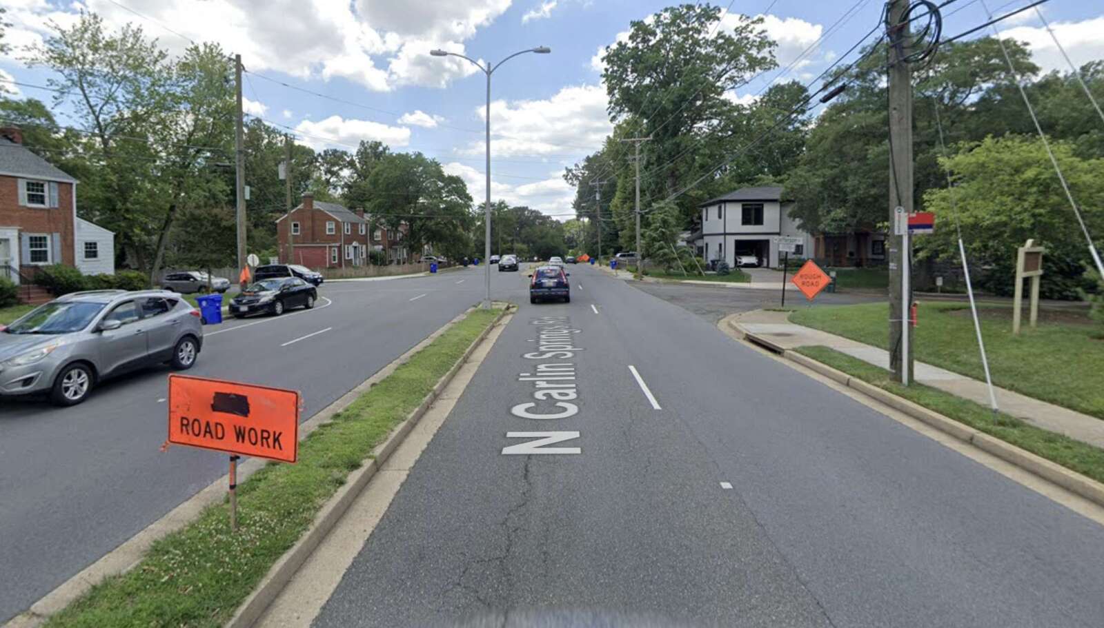
After a year of work surveying residents, two civic associations are going to the county with a request: to make a stretch of N. Carlin Springs Road safer for pedestrians.

Drivers routinely go 40 mph on the 30 mph road, which is used by kids walking to Kenmore Middle School, says Christopher George, who spearheaded the community initiative. People have to cross four lanes of traffic without marked crossings to get to two heavily used bus stations, which lack ramps to make them accessible to people with disabilities.

“It’s very dangerous for people who take the bus to cross the street,” he tells ARLnow. “Kenmore students are pretty much told not to cross the street because it’s so dangerous.”

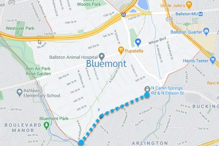
Members of the Bluemont Civic Association (BCA) and the Arlington Forest Citizens Association (AFCA) want slower speeds, safer crossings and greater enforcement of speeding and street crossing laws on N. Carlin Springs Road between N. Edison Street and N. Kensington Street.

Their asks come after more than a year spent surveying neighborhoods, conducting site walks and drafting a report.

Residents say they want to see:

  • Marked crossings accessible to people with disabilities
  • Medians with pedestrian refuges, curb extensions and streetscaping at the intersections of 2nd Street N./N. Jefferson Street and at N. Greenbrier Street
  • A speed limit on N. Carlin Springs Road of 25 mph, not 30 mph
  • Dark sky-compliant Carlyle-style street lights

Members sent a joint resolution to the County Board and County Manager Mark Schwartz requesting that they pilot these changes before fully implementing them.

They said these changes could qualify as upgrades for the county’s annual repaving efforts, its Vision Zero program to reduce pedestrian deaths and serious injuries or the county’s Neighborhood Conservation program, designed to let residents identify and plan projects in their neighborhoods.

The two intersections mentioned by the association members are “in the queue to look into for evaluation,” says Department of Environmental Services spokeswoman Claudia Pors.

And a lower speed limit could be coming to the street. This year, DES is studying 30 mph roads ­­– including N. Carlin Springs Road ­­­– to determine which “could be a good fit for either a speed limit reduction or other measures such as signage,” she said.

DES expects the study will be done before the end of the year.

The two neighborhoods have worked together before to seek funding for pedestrian safety improvements on N. Carlin Springs Road, George said.

Arlington recently made intersection safety upgrades on N. Carlin Springs at N. Edison and N. Wakefield streets that included curb extensions, rapid flashing beacons, accessibility improvements, widened medians and other improvements, Pors said.


Arlington: a highly educated and affluent riverfront county looking over D.C. Some say it has a kindred spirit in Hoboken, New Jersey, described as a “vibrant, walkable” city with waterfront views of New York City.

What makes Hoboken walkable seems to also make it safe for pedestrians. For the last four years, the city has not logged a single pedestrian death.

The trend drew the praise of U.S. Transportation Secretary Pete Buttigieg, whose department released a national plan in January to reduce and eventually eliminate thousands of road deaths.

Arlington, like Hoboken, has adopted a Vision Zero plan to eliminate traffic-related serious injuries and deaths by 2030. The county saw seven deaths between 2018 and 2020, and — depending on the exact location on the D.C./Arlington dividing line — one death in 2021. So what can Arlington and its 26 square miles (population ~237k) learn from the “mile-square city” (population ~53k)?

Arlington crash data from 2013 through November 2021. Crashes involving vehicles are left and crashes involving pedestrians are right (via Arlington County)

Hoboken transportation planner Gregory Francese credits the city’s success to Mayor Ravi Bhalla’s top-down, interdepartmental approach that involves residents. He says Hoboken regularly tackles challenging roads with temporary fixes that are made permanent later.

But the city wasn’t always pedestrian-friendly, he said. Cars could park up to crosswalks, which were faded, and intersections were in poor condition.

Those conditions began to change through repavement projects under the last mayor, and the work accelerated under Mayor Ravinder Bhalla when he established a Vision Zero task force, made of department leaders and residents.

“A big part of Vision Zero is removing the silos between transportation, enforcement [and other departments],” Francese said. “It takes someone who can remove those silos to unite people around Vision Zero.”

Planners test out quick, cheap and temporary solutions to find creative solutions to Hoboken’s main challenge: fitting safety improvements on narrow roads while balancing driving and parking needs. He said this approach translates well to bigger cities.

Like Hoboken, Arlington’s Vision Zero initiative has improved county government-wide cooperation, project manager Christine Baker said.

“The Vision Zero program has truly allowed County staff to place a spotlight on safety for all transportation-related projects and programs,” said Baker. “Our staff are coordinating interdepartmentally in a way that we have not in the past, which has streamlined the ability to get safety improvements on the ground.”

County staff map crash locations and respond with quick-build or capital improvement projects and pilot programs. The Arlington County Board, meanwhile, is setting policy. It has voted to further limit speeds and install speed cameras around schools and road construction areas, as a change in state law recently allowed.

Local transit and safety advocates say the county is on the right track but can still take notes from Hoboken.

Bicycling enthusiast Gillian Burgess picked up on Bhalla’s top-down approach. She also said Hoboken has more concrete actions and deadlines that are easier for the public to find and read, and the city’s emphasis on encouraging drivers to be more careful is front and center.

“When you have good leadership and concrete plans, you get something done,” she said. “We need the County Manager and the County Manager’s office and leadership at the Department of Environmental Services to take more ownership.”

(more…)


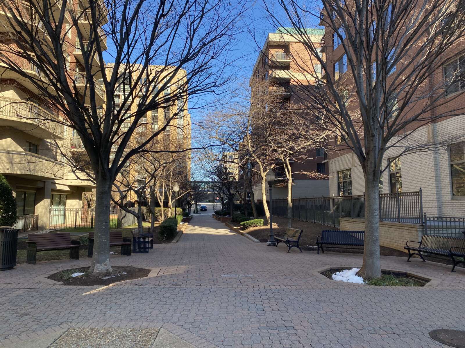
You might have never heard of the “9th Street Greenway,” an unheralded ribbon of greenery that crosses Ballston and Virginia Square, but it’s been decades in the making.

On a cold winter’s day, there’s a calmness to the ten-block-long stretch. The greenway follows 9th Street N, starting near N. Kansas Street and American Legion Post 85, in Virginia Square. It eventually crosses Oakland Park and Welburn Square, before ending as a walking path at N. Vermont Street, next to the Westin hotel.

No signs announce what it is, but the greenway’s features distinguish it from surrounding blocks. The corridor has pedestrian-only pathways, fountains, trees, other greenery, benches, and even some public art. Once you know of its existence, it makes sense.

Yet, the 9th Street Greenway — which was first mentioned in the 1983 Virginia Square Sector Plan — is by no means a finished product, even if it’s been in development for nearly 40 years. County officials and advocates say that was always the intention.

There remains plenty of places for more green space, plus the final connection to Clarendon, which has never been made.

“Major recommendations of this plan call for several zoning changes, improvements in the condition of streets and sidewalks, changes in traffic patterns, and the creation of a ‘greenway’ and additional public open space,” reads the 1983 Virginia Square Sector Plan.

The greenway was noted again in the updated 2002 sector plan.

While it may seem odd that a project first discussed four decades ago isn’t completed yet, county officials tell ARLnow that this was always the intention.

Much like Arlington itself, the 9th Street Greenway is ever-evolving, being developed, and a product of public-private partnerships with the goal of enhancing the livability of the neighborhood.

“The vision for 9th Street in the Virginia Square Sector Plan featured pedestrian access, possibly with more greenery/landscaping and other non-commercial ground floor uses, that would provide an alternative to the busier streets of Fairfax Drive and Wilson Boulevard,” writes Department of Community Planning, Housing and Development spokesperson Elise Cleva. “We expect implementation to occur primarily through partnerships with private property owners when redevelopment projects are considered and approved.”

There are no current active projects or any redevelopment that would impact the 9th Street Greenway, officials note, and there’s no timeline for when it might be considered complete.

Peter Owen was the chair of the Arlington Transportation Commission when the concept was discussed again when devising the 2002 Virginia Square sector plan. He tells ARLnow that the intention, even back then, was that it was very long-term planning.

“My understanding was that it might take a generation or even two for all of those blocks to redevelop and make this path even more available,” Owen says.

Chris Slatt, current chair of the Arlington Transportation Committee, though, tells ARLnow that one can see the 9th Street Greenway’s influence in the not-yet-finalized Pentagon City Plan, with its ribbons of green space, pedestrian focus, and commitment to parks and plazas.

They both admit the idea and the goal of the 9th Street Greenway doesn’t match what’s there yet.

“Right now, it’s a sidewalk with not much to see and do,” says Slatt.

“When walking along it, if you didn’t know it was planned, you wouldn’t know it was supposed to be coherent,” Owen says.

Slatt and Owen say there’s value in continuing the commitment to what was started all those years ago, particularly the connection to Clarendon.

Owen says he walks it often, and even if the 9th Street Greenway remains in an unfinished state, there are components that show what a fully realized vision could bring to Arlington.

“My favorite part is the part near Welburn [Square]… where it’s like a little Eden with the fountain and the outdoor patios protected from traffic,” Owen says. “It’s wonderful.”


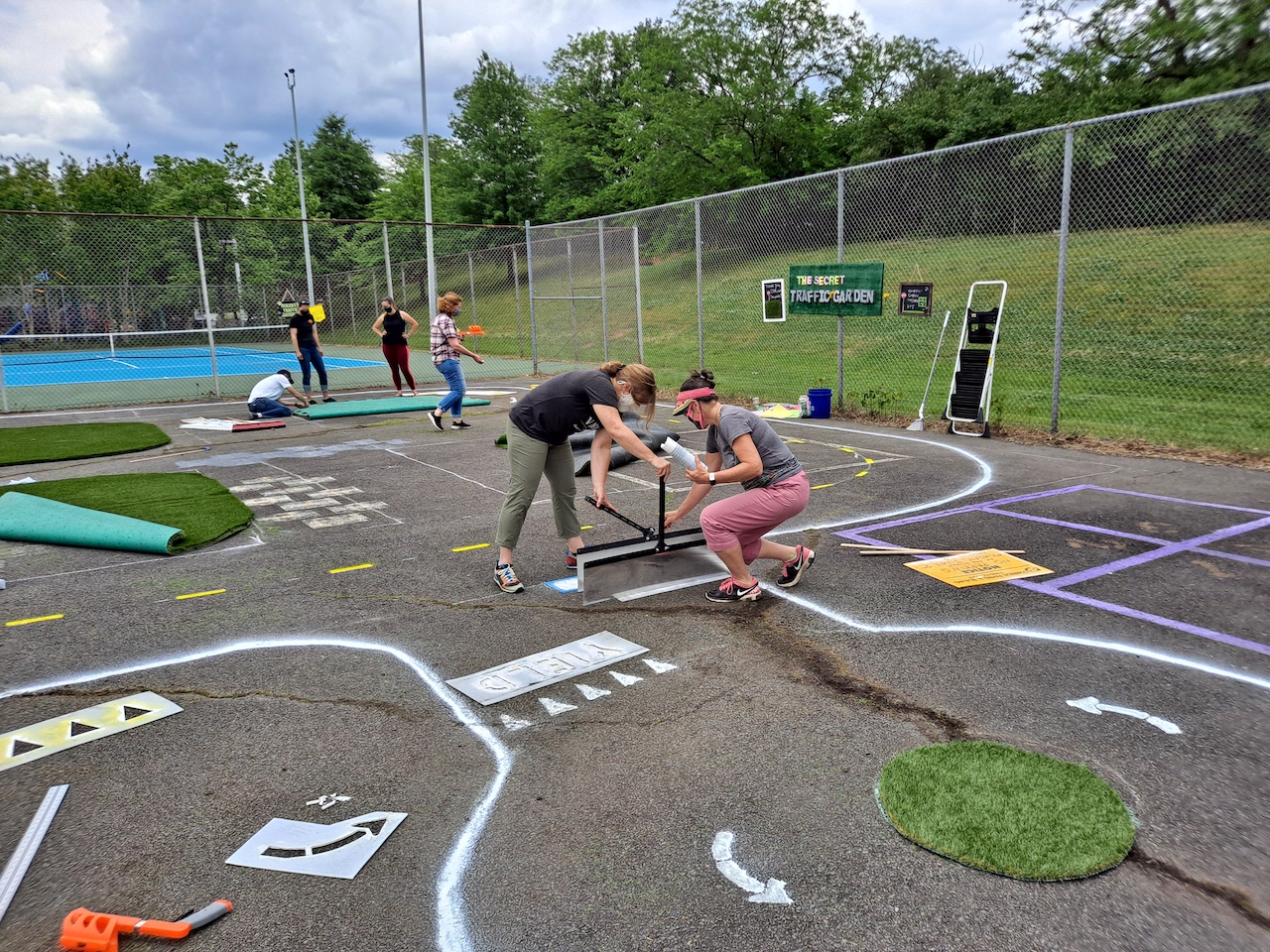
Arlington County is receiving $35,000 of assistance to design more “traffic gardens” to help kids learn about traffic safety.

Earlier this week, the National Capital Region Transportation Planning Board (TPB) awarded $250,000 of consulting services to five D.C.-area projects with the intention of improving “safety on the region’s roadways, especially for its underserved communities.”

One of those is a joint project from Arlington County and Prince George’s County to build traffic gardens at schools.

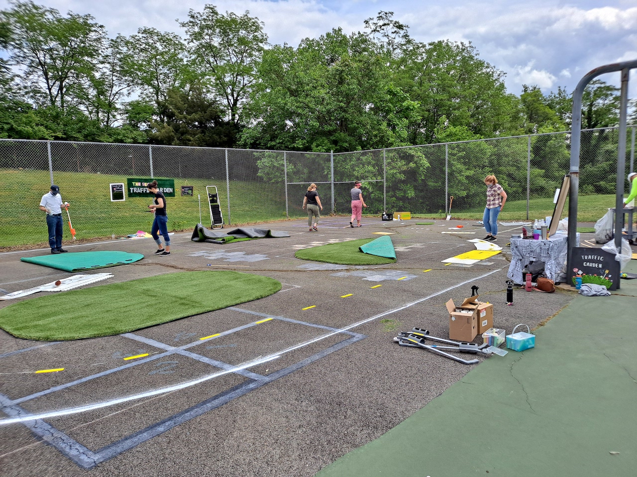
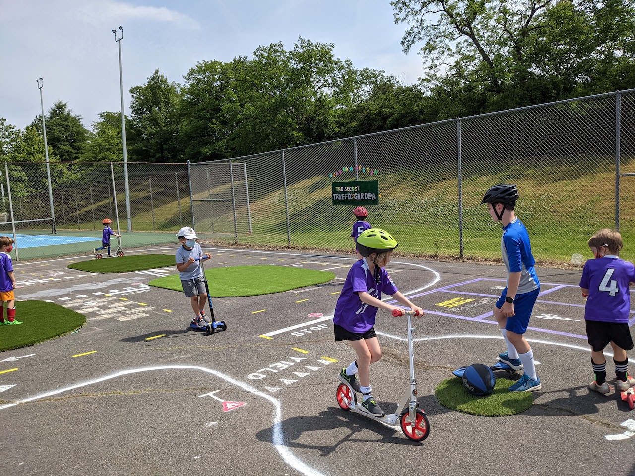
“Traffic gardens are miniature transportation networks with familiar roadway elements, in which children can walk, bike, and scoot to learn the rules of the road and practice their transportation safety skills,” principal planner Christine Baker for Arlington’s Department of Environmental Services writes to ARLnow.

The hope is that this project and the consulting services being granted will help develop universal guidance and templates so that schools can build its own gardens on “any budget” using a number of different materials and equipment.

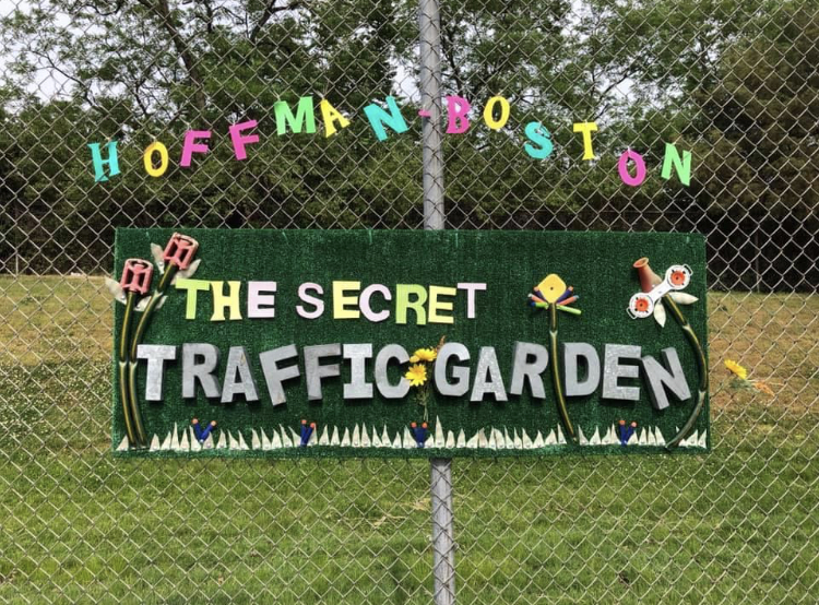
Arlington has had two recent examples of temporary school-based traffic gardens, one at Key Elementary School in the Bluemont neighborhood and the other at Hoffman-Boston Elementary School in Arlington View. Those schools used common, everyday materials — like spray bottles, measuring sticks, string, and chalk — to construct the roadway.

“We expect that schools will use the guidance to evaluate the traffic garden design possibilities for their own site,” says Baker. “Most schools take advantage of under-used hard surfaces outdoors, like blacktops, courts or other asphalt to create more permanent projects, while those with less capacity can retrofit gymnasiums with tape to create pop-up traffic gardens.”

Baker also notes that young students can take the lessons learned on these mini, safer roads and bring them back to their neighborhood.

“Traffic gardens not only help to educate children on the transportation system now but instill safety habits and transportation values that last a lifetime,” Baker says.

The TPB, which operates under the Metropolitan Washington Council of Governments (MWCOG), will in the coming months be hiring a consultant in the  that will be providing working with both counties on the project. It’s unclear at this point when the Arlington schools will have traffic gardens installed.

The initiative fits in with the county’s Vision Zero initiative, a plan to eliminate transportation-related deaths and serious injuries on county streets and trails within the next decade. This includes the recent implementation of “slow zones” near schools.

“Our Vision Zero transportation safety program is not just about engineering safety improvements on our roadways. There is a big emphasis on community engagement and education around safety,” says Baker. “Traffic gardens are an amazing way to educate our community members from a young age to embrace safe transportation practices.”

TPB approved four other projects for funding in nearby jurisdictions, all related to road safety and pedestrian improvements, including in the City of Alexandria, Fairfax County, Prince William County, and the City of Falls Church.


Voting Getting Underway — It’s Election Day. Polling places in Arlington are open from 6 a.m.-7 p.m. today. The statewide race for governor is dominating headlines, but here in Arlington there are local races for County Board, School Board and Virginia House of Delegates, plus bond referenda.

Three-Day Week for Students — “It’ll be a three-day work week, so to speak, for Arlington students this week. Classrooms will be closed on Nov. 2 for Election Day, and on Nov. 4, the school system will for the first time celebrate Diwali – a Hindu festival of lights – by taking the day off.” [Sun Gazette]

More on School Bus Driver Protests — Bus drivers for Arlington Public Schools earn the lowest hourly rate among various D.C. area school systems, as compiled by a local TV station. Drivers protested their treatment just over a week ago. [WUSA 9]

Pedestrian Tunnel Closing for Repairs — From Arlington’s Dept. of Environmental Services: “The pedestrian tunnel between Courthouse Metro station and Colonial Place will be closed for repairs this Wednesday through Friday. Aboveground crosswalks will remain open and the views of CVS are exquisite.” [Twitter]

Ticket Sales Restricted for Football Game — “This coming Saturday, November 6th at 3:30PM, W-L Varsity Football team, Cheerleaders and Marching Band will travel to Yorktown to play our last regular season football game. Please note that attendance at this game will be restricted.  Free passes will not be accepted. There will be no tickets sold at the gate. Due to restrictions put in place by Yorktown to address capacity and supervision concerns (including students rushing the field), W-L has been allocated 600 spectator tickets.” [Generals Athletics, Twitter]

ACPD Toy Drive Returns Next Week — “Help spread joy this holiday season by donating new, unwrapped toys during the Arlington County Police Department’s (ACPD) seventh annual Fill the Cruiser Holiday Toy Drive. This year, with families impacted by the COVID-19 pandemic, the need for donations may be greater than ever and your generosity helps ensure the holidays are bright for some of our most vulnerable community members – children in need.” [ACPD]

It’s Tuesday — Today showers are likely, mainly between 11am and 2pm. Mostly cloudy, with a high near 53. Chance of precipitation is 70%. Sunrise at 7:36 a.m. and sunset at 6:06 p.m. Tomorrow it will be mostly sunny, with a high near 53.


View More Stories