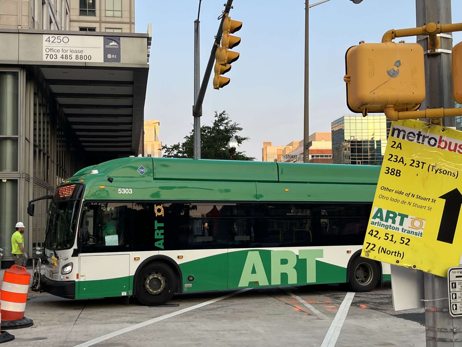
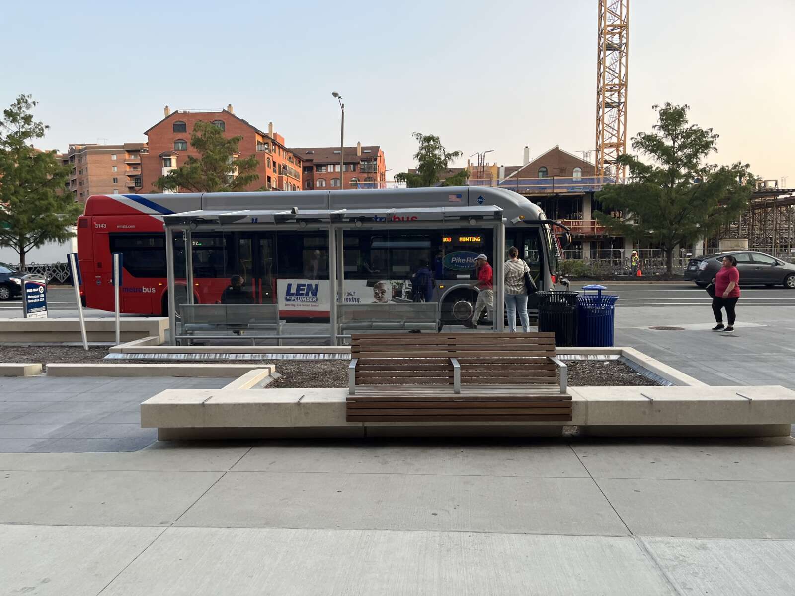
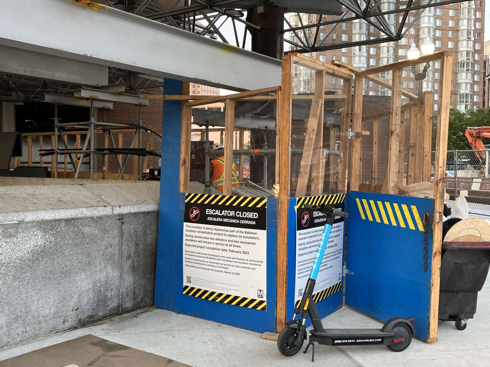
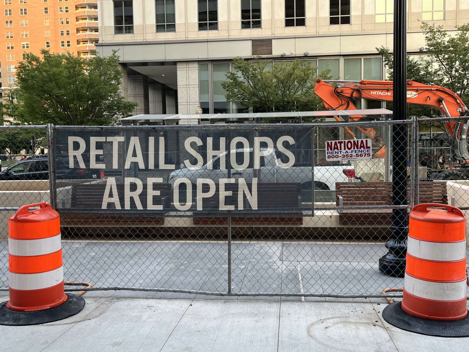
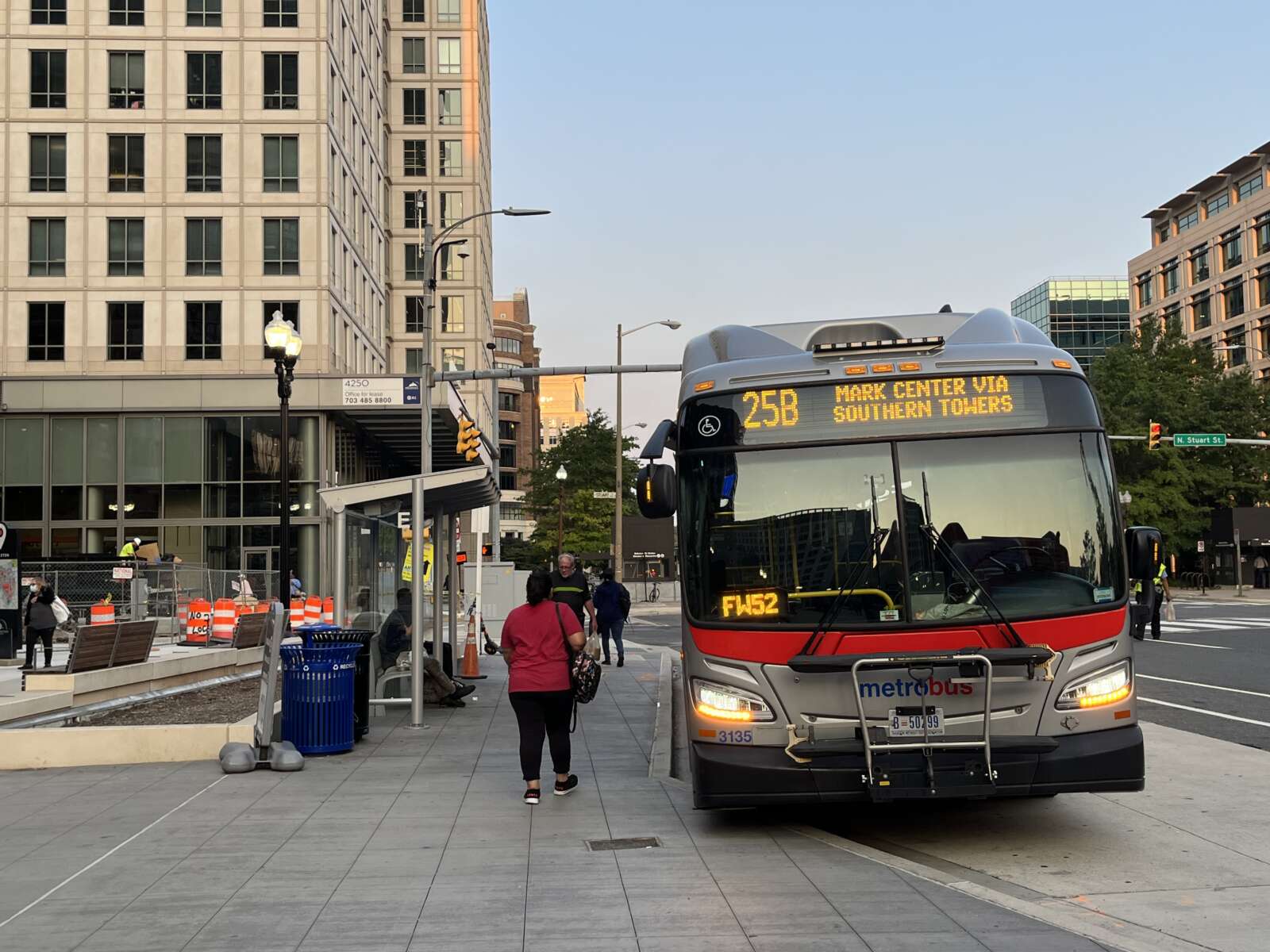
An end date is in sight for construction work around the Ballston Metro station.

After two years of navigating the active work site and catching the bus from temporarily relocated stops, transit riders could have access to the updated transit facilities and adjacent public areas sometime next month.

“Right now we have our sights on completion in late October,” said Dept. of Environmental Services spokeswoman Claudia Pors.

Over the course of four phases, Arlington County aimed to improve the experience of waiting for a bus, getting dropped off by a car, and walking and cycling around the transit hub. The project added:

  • New bus shelters, sidewalks, landscaped planters and benches
  • More bike parking
  • An expanded public space along Fairfax Drive
  • A dedicated “kiss-and-ride” curb space
  • A dedicated shuttle bus curb space and bus shelter
  • Bus stop flag poles
  • Real-time bus information displays

Construction on the four-phase project started in June 2020 and was expected to end in November 2021. But a half dozen “unforeseen conditions” came up during construction, delaying completion by nearly a year, according to a county report.

Before it can sign off on the project, the county says the following three intersections need to be repaved “due to design changes and unforeseen utility work,” per the report.

  • Fairfax Drive and N. Stuart Street
  • Fairfax Drive and N. Stafford Street
  • 9th Street N. and N. Stuart Street

This will cost about $249,000, bringing the total cost of the project to around $5.7 million. The Arlington County Board is set to review a request to authorize this additional spending during its meeting on Saturday.

Contingency funding approved in the initial budget covered the cost of the other surprises. Staff said electric and telecom lines along Fairfax Drive had to be relocated and it took longer than expected to get Dominion Energy to remove existing street light poles.

The underground Metro platform and garages were also closer to the surface than staff initially estimated. To avoid hitting these structures, construction plans had to be updated and one planter had to be redesigned.

Other planters had to be remade because of how the site slopes, while additional pre-made planters had to be purchased because original estimates fell short.

A curb along N. Stafford Street needed to be realigned and a bus landing rebuilt to ensure getting on and off the bus was safe and accessible to people with disabilities.

Pors said county staff are looking forward to wrapping up.

“Obviously, we’re very excited for the completion of this project,” Pors said.

The Washington Metropolitan Area Transit Authority (WMATA) has also finalized where buses will depart from. The listed changes are set to go into effect this Sunday, Sept. 18:

1A to Vienna: Bay F
1B to Dunn Loring: Bay F
2A to Dunn Loring: Bay C
10B to Hunting Point: Bay G
22A to Pentagon: Bay G
23A, 23B, 23T to Shirlington/Crystal City: Bay H
23A, 23T to Tysons: Bay A
25B to Southern Towers/Mark Center: Bay D
38B to Farragut Square: Bay B

Meanwhile, the county is currently working to design proposed west entrance to the Ballston Metro station, located at N. Fairfax Drive and N. Vermont Street, almost a quarter of a mile west of the existing entrance.

Arlington has sought alternative funding sources to cover the ballooning cost of the project, which it attributes to inflation and having more complete designs.

Some transit advocates have argued that funding for the section entrance should be redirected to cheaper upgrades with greater impact, such as sidewalks, protected bike lanes and dedicated bus lanes.


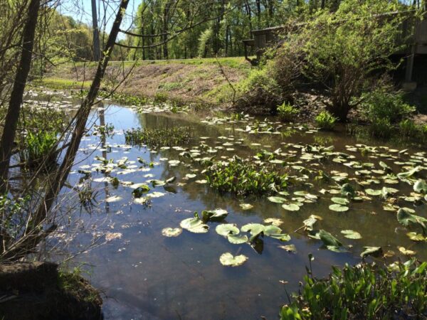
Sparrow Pond, located in Glencarlyn Park and off the Washington & Old Dominion Trail (via Arlington County)

Arlington County is looking to restore and replant a man-made pond along the Washington & Old Dominion Trail starting in 2023.

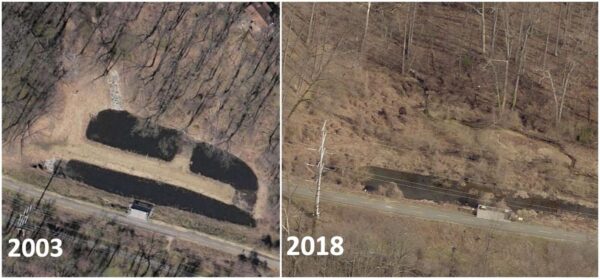
Since it was built between 2001-2002, significant sediment deposits have settled in Sparrow Pond in Glencarlyn Park, harming the wildlife habitat and the water quality. About a decade ago, the county decided to defer cleaning up the sediment and instead, redesign and restore the pond, according to a staff presentation.

Fast forward to 2022 and the county is finally wrapping up the project’s planning phase and preparing for construction.

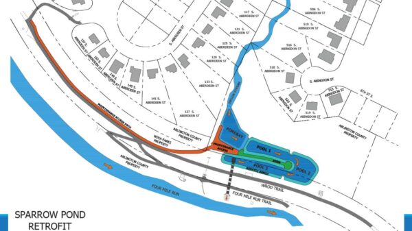
Planned work includes an access path from S. Park Drive, a residential street off Arlington Blvd that dead-ends behind Glencarlyn Park, to the pond. The county intends to dig a sediment forebay and larger pools “to better filter stormwater and restore habitat for herons, ducks, turtles, frogs and fish,” according to the project webpage.

Additional, new stormwater management facilities will redirect runoff to the Four Mile Run stream, which could cut down on pollution and clouding downstream in the Chesapeake Bay. These changes should also prevent the W&OD Trail embankment from flooding during “100-year storm events” — or storms with a 1% chance of occurring every year — such as the 2019 flood precipitated by a torrential rainstorm, according to a staff report.

Two aerial views from Arlington County of Sparrow Pond, in 2003 and 2018

Before it can start, however, the Arlington County Board needs to approve agreements with the NOVA Parks and Dominion Energy, both of which own or control parts of the land surrounding the pond, where the new access path and stormwater facilities will be located.

The Board is slated to review these contracts on Saturday.

New designs for Sparrow Pond (via Arlington County)

If the project is approved, construction would begin next year and take between six and nine months.

Preparatory work is already underway with special attention to wildlife, at the insistence of community members.

In the spring of 2021, the county installed a beaver baffle to help keep water levels stable and prevent the W&OD Trail embankment from flooding, all while not disturbing a beaver encampment in the pond area.

“The beaver baffle was an elegant solution that allowed the beaver to stay without endangering the W&OD trail embankment,” the county said in a project update.”The water levels came down and the pools on the bottom of the slope dried up. The slope and trail were safer again.”

Community members have emphasized in project meetings the importance of protecting wildlife, including beavers and the pond’s namesake swallows.

“We will work together to rescue native plants and affected animals like turtles and fish before beginning construction,” the county said. “Before being released, staff will test the animals so we don’t spread disease around the County.”

Plant and animal rescues will be planned for fall 2022, according to the project page.

This project — like the ongoing dredge work at Four Mile Run to prevent extreme flooding — is part of county efforts to improve stormwater management as storms appear to intensify, which many scientists attribute to climate change.

County staff and environmental advocates have attributed some flooding, at least in part, to development — including the construction of large homes — and the associated loss of trees and other plantings that absorb water.

Fewer trees and shrubs mean more water runs into stream banks, causing erosion, water pollution and sediment build-up. That, in turn, causes more tree loss and harms to wildlife habitats, including the critters of Sparrow Pond. The county has worked to mitigate such effects through stringent stormwater requirements for new construction, though some homebuilders have complained about the cost of such measures.

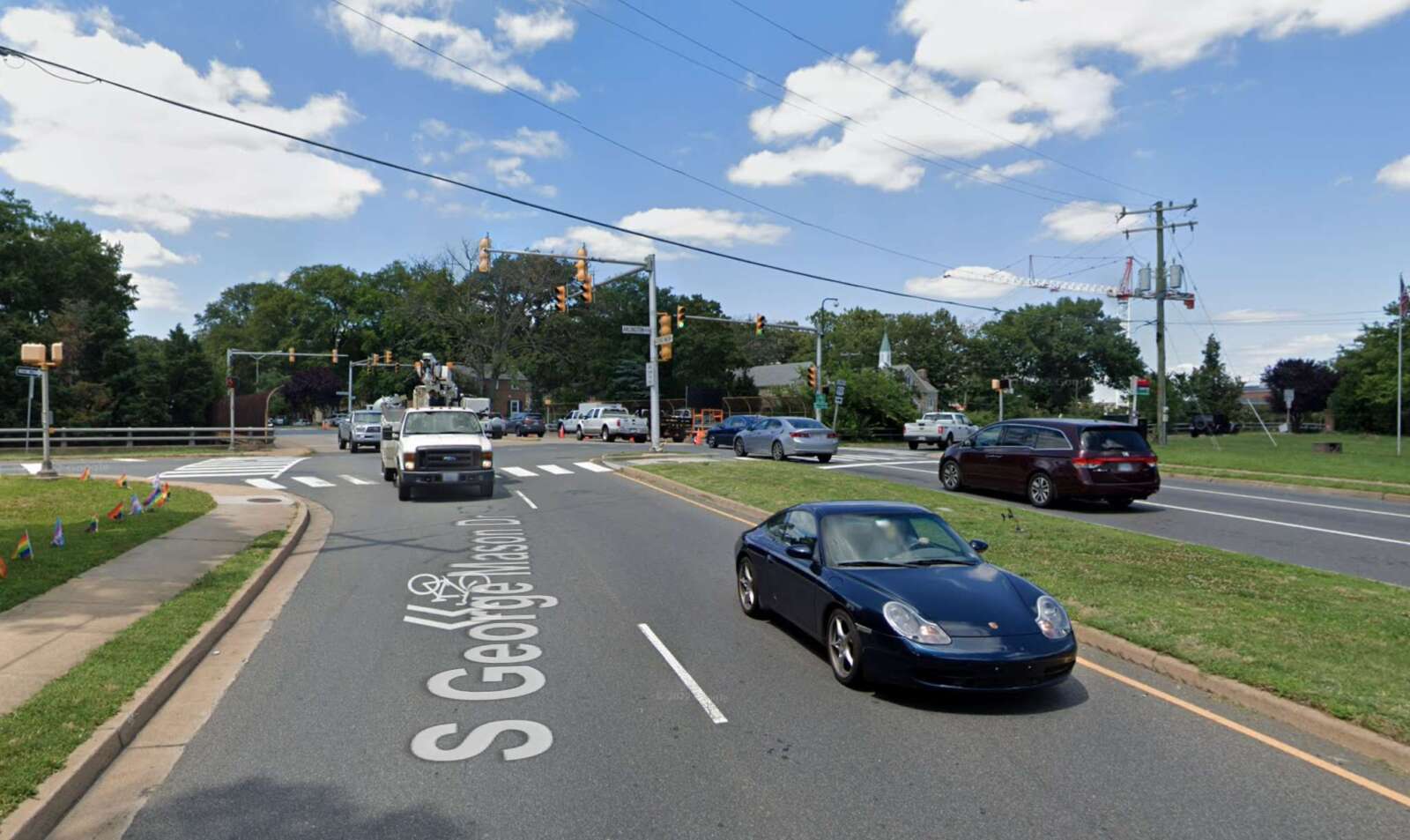
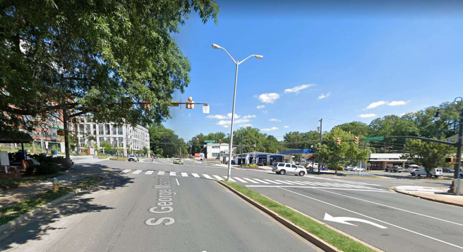
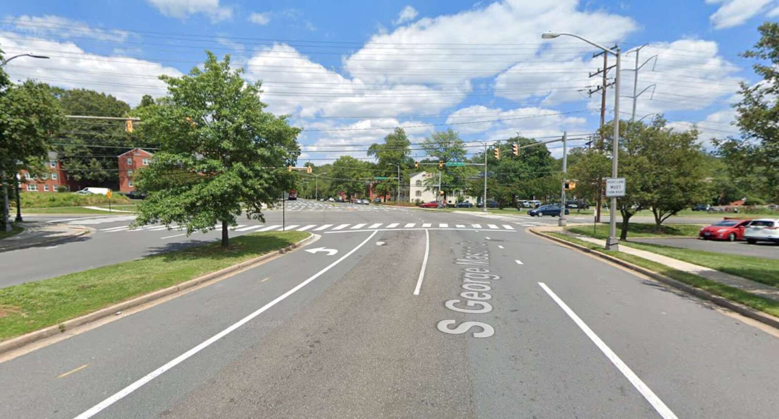
Members of the public can weigh in on proposed improvements to a stretch of S. George Mason Drive that’s being studied.

The road renovation project from Arlington Blvd to the Fairfax County border is part of the South George Mason Drive Multimodal Transportation Study, which aims to “identify improvements” along this “key corridor,” according to the project’s website.

Residents can provide online feedback on proposed design concepts through Sunday, Aug. 7.

The stretch of the roadway being studied is divided into three segments:

  • between Arlington Blvd and Columbia Pike
  • between Columbia Pike and S. Four Mile Run Drive
  • between S. Four Mile Run Drive and the Fairfax County border
A plan showing the first design concept for the three road segments (via Arlington County)

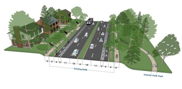
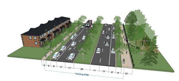
Earlier this month, the county’s Dept. of Environmental Services released its preliminary designs for the three road segments. The first option for all three segments would separate cyclists and cars into different lanes on both sides of the road, and widen the sidewalks and the vegetation buffers on both sides to six feet, according to the concept plans.
However, this design would increase the number of lanes pedestrians have to cross, as well as remove sections of on-street parking and require additional right-of-way behind the curb. Buses would also have to enter the bike lane to pick up passengers, instead of pulling up to the curb, according to an online community meeting.

A plan showing the second design concept for the first road segment between Arlington Blvd and Columbia Pike (via Arlington County)

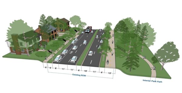
The second option for the segment from Arlington Boulevard to Columbia Pike would widen the west side sidewalk to a 12-foot, multi-use trail and the east sidewalk to six feet. It would also narrow the driving lanes while keeping the parking lane on the east side. The new multi-use trail would connect several county parks, such as Alcova Heights Park and trails like the Arlington Boulevard Trail.

However, this design would remove parking on the west side and require signal phasing changes to reduce conflict with people on the multi-use trail.

A plan showing the second design concept for the second road segment between Columbia Pike and S. Four Mile Run Drive (via Arlington County)

The second design option for the segment from Columbia Pike to S. Four Mile Run Drive would be largely similar except it would keep the two parking lanes on both sides of the road.

A plan showing the second design concept for the third road segment between S. Four Mile Run Drive and the Fairfax County border (via Arlington County)

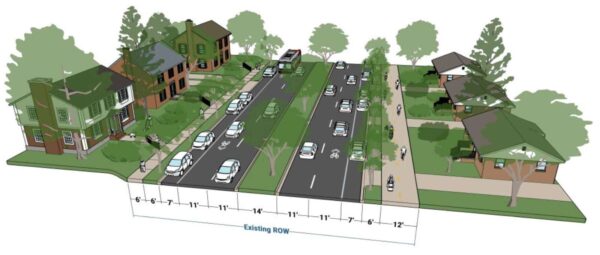
The second design plan for the third road segment would narrow all the driving lanes between S. Four Mile Run and the Fairfax County border to 11 feet and the central median to 14 feet, but it would widen the vegetation buffers on both sides and the sidewalk on the west side to a 12-foot, multi-use trail.

However, this plan may result in tree removal due to narrowing the central median, as well as the removal of some parking spots at intersections and driveways. The county would need to consider more design details, such as how the new road would interact with the driveways of houses along the road segment.

The corridor study is set to conclude between October and November this year. The county then plans to apply for grant funding from the Northern Virginia Transportation Authority.

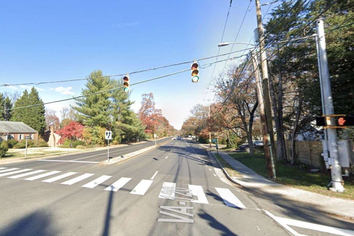
Photos via Google Maps


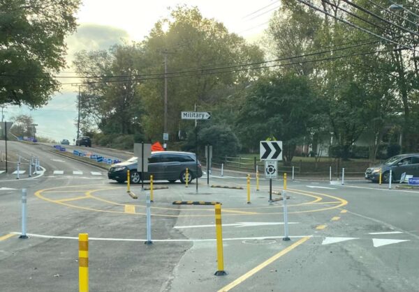
A temporary roundabout on Military Road (staff photo)

A temporary roundabout along Military Road has garnered strong feelings as a deadline for community feedback nears.

The pilot project at Military Road and Nelly Custis Drive launched in October, with bollards in place to direct traffic around the center, and has reduced speeds on all approaches, according to data the county recently released. Benefits to pedestrians are less clear, as vehicle rates were varied and there were small sample sizes for pedestrian crossings.

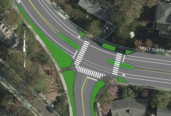
The data collected on the roundabout’s use will be considered, as well as community feedback — which is being collected through this coming Monday, June 6 — when the county decides in October whether to make the roundabout permanent or to configure an intersection with a stop light instead.

A preliminary mock-up of a signal at the Nelly Custis and Military Road intersection (via Arlington County)

More than 100 comments flooded a Nextdoor post that outlined takeaways from a community meeting last month on the pilot.

“By my observation, all but one or two of the citizens present were opposed to the roundabout at the intersection of Military Road and Nelly Custis Drive,” one user wrote about a recent meeting on the roundabout. “The bottom line is that the County is dead set on ‘re-engineering’ that intersection. Returning the intersection to the way it was for 50+ years was not even contemplated, and it either will have a permanent roundabout or a three-way traffic signal.”

Another resident said “this roundabout is absolutely a solution looking for a problem.”

But other posters — especially those who use the roundabout as pedestrians and cyclists — expressed support, stating that the roundabout “is both more efficient and safer, for cars and for pedestrians.”

The Nelly Custis Drive intersection was identified in the county’s Vision Zero action plan as a location for improvements to increase safety for pedestrians and bicyclists. The roundabout is supposed to increase allow more vehicle traffic, shorten crossing distances for people walking through the intersection, provide predictable turning movements and reduce vehicle speeding.

“Our focus is meeting the project goals of increasing safe, accessible travel for people walking, biking, driving and taking transit through this intersection,” Department of Environmental Services spokeswoman Claudia Pors said.

The Old Glebe Civic Association, which is located well to the north of the roundabout but along the commuter route of Military Road, has long fought against the pilot, saying the changes were unwarranted and there were no significant safety concerns at the intersection.

“Detractors contend that the new pattern has generated confusion and near-accidents, that it is difficult to navigate, and that the required merging of auto and cyclist traffic is particularly dangerous and difficult for cyclists… OGCA pledges continued opposition to the roundabout,” the association wrote in an April newsletter.

Prior to the pilot, Nelly Custis Drive met Military Road at the intersection in a T-shape, with a stop sign for traffic on northbound Military Road.

The OGCA previously said three crashes occurred over eight years, including two involving bicycles, out of the approximately 32 million vehicles that passed through the intersection during that period.

Per Arlington’s Dept. of Environmental Services data, about 11,000 vehicles pass through the intersection daily. In a presentation last summer, county staff said conversions to roundabouts reduce pedestrian crashes by 27%, while conversions from stop-controlled intersections reduce injury crashes by 82%.

(more…)


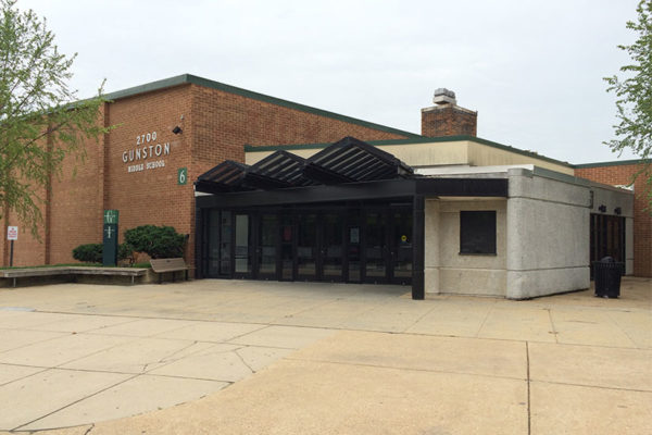
Gunston Middle School (file photo)

The Arlington School Board is set to consider a $1.6 million contract for safety upgrades to the entrance of Gunston Middle School.

At its meeting on Thursday, Board members will also consider approving a preliminary budget of $2.7 million for three other entrance projects.

In 2020, Arlington voters gave the thumbs up to safety renovations for five schools: Gunston, Thomas Jefferson and Williamsburg middle schools, Taylor Elementary School and Wakefield High School.

Construction at Gunston would start in June and be completed in mid-August before school starts on Aug. 29.

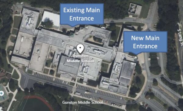
Work includes moving the main school entrance and office closer to S. Lang Street, which will require two science rooms to be relocated. The entrance will feature a vestibule where visitors will check in with office staff.

Planned Gunston entrance change (via APS)

The project scope has also expanded to remediate structural issues related to how the building has settled into the ground over time. APS is budgeting $2.5 million, including contingencies, for the Gunston project and any unspent funds will be used for other capital projects.

This summer, APS will also be making upgrades to Wakefield’s entrance. This project will not have to go out to bid and the school system can move forward without School Board approval.

Design and Construction Director Jeffrey Chambers says the Taylor and Williamsburg projects, meanwhile, have fallen behind. Design work is currently just over halfway complete and staff aim to find a contractor this fall and start work next summer.

“We’re very concerned putting those out to bid or getting pricing or trying to get them constructed this summer because… both from references from our consultants and our experience with regard to projects we’ve recently finished, there are some serious issues still in the supply chain,” he told the School Board last month. “We don’t want to start projects, especially with administrative offices, and not be able to finish them.”

APS staff are recommending that work at Jefferson be deferred until APS is ready to make substantial renovations to the school.

“It was going to require a lot more renovations to that building than what we had budgeted for,” he said. “We felt it was better to defer that to a future, larger project.”

The public schools system is staggering these projects, all part of the adopted FY 2021 Capital Improvement Plan, because “rapid construction price escalation and supply chain delays [have] impacted the anticipated construction cost and completion,” according to the presentation.

APS has made security upgrades to more than half of its school buildings and aims to complete this work “within the next few years,” Chambers said.


There is a new sign of progress on the 30-year-old project to build a boathouse in Arlington.

In anticipation of planning and design work kicking off this year, the Arlington Boathouse Foundation — an organization that exists to ensure residents one day can launch non-motorized boats, such as kayaks, into the Potomac from the county’s shoreline — has launched a new website.

It is intended to provide frequent updates on the project’s progress as well as engagement opportunities, says foundation secretary George Kirschbaum. Those who need a refresher on the project, given how many years it has been discussed, will have easier access to important documents and answers to frequently asked questions, he added.

“We needed something new and fresh that’s more about the project,” Kirschbaum said. “Plus, we hope to provide some new interesting features, such as interviews with community members and interested parties to give their ideas and impressions of why this facility is important to the county and the residents.”

The website will also promote foundation-sponsored educational and promotional events, such as a river cleanup this June by the proposed lower portion of the site. Kirschbaum said foundation leaders hope events such as this one demonstrate the sustained community interest in the facility to project leaders.

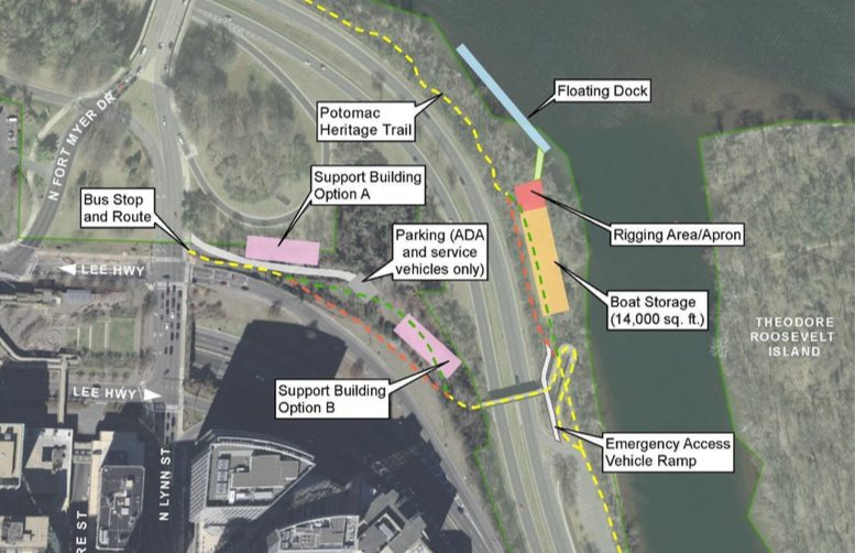
Momentum has been building over the last year to build a boathouse at 2105 N. Lynn Street in Rosslyn. The project is a joint venture between Arlington County and the National Parks Service, as the county’s Potomac shoreline is NPS property.

Most recently, Kirschbaum said boathouse foundation leaders met with county officials, Rep. Don Beyer (D-Va.) and NPS representatives in December to discuss roles and responsibilities and how to keep the project moving forward.

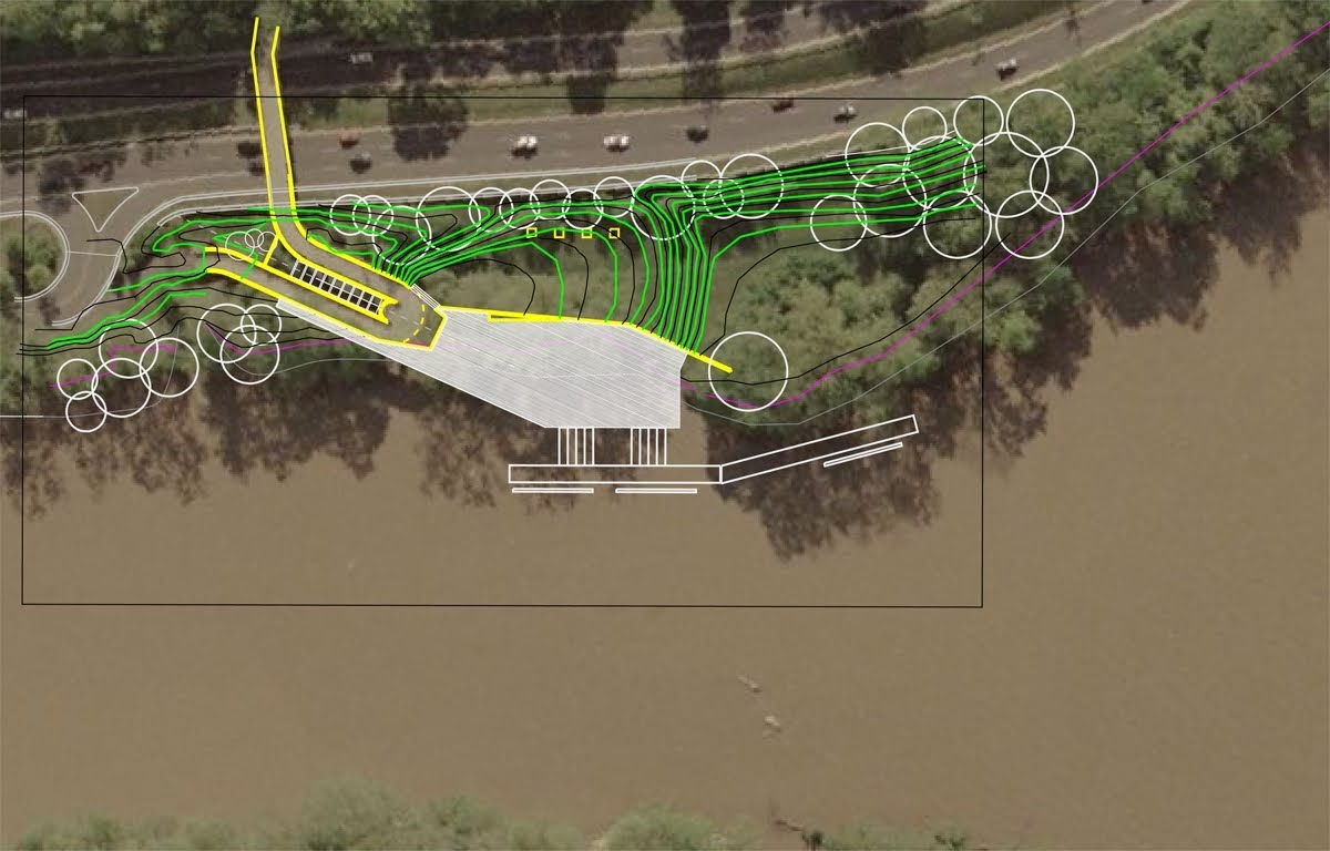
This year, the county will solicit designs for the facility, to be comprised of two buildings: one near the entrance to the Key Bridge with locker rooms, workout areas, offices and meeting spaces, and the other at river level with storage for boat and stand-up paddle equipment, according to the boathouse website.

The county budgeted $4.75 million for planning and initial designs in the 2022-24 Capital Improvements Plan.

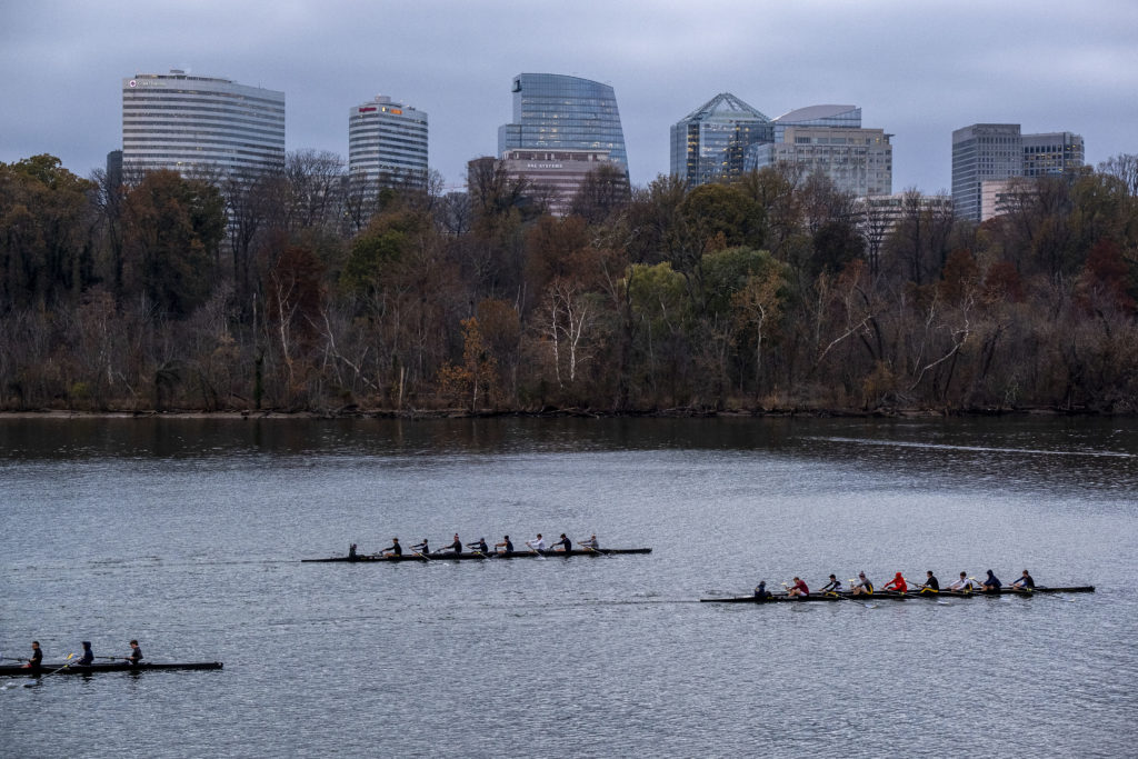
The project is popular with Arlington’s crew community, as it would provide them a more convenient boat launch that is away from D.C.’s crowded boathouses. Crew alumni and their friends also comprise many of the members of the Arlington Boathouse Foundation, which has pushed for the facility since 1991.

“It’s been a long process,” says Kirschbaum, who rowed for Washington-Liberty High School (then Washington-Lee) in the 1980s.

It didn’t gain momentum until 2012, when the parks service initiated an environmental impacts study — looking at how construction could affect floodplains and species living in the waterway. The study was held up several times before resuming in 2016 and wrapping up in 2018.

Meanwhile, the county purchased land south of the Key Bridge in 2014 to speed up the process and, despite some opposition, the Arlington County Board authorized an agreement with NPS in 2019.

“I think it’s important to know that the county has a very vested interest in working with the National Parks Service to see this through to fruition,” Kirschbaum said. “There are still high-level discussions about how are we going to work together to move forward, but those talks are happening… We can actually envision a boathouse where before, it was the dream.”

Kirschbaum says he hopes the boathouse will be ready if and when his currently elementary school-aged kid goes out for crew in high school.


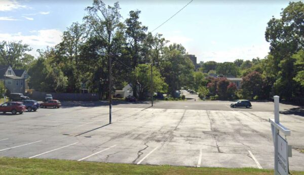
Mount Olivet United Methodist Church parking lot (via Google Maps)

The leadership of Mount Olivet United Methodist Church near Ballston is looking to do something about its parking lot.

The 120-spot surface parking lot fronts N. Glebe Road and is separated from the church, located at 1500 N. Glebe Road, by 16th Street N.

When Mount Olivet bought the parcel in the 1950s, it considered building a youth center and pool on the site, but ultimately paved it over.

Now, 70 years later, church leaders are mulling whether to redevelop the lot, as well as the open space and associate pastor’s parsonage adjacent to it, with a multi-purpose building and underground parking.

Possible uses include a youth recreation center, an arts and cultural space, an expansion of the daycare and preschool, medical offices or senior assisted living, housing or other church uses, according to a presentation on the church’s website.

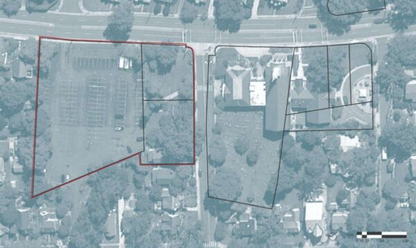
Mount Olivet United Methodist Church and cemetery, outlined in black, and the parking lot, green space and associate pastor’s parsonage, outlined in red (via Mount Olivet United Methodist Church)

The redevelopment idea resurfaced in 2017, when church leadership was drafting a strategic plan guiding future growth, according to the church.

Two years later, a task force began meeting with a local architect to consider uses for the property. Concepts from the task force were presented to parishioners on Sunday during a town hall.

“During the Town Hall, multiple references were made to the fact that the material being presented and the ideas being discussed were in fact only possibilities at this point,” Chuck Mitchell, the chair of the task force, tells ARLnow. “There are no plans to build at this time… If and when the Mount Olivet congregation decides to continue the exploration, there will be multiple and comprehensive meetings with Arlington County, civic organizations and other interested parties to engage in the conversation.”

That town hall was intended to update the congregation on the work the task force over the last two years, he said.

“As a long-term member of Arlington and the local community, should Mount Olivet choose to move forward with a project, we will be scheduling meetings with the local civic organizations,” he said.

To avoid raising money from the congregation, church leaders say they would enter a ground lease with a developer.

Over the course of the lease, Mount Olivet would receive revenue from whatever building the developer constructs. Eventually, the revenue would be used to buy back a portion of the building for the church to use.

After the lease expires, Mount Olivet would own the entire building, as well as the land.

While the church has not settled on a plan to propose and discuss with the local community yet, some neighbors have taken to Nextdoor and other channels to express concerns about things like traffic and safety should a new development replace the parking lot.


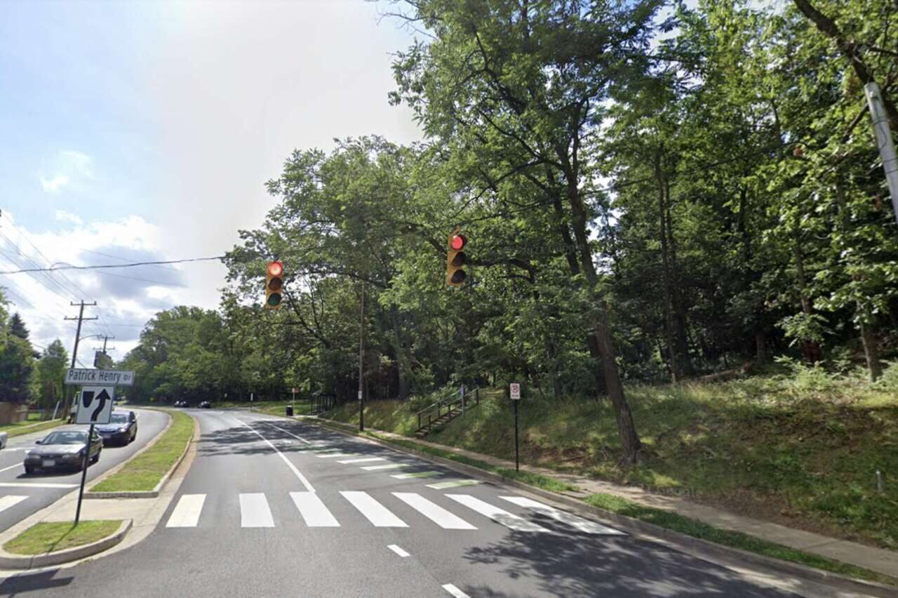
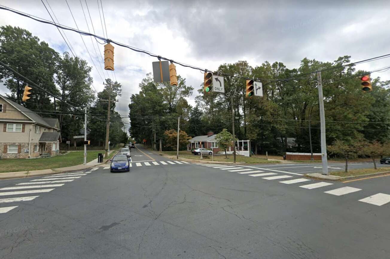
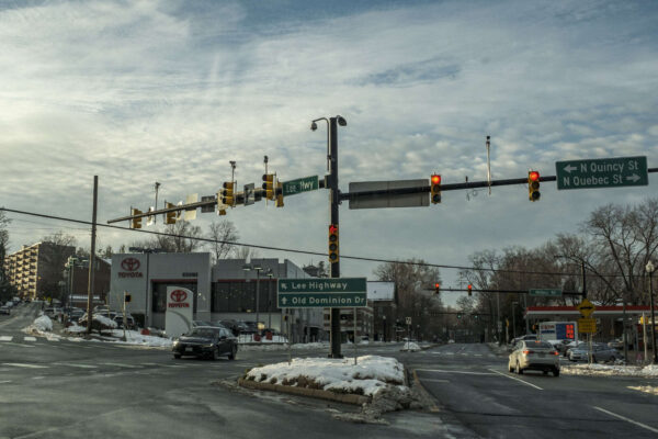
A trio of Arlington intersections could soon be getting some new traffic signals and pedestrian safety improvements.

This Saturday, the Arlington County Board is set to review a $2.3 million contract to replace traffic signals that hang from wires to those attached to poles, or mast arms. The improvements also include wider sidewalks, accessible curb ramps and high-visibility crosswalks.

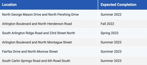
The work will be conducted at the following intersections, each in North Arlington:

The traffic signal replacements are part of a county program replacing outdated traffic signals to meet current federal and local standards.

“Signal upgrade projects implement new technologies such as accessible push button stations, CCTV for monitoring, video detection, and improved intersection lighting to improve safety, efficiency, and accessibility for all modes of travel,” according to a project webpage.

Mast-arm traffic signals on Langston Blvd (staff photo by Jay Westcott)

Installing mast arm traffic signals on wide streets has been found to be a cost-effective way to reduce collisions, according to the Federal Highway Administration. One study of Virginia Department of Transportation data, however, found crashes decreased, but not by a statistically significant amount.

The FHWA also says span wire signals can have higher maintenance costs and are generally considered less aesthetically pleasing due to the overhead wires. But after these replacement projects occurred elsewhere in Arlington, some residents took to Nextdoor to mourn the loss of the wire-hung signals, which they said were not as bulky as the large poles that replaced them.

The three projects would join a half-dozen traffic light replacement projects already planned for this summer and fall.

Planned street signal replacements (via Arlington County)

The county is lumping in pedestrian safety and accessibility improvements with the replacements, per a county report.

Currently, the intersections lack curb ramps that are accessible to people with disabilities, while pedestrians have to contend with long crossings and narrow sidewalks, the county says.

Widening the sidewalks and adding accessible curb ramps and high-visibility crosswalks will create “safe, accessible, and user-friendly intersections,” the county says.


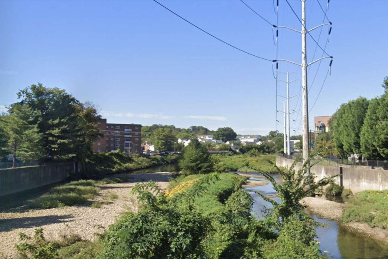
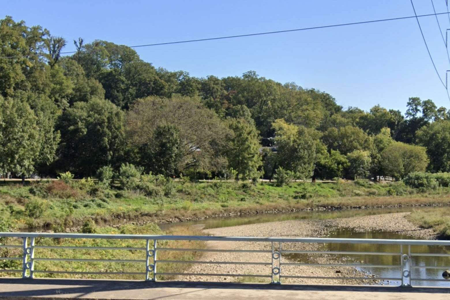
Arlington County plans to dredge stretches of the Four Mile Run and lower Long Branch Creek channels to alleviate potential flooding.

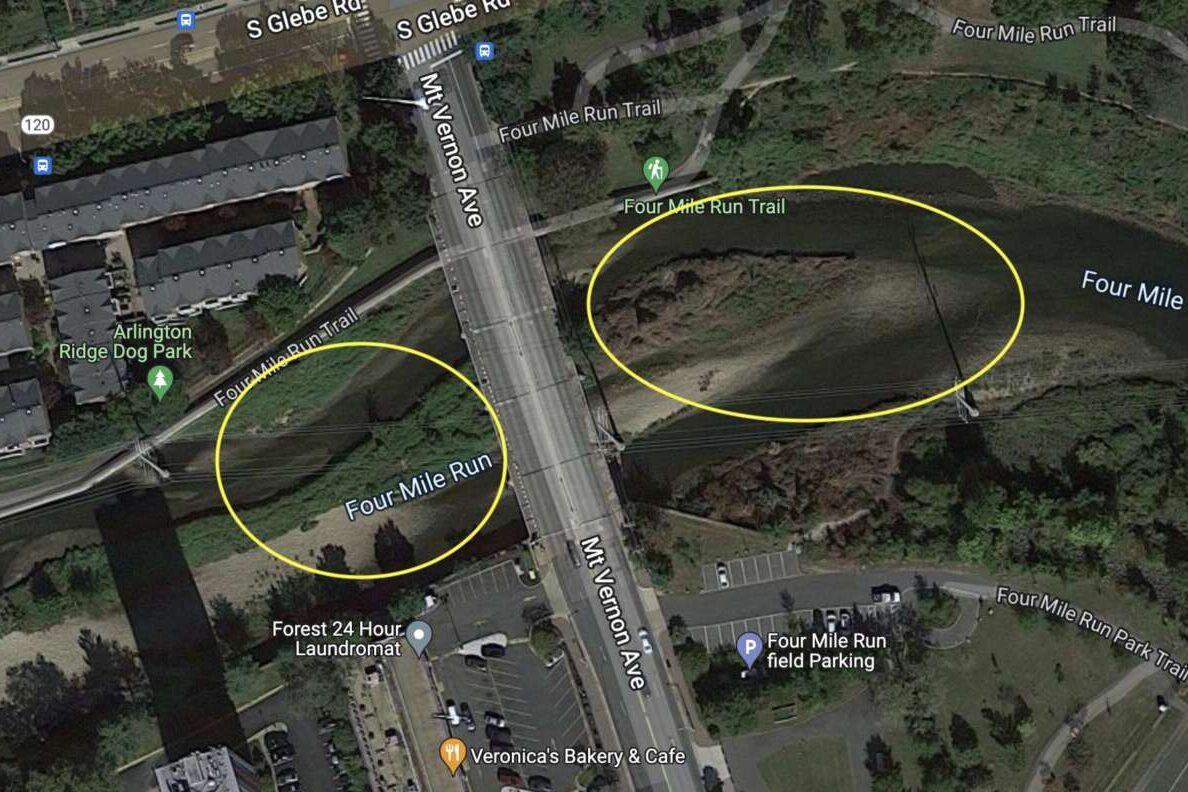
The project targets sections of the waterways near Mt. Vernon Avenue, bordering the City of Alexandria, where U.S. Army Corps of Engineers (USACE) determined soil deposit levels were “unacceptable” for stormwater management.

The Arlington County Board is slated to review the project this Saturday.

The USACE inspection determined the channel had “excessive shoaling” due to shallow water depths. Dredging the soil deposits will address this shoaling and ensure the channel can handle large, once-in-a-century floods, the county says.

As part of the project, erosion damage and degraded stream conditions will also be repaired and debris and vegetation will be cleared. Construction is slated to begin in September and last until February, according to a project webpage.

The maintenance work “addresses maintenance of the Four Mile Run streambed that is required by the USACE, would help alleviate flooding along the Long Branch Tributary and would not significantly change any facilities, program or services provided to the community,” per a county report.

The entire project will take four to six months, Department of Environmental Services spokeswoman Aileen Winquest tells ARLnow. For one month, while work on the Lower Long Branch channel takes place, some access to Troy Park will be limited.

“While the dredging work in Lower Long Branch is underway, there will be a small area at the end of Troy Park (closest to Glebe Road) that will be closed because it will be used for accessing the stream,” Winquist said. “There will be parking restrictions near that end of the park. The majority of the park will remain open and accessible.”

There will be a public meeting about the project in May, she said.

Arlington and the City of Alexandria worked with the USACE to design and build a flood-control channel in this portion of Four Mile Run — not far from where the creek meets the Potomac River — in response to repeated flooding that began in the 1940s. The channel, dubbed the Four Mile Run East and West Levee System, was built between 1974 and 1984. USACE inspects the levee every year to see how well it’s being maintained.

Arlington County will pay for the $5 million project and will receive partial reimbursement from the City of Alexandria, leaving the county on the hook for $2.88 million.


A new bridge in Glencarlyn Park (courtesy Dennis Dimick)

Update at 4 p.m. on 3/15/22 — President Joe Biden has signed a $1.5 trillion spending bill with funding for three projects in Arlington. 

In the 10 months it took for the funding to pass, Arlington County substantially completed two of the projects: repaving parts of the Bluemont Junction Trail and replacing a pedestrian bridge in Glencarlyn Park.

The county moved forward with them in the interim due to safety concerns and the uncertain nature of federal funding, Department of Parks and Recreation spokeswoman Susan Kalish told ARLnow on Tuesday.

The funding will pay for any remaining work and Rep. Don Beyer (D-Va.) is considering how to repurpose any unspent funds on similar projects, she said. 

Earlier: A $1.5 trillion spending bill that cleared Congress on Friday has funding for three projects in Arlington.

The bill includes $13.6 billion in emergency aid for Ukraine’s fight against Russia and will fund the federal government through September, avoiding an impending government shutdown. Now the 2,741-page bill is headed to the desk of President Joe Biden, who is expected to sign it this week.

The bill also sends Arlington County more than $1.4 million to pay for a health initiative and two parks projects, for which Rep. Don Beyer (D-Va.) requested federal assistance last May. In total, the spending package has $5.4 million earmarked for 10 projects in Northern Virginia, at Beyer’s request.

“This funding will translate to significant, beneficial projects in Arlington, Alexandria, Falls Church and Fairfax County,” he said in a statement on Friday. “I am thankful to my colleagues who enacted the legislation to fund these initiatives, and to the local leaders who worked with me to identify and develop the initial requests. These projects will make a real, positive difference in our region.”

Arlington County’s Department of Human Services is getting $390,000 to purchase two medically equipped vehicles for a forthcoming mobile crisis response team. While not yet in existence, the team will be responsible for responding to behavioral health crises and providing on-site treatment.

The team was a recommendation of the Police Practices Group, which identified about 100 ways policing could be reformed in Arlington, including some ways the county could remove police officers from its mental health crisis response.

The county earmarked $574,000 in the current budget to staff the team with a physician’s assistant, nurse and clinician, and to buy a transport van and operating supplies.

DHS spokesman Kurt Larrick says the vehicles will be purchased once the County Board officially accepts and allocates the federal funding, which will take a couple of months. The mobile crisis response team, meanwhile, is “not up and running yet,” he said.

“County residents do have access to Community Regional Crisis Response services, however, which is a mobile crisis response,” he said. “And our Emergency Services staff can and do go into the community when need arises and staffing allows.”

The county will receive $325,000 to fund repaving and repairs for a segment of the Bluemont Junction Trail and adjacent connector paths. A 2018 trails assessment determined the Bluemont Junction Trail needed significant investments, as the condition of the asphalt is deteriorating in many sections.

The section paid for by the federal government spans the intersection of N. George Mason Drive and Wilson Blvd to the intersection of the trail with the Washington & Old Dominion Trail.

This project is divided into two phases, according to the county. The first phase, completed late last year, updated the main trail and most of its connecting paths. The second phase will update three remaining trail connectors, which need to be realigned to be compliant with the Americans with Disabilities Act. Phase two construction is expected to begin and end this spring and early summer.

Arlington budgeted $550,000 in its 2022-24 Capital Improvements Plan for the project.

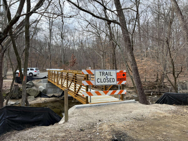
The county will also receive $800,000 for the replacement of a pedestrian bridge in Glencarlyn Park. The bridge, lost during the July 2019 flash flooding, was recently installed. The project was part of the adopted 2021 Capital Improvements Plan.

Outside of Arlington, local earmarks in the bill will support storm sewer and climate resilience improvements in the City of Alexandria and Falls Church City and improve information technology services in Fairfax County. It will also support a pilot program for the deployment of body-worn cameras in the Alexandria Police Department and safety improvements to the GW Parkway.


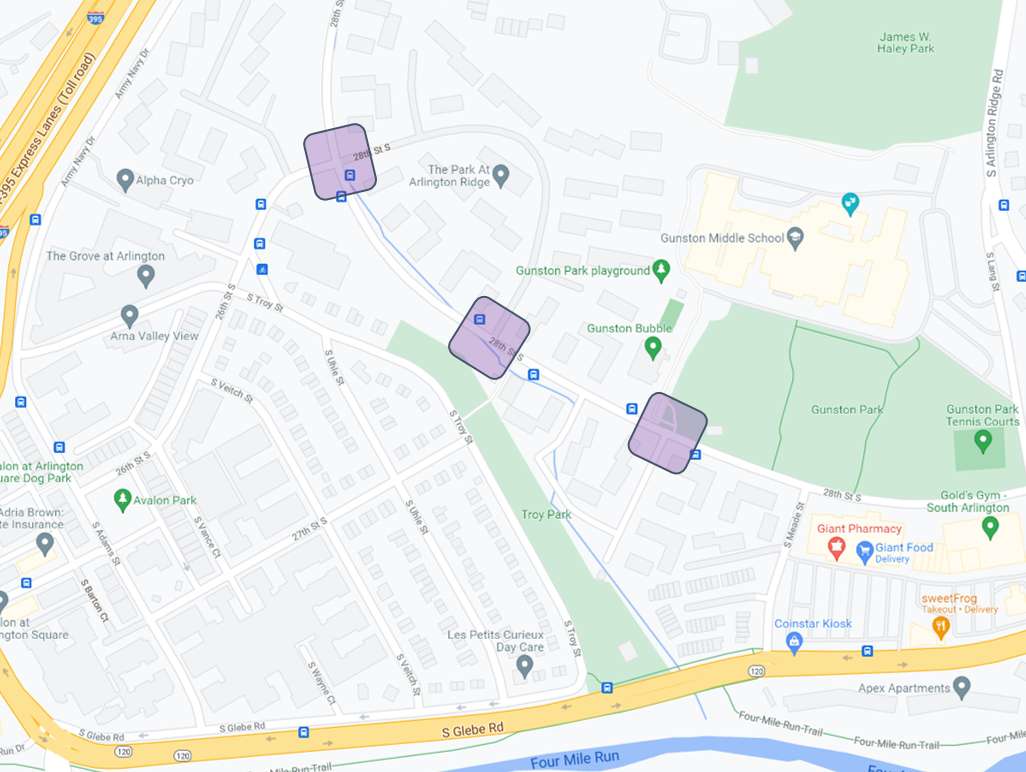
This week, locals can share their thoughts on a county project to make a segment of 28th Street S. near Gunston Park more walkable.

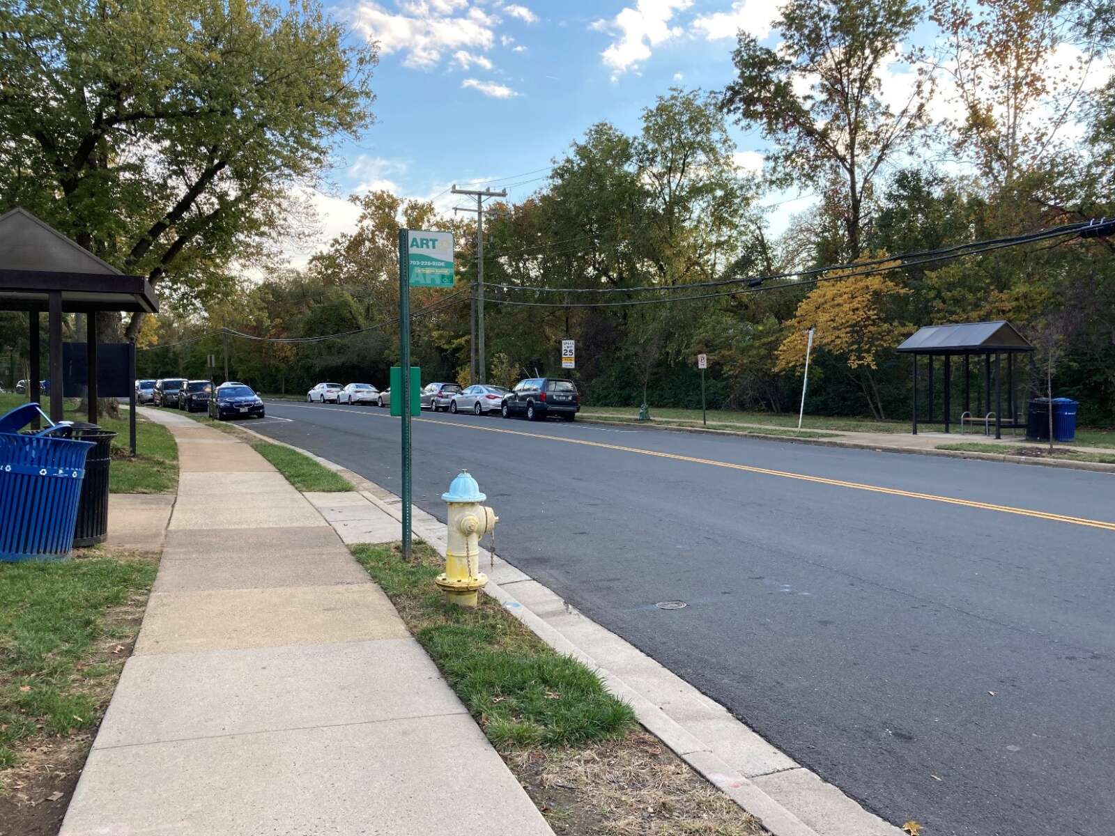
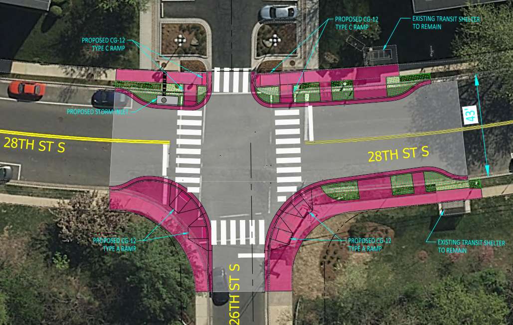
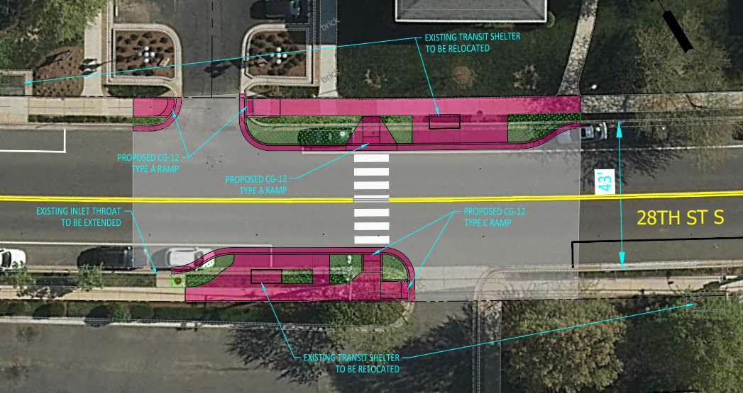
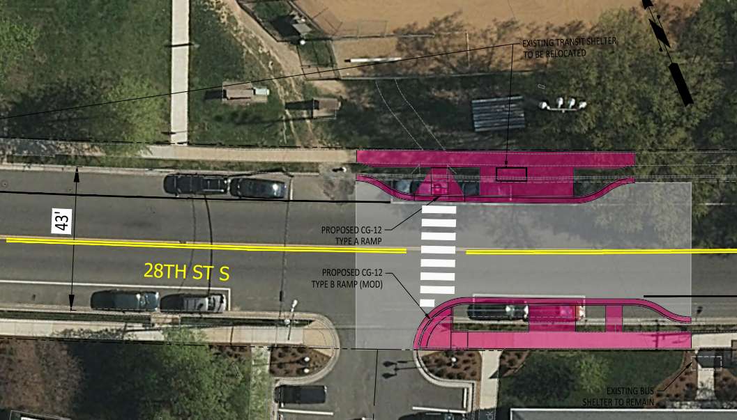
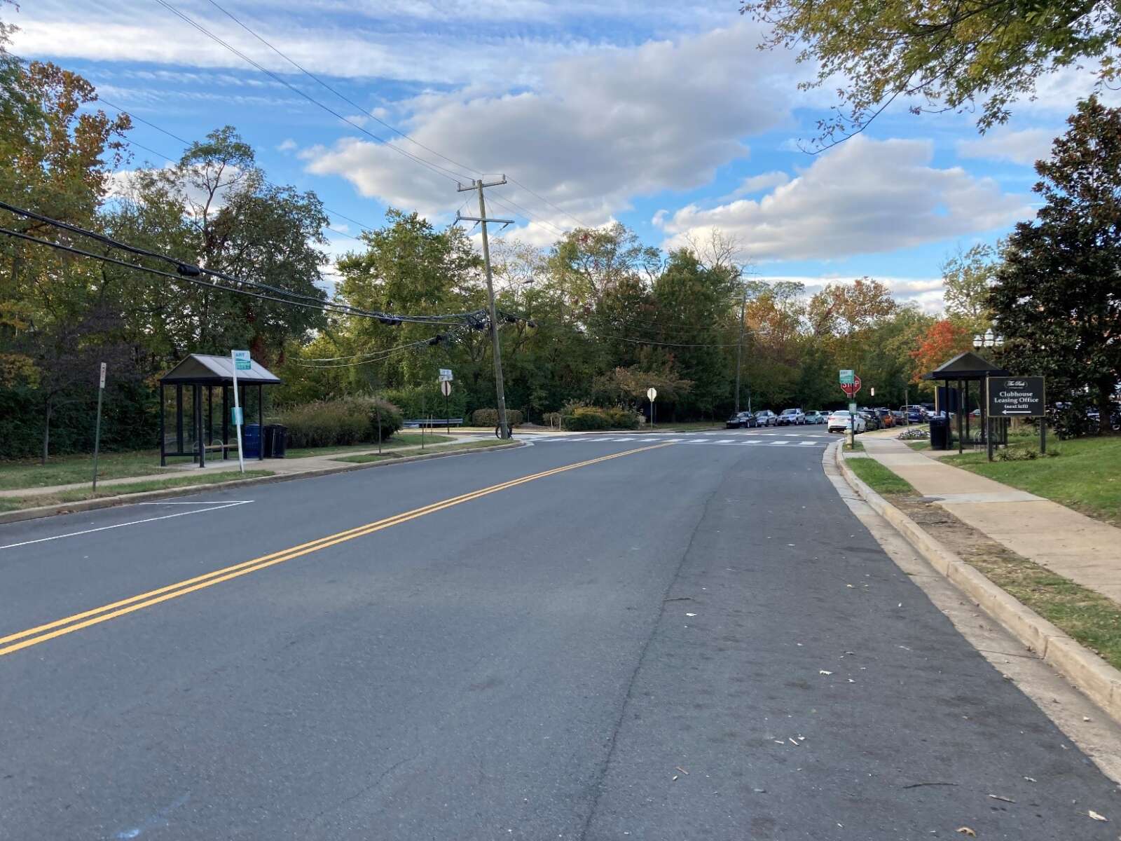
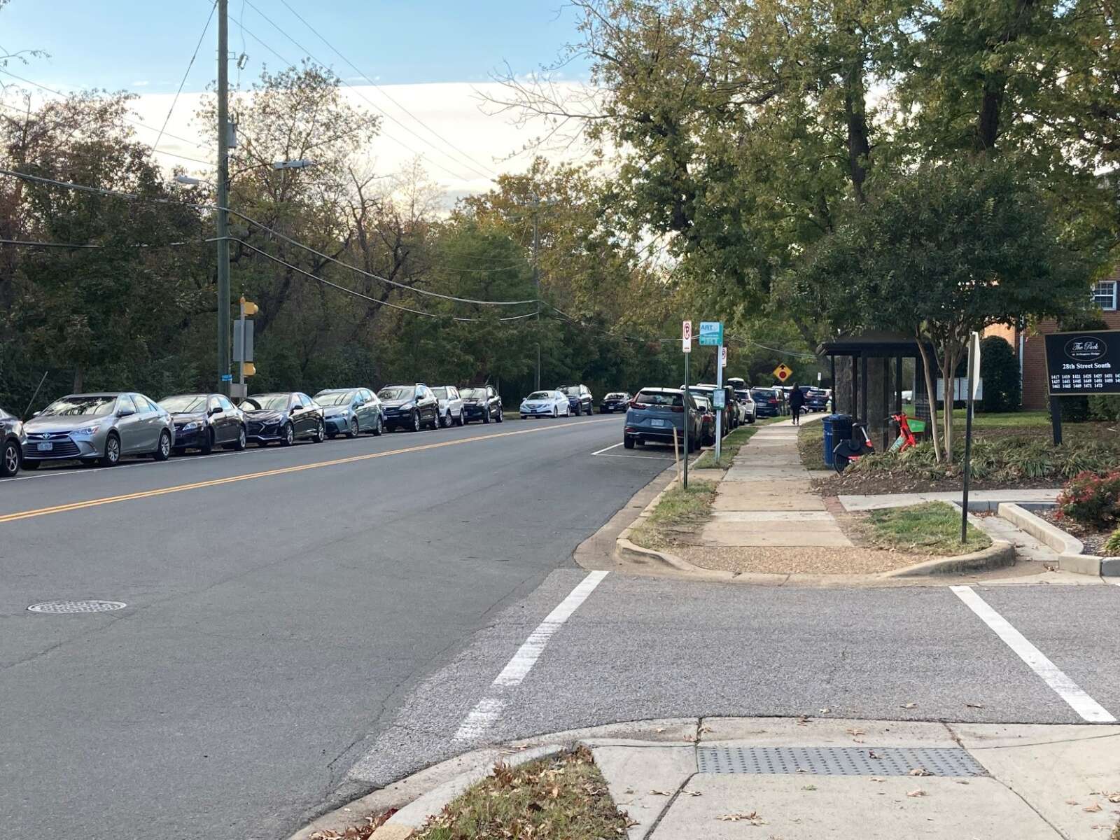
The proposed “Neighborhood Complete Streets” project aims to improve the existing sidewalk, curb ramps and transit stops between S. Meade Street and 26th Street S., near Gunston Middle School and the nearby community center, park and playing field space.

“The improvements seek to provide more comfortable, accessible pedestrian crossings and transit stops that will narrow the roadway and shorten the crossing distances,” according to the county.

Specifically, the county plans to install curb extensions and ramps that comply with the Americans with Disabilities Act to increase access to and shorten pedestrian crossing distances. It will add pavement markings and signage to make pedestrian crossings more visible to motorists.

Folks can provide feedback on the project, still in a preliminary design phase, through this Sunday. The survey asks respondents if the proposed changes would make them feel safer walking, taking public transit, biking, scooting or driving along 28th Street S.

“This feedback will help inform a final design, prioritizing feasibility, safety and available funding,” the county survey says.

The county Neighborhood Complete Streets program, funded through the County’s Capital Improvement Plan, aims to make physical improvements that address safety and access problems on non-arterial streets. At this stage, estimated project costs aren’t known. After the public engagement period for this project ends, it will go to the Neighborhood Complete Streets Commission for approval.

Then, it will advance to the Arlington County Board for approval, kicking off a more detailed design phase.

Meanwhile, renovations to the Gunston Bubble, which houses a year-round synthetic turf field, are scheduled to be completed soon, according to the county. The county embarked on energy efficiency and reliability upgrades to the “bubble” last summer.


View More Stories