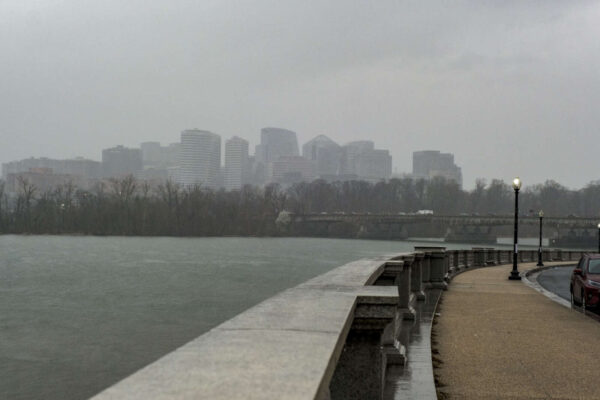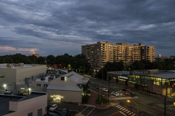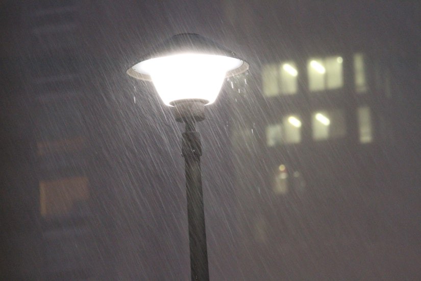
Storms bring heavy rain, wind and flooding at night (file photo)

Tonight’s storm is starting to cause flooding.

The earlier Flood Watch has been upgraded to a Flood Warning as the rain continues to fall.

More from the National Weather Service:

…FLOOD WARNING IN EFFECT UNTIL 4 AM EST MONDAY…

* WHAT…Flooding caused by excessive rainfall is expected.

* WHERE…Portions of DC, including the following , District of Columbia, central Maryland, including the following county, Montgomery, and northern Virginia, including the following counties, Arlington, City of Alexandria, City of Fairfax, City of Falls Church and Fairfax.

* WHEN…Until 400 AM EST Monday.

* IMPACTS…Flooding of rivers, creeks, streams, and other low-lying and flood-prone locations is imminent or occurring.

* ADDITIONAL DETAILS…
– At 949 PM EST, Gauge reports indicated that water is rising to near flood threshold. Flooding is ongoing or expected to begin shortly in the warned area. Between 1 and 1.5 inches of rain have fallen.
– Additional rainfall amounts of 1 to 2 inches are possible in the warned area.
– Some locations that will experience flooding include…

Arlington… Alexandria… Bethesda… Reston… Annandale… Fairfax… Vienna… Falls Church… Mantua… Pimmit Hills… Mclean… American Legion Bridge… Rosslyn… Potomac… North Bethesda… Oakton… Lincolnia… Tysons Corner… Takoma Park… Wolf Trap…
– Please visit www.weather.gov/safety/flood for flood safety and preparedness information


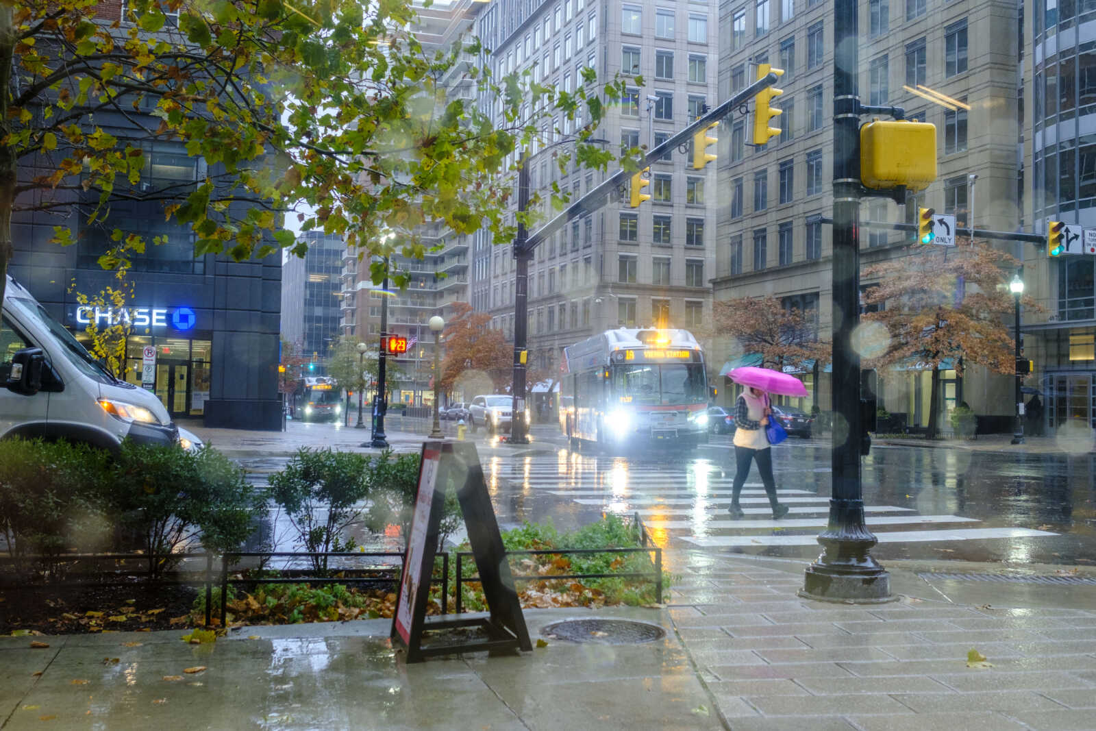
Rain in Ballston (staff photo by Jay Westcott)

It’s going to be a rainy Sunday. A very rainy Sunday.

A Flood Watch for much of the D.C. area was issued Friday night, ahead of the storm. Forecasters say 2-3 inches of rain is expected to fall, potentially causing flooding.

Strong winds are also expected late Sunday.

More from the National Weather Service:

…FLOOD WATCH IN EFFECT FROM SUNDAY AFTERNOON THROUGH LATE SUNDAY NIGHT…

* WHAT…Flooding caused by excessive rainfall is possible.

* WHERE…Portions of DC, including the following , District of Columbia, Maryland, including the following areas, Anne Arundel, Cecil, Central and Southeast Howard, Central and Southeast Montgomery, Charles, Northern Baltimore, Northwest Harford, Prince Georges, Southeast Harford and Southern Baltimore, and northern Virginia, including the following areas, Arlington/Falls Church/Alexandria, Central and Southeast Prince William/Manassas/Manassas Park, Fairfax, Southern Fauquier and Stafford.

* WHEN…From Sunday afternoon through late Sunday night.

* IMPACTS…Excessive runoff may result in flooding of rivers, creeks, streams, and other low-lying and flood-prone locations. Flooding may occur in poor drainage and urban areas. Storm drains and ditches may become clogged with debris.

* ADDITIONAL DETAILS…
– Two to three inches of rain are expected Sunday through late Sunday night with the heaviest rains falling during the afternoon and evening. This amount of rain could cause flooding of small streams, creeks and urban areas.
– Please visit www.weather.gov/safety/flood for flood safety and preparedness information
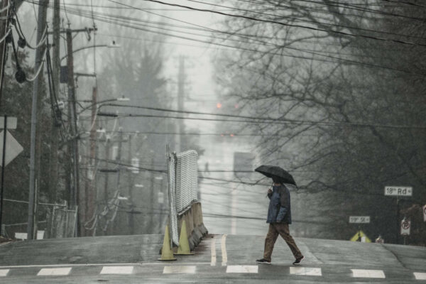

A pedestrian with an umbrella crosses N. Lexington St. in Westover amid a wet snowfall (staff photo by Jay Westcott)

NBC 4 Chief Meteorologist Doug Kammerer revealed his annual winter forecast last night — and it was disappointing if you like snow.

Doug is calling for a measly 1-6 inches of snow during the entire winter in Arlington and D.C. He believes it will be an unusually warm and wetter than average winter, making for plenty of cold rain but very little snow.

It follows a trend: five of the six most recent winters in the D.C. area have seen below average snowfall, Kammerer said.

Long-range forecasting is far from an exact science and there are other predictions that call for more snow. The meteorologists at WUSA 9 and Fox 5 are both calling for average to above average snowfall. The Farmer’s Almanac, meanwhile, while decidedly not a scientific authority, is predicting above average snowfall and below average temperatures for the region.

Should Kammerer’s prediction come to pass and we see six or fewer inches of snow this winter, how would you feel about it?


Heavy rain along the Potomac River, with Rosslyn in the background (staff photo by Jay Westcott)

The remnants of Hurricane Nicole are heading our way, meaning a soggy and stormy Veterans Day is on tap.

The rain will start falling early Friday morning. Downpours and gusty winds are expected to follow as the day goes on, before the skies clear Saturday.

Officials are encouraging local residents to get ready now, clearing leaves from storm drains and gutters.

The storm will make for some large, soggy leaf piles on the side of the road. Arlington County does not start its vacuum leaf collection process until next week.

So far, no watches or warnings have been issued for the county. Nicole is packing a threat of localized flooding and isolated tornadoes, but Arlington is outside of the zones where those threats are most likely.

More via Twitter:

https://twitter.com/readyarlington/status/1590724482364100609?s=46&t=bbAwMb2Xxziyg8Pqu9b9ww


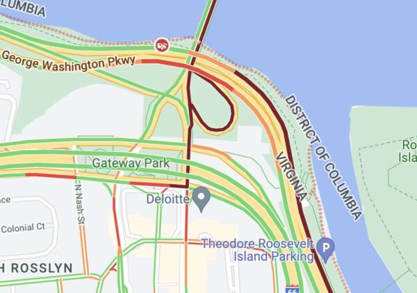
Map showing crash on GW Parkway (via Google Maps)

It happened again.

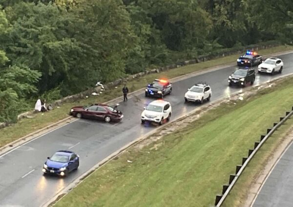
Amid rainy weather, a vehicle crashed and overturned on the northbound GW Parkway near Key Bridge, at a bend in the road that — as we reported yesterday — has been the scene of numerous crashes. This is at least the third crash at that location in the past three days.

The crash occurred shortly before 8:45 a.m. The driver was able to get out of the overturned vehicle and no serious injuries have been reported, according to scanner traffic.

Drivers should expect significant backups on the northbound GW Parkway south of the bridge as a result of the crash.

Many commuter routes in Arlington are currently experiencing heavy traffic due to the rain, crashes, and — in the case of inbound traffic heading over the Key Bridge — a demonstration in D.C.

Map via Google Maps


Vehicle crash on the northbound GW Parkway near Key Bridge on Sunday (photo courtesy Alan Henney)

It’s almost as automatic as Steph Curry draining free throws at this point.

Whenever there’s a soaking rainfall, it seems that some drivers cannot help but slide off the road at a certain bend in the northbound GW Parkway near Key Bridge, sometimes flipping their cars in the process.

One such overturned vehicle crash happened during last night’s commute, shutting down the northbound lanes for nearly an hour.

And that was just the most recent crash during our current rainy stretch.

Over the weekend, police responded to at least one single-vehicle crash in the same spot.

Past crashes reported in the same spot include:

The crashes have, over time, pockmarked the stone wall along that stretch of the Parkway. The wrecks also inspired a Mike Mount cartoon earlier this year.

While this particular bend is arguably the most crash-prone section of the Parkway in Arlington, other sections have seen recent crashes, including the southbound lanes near Memorial Bridge earlier this morning.

The National Park Service, which is responsible for maintaining the Parkway, recently kicked off a major rehabilitation project for the busy commuter route. However, that work is taking place north of both sections referenced above — from Spout Run Parkway to I-495.

Short of potential future safety improvements, the best way for drivers to avoid crashes may be to simply slow down, particularly in rainy weather.


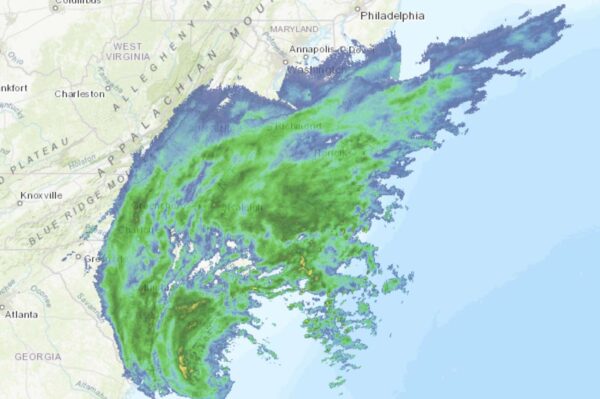
Rains from Hurricane Ian approaching the D.C. area (via National Weather Service)

Rain and wind associated with Hurricane Ian are expected to ramp up tonight in the D.C. area, but the biggest local impacts might be on your weekend plans.

Already a number of Arlington events have been modified or rescheduled, including:

No land-based watches or warnings have been issued for Arlington ahead of the storm, so far, but a Gale Warning has been issued for watercraft on the Potomac. Wind gusts of up to 40 mph are expected between 8 p.m. tonight and 6 a.m. Saturday, according to the National Weather Service.

Rain from the storm system could last all weekend and drag into Tuesday, but after an extended stretch of dry weather little to no flooding is expected locally.

Still, authorities are asking Arlington residents to be prepared just in case.

https://twitter.com/ReadyArlington/status/1575573149550518273


Lightning strikes in the distance on a stormy night in Ballston, looking south along Glebe Road in August 2022 (staff photo by Jay Westcott)

Arlington, Alexandria, D.C. and other parts of the Washington region could see strong storms and pockets of flooding.

A Flood Watch has been issued for much of the area and is set to take effect at 5 p.m.

Forecasters say istorms will likely arrive later this afternoon and may pack heavy rainfall and, in more isolated instances, damaging wind gusts. A “brief tornado” is also possible.

More from the National Weather Service:

1049 AM EDT MON SEP 12 2022

…FLOOD WATCH REMAINS IN EFFECT FROM 5 PM EDT THIS AFTERNOON THROUGH THIS EVENING…

* WHAT…FLASH FLOODING CAUSED BY EXCESSIVE RAINFALL CONTINUES TO BE POSSIBLE. […]

* WHEN…FROM 5 PM EDT THIS AFTERNOON THROUGH THIS EVENING.

* IMPACTS…EXCESSIVE RUNOFF MAY RESULT IN FLOODING OF RIVERS, CREEKS, STREAMS, AND OTHER LOW-LYING AND FLOOD-PRONE LOCATIONS.

* ADDITIONAL DETAILS…
– SHOWERS AND THUNDERSTORMS ARE EXPECTED THIS AFTERNOON INTO THE EVENING AS A COLD FRONT PUSHES THROUGH THE AREA. HEAVY RAINFALL RATES COULD PRODUCE LOCALIZED RAINFALL AMOUNTS OF 2 TO 3 INCHES IN A SHORT PERIOD OF TIME.
– HTTP://WWW.WEATHER.GOV/SAFETY/FLOOD

PRECAUTIONARY/PREPAREDNESS ACTIONS…

YOU SHOULD MONITOR LATER FORECASTS AND BE PREPARED TO TAKE ACTION SHOULD FLASH FLOOD WARNINGS BE ISSUED.


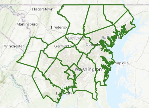
Flood Watch boundaries (via NWS)

Update at 1:50 p.m. — A Severe Thunderstorm Watch was just issued for parts of the D.C. area, including Arlington, and much of the D.C.-Baltimore-Philly-NYC corridor. That’s in addition to the Flood Watch, below.

From the National Weather Service:

Scattered severe thunderstorms are possible this afternoon and evening, mainly north of the D.C. metro area. Damaging wind gusts are the primary threat with an isolated tornado also possible.

Earlier: It’s the middle of July and the humidity level outside is roughly that of an unventilated bathroom after a half-hour hot shower.

Unsurprisingly, that combination is a recipe for possible downpours — and flooding — tonight.

The National Weather Service just issued a Flood Watch, which will go into effect at 4 p.m. Forecasters say “multiple rounds of storms” could cause flooding later today.

More from NWS:

FLOOD WATCH
NATIONAL WEATHER SERVICE BALTIMORE MD/WASHINGTON DC
931 AM EDT MON JUL 18 2022

…FLOOD WATCH IN EFFECT FROM 4 PM EDT THIS AFTERNOON THROUGH THIS EVENING…

* WHAT…FLASH FLOODING CAUSED BY EXCESSIVE RAINFALL IS POSSIBLE.

* WHERE…PORTIONS OF DC, MARYLAND AND NORTHERN VIRGINIA […]

* WHEN…FROM 4 PM EDT THIS AFTERNOON THROUGH THIS EVENING.

* IMPACTS…EXCESSIVE RUNOFF MAY RESULT IN FLOODING OF RIVERS, CREEKS, STREAMS, AND OTHER LOW-LYING AND FLOOD-PRONE LOCATIONS.

* ADDITIONAL DETAILS…
– AFTERNOON TO EVENING SHOWERS AND THUNDERSTORMS MAY PRODUCE VERY HEAVY RAINFALL CAPABLE OF FLASH FLOODING. THIS COULD INCLUDE MULTIPLE ROUNDS OF STORMS WHICH WOULD ENHANCE THE FLOOD RISK. RAINFALL RATES MAY REACH 1 TO 2 INCHES PER HOUR, LOCALLY HIGHER IN SPOTS. THE D.C. AND BALTIMORE METROS WILL BE THE MOST SUSCEPTIBLE GIVEN RECENT HEAVY RAINFALL THE PAST COUPLE OF WEEKS.
– HTTP://WWW.WEATHER.GOV/SAFETY/FLOOD

PRECAUTIONARY/PREPAREDNESS ACTIONS…

YOU SHOULD MONITOR LATER FORECASTS AND BE PREPARED TO TAKE ACTION SHOULD FLASH FLOOD WARNINGS BE ISSUED.


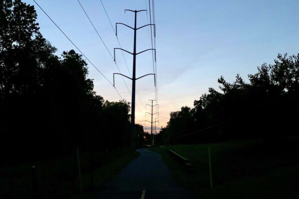
Twilight on the W&OD Trail (Flickr pool photo by Tom Mockler)

Lots of Rain from Wednesday Storms — Most parts of Arlington saw 2-3 inches of rain from Wednesday’s onslaught of storms and downpours, with one weather station in a southwestern portion of the county reporting 3.41 inches. [National Weather Service, Twitter]

No ‘Missing Middle’ Cost Analysis — “Staff leading the effort acknowledge there has been no cost-benefit analysis of exactly how such a major zoning change would impact the local government’s bottom line. Nor is there likely to be one. ‘We typically don’t do analysis of this nature. It’s hard to even capture all of that,’ said Richard Tucker, one of a number of county-government housing personnel dispatched to the June 14 meeting of the Arlington County Civic Federation to address an issue that is fast becoming the most contentious Arlington battle since the Columbia Pike streetcar fight of a decade ago.” [Sun Gazette]

Millions for Local Housing Nonprofits — “Two Arlington-based groups will receive a total of $7 million in federal funding to help provide affordable housing and services to low-income people, U.S. Sens. Mark Warner and Tim Kaine of Virginia announced Thursday… Arlington Partnership for Affordable Housing Inc. will receive $5 million from the fund and Arlington-based AHC Inc. will receive $2 million.” [Patch]

ACPD Pride Event Next Week — “In recognition of Pride Month and the significant contributions of Arlington’s LGBTQ+ communities, the Arlington County Police Department (ACPD) will host the 2nd Annual Pride with the Police… Pride with the Police will take place on: Wednesday, June 29, 20225 p.m. to 7 p.m. [at] Freddie’s Beach Bar and Restaurant, located at 555 23rd Street S.” [ACPD]

F.C. Outranks Arlington for ‘Healthiest Community’ — “The City of Falls Church has been recognized as the second healthiest community in the country by U.S. News & World Report… The City earned an overall score of 98, and is the only community to receive a score of 100 in both education and population health.” Arlington ranked No. 13. [City of Falls Church, U.S. News & World Report]

It’s Friday — Partly cloudy throughout the day. High of 83 and low of 63. Sunrise at 5:46 am and sunset at 8:39 pm. [Weather.gov]

Flickr pool photo by Tom Mockler


Rainy evening in Crystal City along 23rd Street S. (staff photo by Jay Westcott)

Several rounds of storms packing heavy downpours are possible tonight, leading to a Flood Watch being issued for Arlington and much of the region.

The watch is in effect until 4 a.m. Thursday.

Flash flooding and gusty winds are possible tonight, the National Weather Service says.

In Arlington, flooding is often limited to ponding on roadways and streams overtopping their banks, but some past summer rain storms have resulted in widespread flash flooding and numerous flooded basements.

From NWS:

…FLOOD WATCH IN EFFECT UNTIL 4 AM EDT THURSDAY…

* WHAT…Flash flooding caused by excessive rainfall is possible.

* WHERE…Portions of DC, Maryland, Virginia and panhandle West Virginia, including the following areas: in DC, District of Columbia. In Maryland, Anne Arundel, Central and Southeast Howard, Central and Southeast Montgomery, Frederick MD, Northwest Howard, Northwest Montgomery, Prince Georges and Washington. In Virginia, Arlington/Falls Church/Alexandria, Clarke, Eastern Loudoun, Fairfax, Frederick VA and Western Loudoun. In panhandle West Virginia, Berkeley, Jefferson and Morgan.

* WHEN…Until 4 AM EDT Thursday.

* IMPACTS…Excessive runoff may result in flooding of rivers, creeks, streams, and other low-lying and flood-prone locations.

* ADDITIONAL DETAILS…
– Numerous showers and thunderstorms with heavy rain are expected through this evening and into the overnight. Rainfall rates of 2 inches per hour are possible, leading to the potential for flash flooding especially in areas that see multiple rounds of heavy rain.
– Please visit https://www.weather.gov/safety/flood for flood safety and preparedness information.

PRECAUTIONARY/PREPAREDNESS ACTIONS…

You should monitor later forecasts and be prepared to take action should Flash Flood Warnings be issued.


View More Stories