Arlington and the rest of the D.C. area is now under a Flood Warning.

The National Weather Service says urban areas and streams are in danger of flooding as heavy rain continues to fall. Already parts of Old Town Alexandria have flooded and some streams in Arlington are overflowing their banks.

From NWS:

THE NATIONAL WEATHER SERVICE IN STERLING VIRGINIA HAS ISSUED A

* FLOOD WARNING FOR URBAN AREAS AND SMALL STREAMS…

* UNTIL 300 PM EDT

* AT 903 AM EDT… RADAR INDICATED HEAVY RAIN OF UP TO ONE INCH HAD FALLEN IN THE METRO AREA IN THE LAST TWO HOURS. SIMILAR RAINFALL RATES ARE EXPECTED FOR THE NEXT SEVERAL HOURS… WHICH WILL CAUSE STREAMS TO RISE OUT OF THEIR BANKS AND CAUSE FLOODING IN URBAN AREAS.

PRECAUTIONARY/PREPAREDNESS ACTIONS…

A FLOOD WARNING MEANS THAT FLOODING IS IMMINENT OR HAS BEEN REPORTED. STREAM RISES WILL BE SLOW. HOWEVER… ALL INTERESTED PARTIES SHOULD TAKE NECESSARY PRECAUTIONS IMMEDIATELY.

MOST FLOOD DEATHS OCCUR IN AUTOMOBILES. NEVER DRIVE YOUR VEHICLE INTO AREAS WHERE THE WATER COVERS THE ROADWAY. FLOOD WATERS ARE USUALLY DEEPER THAN THEY APPEAR. JUST ONE FOOT OF FLOWING WATER IS POWERFUL ENOUGH TO SWEEP VEHICLES OFF THE ROAD. WHEN ENCOUNTERING FLOODED ROADS MAKE THE SMART CHOICE… TURN AROUND… DONT DROWN.


A flash flood watch has been issued for Arlington County and the surrounding D.C. metro area.

Forecasters expect 3-5 inches of rain to fall between now and Thursday as a storm system soaks the region for much of the week. The deluge may cause local creeks, streams and low-lying areas to flood. From the National Weather Service:

… FLASH FLOOD WATCH IN EFFECT FROM TUESDAY EVENING THROUGH LATE WEDNESDAY NIGHT…

THE NATIONAL WEATHER SERVICE IN STERLING VIRGINIA HAS ISSUED A

* FLASH FLOOD WATCH FOR PORTIONS OF MARYLAND… THE DISTRICT OF COLUMBIA AND VIRGINIA… INCLUDING THE FOLLOWING AREAS… IN MARYLAND… ANNE ARUNDEL… CALVERT… CARROLL… CHARLES… HARFORD… HOWARD… MONTGOMERY… BALTIMORE… PRINCE GEORGES… AND ST. MARYS. IN VIRGINIA… ARLINGTON/FALLS CHURCH/ALEXANDRIA… FAIRFAX… KING GEORGE… PRINCE WILLIAM/MANASSAS/MANASSAS PARK… SOUTHERN FAUQUIER… SPOTSYLVANIA AND STAFFORD… AND THE DISTRICT OF COLUMBIA.

* FROM TUESDAY EVENING THROUGH LATE WEDNESDAY NIGHT

* RAIN WILL CONTINUE THROUGH WEDNESDAY NIGHT… WITH THE HEAVIEST RAIN EXPECTED TUESDAY NIGHT THROUGH WEDNESDAY NIGHT. STORM TOTAL RAINFALL AMOUNTS WILL AVERAGE BETWEEN 3 AND 5 INCHES WITH LOCALLY HIGHER AMOUNTS LIKELY.

* HEAVY AMOUNTS OF RAIN IN SHORT PERIODS OF TIME MAY CAUSE FLASH FLOODING OF CREEKS… STREAMS AND URBAN AREAS.

PRECAUTIONARY/PREPAREDNESS ACTIONS…

A FLASH FLOOD WATCH MEANS THAT THERE IS THE POTENTIAL FOR FLASH FLOODING. FLASH FLOODING IS A VERY DANGEROUS SITUATION. RAPIDLY MOVING WATER IS POWERFUL AND CAN BE A THREAT TO VEHICLES AS WELL AS PEOPLE AND PROPERTY.

YOU SHOULD MONITOR LATER FORECASTS AND BE PREPARED TO TAKE ACTION SHOULD WARNINGS BE ISSUED. A WARNING WOULD MEAN THAT WE HAVE MOVED FROM THE POSSIBILITY OF FLOODING TO A FLOODING SITUATION IN A SPECIFIC AREA.


Arlington and the surrounding D.C. region is under a Flood Watch through midnight tonight.

Forecasters say 3-6 inches of rain has fallen since Wednesday and another 1-3 inches is expected tonight, raising the possibility of flooding. From the National Weather Service:

…FLOOD WATCH IN EFFECT UNTIL MIDNIGHT EDT TONIGHT…

THE NATIONAL WEATHER SERVICE IN STERLING VIRGINIA HAS EXPANDED
THE

* FLOOD WATCH TO INCLUDE PORTIONS OF MARYLAND…THE DISTRICT OF
COLUMBIA AND VIRGINIA…INCLUDING THE FOLLOWING AREAS…IN
MARYLAND…ANNE ARUNDEL…CALVERT…CHARLES…HOWARD…
MONTGOMERY…PRINCE GEORGES AND ST. MARYS. THE DISTRICT OF
COLUMBIA. IN VIRGINIA…ARLINGTON/FALLS CHURCH/ALEXANDRIA…
CULPEPER…FAIRFAX…GREENE…KING GEORGE…LOUDOUN…
MADISON…NORTHERN FAUQUIER…ORANGE…PRINCE
WILLIAM/MANASSAS/MANASSAS PARK…RAPPAHANNOCK…SOUTHERN
FAUQUIER…SPOTSYLVANIA AND STAFFORD.

* UNTIL MIDNIGHT EDT TONIGHT

* THREE TO SIX INCHES OF RAIN HAS ALREADY FALLEN SINCE WEDNESDAY
ACROSS THE GREATER WASHINGTON DC METRO AREA…CENTRAL MARYLAND
AND THE NORTHERN PIEDMONT REGION OF VIRGINIA. STEADY MODERATE TO
HEAVY RAIN CURRENTLY OVER NORTHERN VIRGINIA WILL SLOWLY SHIFT
SOUTHWARD THROUGH MIDNIGHT.

* ADDITIONAL AMOUNTS OF ONE TO LOCALLY THREE INCHES ARE POSSIBLE
THROUGH THIS EVENING. THIS AMOUNT OF RAINFALL WOULD CAUSE
FLOODING OF SMALL STREAMS AND URBAN AREAS.

PRECAUTIONARY/PREPAREDNESS ACTIONS…

A FLOOD WATCH MEANS THERE IS A POTENTIAL FOR FLOODING BASED ON
CURRENT FORECASTS.

YOU SHOULD MONITOR LATER FORECASTS AND BE ALERT FOR POSSIBLE
FLOOD WARNINGS. THOSE LIVING IN AREAS PRONE TO FLOODING SHOULD BE
PREPARED TO TAKE ACTION SHOULD FLOODING DEVELOP.


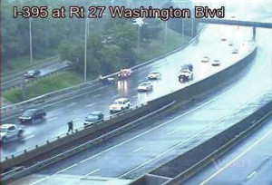
Rainy accident on I-395 at Washington Boulevard (file photo)Numerous accidents have been reported around Arlington today as continued rainy weather is making for slick conditions on the roads.

AAA Mid-Atlantic is reminding motorists to drive carefully in wet weather.

The association sent out the following press release this afternoon.

As the coastal storm continues through the Washington metro area today, motorists will face hazardous driving conditions during their evening commute due to rain and standing water, warns AAA Mid-Atlantic.  The auto club is advising motorists to exercise caution when driving.

“Commuters heading home tonight will face the same hazardous weather conditions as this morning’s drive to work,” said John B. Townsend II, AAA Mid-Atlantic’s Manager of Public and Government Affairs.  “When driving in wet weather remember to buckle up, slow down, and keep a safe distance from the car in front of you. Also, remember, it’s the law in the District of ColumbiaMaryland and Virginia to turn your headlights on if your windshield wipers are in use.”

To minimize the hazards associated with wet weather driving, AAA Mid-Atlantic recommends the following precautions for navigating in heavy rain, reduced visibility and slick pavement:

  • Slow down and increase following distances. Speed limits are set for ideal road conditions. When it rains, visibility is reduced and braking distances increase. On dry pavement, a safe following distance permits two to three seconds for stopping; that should be increased to eight seconds on slippery roads. Train your eyes farther down the road than normal, so you can anticipate changes and adjust your course gradually.
  • Do not attempt to drive through standing water on the roads that look too deep. Avoid bridges and roads that are known to flood. When driving on pothole-filled roads, hold the steering wheel firmly to avoid losing control. Just a few inches of water can turn your vehicle into a boat, and could put your life, and the lives of those around you, at great risk. Turn around; find another way to get to your destination.
  • Watch out for hydroplaning. No car is immune from hydroplaning on wet surfaces, including four-wheel drive vehicles. Just because brakes work under normal conditions doesn’t mean they will react the same on slippery roads where tires roll with far less traction.
  • Alert drivers behind you that you’re slowing with your brake lights. Without anti-lock brakes, squeeze the brakes until they are about to lock up and then release. With anti-lock brakes, use the same move – but don’t pump the brakes, which would work against the operation of the ABS system. Slow down as you approach a pothole. However, do not brake when your vehicle is directly over a pothole.
  • Use the central lanes. When driving during heavy rain, use center lanes of the road (without straddling the yellow line). Avoid outside lanes where the water collects at curbside.
  • Use low-beam headlights to help other drivers see your car and increase visibility.
  • Use your defroster with your air conditioning to keep the air dry and prevent windows from fogging.
  • Do not drive around barricades. Many lives have been lost when drivers disregard official orders and find themselves trapped in rising waters.
  • Turn off the cruise control in wet weather driving. The use of cruise control on wet roads can cause hydroplaning.
  • If conditions worsen to the point where there is any doubt about your safety, take the nearest exit and find a safe location.  Don’t just stop on the shoulder or under a bridge where you may feel less anxiety. If your visibility is compromised, other drivers may be struggling too.
  • Watch for slick spots on the road. Fumes and oil leaks that build up on dry pavement rise to the surface of the road when it rains, making the road far slicker than it may seem.

Update at 9:35 a.m. — Departing flights are experiencing a “gate hold” at DCA. Delays of at least 30 minutes should be expected, and could get worse throughout the day.

Update at 8:55 a.m. — There is a ground stop for flights arriving at Reagan National Airport due to the weather. Check with your airline for the status on any outgoing flights.

The National Weather Service has put Arlington and the rest of the metro area under a Severe Thunderstorm Watch until 11:00 a.m. That’s in addition to the Flash Flood watch that went into effect at midnight and will last until 8:00 p.m.

NWS notes several rounds of strong storms could soak the area. That could create trouble due to the level of ground saturation from the heavy rains that caused flooding earlier this week. From NWS:

* SHOWERS AND THUNDERSTORMS WILL LIKELY MOVE ACROSS THE REGION
THIS MORNING AND PRODUCE HEAVY DOWNPOURS. RAINFALL AMOUNTS IN
EXCESS OF 1 INCH ARE POSSIBLE. ANOTHER ROUND OF STORMS MAY BRING
HEAVY RAIN THIS AFTERNOON AND EVENING WITH AN ADDITIONAL 1 TO 2
INCHES POSSIBLE.

* WITH THE GROUND ALREADY SATURATED FROM HEAVY RAINFALL DURING
THE PAST WEEK…ONLY AN INCH OF RAINFALL IN AN HOUR COULD
PRODUCE FLASH FLOODING OF STREAMS AND LOW LYING AREAS.

PRECAUTIONARY/PREPAREDNESS ACTIONS…

A FLASH FLOOD WATCH MEANS THAT CONDITIONS MAY DEVELOP THAT LEAD
TO FLASH FLOODING. FLASH FLOODING IS A VERY DANGEROUS SITUATION.

YOU SHOULD MONITOR LATER FORECASTS AND BE PREPARED TO TAKE ACTION
SHOULD FLASH FLOOD WARNINGS BE ISSUED.

Although the storms have the potential to bring damaging winds and the word “derecho” is being thrown around, the Capital Weather Gang doesn’t expect it to be as strong as the derecho that struck last year.

The Office of Personnel Management has kept all federal offices open, but employees have the option of unscheduled leave or unscheduled telework.


Rainy Reflections (photo by Katie Pyzyk)Arlington has been feeling the impacts of Tropical Storm Andrea today.

The storm has been dumping rain on the region all day, and even heavier rains and stronger wind gusts are expected during the evening commute.

Tonight’s outdoor showing of “Risky Business” in Rosslyn has been cancelled due to the weather. Meanwhile, the soaking rains and wind might be responsible for knocking down power lines along N. Pershing Drive in the Ashton Heights area. Pershing is currently closed between Lincoln and Monroe Streets while police and firefighters wait for Dominion Power crews to repair the lines.

AAA Mid-Atlantic is warning drivers to be careful on the roads tonight, especially during periods of heavier rain.

“Tropical Storm Andrea passes through the Washington Metro area today and will continue north along the I-95 corridor,” the organization said in a press release. “Motorists will face hazardous driving conditions during the evening commute due to heavy winds, torrential rains, and flooding… The auto club is advising motorists to exercise caution if they must take to the roads during the squally driving conditions.”

AAA issued the following list of wet weather driving tips.

  • Slow down and increase following distances. Speed limits are set for ideal road conditions. When it rains, visibility is reduced and braking distances increase. On dry pavement, a safe following distance permits two to three seconds for stopping; that should be increased to eight seconds on slippery roads. Train your eyes farther down the road than normal, so you can anticipate changes and adjust your course gradually.
  • Do not attempt to drive through standing water. Try to avoid bridges and roads that are known to flood. Cross them only if there is little standing or streaming water. When driving on pothole-filled roads, hold the steering wheel firmly to avoid losing control. Just a few inches of water can turn your vehicle into a boat, and could put your life, and the lives of those around you, at great risk. Turn around; find another way to get to your destination.
  • Watch out for hydroplaning. No car is immune from hydroplaning on wet surfaces, including four-wheel drive vehicles. Just because brakes work under normal conditions doesn’t mean they will react the same on slippery roads where tires roll with far less traction.
  • Alert drivers behind you that you’re slowing with your brake lights. Without anti-lock brakes, squeeze the brakes until they are about to lock up and then release. With anti-lock brakes, use the same move – but don’t pump the brakes, which would work against the operation of the ABS system. Slow down as you approach a pothole. However, do not brake when your vehicle is directly over a pothole.
  • Use the central lanes. When driving during heavy rain, use center lanes of the road (without straddling the yellow line). Avoid outside lanes where the water collects at curbside.
  • Use low-beam headlights to help other drivers see your car and increase visibility. Remember many states legally require drivers to use their headlights during inclement weather. In our neck of the woods Virginia, Maryland, Delaware, Pennsylvania, and New Jersey have wipers on, lights on laws, according to the AAA Digest of Motor Laws.
  • Use your defroster with your air conditioning to keep the air dry and prevent windows from fogging.
  • Do not drive around barricades. Many lives have been lost when drivers disregard official orders and find themselves trapped in rising waters.
  • Turn off the cruise control in wet weather driving. The use of cruise control on wet roads can cause hydroplaning.
  • If conditions worsen to the point where there is any doubt about your safety, take the nearest exit and find a safe location. Don’t just stop on the shoulder or under a bridge where you may feel less anxiety. If your visibility is compromised, other drivers may be struggling too.
  • Fumes and oil leaks that build up on dry pavement rise to the surface of the road when it rains, making the road far slicker than it may seem.

Arlington is currently under a Flash Flood Watch.

File photo


Update at 3:35 p.m. — Although the weather remains rainy and windy, the National Weather Service has canceled the flood watch.

A flood watch has been issued for Arlington and the surrounding areas in light of the heavy rains that are predicted for this afternoon.

The National Weather Service issued the watch, which begins at 3:00 p.m. and remains in effect through the evening.

* A PERIOD OF MODERATE TO LOCALLY HEAVY RAINFALL IS EXPECTED
TUESDAY AFTERNOON AND EVENING. RAINFALL TOTALS BETWEEN ONE AND
TWO INCHES ARE EXPECTED.

* LOCALLY HEAVY RAINFALL MAY CAUSE SMALL STREAMS AND CREEKS TO
RISE OUT OF THEIR BANKS…OVERFLOWING LOW LYING AND URBAN
AREAS. DO NOT EVER DRIVE INTO FLOOD WATERS.

PRECAUTIONARY/PREPAREDNESS ACTIONS…

A FLOOD WATCH MEANS THERE IS A POTENTIAL FOR FLOODING BASED ON
CURRENT FORECASTS.

YOU SHOULD MONITOR LATER FORECASTS AND BE ALERT FOR POSSIBLE
FLOOD WARNINGS. THOSE LIVING IN AREAS PRONE TO FLOODING SHOULD BE
PREPARED TO TAKE ACTION SHOULD FLOODING DEVELOP.

Although the rains should stop by tonight, the effects could be felt for several days. The NWS has also issued a Hazardous Weather Outlook for the area.

.DAY ONE…TODAY AND TONIGHT

HEAVY RAIN THIS AFTERNOON AND EVENING HAS THE POTENTIAL TO CAUSE
FLOODING OF STREAMS AND LOW AREAS IN THE WASHINGTON AND BALTIMORE
METRO AREAS. A FLOOD WATCH HAS BEEN ISSUED FOR THESE AREAS.

OVER THE WATERS…GUSTY WINDS ARE EXPECTED TODAY AND TONIGHT AND
A SMALL CRAFT ADVISORY HAS BEEN ISSUED.

TIDES WILL BE HIGHER THAN NORMAL DUE TO ONSHORE WINDS. FOR THOSE
ALONG THE WESTERN SHORE OF THE MARYLAND CHESAPEAKE BAY AND THE
SHORELINE OF THE TIDAL POTOMAC RIVER…MINOR TIDAL FLOODING IS
POSSIBLE DURING THE TIMES OF HIGH TIDE BETWEEN THIS AFTERNOON AND
WEDNESDAY MORNING.

.DAYS TWO THROUGH SEVEN…WEDNESDAY THROUGH MONDAY

OVER THE WATERS…GUSTY WINDS MAY REMAIN STRONG ENOUGH TO NEED A
SMALL CRAFT ADVISORY THROUGH WEDNESDAY NIGHT.

TIDES WILL BE HIGHER THAN NORMAL DUE TO ONSHORE WINDS. FOR THOSE
ALONG THE WESTERN SHORE OF THE MARYLAND CHESAPEAKE BAY AND THE
SHORELINE OF THE TIDAL POTOMAC RIVER…MINOR TIDAL FLOODING IS
POSSIBLE DURING THE TIMES OF HIGH TIDE WEDNESDAY MORNING.

RAIN OR SNOW SHOWERS ARE POSSIBLE WEDNESDAY NIGHT AND THURSDAY.


A cold front will bring high winds, heavy rain and possible thunderstorms tonight.

A Flash Flood Watch is in effect for Arlington and the D.C. region and Arlington County just issued the following alert.

The National Weather Service (NWS) reports they are monitoring 3 weather related threats to the metropolitan DC area starting this afternoon and into the night; high winds, a line of thunderstorms, and rainfall accumulations.

The NWS predicts wind gusts around 35-40 MPH starting in the early afternoon hours. The NWS is also monitoring threats of a line of thunderstorms approaching from the west which is expected to reach the area between 7 and 10 PM. The storms have the potential to produce heavy rainfall and wind gusts up to 70 MPH. The National Weather Service reports this line of thunderstorms is fast moving and will last around 15 to 20 minutes with residual rainfall immediately following. The area should expect up to 2 inches of rainfall.


The National Weather Service has issued a flash flood Arlington for the region, specifically mentioning Arlington as an area that might be impacted by heavy rains from a line of thunderstorms.

THE NATIONAL WEATHER SERVICE IN STERLING VIRGINIA HAS ISSUED A

* FLASH FLOOD WARNING FOR… THE DISTRICT OF COLUMBIA… SOUTHEASTERN MONTGOMERY COUNTY IN CENTRAL MARYLAND… CITY OF FAIRFAX IN NORTHERN VIRGINIA… CITY OF FALLS CHURCH IN NORTHERN VIRGINIA… NORTHERN CITY OF MANASSAS IN NORTHERN VIRGINIA… ARLINGTON COUNTY IN NORTHERN VIRGINIA… CITY OF MANASSAS PARK IN NORTHERN VIRGINIA… CITY OF ALEXANDRIA IN NORTHERN VIRGINIA… CENTRAL PRINCE WILLIAM COUNTY IN NORTHERN VIRGINIA… NORTHERN PRINCE GEORGES COUNTY IN CENTRAL MARYLAND… FAIRFAX COUNTY IN NORTHERN VIRGINIA…

* UNTIL 830 PM EDT

* AT 527 PM EDT… NATIONAL WEATHER SERVICE DOPPLER RADAR INDICATED FLASH FLOODING FROM THUNDERSTORMS ALONG A LINE EXTENDING FROM RESTON TO ALEXANDRIA… MOVING NORTHEAST AT 40 MPH.

* SOME LOCATIONS THAT WILL CONTINUE TO BE AFFECTED BY THE HEAVY RAIN INCLUDE WASHINGTON DC… ARLINGTON… ALEXANDRIA… AND FAIRFAX.

PRECAUTIONARY/PREPAREDNESS ACTIONS…

RAINFALL AMOUNTS OF 1 TO 2 INCHES HAVE FALLEN AND ADDITIONAL RAINFALL AMOUNTS OF 1 TO 2 INCHES ARE POSSIBLE IN THE WARNED AREA.

EXCESSIVE RUNOFF FROM HEAVY RAINFALL WILL CAUSE FLOODING OF SMALL CREEKS AND STREAMS… URBAN AREAS… HIGHWAYS… STREETS AND UNDERPASSES AS WELL AS OTHER DRAINAGE AREAS AND LOW LYING SPOTS.

DO NOT DRIVE YOUR VEHICLE INTO AREAS WHERE THE WATER COVERS THE ROADWAY. THE WATER DEPTH MAY BE TOO GREAT TO ALLOW YOUR CAR TO CROSS SAFELY. MOVE TO HIGHER GROUND.


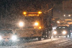
(Updated at 2:05 p.m.) Here we go again. Right in the midst of a stretch of mild weather, we’re bracing for the possibility of snow this weekend.

Forecasters have been predicting some sort of precipitation on Sunday, but it’s unclear whether it will be mainly snow or rain. As is often the case in our area, weather models are changing by the hour. Don’t get your hopes up for a repeat of the Presidents Day Blizzard of 2003 — but do plan on the chance of the season’s most significant snowfall.

In advance of the possible storm, the Arlington County Department of Environmental Services has issued a Phase 1 Alert, meaning crews will pre-treat roads with salt or brine as necessary. They’re also preparing snow removal equipment and personnel for the weekend.

Dominion Virginia Power also reports making preparations. Trucks are being stocked and fueled, and crews are ready to respond to outages. Customers can call 1-866-DOM-HELP to report outages and downed lines.


View More Stories