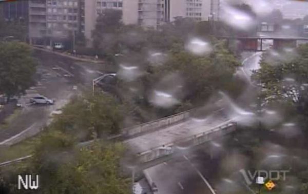
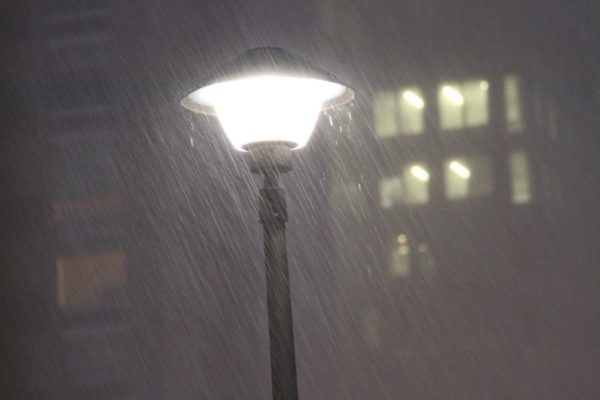
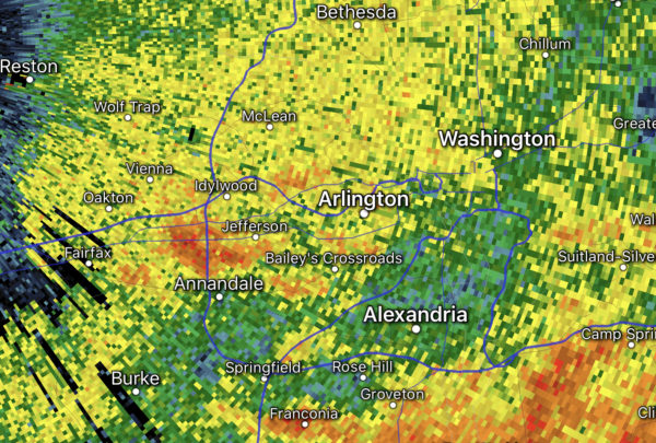
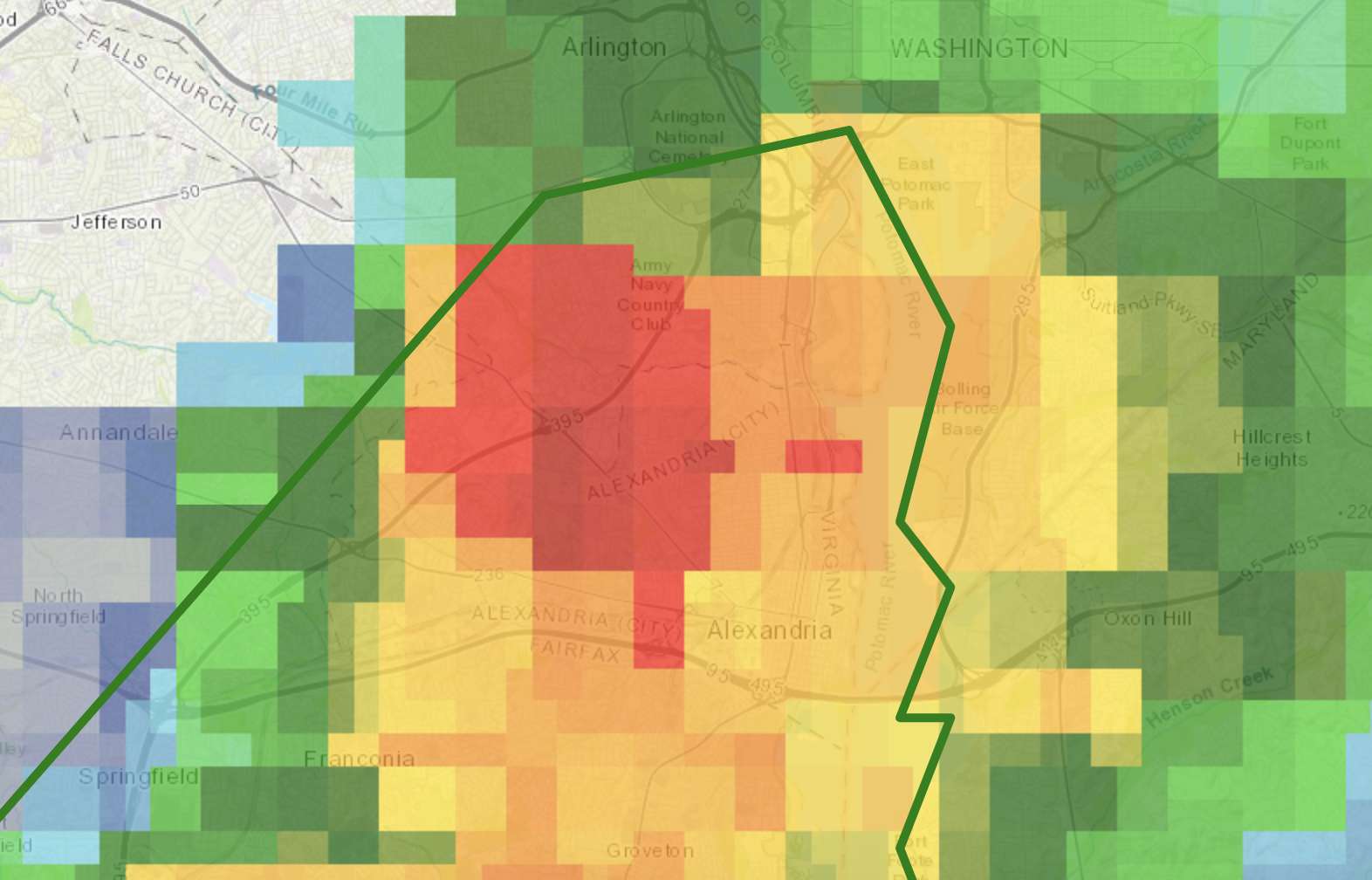
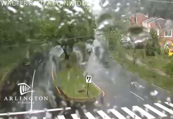
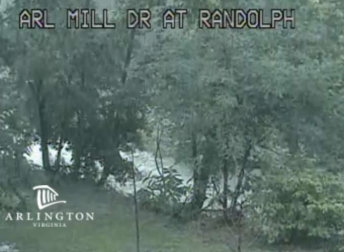
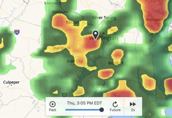
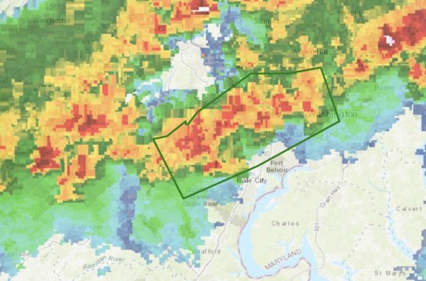
(Updated at 5:30 p.m.) Flooding has been reported in parts of Arlington, AlexandriaD.C. and Montgomery County after a period of very heavy rain.

In Arlington, the deluge left high water on Route 110, prompting police to close the highway between Rosslyn and the Pentagon. Standing water was also reported on Columbia Pike near the Pentagon.

Flooding was also reported on the GW Parkway, near the airport.

As of 5 p.m., both Route 110 and the GW Parkway were reported to be back open.

The Flash Flood Warning was issued earlier this afternoon, and was in effect until 4:30 p.m. More from the National Weather Service:

140 PM EDT THU SEP 10 2020

…FLASH FLOOD WARNING REMAINS IN EFFECT UNTIL 430 PM EDT THIS AFTERNOON FOR SOUTHEASTERN MONTGOMERY, NORTHWESTERN PRINCE GEORGES,  SOUTHEASTERN ARLINGTON AND SOUTHEASTERN FAIRFAX COUNTIES AND THE DISTRICT OF COLUMBIA AND THE CITY OF ALEXANDRIA…

AT 140 PM EDT, DOPPLER RADAR INDICATED THUNDERSTORMS PRODUCING HEAVY RAIN ACROSS THE WARNED AREA. BETWEEN 1 AND 2 INCHES OF RAIN HAVE FALLEN. FLASH FLOODING IS ONGOING OR EXPECTED TO BEGIN SHORTLY.

HAZARD…LIFE THREATENING FLASH FLOODING. THUNDERSTORMS PRODUCING FLASH FLOODING.

SOURCE…DOPPLER RADAR.

IMPACT…LIFE THREATENING FLASH FLOODING OF CREEKS AND STREAMS, URBAN AREAS, HIGHWAYS, STREETS AND UNDERPASSES.

ADDITIONAL RAINFALL AMOUNTS OF 1 TO 2 INCHES ARE POSSIBLE IN THE WARNED AREA.

PRECAUTIONARY/PREPAREDNESS ACTIONS…

TURN AROUND, DON’T DROWN WHEN ENCOUNTERING FLOODED ROADS. MOST FLOOD DEATHS OCCUR IN VEHICLES.


A Flash Flood Watch has been issued for Arlington, set to take effect early tomorrow morning.

The watch is in effect from 2 a.m.-8 p.m. Thursday. Forecasters say expected heavy rain could result in flash flooding.

More from the National Weather Service:

…FLASH FLOOD WATCH IN EFFECT FROM 2 AM EDT THURSDAY THROUGH  THURSDAY EVENING…

THE NATIONAL WEATHER SERVICE IN STERLING VIRGINIA HAS EXPANDED THE

* FLASH FLOOD WATCH TO INCLUDE PORTIONS OF DC… MARYLAND AND NORTHERN VIRGINIA, INCLUDING THE FOLLOWING AREAS: IN DC, DISTRICT OF COLUMBIA. IN MARYLAND, CENTRAL AND SOUTHEAST HOWARD, CENTRAL AND SOUTHEAST MONTGOMERY, SOUTHEAST HARFORD AND SOUTHERN BALTIMORE. IN NORTHERN VIRGINIA, ARLINGTON/FALLS CHURCH/ALEXANDRIA, FAIRFAX AND PRINCE WILLIAM/MANASSAS/MANASSAS PARK.

* FROM 2 AM EDT THURSDAY THROUGH THURSDAY EVENING

* NUMEROUS SHOWERS AND A FEW THUNDERSTORMS WILL CONTINUE TO DEVELOP ACROSS THE AREA, WITH LOCALLY HEAVY RAIN MOST LIKELY FROM LATE TONIGHT THROUGH THURSDAY AFTERNOON. AVERAGE RAINFALL AMOUNTS OF ONE TO TWO INCHES ARE EXPECTED, WITH ISOLATED HIGHER AMOUNTS POSSIBLE.

* HEAVY RAINFALL MAY RESULT IN RAPID RISES OF WATER IN SMALL CREEKS AND STREAMS, AS WELL AS IN URBAN AND POOR DRAINAGE AREAS.

PRECAUTIONARY/PREPAREDNESS ACTIONS…

A FLASH FLOOD WATCH MEANS THAT CONDITIONS MAY DEVELOP THAT LEAD TO FLASH FLOODING. FLASH FLOODING IS A VERY DANGEROUS SITUATION. YOU SHOULD MONITOR LATER FORECASTS AND BE PREPARED TO TAKE ACTION SHOULD FLASH FLOOD WARNINGS BE ISSUED.


Changes Proposed for Rosslyn Development — “The Dittmar Co. is tinkering with it plans for the redevelopment of the Holiday Inn in Rosslyn, shrinking the size of a planned hotel and adding more residential to account for Covid-19’s impact on the hospitality industry. The developer filed revised plans for the project with Arlington County earlier this month, outlining its new designs for a 326-room hotel and a 523-unit apartment building” [Washington Business Journal]

Rainstorm Leads to Vivid Rainbows — “For such an awful year, 2020 has lots of rainbows. This one continued into the grass below me.” [@STATter911/Twitter, @RosslynVA/Twitter]

County Stats on Missing Middle Housing — “So, just how missing is this missing middle? 6%. That’s the percentage of Arlington’s 116,000 homes that the county estimates are townhomes, side-by-side duplexes, or stacked duplexes. If you count low-rise multifamily apartments as missing middle, the percentage increases to a little less than a third of the county’s current housing stock.” [Greater Greater Washington]

Mulch Available for Arlington Residents — “Free wood mulch for pickup is available for the first time since March. Get it while it’s hot. The stuff doesn’t grow on … nevermind.” [@ArlingtonDES/Twitter, Arlington County]

Lebanese Taverna Owners in Beirut — “Monday’s kitchen at full swing from @WCKitchen HQ’s over 11k meals between 9 total kitchens with amazing committed partners and volunteers! Thankful to @lebanesetaverna Abi-Najm family for showing up in person and supporting Beirut operation financially #ChefsForBeirut” [@chefjoseandres/Twitter]

Rep. Beyer’s GOP Challenger — “Jeff Jordan has his work cut out for him. The Republican supports President Donald Trump, and he’s running an uphill battle against Rep. Don Beyer for Virginia’s 8th Congressional District seat, which has remained solidly in Democratic hands for the last 30 years.” [ALXnow]

Hockey: W-L Defeats Yorktown — “It took nearly five months and some intricate planning. Then at last, the popular and annual all-Arlington ice hockey high-school club match between the Washington-Liberty Generals and Yorktown Patriots was played Aug. 1. The Generals won, 5-3, at the Medstar Capitals Iceplex. The season-ending rivalry match was originally scheduled for March 13, but was postponed because of the COVID-19 pandemic.” [InsideNova]

Online Home Lighting Discussion — Sponsored — “Olson Weaver Lighting Design & is hosting a Q & A session to answer lighting questions from designers/architects, contractors, & homeowners” on Friday from 6:30-7:30 p.m. [Eventbrite]


Arlington is under a Flash Flood Watch for the second day in a row.

After nary a raindrop fell in Arlington yesterday, today is starting out with steady rain and a bit of thunder — and there’s more rain on the way.

The National Weather Service says that the rain could be heavy at times and cause flash flooding. Flooding is already being reported south and west of Arlington this morning, in Prince William, Fauquier and Spotsylvania counties.

The Flash Flood Watch is in effect throughout the day today for most of the D.C. area More from NWS:

…FLASH FLOOD WATCH IN EFFECT THROUGH THIS EVENING…

The National Weather Service in Sterling Virginia has expanded the Flash Flood Watch to include portions of central Maryland, The District of Columbia, and Virginia, including the following areas, in central Maryland, Anne Arundel and Prince Georges. The District of Columbia. In Virginia, Albemarle, Arlington/Falls Church/Alexandria, Augusta, Central Virginia Blue Ridge, Culpeper, Eastern Highland, Fairfax, Greene, King George, Nelson, Northern Fauquier, Orange, Prince William, Rappahannock, Rockingham, Southern Fauquier, Spotsylvania, Stafford, and Western Highland.

Through this evening slow moving thunderstorms capable of producing heavy rainfall may develop today. Heavy rainfall from thunderstorms may lead to flash flooding. Potential impacts include rapid rises of water, flooded roads and flooding of structures in low lying areas near streams. Landslides and washouts are also possible.

PRECAUTIONARY/PREPAREDNESS ACTIONS…

A Flash Flood Watch means that conditions may develop that lead to flash flooding. Flash flooding is a very dangerous situation. You should monitor later forecasts and be prepared to take action should Flash Flood Warnings be issued.


After an early morning storm, Arlington is expecting more heavy rain today.

The region is under a Flash Flood Watch starting at noon. Forecasters say slow-moving storms could dump several inches of rain, potentially causing flash flooding.

More from the National Weather Service:

…FLASH FLOOD WATCH REMAINS IN EFFECT FROM NOON EDT TODAY THROUGH THIS EVENING…

* A COLD FRONT WILL MOVE INTO THE AREA WEDNESDAY AND THEN STALL OUT. NUMEROUS SLOW MOVING SHOWERS AND THUNDERSTORMS WILL POSE A RISK OF FLASH FLOODING. THUNDERSTORMS COULD PRODUCE ONE TO TWO INCHES OF RAIN WITH ISOLATED AMOUNTS UP TO FOUR INCHES POSSIBLE.

PRECAUTIONARY/PREPAREDNESS ACTIONS…

A FLASH FLOOD WATCH MEANS THAT CONDITIONS MAY DEVELOP THAT LEAD TO FLASH FLOODING. FLASH FLOODING IS A VERY DANGEROUS SITUATION.

YOU SHOULD MONITOR LATER FORECASTS AND BE PREPARED TO TAKE ACTION SHOULD FLASH FLOOD WARNINGS BE ISSUED.


A portion of southern Arlington County is now under a Flood Warning, as a slow-moving storm drenches areas south of Route 50.

The warning is in effect until 8:45 p.m. An inch or so of rain has fallen and flooding is imminent, the National Weather Service says.

A Flash Flood Watch, meanwhile, remains in effect until 6 a.m.

More from NWS:

BULLETIN – IMMEDIATE BROADCAST REQUESTED
FLOOD WARNING
NATIONAL WEATHER SERVICE BALTIMORE MD/WASHINGTON DC
453 PM EDT THU AUG 6 2020

THE NATIONAL WEATHER SERVICE IN STERLING VIRGINIA HAS ISSUED A

* FLOOD WARNING FOR… SOUTHEASTERN ARLINGTON COUNTY IN NORTHERN VIRGINIA… SOUTHEASTERN FAIRFAX COUNTY IN NORTHERN VIRGINIA… THE CITY OF ALEXANDRIA IN NORTHERN VIRGINIA…

* UNTIL 845 PM EDT.

* AT 452 PM EDT, DOPPLER RADAR INDICATED THUNDERSTORMS PRODUCING HEAVY RAIN WHICH WILL CAUSE FLOODING. UP TO ONE INCH OF RAIN HAS ALREADY FALLEN. ADDITIONAL RAINFALL AMOUNTS OF UP TO ONE INCH ARE POSSIBLE.

* SOME LOCATIONS THAT WILL EXPERIENCE FLOODING INCLUDE… ARLINGTON, ALEXANDRIA, SPRINGFIELD, FORT WASHINGTON, FORT HUNT, GROVETON, HUNTINGTON, FORT BELVOIR, CRYSTAL CITY, LINCOLNIA, LORTON, FRANCONIA, HYBLA VALLEY, NEWINGTON, WEST SPRINGFIELD, MOUNT VERNON, HAYFIELD AND MASON NECK.

PRECAUTIONARY/PREPAREDNESS ACTIONS…

TURN AROUND, DON’T DROWN WHEN ENCOUNTERING FLOODED ROADS. MOST FLOOD DEATHS OCCUR IN VEHICLES.

EXCESSIVE RUNOFF FROM HEAVY RAINFALL WILL CAUSE FLOODING OF SMALL CREEKS AND STREAMS, URBAN AREAS, HIGHWAYS, STREETS AND UNDERPASSES AS WELL AS OTHER DRAINAGE AREAS AND LOW LYING SPOTS.


(Updated at 1:35 p.m.) After getting drenched by a storm early this morning, Arlington may be getting another round of heavy rain tonight.

The county and the D.C. region is currently under a Flash Flood Watch. Slow-moving storms are expected to form this afternoon, dumping torrential rainfall on ground already saturated by the morning storm and Isaias earlier this week — a recipe for flooding.

The watch is now in effect until 6 a.m. Friday; it was originally set to expire at midnight but was extended Thursday afternoon.

More from the National Weather Service:

…FLASH FLOOD WATCH IN EFFECT THROUGH THIS EVENING…

Through this evening… Numerous slow moving showers and thunderstorms continue to develop across the region and should expand and redevelop with time. Locations which are repetitively affected could receive multiple-inch rainfall totals. This could lead to rapid rises on streams and flash flooding of low lying areas.

PRECAUTIONARY/PREPAREDNESS ACTIONS… A Flash Flood Watch means that conditions may develop that lead to flash flooding. Flash flooding is a very dangerous situation. You should monitor later forecasts and be prepared to take action should Flash Flood Warnings be issued.

Image via The Weather Channel


More heavy rain and storms are expected tonight (Friday).

A Flash Flood Watch is in effect until midnight, as slow-moving storms and an additional 1-3 inches of rain could send creeks and streams over their banks. The storms are currently expected to arrive in the Arlington area around 6 p.m.

More from the National Weather Service:

…FLASH FLOOD WATCH REMAINS IN EFFECT UNTIL MIDNIGHT EDT TONIGHT… AREAS OF HEAVY RAIN FELL ACROSS THE WATCH AREA LAST NIGHT. ADDITIONAL HEAVY RAINFALL IS EXPECTED THIS AFTERNOON AS SLOW MOVING THUNDERSTORMS DEVELOP BY MIDDAY AND SLIDE EAST DURING THE AFTERNOON AND EVENING. SOME AREAS COULD RECEIVE AN ADDITIONAL 1 TO 3 INCHES OF RAIN, WHICH COULD RESULT IN FLASH FLOODING. PRECAUTIONARY/PREPAREDNESS ACTIONS… A FLASH FLOOD WATCH MEANS THAT CONDITIONS MAY DEVELOP THAT LEAD TO FLASH FLOODING. FLASH FLOODING IS A VERY DANGEROUS SITUATION. YOU SHOULD MONITOR LATER FORECASTS AND BE PREPARED TO TAKE ACTION SHOULD FLASH FLOOD WARNINGS BE ISSUED. &&


Arlington County is under a Flood Warning through 5:30 a.m.

Heavy rain overnight may cause flooding along streams and in flood-prone areas, forecasters say. D.C., Falls Church, Alexandria, and Fairfax County are also included in the warning.

More from the National Weather Service:

THE NATIONAL WEATHER SERVICE IN STERLING VIRGINIA HAS ISSUED A

* FLOOD WARNING…

* UNTIL 530 AM EDT FRIDAY.

* AT 1126 PM EDT, DOPPLER RADAR INDICATED HEAVY RAIN THAT WILL CAUSE FLOODING. UP TO ONE INCH OF RAIN HAS ALREADY FALLEN AND AN ADDITIONAL INCH OR TWO IS EXPECTED OVERNIGHT. THIS WILL CAUSE  CREEKS AND STREAMS TO RISE OUT OF THEIR BANKS AS WELL AS FLOODING IN URBAN AREAS.

* SOME LOCATIONS THAT WILL EXPERIENCE FLOODING INCLUDE… ARLINGTON, ALEXANDRIA, CENTREVILLE, DALE CITY, BETHESDA, RESTON, ANNANDALE, SPRINGFIELD, COLLEGE PARK, SOUTH RIDING, HERNDON, FAIRFAX, LANGLEY PARK, VIENNA, GROVETON, FALLS CHURCH, HUNTINGTON, CORAL HILLS, BLADENSBURG AND MANTUA.

PRECAUTIONARY/PREPAREDNESS ACTIONS…

TURN AROUND, DON’T DROWN WHEN ENCOUNTERING FLOODED ROADS. MOST FLOOD DEATHS OCCUR IN VEHICLES.

BE ESPECIALLY CAUTIOUS AT NIGHT WHEN IT IS HARDER TO RECOGNIZE THE DANGERS OF FLOODING.

Arlington also remains under a Flash Flood Watch, which was issued around 11 p.m.

THE NATIONAL WEATHER SERVICE IN STERLING VIRGINIA HAS ISSUED A

* FLASH FLOOD WATCH…

* UNTIL 4 AM EDT FRIDAY

* REPEATING ROUNDS OF SHOWERS AND THUNDERSTORMS MAY PRODUCE LOCALIZED RAINFALL AMOUNTS OF 1 TO 3 INCHES IN A RELATIVELY SHORT AMOUNT OF TIME. THIS MAY CAUSE RAPID RISES OF WATER ON STREAMS AND CREEKS AND IN URBAN AND POOR DRAINAGE AREAS.

PRECAUTIONARY/PREPAREDNESS ACTIONS…

A FLASH FLOOD WATCH MEANS THAT CONDITIONS MAY DEVELOP THAT LEAD TO FLASH FLOODING. FLASH FLOODING IS A VERY DANGEROUS SITUATION.

YOU SHOULD MONITOR LATER FORECASTS AND BE PREPARED TO TAKE ACTION SHOULD FLASH FLOOD WARNINGS BE ISSUED.


The arrival of cold temperatures was preceded by a line of rain showers packing gusty winds that knocked out power to part of Arlington.

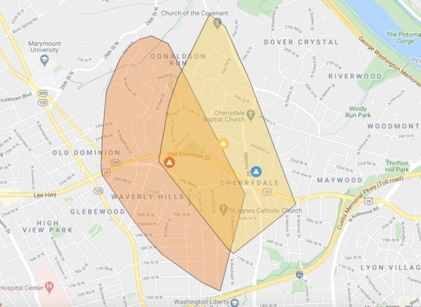
Portions of residential North Arlington along Lee Highway — including the Cherrydale, Waverly Hills and Donaldson Run neighborhoods — are without power as of 8:30 p.m. In all, Dominion is reporting 1,641 customers in the dark.

Video posted to social media shows dark clouds and rain arriving, as flashes from transformers can be seen in the background.

Traffic backups are being reported at the now-dark “five points” intersection on Lee Highway in Cherrydale. Police have also been dispatched to assist with traffic control on N. Quincy Street at 20th Street N., where downed utility lines have been reported.

Mother Nature, meanwhile, is not done with us yet. High winds and near-freezing temperatures are expected Saturday. From the National Weather Service:

STRONG WINDS ARE EXPECTED SATURDAY. A WIND ADVISORY MAY BE NECESSARY AS WINDS COULD GUST TO 50 MPH.

A FREEZE WATCH IS IN EFFECT SATURDAY NIGHT INTO SUNDAY MORNING FOR PORTIONS OF NORTHERN VIRGINIA.

More on the storm and the power outages via social media:

https://twitter.com/hoborocks/status/1258915025743421440


Arlington and other parts of the D.C. area are under a Flash Flood Watch through early Monday morning.

Storms approaching the area might dump 1-2 inches of rain in short order, causing flash flooding, forecasters say.

More from the National Weather Service:

…FLASH FLOOD WATCH IN EFFECT UNTIL 2 AM EDT MONDAY… THE NATIONAL WEATHER SERVICE IN STERLING VIRGINIA HAS ISSUED A * FLASH FLOOD WATCH FOR PORTIONS OF MARYLAND, THE DISTRICT OF COLUMBIA, VIRGINIA, AND EASTERN WEST VIRGINIA… SHOWERS AND THUNDERSTORMS WITH LOCALLY HEAVY RAIN ARE EXPECTED TO OVERSPREAD THE AREA THIS EVENING AND CONTINUE UNTIL SHORTLY AFTER MIDNIGHT. WITH WET ANTECEDENT CONDITIONS, A RAPIDLY FALLING 1 TO 2 INCHES OF RAIN COULD RESULT IN FLASH FLOODING. PRECAUTIONARY/PREPAREDNESS ACTIONS… A FLASH FLOOD WATCH MEANS THAT CONDITIONS MAY DEVELOP THAT LEAD TO FLASH FLOODING. FLASH FLOODING IS A VERY DANGEROUS SITUATION. YOU SHOULD MONITOR LATER FORECASTS AND BE PREPARED TO TAKE ACTION SHOULD FLASH FLOOD WARNINGS BE ISSUED. &&

Flickr pool photo by Kevin Wolf


View More Stories