Update at 4:25 p.m. — The Flash Flood Watch has been cancelled.

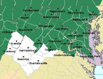
Arlington and much of the rest of the D.C. area is under a Flash Flood Watch today.

Heavy rain and storms are expected today. Rainfall rates of 1-2 inches per hours could produce flash flooding, forecasters warn.

More from the National Weather Service:

… FLASH FLOOD WATCH NOW IN EFFECT FROM 9 AM EDT THIS MORNING THROUGH THIS EVENING… THE FLASH FLOOD WATCH IS NOW IN EFFECT… * FROM 9 AM EDT THIS MORNING THROUGH THIS EVENING * MULTIPLE ROUNDS OF SHOWERS AND THUNDERSTORMS ARE EXPECTED TODAY WITH LOCALIZED HEAVY RAINFALL RATES OF 1 TO 2 INCHES PER HOUR POSSIBLE. * RUNOFF FROM EXCESSIVE RAINFALL MAY CAUSE RAPID RISES OF WATER IN LOW-LYING AND POOR DRAINAGE AREAS AS WELL AS STREAMS AND CREEKS, RESULTING IN FLASH FLOODING. URBAN AREAS WILL BE MOST SUSCEPTIBLE. PRECAUTIONARY/PREPAREDNESS ACTIONS… A FLASH FLOOD WATCH MEANS THAT CONDITIONS MAY DEVELOP THAT LEAD TO FLASH FLOODING. FLASH FLOODING IS A VERY DANGEROUS SITUATION. YOU SHOULD MONITOR LATER FORECASTS AND BE PREPARED TO TAKE ACTION SHOULD FLASH FLOOD WARNINGS BE ISSUED. &&


Today’s heavy rain has turned Four Mile Run into a raging torrent of murky water.

A Columbia Pike resident posted videos of the overflowing stream on Twitter this afternoon (Friday). The video was taken near S. George Mason Drive.

No major flooding problems were reported during the daytime Friday in Arlington, though forecasters warn that more rain may cause additional problems tonight.

There have, however, been scattered weather-related issues reported. A number of traffic signals have started flashing or gone dark and, as of 6:30 p.m., 165 Dominion customers were without power.

On N. Troy Street near Rosslyn, between Key Blvd and Wilson Blvd, a large tree fell on cars and power lines, according to scanner reports.

More videos of Four Mile Run, after the jump.

(more…)


Updated at 6:25 p.m. — The National Weather Service is warning of a continued threat of very heavy rainfall and flooding tonight.

Update at 3:20 p.m. — A new Flash Flood Warning has been issued for southern portions of Arlington.

Earlier: The National Weather Service has issued a Flash Flood Warning for Arlington, warning that flooding is “imminent” due to very heavy rain.

The Flash Flood Warning covers southern Arlington County, Falls Church, Alexandria, central Fairfax County and Fairfax city.

More from NWS:

THE NATIONAL WEATHER SERVICE IN STERLING VIRGINIA HAS ISSUED A * FLASH FLOOD WARNING FOR… THE CITY OF FAIRFAX IN NORTHERN VIRGINIA… SOUTHERN ARLINGTON COUNTY IN NORTHERN VIRGINIA… THE CITY OF FALLS CHURCH IN NORTHERN VIRGINIA… CENTRAL FAIRFAX COUNTY IN NORTHERN VIRGINIA… THE CITY OF ALEXANDRIA IN NORTHERN VIRGINIA… * UNTIL 230 PM EDT * AT 1024 AM EDT, DOPPLER RADAR INDICATED THUNDERSTORMS PRODUCING HEAVY RAIN ACROSS THE AREA. OVER TWO INCHES OF RAIN HAVE ALREADY FALLEN NEAR MERRIFIELD, WITH OVER ONE INCH IN MUCH OF THE REMAINDER OF THE AREA. ADDITIONAL RAINFALL AMOUNTS OF ONE TO TWO INCHES ARE POSSIBLE. FLASH FLOODING IS EXPECTED TO BEGIN SHORTLY. * SOME LOCATIONS THAT MAY EXPERIENCE FLOODING INCLUDE… ARLINGTON, ALEXANDRIA, RESTON, ANNANDALE, SPRINGFIELD, FAIRFAX, VIENNA, FALLS CHURCH, HUNTINGTON, MANTUA, PIMMIT HILLS, MCLEAN, POTOMAC, BURKE, OAKTON, LINCOLNIA, TYSONS CORNER, FRANCONIA, WOLF TRAP AND GREAT FALLS. THIS INCLUDES FLOOD PRONE LOCATIONS SOUTH TROY STREET NEAR LONG BRANCH… WEST STREET NEAR BRADDOCK ROAD… HOLMES RUN BELOW LAKE BARCROFT… WOODBURN ROAD AT ACCOTINK CREEK… BEULAH ROAD AT BROWNS MILL ROAD AT WOLFTRAP CREEK… FAIRFAX BOULEVARD AT OAK STREET… FAIRFAX BOULEVARD AT UNIVERSITY DRIVE… AND PICKETT RD AT ACCOTINK CREEK NEAR OLD PICKETT RD. PRECAUTIONARY/PREPAREDNESS ACTIONS… TURN AROUND, DON’T DROWN WHEN ENCOUNTERING FLOODED ROADS. MOST FLOOD DEATHS OCCUR IN VEHICLES. A FLASH FLOOD WARNING MEANS THAT FLOODING IS IMMINENT OR OCCURRING. IF YOU ARE IN THE WARNED AREA MOVE TO HIGHER GROUND IMMEDIATELY. RESIDENTS LIVING ALONG STREAMS AND CREEKS SHOULD TAKE IMMEDIATE PRECAUTIONS TO PROTECT LIFE AND PROPERTY. &&

https://twitter.com/ACFDPIO/status/890943656106094593

https://twitter.com/amelia_draper/status/890944643470430211

File photo


Arlington County and much of the D.C. region is under Flash Flood Watch from Friday afternoon to Saturday afternoon.

Forecasters say a slow-moving storm system is threatening to dump three inches or more of rain, starting Friday. Residents are being urged to take precautions near streams and creeks, in low-lying areas, and on the roads,

More from the National Weather Service:

… FLASH FLOOD WATCH IN EFFECT FROM FRIDAY AFTERNOON THROUGH SATURDAY AFTERNOON… THE NATIONAL WEATHER SERVICE IN STERLING VIRGINIA HAS ISSUED A * FLASH FLOOD WATCH FOR PORTIONS OF MARYLAND, THE DISTRICT OF COLUMBIA, VIRGINIA, AND WEST VIRGINIA… * FROM FRIDAY AFTERNOON THROUGH SATURDAY AFTERNOON * LOW PRESSURE IS GOING TO DEVELOP OVER THE MID ATLANTIC FRIDAY AND REMAIN NEARLY STATIONARY THIS WEEKEND. THIS WILL HAVE THE POTENTIAL TO BRING 3 INCHES OR MORE OF RAIN TO THE REGION THROUGH SATURDAY AFTERNOON. THUNDERSTORMS COULD CAUSE LOCALLY HIGHER RAINFALL AMOUNTS. * HEAVY RAINFALL MAY RESULT IN RAPID RISES IN STREAMS AND CREEKS. THIS COULD QUICKLY RESULT IN FLOODING… ESPECIALLY IN LOW LYING AND POOR DRAINAGE AREAS. PRECAUTIONARY/PREPAREDNESS ACTIONS… A FLASH FLOOD WATCH MEANS THAT CONDITIONS THAT LEAD TO FLASH FLOODING. FLASH FLOODING IS A VERY DANGEROUS SITUATION. YOU SHOULD MONITOR LATER FORECASTS AND BE PREPARED TO TAKE ACTION SHOULD FLASH FLOOD WARNINGS BE ISSUED. PRECAUTIONARY/PREPAREDNESS ACTIONS… A FLASH FLOOD WATCH MEANS THAT CONDITIONS MAY DEVELOP THAT LEAD TO FLASH FLOODING. FLASH FLOODING IS A VERY DANGEROUS SITUATION. YOU SHOULD MONITOR LATER FORECASTS AND BE PREPARED TO TAKE ACTION SHOULD FLASH FLOOD WARNINGS BE ISSUED.


Girls’ Firefighting Camp Featured on BBC — The annual girls’ firefighting camp held by Arlington County was the subject of a BBC News video segment, which was published online yesterday. [BBC]

Arlington Treated to ‘Massive’ Rainbow — After yesterday’s downpours, a bright rainbow was visible over Arlington, prompting a photo opportunity that many took advantage of. [Twitter]

Sunday’s Storm on Video — A Pentagon City resident captured one of Sunday’s storms on video, showing torrential rain, strong wind and a screen door that had blown off a building and got stuck in a tree. [YouTube]


Arlington County is under a flash flood watch until 7 p.m. tonight, with the rest of the D.C. metropolitan area.

The National Weather Service said between one and three inches of rain are possible, with multiple rounds of rainfall throughout the day. More showers are expected this afternoon, and thunderstorms may also hit the region.

NWS advises that those living near rivers, streams and creeks should watch water levels during heavy rain.

Update at 5:55 p.m. — The Flash Flood Watch was extended until 2 a.m.


Widening of W&OD Trail Studied — The Northern Virginia Regional Park Authority is considering a proposal to widen the W&OD Trail in parts of Arlington, Falls Church and Fairfax County. The proposal also calls for separating pedestrians and cyclists along the widened portions of trail. [The Wash Cycle]

Stormy Weather Expected Over the Next 24 Hours — The remnants of Tropical Storm Cindy are expected to bring heavy rain and scattered storms to the area between now and Saturday morning. Most of the rain is expected to fall early Saturday. [Twitter, Capital Weather Gang]

Lawmakers Confronted at DCA — Protesters confronted lawmakers returning home to their districts at Reagan National Airport yesterday. They were protesting against the proposed GOP health care bill, holding signs like “don’t take away our healthcare” and “Medicaid matters.” [The Hill]

Middle School Students Burning Books — Yesterday, on the last day of middle school in Arlington, the fire department was called for a report of middle school students burning books in a field. An ACFD spokesperson could not be reached for additional information. [Twitter]

Last Day of School — High school is already out and the Class of 2017 has held its graduation ceremonies. Middle school ended yesterday. Today elementary students will have their last half-day before Arlington Public Schools is officially on summer break until Tuesday, Sept. 5. [Arlington Public Schools]


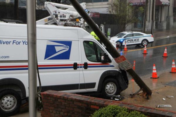
Police closed a section of Washington Blvd in Virginia Square this morning after a U.S. Postal Service truck struck a utility pole.

Officers shut down the 3400 block of Washington Blvd between N. Kirkwood and N. Lincoln streets just after 11 a.m. Thursday.

The driver of the truck told police she turned left from N. Kirkwood Street onto Washington Blvd, but in the heavy rain and slippery conditions lost control of the vehicle and hit the pole.

No injuries were reported, there was reportedly no other traffic nearby and businesses nearby did not appear to lose power.

Crews from Dominion Virginia Power were on the scene to repair the pole and the power lines attached to it.


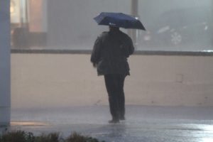
(Updated at 9:55 a.m.) It’s going to be a rainy day in Arlington and the D.C. area, with heavy rain and scattered storms likely.

The rain may cause some minor flooding problems on the roadways and along streams, forecasters say.

“Rain will be locally heavy at times through this evening,” said the National Weather Service. “Localized flooding of small streams and creeks as well as urban areas is possible late this morning into this evening.”

More from NWS:

At 907 AM EDT, radar indicated showers with isolated thunderstorms were located along a line extending from Ashburn to Aquia Creek. Movement was northeast at 40 mph.

Locally heavy rainfall can be expected.

Locations impacted include…
Arlington, Alexandria, Stafford, Columbia, Germantown, Centreville, Waldorf, Dale City, Rockville, Bethesda, Gaithersburg, Reston, Leesburg, Annandale, Clinton, Olney, Springfield, College Park, South Riding and Fort Washington.

Locally heavy rainfall is also occurring with these showers, and may cause ponding of water on roadways and cause small streams to go out of their banks. Be alert for the potential of standing water and hydroplaning.

The weather is already causing problems on the roads and at the airport:


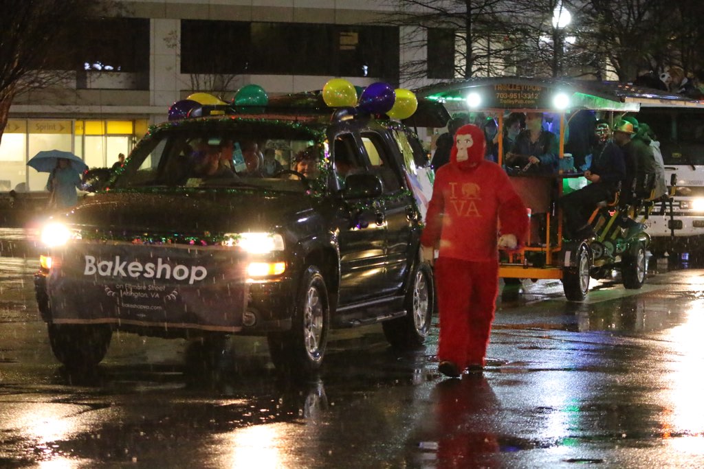
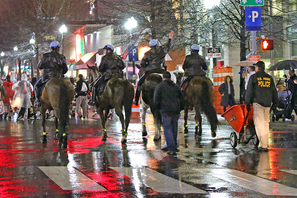
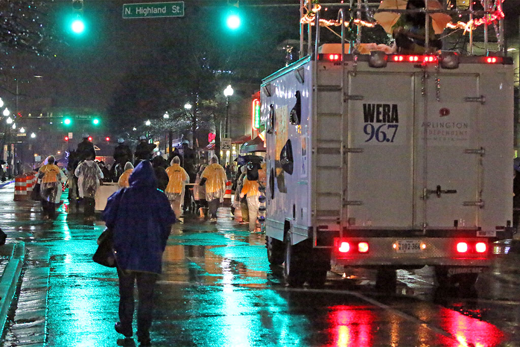
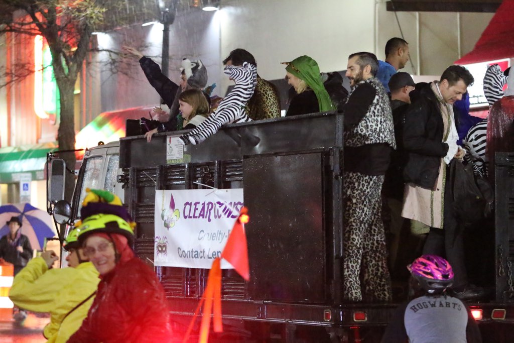
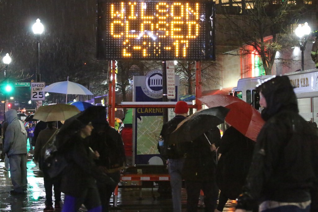
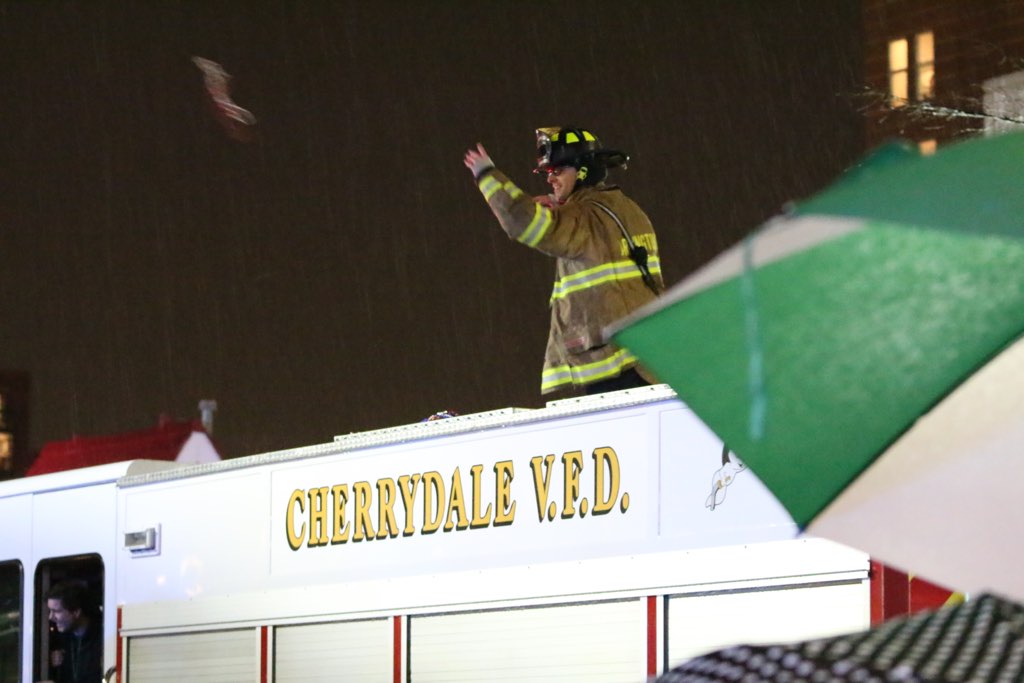
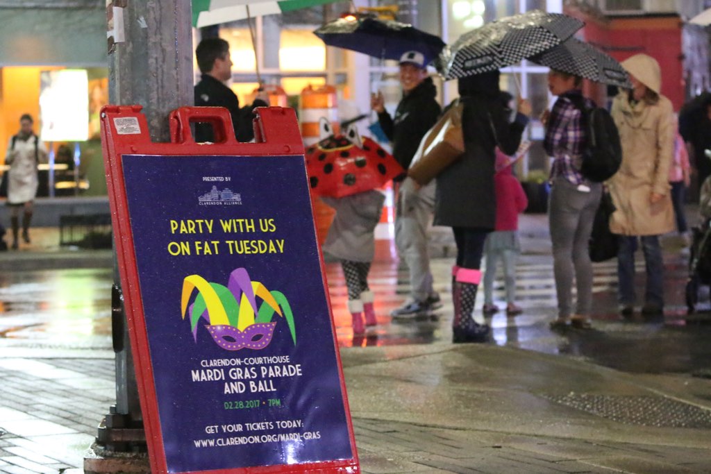
(Updated at 9 a.m.) As feared, it was pouring rain during last night’s Clarendon Mardi Gras parade.

But the raindrops did not dampen the spirits of those in the parade, who made their way up Wilson Blvd to the delight of thin but enthusiastic crowds.

From a dancing monkey to a guy on a penny-farthing to a bunch of people pedaling on the Trolley Pub, the parade hearkened back to a bygone era when “Keep Clarendon Weird” was the neighborhood’s motto.


Hourly forecast for 2017 Clarendon Mardi Gras parade (via Weather.com)

(Updated at 5:45 p.m.) Organizers are hoping for a Mardi Gras miracle, but it looks like tonight’s parade in Clarendon will be a soggy one.

The 18th annual Clarendon-Courthouse Mardi Gras Parade is slated to kick off at 7 p.m., making its way up Wilson Boulevard from N. Barton Street to N. Irving Street.

2013 Clarendon Mardi Gras paradeAn hourly forecast suggests rain may begin shortly before the parade begins, but Matt Hussmann, executive director of the Clarendon Alliance, says it will go on rain or shine — unless there is lightning in the area.

“We’re going forward and hoping the weather holds off,” said Hussmann. “The Mardi Gras Ball will go on irrespective.”

The annual parade has not had the best luck with weather. It was postponed in 2010, postponed and then cancelled in 2014, and postponed again in 2015 — all due to snow. It rained during the rescheduled 2015 parade.

Screen capture (top) via Weather.com. Photo (bottom) courtesy Jason Dixson Photography.


View More Stories