The Washington & Old Dominion and Custis trails are set for further construction this summer, with the hope of increasing safety for bicyclists, pedestrians and public transportation users.

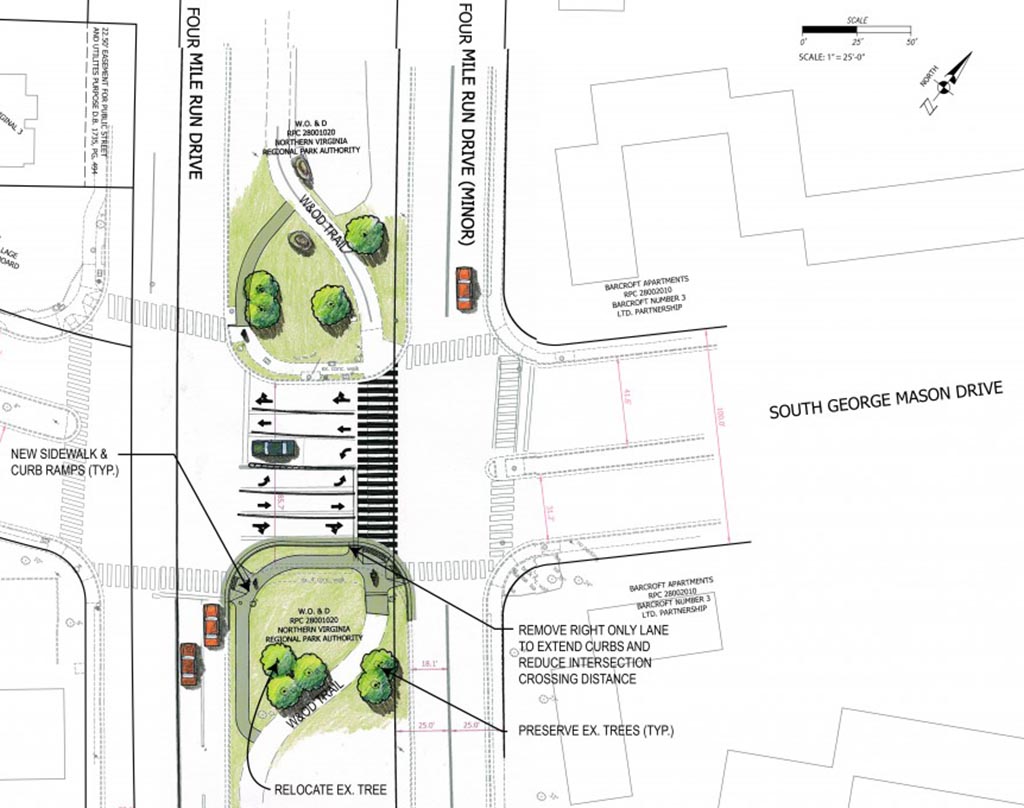
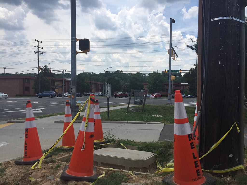
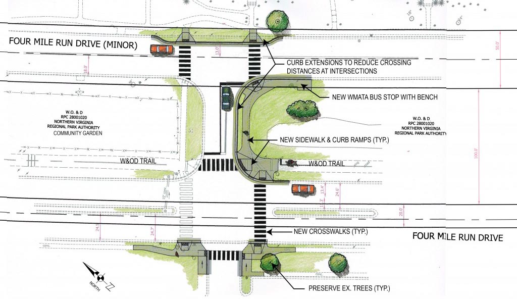
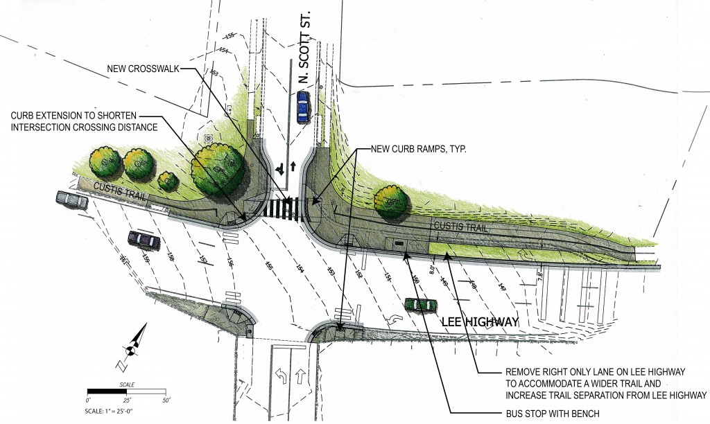
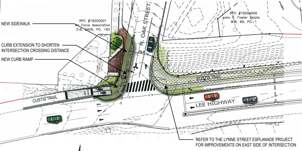
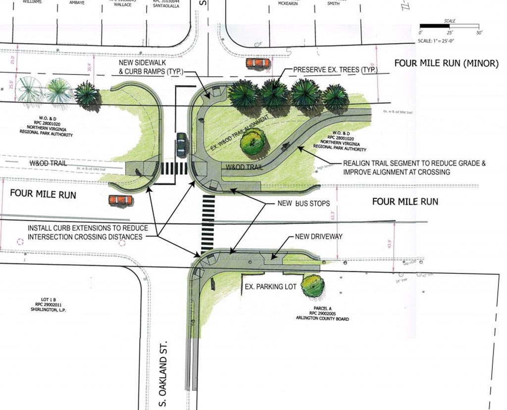
The improvements will reduce the distance of crossing some streets, upgrade curb ramps and bus stops, create high visibility crosswalks, improve trail crossing alignments and update traffic signals to meet Arlington County’s standards, among other changes.

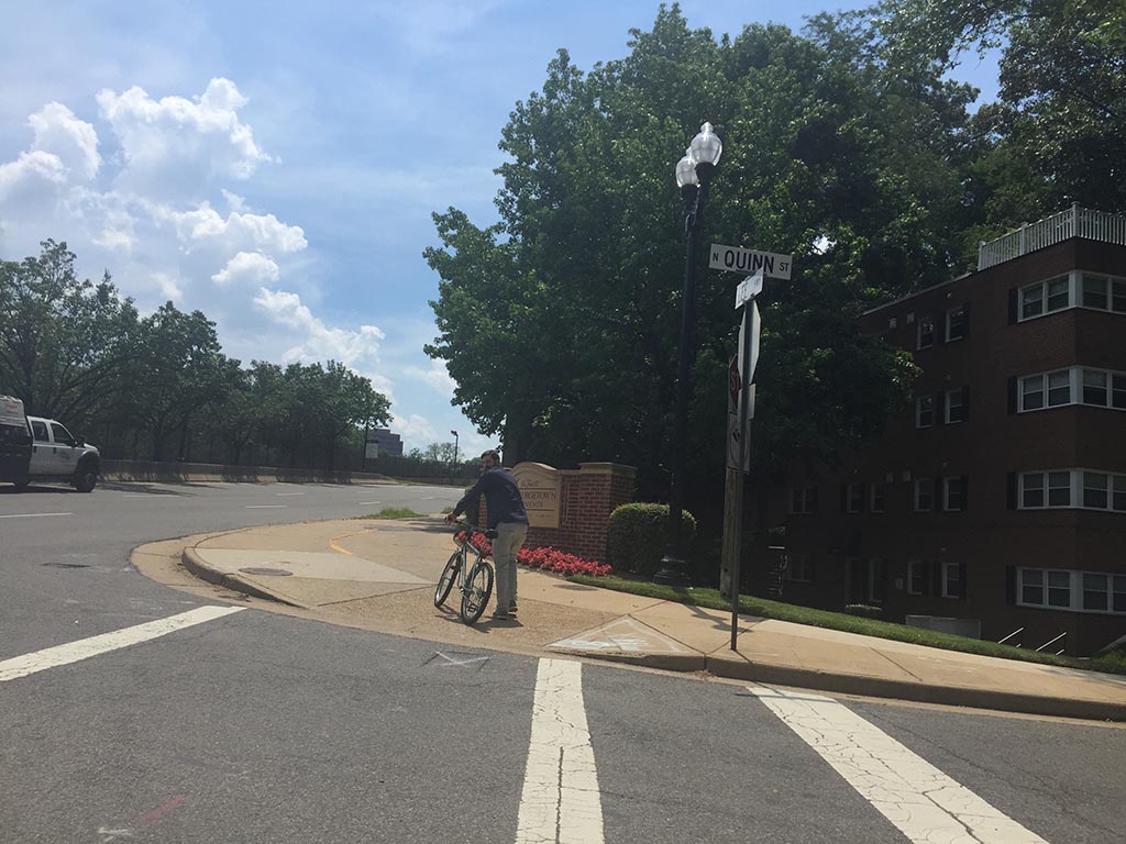
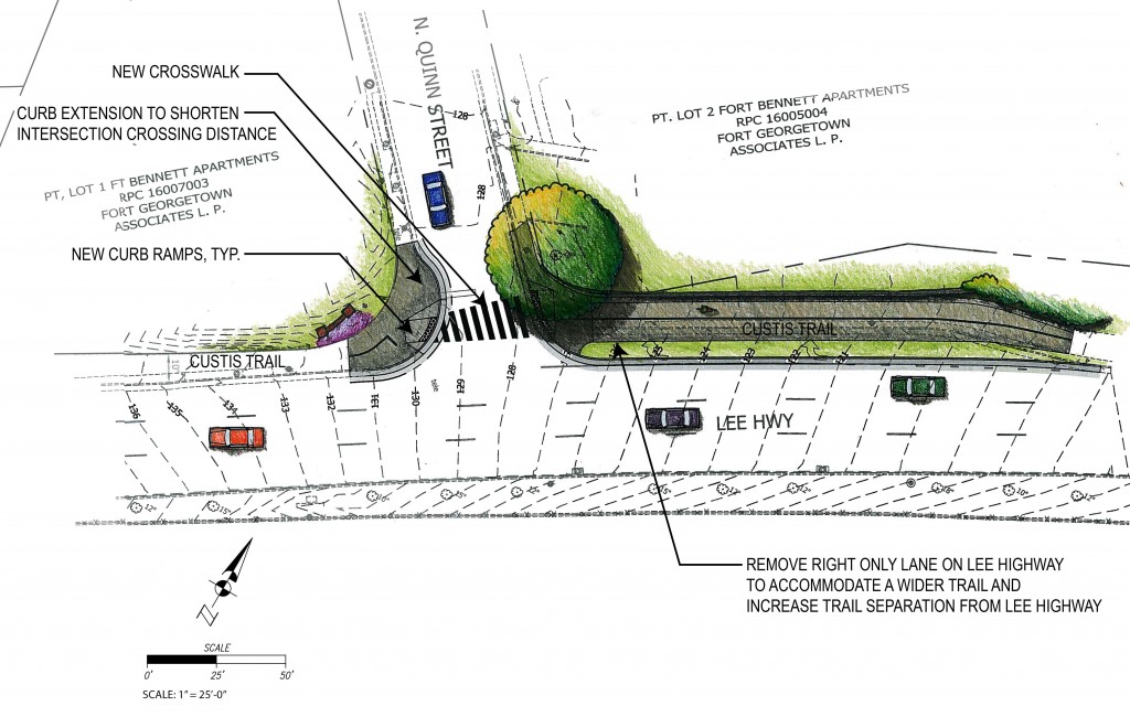
Lanes would also be reconfigured on the W&OD Trail at its crossing with S. George Mason Drive and on the Custis Trail at N. Quinn and N. Scott streets.

The changes that the trails would undergo were recommendations made in the county’s Shared Use Trail Traffic Control Study, completed in 2010.

Three sections along each trail are set for improvements. Along the W&OD Trail, the areas are:

  • The intersection of S. Four Mile Run Drive and S. George Mason Drive
  • S. Four Mile Run Drive at the Barcroft Sports Center (4200 S. Four Mile Run Drive)
  • The intersection of S. Four Mile Run Drive and S. Oakland Street

The sections set to be under construction along the Custis Trail are:

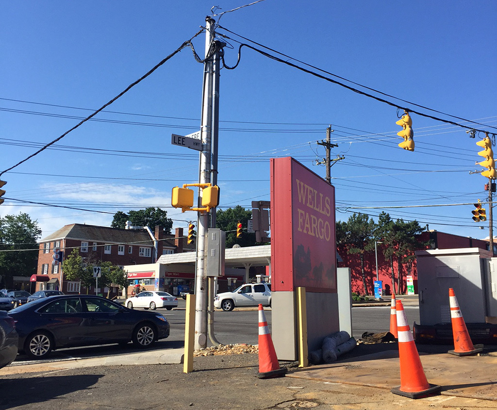
  • The intersection of Lee Highway and N. Scott Street
  • The intersection of Lee Highway and N. Quinn Street
  • The trail crossing at the intersection of Lee Highway and N. Oak Street

The Arlington County Board has approved the costs for the trail renovations, which will be funded primarily by the federal Highway Safety Improvement Program.

Under a timeline put forward by county staff, construction would begin this summer on both projects. A contract worth a combined $1.67 million has been proposed for both, with just over $335,000 in contingency for any cost overruns.


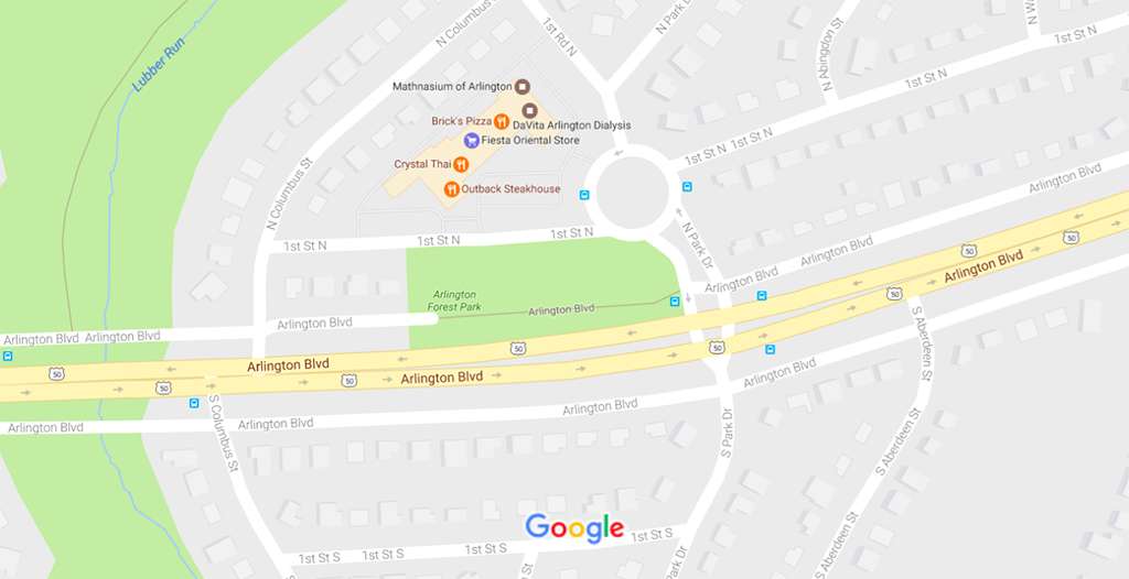
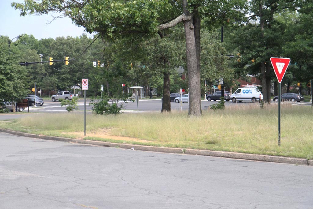
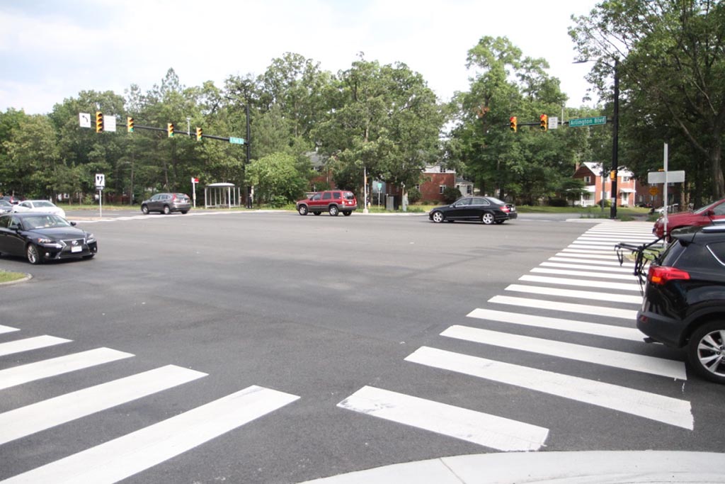
The busy intersection of Route 50 and Park Drive is set for improvements under a plan being considered Saturday by the Arlington County Board.

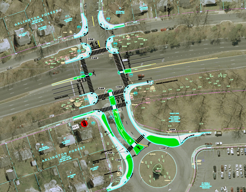
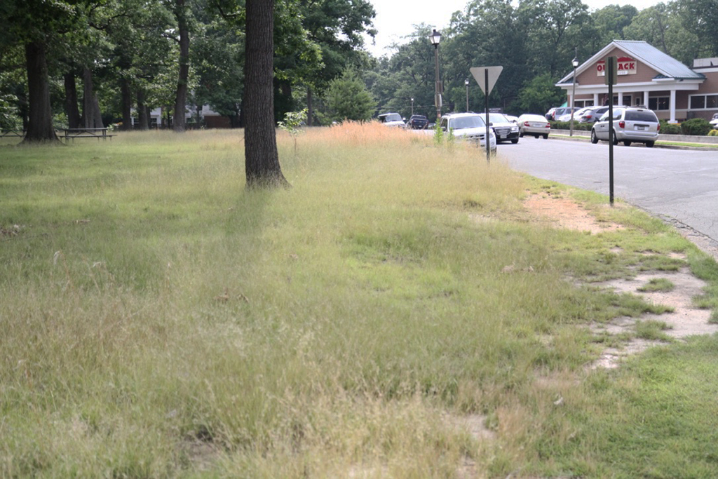
The intersection, in the Arlington Forest neighborhood, is slated for new sidewalks, upgraded traffic lights, high-visibility crosswalks and new trees, curbs and gutters.

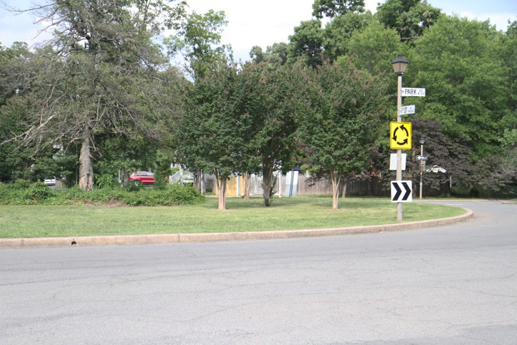
The majority of improvements are slated for the intersection and a small stretch of N. Park Drive between Route 50 and a traffic circle. That’s also near a small strip mall that includes an Outback Steakhouse restaurant.

County staff estimate that 64,000 cars travel through the intersection daily, and the traffic volume and speed can make life difficult for bicyclists, pedestrians and those getting on and off buses. The intersection has also been the scene of numerous crashes.

Staff said the plan creates an “urban-style intersection that will reduce speeding and the incidence of collisions, and ultimately improve safety for all.

“The project will create better access and crossings for pedestrians, transit users, bikers and those traveling on the shared-use paths parallel to Arlington Boulevard,” they continued.

The County Board is set to award a construction contract for the plan at its meeting Saturday. The contract is worth just under $1.5 million, with $224,000 as a contingency for rising costs. More than $1 million of funding is through the Virginia Department of Transportation’s Highway Safety Improvement Program, with the county adding $461,000 in general obligations bonds.

Under a timeline proposed by staff, construction would begin in August.


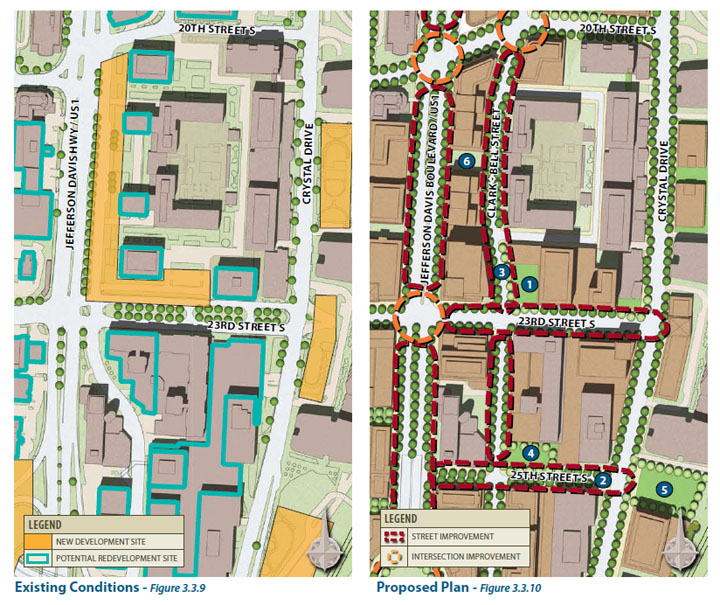
A key transportation goal of the Crystal City Sector Plan is close to becoming reality.

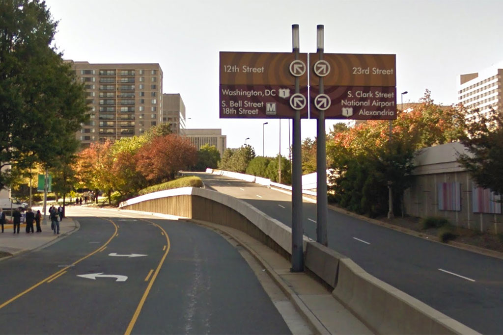
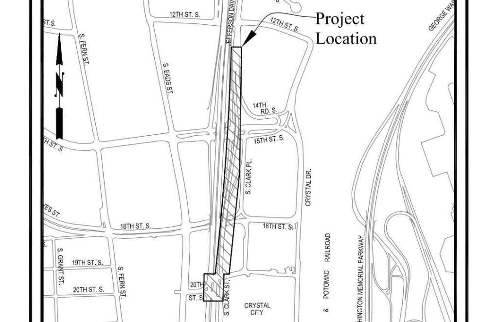
The Arlington County Board on Saturday is expected to consider a $6.3 million contract to demolish the elevated portion of S. Clark Street between 12th Street and 20th Street S.

While taking away a useful but relatively lightly used shortcut across Crystal City, the project will “normalize the street network and create more development space in the Crystal City area,” according to the county staff report.

More from the county’s webpage for the project:

The South Clark-Bell Street Demolition project is a goal of both the Crystal City Sector Plan and Crystal City Multimodal Transportation Study. It will improve safety for all modes of transportation and will establish the long-term street grid for the north and south portions of Crystal City along with the 15th Street South/South Clark-Bell Street Realignment project.

The elevated portions of South Clark-Bell Street will be demolished north of 18th Street South. South of 18th Street South, new open space will be created in the existing roadway right-of-way and new sidewalks, landscaping, and lighting along U.S. Route 1 will be provided. The project will also establish new building pad development sites for redevelopment of Crystal City, with the necessary infrastructure to transform the U.S. Route 1 corridor in Crystal City on the east side.

The project also includes traffic signal upgrades at 20th Street S. and Route 1.

The winning bid on the project was $6.3 million from Ardent Company, LLC, which was higher than the original $5.5 million county engineer’s estimate, but much lower than the only other bid published: $15 million from Fort Myer Construction Corporation.

If approved by the County Board, the contract would include a $1.3 million contingency for a total authorization of $7.6 million.

Construction is expected to begin this fall and wrap up in the summer of 2019.

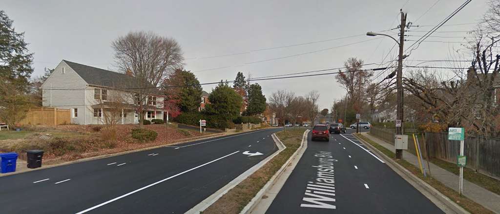
Photo via Google Maps


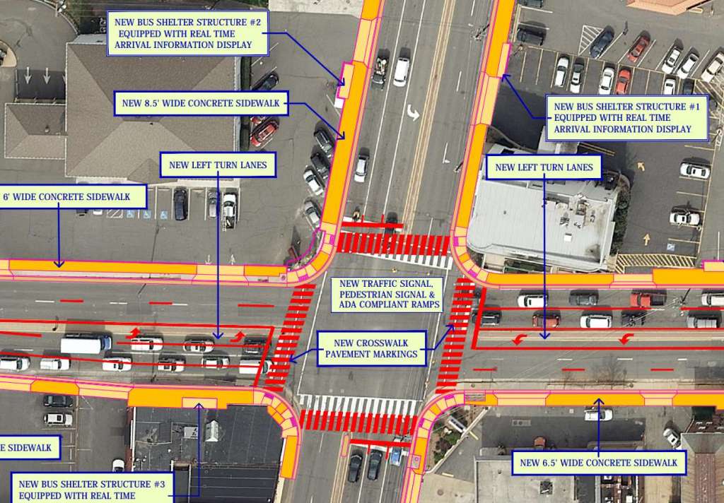
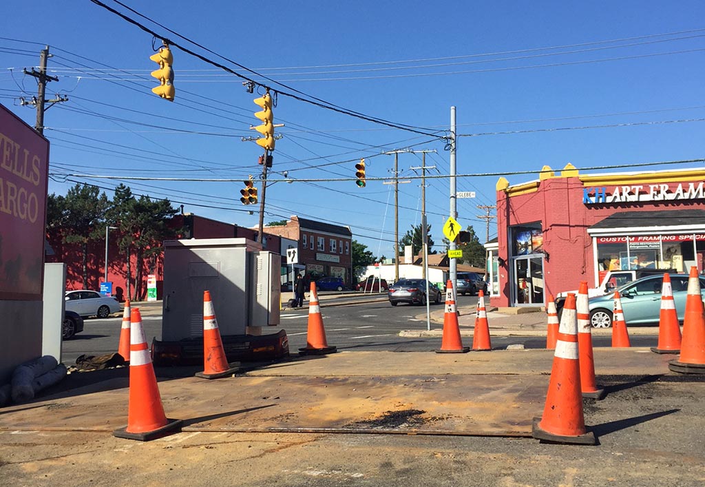
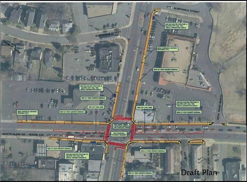
The first phase for the upgrades on the intersection between Lee Highway and N. Glebe Road are well underway after construction began March 6.

A spokeswoman for the county’s Dept. of Environmental Services (DES) said the installation of spaces for underground utilities should be done by the end of the year.

After that is complete, utility cables will be transferred underground from the overhead poles. Each individual wooden overhead pole will then be removed and any remaining existing overhead utilities will be rearranged.

Improvements include wider sidewalks, upgraded traffic signals, enhanced left-turn lanes and the installation of left-turn lanes for N. Glebe Road. The area will also get four new bus shelters with real-time arrival information, new streetlights and crosswalk markings.

Currently the construction hours are 9:30 a.m. to 3 p.m. Monday through Thursday and 9:30 a.m. to 2 p.m. on Fridays.

Workers may close a single lane of traffic in one or both directions along Lee Highway, Glebe Road or both during construction. Vehicles turning left or right might also be detoured as construction moves into the intersection itself.

Additionally, some bus stops in the area will be relocated and some sidewalks will be closed or rerouted to allow for construction. Off-street parking in the area may also be reduced in the coming months.

DES says it does not expect any changes to be made to the current design plan for the project.


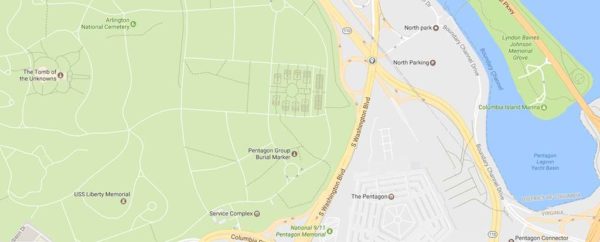
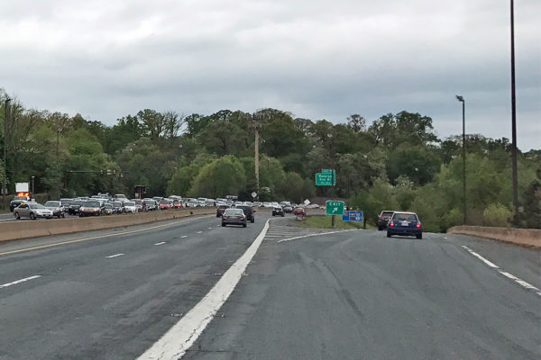
Lanes will close on Route 110 near the Pentagon next week for up to two months as part of a state construction project.

The right lane of northbound Route 110 at Washington Blvd will close Wednesday night and the right lane of southbound Route 110 will close Thursday night at the same interchange.

The Virginia Department of Transportation said the closures are to remove and rebuild the bridge piers on the shoulders. Message signs alerting motorists to the lane closures are in place.

The left lane of northbound Route 110 and the left lane of southbound Route 110, which have been closed since early April to reconstruct the bridge pier in the median, will reopen Tuesday night.

The work is part of the Route 27 over Route 110 project, which is scheduled for completion next spring. The project will modify and repair the Washington Blvd bridge, including widening it and making it longer, wider and taller than the existing bridge.


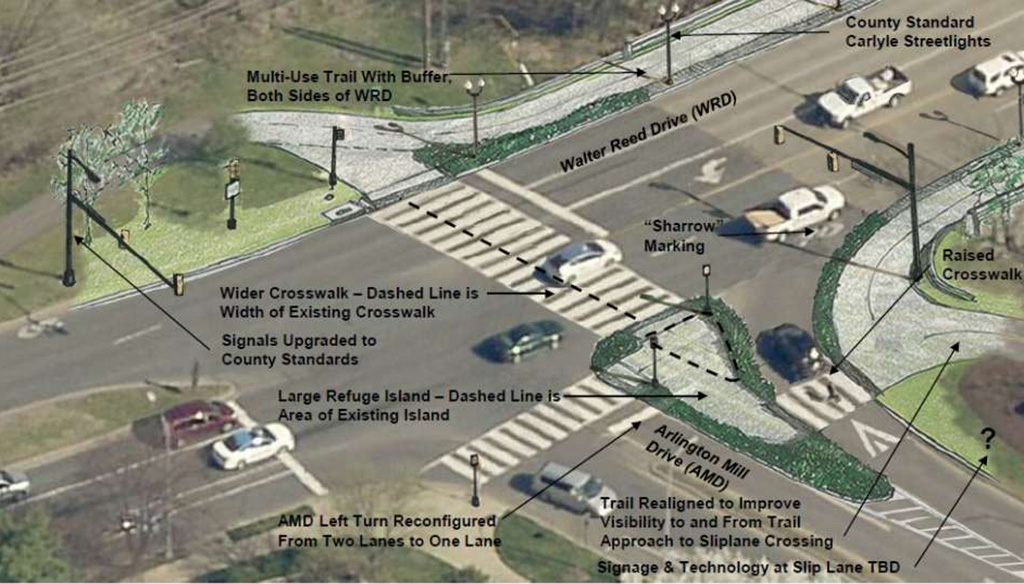
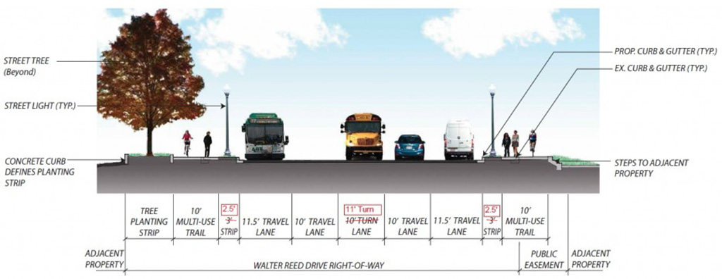
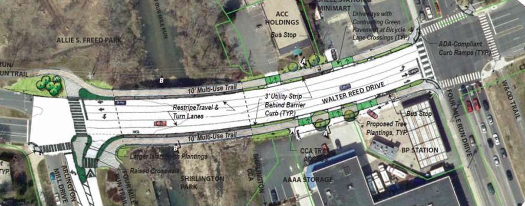
Construction is set to begin this winter on improvements to S. Walter Reed Drive between S. Arlington Mill Drive and S. Four Mile Run Drive near Shirlington, a plan in the works since 2014.

S. Arlington Mill Drive will get new left and right turn lanes to make crossing easier for pedestrians and bicyclists.  The realignment will be installed temporarily to allow residents to test out the proposed changes, and will remain in place until the work begins.
During the test period, staff will monitor the intersection’s usage to determine signal timings and markings prior to construction.

In addition, the project will include new crosswalks and curb ramps, ADA-compliant bus stops, upgraded traffic and pedestrian signals and new street lighting, among other improvements. S. Walter Reed Drive’s lanes will be restriped and widened slightly.
It is hoped the project will improve bicycle and pedestrian access to Shirlington. The intersection serves as an access point to the neighborhood’s commercial area, while county vehicles are also based at nearby facilities.

The funding for this project is provided through a slew of county sources as well as the Virginia Department of Transportation’s Revenue Sharing Program.


The Arlington County Board on Saturday is expected to consider five neighborhood improvement projects with a cumulative price tag of $5.3 million.

The projects have been advanced by a county committee via Arlington’s Neighborhood Conservation Program, which encourages neighborhoods to apply for funding for various types of local improvements.

The projects set for approval are:

  •  A new neighborhood sign for Long Branch Creek ($12,500)
  • Street improvements and new streetlights along 31st Street S. in Fairlington, between S. Randolph and Woodrow Streets ($1.7 million)
  • New streetlights on S. Oak, Ode and Orme Streets in Foxcroft Heights ($562,704)
  • Intersection improvements along 2nd Street S. at S. Wayne, Uhle and Wise Streets in Penrose ($1.6 million)
  • Street improvements along N. George Mason Drive between 11th Street N. and I-66 in Waycroft-Woodlawn ($1.4 million)

The County Board is expected to vote on the Neighborhood Conservation projects at its Saturday meeting. The measure also includes an additional $200,000 for the county’s “Missing Link Program,” which funds the construction of small stretches of new sidewalk to connect existing sidewalks.


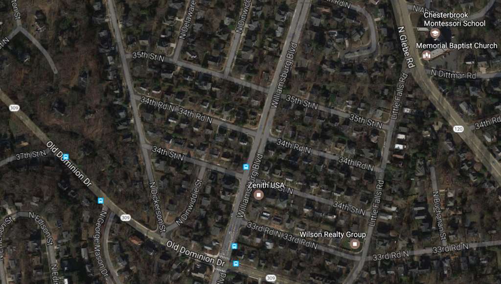
The Arlington County Board will consider a plan to make a stretch of Williamsburg Blvd a so-called “Green Street” at its meeting Saturday.

The section of Williamsburg Blvd, between 33rd Road N. and 35th Street N., would have new trees added as well as two 1,000-square-foot rain gardens in the median. The project is intended to improve local water quality and address permit requirements as part of the county’s Green Streets project for stormwater management.

County staff estimated that installing the trees and rain gardens will treat runoff from 2.2 acres of impervious surfaces that do not allow rainwater to soak in. That water then runs off into the Little Pimmit Run watershed, which leads to the Chesapeake Bay, with Arlington under instructions along with other jurisdictions to reduce pollution in the bay.

If the County Board approves the plan, a contract worth an initial $1.23 million would be awarded, with $246,000 in contingency.

County staff recommends approval of the project, which is being coordinated with the second phase of improvements to Old Dominion Drive. Construction is set to start in June or July.


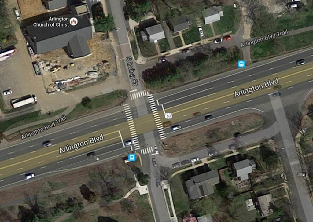
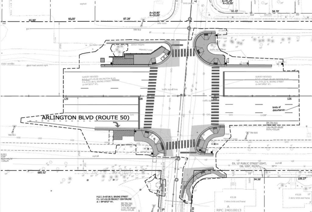
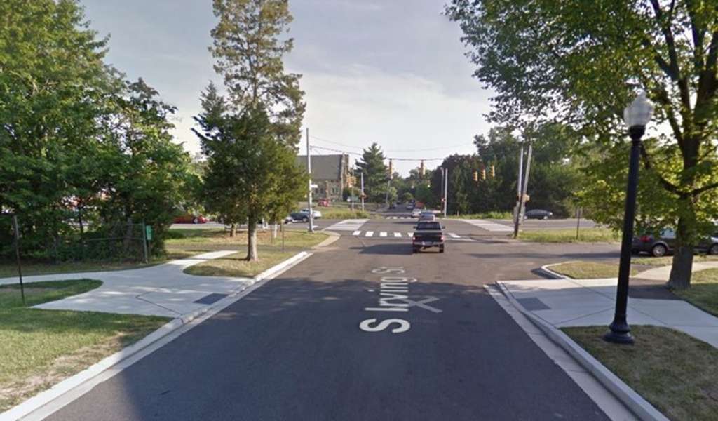
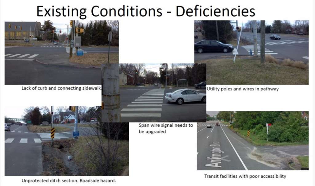
The intersection of Arlington Boulevard (Route 50) and N. Irving Street is set to undergo a major safety transformation.

The County Board due to award a contract for the work on Saturday. Upgraded traffic signals, improved sidewalk connectivity, new and more accessible bus stops and marked turn lanes are slated for the intersection.

There will also be better connections to the nearby Arlington Blvd trail, while pedestrians will get new push buttons to help them cross the street, countdown signals and technology to detect vehicles and cyclists in the street.

The project is close to Thomas Jefferson Middle School and Community Center and what will, in two years, be a new elementary school.

The County Board will vote on awarding a contract worth an initial $729,000, with an additional $109,000 as a contingency. A report by county staff on the project notes that it is administered by the Virginia Department of Transportation, with primary funding from the federal Highway Safety Improvement Program.

Under the current funding model, just over $650,000 will be covered by federal money, with the remaining $180,000 covered by the county’s Transportation Capital Fund, which allocates commercial tax revenues to transportation projects.

In their report, staff did not raise any issues with the project. It has already been presented to the Arlington Heights and Ashton Heights Civic Associations and the Bicycle and Pedestrian Advisory Committees.

If approved by the County Board, construction is set to begin this fall. There are no road closures planned for the project.

Kalina Newman contributed reporting.


Arlington Taking Roadwork Suggestions — “Arlington’s Neighborhood Complete Streets Program is asking residents to nominate neighborhood streets they believe could be made safer and more comfortable for all users for potential improvement projects. If you know a neighborhood street that is missing a section of sidewalk, needs an accessible curb ramp or better street lighting, consider nominating it. The County is accepting submissions through Friday, June 16.” [Arlington County]

Commuting Habits in Arlington — Arlington County’s new “Profile 2017” data packet has a surprising statistic on community habits: more Fairfax County residents commute into Arlington each day than Arlington residents commute into D.C. [Twitter]

Candidates Dither on Exotic Pet Ban — Three out of four of the Democratic candidates for County Board would not give a straight answer to the question of whether they support a proposed ban on wild and exotic pets. [InsideNova]

Metro 29 Named Best Diner in Va. — A new list of the best diner in all 50 states lists Metro 29 diner on Lee Highway as the best in Virginia. [Mental Floss]

Beyer on House Healthcare Bill — Rep. Don Beyer (D-Va.) says yesterday’s narrow passage of the GOP healthcare bill is “a dark stain on the history of the House of Representatives.” [Rep. Don Beyer]

Comment Ads Turned Off — To improve the user experience, we’ve turned off those semi-trashy tile ads below the comments. They’re prevalent on lots of websites, especially news websites, and they generate decent revenue, but we could not longer stand having them associated with our site. Replacing the ads are links to previous ARLnow.com articles.


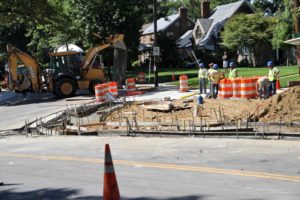
Construction has begun on new, more aesthetically-pleasing road medians in Ballston.

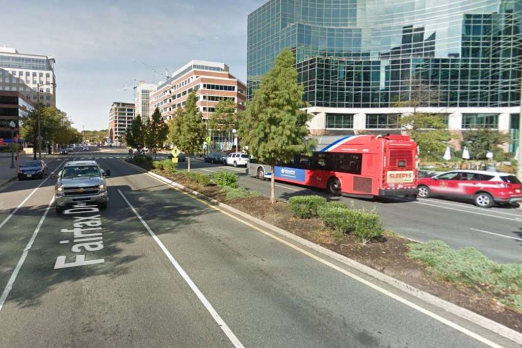
Work kicked off yesterday on the medians along Fairfax Drive, from N. Quincy Street to Glebe Road. The improvements include a decorative fence, solar-powered “gateway signage” and “more plantings of annuals and perennials while maintaining the stately Bald Cypress trees.”

The Ballston Business Improvement District is spearheading the initiative as part of its placemaking efforts.

More from the BID:

A new pedestrian fence inspired by Ballston’s distinctive brand will increase pedestrian safety, solar-powered gateway signs will welcome all to the neighborhood, and an artistic design will be created on the median noses using the iconic Ballston-orange.

Initial work will include some demolition, repair and replacement of existing medians. The pedestrian fence installation will commence mid-May, and the final stages of work including painting, signage and plantings will follow in early June. Work will take place after morning rush and before evening rush hours with a vehicle lane closure on each side of the medians from Glebe Road to Fairfax Drive.

First image via Ballston BID. Second image via Google Maps


View More Stories