The County Board is set to vote this weekend on a contract to build a long-awaited pedestrian bridge.

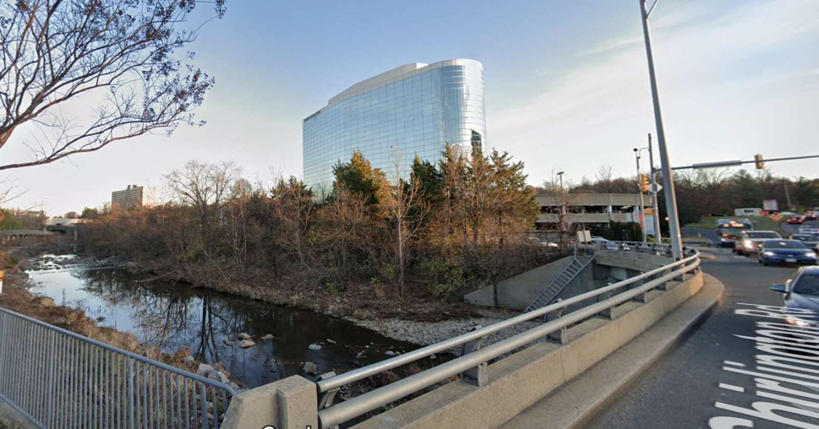
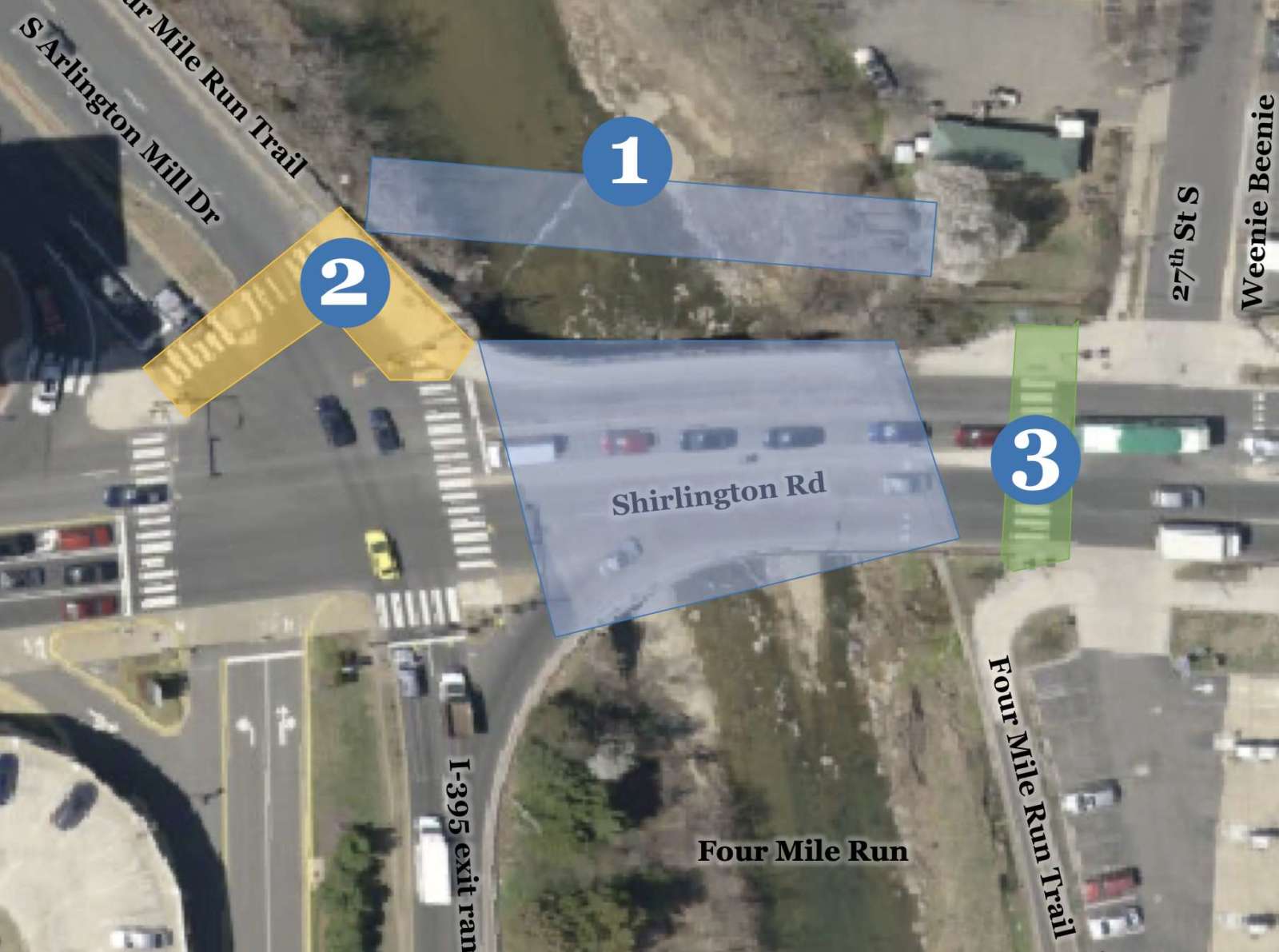
On Saturday, it is expected that the Arlington County Board will approve a $1.6 million contract to construct the Shirlington Road Pedestrian Bridge. The 15-foot-wide prefabricated steel bridge will run the length of Four Mile Run and parallel to the road with the purpose of providing safer bicycle and pedestrian access.

It will connect Shirlington and S. Arlington Mill Drive to Jennie Dean Park and the Green Valley neighborhood. It will also serve local users of the heavily-used Four Mile Run and W&OD trails nearby.

Work on the bridge could begin in the second half of this year if the contract is approved over the weekend, Arlington Dept. of Environmental Services spokesperson Claudia Pors told ARLnow. That would mean a completion date in mid to late 2024.

“The existing Shirlington Road vehicular bridge primarily funnels vehicles to/from I-395 and lacks safe, comprehensive accommodations for pedestrians and bicyclists traveling through this area,” the report to the Board says.

“This project will provide a key missing link in the County’s bicycle network by providing a north-south protected bicycle facility that will link up with the existing Four Mile Run Trail along South Arlington Mill Drive to the west and along Four Mile Run in the City of Alexandria to the east of the bridge,” the report adds.

The bridge has been under discussion for two decades and has been the topic of conversation among county staff and the public for years.

It will be constructed in two parts, per Pors. First, the span will be built offsite, a process that will take about nine months, while abutments will be added at S. Arlington Mill Drive and Jennie Dean Park where each end of the bridge will go. Around this time, the bridge’s walls will be built and the sidewalk and crosswalk at S. Arlington Mill Drive will be shuttered. Bike and pedestrian traffic will be detoured.

The bridge, then, will be lifted by a crane and installed.

“It’s possible that lanes on the existing bridge will close to accommodate this installation, and the public would be given notice of any detours,” Pors noted.

New street lighting on each end of the bridge will be installed as well, plus median, sidewalk and crosswalk retrofits. A new Rectangular Rapid Flashing Beacon will be installed in the median as well.

The work is set to be done by D.C.-based Milani Construction, whose $1.38 million bid (plus $277,000 in contingency costs) actually came in under the county engineer’s estimated construction cost.

Last year, work was completed on the parallel vehicle bridge on Shirlington Road. That included resurfacing, routine maintenance, widening the sidewalk by several feet on the west side of the bridge, widening curb ramps, and adding a median at the mid-block crosswalk near 27th Street S.

A number of these improvements came as a result of public feedback.

Additionally, the county is set to study the feasibility of adding another crossing at the intersection of S. Arlington Mill Drive and Shirlington Road.

“County staff have begun study efforts and anticipate reaching out to the public for input this fall,” Pors said.


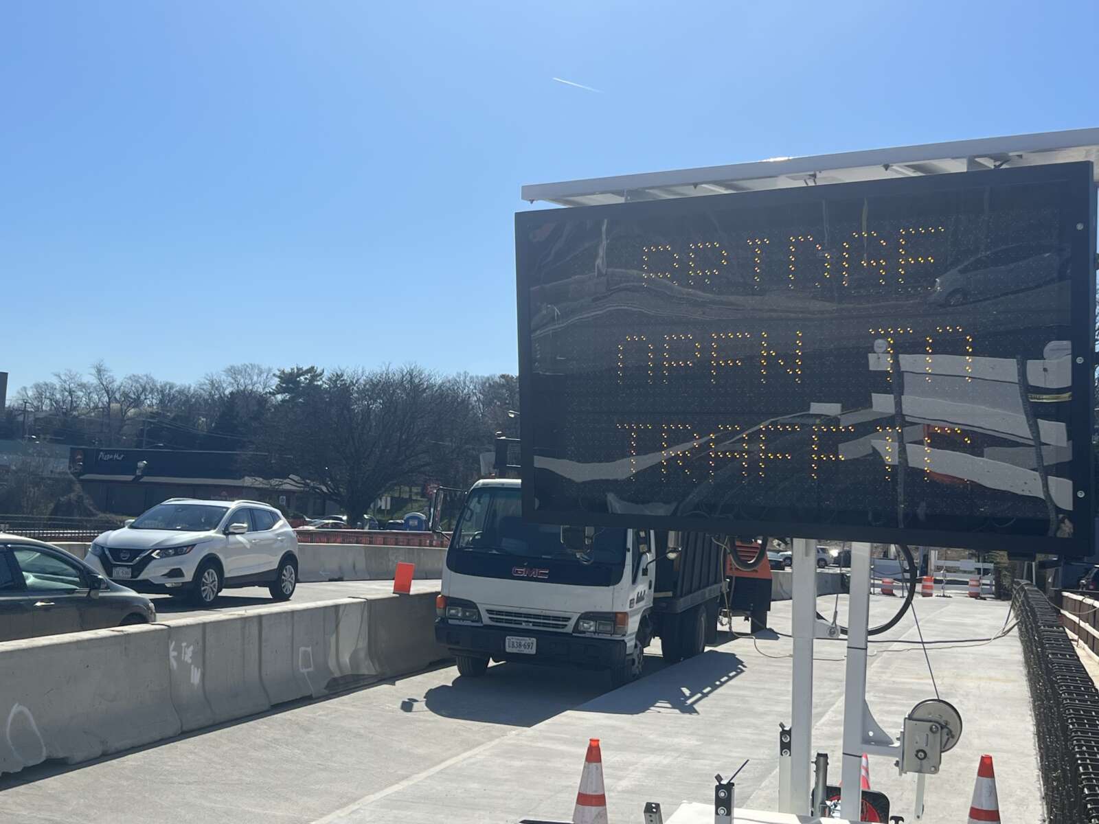
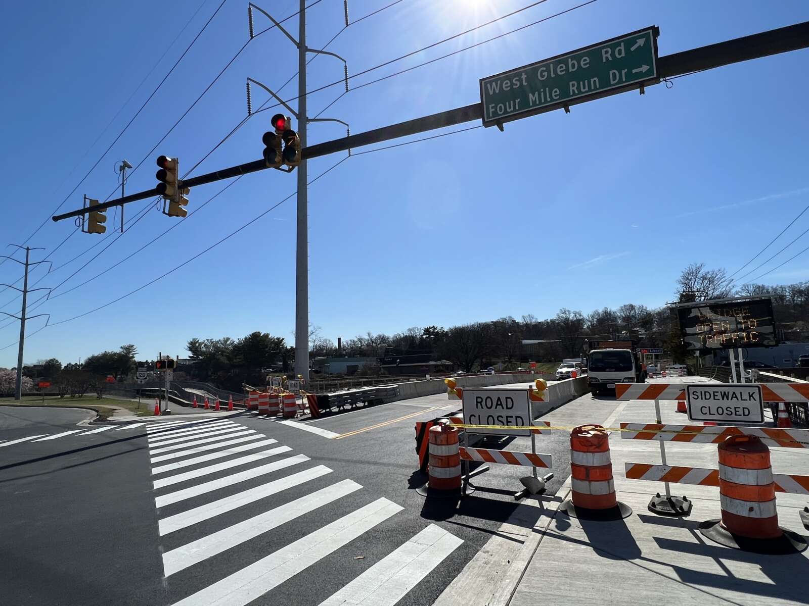
The West Glebe Road bridge partially reopened yesterday, though pedestrian and bicycle traffic will have to wait to make use of the span over Four Mile Run.

The bridge had severely deteriorated, requiring partial closures over the years until the bridge was fully closed last summer.

Work then began to replace the deteriorated roadway substructure, while reusing existing piers to shorten the construction time and keep costs down, according to Arlington County.

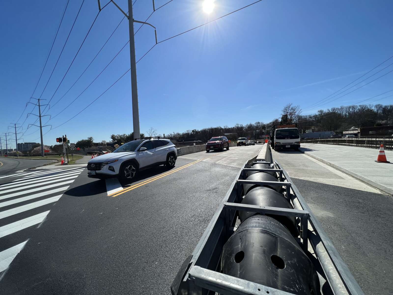
The bridge partially reopened yesterday (Wednesday) with one lane open in each direction.

According to the county website:

As of March 8, 2023, the West Glebe Road bridge is open to motor vehicle traffic, with one lane open in each direction. Pedestrian and bike traffic will continue to detour on the temporary bridge to the east of the main bridge.

The bridge is expected to fully open in summer of 2023, after completion of work on parapets, substructure, and streetlights.

The county says the next phase of construction will see the bike lane, curb and sidewalk put into place.

The Four Mile Run Trail underpass on the north end of the bridge remains closed until reconstruction is completed.


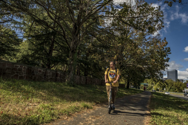
Scooting along near Arlington National Cemetery (staff photo by Jay Westcott)

The third time could be the charm for Arlington County, which is applying for federal funding to improve cycling and walking connections around Arlington National Cemetery.

On Saturday, the Arlington County Board is scheduled to review the county’s third application for funding from the Rebuilding American Infrastructure with Sustainability and Equity (RAISE) Program.

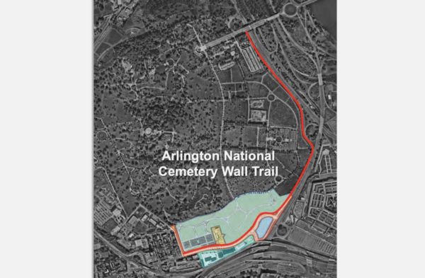
The money would partially fund the construction of a long-proposed Arlington National Cemetery (ANC) Wall Trail along Washington Blvd, which would connect Columbia Pike and the Pentagon City area with Memorial Avenue and the Arlington Memorial Bridge into D.C.

“Connectivity for bike-ped users across this part of the County is complicated by the combined barrier effects of secured federal facilities such as ANC, Joint Base Myer-Henderson Hall, and the Pentagon Reservation” and “a high-volume roadway network” comprised of Arlington Boulevard, Washington Blvd, Route 1 as it runs through Pentagon City, I-395 and the GW Parkway, the county notes in a report.

The new trail would run along the western side of Washington Blvd. An existing trail on the opposite side gets dicey near Memorial Circle for pedestrians and cyclists looking to connect to the Mt. Vernon Trail or cross into D.C.

The Federal Highway Administration is designing this multi-use trail in conjunction with the realignment of Columbia Pike. This work is being done to accommodate the 50-acre southern expansion of the ANC, which will add about 80,000 burial sites, allowing burials through the 2050s.

Arlington County has unsuccessfully applied for RAISE funding in the 2021 and 2022 fiscal years. This fiscal year, the federal program has nearly $2.3 billion to dole out “for investments in surface transportation that will have a significant local or regional impact,” per the notice of funding opportunity.

“RAISE is a cost reimbursement program and not a lump sum grant award,” the county report notes. “Previous programs have been highly competitive.”

The Arlington Memorial Trail will run west along Washington Blvd and Richmond Hwy, starting at the eastern end of a realigned Columbia Pike to Memorial Avenue, immediately adjacent to the Arlington Cemetery Metro station.

It will link up to an existing trail along the west side of Richmond Hwy, which provides a connection to the Iwo Jima Memorial, to Rosslyn and to the larger network of bicycle and pedestrian trails along the Rosslyn-Ballston corridor.

Renderings of Arlington National Cemetery expansion and Columbia Pike reconfiguration project (via National Capital Planning Commission)

The estimated cost of the Arlington Memorial Trail in the approved 10-year capital improvement plan is $25 million. If the federal government green lights the full $15 million, the county would cover the remaining $10 million through a mix of the commercial and industrial tax and funding it receives from the Northern Virginia Transportation Authority for local projects.

Projects can receive $5 million to $25 million. A single state cannot receive more than $225 million and awards must be split evenly between urban and rural areas.

Selected projects will be announced by the end of June.


Repairs are in progress on the bridge that takes traffic from southbound I-395 to Route 1 in the Crystal City area.

The $4 million Virginia Dept. of Transportation project will “improve safety and extend the overall life of the bridge,” which was originally built in 1976.

More from a VDOT press release:

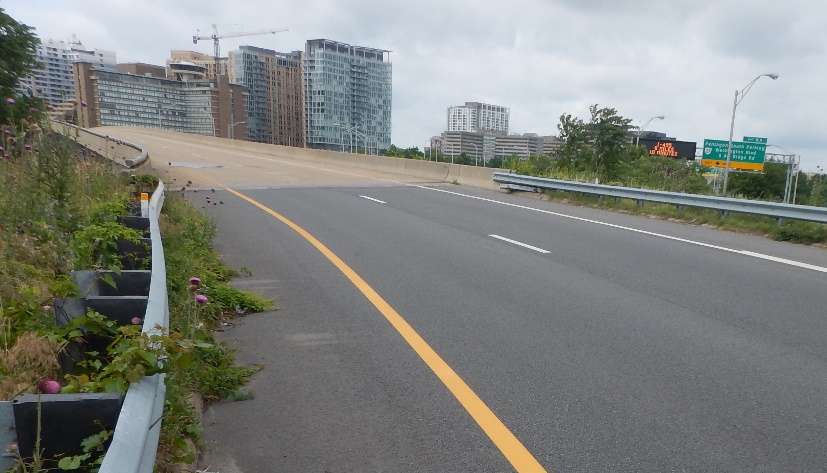
Repairs are underway on the weight-restricted (20 tons) southbound I-395/Route 1 Exit 8C bridge, according to the Virginia Department of Transportation. The project will improve safety and extend the overall life of the bridge, which carries southbound Route 1 over the 395 Express Lanes, the northbound I-395 general purpose lanes and northbound Route 110.

The project includes retrofitting and spot painting structural steel, and replacing the catcher beam system and strip seal at the joint.

During the project, some day and overnight single-lane closures may be scheduled, along with occasional overnight full closures of the bridge with detours.

The bridge, which was originally built in 1976 and rehabilitated in 1999, is about a fifth of a mile long and averages 20,000 vehicles a day.

The $4 million project is financed with federal and state funding and is scheduled for completion in late 2023. […]

Drivers are reminded to use caution when traveling in active work zones. Be alert to new traffic patterns and limit distractions.

The entrance to the bridge has been the scene of numerous crashes caused by drivers trying to exit across multiple lanes at the last second, as documented by public safety watcher Dave Statter.


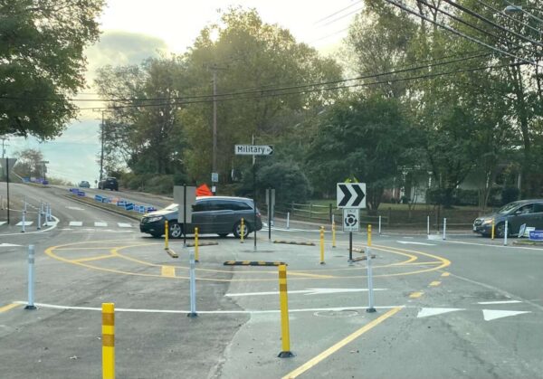
A temporary roundabout on Military Road (staff photo)

Arlington County has not ruled out the possibility of a permanent roundabout on Military Road despite the confusion a temporary version has caused for the past year.

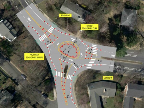
In October 2021, where there used to be a stop sign for traffic on northbound Military Road, the county added paint lines, bollards and raised temporary curbs, and partially demolished a median. The work was aimed at improving safety where Military Road intersects with Nelly Custis Drive.

While preliminary data from the county found the roundabout did lower speeds, 53% of drivers, 27% of pedestrians and 26% of cyclists said they felt “less safe” or “much less safe” using the new traffic pattern, per a summary of feedback collected this summer.

“The majority of all respondents reported feeling less safe while using the pilot intersection, but the margins were very narrow for those who walked or biked through the intersection,” the report says. “Those who reported feeling less safe highlighted concerns with operational confusion, the size of the pilot roundabout and the perceived lack of sufficient space for a well-designed roundabout in the future condition.”

Drivers said they were confused about proper procedure in the intersection, while cyclists said drivers exhibited inconsistent behavior and would revert to habits they had when the intersection had a stop sign, per the report. Additionally, several users said the temporary materials caused visual challenges that contributed to the confusion.

Responses from a survey regarding a traffic circle on Military Road (via Arlington County)

About 31% of drivers, 26% of pedestrians and 18% of cyclists said they felt “safer” or “much safer” with the traffic circle, the summary says.

Road users in this camp were also concerned about confusion, but “reported better yield rates by vehicles to pedestrians, slower vehicle speeds, and easier operations for traffic flow and left turns from Military to Military,” the report said.

For now, it seems the roundabout is still in play as a permanent change.

The Military Road and Nelly Custis Road intersection roundabout (via Arlington County)

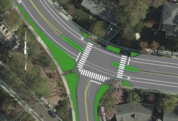
The report says that the project can “take the form of either a signalized intersection or a roundabout” and that a majority of issues locals raised “can be addressed through design in a capital project, where the intersection design will not be limited by existing curb lines.”

A preliminary mock-up of a signal at the Nelly Custis and Military Road intersection (via Arlington County)

Meanwhile, the Old Glebe Civic Association, which previously called the changes “unwanted” and says it has opposed the potential project for four years, says it has sources claiming the roundabout is all but a done deal.

“Two County staff members recently stated that the County will be building a permanent roundabout, which will take about 12 to 15 months, independent of the public feedback,” writes Peter Jaffe in the October edition of OGCA’s newsletter. “They said that the permanent roundabout will be larger than the temporary one and that the increased size will help address confusion by drivers about who is in the roundabout and who has the right of way.”

The report notes that recently, signs in the middle of the roundabout “have been knocked down and later repaired at least twice, suggesting that incidents have occurred at the roundabout.” The Old Glebe neighborhood is about 2 miles west of the roundabout, but Military Road is a popular commuter route for those heading east.

In response to OGCA’s letter, Dept. of Environmental Services spokeswoman Claudia Pors tells ARLnow there is no official recommendation yet.

“The County has not shared any recommendation or decision for the Military Road and Nelly Custis Roundabout Pilot Project at this time,” she said.

As for the signage, she said the team at DES is aware of the issue.

“Throughout the pilot’s duration, signage has been knocked over,” she said. “Staff has repaired or replaced these signs as soon as possible. We do not have information on the exact causes of these incidents or how many times they occurred.”

(more…)


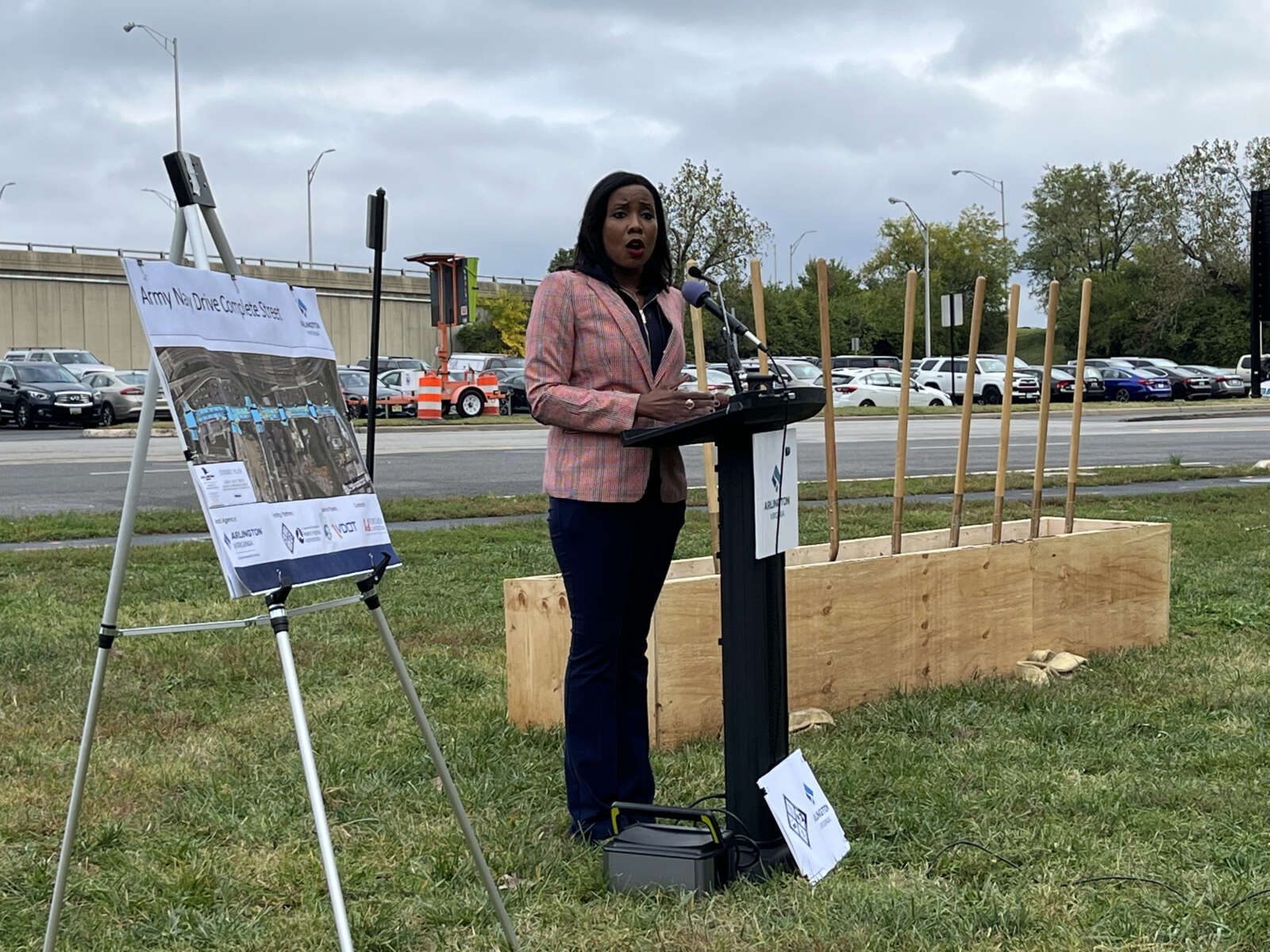
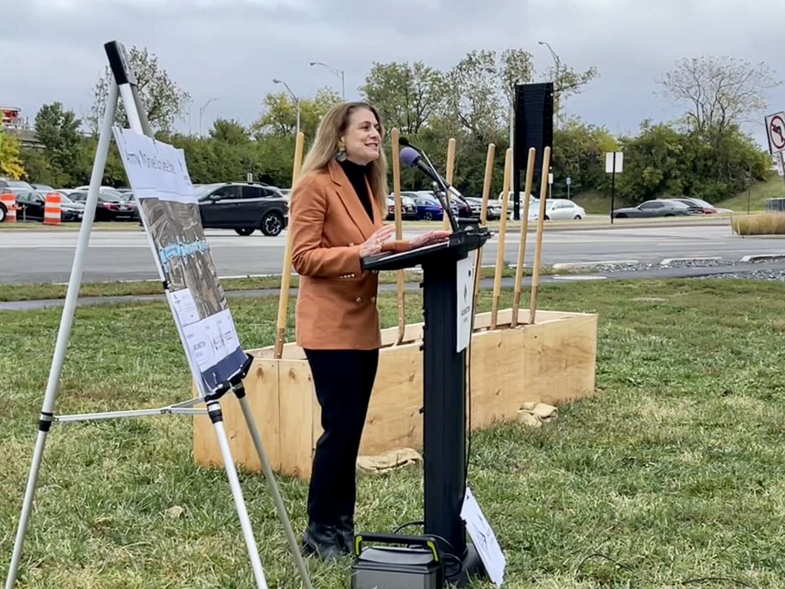
Work to rebuild Army Navy Drive through Pentagon City and improve safety and transit along the corridor is officially underway.

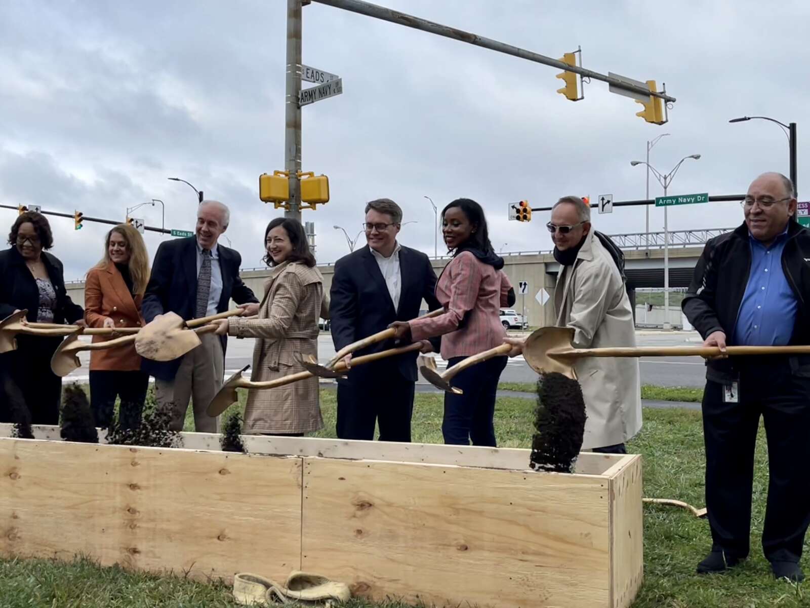
This morning, Arlington County and the Northern Virginia Transportation Authority ceremonially broke ground on the long-planned Army Navy Drive “Complete Street” Project, which is intended to make the current multi-lane expanse of Army Navy Drive between S. Joyce Street and 12th Street S. more friendly to pedestrians, cyclists and transit users.

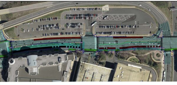
The project includes shortened pedestrian crossings, dedicated transit lanes between S. Joyce Street and S. Hayes Street, planted medians, new traffic signals at five intersections, and in some places, narrowed or reduced vehicle travel lanes. There will be a protected, two-way bicycle lane along the south side of Army Navy Drive.

Work kicks off as the number of workers and residents in the area is projected to significantly increase in the coming years. Amazon is preparing to build the second phase of its HQ2 — known as PenPlace, and which includes the iconic “Helix” building — at the corner of Army Navy Drive and S. Eads Street, while continuing to hire toward its goal of 25,000 employees. Meanwhile, JBG Smith has filed plans to add 1,668 residential units to surface parking lots at the nearby RiverHouse complex.

For the next three weeks, road users will see signs of crews setting up for the Army Navy Drive project, like cones and a construction management trailer, says Mark Dennis, project manager for Arlington’s Dept. of Environmental Services. In mid-November, people will start to see demolition work.

“Both sides of the corridors will have markings and indicators that the entire area is a working construction zone,” Dennis told ARLnow. “There will be slight changes in traffic patterns to accommodate lane shifts that are needed.”

He said drivers will need to pay extra attention to navigate these changes.

“Complete Streets” project plan for portion of Army Navy Drive (via Arlington County)

Before scooping ceremonial dirt with gold-colored shovels, local and regional dignitaries celebrated the expected benefits of the project.

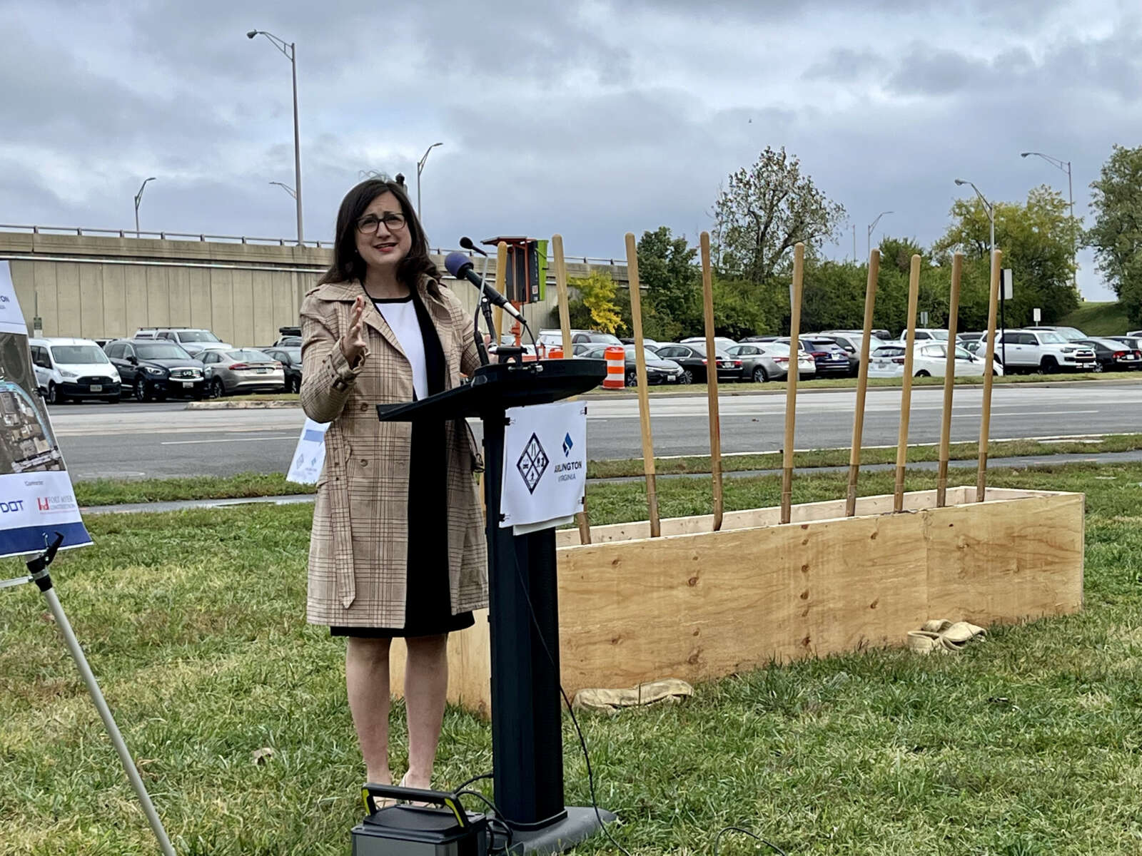
Arlington County Board Chair Katie Cristol said the project will make Army Navy Drive safer for pedestrians and cyclists and more convenient for bus riders. It will also slow down drivers, improve air quality and reduce stormwater runoff, she said.

“It’s better for all of us because providing safe, accessible and multimodal transportation is a key part of the economic competitiveness of Pentagon City and Arlington overall,” said Cristol.

NVTA CEO Monica Backmon celebrated the project for “getting people out of their single-occupancy vehicles and giving people options.”

https://twitter.com/NVTAuthority/status/1584554450823544832

The transportation authority said in a press release that it has invested more than $227 million into transportation projects located in Pentagon City, Crystal City and Potomac Yard, known collectively as National Landing.

(more…)


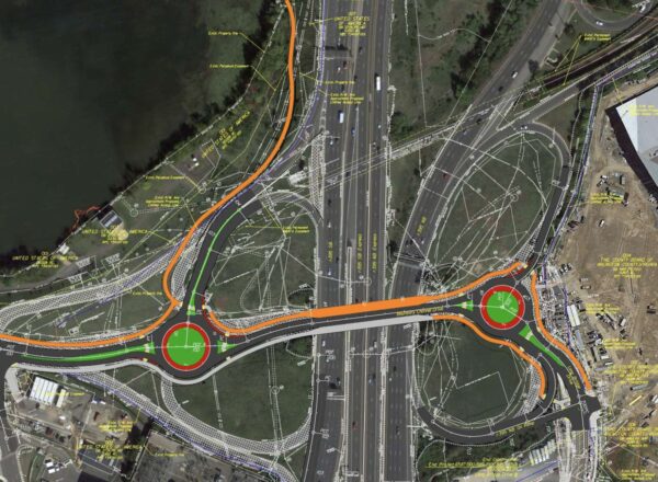
Changes coming to Boundary Channel Drive and I-395 interchange (image via VDOT)

Construction is starting next week to make Boundary Channel Drive and the I-395 interchange near Crystal City and the Pentagon safer.

The impact on locals should be “minimal,” Virginia Department of Transportation spokesperson Mike Murphy told ARLnow. While there could be lane closures, access to surrounding facilities will be kept open.

“Some day and overnight lane closures may be scheduled along I-395, Boundary Channel Drive, and Long Bridge Drive in the project area,” Murphy said. “Access to I-395 via Boundary Channel Drive, as well as access to Pentagon facilities and the Long Bridge Aquatics & Fitness Center will be maintained during construction.”

The long-planned $20 million project is set to reduce traffic lanes on Boundary Channel Drive to make room for paths and sidewalks, install roundabouts, reconfigure ramps, and add crosswalks.

The purpose of the renovations is to simplify traffic patterns and to make it safer for pedestrians, cyclists and drivers.

“We’ve long sought these improvements,” then-County Board Chair Matt de Ferranti said at a Board meeting last year when voting to approve the project. “They will reconfigure the interchange that you see to make it work a lot better and safer for everyone.”

The VDOT-led project is expected to be completed about a year from now, in fall 2023.

Crews will begin with work on Boundary Channel Drive, where both directions will be reduced to one lane to allow for the construction of the new roundabouts, utility work, and pedestrian improvements.

Those improvements include a path along the south side of Boundary Channel Drive, complete with crosswalks, landscaping, and street lighting.

The new shared-use path, varying in width between ten and twelve feet, will start at the Long Bridge Aquatic Center parking lot entrance. It will then follow Long Bridge Drive northbound before connecting with westbound Boundary Channel Drive, per Murphy. The half-mile-long path will pass under I-395 and turn north at the soon-to-be-built western Boundary Channel Drive interchange roundabout.

The new path will ultimately connect with the existing one that parallels the southbound George Washington Memorial Parkway ramp to I-395 southbound.

This project has been in the works since at least 2014 and is estimated to cost $19.6 million. It’s being paid for by a combination of state, federal, regional, and county money.


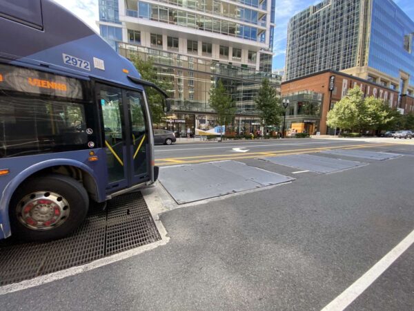
The banging metal covers on Wilson Blvd near the intersection of N. Randolph Street (staff photo)

A set of utility covers in the middle of Wilson Blvd that have bothered residents for nearly a decade may finally get a permanent fix.

For Alex Korolkoff, the banging noise from cars and buses driving over the covers is so loud — even on the 10th floor of his Ballston apartment building — he’s resorted to fans and white noise machines to drown it out.

Carlos Moran said the “constant heavy banging” coming from near the corner of Wilson Blvd and N. Randolph Street, across from Ballston Quarter mall, “affect our quality of life” and prevent him from sleeping in his home.

Another nearby resident compares the situation to war.

​”It feels as if we are being held hostage, like POWs, in our very own apartments, bound by our leases and forced to live with the continual banging,” they wrote ARLnow. The noise happens day and night given that the metal covers are along one of Ballston’s most highly-trafficked corridors.

The banging is particularly loud when bearing the brunt of buses and trucks, with the noise bouncing off Ballston’s high-rises.

“There’s such disruption that we deal with 24/7, while trying to work from home, we can’t sit on our small balcony without it being even louder, and sleeping is difficult,” one nearby neighbor wrote ARLnow. “The noise is truly endless because traffic never ceases.”

And it’s been a problem for nearly a decade. ARLnow first reported on the loose plates in 2013, when they were deemed a “temporary measure” and would be fixed soon. The covers were also listed as one of Arlington’s most wanted road repairs.

Nine years later, though, they are still there, loose, and driving some neighbors nuts.

The plates are the responsibility of nearby apartment building Ava Ballston, both Arlington County and the building’s parent company AvalonBay — which happens to have its headquarters across the street — confirmed to ARLnow. The flat sheets of metal are protecting Dominion Power equipment that help provides electricity to the building.

Over the years, ARLnow has received periodic emails from Ballston residents complaining about them.

One 2019 note speculated that the surrounding apartment complexes might have a hard time renting out units because of the noise. Another from October 2021 called the plates “steel drums.”

Another annoyed neighbor wrote in November 2021 that they put together a petition with more than 110 signatures of neighbors asking the county to do something to “right the wrong for a longstanding steel plate noise issue… it is distressing for those residents who need to rest, sleep, and work from home.”

ARLnow’s initial 2013 story was also spurred by an email from a reader.

“The noise within the apartments is now incredibly loud,” wrote a resident of the building that was then-called Archstone Ballston Square in March 2013. “This is a project that residents and the county were told would go on a few weeks — it’s [now] nearly 18 months later.”

(more…)


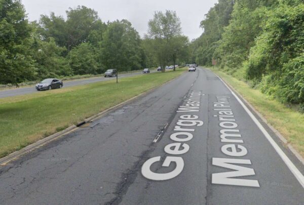
GW Parkway between Spout Run and Chain Bridge (photo via Google Maps)

Rolling single-lane closures are coming to a busy portion of George Washington Memorial Parkway starting today (August 1) and continuing through Friday (August 5).

Impacted will be the seven-mile segment of the GW Parkway between Spout Run Parkway in Arlington and the I-495 interchange in McLean.

The closures are needed to complete survey work for the road’s first major rehab project in six decades, the National Park Service announced in a press release late last week.

Northbound lane closures will take place between 7 a.m. and 2:45 p.m. while the southbound closures will run from 9 a.m. to 6:30 p.m.

These will be rolling, single-lane closures, meaning the road won’t be shut down completely. However, NPS is still asking drivers to “proceed with caution in these areas and consider using alternate routes” over the next five days.

Concurrent closures maximize the number of survey crews and minimize the duration of closures.

“Single lane closures are needed to create a safe work zone for surveyors conducting surveys,” the press release reads. “These surveys are needed to inform the design for the northern parkway rehabilitation project.”

For the first time since it was built in 1962, the northern section of the GW Parkway is getting a major overhaul. This is the busiest section of the parkway, according to NPS, serving 26 million drivers annually.

“The project will retain and revive the historic beauty and significance of the parkway – including opening scenic views to Washington, D.C – while updating aspects of it to improve the driving experience, safety and water drainage,” notes the agency’s website.

The work will include replacing asphalt, redesigning interchanges, reconstructing stone walls and barriers, replacing the drainage system, lengthening some entrance and exit lanes, and rehabbing the parkway’s historic overlooks.

In recent years, the road has had to close at least several times due to sinkholes.

The $161 million infrastructure project is being funded by the Great American Outdoors Act. Earlier this month, a number of federal officials and local lawmakers participated in a ground-breaking ceremony that kicked off the work.

The project’s first step is the design phase, which starts this week with surveying. Construction is expected to start next year and be completed in 2025.

The full press release from the National Park Service about this week’s lane closures is below.

On Monday, August 1 through Friday, August 5 there will be single lane, rolling closures in the northbound and southbound right lanes between Spout Run Parkway and the 495 interchange. Drivers should proceed with caution in these areas and consider using alternate routes.

  • All northbound closures will take place from 7 a.m. to 2:45 p.m.
  • All southbound closures will take place from 9:30 a.m. to 6 p.m.

All work is weather dependent, and closures are subject to change. Concurrent northbound and southbound closures and maximizing survey crews minimizes the duration of lane closures.

Single lane closures are needed to create a safe work zone for surveyors conducting surveys. These surveys are needed to inform the design for the northern parkway rehabilitation project.

The NPS has closed parking lot C-2 and part of parking lot B at Turkey Run Park as part of the project to rehabilitate the north section of the George Washington Memorial Parkway. These parking areas will be closed for the duration of the project.

The rehabilitation of the northern section of the parkway was announced by the Department of the Interior on December 7, 2021. In partnership with the National Park Service, the Federal Highway Administration awarded a $161 million contract to rehabilitate this section of the George Washington Memorial Parkway. The project will improve the driving experience, safety and water drainage while retaining and reviving the historic beauty and significance of the parkway – including opening scenic views to Washington, D.C.

Photo via Google Maps


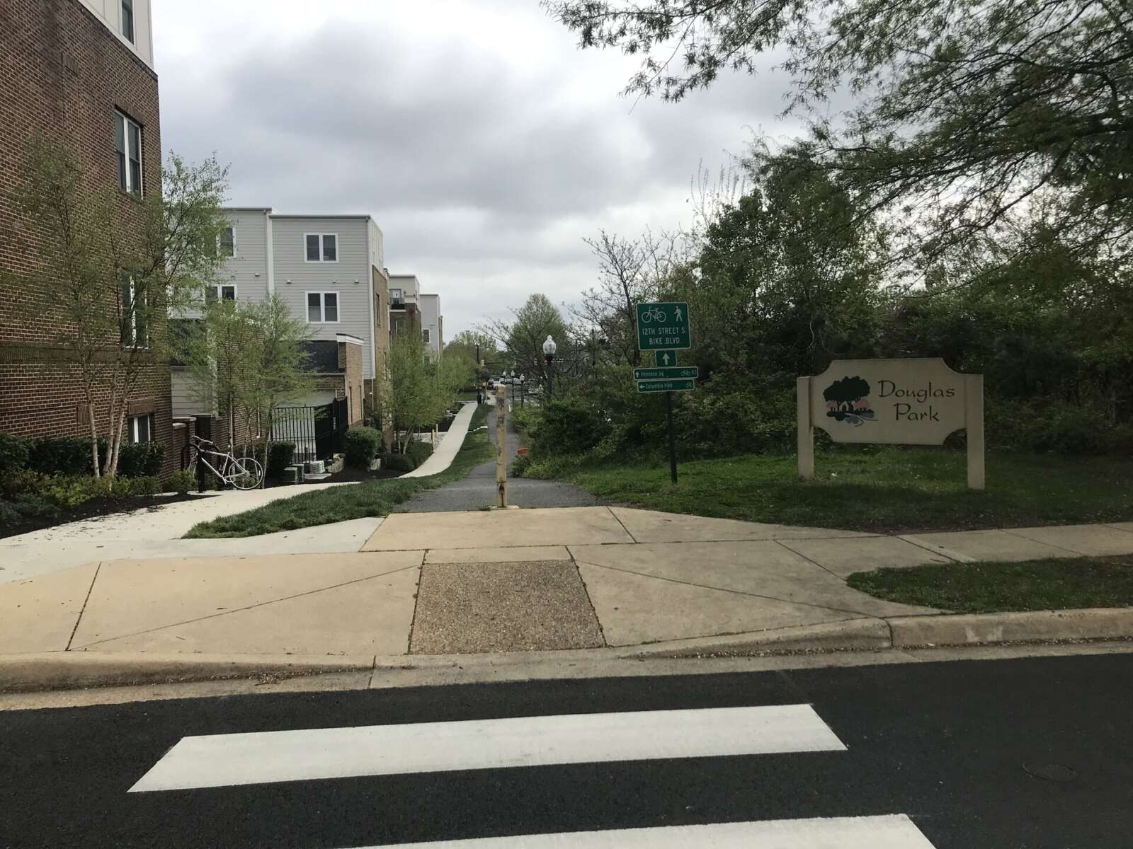
(Updated at 1:45 p.m.) The Arlington County Board has put a project to construct a segment of 12th Street S. on hold indefinitely in its Capital Improvement Plan guidance.

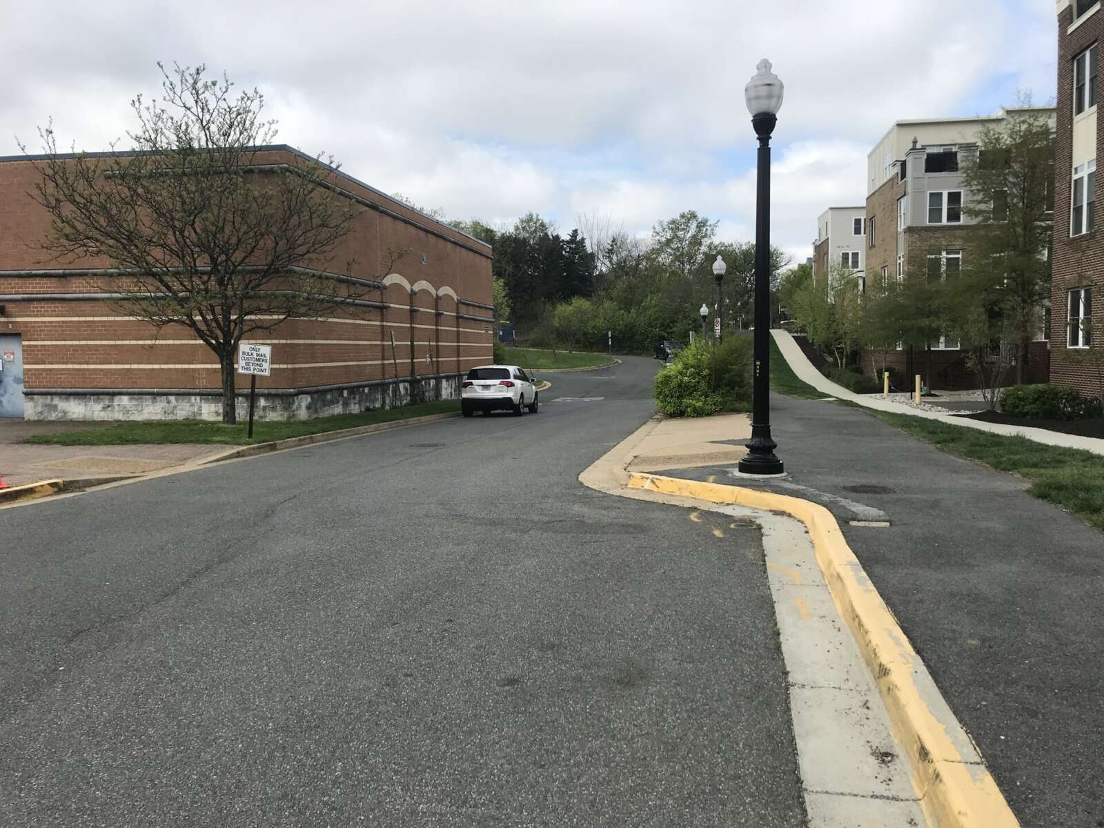
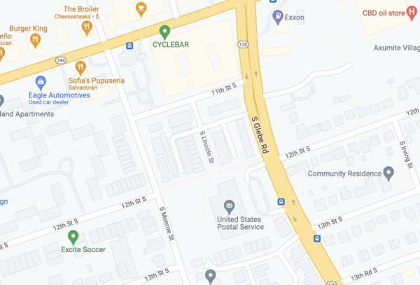
The segment between S. Monroe Street and S. Glebe Road, located near the post office in the Douglas Park neighborhood, is currently a paved sidepath. The path runs in the middle of two sections of 12th Street S., which is designated as one of the Columbia Pike Bike Boulevards, according to the project’s website.

The project to change the path into a two-lane street with curb and gutter was put on hold by the County Board after evaluating the “multiple additional improvements” needed to fulfil Vision Zero, a national initiative to eliminate all serious traffic accidents, and the Columbia Pike Neighborhood Plan, according to the County Board Guidance for CIP.

“This is a particularly challenging project initially identified as an opportunity to improve grid connectivity,” County Board Chair Katie Cristol said in a Board meeting. “I think we have found that it has been very difficult to serve the needs and meet the needs of all users as envisioned in that project.”

Instead, the County Board decided to move the $2.7 million allocated to other “priority projects” within the Columbia Pike Bike Boulevard program, which is intended to provide cyclists with a continuous route parallel to Columbia Pike.

Since the shelving of the project, the county’s Department of Environmental Services is planning to “conduct a corridor analysis” to complete the bicycle route, DES spokesperson Erin Potter said.

The project on 12th Street S. prompted a significant amount of concern from residents, especially on the introduction of cars to what is currently a bike-and-pedestrian-only path. Many commenters wanted “the existing trail and sidewalk configuration to remain as is” with no cars allowed, according to a summary of public feedback done in the beginning of this year.

Moreover, residents who gave feedback were concerned about possible increase in cut-through traffic if a two-lane street were to be constructed, as well as the risk to children since the road segment was near a school bus stop, according to the summary.

This project originally aimed at connecting S. Lincoln Street, now a dead-end street in the middle of the block between Glebe and Monroe, to 12th Street S., as well as to fill the gap in the bike boulevard. Construction was originally supposed to begin in spring next year, according to documents for a public meeting.

Map showing the path between stretches of 12th Street S. (via Google Maps)

More on the decision, from the project web page:

Based on County Board Guidance on the FY 23-32 Capital Improvement Plan (CIP), this project is being indefinitely deferred. Funding allocated to this project will be “redirected to support future priority projects within the Columbia Pike Bike Boulevard Program. Staff will conduct additional feasibility and scoping work that would focus on completing the Bike Boulevards throughout the Columbia Pike corridor and specifically addressing areas where gaps exist.”

The project may be revisited in the future, “triggered by changing conditions including development opportunities, multimodal corridor needs, and other County priorities.”

Map via Google Maps


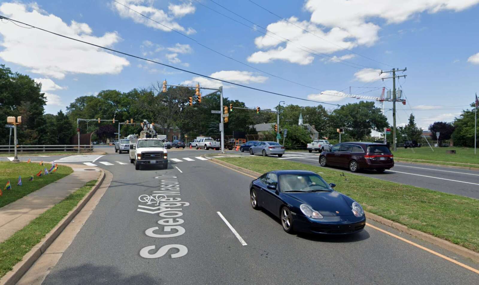
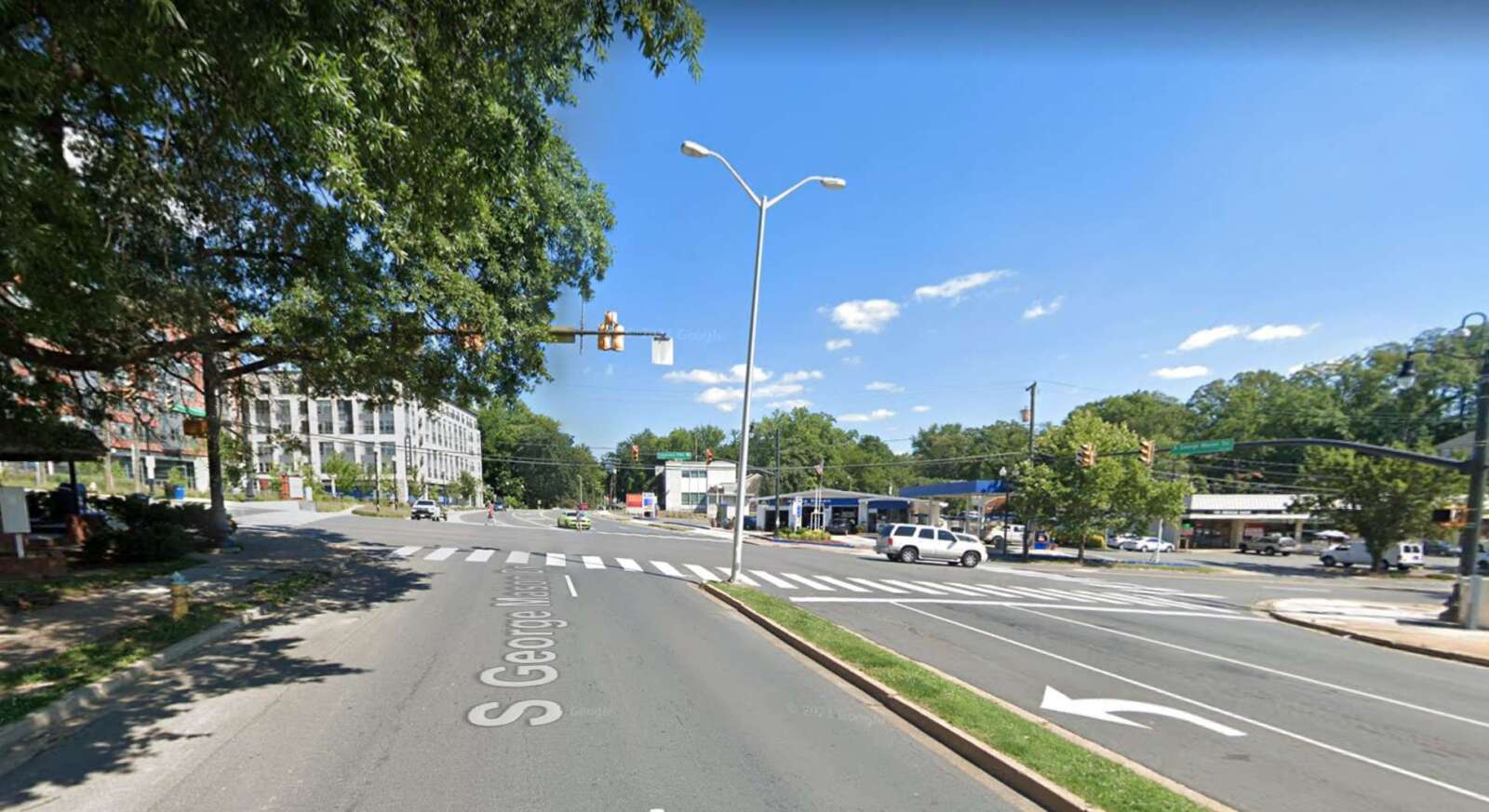
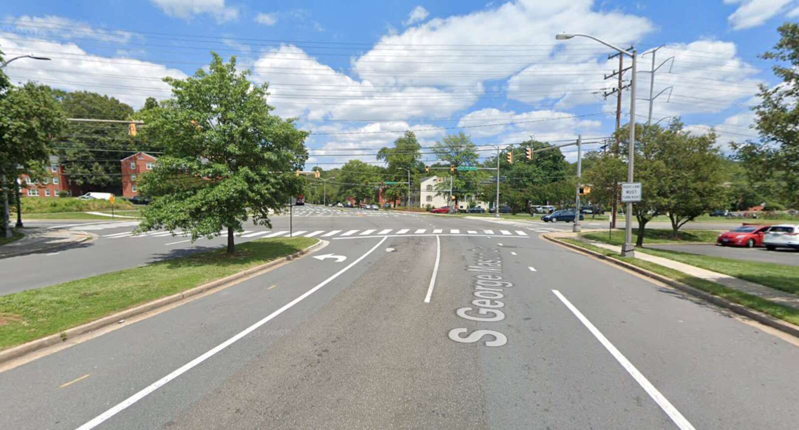
Members of the public can weigh in on proposed improvements to a stretch of S. George Mason Drive that’s being studied.

The road renovation project from Arlington Blvd to the Fairfax County border is part of the South George Mason Drive Multimodal Transportation Study, which aims to “identify improvements” along this “key corridor,” according to the project’s website.

Residents can provide online feedback on proposed design concepts through Sunday, Aug. 7.

The stretch of the roadway being studied is divided into three segments:

  • between Arlington Blvd and Columbia Pike
  • between Columbia Pike and S. Four Mile Run Drive
  • between S. Four Mile Run Drive and the Fairfax County border
A plan showing the first design concept for the three road segments (via Arlington County)

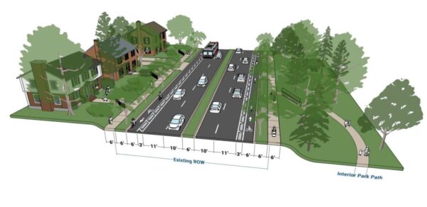
Earlier this month, the county’s Dept. of Environmental Services released its preliminary designs for the three road segments. The first option for all three segments would separate cyclists and cars into different lanes on both sides of the road, and widen the sidewalks and the vegetation buffers on both sides to six feet, according to the concept plans.

However, this design would increase the number of lanes pedestrians have to cross, as well as remove sections of on-street parking and require additional right-of-way behind the curb. Buses would also have to enter the bike lane to pick up passengers, instead of pulling up to the curb, according to an online community meeting.

A plan showing the second design concept for the first road segment between Arlington Blvd and Columbia Pike (via Arlington County)

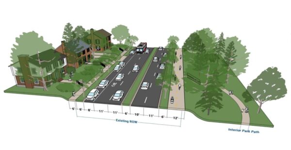
The second option for the segment from Arlington Boulevard to Columbia Pike would widen the west side sidewalk to a 12-foot, multi-use trail and the east sidewalk to six feet. It would also narrow the driving lanes while keeping the parking lane on the east side. The new multi-use trail would connect several county parks, such as Alcova Heights Park and trails like the Arlington Boulevard Trail.

However, this design would remove parking on the west side and require signal phasing changes to reduce conflict with people on the multi-use trail.

A plan showing the second design concept for the second road segment between Columbia Pike and S. Four Mile Run Drive (via Arlington County)

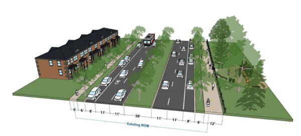
The second design option for the segment from Columbia Pike to S. Four Mile Run Drive would be largely similar except it would keep the two parking lanes on both sides of the road.

A plan showing the second design concept for the third road segment between S. Four Mile Run Drive and the Fairfax County border (via Arlington County)

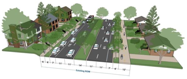
The second design plan for the third road segment would narrow all the driving lanes between S. Four Mile Run and the Fairfax County border to 11 feet and the central median to 14 feet, but it would widen the vegetation buffers on both sides and the sidewalk on the west side to a 12-foot, multi-use trail.

However, this plan may result in tree removal due to narrowing the central median, as well as the removal of some parking spots at intersections and driveways. The county would need to consider more design details, such as how the new road would interact with the driveways of houses along the road segment.

The corridor study is set to conclude between October and November this year. The county then plans to apply for grant funding from the Northern Virginia Transportation Authority.

Photos via Google Maps


View More Stories