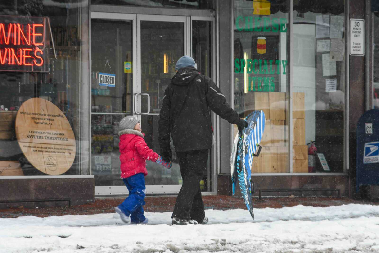
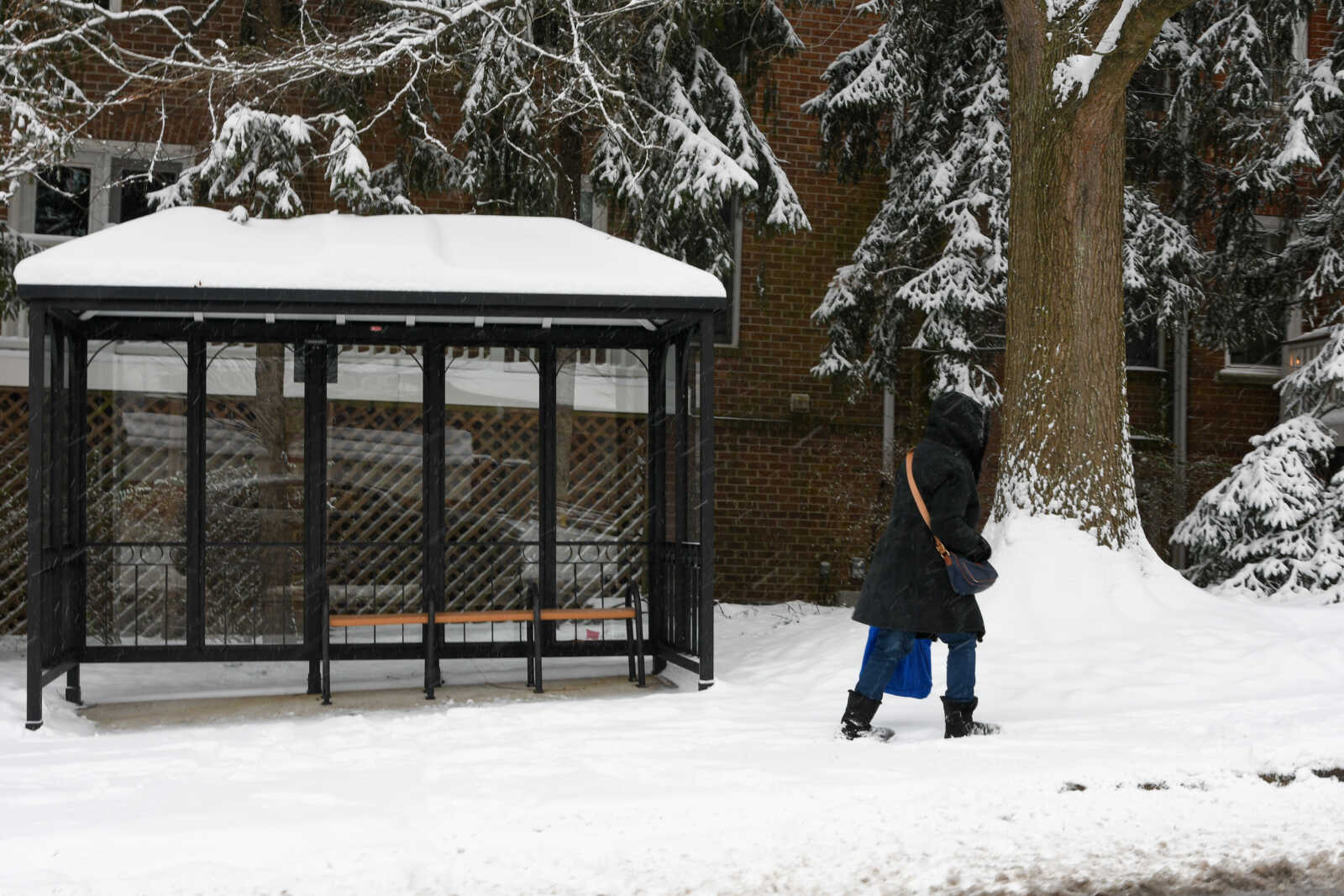
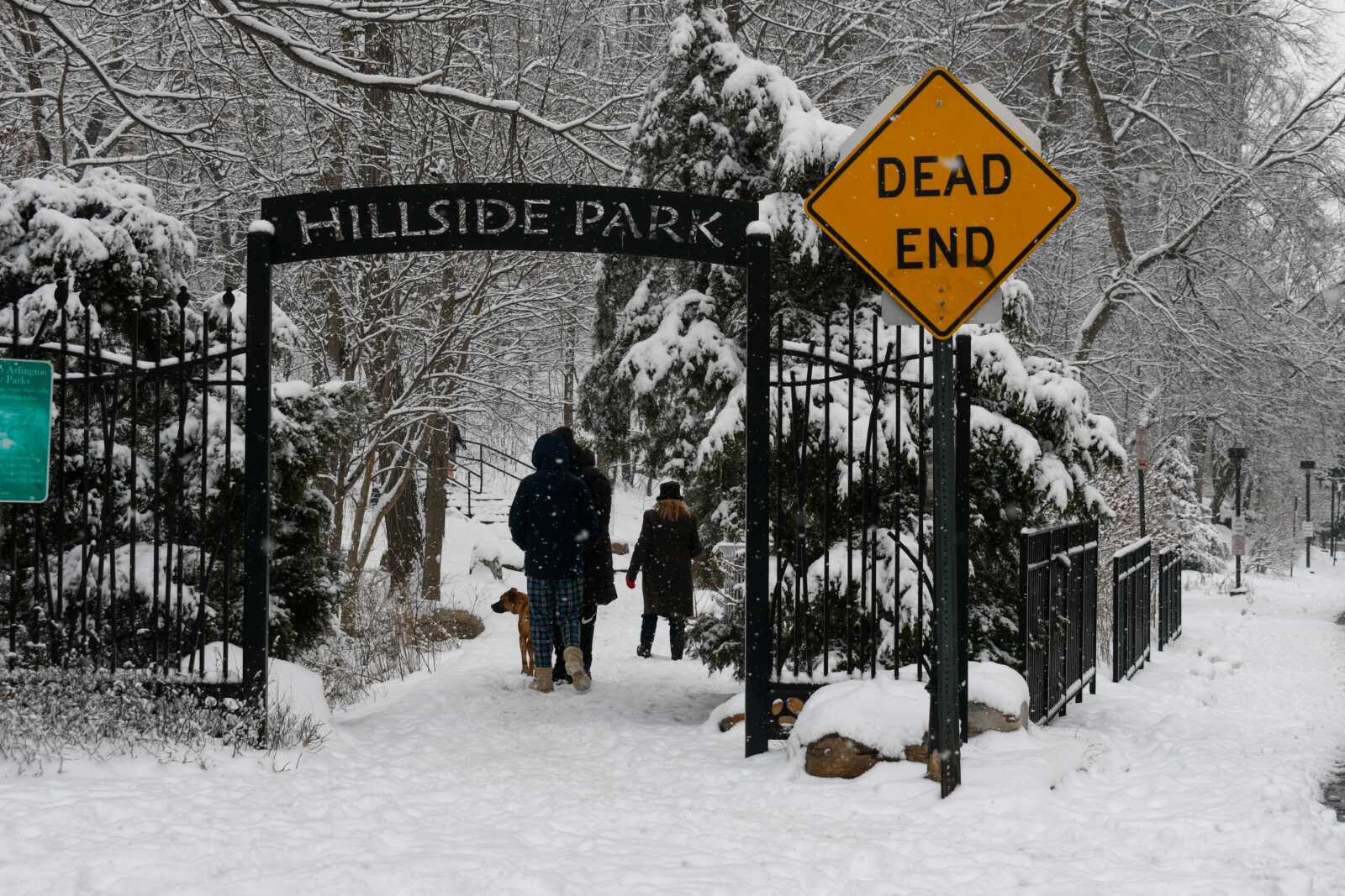
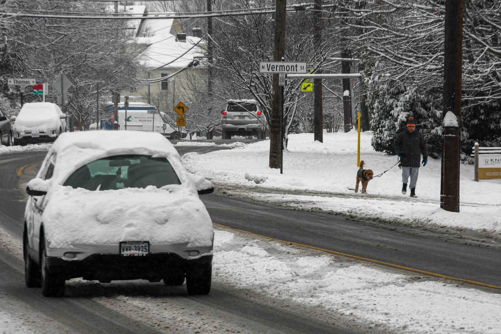
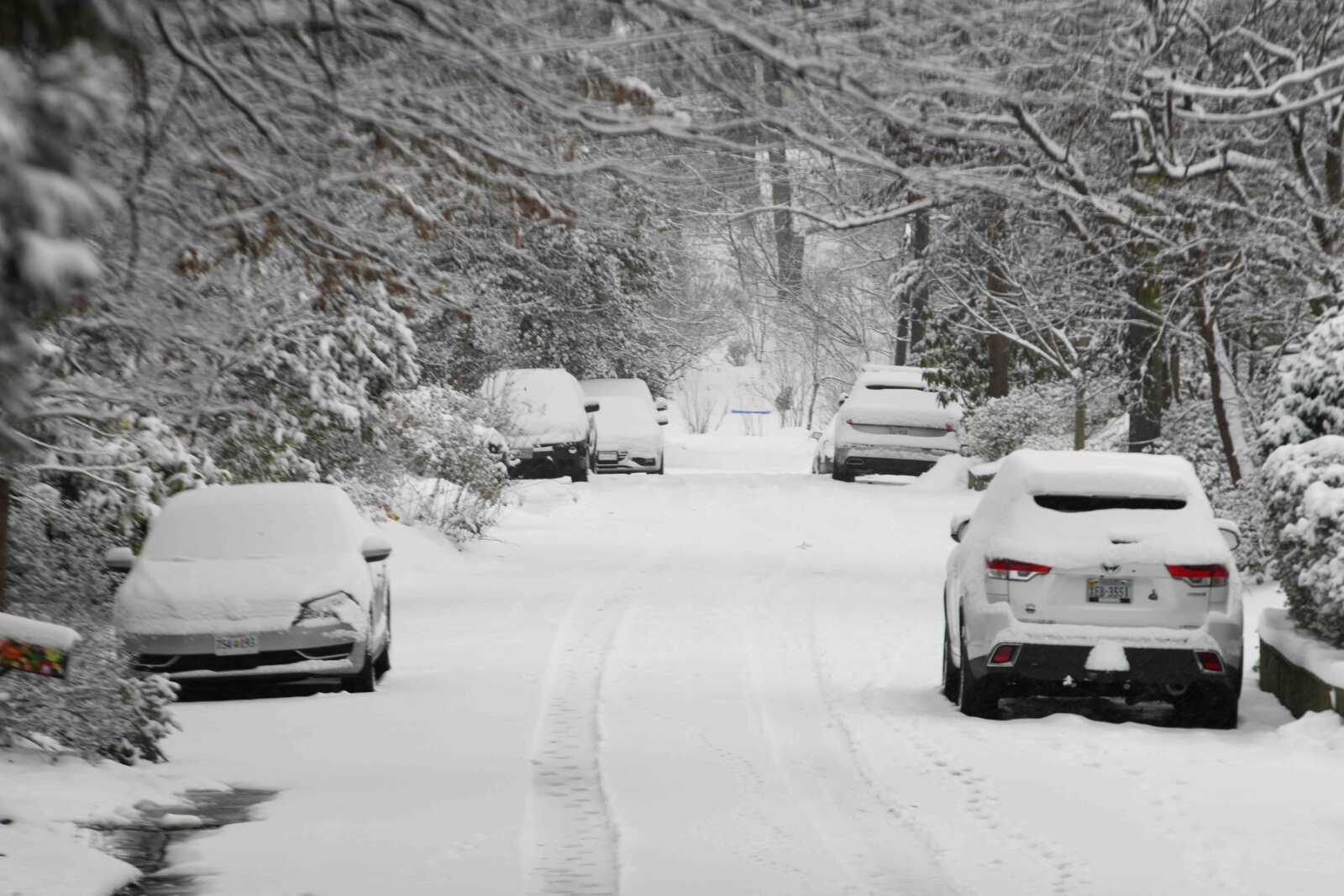
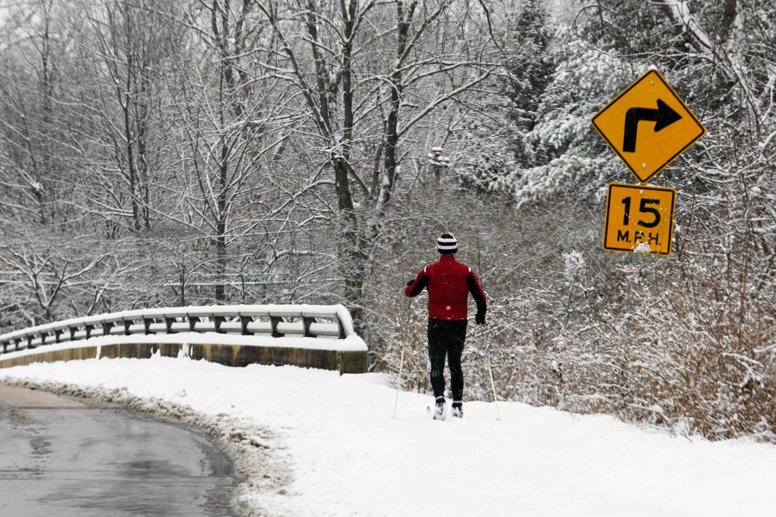
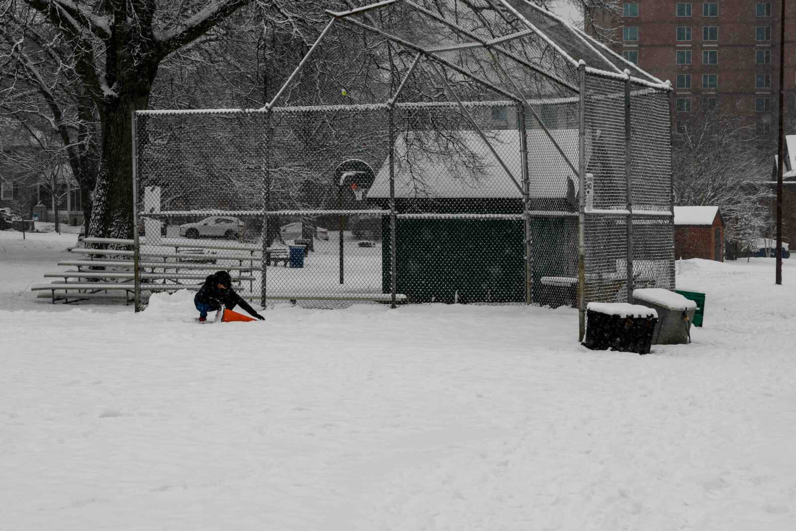
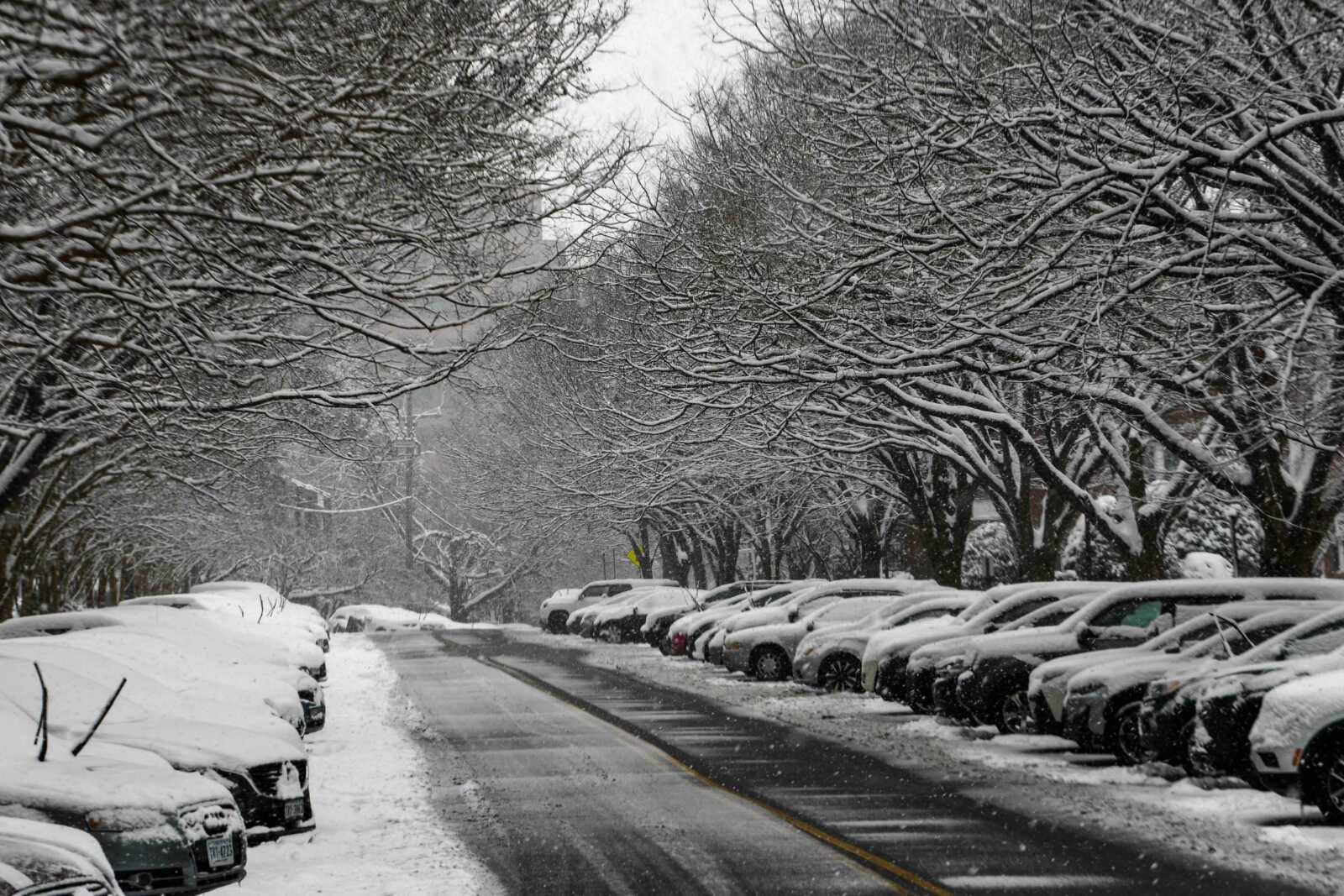
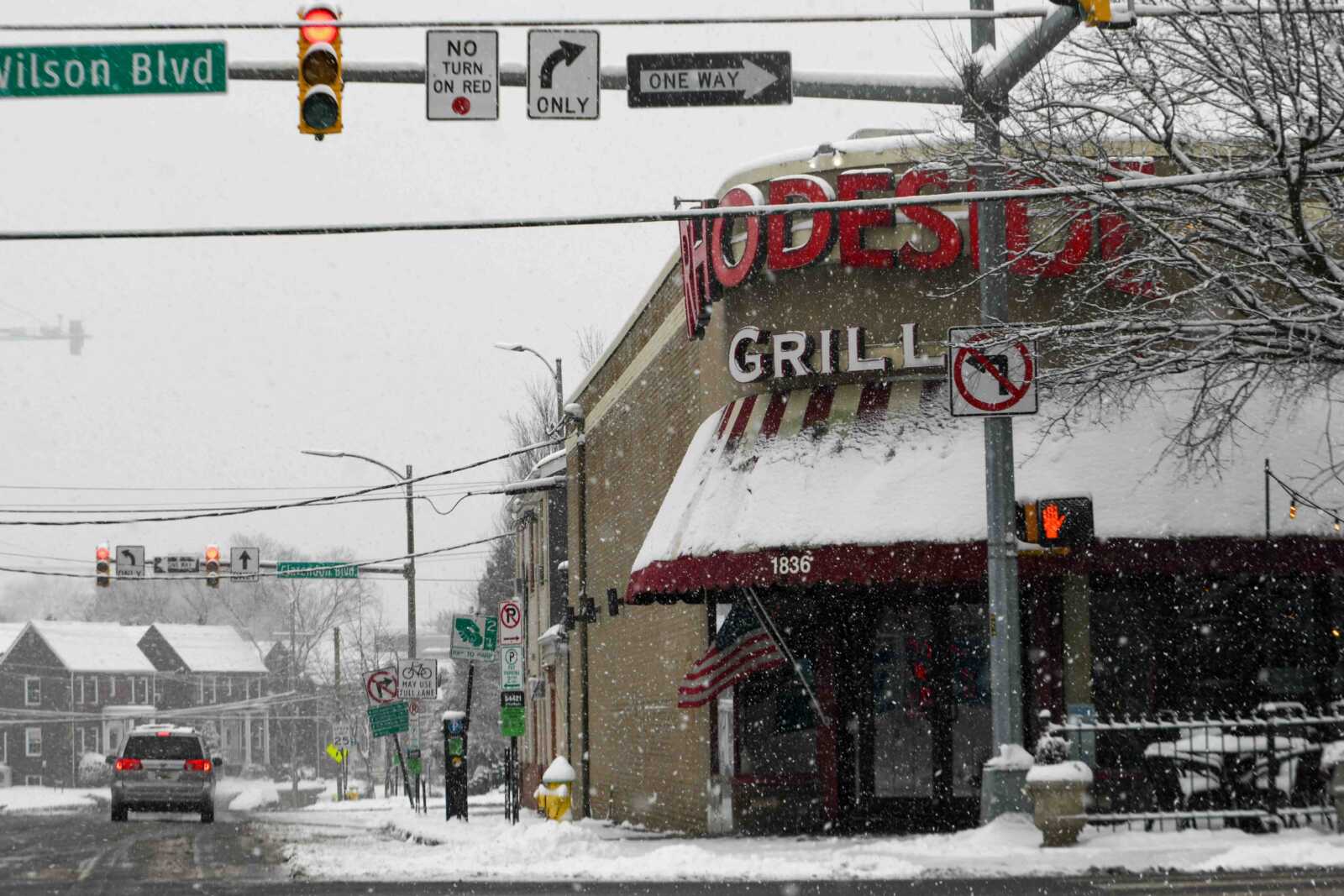
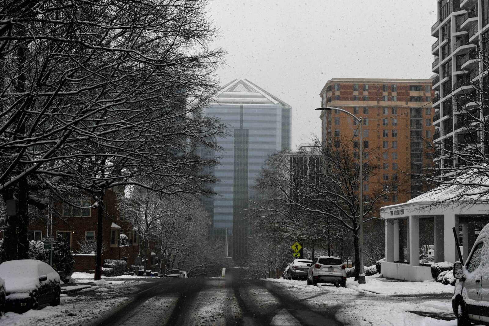
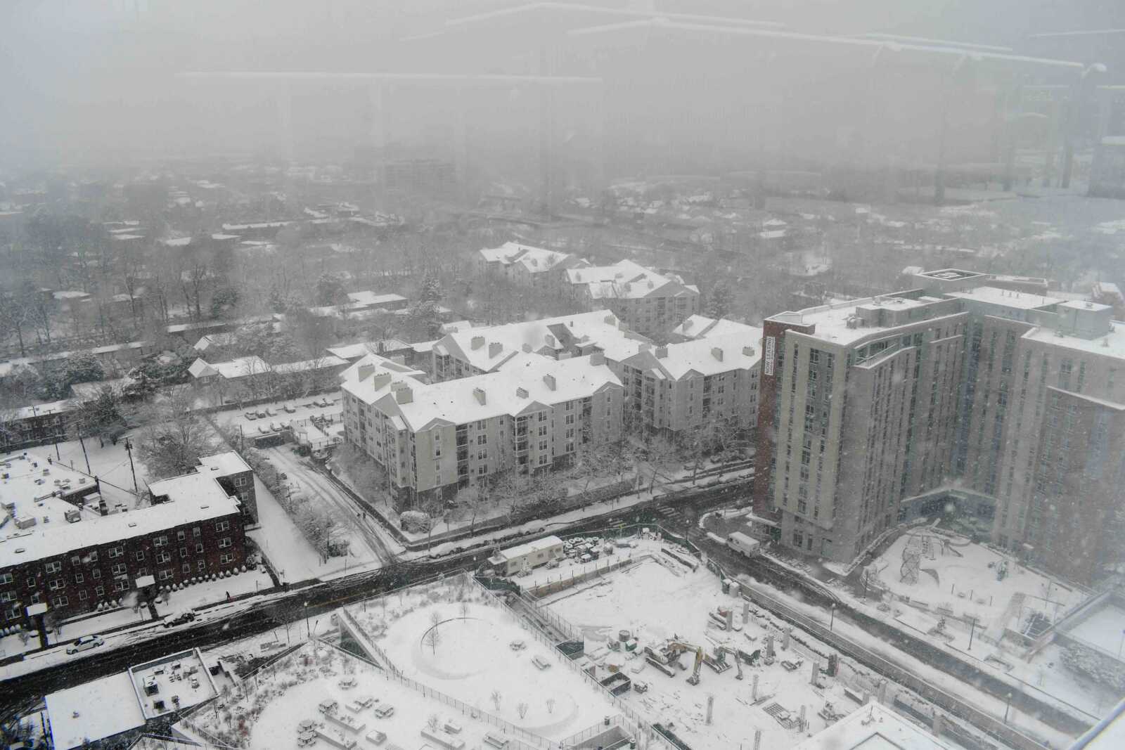
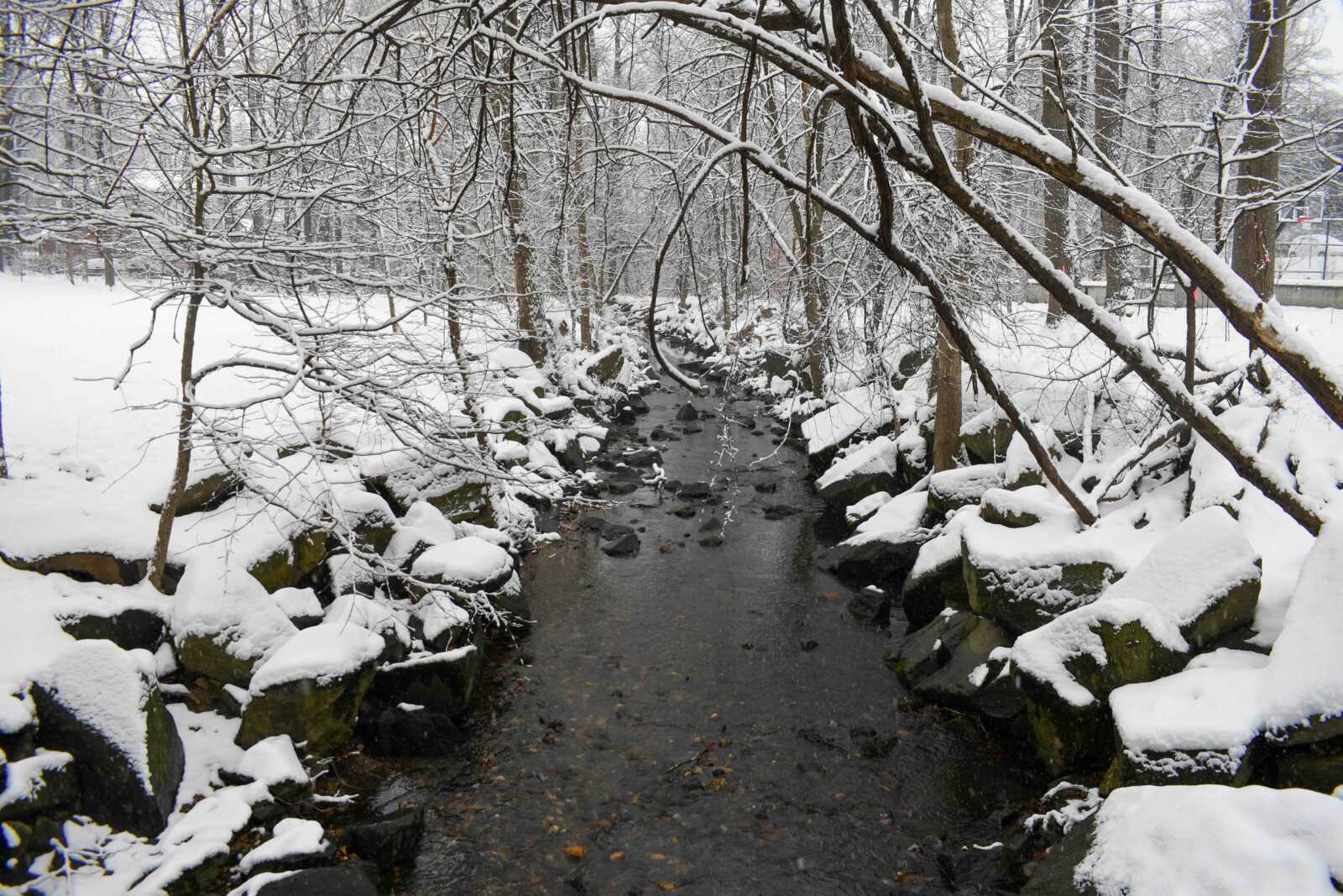
(Updated at 5:20 p.m.) A significant snowfall blanketed Arlington today, transforming the county into a picturesque winter scene.

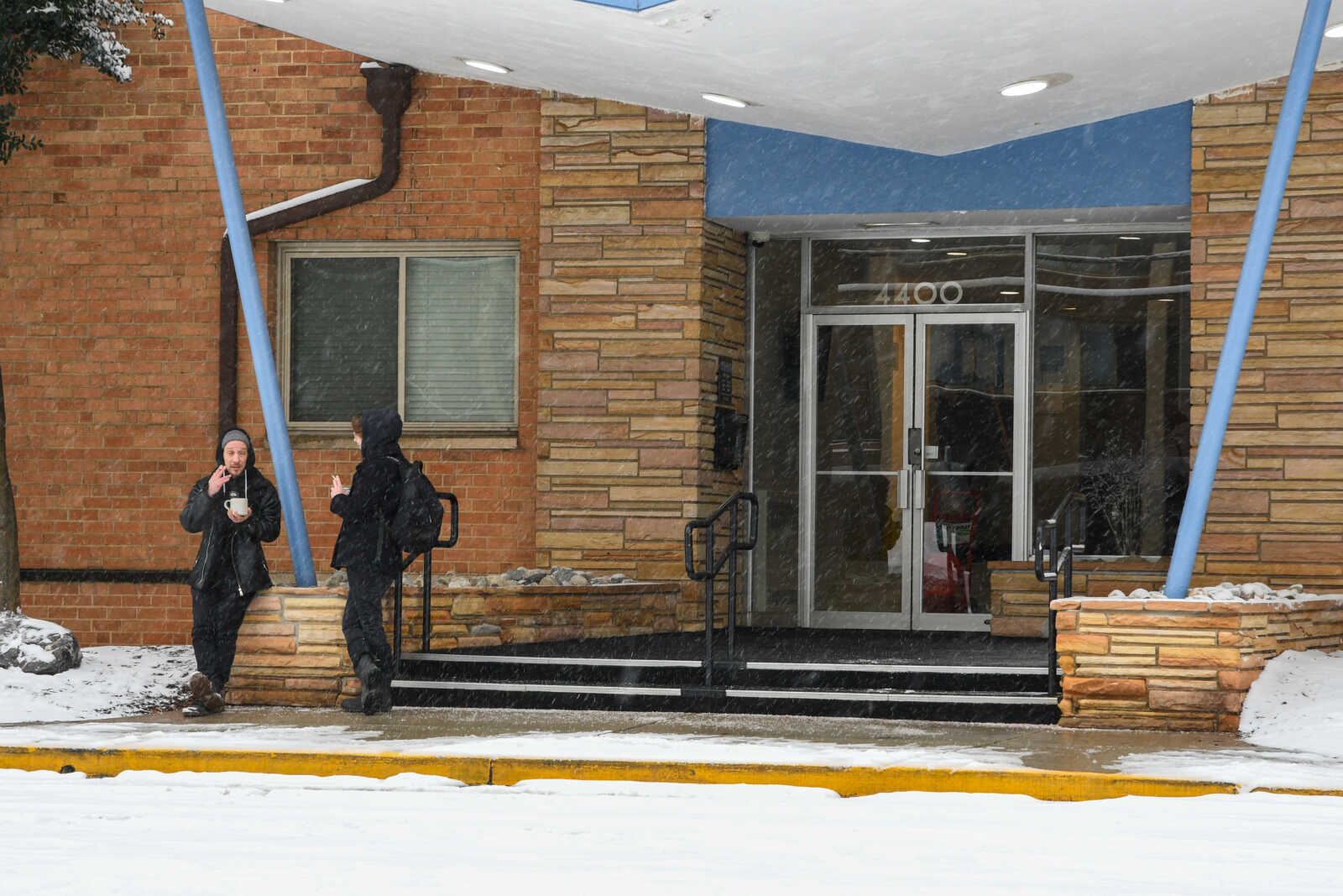
Residents across the area experienced a mix of disruptions and delightful winter activities as the snow, which began in the early morning, continued steadily throughout the day on Friday.

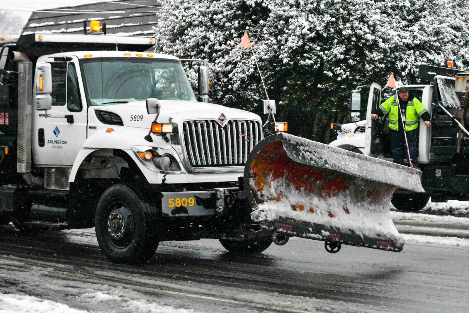
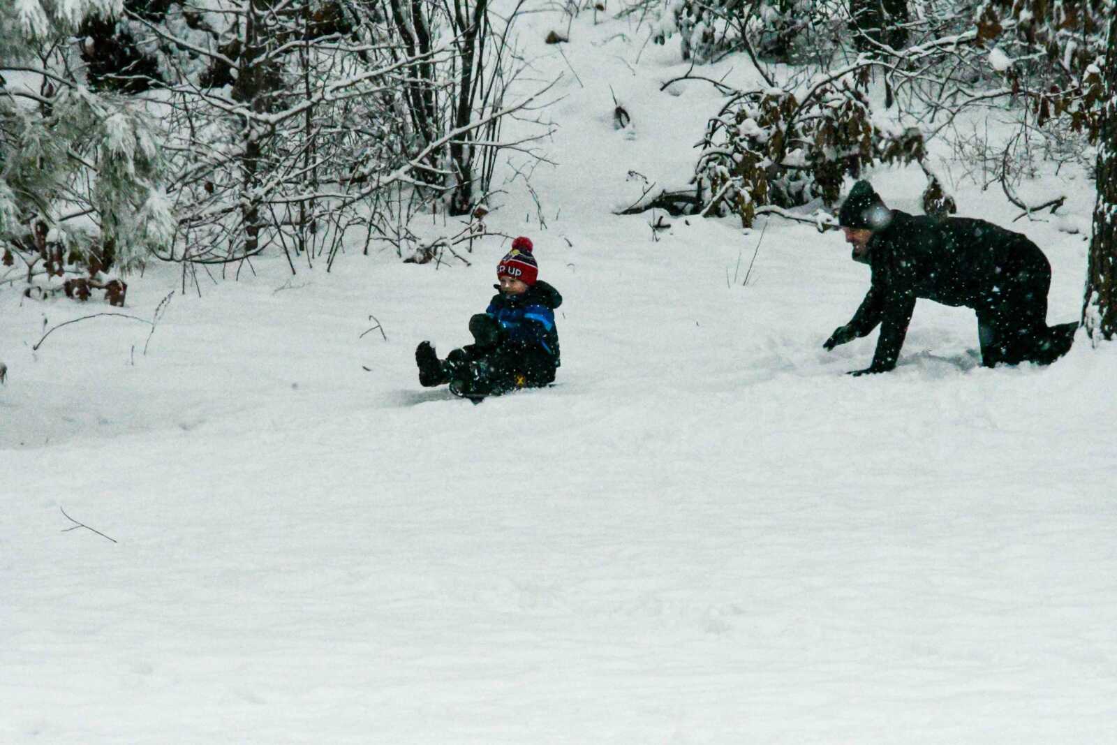
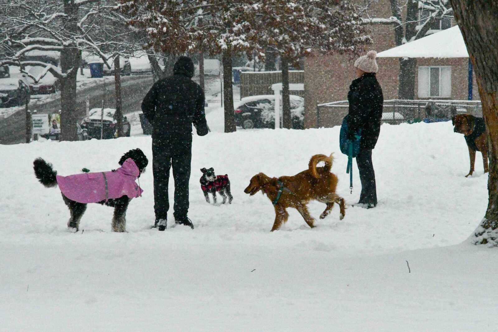
While VDOT and Arlington County crews were busy treating the roads, children and families ventured to parks and hills, reveling in sledding and play following the closure of Arlington Public Schools.

Today’s snowfall is the second significant snowstorm of the week after none for two years.

Earlier today, Arlington County announced it had begun phase two of its snow removal efforts, focusing on treating and plowing arterial roads. A Winter Weather Advisory remains in effect until 7 p.m. tonight (Friday).

This morning, meanwhile, Arlington County announced the cancellation of trash and recycling collection today due to the inclement weather and challenging road conditions. Trash and recycling, but not organics, will be collected tomorrow instead.

“The County’s contractor will have additional trucks and crews tomorrow, Jan. 20, to service customers who are on Wednesday, Thursday and Friday routes,” per the county website.


Snow in Rosslyn on a traffic camera just before 11 p.m. on Jan. 15, 2024

(Updated at 12:40 a.m.) Arlington is now under a Winter Storm Warning, with total snowfall expected to reach 4-6 inches.

The National Weather Service upgraded the previous Winter Weather Advisory around 10:30 p.m. The snow accumulation is making travel difficult, prompting Metro and Arlington Transit to implement severe snow plans for buses.

The snow is also delaying and cancelling flights at National Airport — and reportedly stranding several flights on the tarmac for extended periods of time. The GW Parkway remains closed between Spout Run and the Beltway, due to the snow.

From NWS:

URGENT – WINTER WEATHER MESSAGE
National Weather Service Baltimore MD/Washington DC
1028 PM EST Mon Jan 15 2024

…WINTER STORM WARNING IN EFFECT UNTIL 10 AM EST TUESDAY…

* WHAT…Heavy snow, possibly changing to light freezing rain or freezing drizzle along the Interstate 95 corridor toward morning. Total snow accumulation of 4 to 6 inches and ice accumulations of a light glaze.

* WHERE…Portions of central Maryland, The District of Columbia and northern Virginia.

* WHEN…Until 10 AM EST Tuesday.

* IMPACTS…Plan on slippery road conditions. The hazardous conditions could impact the Tuesday morning commute.

* ADDITIONAL DETAILS…Moderate to heavy snow this evening and overnight may produce snow of one half to one inch per hour and reduce visibility to one half mile or less at times. Snow intensity will taper off toward morning.

PRECAUTIONARY/PREPAREDNESS ACTIONS…

If you must travel, keep an extra flashlight, food, and water in your vehicle in case of an emergency.

When venturing outside, watch your first few steps taken on steps, sidewalks, and driveways, which could be icy and slippery, increasing your risk of a fall and injury.

Arlington Public Schools has canceled classes tomorrow and the county government will, as of now, open on a delay.

Federal government offices are also closing for the day.

Metro, meanwhile, issued the following press release Monday night about its operating status. Metro — along with Arlington Transit — is operating limited bus service due to the snow.

For the rest of the evening on Monday, Jan. 15, and early morning on Tuesday, Jan. 16, Metrobus will be operating under its Severe Snow Plan with approximately 40-plus bus routes operating.

Under a Severe Snow Plan, bus service is limited to major roads, with additional snow detours possible based on road conditions.

Customers are advised to travel only if necessary, as snow and ice may create hazardous conditions, causing delays and increased wait times. If snow is blocking the curb, wait on the sidewalk instead of the street until the bus arrives.

Metro is deploying resources throughout the system and across the region to monitor road conditions and keep parking lots, walkways, and stations clear of snow. Customers should build in additional travel time and use caution on platforms, escalators, parking lots, and other areas that may be slippery.

Metrorail is running regular service, though service may change based on weather conditions and staffing availability.

MetroAccess is running regular service, but customers are encouraged to travel only if necessary. Some trips may experience delays due to road conditions. If door-to-door service is not possible, curb-to-curb service will be provided instead.

The decision to reduce bus service was made to support the safety of our customers and employees. The plan was developed in conjunction and coordination with our jurisdictions and regional partners.

Metro will re-evaluate weather conditions throughout the day Tuesday and we aim to return to normal bus service as soon as conditions allow.

Customers are encouraged to sign up for MetroAlerts text and email messages to receive the latest service updates. You can also visit the Status and Alerts page and check Metro’s social media channels @wmata@MetrorailInfo and @Metrobusinfo.


Heavy rain in Clarendon on Jan. 9, 2024

(Updated at 5 p.m.) Arlington County is now under a Flood Warning as heavy, wind-driven rain continues across the region.

The National Weather Service issued the warning, below, around 3:30 p.m. It’s in addition to the earlier High Wind Warning, which is in effect until 1 a.m.

Local streams have been rising throughout the day and ponding can be seen on local roads. Among the first reports of significant flooding, Columbia Pike was being closed near the Pentagon as of 4 p.m. due to reported high water.

Forecasters say conditions will continues to get worse.

…FLOOD WARNING IN EFFECT UNTIL 1130 PM EST THIS EVENING…

* WHAT…Flooding caused by excessive rainfall is expected.

* WHERE…Portions of DC, including the following , District of Columbia, central Maryland, including the following county, Montgomery, and northern Virginia, including the following counties, Arlington, City of Alexandria, City of Fairfax, City of Falls Church, City of Manassas, City of Manassas Park, Fairfax, Loudoun and Prince William.

* WHEN…Until 1130 PM EST Tuesday.

* IMPACTS…Flooding of rivers, creeks, streams, and other low-lying and flood-prone locations is imminent or occurring.

* ADDITIONAL DETAILS…
– At 327 PM EST, Doppler radar indicated a broad area of moderate to heavy rainfall. Flooding is ongoing or expected to begin shortly in the warned area. Between 1 and 1.5 inches of rain have fallen. Given moist soil conditions due to recent rains, rivers are responding quickly and rising towards flood stage.
– Additional rainfall amounts of 1 to 2 inches are possible in the warned area.

Officials have been cautioning residents to avoid driving into flooded streets and to stay home, if possible, until the storm passes.

Earlier, Arlington Public Schools cancelled after-school and evening activities.

Only minor power outages have been reported in Arlington so far this afternoon, though several thousand homes and businesses are currently without power in neighboring Fairfax County.

At Reagan National Airport, meanwhile, flight delays are building as the storm makes its way up the East Coast.


Wind-blown raindrops on a window (staff photo)

Update at 3:55 p.m. — A Flood Warning has been issued for Arlington.

Update at 12:30 p.m. — The earlier Wind Advisory has been upgraded to a High Wind Warning.

…HIGH WIND WARNING IN EFFECT UNTIL 1 AM EST WEDNESDAY…

* WHAT…Southeast winds 25 to 40 mph with gusts up to 60 mph expected.

* WHERE…In District of Columbia, District of Columbia. In Maryland, Prince Georges, Charles, Central and Southeast Montgomery and Central and Southeast Howard Counties. In Virginia, Fairfax, Stafford, King George and Central and Southeast Prince William/Manassas/Manassas Park Counties, and Arlington/Falls Church/Alexandria.

* WHEN…Until 1 AM EST Wednesday.

* IMPACTS…Damaging winds will blow down trees and power lines. Widespread power outages are expected. Travel will be difficult, especially for high profile vehicles.

Update at 12:25 p.m. — The National Weather Service has issued the following forecast update, predicting deteriorating conditions and a period of “intense” rainfall between 6-10 p.m.

…HAZARDOUS WEATHER CONDITIONS FOR BALTIMORE/WASHINGTON
REGION TODAY BETWEEN 500 PM AND 1000 PM EST…

Weather conditions will deteriorate as a strong frontal system approaches this afternoon, then passes through the greater Baltimore/Washington region this evening. This will result high winds capable of downing trees and powerlines, tidal flooding, and the potential for flooding of small streams and creeks. This will create hazardous travel conditions late this afternoon through late evening across the region.

Light-to-moderate rain will continue early this afternoon, then increase in intensity late this afternoon, with a several hour period of heavy, intense rainfall expected between 6 PM and 10 PM. This heavy rainfall, coupled with already saturated soils from recent rainfall, will cause flooding of small streams and creeks. Do not attempt to drive across flooded roadways; additionally, flooding at night increases the risk for motorists not being able to quickly identify the water hazards due to decreased visibilities by the heavy rain and darkness.

Easterly winds will increase in intensity as well this afternoon across the region, with gusts to 50 MPH expected late this afternoon through mid-evening. Locations closer to the Chesapeake Bay will see higher wind gusts of 60-70 MPH. Strong winds will increase the risk of falling trees and downed powerlines. Again, the risk of poor outcomes resulting from high winds is increased during nighttime. Winds will decrease after midnight tonight.

Finally, areas along the tidal Potomac River and western shore of the Chesapeake Bay north of Smith Point VA should prepare for moderate-to-major tidal flooding. The cities of Baltimore, Annapolis MD, and Alexandria VA are most prone to tidal flooding, and the coupling of heavy rainfall and strong onshore winds of 50-60 MPH in these locations will work together to create moderate-to-major tidal impacts.

Earlier: Arlington County will be under a Wind Advisory and a Flood Watch from early this afternoon until Wednesday morning.

A storm packing heavy rain and gusty winds will sweep through the area, forecasters say, potentially causing widespread power outages.

Some local school districts like Montgomery County are dismissing students early, but Arlington and neighboring Alexandria and Fairfax County have so far not announced any early dismissals.

As of noon Arlington Public Schools said that after-school and evening activities have been canceled.

All APS after-school and evening activities are canceled for today, Tue, Jan. 9, 2024, including extracurricular activities, games, team practices, field trips, adult education classes, and programs in schools and on school grounds. The School Board Work Session scheduled for this evening is also canceled. Extended Day will remain open until 6 p.m. For updates about Pool Operations, go to www.apsva.us/aquatics.  For information about Arlington County programs and operations, go to www.arlingtonva.us.

VDOT, meanwhile, is warning of a potentially hazardous evening on local roads. From a press release:

…heavy rain is forecast across the commonwealth from Tuesday afternoon through Tuesday night, with precipitation pushing off to the east after midnight into early Wednesday morning. Areas of flooding will be possible due to the saturated soils already in place. Wind gusts of up to 65 mph may also occur.

VDOT crews will be monitoring roadways and treating conditions as they develop.

This severe weather system may cause downed trees and power lines and other debris, as well as flooding that will make roadways extremely hazardous or impassable. Stay away from downed wires and do not approach or touch trees or limbs that are entangled with wires as they could be extremely dangerous. If those are in state maintained roadways, VDOT crews must await the power company to remove any electrical hazard before addressing downed trees or other roadway debris.

(more…)


Storms bring heavy rain, wind and flooding at night (file photo)

Tonight’s storm is starting to cause flooding.

The earlier Flood Watch has been upgraded to a Flood Warning as the rain continues to fall.

More from the National Weather Service:

…FLOOD WARNING IN EFFECT UNTIL 4 AM EST MONDAY…

* WHAT…Flooding caused by excessive rainfall is expected.

* WHERE…Portions of DC, including the following , District of Columbia, central Maryland, including the following county, Montgomery, and northern Virginia, including the following counties, Arlington, City of Alexandria, City of Fairfax, City of Falls Church and Fairfax.

* WHEN…Until 400 AM EST Monday.

* IMPACTS…Flooding of rivers, creeks, streams, and other low-lying and flood-prone locations is imminent or occurring.

* ADDITIONAL DETAILS…
– At 949 PM EST, Gauge reports indicated that water is rising to near flood threshold. Flooding is ongoing or expected to begin shortly in the warned area. Between 1 and 1.5 inches of rain have fallen.
– Additional rainfall amounts of 1 to 2 inches are possible in the warned area.
– Some locations that will experience flooding include…

Arlington… Alexandria… Bethesda… Reston… Annandale… Fairfax… Vienna… Falls Church… Mantua… Pimmit Hills… Mclean… American Legion Bridge… Rosslyn… Potomac… North Bethesda… Oakton… Lincolnia… Tysons Corner… Takoma Park… Wolf Trap…
– Please visit www.weather.gov/safety/flood for flood safety and preparedness information


Rain drops in a puddle in Westover (staff photo by Jay Westcott)

It’s going to be a very soggy Sunday.

A Flood Watch has been issued for Arlington and much of the Washington region ahead of an expected coastal storm. The watch is in effect from Sunday evening to 6 a.m. Monday.

More, below, from the National Weather Service.

…FLOOD WATCH IN EFFECT FROM SUNDAY EVENING THROUGH LATE SUNDAY NIGHT…

* WHAT…Flooding caused by excessive rainfall is possible. […]

* WHEN…From Sunday evening through early Monday morning

* IMPACTS…Excessive runoff may result in flooding of rivers, creeks, streams, and other low-lying and flood-prone locations. Flooding may occur in poor drainage and urban areas. Storm drains and ditches may become clogged with debris.

* ADDITIONAL DETAILS…
– One to three inches of rain are mostly likely Sunday evening through early Monday morning. This amount of rain could cause flooding of small streams, creeks and urban areas. Localized amounts up to four inches are possible along and east of I-95.
– Please visit www.weather.gov/safety/flood for flood safety and preparedness information


Examples of impervious area that causes stormwater runoff (via Arlington County)

This weekend, the Arlington County Board is set to consider a new tax based on how much hard surface your property has.

Property owners with more hard surfaces that do not let rain soak into the ground — such as roofs and driveways — can expect to pay larger fees than those with fewer such surfaces. Revenue would support the county’s stormwater management fund, which pays for flooding mitigation projects.

The proposed rate would cost residents $258 per 2,400 square feet of impervious area, though this figure could change annually to support the budget, similar to how the county approves other fees and taxes. Property owners can receive credits for steps they take to reduce stormwater runoff.

Like the current sanitary district tax, the stormwater fee will be billed twice a year on the real estate bill, a county report says. The first bill will be sent to property owners in May, due June 15, 2024, and the second bill will come in September, due Oct. 5, 2024.

Homeowners can get a sense of their bill by plugging their address into an online map, which estimates impervious area using satellite imagery. This can range from $154 for a home under 1,600 square feet to some $19,000 for one local Catholic church.

The rate structure for the stormwater utility (via Arlington County)

If approved, the stormwater utility tax would replace the current sanitary district tax ($0.017 per $100 of assessed value on all taxable property) starting in the new year. The county says this is a fairer approach than using property assessments because there is not much of a correlation between property assessments and impervious areas.

“The rationale for using the amount of impervious area on each property, rather than all taxable real estate, is that it directly correlates with stormwater runoff that contributes to the County’s stormwater system,” a county report says. “Under the stormwater utility model, properties with more impervious area, which are therefore contributing more to the stormwater system, pay a higher fee.”

Following state requirements, Arlington will offer credits to customers who reduce the runoff their properties contribute to the stormwater system. In an informal Q&A last week, county staff said the number of credit applications coming in has kept them busy.

Arlington’s credit program rewards voluntary actions such as adding rain gardens. Now through Jan. 15, all property owners can apply for voluntary credits to offset up to 35% of their bill, or about $80 per 2,400 square feet. Details on credit options are spelled out in this county manual.

Properties where owners have added stormwater facilities mandated by statute, around 1,900, will automatically receive credits. These properties add up to about 1% of projected revenue and the county budgeted a total of 2% of revenue for credits.

Staff said the county will evaluate the amount of credits it dolls out each year, against the amount of revenue it needs to generate, to determine rates, and will study its rates every five years.

Senior and disabled residential property owners as well as disabled veterans and their surviving spouses are eligible for total fee relief, as they currently qualify for real estate tax exemptions and deferrals.

The idea of funding the county stormwater program with a tax on impervious surfaces has been in the works for three years. In May 2020, a consulting firm recommended Arlington transition to a utility funding model after researching how such a fee would affect different types of customers and examining different rate structures.

One year later, the Arlington County Board directed staff to do more analysis, engage the community and provide options for a utility fee by the 2024 proposed budget. In April, the Board adopted a resolution signaling its intent to adopt the stormwater utility ordinances.


A window washer works as storm clouds loom over Ballston (staff photo by Jay Westcott)

Yesterday’s Severe Thunderstorm Watch resulted in nary a raindrop for Arlington — but Friday evening might be different.

Another Severe Thunderstorm Watch has been issued for the county, for D.C., and for much of the region. It’s in effect until 11 p.m. tonight.

“[The] main hazards for these storms will be heavy rain, damaging winds and large hail,” the National Weather Service says. “Additionally, isolated instances of flooding rainfall are
possible, mainly in urban areas.”

The scattered storms are expected to arrive locally at or after dinnertime and, like yesterday, could miss Arlington entirely.

More from social media:


Severe Thunderstorm Watch graphic (via National Weather Service)

Arlington — along with D.C., Alexandria, Fairfax County and other neighboring jurisdictions — is under a Severe Thunderstorm Watch.

Amid temperatures in the mid-90s and several Severe Thunderstorm Warnings to the west, the National Weather Service issued the watch around 1:15 p.m. It is in effect until 9 p.m. and includes much of eastern Pennsylvania and portions of New York State.

Forecasters say that scattered strong storms are likely later today in the immediate D.C. area.

“Scattered to numerous severe storms are possible this afternoon and evening,” the National Weather Service said. “Damaging wind gusts are the primary threat. Isolated instances of considerable wind damage from severe thunderstorms are possible. Isolated instances of large hail are possible as well.”

After the line of storms passes things should quiet down for the rest of the night, but another round of severe weather is expected Friday, forecasters say.


Last week, residents may have received a postcard outlining a new tax they can expect next year: a stormwater utility fee.

Like electric, gas, or water utility bills, this fee effective Jan. 1, 2024, would charge properties a fee based on use of and impact on Arlington County’s stormwater system. The new fee will replace an existing sanitary district tax calculated based on property assessments.

Residents of properties with more hard surfaces that do not let rain soak into the ground — such as roofs and driveways — can expect to pay larger fees than those with fewer such surfaces. Property owners can receive credits for steps they take to reduce stormwater runoff.

Revenue from the fee will fund stormwater capital projects — to the tune of $331 million over the next decade. To mitigate flooding, Arlington is also buying properties in flood-prone areas, adding stormwater detention vaults and making small drainage improvements, among other projects.

“The County is making this change now because the rise in severe flooding in recent years requires us to increase investments in our stormwater system, and a utility is a fairer way to distribute the cost,” per the county website. “These investments will help maintain, upgrade, and scale our stormwater infrastructure to better protect Arlington from future severe rainstorms.”

The Arlington County Board approved the fee with the 2024 budget earlier this year. It comes on the heels of a 2020 study by a consultant that recommended the switch and further study by staff.

The new model is fairer, says Arlington County, because it found property assessments were “weakly correlated” to impervious surface and these impermeable areas are “a better estimate of usage of the stormwater assessment.”

Before, the sanitary tax amounted to $0.017 per $100 of assessed value, or $136 a year for a home assessed at $800,000. Now, single-family homes could see a similar starting point for the stormwater utility fee, of $138 for homes under 1,600 square feet, with fees increasing as square footage increases.

Apartment and condo dwellers could see a flat rate of around $45.

This fee is based on a unit of measure Arlington County devised, called an “Equivalent Residential Unit.” The county calculated this by finding the average impervious coverage for single-family detached properties, which is 2,400 square feet.

Currently, one ERU is roughly $230-250, according to the county, though the final rate for 2024 will be set this fall and annually thereafter. Property owners would be charged based on how many ERUs compose their property. They can estimate that fee using a tool the county created.

The rate structure for the stormwater utility (via Arlington County)

People looking for some relief can apply for a credit program that rewards voluntary actions such as adding rain gardens. From Nov. 1 through Jan. 15, all property owners can apply for voluntary credits to offset up to 35% of their bill, or about $80 per ERU.

“The credit program is not a bill assistance program, but rather a thank you to customers for doing the right thing for the environment,” the county website says.

(more…)


After big storms, many of the same questions are asked: namely, why don’t we just bury power lines?

Surely the expense of constantly fixing power lines downed by falling trees, branches and the occasional crash — both in terms of the repairs themselves, lost productivity, etc. — cannot be far off from the cost of just moving them underground?

As our exploration of the topic last week found, however, it’s not quite that simple. It would cost tens of billions of dollars to bury lines across the state, and previous looks at the question specifically in Arlington also concluded that it’s infeasible from both a cost and a permissions perspective — getting everyone to agree to let the power company dig up their yards.

Instead, Dominion and local governments have been conducting more targeted undergroundings, along high-density corridors like Columbia Pike and in places where storm damage is more frequent. That has cut the power restoration time after big storms, a Dominion spokeswoman told us, but outages will remain a fact of life as long as there are storms and trees.

Of course, there are likely those that would argue that with climate change whipping up fiercer storms, burying more lines should be more seriously considered.

Where do you stand?


View More Stories