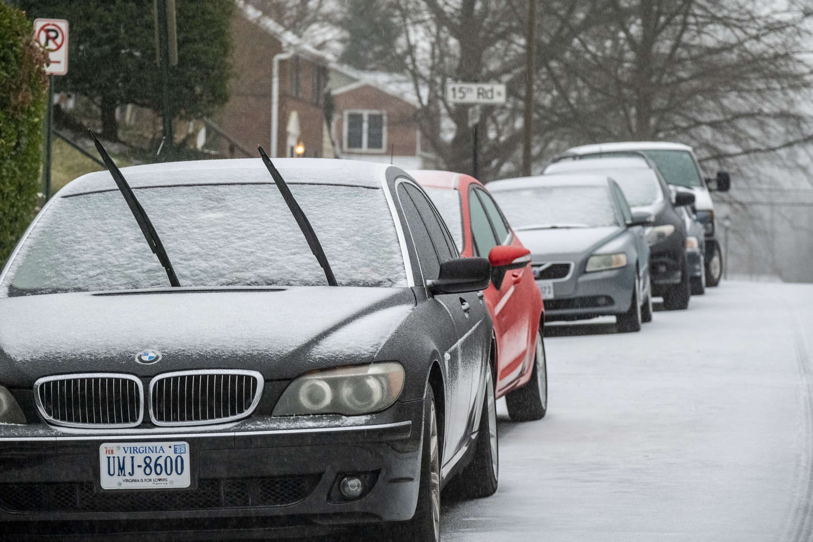
(Updated at 9 a.m.) What was supposed to be snow is actually falling as sleet this morning, but the change in precipitation is not dampening the jubilation of local students, who now have the day off.

Arlington Public Schools announced shortly after 5 a.m. that it’s a snow day, even for remote learning.

“In-person and distance learning are canceled for all students today, Thursday, Feb. 18, due to inclement weather,” the school system said. “APS school buildings and offices will be closed… All in-person learning support programs, athletic activities, team practices, in-person technology support and other activities in schools and on school grounds are canceled.”

Via social media, APS explained that it was following the lead of the federal government, which is also closed today, and taking into account the forecast for more sleet and freezing rain as the day goes on.

According to the officials National Weather Service measurement at Reagan National Airport, 0.3 inches of snow has fallen so far this morning.

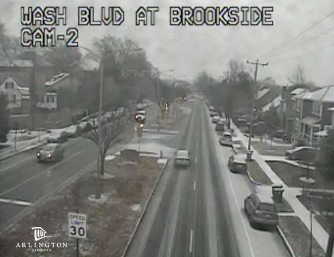
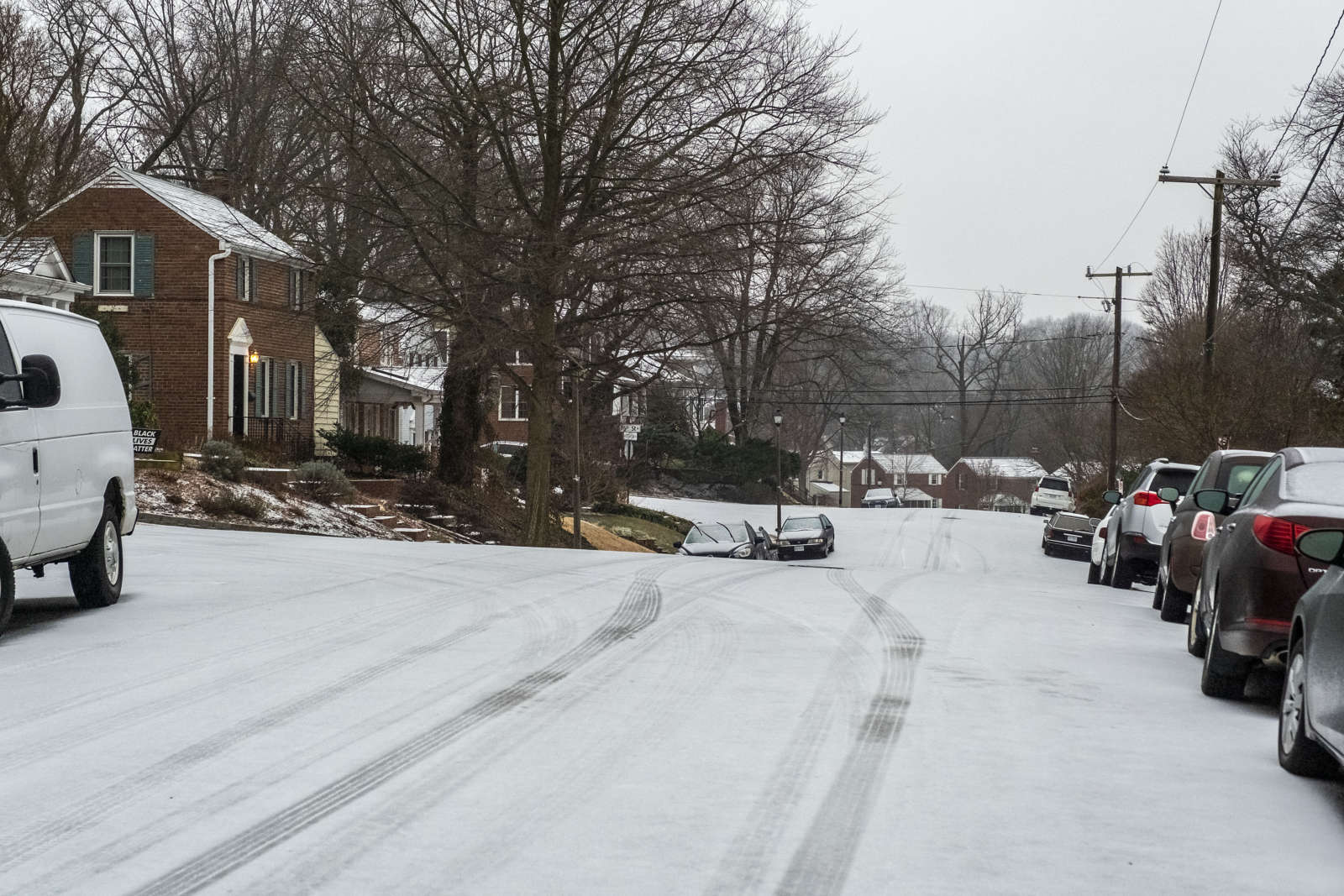
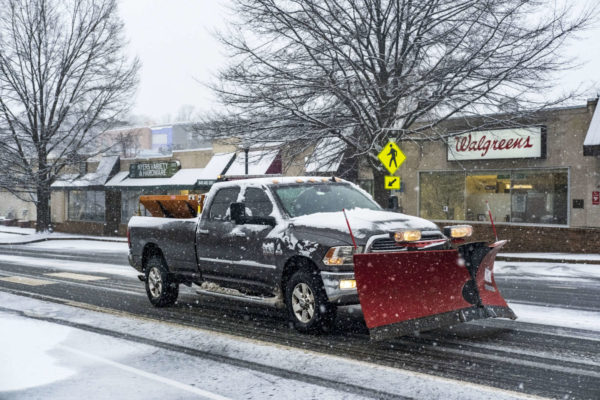
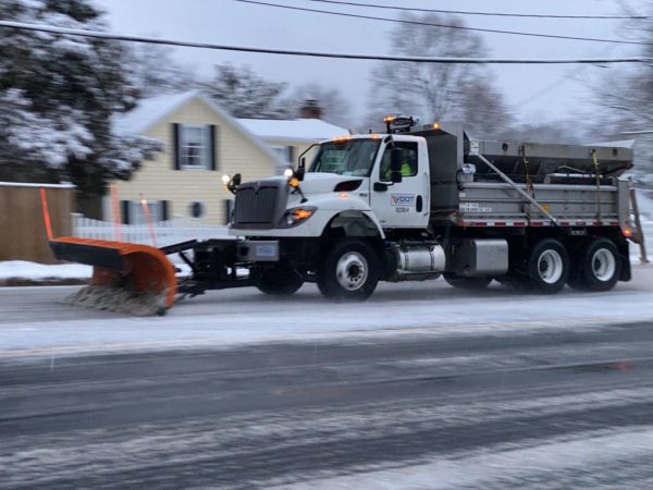
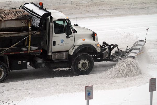
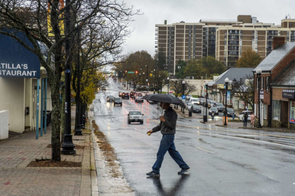
Across the county, most main roads are mostly slushy, thanks to the efforts of snow clearing crews. Many side roads have not been treated and are treacherous. Residents are being urged to stay home or exercise extreme caution if driving today.

“Yet, again, Virginia State Police is encouraging folks to hold off on traveling until conditions improve,” state police said last night.

A number of crashes have been reported this morning, including one that closed a portion of Carlin Springs Road at N. Galveston Street after a car reportedly spun off the roadway and crashed, injuring the driver.

Dominion Energy says it is prepared to respond to power outages in Northern Virginia, should freezing rain cause trees and branches to fall and power lines to be knocked out.

Arlington County government facilities, meanwhile, are closed, though the local government is still operating on a virtual basis. Arlington County’s trash and recycling service is not running today, and will instead be delayed a day and will resume Friday, with Thursday’s routes.

Buses, including ART and Metro buses, are operating on modified schedules.

As of 8:25 a.m., sleet was continuing to fall, with some freezing rain mixing in. The frozen precipitation is expected to continue through Friday morning.


Yesterday’s Winter Storm Watch has been upgraded to a Winter Storm Warning.

The winter storm that has been causing major problems in Texas and the central U.S. is making its way towards the D.C. area on its march up to New England. It’s expected to drop 3-6 inches of snow on Arlington and the immediate D.C. area before the precipitation switches to sleet and freezing rain.

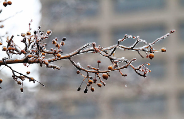
The ice accumulation could cause dangerous road conditions and power outages, forecasters and local officials warn.

“With heavy snow, sleet, freezing rain and ice in the forecast for Northern Virginia on Thursday and Friday, significant road impacts are expected,” the Virginia Dept. of Transportation said today. “While VDOT crews prepare to deploy, residents are asked to closely monitor weather updates and plan ahead to avoid nonessential travel tomorrow and Friday.”

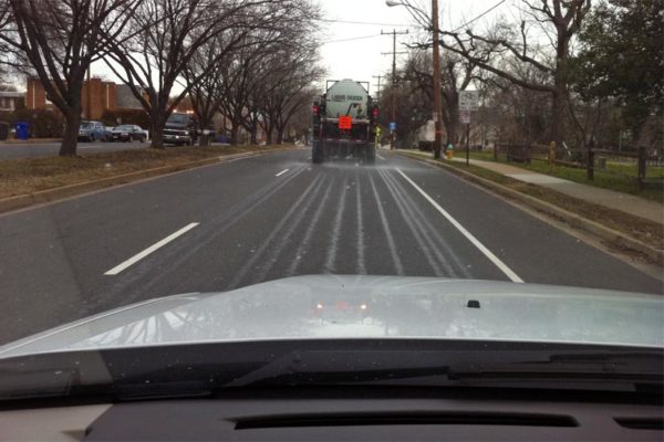
“Crews will finish pre-treating about 2,000 lane miles of interstates and primary routes in Arlington, Fairfax, Loudoun and Prince William counties today,” VDOT added. “Drivers are asked to be alert to brine tankers and to give them room, as they move slowly to spray the salt water solution on the pavement. Pretreatment will help prevent ice from bonding to assist crews with snow and ice removal at the storm’s onset.”

Arlington County crews are also currently pretreating local roadways.

A Winter Storm Warning was issued for the region this morning. More from the National Weather Service:

1024 AM EST WED FEB 17 2021

…WINTER STORM WARNING REMAINS IN EFFECT FROM 3 AM THURSDAY TO 6 AM EST FRIDAY…

* WHAT…HEAVY SNOW ALONG WITH SLEET AND FREEZING RAIN. TOTAL SNOW ACCUMULATIONS AROUND 3 TO 6 INCHES WITH ICE ACCUMULATION AROUND ONE TENTH TO ONE QUARTER OF AN INCH.

* WHERE…THE WASHINGTON AND BALTIMORE METROPOLITAN AREAS.

* WHEN…FROM 3 AM THURSDAY TO 6 AM EST FRIDAY. SNOW WILL BEGIN BETWEEN 3 AND 5 AM. SNOW WILL CHANGE TO A MIXTURE OF SLEET AND FREEZING RAIN DURING THE LATE MORNING AND EARLY AFTERNOON HOURS.

* IMPACTS…POWER OUTAGES AND TREE DAMAGE ARE LIKELY DUE TO THE ICE. TRAVEL COULD BE NEARLY IMPOSSIBLE. THE HAZARDOUS CONDITIONS COULD IMPACT THE MORNING OR EVENING COMMUTE.

* ADDITIONAL DETAILS…SNOW THURSDAY MORNING WILL BE HEAVY AT TIMES WITH SNOWFALL RATES AROUND 1 TO 2 INCHES PER HOUR POSSIBLE ALONG WITH VISIBILITY REDUCED TO AROUND ONE-QUARTER MILE AT TIME.

PRECAUTIONARY/PREPAREDNESS ACTIONS…

IF YOU MUST TRAVEL, KEEP AN EXTRA FLASHLIGHT, FOOD, AND WATER IN YOUR VEHICLE IN CASE OF AN EMERGENCY.

WHEN VENTURING OUTSIDE, WATCH YOUR FIRST FEW STEPS TAKEN ON STEPS, SIDEWALKS, AND DRIVEWAYS, WHICH COULD BE ICY AND SLIPPERY, INCREASING YOUR RISK OF A FALL AND INJURY.

File photo


Arlington is under a Winter Storm Watch from Wednesday night until Thursday night.

The watch was issued shortly before 3 p.m. Tuesday. Forecasters say five or more inches of snow, plus some ice accumulation, is possible in the D.C. area during that timeframe.

More from the National Weather Service:

250 PM EST TUE FEB 16 2021

…WINTER STORM WATCH IN EFFECT FROM LATE WEDNESDAY NIGHT THROUGH LATE THURSDAY NIGHT…

* WHAT…TOTAL SNOW ACCUMULATIONS OF 5 OR MORE INCHES AND TOTAL ICE ACCUMULATIONS OF A QUARTER INCH OR MORE ARE POSSIBLE.

* WHERE…THE WASHINGTON, BALTIMORE, AND FREDERICKSBURG METROPOLITAN AREAS.

* WHEN…FROM LATE WEDNESDAY NIGHT THROUGH LATE THURSDAY NIGHT.

* IMPACTS…POWER OUTAGES AND TREE DAMAGE ARE LIKELY DUE TO THE ICE. TRAVEL COULD BE NEARLY IMPOSSIBLE. THE HAZARDOUS CONDITIONS COULD IMPACT THE MORNING OR EVENING COMMUTE.

PRECAUTIONARY/PREPAREDNESS ACTIONS…

MONITOR THE LATEST FORECASTS FOR UPDATES ON THIS SITUATION.

Arlington’s emergency management office is encouraging residents to prepare for a possible snowstorm and — when it snows — to help neighbors shovel if need be.


(Updated at 5 p.m.) Arlington County is under a Winter Weather Advisory for Saturday into Sunday.

The National Weather Service says wintry precipitation starting Saturday morning may lead to slippery roads, with ice accumulation up to a fifth of an inch or so.

An earlier Winter Storm Watch was downgraded to an advisory Friday afternoon.

More from NWS:

310 PM EST Fri Feb 12 2021

…WINTER WEATHER ADVISORY IN EFFECT FROM 10 AM SATURDAY TO 7 AM EST SUNDAY…

* WHAT…Freezing rain, mixed with sleet at times. Storm total ice accumulations of one tenth to two tenths of an inch.

* WHERE…The District of Columbia, and portions of central and southern Maryland and central, northern and northwest Virginia.

* WHEN…From 10 AM Saturday to 7 AM EST Sunday.

* IMPACTS…Prepare for difficult travel conditions.

* ADDITIONAL DETAILS…Even a small amount of ice on untreated surfaces can make travel treacherous.

PRECAUTIONARY/PREPAREDNESS ACTIONS…

Slow down and use caution while traveling. Prepare for possible power outages.

When venturing outside, watch your first few steps taken on steps, sidewalks, and driveways, which could be icy and slippery, increasing your risk of a fall and injury.

In a sign of what may be to come, Metro is planning to operate on a moderate snow service plan to start the day on Saturday.

It does not take much ice buildup on roadways to create very dangerous conditions. On Thursday morning, an icy highway in Fort Worth, Texas caused a massive pileup that killed six people and involved more than 100 vehicles.


Despite temperatures expected to reach 50 degrees today, Arlington is mere hours from the start of a winter storm with snowfall that may exceed that of last weekend.

A Winter Storm Warning has been issued for Arlington and surrounding communities, with forecasters calling for 3-6 inches of accumulation. The warning is in effect from 3 a.m.-noon on Super Bowl Sunday.

Periods of heavy snow are expected Sunday morning, making travel treacherous, but warming temperatures should allow those with plans for the big game to get around with few issues later in the afternoon.

Snow crews are getting ready to do battle with the elements once again

“VDOT Northern Virginia crews are ready for a quick-hitting winter storm expected to impact the district early Sunday,” VDOT said today. “Today, crews are pre-treating bridges, ramps, overpasses and other trouble spots throughout Arlington, Fairfax, Loudoun, and Prince William counties, to help prevent ice and snow from bonding to the pavement at the onset of the storm.”

“Residents are asked to monitor forecasts, plan ahead to avoid nonessential travel during the storm, and be aware of the potential for slick spots overnight Sunday.” the transportation agency noted.

The City of Falls Church, meanwhile, is activating its snow emergency routes at 9 p.m. tonight (Saturday).

More from the National Weather Service:

…WINTER STORM WARNING REMAINS IN EFFECT FROM 3 AM TO NOON EST SUNDAY…

* WHAT…HEAVY SNOW EXPECTED. TOTAL SNOW ACCUMULATIONS OF 3 TO 6 INCHES.

* WHERE…THE DISTRICT OF COLUMBIA, AND PORTIONS OF CENTRAL AND SOUTHERN MARYLAND AND NORTHERN VIRGINIA.

* WHEN…FROM 3 AM TO NOON EST SUNDAY.

* IMPACTS…TRAVEL COULD BE VERY DIFFICULT.

* ADDITIONAL DETAILS…SNOW IS EXPECTED TO BEGIN BETWEEN 3 AM AND 5 AM, AND MAY BRIEFLY MIX WITH RAIN AT FIRST. THE HEAVIEST SNOW IS EXPECTED BETWEEN 6 AM AND 10 AM, WHEN VISIBILITY MAY BE REDUCED TO A QUARTER MILE AND SNOWFALL RATES COULD REACH ONE INCH PER HOUR.

PRECAUTIONARY/PREPAREDNESS ACTIONS…

IF YOU MUST TRAVEL, KEEP AN EXTRA FLASHLIGHT, FOOD, AND WATER IN YOUR VEHICLE IN CASE OF AN EMERGENCY.

WHEN VENTURING OUTSIDE, WATCH YOUR FIRST FEW STEPS TAKEN ON STEPS, SIDEWALKS, AND DRIVEWAYS, WHICH COULD BE ICY AND SLIPPERY, INCREASING YOUR RISK OF A FALL AND INJURY.


Arlington County and much of the D.C. region is under a Winter Storm Watch, with close to a half-foot of snow possible over the weekend.

The National Weather Service issued the watch this afternoon, saying that the snow will fall from late Saturday night through the afternoon of Super Bowl Sunday. That’s despite today’s relative warmth, in the mid-50s.

The Washington Post’s Capital Weather Gang is a bit more conservative in its forecast, currently calling for 1-3 inches.

More from NWS:

313 PM EST FRI FEB 5 2021

…WINTER STORM WATCH IN EFFECT FROM LATE SATURDAY NIGHT THROUGH SUNDAY AFTERNOON…

* WHAT…HEAVY SNOW POSSIBLE. TOTAL SNOW ACCUMULATIONS OF 5 OR MORE INCHES POSSIBLE.

* WHERE…THE DISTRICT OF COLUMBIA, AND PORTIONS OF CENTRAL AND SOUTHERN MARYLAND, NORTHERN VIRGINIA, AND EASTERN WEST VIRGINIA.

* WHEN…FROM LATE SATURDAY NIGHT THROUGH SUNDAY AFTERNOON.

* IMPACTS…PLAN ON SLIPPERY ROAD CONDITIONS.

PRECAUTIONARY/PREPAREDNESS ACTIONS…

MONITOR THE LATEST FORECASTS FOR UPDATES ON THIS SITUATION.


Arlington, D.C. and much of the region is now under a Winter Storm Warning.

The county is expected to receive 4-8 inches of snow accumulation from the incoming winter storm, likely the biggest in two years. The flakes are expected to start falling Sunday morning before the nor’easter finally pulls out Monday night, as it makes its way up the East Coast.

Arlington County and VDOT crews have been pre-treating roads and trails ahead of the winter weather, and snowplows will operate in shifts as the snow accumulates.

“Crews will finish pretreating roads in Arlington, Fairfax, Loudoun, and Prince William counties today, to help prevent ice and snow from bonding to the pavement at the onset of the storm,” VDOT said today. “More than 1,850 trucks will be staged by the onset of the storm ready to treat roads, and will begin to plow once two inches of snow have accumulated. Additional equipment and crews are ready as needed, including tree crews to handle downed branches from ice.”

“Monitor the forecast closely and prepare to stay off roads when the storm begins to allow crews room to work. Plan to avoid travel Sunday and into Monday,” the state transportation agency added. “Park in driveways or a single side of the street to allow a wider path for plows. If you must drive, ensure gas and wiper fluid tanks are full, be prepared with an emergency kit and be familiar with these winter driving tips.”

Metrobuses will operate under a “moderate snow plan” on Sunday. Metrorail will operate under a normal weekend schedule, though changes may be make if the snow accumulates more than 6 inches. Arlington Transit buses are also likely to operate under some form of limited service.

Nearby Falls Church is activating its snow emergency routes at 9 a.m. Sunday.

In parts of Arlington today, some grocery shelves were bare as shoppers stocked up before the multi-day storm. While the pandemic has nixed most local events, some that are still being held, including the Columbia Pike Farmers Market, have been cancelled.

The snow, meanwhile, isn’t the only weather threat to monitor. Gusty winds from Monday into Tuesday could, in combination with the wet snowfall, cause tree branches to fall, resulting in power outages.

More on the Winter Storm Warning, from the National Weather Service:

230 PM EST SAT JAN 30 2021

…WINTER STORM WARNING REMAINS IN EFFECT FROM 1 AM SUNDAY TO MIDNIGHT EST SUNDAY NIGHT…

* WHAT…HEAVY SNOW EXPECTED. SNOW ACCUMULATIONS THROUGH SUNDAY NIGHT AROUND 3 TO 6 INCHES WITH ICE ACCUMULATIONS AROUND ONE TENTH OF AN INCH.

* WHERE…THE WASHINGTON METROPOLITAN AREA.

* WHEN…FROM 1 AM SUNDAY TO MIDNIGHT EST SUNDAY NIGHT. SNOW WILL OVERSPREAD THE AREA BETWEEN 3 AND 5 AM EARLY SUNDAY MORNING. THE STEADIEST SNOW WILL FALL THROUGH SUNDAY AFTERNOON BEFORE  TAPERING OFF TO AN INTERMITTENT MIX OF LIGHT SNOW, SLEET, AND FREEZING RAIN. ADDITIONAL SNOW IS EXPECTED MONDAY THROUGH MONDAY NIGHT WITH ADDITIONAL ACCUMULATIONS MOST LIKELY AROUND 1 TO 3 INCHES, BRINGING THE STORM TOTAL ACCUMULATIONS AROUND 4 TO 8 INCHES.

* IMPACTS…TRAVEL WILL BE VERY DIFFICULT SUNDAY THROUGH TUESDAY MORNING DUE TO A PROLONGED PERIOD OF SNOW AND WINTRY PRECIPITATION WITH TEMPERATURES NEAR OR BELOW FREEZING.

PRECAUTIONARY/PREPAREDNESS ACTIONS…

IF YOU MUST TRAVEL, KEEP AN EXTRA FLASHLIGHT, FOOD, AND WATER IN YOUR VEHICLE IN CASE OF AN EMERGENCY.

WHEN VENTURING OUTSIDE, WATCH YOUR FIRST FEW STEPS TAKEN ON STEPS, SIDEWALKS, AND DRIVEWAYS, WHICH COULD BE ICY AND SLIPPERY, INCREASING YOUR RISK OF A FALL AND INJURY.

Two snowfall maps, from NWS and the Capital Weather Gang, are below.


(Updated at 9:30 a.m.) Arlington and much of the D.C. area will be under a Flash Flood Watch on Christmas Eve.

A strong storm is expected to sweep through the area tomorrow afternoon and evening, bringing heavy rain and gusty wind. There may also be a few snowflakes near the end, as temperatures plummet, but no accumulation is expected locally.

More on the flooding potential, from the National Weather Service, is below.

…FLASH FLOOD WATCH NOW IN EFFECT FROM THURSDAY AFTERNOON THROUGH LATE THURSDAY NIGHT…

* ONE AND HALF TO TWO AND HALF INCHES OF RAIN ARE EXPECTED THURSDAY  AFTERNOON AND THURSDAY NIGHT. THIS IS EXPECTED TO RESULT IN FLASH FLOODING OF SMALL STREAMS AND CREEKS AND POSSIBLE RIVER FLOODING.


Green Building Update — “The County Board today adopted an update to the Green Building Incentive Policy for site plan projects that strengthens Arlington’s commitment to sustainability and carbon neutrality… ‘By raising the bar on green building incentives for site plan developments, Arlington is reaffirming our commitment to our goal of becoming carbon neutral by 2050,’ Arlington County Board Chair Libby Garvey said.” [Arlington County]

Big Storm Expected Mid-Week — “A major winter storm is set to wallop the Mid-Atlantic and the Northeast on Wednesday and Thursday, with many areas from western Virginia to southern New England expected to see heavy snowfall. But for the immediate Washington area, a messy mix of precipitation is more likely than a major snowstorm.” [Capital Weather Gang, Twitter]

Arlington Officer Honored — “Arlington County Police Officer Anthony Gatto was among 18 law-enforcement personnel from across the region who were cited Dec. 11 with the area’s 23rd annual ‘Law Enforcement Awards of Excellence for Impaired Driving Prevention.'” [InsideNova]


Local Dog Adoption Demand is High — “Kim Williams, who volunteers for the Lost Dog and Cat Rescue Foundation of Arlington, Virginia, has tapped into a puppy pipeline of sorts to bring some of Georgia’s homeless pet population to the mid-Atlantic region where they are bombarded by requests for dogs to adopt.” [WMAZ]

American Reducing Service at DCA — “American Airlines is discontinuing service to more than 20 destinations from Reagan National Airport in January, according to new data reported by the Official Airline Guide. Cities and/or airports dropped range from major (New York-JFK; Las Vegas; St. Louis; Minneapolis-St. Paul) to smaller (Jackson, Miss.; Manchester, N.H.; Greensboro, N.C.). Many were served just once or twice per day.” [InsideNova]

Land Transfer May Speed Bridge Project — “Interesting: NPS is ‘supportive’ of conveying four acres of parkland to VA and DC to construct the Long Bridge(s), rather than just permitting. That would likely speed design and construction, and could result in a ped/bike span that doesn’t compromise as much on width and lighting in order to conform to NPS interests.” [@CarFreeHQ2/Twitter]

Local Wildlife Caught on Camera — “Arlington resident Levi Novey and his wife Alicia have captured footage documenting quite an array of critters passing through their yard via a fence that Levi has dubbed a ‘wildlife superhighway…’ So far their fence camera has photographed foxes, raccoons, mice, housecats, chipmunks, and lots of birds and possums.” [WJLA]

Redistricting Commission Applications Open — “Beginning Monday, Virginians will have a month to apply for one of eight public seats on the state’s new redistricting commission, which has begun its work with a panel of retired judges setting out plans for the application process.” [Washington Post]

Stormy Day Today — “Get ready for a wild weather finish to November. A strong storm system develops and moves through… bringing a mix of hazards to our area in a short time frame, capped off by the potential for strong to possibly severe storms Monday afternoon. No specific warnings or advisories have been issued, but expect a good soaking of one to two-plus inches of rain (and some wild temperature swings).” [Capital Weather Gang, Twitter]


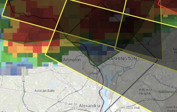
Northern and eastern portions of Arlington County are now under a Severe Thunderstorm Warning.

The tail end of a strong storm that brought high winds and possibly tornadoes to Montgomery County is expected to blow through part of the county.

From the National Weather Service:

BULLETIN – IMMEDIATE BROADCAST REQUESTED
SEVERE THUNDERSTORM WARNING
NATIONAL WEATHER SERVICE BALTIMORE MD/WASHINGTON DC
527 PM EDT THU SEP 3 2020

THE NATIONAL WEATHER SERVICE IN STERLING VIRGINIA HAS ISSUED A

* SEVERE THUNDERSTORM WARNING FOR…
THE DISTRICT OF COLUMBIA…
SOUTH CENTRAL ANNE ARUNDEL COUNTY IN CENTRAL MARYLAND…
SOUTH CENTRAL MONTGOMERY COUNTY IN CENTRAL MARYLAND…
NORTHWESTERN CALVERT COUNTY IN SOUTHERN MARYLAND…
CENTRAL PRINCE GEORGES COUNTY IN CENTRAL MARYLAND…
ARLINGTON COUNTY IN NORTHERN VIRGINIA…
EAST CENTRAL FAIRFAX COUNTY IN NORTHERN VIRGINIA…

* UNTIL 630 PM EDT.

* AT 527 PM EDT, A SEVERE THUNDERSTORM WAS LOCATED OVER FRIENDSHIP VILLAGE, OR NEAR FORT TOTTEN, MOVING EAST AT 35 MPH.

HAZARD…60 MPH WIND GUSTS AND QUARTER SIZE HAIL.

SOURCE…RADAR INDICATED.

IMPACT…DAMAGING WINDS WILL CAUSE SOME TREES AND LARGE BRANCHES TO FALL. THIS COULD INJURE THOSE OUTDOORS, AS WELL AS DAMAGE HOMES AND VEHICLES. ROADWAYS MAY BECOME BLOCKED BY DOWNED TREES. LOCALIZED POWER OUTAGES ARE POSSIBLE. UNSECURED LIGHT OBJECTS MAY BECOME PROJECTILES.

* LOCATIONS IMPACTED INCLUDE… ARLINGTON, BETHESDA, BOWIE, CLINTON, FORESTVILLE, LARGO, CORAL HILLS, BLADENSBURG, MAYO, SHADY SIDE, CHESAPEAKE BEACH, DEALE, UPPER MARLBORO, NATIONALS PARK, FEDEX FIELD, HOWARD UNIVERSITY, RHODE RIVER, GALLAUDET UNIVERSITY, FORT TOTTEN AND REAGAN NATIONAL AIRPORT.

PRECAUTIONARY/PREPAREDNESS ACTIONS…

A TORNADO WATCH REMAINS IN EFFECT UNTIL 1000 PM EDT FOR DISTRICT OF COLUMBIA…CENTRAL AND SOUTHERN MARYLAND…AND NORTHERN VIRGINIA.

FOR YOUR PROTECTION MOVE TO AN INTERIOR ROOM ON THE LOWEST FLOOR OF A BUILDING.


View More Stories