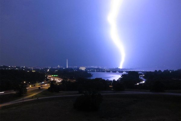
Part of south Arlington is under a Severe Thunderstorm Warning late Thursday afternoon

From the National Weather Service:

THE NATIONAL WEATHER SERVICE IN STERLING VIRGINIA HAS ISSUED A * SEVERE THUNDERSTORM WARNING FOR… THE CENTRAL DISTRICT OF COLUMBIA… WEST CENTRAL PRINCE GEORGES COUNTY IN CENTRAL MARYLAND… NORTHWESTERN CHARLES COUNTY IN SOUTHERN MARYLAND… SOUTHEASTERN ARLINGTON COUNTY IN NORTHERN VIRGINIA… SOUTHEASTERN FAIRFAX COUNTY IN NORTHERN VIRGINIA… THE CITY OF ALEXANDRIA IN NORTHERN VIRGINIA… * UNTIL 615 PM EDT * AT 527 PM EDT, A SEVERE THUNDERSTORM WAS LOCATED OVER FORT BELVOIR, MOVING NORTHEAST AT 15 MPH. HAZARD… 60 MPH WIND GUSTS AND QUARTER SIZE HAIL. SOURCE… RADAR INDICATED. IMPACT… DAMAGING WINDS WILL CAUSE SOME TREES AND LARGE BRANCHES TO FALL. THIS COULD INJURE THOSE OUTDOORS, AS WELL AS DAMAGE HOMES AND VEHICLES. ROADWAYS MAY BECOME BLOCKED BY DOWNED TREES. LOCALIZED POWER OUTAGES ARE POSSIBLE. UNSECURED LIGHT OBJECTS MAY BECOME PROJECTILES. * LOCATIONS IMPACTED INCLUDE… ARLINGTON, ALEXANDRIA, SPRINGFIELD, FORT WASHINGTON, FORT HUNT, GROVETON, HUNTINGTON, CORAL HILLS, FORT BELVOIR, NATIONAL HARBOR, REAGAN NATIONAL AIRPORT, CRYSTAL CITY, RFK STADIUM, NATIONALS PARK, GALLAUDET UNIVERSITY, BURKE, LINCOLNIA, LORTON, FRANCONIA AND OXON HILL. PRECAUTIONARY/PREPAREDNESS ACTIONS… GET INDOORS TO PROTECT YOURSELF FROM WIND AND LIGHTNING. TREES AROUND YOU MAY BE DOWNED FROM DAMAGING WINDS, SO IF YOU ARE NEAR LARGE TREES, MOVE TO AN INTERIOR ROOM ON THE LOWEST FLOOR. DON’T DRIVE UNDERNEATH TREES OR IN WOODED AREAS UNTIL THE THREAT HAS PASSED. && HAIL… 1.00IN WIND… 60MPH


The National Weather Service has issued a severe thunderstorm warning for southeastern Arlington until 9:30 a.m.

NWS said severe thunderstorms are along a line from Fort Belvoir to near Prince Frederick, and are moving north towards the D.C. metro area at 65 miles per hour. Residents should expect gusting winds up to 60 miles per hour that could cause some trees to fall and damage homes and cars. Heavy rain is expected to last all morning.

The Capital Weather Gang noted this morning that some isolated storms may be possible in the region later this afternoon. Those storms could be powerful, and bring with them hail, wind and even a tornado.

More from NWS:

The National Weather Service in Sterling Virginia has issued a

* Severe Thunderstorm Warning for…
The District of Columbia…
Central Anne Arundel County in central Maryland…
Northern St. Marys County in southern Maryland…
Southeastern Montgomery County in central Maryland…
Northwestern Calvert County in southern Maryland…
Prince Georges County in central Maryland…
Northeastern Charles County in southern Maryland…
Southeastern Arlington County in northern Virginia…
Southeastern Fairfax County in northern Virginia…
The City of Alexandria in northern Virginia…

* Until 930 AM EDT

* At 835 AM EDT, severe thunderstorms were located along a line
extending from near Fort Belvoir to near Prince Frederick, moving
north at 65 mph.

HAZARD…60 mph wind gusts.

SOURCE…Radar indicated.

IMPACT…Damaging winds will cause some trees and large branches
to fall. This could injure those outdoors, as well as
damage homes and vehicles. Roadways may become blocked by
downed trees. Localized power outages are possible.
Unsecured light objects may become projectiles.

* Locations impacted include…
Arlington, Alexandria, Waldorf, Bowie, Annapolis, Clinton, College
Park, Crofton, Fort Washington, Greenbelt, Langley Park,
Beltsville, Fort Hunt, Groveton, Forestville, Huntington, Largo,
Coral Hills, Bladensburg and Mayo.


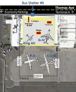
Next Tuesday, for the first time at Reagan National Airport, the public can tour four planes that fly into hurricanes for better weather forecasts.

Hurricane Hunter aircraft pilots from the National Oceanic and Atmospheric Administration and the U.S. Air Force will be on hand, as well as hurricane experts. Dr. Rick Knabb, director of the National Hurricane Center, NHC hurricane specialists and local National Weather Service meteorologists will educate residents of vulnerable communities about hurricane preparedness.

NOAA will be joined by staff from FEMA, local and state emergency management offices, non-profit organizations such as the American Red Cross, and other partners.

Participating aircraft are the WC-130J, the Lockheed WP-3D Orion “Hurricane Hunter,” the NOAA G-IV and NOAA’s King Air Special Mission. All the planes are used to gather data on hurricanes and forecast their future intensity.

Tours are scheduled to be open to the public from 2-5 p.m.

Registration is not required for the public tours, although no backpacks or large bags are permitted. Tours begin at the aircraft hangar near the Signature Air terminal at shuttle bus stop No. 9. Four pre-selected school groups of 80 local fourth- and fifth-graders will also tour the event and aircraft that morning.

Image via National Weather Service


Update at 9:10 p.m. — The Severe Thunderstorm Watch has been cancelled.

Earlier: The National Weather Service issued a severe thunderstorm watch for Arlington, in effect until 11 p.m.

NWS said a line of showers and thunderstorms are moving west, and have the potential to bring strong to damaging gusts of wind this evening.


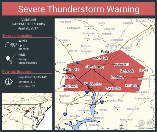
The National Weather Service has issued a severe thunderstorm warning for Arlington.

The warning is in effect until 8:45 p.m.

From NWS:

National Weather Service Baltimore MD/Washington DC
805 PM EDT THU APR 20 2017

The National Weather Service in Sterling Virginia has issued a

* Severe Thunderstorm Warning for…
The District of Columbia…
Southeastern Montgomery County in central Maryland…
Northern Prince Georges County in central Maryland…
Arlington County in northern Virginia…
The City of Falls Church in northern Virginia…
Northeastern Fairfax County in northern Virginia…

* Until 845 PM EDT

* At 804 PM EDT, a severe thunderstorm was located over American
University, or near Rosslyn, moving east at 30 mph.

HAZARD…60 mph wind gusts.

SOURCE…Radar indicated.

IMPACT…Damaging winds will cause some trees and large branches
to fall. This could injure those outdoors, as well as
damage homes and vehicles. Roadways may become blocked by
downed trees. Localized power outages are possible.
Unsecured light objects may become projectiles.

* Locations impacted include…
Arlington, Bethesda, Bowie, College Park, Greenbelt, Langley Park,
Beltsville, Forestville, Falls Church, Largo, Coral Hills,
Bladensburg, Pimmit Hills, Mclean, Byrd Stadium, Fedex Field, Fort
Totten, Rosslyn, Nationals Park and Howard University.

PRECAUTIONARY/PREPAREDNESS ACTIONS…

Get indoors to protect yourself from wind and lightning. Trees around
you may be downed from damaging winds, so if you are near large
trees, move to an interior room on the lowest floor. Don`t drive
underneath trees or in wooded areas until the threat has passed.


There’s been a lot of clean-up in Arlington following last Thursday’s strong storms that produced a weak tornado.

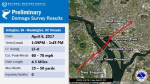
The National Weather Service says the tornado formed adjacent to the Army Navy Country Club and lasted for six minutes on its 4.5 mile journey through Pentagon City and into Washington, D.C. The F-0 tornado had peak winds of 60-70 miles per hour.

The Army Navy Country Club property experienced quite a bit of damage, and a spokesperson issued the following statement to ARLnow on Monday:

“The tornado did interrupt some of the Club’s golf operations, as we had to close 18 of the 27 holes of golf in the Club’s Arlington location. Due to the tornado, we lost dozens of trees, several water coolers, trash cans, and benches on the course. We are fortunate that the path of the tornado did not cause any injuries or damages to the buildings.”

The last time a tornado was recorded in Arlington was on September 24, 2001, when an F-1 that originated in Fairfax County traveled northeast for 15 miles through Alexandria and Arlington, then it crossed the 14th Street Bridge into the District. It caused extensive damage and injured two people in south Arlington.

The scene was different for Thursday’s tornado in Arlington and the two others confirmed in the region that day, said Chris Strong, a warning coordination meteorologist with NWS Baltimore/Washington. Not only were the tornadoes weaker, but they also formed in a different manner.

“These weaker ones last week were basically eddies along a gust front, rather than more classic supercell thunderstorm tornadoes,” Strong says. “Those eddies produced small whirls of wind that in narrow corridors snapped some trees and caused siding and roofing damages.”

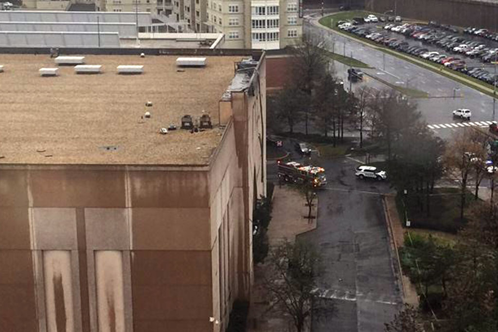
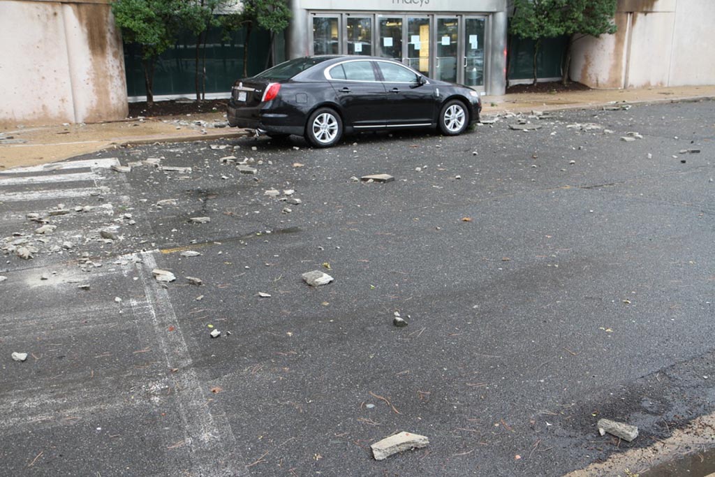
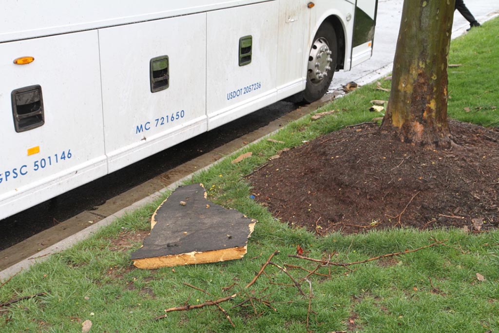
Some of that damage occurred when a portion of the facade and roof of the Macy’s at the Pentagon City mall ripped off and fell onto a car, resulting in one minor injury.

Technological advances have prompted changes in how local emergency managers warn the public about tornadoes and other weather emergencies. Some parts of the country, especially those that are more prone to tornadoes, use sirens as a warning. But sirens aren’t necessarily as effective in Arlington and the District, partially because of the dense buildings and foliage.

“Tornado sirens are not used much in this region of the country,” Strong said. “One of the reasons they work better in tornado alley is the wide open spaces with lack of trees that allows the sound to travel well.”

(more…)


Update at 11:20 p.m. — The National Weather Service confirms that an EF-0 tornado tracked through Arlington and into the District on Thursday.

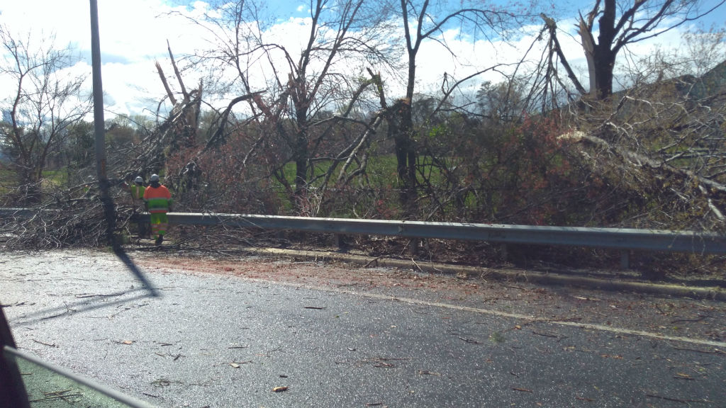
Earlier: The storms that whipped through Arlington and the D.C. region yesterday brought power outages and damage, and more trees toppled today, according to the Arlington County Fire Department.

But now the Capital Weather Gang believes the storms caused something else: a rare tornado in Arlington.

As CWG reported, the National Weather Service officially confirmed tornadoes in Herndon and in Southeast D.C. on Thursday. But the CWG team lists several other areas where they believe small tornadoes may have touched down, including in South Arlington near the Pentagon.

Radar indicated rotation there around 1:40 p.m., as noted on Twitter by weather enthusiast Ian Livingston.

Photographic evidence of damage near the Army Navy Country Club is consistent with tornadic activity, according to CWG. That’s also close to where one person was hurt when part of the Macy’s facade and roof at the Pentagon City mall was damaged and fell onto a car yesterday.

The National Weather Service reportedly is assessing damage near the Tidal Basin to determine if a tornado occurred there and along the H Street Corridor; the same storm caused the Arlington circulation. The Capital Weather Gang indicates the possible Arlington tornado may have been a separate occurrence from the one at the Tidal Basin, or that one tornado may have passed over the entire area in question.


(Updated at 2:50 p.m.) A severe thunderstorm that ripped through Arlington just after lunchtime has left some debris and damage in its wake.

In Pentagon City, part of the facade and roof of the Macy’s at the Pentagon City mall was damaged and a portion of it fell onto a car. One minor injury has been reported. As of 2:45 p.m., workers were on the roof inspecting the damage.

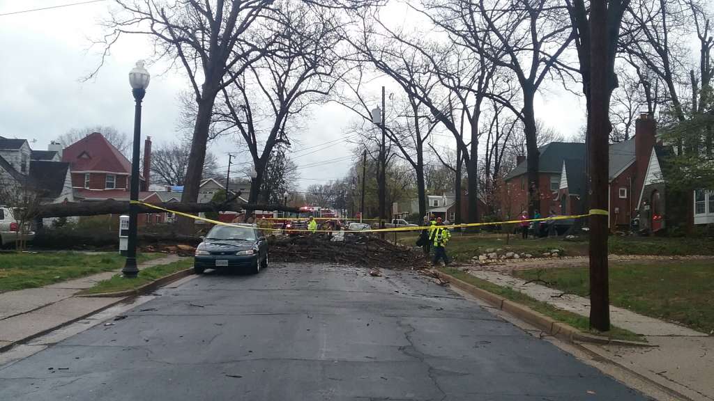
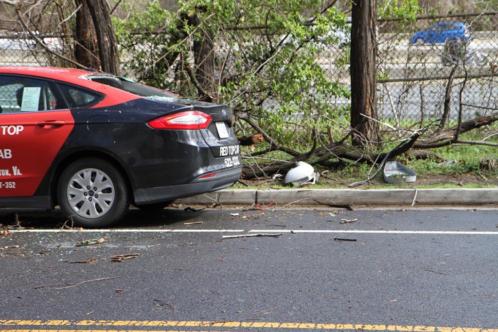
According to scanner reports, a tree fell on a car near the intersection of Route 50 and Park Drive. The two occupants of the vehicle were shaken up but not injured.

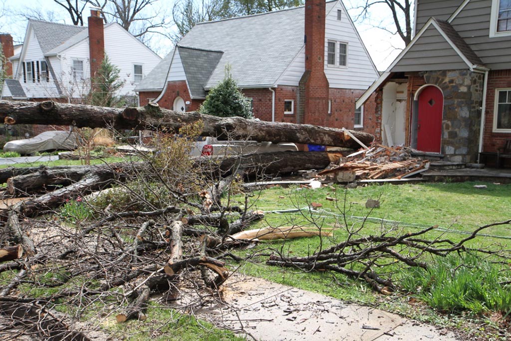
A tree fell into a home on the 1400 block of N. Wakefield Street, a few blocks from Washington-Lee High School, according to a fire department dispatch. The tree caused damage to the front of the house, but did not hit a car parked next door.

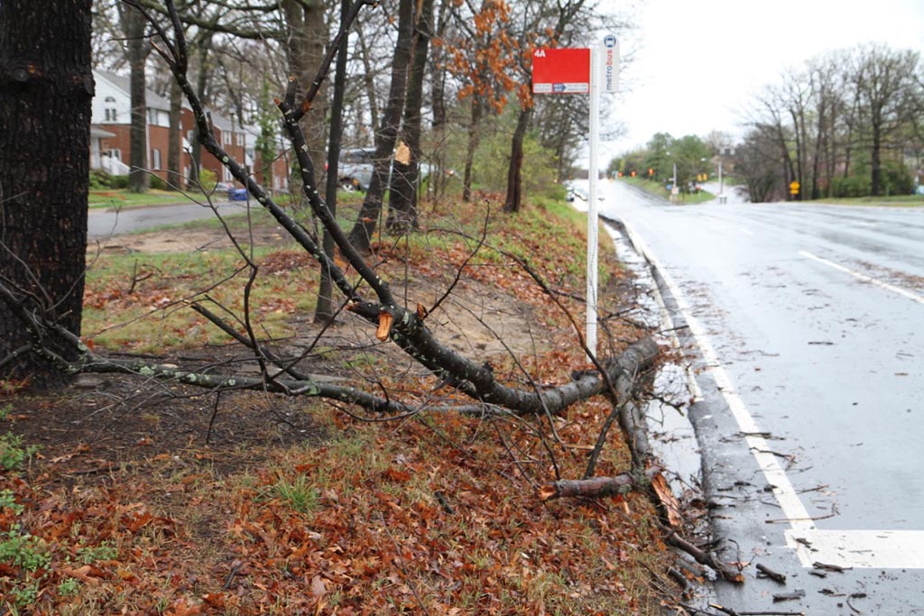
A number of other instances of trees and utility lines falling have been reported around the county, including at the intersections of S. Wayne Street and 6th Street S., S. Adams Street and 8th Street S., and 31st Street S. and S. Randolph Street.

As of 2:45 p.m., just over 550 Dominion customers were without power, according to the company’s outage map.

Via Twitter, residents say the storm brought hail in addition to very strong winds.


(Updated at 1:30 p.m.) A Severe Thunderstorm Warning has been issued for Arlington County.

From the National Weather Service:

* Severe Thunderstorm Warning

* Until 200 PM EDT

* At 111 PM EDT, severe thunderstorms were located along a line extending from near Warrenton to 6 miles west of Dale City to Triangle, moving northeast at 50 mph.

HAZARD…60 mph wind gusts and quarter size hail.

SOURCE…Radar indicated.

IMPACT…Damaging winds will cause some trees and large branches to fall. This could injure those outdoors, as well as damage homes and vehicles. Roadways may become blocked by downed trees. Localized power outages are possible. Unsecured light objects may become projectiles.

* Locations impacted include… Arlington, Alexandria, Germantown, Centreville, Dale City, Rockville, Bethesda, Gaithersburg, Reston, Leesburg, Annandale, Olney, Springfield, College Park, South Riding, Fort Washington, Herndon, Greenbelt, Fairfax and Langley Park.

PRECAUTIONARY/PREPAREDNESS ACTIONS…

Get indoors to protect yourself from wind and lightning. Trees around you may be downed from damaging winds, so if you are near large trees, move to an interior room on the lowest floor. Don’t drive underneath trees or in wooded areas until the threat has passed.

A Severe Thunderstorm Watch is also in effect, until 5 p.m.


(Updated at 9:55 a.m.) It’s going to be a rainy day in Arlington and the D.C. area, with heavy rain and scattered storms likely.

The rain may cause some minor flooding problems on the roadways and along streams, forecasters say.

“Rain will be locally heavy at times through this evening,” said the National Weather Service. “Localized flooding of small streams and creeks as well as urban areas is possible late this morning into this evening.”

More from NWS:

At 907 AM EDT, radar indicated showers with isolated thunderstorms were located along a line extending from Ashburn to Aquia Creek. Movement was northeast at 40 mph.

Locally heavy rainfall can be expected.

Locations impacted include…
Arlington, Alexandria, Stafford, Columbia, Germantown, Centreville, Waldorf, Dale City, Rockville, Bethesda, Gaithersburg, Reston, Leesburg, Annandale, Clinton, Olney, Springfield, College Park, South Riding and Fort Washington.

Locally heavy rainfall is also occurring with these showers, and may cause ponding of water on roadways and cause small streams to go out of their banks. Be alert for the potential of standing water and hydroplaning.

The weather is already causing problems on the roads and at the airport:


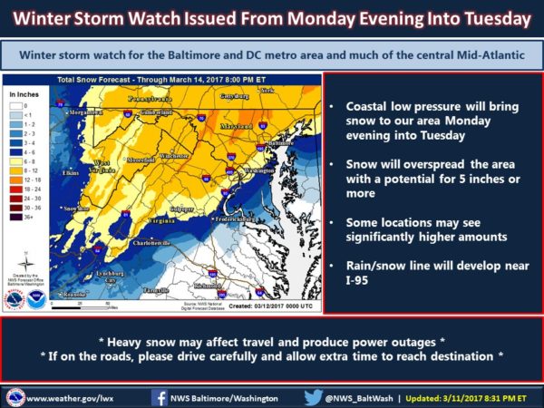
(Updated at 6:25 p.m.) Arlington and a large portion of the D.C. area is now under a Winter Storm Warning.

A “monster nor’easter” could bring a half foot of snow or more to the area from Monday night into Tuesday. Other coastal northeastern cities are also in the storm’s path.

From the National Weather Service:

… WINTER STORM WARNING IN EFFECT FROM 7 PM MONDAY TO 2 PM EDT TUESDAY… THE NATIONAL WEATHER SERVICE IN BALTIMORE MD/WASHINGTON HAS ISSUED A WINTER STORM WARNING FOR SNOW, WHICH IS IN EFFECT FROM 7 PM MONDAY TO 2 PM EDT TUESDAY. THE WINTER STORM WATCH IS NO LONGER IN EFFECT. * PRECIPITATION TYPE… SNOW… POSSIBLY MIXED WITH SLEET AT TIMES MONDAY NIGHT. * ACCUMULATIONS… SNOW ACCUMULATION OF 6 TO 10 INCHES. * TIMING… SNOW WILL OVERSPREAD THE AREA MONDAY EVENING AND PERSIST THROUGH TUESDAY MORNING. * IMPACTS… THE HEAVY SNOW WILL CREATE DIFFICULT TRAVEL CONDITIONS AND MAY PRODUCE SCATTERED POWER OUTAGES. * WINDS… NORTHEAST 5 TO 15 MPH WITH GUSTS UP TO 30 MPH. * TEMPERATURES… IN THE LOWER 30S. PRECAUTIONARY/PREPAREDNESS ACTIONS… A WINTER STORM WARNING FOR HEAVY SNOW MEANS SEVERE WINTER WEATHER CONDITIONS ARE EXPECTED OR OCCURRING. SIGNIFICANT AMOUNTS OF SNOW ARE FORECAST THAT WILL MAKE TRAVEL DANGEROUS. ONLY TRAVEL IN AN EMERGENCY. IF YOU MUST TRAVEL, KEEP AN EXTRA FLASHLIGHT, FOOD, AND WATER IN YOUR VEHICLE IN CASE OF AN EMERGENCY. &&

More via Twitter:


View More Stories