Arlington County is under a Severe Thunderstorm Warning through 8:30 p.m.

From the National Weather Service:

AT 742 PM EDT… DOPPLER RADAR INDICATED A LINE OF SEVERE THUNDERSTORMS CAPABLE OF PRODUCING QUARTER SIZE HAIL AND DAMAGING WINDS IN EXCESS OF 60 MPH. THESE STORMS WERE LOCATED ALONG A LINE EXTENDING FROM NEAR FAIRFAX TO NEAR TRIANGLE… AND MOVING NORTHEAST AT 45 MPH.

* LOCATIONS IMPACTED INCLUDE… ARLINGTON… COLLEGE PARK… VIENNA… FALLS CHURCH… BLADENSBURG… FORESTVILLE IN PRINCE GEORGES COUNTY… PIMMIT HILLS… MANTUA… THE I395 AND I495… GALLAUDET UNIVERSITY… NATIONALS PARK… CLINTON… CORAL HILLS… WOODBRIDGE… THE I66 AND I495… LANGLEY PARK… ANNANDALE… DALE CITY… CRYSTAL CITY AND HUNTINGTON IN FAIRFAX COUNTY.

PRECAUTIONARY/PREPAREDNESS ACTIONS…

SEVERE THUNDERSTORMS PRODUCE DAMAGING WINDS… DESTRUCTIVE HAIL… DEADLY LIGHTNING AND VERY HEAVY RAIN. FOR YOUR PROTECTION… MOVE TO AN INTERIOR ROOM ON THE LOWEST FLOOR OF YOUR HOME OR BUSINESS. HEAVY RAINS FLOOD ROADS QUICKLY SO DO NOT DRIVE INTO AREAS WHERE WATER COVERS THE ROAD.


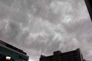
Storm clouds over Rosslyn 7/3/14A Tornado Watch has been issued for Arlington and the D.C. region through 10:00 tonight.

Forecasters say severe storms are likely late this afternoon and this evening and that an isolated tornado is possible.

Showers and thunderstorms are expected to reach the around the evening rush hour.

From the National Weather Service:

THUNDERSTORMS ARE LIKELY LATE THIS AFTERNOON AND EVENING. A FEW OF THE THUNDERSTORMS MAY BECOME SEVERE WITH A THREAT OF DAMAGING WIND GUSTS…LARGE HAIL AND AN ISOLATED TORNADO.


Car wash (Flickr pool photo by Kevin Wolf)

Record No. of Arlington Runners in Boston — An “all-time record” of 116 Arlington runners are registered to participate in the 2015 Boston Marathon today. [InsideNova]

Vehicle Overturns in Ashton Heights — A vehicle “pinballed off two parked cars” and overturned near the intersection of 6th Street and N. Lincoln Street in Ashton Heights Sunday morning. [Twitter]

H-B No. 1 in Challenge Index — Three Arlington high schools have made the top 10 of the Washington Post’s 2015 Challenge Index of local public high schools. The H-B Woodlawn secondary program ranked No. 1, Yorktown ranked No. 6 and Washington-Lee ranked No. 10. [Washington Post]

Complaints Against Towing Co., Questions About Video — While ESPN reporter Britt McHenry serves out her suspension for berating an Advanced Towing employee in Arlington, there’s some push back against the towing company and the video it produced of McHenry’s mean-spirited remarks. NBC 4 notes that there have been 155 complaints to police against Advanced from 2012 to 2014. Us Weekly, meanwhile, gossips that “a source close to the situation” says the video was edited “to make it look like Britt has gone on a one-way tirade as opposed to being in a two-way verbal spat with someone.” [NBC Washington, Us Weekly]

Net Migration Negative for Arlington in 2014 — More people moved out of Arlington than moved in last year, according to new census estimates. Arlington’s net migration in 2014 was -1,520, compared to +2,004 in 2013. That follows a broader trend of slowing growth in the D.C. region, which is still growing thanks mostly to births. [Washington Post]

County Board to Pay School Delays Costs — The Arlington County Board, which in January put the brakes on a plan to build a new elementary school in South Arlington, pledged last week to “take the financial hit” for the project’s delay, which is expected to cost up to $2.1 million. The County Board rejected the plan to build a new elementary school next to Thomas Jefferson Middle School after residents raised concerns about traffic and the school’s impact on a nearby park. [InsideNova]

‘Enhanced Risk’ of Severe Weather Today — The National Weather Service says there’s an enhanced risk of severe weather in the D.C. area this afternoon, including a 1-in-3 chance of damaging wind gusts and hail. [Twitter]

Flickr pool photo by Kevin Wolf


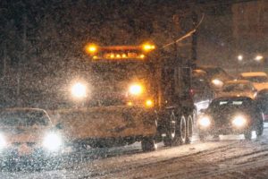
Snow 3/3/14 (file photo)Arlington residents and area snow crews are gearing up for what may be the year’s final — and most potent — winter storm.

Up to 8 inches of snow are expected to fall Thursday, as cold air moves in and rain turns to sleet and snowflakes.

Arlington road crews — about 50 trucks total — are expected to start a “full team effort” to plow and treat roads at midnight, according to a Dept. of Environmental Services spokeswoman.

VDOT, meanwhile, said it has “all hands on deck” for Thursday’s storm. It has a website for residents to monitor snow-clearing progress: vdotplows.org.

VDOT issued the following press release Wednesday afternoon, urging drivers to stay off the roads Thursday.

Road crews in Fairfax, Loudoun, Prince William and Arlington counties are preparing for another winter storm to include rain, sleet, and snow, followed by several days of frigid temperatures that will make clearing roads a challenge. By midnight, more than 3,800 trucks will be staged along interstates, major roads and neighborhood streets.

“We’re asking drivers to prepare now for a long couple of days,” said Branco Vlacich, VDOT’s district maintenance engineer for northern Virginia. “It will be vital to stay off the roads tomorrow, as conditions will be treacherous during the storm. Crews will also need that room to clear snow quickly during the day, because frigid temperatures overnight and through the weekend will mean repeated refreeze of any accumulation left on the road.”

With the storm expected to begin as rain, crews will not pre-treat for this storm. They will treat roads with salt and sand during sleet and freezing rain, and begin to plow as the storm transitions to accumulating snow.

What motorists and residents should know:

  • Road conditions will be treacherous during the storm. Drivers should stay off roads throughout the day tomorrow to provide crews as much room as possible to plow and treat roads.
  • Crews will plow and treat interstates, major roads and neighborhoods in northern Virginia concurrently.
  • Residents are asked to park in driveways or on the odd-numbered side of the street to allow plows room to pass.
  • Chemicals are not used in subdivisions, but crews sand hills, curves and intersections to provide traction. For most storms, one snowplow pass, about eight to ten feet wide, is made.
  • Repeated refreeze and black ice are likely through the weekend, with single-digit lows overnight and below-freezing pavement temperatures forecasted to persist for the next several days.

Arlington middle schools and most elementary schools are already slated to be closed to students Thursday and Friday for parent-teacher conferences. Arlington Public Schools has yet to make a final call on closing schools entirely on Thursday.

Milder weather is expected this weekend and early next week — but those hoping that spring will be here to stay would be well-advised to remember last year — when a winter storm on March 3, 2014 dropped about 4 inches of snow on the area, lower than most forecasts at the time. That storm was followed by warmer weather then, two weeks later, a St. Patrick’s Day storm that resulted in 7-8 inches of accumulation.


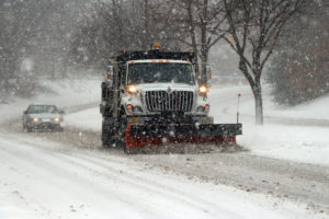
Arlington County snow plowArlington County is bracing for a yet another significant snowstorm, with forecasters calling for up to 8 inches of accumulation Thursday.

Arlington’s Dept. of Environmental Services says they will have all 50 of their snow-clearing trucks ready to clear Arlington’s 974 lane miles of roadway. So far, the department does not have an estimate for when crews will be able to move from clearing main roads to residential streets.

“We are closely monitoring the weather and will have our full resources (approximately 50 trucks) available,” said DES spokeswoman Shannon Whalen McDaniel. “The actual amount of snow that falls and the duration of the event (how long it falls) will dictate when our trucks can move from Phase 2 of clearing Primary Routes to Phase 3 – Residential Streets. We will notify the community when we shift phases.”

Whalen McDaniel said the heavy rain that’s expected today (Wednesday) will make pre-treating roads virtually impossible.

The National Weather Service, meanwhile, has issued a Winter Storm Warning for Arlington and the D.C. area.

… WINTER STORM WARNING REMAINS IN EFFECT FROM MIDNIGHT TONIGHT TO 9 PM EST THURSDAY…

* PRECIPITATION TYPES… WINTRY MIX… THEN ALL SNOW… HEAVY AT TIMES.
* ACCUMULATIONS… SNOW ACCUMULATION OF 4 TO 8 INCHES… ALONG WITH AROUND A TRACE OF ICE.
* TIMING… RAIN CHANGES TO WINTRY MIX AROUND MIDNIGHT THEN ALL SNOW THURSDAY. SNOW HEAVIEST THURSDAY LATE MORNING INTO THE AFTERNOON.
* TEMPERATURES… IN THE UPPER 20S.
* WINDS… NORTH 10 TO 15 MPH WITH GUSTS UP TO 25 MPH.
* IMPACTS… ROADS WILL BE SNOW COVERED… VISIBILITIES WILL DROP TO AROUND A QUARTER-MILE AT TIMES… MAKING TRAVEL DANGEROUS.

PRECAUTIONARY/PREPAREDNESS ACTIONS…

A WINTER STORM WARNING FOR HEAVY SNOW MEANS SEVERE WINTER WEATHER CONDITIONS ARE EXPECTED OR OCCURRING. SIGNIFICANT AMOUNTS OF SNOW ARE FORECAST THAT WILL MAKE TRAVEL DANGEROUS. ONLY TRAVEL IN AN EMERGENCY. IF YOU MUST TRAVEL… KEEP AN EXTRA FLASHLIGHT… FOOD… AND WATER IN YOUR VEHICLE IN CASE OF AN EMERGENCY.


Some 2,750 Dominion customers are reportedly without power in Arlington tonight (Saturday).

The outages appear to be centered around the Clarendon, Virginia Square, Cherrydale and East Falls Church neighborhoods.

Via Twitter, numerous Arlington residents reported seeing the bright flash of a transformer explosion. The East Falls Church outage, meanwhile, is said to be the result of a traffic accident.


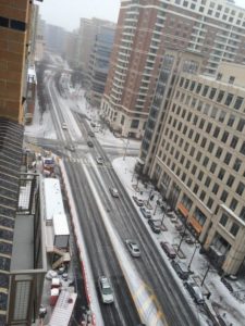
Snow falling in Ballston (photo courtesy @SDfromDC)(Updated at 7:30 p.m.) Snowflakes have started flying across Arlington, marking the beginning of what’s expected to be a significant snowstorm.

A Winter Storm Warning is now in effect, with forecasters calling for 6-10 inches of snow through noon tomorrow (Tuesday).

As of 4:20 p.m., Arlington County said it’s transitioning from a “Phase 1” to a “Phase 2” snow response.

“Snow crews began pre-treating primary and secondary routes earlier today with brine,” according to Arlington Dept. of Environmental Services spokeswoman Shannon Whalen McDaniel. “Most streets had residual brine from Saturday’s event, which will help with the initial snowfall this afternoon. Trucks were also hooked up with plows, chains and spreaders in preparation.”

“We’ll be on full-deployment with approximately 50 trucks until the snow stops tomorrow,” Whalen McDaniel said.

Thanks to frigid temperatures throughout the weekend, snow is sticking on pavement and grassy surfaces. Authorities are asking residents to stay home during the snowstorm, if possible, and plan for treacherous driving conditions in the days following the storm.

Long lines at the Harris Teeter store at Pentagon Row“Virginia State Police is advising all motorists to delay travel plans for tonight and/or Tuesday morning, as roads will be treacherous,” VSP said in a press release. “With the forecasted freezing temperatures, any snow and ice accumulations are expected to stick around for a few days. So it is important to prepare your home, family, and vehicle in advance.”

Long lines are being reported at various Arlington grocery stores. The Harris Teeter at Shirlington, meanwhile, is temporarily closed due to a burst pipe.

MetroAccess service is being suspended as of 6:00 p.m. Monday and will remain suspended Tuesday, according to WMATA. Metrobuses are suspended from 1:00 to 5:00 a.m., then will operate under Metro’s severe snow plan. Metrorail will operate on a Saturday schedule on Tuesday.

Arlington County Police say several accidents have been reported since the snow started falling.

Photo (top) courtesy @SDfromDC


Snowy scene along Columbia Pike (from 1/26/11)(Updated at 4:30 p.m.) The Winter Storm Watch issued for Arlington and the rest of the D.C. area Sunday afternoon has been upgraded to a Winter Storm Warning.

As of Monday morning, forecasters said 6-10 inches of snow may fall overnight. The snow is expected to begin Monday afternoon and wrap up Tuesday morning.

From the National Weather Service:

… WINTER STORM WARNING NOW IN EFFECT UNTIL NOON EST TUESDAY…

* PRECIPITATION TYPE… SNOW.
* ACCUMULATIONS… 6 TO 10 INCHES… WITH LOCALLY HIGHER AMOUNTS EXPECTED ACROSS PORTIONS OF LOWER SOUTHERN MARYLAND.
* TIMING… SNOW WILL INCREASE IN INTENSITY THROUGH THE EVENING HOURS. HEAVIEST SNOW IS EXPECTED LATE TONIGHT INTO EARLY TUESDAY MORNING.
* TEMPERATURES… MID TEENS TO LOWER 20S.
* WINDS… EAST 5 TO 10 MPH.
* IMPACTS… BEGINNING THIS EVENING… ROADS WILL BECOME SNOW COVERED AND SLIPPERY WITH VISIBILITIES BEING REDUCED TO ONE HALF MILE OR LESS AT TIMES. THE COMBINATION OF SNOW COVERED ROADS AND LOW VISIBILITY WILL MAKE TRAVELING DANGEROUS.

PRECAUTIONARY/PREPAREDNESS ACTIONS…

A WINTER STORM WARNING FOR HEAVY SNOW MEANS SEVERE WINTER WEATHER CONDITIONS ARE EXPECTED OR OCCURRING. SIGNIFICANT AMOUNTS OF SNOW ARE FORECAST THAT WILL MAKE TRAVEL DANGEROUS. ONLY TRAVEL IN AN EMERGENCY. IF YOU MUST TRAVEL… KEEP AN EXTRA FLASHLIGHT… FOOD… AND WATER IN YOUR VEHICLE IN CASE OF AN EMERGENCY.


Woman walks through the wind and rain caused by Hurricane Irene (file photo)Today’s sunny and unseasonable warm weather will give way to wind, rain and some strong storms Wednesday.

An approaching cold front will bring the potential for flooding and damaging winds, according to forecasters. Some higher-elevation areas to our west are under a wind advisory starting at 6:00 tonight.

This afternoon, the National Weather Service issued the following advisory for the D.C. area.

A STRONG COLD FRONT WILL IMPACT THE REGION WEDNESDAY INTO EARLY THURSDAY. THE POTENTIAL EXISTS FOR HEAVY RAINFALL AND FLOODING ACROSS THE OUTLOOK AREA. IN ADDITION…A FEW STRONG THUNDERSTORMS CAPABLE OF PRODUCING DAMAGING WIND GUSTS WILL BE POSSIBLE WEDNESDAY AND WEDNESDAY NIGHT.

MINOR COASTAL FLOODING IS LIKELY ALONG THE WESTERN SHORE OF THE CHESAPEAKE BAY AND TIDAL POTOMAC RIVER WEDNESDAY INTO THURSDAY. MODERATE COASTAL FLOODING IS ALSO POSSIBLE AT SENSITIVE SITES WEDNESDAY AND WEDNESDAY NIGHT.

A SMALL CRAFT ADVISORY IS IN EFFECT FOR THE ENTIRE MARYLAND PORTION OF THE CHESAPEAKE BAY AND TIDAL POTOMAC RIVER WEDNESDAY…AND WILL LIKELY NEED TO BE EXTENDED INTO WEDNESDAY NIGHT. GALES ARE ALSO POSSIBLE WEDNESDAY AND WEDNESDAY NIGHT.


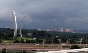
Thunderstorm approaches Arlington, with Rosslyn, the Air Force Memorial and Arlington National Cemetery in the background (file photo)Severe thunderstorms may disrupt outdoor events in Arlington this afternoon and evening.

The National Weather Service has issued a Severe Thunderstorm Watch that’s in effect through 9:00 p.m.

Forecasters say strong storms are possible in the D.C. and Baltimore areas.

From the NWS:

DAMAGING THUNDERSTORMS ARE POSSIBLE THIS AFTERNOON AND EVENING FOR THE BALTIMORE AND WASHINGTON METROPOLITAN AREAS AS WELL AS PORTIONS OF EASTERN WEST VIRGINIA…NORTHERN AND CENTRAL VIRGINIA…AND SOUTHERN MARYLAND. PLEASE MONITOR THIS SITUATION VERY CLOSELY AND ENSURE YOUR NOAA WEATHER RADIOS ARE SET TO ALERT MODE. SEVERE WEATHER WARNINGS MAY BECOME NECESSARY FOR INDIVIDUAL STORMS AND WILL ALERT WEATHER RADIOS IF ISSUED. IF ONE IS ISSUED FOR YOUR AREA…KNOW WHAT TO DO. HERE ARE SOME SAFETY RULES TO KEEP IN MIND WHEN SEVERE WEATHER IS EXPECTED OR IS OCCURRING.

IF A WARNING IS ISSUED FOR YOUR SPOT…HEAD INDOORS IMMEDIATELY. GO TO THE LOWEST FLOOR AWAY FROM WINDOWS. A SEVERE THUNDERSTORM IS DEFINED AS PRODUCING QUARTER SIZE OR GREATER HAIL AND DAMAGING WIND GUSTS OF 58 MPH OR MORE.

STAY TUNED TO NOAA WEATHER RADIO…COMMERCIAL RADIO OR TELEVISION FOR THE LATEST ON THIS POTENTIAL SEVERE WEATHER EVENT. ADDITIONAL WEATHER INFORMATION…CAN BE FOUND AT WEATHER.GOV/WASHINGTON OR WEATHER.GOV/BALTIMORE.


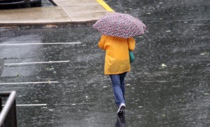
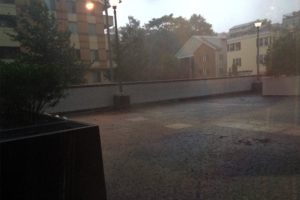
Heavy rain from storm in Arlington on 7/14/14The National Weather Service has issued another Severe Thunderstorm Watch for Arlington and the D.C. area tonight.

The watch is in effect from now until 9:00 p.m. Forecasters say more storms with damaging winds and heavy downpours are possible.

Yesterday a similar watch was issued, and was followed by a storm that knocked out power to more than 5,500 Dominion customers in Arlington County.

From NWS:

THUNDERSTORMS ARE EXPECTED…ESPECIALLY THIS AFTERNOON AND EVENING. THUNDERSTORMS WILL BE CAPABLE OF PRODUCING DAMAGING WIND GUSTS AND HEAVY DOWNPOURS THAT COULD LEAD TO LOCALIZED FLASH FLOODING.


View More Stories