Arlington and the entire D.C. area is under a Tornado Watch through 7:00 tonight.

Forecasters say a line of strong storms will make its way through the area between 1:00 and 7:00 p.m. The storms could produce damaging winds, heavy rains and isolated tornadoes, according to the National Weather Service.

SHOWERS AND THUNDERSTORMS ARE EXPECTED ALONG AND AHEAD OF A COLD FRONT THROUGH THIS EVENING. HEAVY DOWNPOURS COULD LEAD TO LOCALIZED FLASH FLOODING. IN ADDITION…SOME THUNDERSTORMS MAY BE SEVERE AND PRODUCE DAMAGING WIND GUSTS AND ISOLATED TORNADOES. THE MOST LIKELY TIME FOR SEVERE WEATHER LOOKS TO BE FROM 1 PM TO 7 PM.


Arlington County officials are warning of the possibility of severe weather tomorrow.

Forecasters say a cold front is likely to bring high winds and very heavy rain during the afternoon and evening hours.

The National Weather Service is reporting the possibility of widespread showers and thunderstorms expected across Virginia Tuesday into Tuesday night along and ahead of a strong cold front. There is potential for development of strong to severe thunderstorms with threats of damaging winds (10-25 mph with gusts up to 50 mph), isolated tornadoes and periods of heavy rainfall which could cause threat of localized flash flooding, especially Tuesday afternoon and evening. Please pay close attention to your local news and weather media outlets for further information.


Update at 8:45 p.m. — The number of Dominion customers without power in Arlington is currently listed as 5,762.

Update at 4:55 p.m. — Dominion is now reporting 9,262 customers without power in Arlington, mostly in South Arlington.

Update at 4:50 p.m. — The Arlington 9-11 Memorial 5K race is still on, but may follow an alternate route due to flooding on Long Bridge Drive. The race start time may also be slightly delayed, organizers say.

Update at 4:35 p.m. — Traffic on southbound I-395 is backed up from the downed tree near King Street to the area of the Pentagon. Most of the potential for severe weather in the area has now passed, according to forecasters.

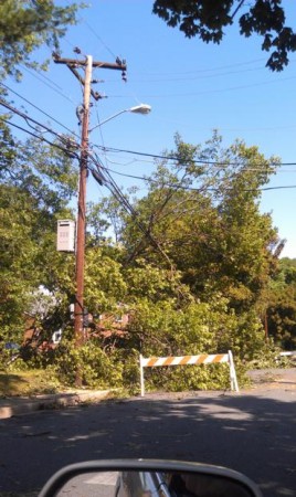
Update at 4:25 p.m. — Numerous trees and power lines are reported down in parts of south and north Arlington. A tree is currently blocking the southbound lanes of S. Eads Street in the area of 12th Street, in Pentagon City.

Update at 4:15 p.m. — At least 1,000 Dominion customers in Arlington are currently without power, mostly in South Arlington along S. Glebe Road and S. Walter Reed Drive.

Update at 4:10 p.m. — A tree is down across all but one lane of southbound I-395 near King Street.

Update at 4:00 p.m. — Arlington County is dispatching a technical rescue for a report of a person trapped under a stage at the Rosslyn Jazz Festival. Update: The individual is no longer trapped and being evaluated by medics.

Arlington County is under a Tornado Warning through 4:15 p.m.

From the National Weather Service:

THE NATIONAL WEATHER SERVICE IN STERLING VIRGINIA HAS ISSUED A

* TORNADO WARNING FOR… CITY OF FALLS CHURCH IN NORTHERN VIRGINIA… SOUTHERN ARLINGTON COUNTY IN NORTHERN VIRGINIA… CITY OF ALEXANDRIA IN NORTHERN VIRGINIA… EASTERN FAIRFAX COUNTY IN NORTHERN VIRGINIA…

* UNTIL 415 PM EDT

* AT 343 PM EDT… A CONFIRMED TORNADO WAS REPORTED NEAR FAIRFAX… AND WAS MOVING EAST AT 50 MPH. THIS TORNADO HAS BEEN CONFIRMED BY COUNTY OFFICIALS.

* LOCATIONS IMPACTED INCLUDE… ALEXANDRIA… HUNTINGTON… CRYSTAL CITY… BALLSTON… THE WOODROW WILSON BRIDGE… REAGAN NATIONAL AIRPORT…

PRECAUTIONARY/PREPAREDNESS ACTIONS…

TAKE COVER NOW. MOVE TO AN INTERIOR ROOM ON THE LOWEST FLOOR OF A STURDY BUILDING AND AVOID WINDOWS. IF OUTDOORS OR IN A MOBILE HOME OR VEHICLE… MOVE TO THE CLOSEST SUBSTANTIAL SHELTER AND PROTECT YOURSELF FROM FLYING DEBRIS.

MOTORISTS SHOULD NOT TAKE SHELTER UNDER HIGHWAY OVERPASSES. AS A LAST RESORT… EITHER PARK AND STAY IN YOUR VEHICLE… OR ABANDON YOUR VEHICLE AND LAY FLAT IN A LOW SPOT.

THIS TORNADO MAY BE WRAPPED IN RAIN AND HARD TO SEE. TAKE COVER NOW.


Update at 3:35 p.m. — Arlington is now under a Severe Thunderstorm Warning through 4:30 p.m.

A Severe Thunderstorm Watch has been issued for the region through 10:00 p.m.

The National Weather Services says an approaching line of storms could bring heavy rain and damaging winds.

A SEVERE THUNDERSTORM WATCH HAS BEEN ISSUED UNTIL 10PM EDT. THUNDERSTORMS ARE EXPECTED THIS AFTERNOON INTO THE EVENING IN ADVANCE OF A COLD FRONT APPROACHING FROM THE WEST. SOME STORMS WILL PRODUCE DAMAGING WIND GUSTS OF UP TO 70 MPH. ISOLATED TORNADOES ARE ALSO POSSIBLE.


Update at 8:25 p.m. — The storm threat appears to have passed.

A line of strong thunderstorms, packing heavy rains and gusty winds, is heading toward Arlington.

The National Weather Service has issued the following Special Weather Statement.

… STRONG THUNDERSTORMS TO AFFECT THE DISTRICT OF COLUMBIA… ARLINGTON… MONTGOMERY… PRINCE WILLIAM… PRINCE GEORGES AND FAIRFAX COUNTIES…

AT 414 PM EDT… STRONG THUNDERSTORMS WERE LOCATED ALONG A LINE EXTENDING FROM 2 MILES NORTHWEST OF DALE CITY TO CAMP SPRINGS… MOVING NORTH AT 20 MPH.

LOCATIONS IMPACTED INCLUDE JEFFERSON MANOR… HUNTINGTON… FOREST HEIGHTS… MORNINGSIDE… WEST SPRINGFIELD… DISTRICT HEIGHTS… SUITLAND-SILVER HILL… SUITLAND… NORTH SPRINGFIELD AND BOLLING AIR FORCE BASE.

HEAVY RAIN WITH THESE STORMS WILL REDUCE VISIBILITIES TO BELOW ONE MILE AND CAUSE PONDING OF WATER ON ROADWAYS.

WIND GUSTS OF 40 MPH CAN BE EXPECTED WITH THESE STORMS.


Arlington County is using the 911 problems following the June 29 derecho as a learning opportunity.

In the days following the storm, which left 1 million customers without power in Virginia, Arlington and Fairfax counties experienced numerous problems with its 911 service, which made 911 unreachable for many emergency callers; some callers got a busy signal after calling 911, others heard nothing.

The problems were traced back to Verizon’s local communications backbone. In a report released last week, Verizon said the 911 problems started as a result of power outages.

Verizon’s central phone facility in Arlington lost power after the storm. It operated for a few hours on battery power, but a generator at the location failed to start (due to fuel line problems) and the facility lost power at 5:00 a.m. on June 30, after the batteries drained. Although Dominion restored power to the facility at 12:45 p.m., it took time for Verizon to recover its “telemetry” systems, which allow it to see and diagnose problems in its phone network, which had been been damaged by falling trees pulling down phone lines.

In Arlington, 911 service was spotty for days, but was deemed restored and stable by July 4.
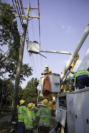
In its report, Verizon said it has learned lessons from its 911 failure and will be improving its generator maintenance and redesigning some of its network systems to improve redundancy and reliability. Arlington County says it, too, has learned lessons from the experience.

Jack Brown, Arlington’s director of emergency management, said he’s hopeful that a 911 failure will never happen again. Should it happen, however, he said the county will have a more defined playbook of how to handle the situation.

During the days after the storm, Arlington advised those with emergencies to call the county’s non-emergency line at 703-558-2222. If all else failed, the county also staffed its fire stations so that residents could walk in and report an emergency. A “couple of people” did end up resorting to walking to fire stations, according to Brown.

Through the county’s efforts and somef luck, Brown said no one in Arlington was seriously harmed as a result of the 911 failure.

“We are very lucky that we didn’t have any life-threatening emergencies that couldn’t get through during that time,” said Brown. “We were very vulnerable during that period.”

In Virginia, a state panel is currently investigating the 911 failures, Brown said. Northern Virginia congressmen also called for the FCC to investigate the problems.

Flickr pool photo by ddimick


Close Call at Reagan National — Three commuter jets nearly collided at Reagan National Airport on Tuesday afternoon due to a communications failure among air traffic control personnel. The planes were about 12 seconds away from a collision when a tower controller corrected her mistake. [Washington Post]

Ebbin Endorses Krupicka — State Sen. Adam Ebbin (D) has endorsed Alexandria Councilman Rob Krupicka (D) in the Sept. 4 special election to fill Del. David Englin’s former 45th District House of Delegates Seat. “[Krupicka] has been a steadfast ally in the fight for true equality, world-class education system, a cleaner environment, smart transportation solutions, and innovative policies that keep our economy strong,” Ebbin said.

Kaine to Visit Arlington Business Today — Democratic U.S. Senate candidate and former Virginia governor Tim Kaine will be visiting Clarendon-based business GridPoint this afternoon. Kaine, who will be joined by Sen. Ron Wyden (D-Ore.), will highlight his “Strengthening Our Economy Through Energy Innovation” plan.

Extreme Weather on the Rise in Va.? — Extreme downpours and snowstorms are happening 33 percent more frequently in Virginia compared to 65 years ago, according to a new report by Environment Virginia. The group says the finding supports the idea that global warming is changing weather patterns. “We need to heed scientists’ warnings that this dangerous trend is linked to global warming, and do everything we can to cut carbon pollution today,” said Environment Virginia Field Organizer Laura Kate Anderson. [Environment Virginia]


The National Weather Service has put Arlington and the surrounding areas under a Severe Thunderstorm Watch until 10:00 p.m. on Saturday. Conditions are favorable for strong storms, so anyone with outdoor plans for this evening should monitor weather reports.

A SEVERE THUNDERSTORM WATCH IS IN EFFECT UNTIL 10 PM FOR THE OUTLOOK AREA. THUNDERSTORMS WILL BE CAPABLE OF PRODUCING DAMAGING WIND GUSTS AND LARGE HAIL.


Arlington and the surrounding region is under a Severe Thunderstorm Watch through early Friday morning. A line of storms approaching the area may bring downpours, lighting and high winds.

From Arlington Alerts:

The National Weather Service has issued a SEVERE THUNDERSTORM WATCH for Arlington County and surrounding suburbs and the District until 1:00 am.

Those with outdoor plans this evening should monitor the skies and be prepared for threatening weather. Lightning is the number one severe weather killer in the US. If you are outdoors and a storm approaches, seek safe shelter indoors.

A SEVERE THUNDERSTORM WATCH means conditions are favorable for severe storms in and close to the watch area. Severe thunderstorms can and occasionally do produce tornadoes with little or no advanced warning. Residents should be on the lookout for threatening weather conditions and listen for later statements and possible warnings.


Arlington is hoping to receive some federal funds to cover the hundreds of thousands of dollars it spent during emergency response to the June 29 derecho storm.

County Manager Barbara Donnellan got the ball rolling by declaring a local emergency on June 30. Nearly 50 other Virginia localities did the same. Yesterday, Governor Bob McDonnell formally requested assistance for the state from the the Federal Emergency Management Agency, estimated at $27.5 million. Now it’s up to President Obama to either approve or deny the disaster funding.

Jack Brown, Director of the Arlington County Office of Emergency Management, explains that to be eligible for federal funds, the county must incur more than around $700,000 in expenses. So far, the bill from the June storm adds up to approximately $802,000, which includes costs for personnel, equipment and debris removal. The total could increase as more numbers are finalized.

Brown offers a reminder that there’s a lot of paperwork and a long review process involved, and that reimbursements filter in gradually once approved.

“They don’t just cut one check for the whole amount,” he said. “We went through this after the huge snowstorms of 2009 and 2010. It’s about a year long process.”

Arlington didn’t get all the funding it requested following those snowstorms, but it fared better than many surrounding jurisdictions, according to Brown. He credits all of the individual departments involved for collecting and sorting the receipts and data that had to be submitted. The county received a total of $1.6 million, covering one storm in December 2009 and two in February 2010.

Although receiving reimbursements often involves an arduous process, Brown said the end result makes up for it.

“Once we know there has been a federal declaration, then we would go through the process with FEMA and the state, and go through all those records,” said Brown. “But it’s worth it at the end of the day.”

For now, Brown said the county continues to calculate its expense requests from the derecho, while waiting for word from the President.

“Other areas of the country were hit harder than we were with different storms, so we’re all just waiting,” said Brown.


A Severe Thunderstrom Watch has been issued for Arlington and the surrounding region through 8:00 p.m.

The National Weather Service says the potential exists for storms and damaging winds this evening.

A SEVERE THUNDERSTORM WATCH IS IN EFFECT UNTIL 800 PM EDT. SHOWERS AND THUNDERSTORMS WILL CONTINUE TO DEVELOP THIS AFTERNOON ALONG AND SOUTH OF A SLOW-MOVING COLD FRONT. SOME STORMS WILL BECOME SEVERE AND WILL BE CAPABLE OF PRODUCING DAMAGING WIND GUSTS AND POSSIBLY LARGE HAIL.


View More Stories