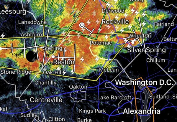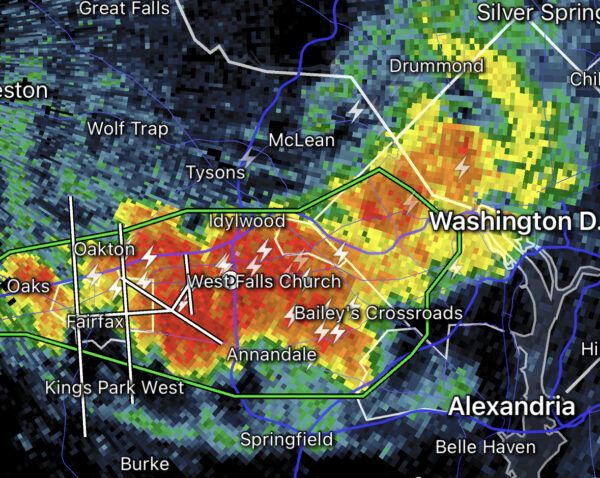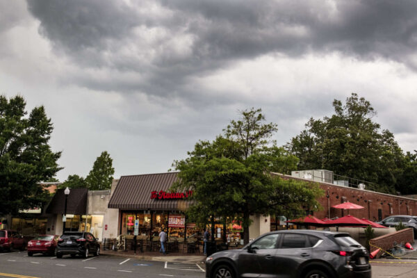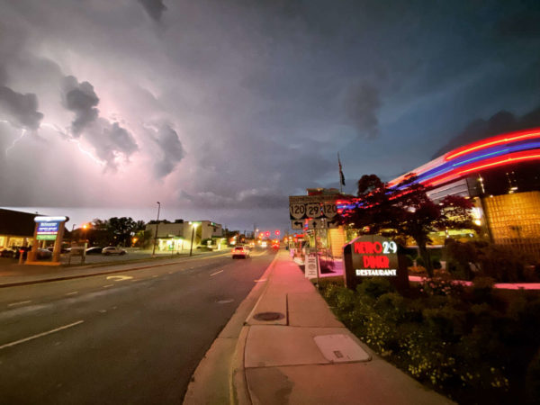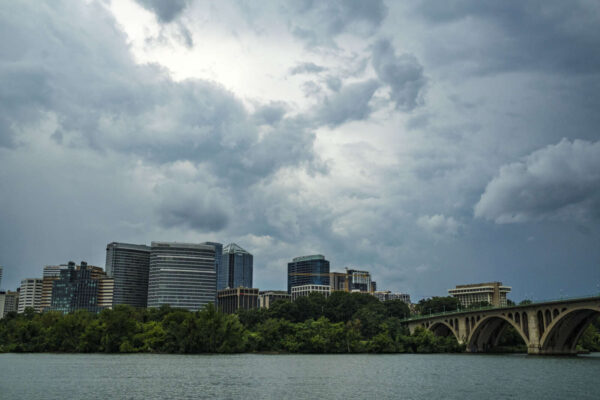
Storm clouds over Rosslyn (staff photo by Jay Westcott)

(Updated at 12:50 p.m.) Arlington, D.C. and other parts of the region are now under both a Severe Thunderstorm Watch and a Flood Watch

The D.C. area is on the southern end of the Severe Thunderstorm Watch area, which runs up the East Coast and includes Philadelphia, New York City, and much of Connecticut. That watch is in effect until 8 p.m.

Strong storms packing frequent lightning, damaging hail and wind gusts up to 70 mph are possible, according to the National Weather Service. Storms are expected later this afternoon and into the evening.

Following the storm watch, NWS issued a Flood Watch for the region as well.

…FLOOD WATCH IN EFFECT UNTIL 8 PM EDT THIS EVENING…

* WHAT…Flash flooding caused by excessive rainfall is possible.

* WHERE…Portions of DC, Maryland and northern Virginia, including the following areas: in DC, District of Columbia. In Maryland, Anne Arundel, Calvert, Cecil, Central and Southeast Howard, Central and Southeast Montgomery, Charles, Prince Georges, Southeast Harford and Southern Baltimore. In northern Virginia, Arlington/Falls Church/Alexandria, Central and Southeast Prince William/Manassas/Manassas Park and Fairfax.

* WHEN…Until 8 PM EDT this evening.

* IMPACTS…Excessive runoff may result in flooding of rivers, creeks, streams, and other low-lying and flood-prone locations.

* ADDITIONAL DETAILS…
– Multiple rounds of thunderstorms are possible this afternoon into this evening. Where multiple thunderstorms occur, rainfall totals on the order of one to three inches are possible in a short period of time.
– Please visit www.weather.gov/safety/flood for flood safety and preparedness information

More from NWS, via Twitter:


Updated at 6:35 p.m. — The Severe Thunderstorm Warning has been extended to southern portions of the county.

Earlier: A northern section of Arlington may get brushed by an intense thunderstorm.

A Severe Thunderstorm Warning has been issued for part of Arlington as a storm approaches from the northwest.

More from the National Weather Service:

BULLETIN – IMMEDIATE BROADCAST REQUESTED
SEVERE THUNDERSTORM WARNING
NATIONAL WEATHER SERVICE BALTIMORE MD/WASHINGTON DC
538 PM EDT FRI JUL 14 2023

THE NATIONAL WEATHER SERVICE IN STERLING VIRGINIA HAS ISSUED A

* SEVERE THUNDERSTORM WARNING […]

* UNTIL 630 PM EDT.

* AT 538 PM EDT, A SEVERE THUNDERSTORM WAS LOCATED OVER AMERICAN LEGION BRIDGE, MOVING EAST AT 35 MPH.

HAZARD…60 MPH WIND GUSTS AND QUARTER SIZE HAIL.

SOURCE…RADAR INDICATED.

IMPACT…DAMAGING WINDS WILL CAUSE SOME TREES AND LARGE BRANCHES TO FALL. THIS COULD INJURE THOSE OUTDOORS, AS WELL AS DAMAGE HOMES AND VEHICLES. ROADWAYS MAY BECOME BLOCKED BY DOWNED TREES. LOCALIZED POWER OUTAGES ARE POSSIBLE. UNSECURED LIGHT OBJECTS MAY BECOME PROJECTILES.

* LOCATIONS IMPACTED INCLUDE… ARLINGTON, ROCKVILLE, BETHESDA, BOWIE, OLNEY, COLLEGE PARK, GREENBELT, LANGLEY PARK, BELTSVILLE, FORESTVILLE, FALLS CHURCH, LARGO, CORAL HILLS, BLADENSBURG, PIMMIT HILLS, MCLEAN, FEDEX FIELD, FORT TOTTEN, ROSSLYN AND UNIVERSITY OF MARYLAND.

PRECAUTIONARY/PREPAREDNESS ACTIONS…

FOR YOUR PROTECTION MOVE TO AN INTERIOR ROOM ON THE LOWEST FLOOR OF A BUILDING.

LARGE HAIL AND DAMAGING WINDS AND CONTINUOUS CLOUD TO GROUND LIGHTNING IS OCCURRING WITH THIS STORM. MOVE INDOORS IMMEDIATELY. LIGHTNING IS ONE OF NATURE’S LEADING KILLERS. REMEMBER, IF YOU CAN HEAR THUNDER, YOU ARE CLOSE ENOUGH TO BE STRUCK BY LIGHTNING.

TORRENTIAL RAINFALL IS OCCURRING WITH THIS STORM, AND MAY LEAD TO FLASH FLOODING. DO NOT DRIVE YOUR VEHICLE THROUGH FLOODED ROADWAYS.


Flash Flood Warning on 7/5/23

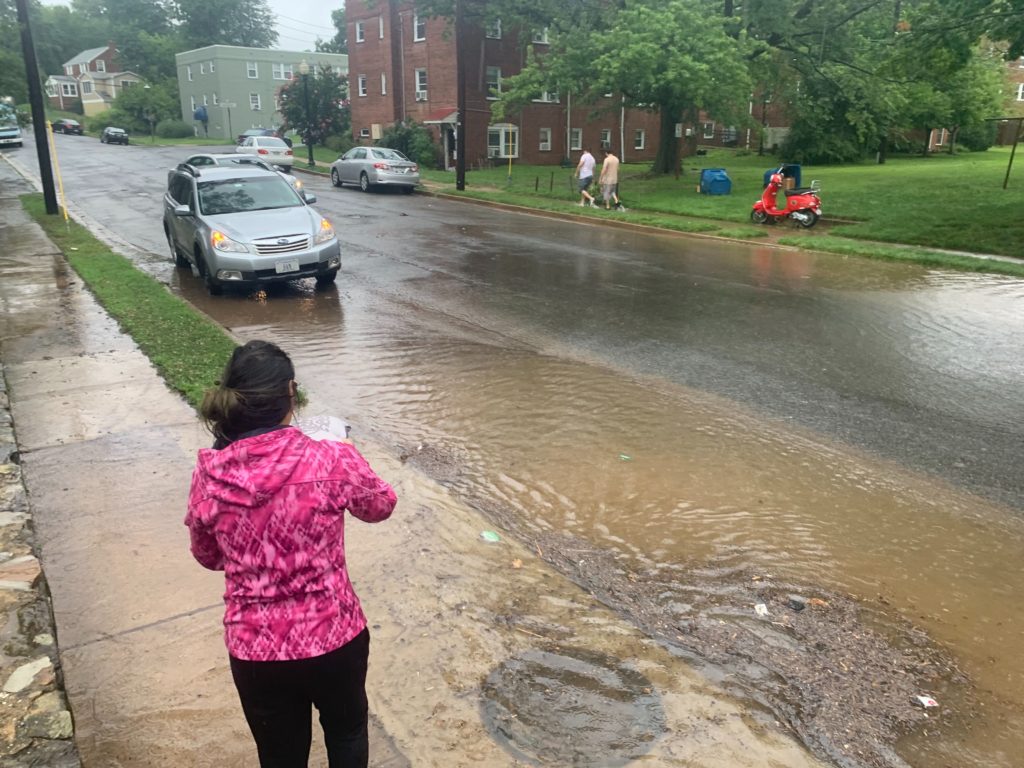
A slow-moving thunderstorm is hovering over northern and western portions of Arlington, prompting a Flash Flood Warning.

The storm is dropping copious amounts of rain, which could cause streams to overtop their banks and basements to flood. The warning is in effect until 6:30 p.m.

The Falls Church area is getting hit particularly hard by the downpour.

More from the National Weather Service:

The National Weather Service in Sterling Virginia has issued a

* Flash Flood Warning for… Western Arlington County in northern Virginia… Central Fairfax County in northern Virginia… The Northwestern City of Alexandria in northern Virginia… The City of Fairfax in northern Virginia… The City of Falls Church in northern Virginia…

* Until 630 PM EDT.

* At 325 PM EDT, Doppler radar indicated thunderstorms producing heavy rain across the warned area. Between 0.5 and 1.5 inches of rain have fallen. Additional rainfall amounts of 1 to 3 inches are possible in the warned area. Flash flooding is ongoing or expected to begin shortly.
HAZARD…Flash flooding caused by thunderstorms.
SOURCE…Radar.
IMPACT…Flash flooding of small creeks and streams, urban areas, highways, streets and underpasses as well as other poor drainage and low-lying areas.


Storm clouds moving in over Westover (staff photo by Jay Westcott)

Arlington and the D.C. area are under a Severe Thunderstorm Watch Monday afternoon and evening.

The watch is in effect until 10 p.m.

From the National Weather Service: “A Severe Thunderstorm Watch is in effect until 10pm. Scattered severe storms capable of producing damaging wind gusts and large hail are possible through this evening. An isolated tornado cannot be ruled out. There is also an isolated threat for flash flooding during this time.”


Storm at 2:15 p.m. on 6/27/23

Update at 3:10 p.m. — So far, only 86 Dominion customers are reported to be without power in Arlington, compared with nearly 2,800 in Fairfax County and the City of Fairfax.

Update at 2:45 p.m. — A particularly intense portion of the storm is over Rosslyn, according to the National Weather Service. Additionally, a tree has been reported down on power lines on the 600 block of N. Kenmore Street in Ashton Heights.

At 240 PM EDT, a severe thunderstorm was located over American University, or over Rosslyn, moving east at 25 mph.
HAZARD…60 mph wind gusts and nickel size hail.
SOURCE…Broadcast media. At 2:25pm a downed tree was reported in Tysons.
IMPACT…Damaging winds will cause some trees and large branches to fall. This could injure those outdoors, as well as damage homes and vehicles. Roadways may become blocked by downed trees. Localized power outages are possible. Unsecured light objects may become projectiles.

Earlier: All of Arlington County is under a Severe Thunderstorm Warning.

A strong storm is currently approaching from the west, packing damaging winds and hail. Most of D.C. is included in the warning, which is in effect until 3 p.m.

More from the National Weather Service:

The National Weather Service in Sterling Virginia has issued a

* Severe Thunderstorm Warning…

* Until 300 PM EDT.

* At 209 PM EDT, a severe thunderstorm was located over Oakton, or over Vienna, moving east at 25 mph.

HAZARD…60 mph wind gusts and quarter size hail.
SOURCE…Radar indicated.
IMPACT…Damaging winds will cause some trees and large branches to fall. This could injure those outdoors, as well as damage homes and vehicles. Roadways may become blocked by downed trees. Localized power outages are possible. Unsecured light objects may become projectiles.

* Locations impacted include…

Arlington, Alexandria, Centreville, Rockville, Bethesda, Reston, Annandale, Clinton, Springfield, Fort Washington, Herndon, Fairfax, Langley Park, Fort Hunt, Vienna, Groveton, Falls Church, Huntington, Mantua and Fort Belvoir.

HAIL THREAT…RADAR INDICATED
MAX HAIL SIZE…1.00 IN
WIND THREAT…RADAR INDICATED
MAX WIND GUST…60 MPH


Lightning over Langston Blvd and Metro 29 Diner (file photo)

Arlington County and the rest of the D.C. region are now under a Severe Thunderstorm Watch.

The watch is in effect until 9 p.m.

Severe storms packing damaging wind gusts and large hail are possible this afternoon and evening, forecasters say. There’s also a threat of flash flooding and a brief tornado.

More from the National Weather Service:

VDOT, meanwhile, says its crews are preparing for the worst.

Earlier today much of the state — including Richmond, Virginia Beach and most of Northern Virginia — were placed under an “enhanced” threat of severe weather by the NWS Storm Prediction Center. That designation is usually only issued once or twice per year for our area.

More, below, from VDOT.

The Virginia Department of Transportation (VDOT) is prepared to address the potential impacts of the forecasted severe weather expected this afternoon and into the evening.

At this time, forecasts indicate that heavy rain and wind gusts will arrive in the Commonwealth between 2 p.m. in western portions of Virginia to midnight in the eastern areas, with regions east of Interstate 81 experiencing the worst conditions. Severe weather threats along and east of the I-95 Corridor could include wind gusts up to 75 mph, large hail and possible isolated tornadoes. The safety of the traveling public and our crews is VDOT’s top priority. As forecasts and conditions could change, travelers should pay close attention to local weather reports and announcements from officials and limit their travels based on conditions.

The weather impacts may cause downed trees, power lines and other debris, as well as flooding that will make roadways extremely hazardous or impassable. Stay away from downed wires and do not approach or touch trees or limbs that are entangled with wires as they could be extremely dangerous. If those are in state maintained roadways, VDOT crews will await the power company to remove any electrical hazard before addressing downed trees or other roadway debris.

“Whenever severe weather is expected, we partner with the Virginia Department of Emergency Management and Virginia State Police to coordinate efforts,” said VDOT Commissioner Stephen C. Brich, P.E. “Teams throughout the Commonwealth are prepared to address impacts from this storm. We ask for the public’s assistance to remain safe and stay aware of changing weather and road conditions in their area and along their travel routes.”

Travelers should use extreme caution on roadways:

  • Obey all “road closed” signage.
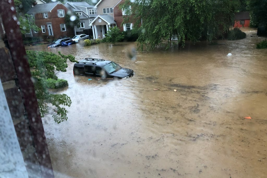
  • “Turn around, don’t drown” – Do not attempt to travel through flooded roadways. According to the Centers for Disease Control, the primary causes of flood-related deaths occur to individuals driving into or walking in or near flood waters.
    • 6 inches of flood water is enough to knock an adult off of their feet
    • 12 inches can move most cars
    • 18-24 inches can carry away most large SUVs, vans and trucks
  • Be alert to debris, downed trees and power lines
  • Move over for emergency crews operating in or near roadways.
  • Be alert to High Wind Advisories, especially on bridges or taller structures. High-profile vehicles such as tractor trailers, SUVs or box trucks are especially vulnerable and should not cross a bridge when a High Wind Advisory is posted.

Prior to travel, the public should check road conditions by calling 511, visiting www.511Virginia.org or checking the 511 Virginia mobile app.


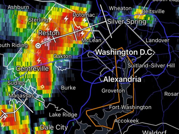
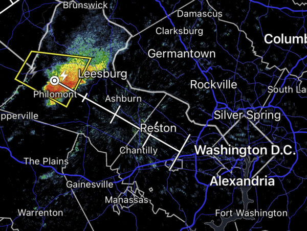
Weather radar as of 4:30 p.m. amid Severe Thunderstorm Watch

Arlington is under one of the few Severe Thunderstorm Watches so far this year.

The watch was just expanded into Arlington and also covers D.C., Alexandria, Falls Church and Fairfax County.

More from the National Weather Service:

A Severe Thunderstorm Watch is in effect for portions of northern VA, southern MD and DC metropolitan areas and adjacent marine waters until 9 PM.

Already, one severe storm out in Loudoun County is currently heading in the general direction of Arlington County.


This spring, Arlington County began buying up properties in the Waverly Hills area to combat flooding.

Already, despite some concerns about how the program would work, three residents have agreed to sell their homes. The county will tear them down and replant the land so water has a place to flow during large rain storms.

All seven Arlington County Board candidates — six of whom are vying for the support of the local Democratic party this primary — say the county needs to change its land-use policies and get more people on board with adding stormwater infrastructure in their backyards, in order to make neighborhoods more resilient to a predicted increase in flooding.

“The July 2018 and 2019 floods in particular really drove this home for us — we had some real life-safety issues pertaining to flooding,” Susan Cunningham said in a forum hosted by nonprofit advocacy group EcoAction Arlington last week.

“[It] highlighted that, not only because of climate change but really because of lack of long-range planning, we have very outdated stormwater management systems that we don’t have a budget to improve,” she continued. “We do have a lot of catch up to do.”

Since the floods, Arlington County has taken steps to manage stormwater beyond buying homes for flood relief.

Starting next year, Arlington will fund its stormwater management plan with a stormwater utility fee. The county will charge property owners a rate based on how much of their property is covered in hard surfaces, like roofs and driveways. (Currently, it is funded by a tax based on property assessments.)

Other changes include new regulations requiring single-family home construction projects to retain more water and some $90 million in bond referenda from 2020 and 2022 for stormwater projects.

Developers of single-family homes report higher construction costs due to retention regulations. Bonds and the new stormwater utility fee, meanwhile, could spell higher taxes for residents.

So, in this race, some candidates say the county should examine how its own policies encourage flooding before requiring more of residents.

Cunningham and Natalie Roy, both of whom have opposed the recently adopted Missing Middle zoning changes, that starts with reducing the allowable buildable area that homes can occupy on a lot.

“This is something that we should’ve done 10 years ago and definitely something we should have done before approving the misguided [Missing Middle] plan,” Roy said.

Perennial independent candidate Audrey Clement said she would call for the repeal of Missing Middle, linking the new policy to tree loss and thus, increased flooding.

She said she would also end a practice among developers to subdivide lots to circumvent state environmental ordinances preventing construction near protected land along Arlington streams called “resource protection areas,” or RPAs.

“It was by this sleight of hand that the county permitted a tear-down McMansion in a North Arlington RPA in 2018 but also the destruction of a 100-foot state champion redwood on the same lot,” she said.

(more…)


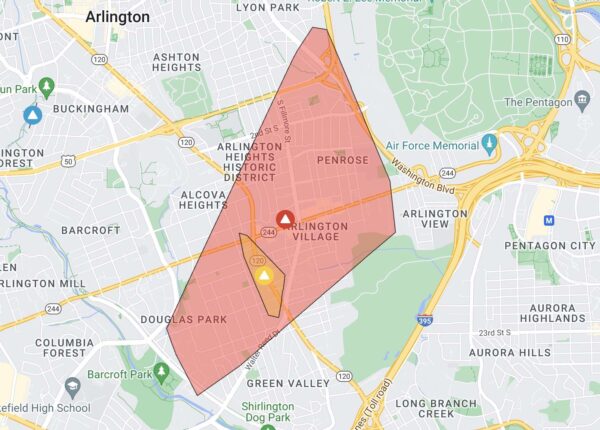
Arlington power outages 4/22/23 (via Dominion)

Just over 5,000 Dominion customers were without power Saturday afternoon, according to the power company’s website.

The large outage, centered around Columbia Pike but running from Douglas Park in the south to Lyon Park in the north, is the result of storm damage, Dominion said. A line of thunderstorms with gusty winds and heavy rain rolled through Arlington prior to the outage.

A total of 5,044 customers were affected as of 2:45 p.m.

Dominion reported nearly 20,000 outages throughout Northern Virginia following the storms. The good news is that an earlier Severe Thunderstorm Watch has been dropped for Northern Virginia locales, suggesting that the worst of the storms is over.

Update at 7:20 p.m. — Power has mostly been restored after an hours-long outage. Fewer than 250 homes and businesses in Arlington remain in the dark as night falls, according to Dominion.


Arlington County is poised to purchase two additional homes for stormwater management in the Waverly Hills neighborhood.

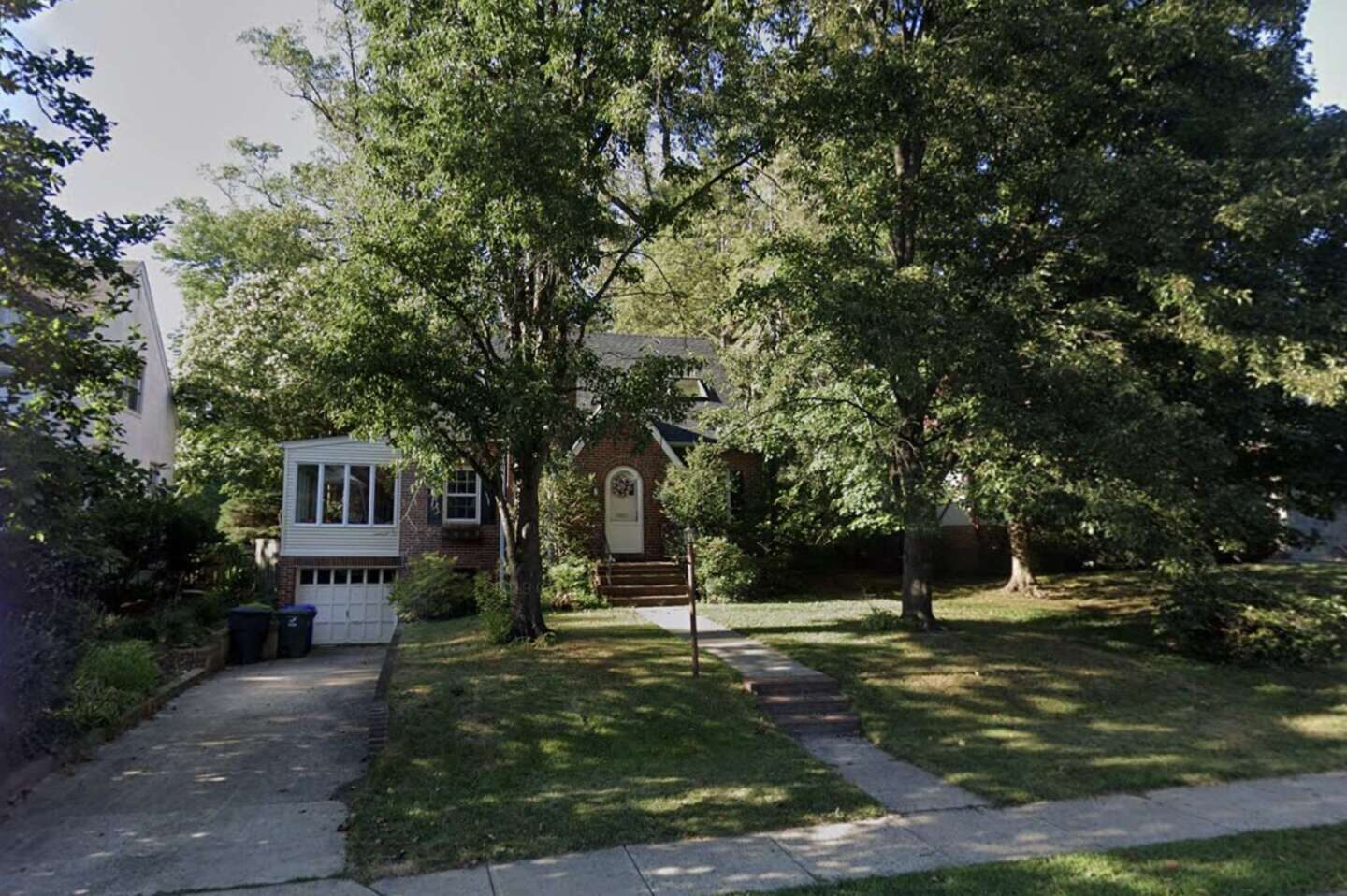
The pair of homes are a few doors down from the first home it purchased last month on 18th Street N.

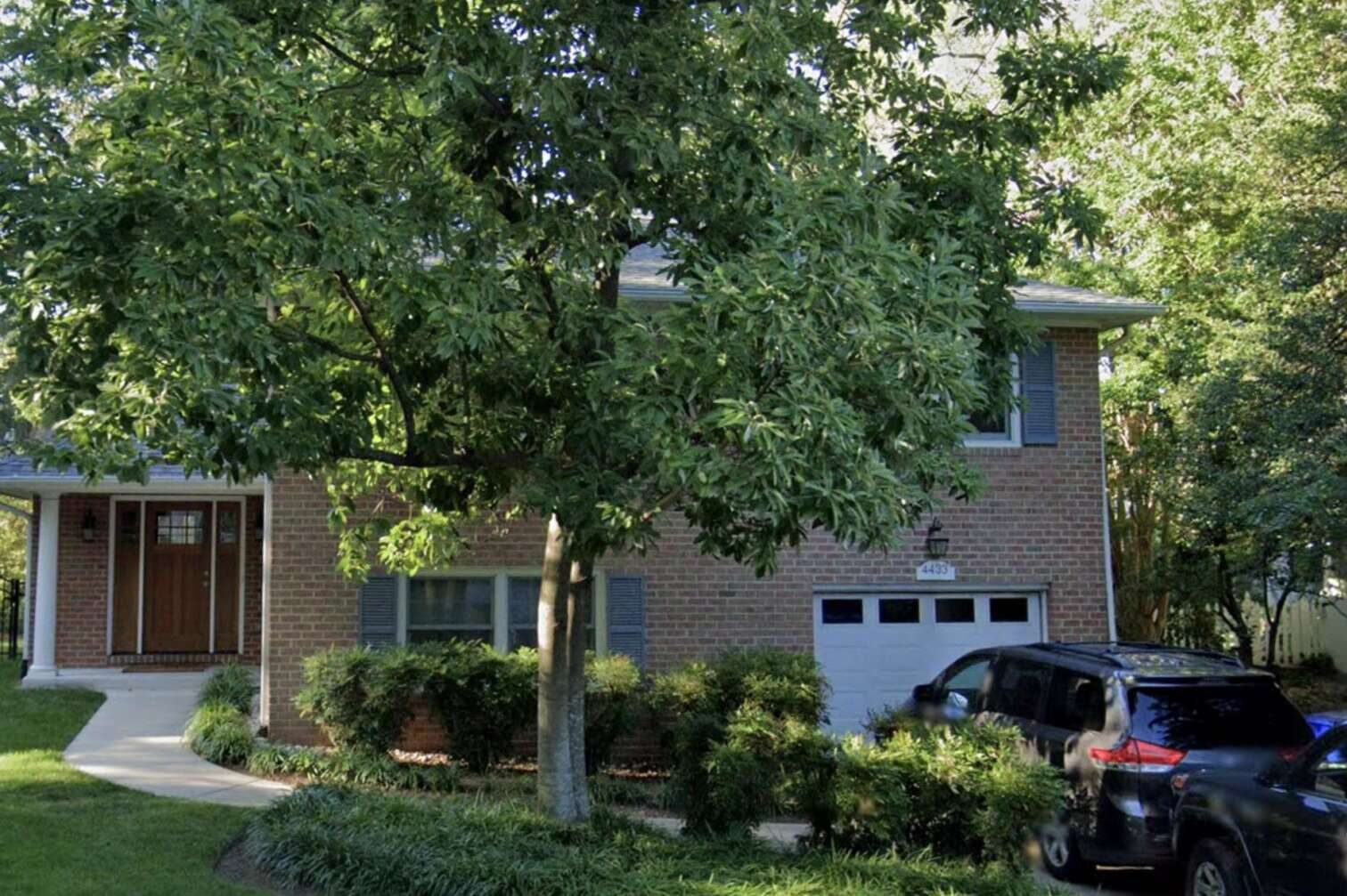
The county will pay $1 million for the home at 4423 18th Street N. and $1.3 million for the other at 4433 18th Street N., per county reports prepared for each sale contract. The Arlington County Board is set to review these contracts during its meeting on Saturday.

The two will be torn down for $350,000 apiece and the land will be replanted to create green spaces that will act as overland relief — essentially a safe pathway for water to flow during large flooding events, such as the floods of July 2019. Such flooding events have particularly impacted the Spout Run watershed, where the county is targeting its land acquisition efforts.

Neither home has a historic designation nor architectural significance but staff from the county’s Historic Preservation Program recommend that viable parts of the home be salvaged and photos taken of the interior and exterior for the program’s archives.

Sales are expected to be settled in about five months and the residents will have two months beyond that to move out.

Arlington County previously told residents of the Waverly Hills and Cherrydale neighborhoods it is considering several stormwater management strategies but voluntary property acquisition will be “necessary” for reducing flood risk.

At the time, it said it would first focus its efforts on the Waverly Hills neighborhood and touted benefits of selling to the county such as lower closing costs and peace of mind.


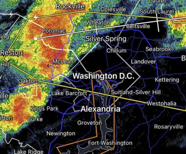
Radar image of incoming storm

A strong storm is approaching Arlington from the west, prompting a Severe Thunderstorm Warning — the first of the year.

From the National Weather Service:

The National Weather Service in Sterling Virginia has issued a

* Severe Thunderstorm Warning for… The District of Columbia… Southeastern Montgomery County in central Maryland… Northern Prince Georges County in central Maryland…

Arlington County in northern Virginia… The City of Falls Church in northern Virginia… Northeastern Fairfax County in northern Virginia…

* Until 700 PM EDT.

* At 617 PM EDT, a severe thunderstorm was located over Tysons Corner, or over American Legion Bridge, moving east at 40 mph.
HAZARD…60 mph wind gusts.
SOURCE…Radar indicated.
IMPACT…Damaging winds will cause some trees and large branches to fall. This could injure those outdoors, as well as damage homes and vehicles. Roadways may become blocked by downed trees. Localized power outages are possible. Unsecured light objects may become projectiles….

HAIL THREAT…RADAR INDICATED
MAX HAIL SIZE…<.75 IN
WIND THREAT…RADAR INDICATED
MAX WIND GUST…60 MPH


View More Stories