Last night’s sleet and snow seems to have pulled off the trick of actually improving traffic.

Right now it’s clear sailing in Arlington on I-395, I-66, Route 1, Route 50 and Columbia Pike. Traffic volume has remained light and no major problems are reported.

Many side streets are still covered in a thin frozen glaze, but are passable.

The storm, which left less than an inch of accumulation, prompted Arlington Public Schools to open on a two-hour delay. The county and federal governments are open with an option for unscheduled leave or telework.


Drive across the county today and you see the same scene repeated over again.

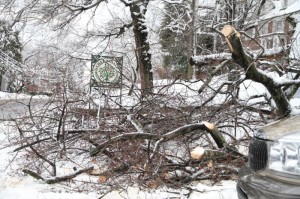
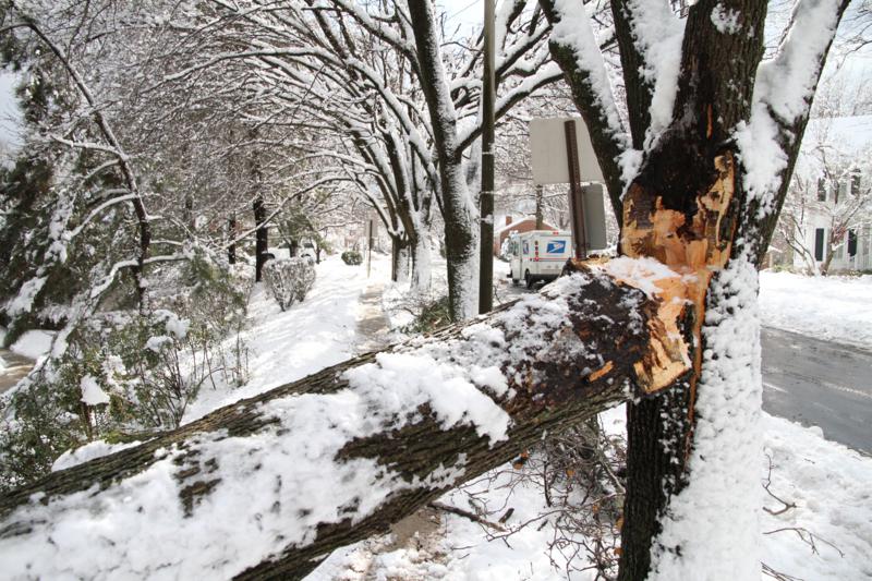
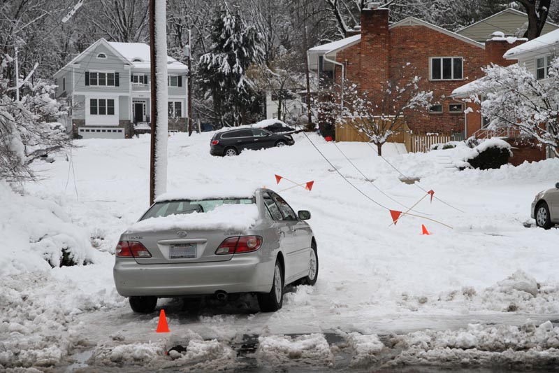
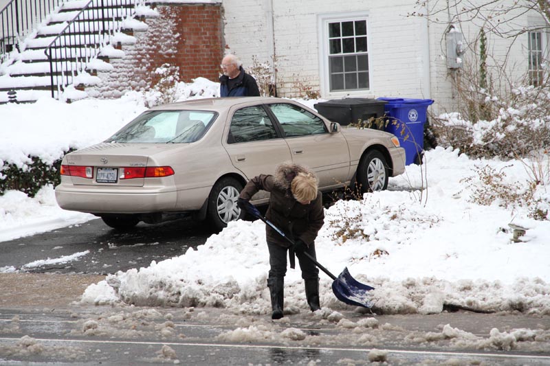
Tree limbs down the the score. Fallen utility lines coned off and marked with orange flags. Neighbors out with shovels and snow blowers. Kids, off from school, toting around plastic sleds. Stretches where power and traffic lights were out (including a busy section of Lee Highway between Kirkwood and Veitch). Police and firefighters responding to call after call after call.

In the aftermath of what caused so much frustration last night were more glimpses of the good that snow brings out in many of us. On side streets, many of those neighbors with shovels and snow blowers were out helping to clear the still un-plowed roads. Others could be seen clearing public sections of sidewalk so others didn’t have to walk in the street.

From reader Ann B.:

I have to give a shout out to two great neighbors today.

I’ve lived near the corner of N. Adams and Lee HWY for over 6 years now. This morning, two neighborhood guys actually shoveled the snow from the southeast corner to the bus shelter on Lee. This is one of the few times this has ever happened in 6 years.

I had a young one with me and it made all the difference. It’s nice to see neighbors giving a hand!

(Reminder: Per the county’s snow removal ordinance, property owners must clear their sidewalks by early tomorrow morning.)

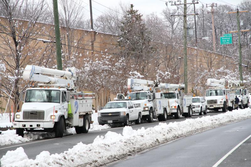
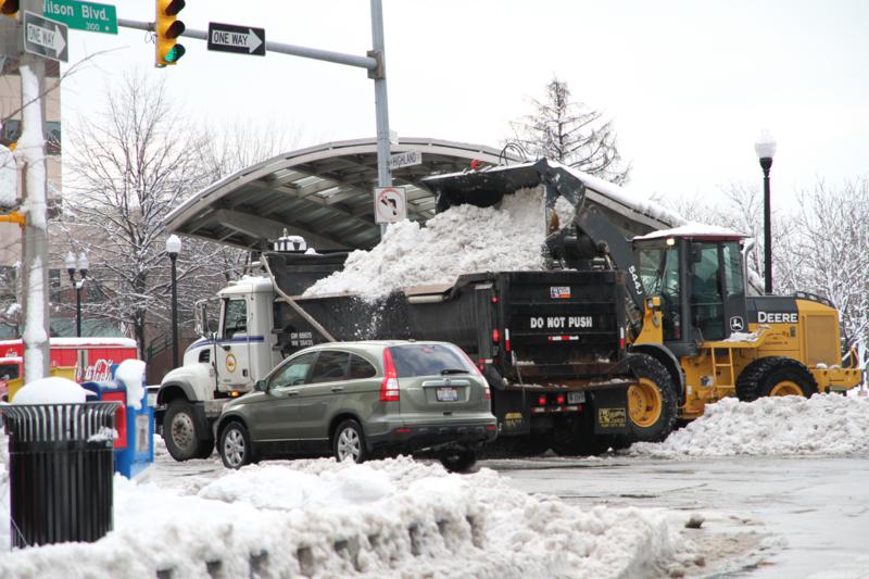
Although it was difficult to find a navigable place to park in many parts of the county, here are some of the photos we managed to snap around North Arlington this afternoon.


It has been about 16 hours since the snow stopped falling, yet firefighters are still responding to non-stop calls of wires and trees down around the county. The workload speaks to just how widespread the damage from last night’s snow storm really was.

Dominion has been out in force, working furiously to restore service to the thousands of customers who lost power last night. As of 3:45 p.m., the number without power in Arlington has been cut to 6,700 — down from 16,700 last night.

Most Dominion customers in Arlington should have their power restored at some point tonight. Still, Dominion says 10 percent of affected customers will have to wait until Friday night for the lights to come back on. And the company doesn’t expect to have power restored to all Northern Virginia customers until Saturday.

“We have about 2,000 workers engaged in our restoration effort, including crews from Eastern and Central Virginia and North Carolina assisting in Northern Virginia,” Dominion executive Rodney Blevins said in a statement. “Please stay clear of downed lines and use extreme caution if you must be on the roads where snow, abandoned vehicles and downed trees could be affecting traffic patterns.”

More than 300 bucket trucks are working to restore power to the nearly 192,000 Northern Virginia customers who lost power last night, Dominion said.


Arlington County snow crews are finalizing plans to tackle the winter storm that’s predicted to hit the region tomorrow evening.

Employees from the county’s Water Sewer Streets Bureau will be divided up into two teams that will work 12-hour, round-the-clock shifts starting tomorrow before the storm’s arrival.

Snow-clearing equipment will be readied tomorrow morning, with crews getting on the road by mid-afternoon, according to Department of Environmental Services spokeswoman Myllisa Kennedy.

County plows will continue clearing roads throughout the overnight hours, Kennedy said.


A winter storm watch has been issued for Arlington (and the rest of the Washington region) tomorrow.

Forecasters are calling for snow to start falling tomorrow afternoon, with accumulations of five or more inches possible.

… WINTER STORM WATCH IN EFFECT FROM WEDNESDAY AFTERNOON THROUGH LATE WEDNESDAY NIGHT…

THE NATIONAL WEATHER SERVICE IN BALTIMORE MD/WASHINGTON HAS ISSUED A WINTER STORM WATCH… WHICH IS IN EFFECT FROM WEDNESDAY AFTERNOON THROUGH LATE WEDNESDAY NIGHT.

* PRECIPITATION TYPE… BECOMING ALL SNOW DURING LATE AFTERNOON AND EVENING.

* ACCUMULATIONS… 5 OR MORE INCHES OF SNOW POSSIBLE.

* TIMING… SNOW STARTING DURING THE LATE AFTERNOON AND EARLY EVENING. ENDING AFTER MIDNIGHT FROM SOUTHWEST TO NORTHEAST WEDNESDAY NIGHT.

* TEMPERATURES… MID TO UPPER 30S WEDNESDAY… DROPPING TO THE LOWER 30S BY THE EVENING. THE UPPER 20S WEDNESDAY NIGHT.

* WINDS… NORTHEAST 10 TO 15 MPH WEDNESDAY… BECOMING NORTHWEST AROUND 15 MPH WEDNESDAY EVENING.

PRECAUTIONARY/PREPAREDNESS ACTIONS…

A WINTER STORM WATCH MEANS THERE IS A POTENTIAL FOR SIGNIFICANT SNOW… SLEET… OR ICE ACCUMULATIONS THAT MAY IMPACT TRAVEL. CONTINUE TO MONITOR THE LATEST FORECASTS.


Update at 2:00 p.m. — The winter storm warning has been dropped. Arlington is now expected to just get a dusting of snow.

Update at 3:00 a.m. — It now appears that the storm will be smaller than anticipated locally.

The Arlington Office of Emergency Management has broadcast the following alert about the snowstorm that will be impacting the Washington area tomorrow.

The National Weather Service has issued a Winter Storm Warning for NCR, effective from 6AM Sunday to 6AM Monday. Currently, the anticipated amount of snowfall is 6-7 inches. However, the area is right on the borderline between receiving a direct hit by the storm, and only receiving moderate snow, so anywhere from 3-10 inches should be anticipated. Light snow will start early Sun morning, and become heavier from mid-morning to early evening. High temp 30. Snow will taper off at night, but winds will pick up. Low 23. Monday will provide clearing but with windy conditions, and possibly blowing snow. High 31.

Arlington OEM would like to offer the following tips:

-Drive only if it is absolutely necessary. If you must drive, stay on main roads, and avoid back roads and alleys.

-Avoid overexertion when shoveling snow. Overexertion can bring on a heart attack—a major cause of death during the winter.

-Listen to your radio, television or NOAA Weather Radio for weather reports and emergency information.

-Dress for the weather. Wear several layers of loose fitting, lightweight, warm clothing rather than one layer of heavy clothing. Wear mittens, a hat and cover your mouth with a scarf to protect your lungs.

-Watch for signs of frostbite (skin appears white and waxy, numbness or no feeling) and hypothermia (shivering, confusion or dizziness, slow or slurred speech). Go to a medical facility immediately if you or someone you know is experiencing these symptoms.


So far, so good, at least for Arlington. There are no reports of significant damage or widespread power outages in the county as a result of this morning’s nasty weather.

As of 7:20 a.m., Dominion is reporting 115 customers without power in Arlington.

Compare that to the nearly 10,000 Dominion customers without power in Fairfax County.

Update at 9:00 a.m. — There are now a mere 8 power outages in Arlington County.


This morning’s heavy rain and high winds have prompted the National Weather Service to issue a number of alerts and advisories for Arlington and the surrounding area:

Tornado Watch:

THE NATIONAL WEATHER SERVICE HAS ISSUED TORNADO WATCH 762 IN EFFECT UNTIL 10 AM EST THIS MORNING FOR THE FOLLOWING AREAS

ABERDEEN… ALEXANDRIA… ANNAPOLIS… ARLINGTON… BALTIMORE… BEL AIR… BERRYVILLE… CHANTILLY… CHARLES TOWNN… CHESAPEAKE BEACH… COLUMBIA… CULPEPER… EDGEWOOD… FAIRFAX… FALLS CHURCH… FALLSTON… FREDERICK… FRONT ROYAL… GAITHERSBURG… HAGERSTOWN… HAVRE DE GRACE… JOPPATOWNE… LAUREL… LEESBURG… LURAY… MADISON… MANASSAS… MANASSAS PARK… MARTINSBURG… MCLEAN… RESTON… ST MARYS… STANARDSVILLE… STERLING… TOWSON… WALDORF… WARRENTON… WASHINGTON… WASHINGTON… WESTMINSTER… WINCHESTER… WINCHESTER AND WOODBRIDGE.

Wind Advisory:

… WIND ADVISORY REMAINS IN EFFECT UNTIL 11 AM EST THIS MORNING…

A WIND ADVISORY REMAINS IN EFFECT UNTIL 11 AM EST THIS MORNING.

* TIMING… GUSTS WILL CONTINUE THROUGH MID MORNING. GUSTS WILL SUBSIDE BEFORE NOON.

* WINDS… SOUTHEASTERLY WIND GUSTS OF 45-50 MPH.

PRECAUTIONARY/PREPAREDNESS ACTIONS…

A WIND ADVISORY MEANS THAT WIND GUSTS IN EXCESS OF 45 MPH ARE EXPECTED. WINDS THIS STRONG CAN MAKE DRIVING DIFFICULT… ESPECIALLY FOR HIGH PROFILE VEHICLES. USE EXTRA CAUTION.

Special Weather Statement:

… HEAVY RAIN TO AFFECT THE DISTRICT OF COLUMBIA… ARLINGTON… MONTGOMERY… PRINCE GEORGES… CALVERT… STAFFORD… LOUDOUN… PRINCE WILLIAM/MANASSAS/MANASSAS PARK… CHARLES AND FAIRFAX COUNTIES…

AN AREA OF RAIN WITH EMBEDDED VERY HEAVY DOWNPOURS WILL MOVE OVER THE WASHINGTON METROPOLITAN AREA DURING THE MORNING COMMUTE. RAINFALL RATES OF UP TO 1 INCH PER HOUR WILL SIGNIFICANTLY REDUCE VISIBILITY AND WILL CAUSE PONDING OF WATER ON ROADWAYS AND OTHER LOW LYING AREAS. MOTORISTS ARE URGED TO USE CAUTION.

Flash Flood Watch:

… FLASH FLOOD WATCH REMAINS IN EFFECT UNTIL 1 PM EST THIS AFTERNOON…

THE FLASH FLOOD WATCH CONTINUES FOR

* PORTIONS OF MARYLAND… THE DISTRICT OF COLUMBIA AND VIRGINIA.

* UNTIL 1 PM EST THIS AFTERNOON

* A COLD FRONT WILL MOVE THROUGH THE MID-ATLANTIC REGION THIS MORNING. RAIN AMOUNTS OF ONE TO TWO INCHES ARE EXPECTED. THIS AMOUNT OF RAIN MAY CAUSE SMALL STREAMS AND CREEKS TO RISE OUT OF THEIR BANKS.

PRECAUTIONARY/PREPAREDNESS ACTIONS…

A FLASH FLOOD WATCH MEANS THAT CONDITIONS MAY DEVELOP THAT LEAD TO FLASH FLOODING. FLASH FLOODING IS A VERY DANGEROUS SITUATION.

MONITOR LATER FORECASTS AND BE PREPARED TO TAKE ACTION SHOULD FLASH FLOOD WARNINGS BE ISSUED.

(more…)


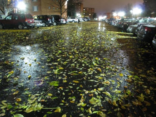
Be Careful Commuting This Morning — A thunderstorm packing driving rain and high winds swept through the area overnight, causing trees and power lines to fall and coating local sidewalks and roadways with wet leaves. The leaves could make for slick conditions for cyclists, pedestrians and drivers alike this morning. More on the storm damage, including this morning’s closure of George Mason Drive, here.

Whitlow’s Hopes to Open Rooftop Deck by Thanksgiving — Whitlow’s owner Greg Cahill tells TBD that he hopes to have his new rooftop bar, Wilson’s on Whitlow’s, open in one or two weeks. Cahill is working hard to open in time for Thanksgiving eve, traditionally one of the busiest nights for bars. Bring your coat.

Meet Arlington’s County Manager — Barbara Donnellan, Arlington’s (relatively) new county manager, will participate in a public forum with the local League of Women Voters tonight. Donnellan “will speak about challenges facing the County and her plans for the County’s future,” according to an invitation. The forum will be held from 6:45 p.m. to 8:00 p.m. in the third-floor county board room at 2100 Clarendon Blvd.


(Updated at 3:15 a.m.) A brief but intense thunderstorm ripped through Arlington around 12:45 this morning, bringing with it high winds and driving rain.

A 54 mile per hour wind gust was recorded at Reagan National Airport during the storm, which covered area roadways with wet leaves and, in some cases, trees and utility lines. As of 3:10 a.m., 2,400 Dominion customers were without power in Arlington.

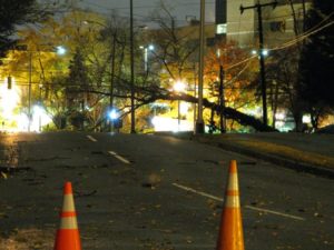
The most significant damage was reported in Arlington’s Tara-Leeway Heights neighborhood, near Virginia Hospital Center. Downed trees and utility lines blocked numerous side streets, which were darkened by the power outage. County tree crews were out in the neighborhood with chainsaws and wood chippers at 2:30 this morning.

A large tree and live power lines also fell across George Mason Drive, next to the hospital. Police have shut down George Mason Drive between Washington Boulevard and 15th Street while Dominion cleans up the mess. The road is expected to remain closed through the morning rush hour.

Storm damage was reported in the following locations:

  • 1600 block of North George Mason Drive
  • 1900 block of North Glebe Road
  • 1400 block of North Greenbrier Street
  • 5500 block of 14th Road North
  • 1300 block of North Illinois Street
  • 1600 block of North Harrison Street
  • 1800 block of South Monroe Street
  • 2900 block of 16th Road South

Update at 9:55 a.m. — The number of Dominion customers without power is now below 300. However, the medical offices of Virginia Hospital Center (not the hospital itself) are among those in the dark. Dominion spokesperson Le-Ha Anderson says crews hope to have power restored there within an hour.

Update at 10:00 a.m. — WJLA meteorologist Adam Caskey says that after analyzing radar data, he believes there’s a slight possibility that a tornado hit part of Arlington.
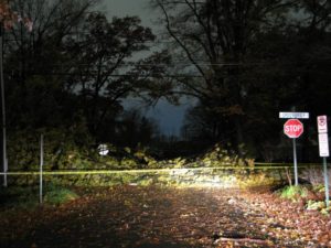
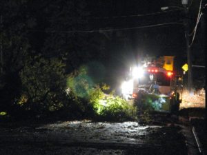
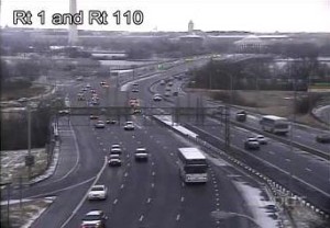
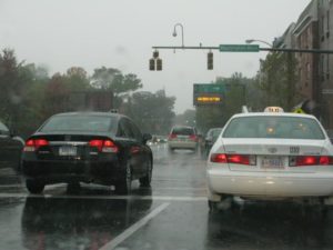
(Updated at 3:00 p.m.) Driving rain and high winds knocked out power, flooded roads and led to numerous accidents in Arlington this morning.

Parts of Ballston and the area around Lee Highway and North Glebe Road lost power during the storm. A storm-related electrical fire in the parking garage of the National Science Foundation building caused dozens of workers to be evacuated. As of 2:50 p.m., the Arlington Central Library was still without power.

During the storm, several accidents were reported on I-66 and elsewhere.

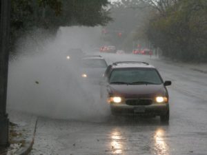
On Washington Boulevard near Utah Street, north of Ballston, standing water in one of the far lanes caused a big splash as cars drove through it. Further up the street, at the intersection with Glebe Road, a backup formed as traffic lights flashed yellow.

The National Weather Service has issued a flash flood warning until 4:15 this afternoon, and a tornado watch until 9:00 tonight.

Update at 3:05 p.m. — Central Library has closed until further notice due to the lack of power and phone service.

Update at 3:55 p.m. — The tornado watch has been canceled.

Update on 10/28 — More about the Ballston power outages here.


View More Stories