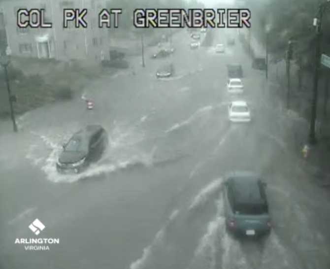
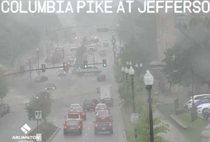
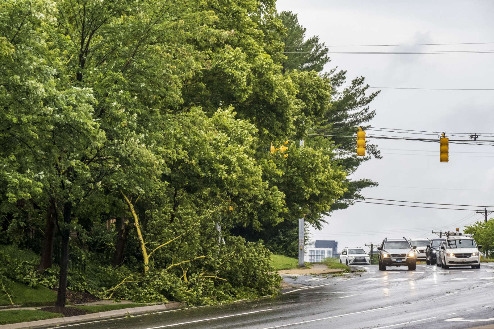
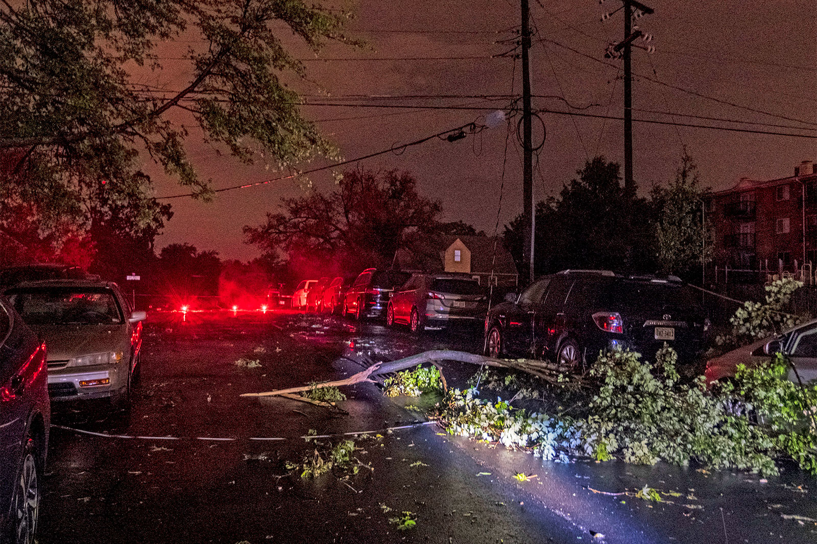
High water in the roadway on Columbia Pike at S. Greenbrier Street
High water in the roadway on Columbia Pike at S. Greenbrier Street
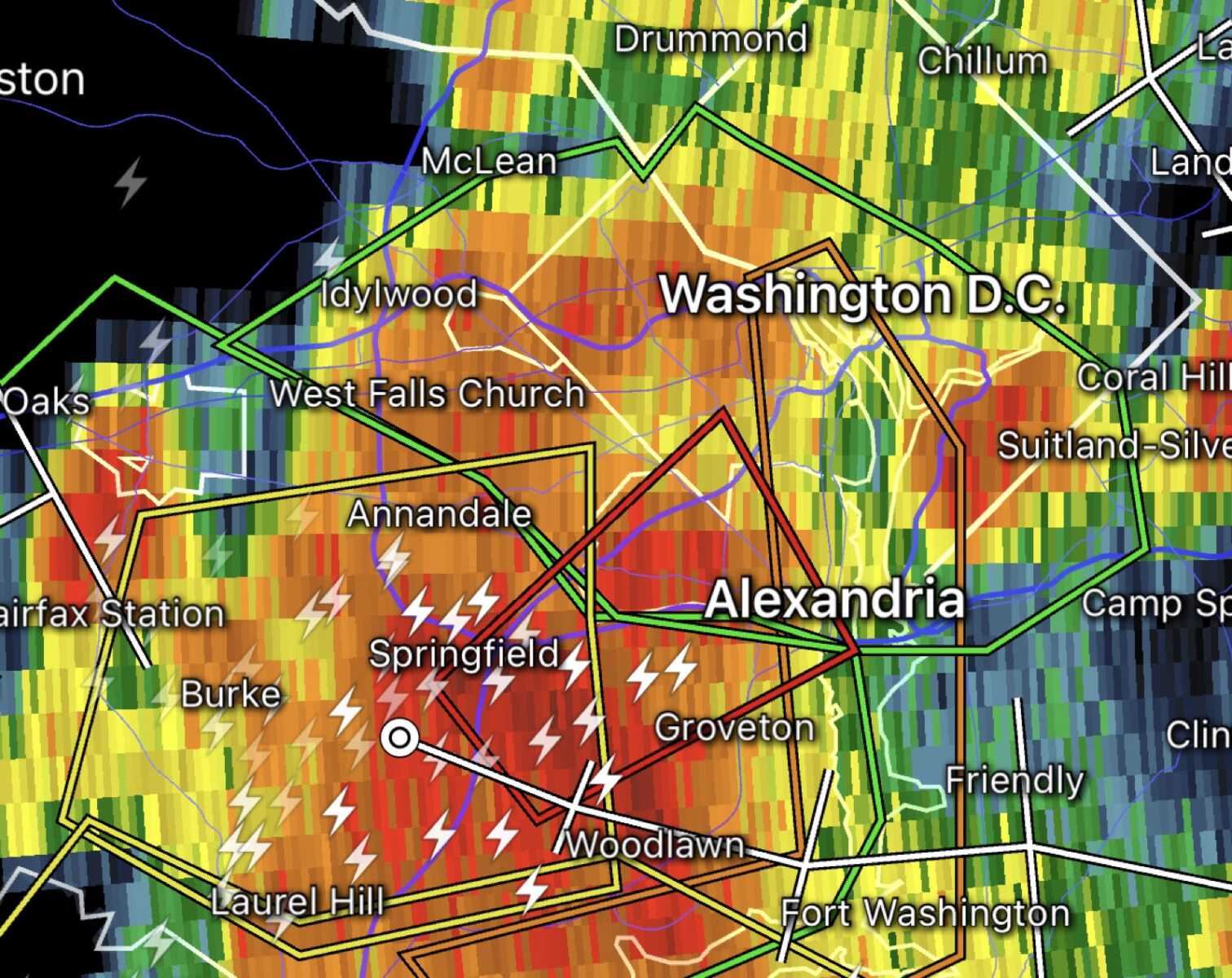
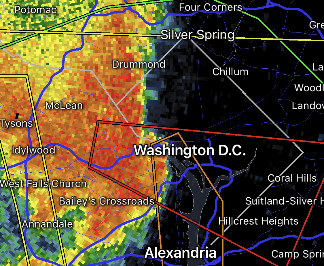
Tornado and Flash Flood Warnings as of 4:20 p.m. on Aug. 14, 2023
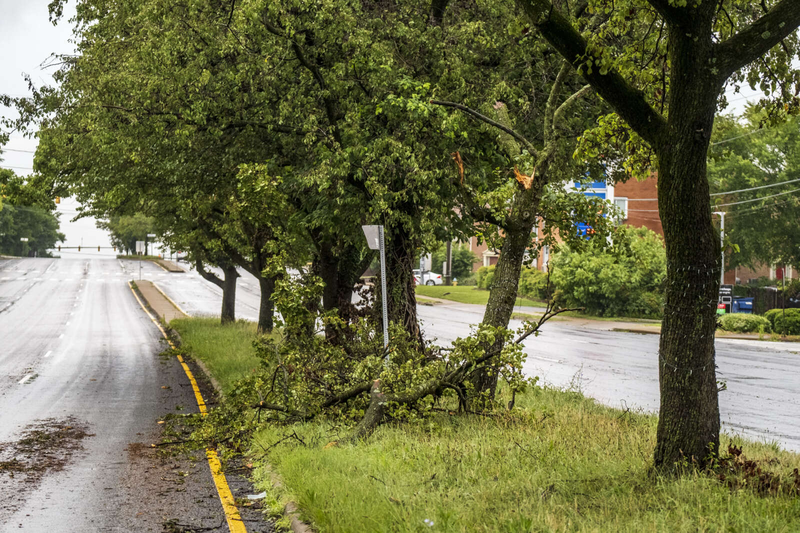
(Updated at 5:25 p.m.) A Tornado Warning was issued for part of Arlington and the entire county is under Flash Flood and Severe Thunderstorm warnings.
The warnings were all initially issued between about 4:15-4:25 p.m., with forecasters saying there was imminent danger of a tornado in parts of South Arlington and flash flooding throughout the county.
The Tornado Warning was cancelled shortly after 4:30 p.m., though the other warnings remained in effect and have since been updated with newer information.
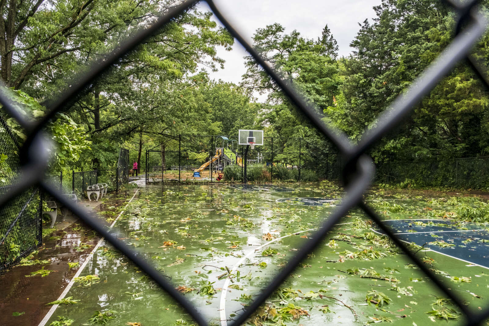
As of 4:50 p.m. flooding could be seen occurring on Columbia Pike at S. Greenbrier Street — a frequent problem spot — with high standing water in the roadway and some motorists trying to drive through it while others were seen turning around. As of 5 p.m. much of the water had receded.
More on the flash flooding from the National Weather Service:
The National Weather Service in Sterling Virginia has issued a
* Flash Flood Warning for… Southeastern Arlington County in northern Virginia… Southeastern Fairfax County in northern Virginia… The City of Alexandria in northern Virginia…
* Until 745 PM EDT.
* At 436 PM EDT, emergency management reported thunderstorms producing heavy rain in in the Springfield area. Between 1 and 3 inches of rain have fallen. Additional rainfall amounts of 0.5 to 1 inch are possible in the warned area. Flash flooding is already occurring.
HAZARD…Life threatening flash flooding. Thunderstorms producing flash flooding.
SOURCE…Emergency management reported.
IMPACT…Life threatening flash flooding of creeks and streams, urban areas, highways, streets and underpasses.
Also from NWS, as of 5 p.m., on the storms:
…THE SEVERE THUNDERSTORM WARNING FOR THE DISTRICT OF COLUMBIA… SOUTHERN MONTGOMERY…WEST CENTRAL PRINCE GEORGES…ARLINGTON…AND EAST CENTRAL FAIRFAX COUNTIES AND THE CITY OF ALEXANDRIA WILL EXPIRE AT 500 PM EDT…
The storm which prompted the warning has moved out of the area. Therefore, the warning will be allowed to expire. However gusty winds and heavy rain are still possible with this thunderstorm. To report severe weather, contact your nearest law enforcement agency. They will relay your report to the National Weather Service Sterling Virginia.
Severe Thunderstorm Warning including Washington DC, Arlington VA and Alexandria VA until 5:00 PM EDT pic.twitter.com/TGaRBOkVZy
An ominous storm cloud over Arlington in July 2023 (Flickr pool photo by John Sonderman)
(Updated at 3 p.m.) A widespread outbreak of severe weather is expected this evening, prompting a Tornado Watch for Arlington and much of the region.
Forecasters say the threats include “damaging and locally destructive hurricane-force winds, along with the potential for large hail and tornadoes, even strong tornadoes.”
Winds in excess of 70 miles per hour are possible.
Wind threat on Aug. 7, 2023 (via National Weather Service)
The Tornado Watch is in effect until 9 p.m.
Arlington Public Schools, meanwhile, is closing facilities early today due to the weather threat. From a School Talk email to families:
Due to forecasted severe weather, Arlington Public Schools will shift to virtual operations today, Aug. 7, at 4 p.m. All APS facilities and programs held after 4 p.m. are canceled unless otherwise stated.
Extracurricular [activities], games, team practices, field trips, adult education classes and programs in schools and on school grounds are canceled this evening. For your safety, we strongly urge the community to stay off the roads between the hours of 4 and 8 p.m.
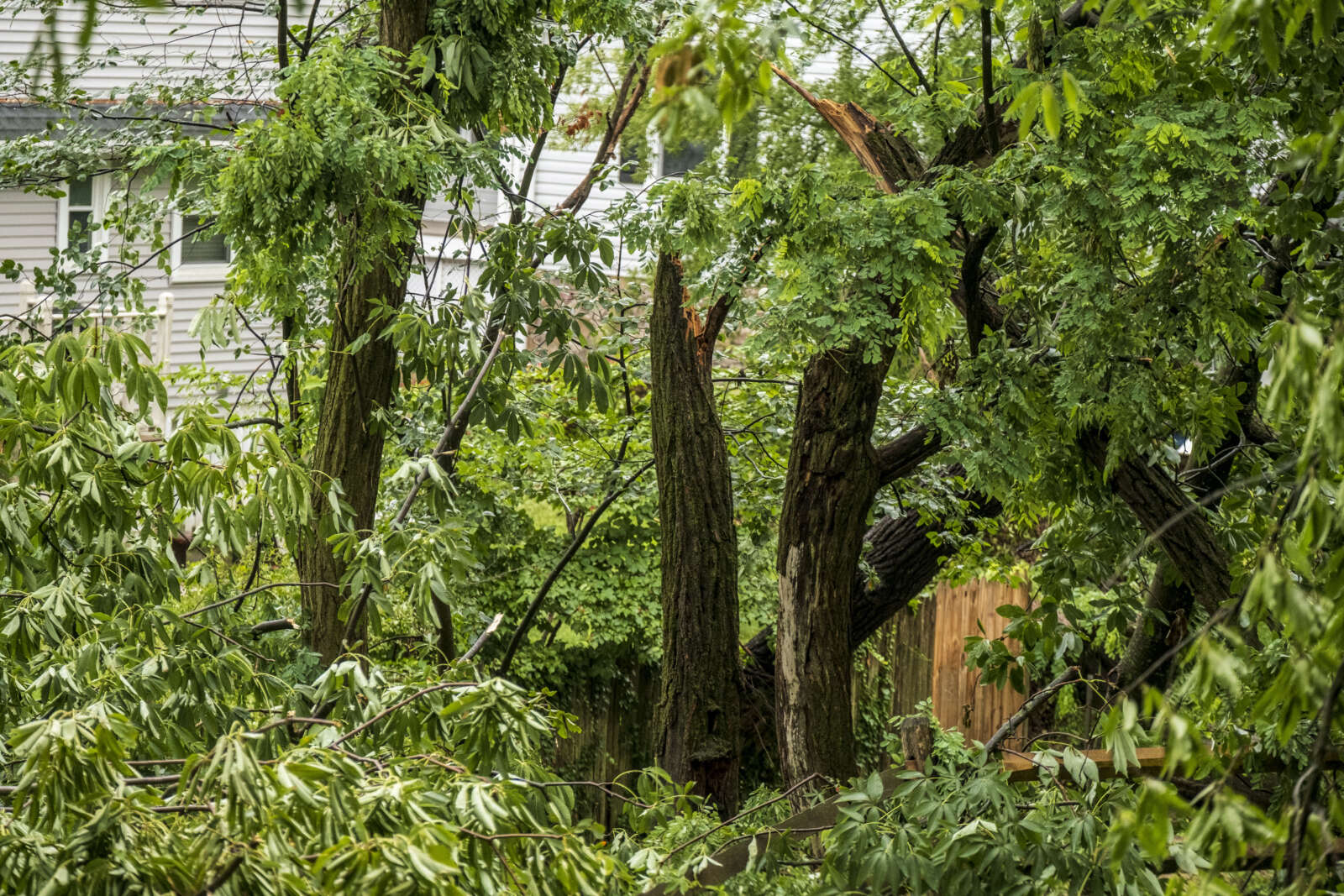
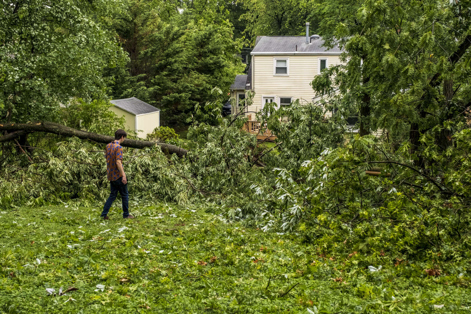
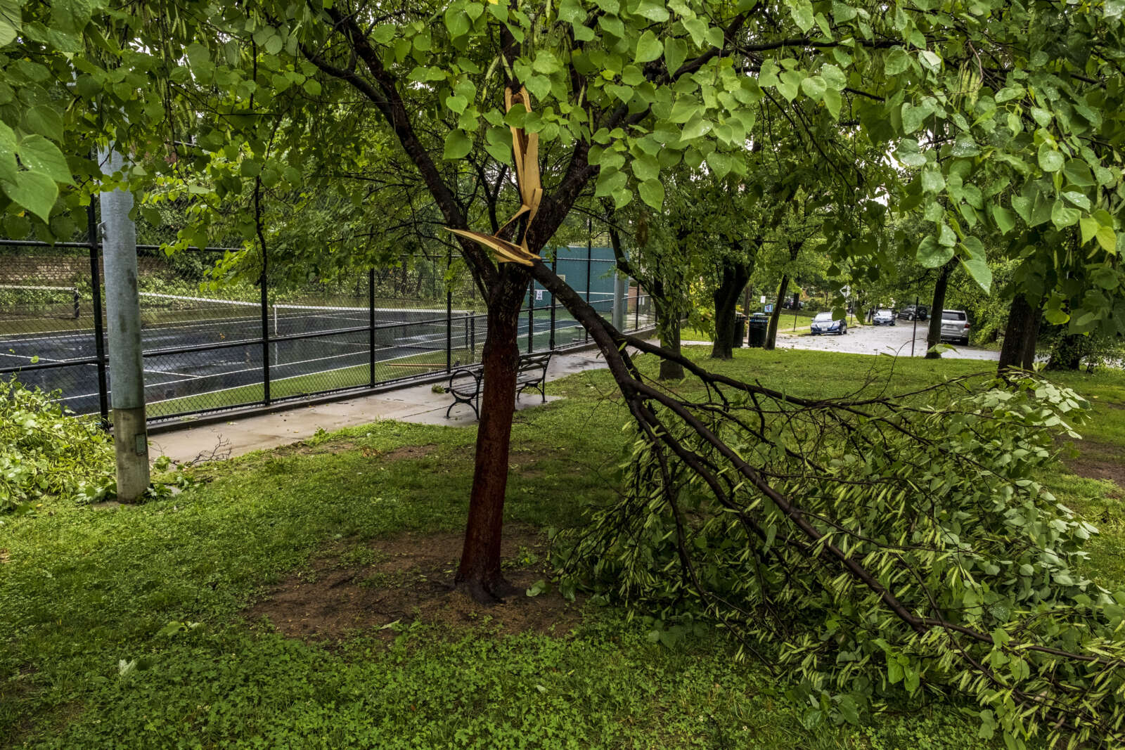
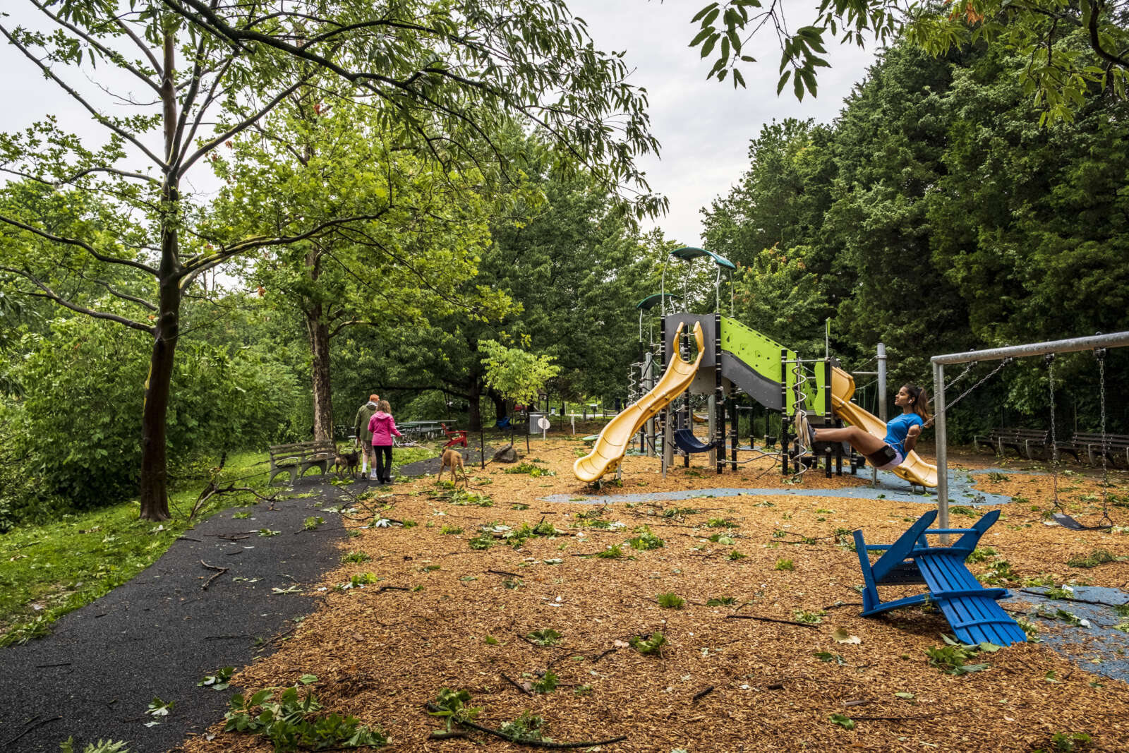
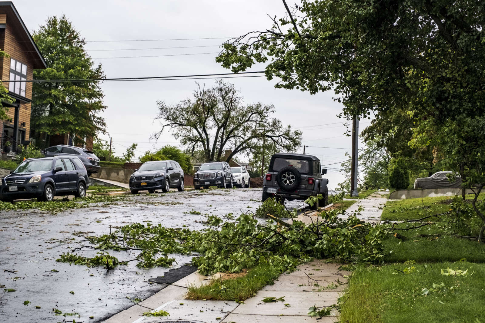
The expected outbreak follows the storms just over a week ago that toppled trees throughout Arlington and knocked out power to more than 34,000 Dominion customers.
More from the National Weather Service:
…SEVERE WEATHER OUTBREAK EXPECTED OVER THE MID-ATLANTIC REGION BETWEEN 2 PM AND 10 PM TODAY, INCLUDING THE GREATER BALTIMORE/WASHINGTON METROPOLITAN AREAS…
An outbreak of severe storms is expected this afternoon and evening across the greater Baltimore/Washington region, with numerous severe thunderstorms expected. There is a significant threat for damaging and locally destructive hurricane-force winds, along with the potential for large hail and tornadoes, even strong tornadoes.
The timing of this outbreak varies with your location. West of the Blue Ridge Mountains, you can expect the storms to arrive between 12 Noon and 3 PM. East of the Blue Ridge Mountains, timing will be from 4 PM to 8 PM. The greater Baltimore/Washington Metropolitan Areas can expect the storms to arrive between 5 PM and 7 PM.
Now is the time to review your severe weather safety procedures for the possibility of dangerous weather today. Do not be outdoors when the storms arrive. When you hear thunder, go indoors to a sturdy building or structure. While seeking shelter indoors, go to the lowest floor to an interior room. Stay away from windows. Those in mobile homes or weaker structures should plan ahead of time to shelter in a stronger shelter. Be prepared for extended power outages, and the potential for some roads to be blocked by fallen trees.
For the after-event cleanup, do not go outside until 30 minutes after you hear the last thunder, otherwise you will be still susceptible to lightning strikes. Be aware of downed power lines and unstable branches and trees.
Stay tuned to NOAA Weather Radio, weather.gov, or other media for watches and warnings. If a Severe Thunderstorm Warning or Tornado Warning is issued for your area, move to a place of safety, ideally in an interior room on the lowest level of a sturdy building.
A tornado watch has been issued for parts of District of Columbia, Maryland, Pennsylvania, Virginia and West Virginia until 9 PM EDT pic.twitter.com/Z92GYLkeFp
Much of the D.C. area, including Arlington, is under a 4 out of 5 risk of severe weather, a rare designation not seen in the region in more than a decade.
Trampoline stuck in a tree in Waverly Hills after a tornado in 2021 (staff photo)
Springtime is upon us and that means more frequent severe weather outbreaks.
To prepare residents, the Commonwealth of Virginia is holding its annual statewide tornado drill today at 9:45 a.m. A test alert will be broadcast on NOAA Weather Radio and the Emergency Alert System, but should not trigger mobile phone alerts.
Participating businesses and schools will prepare taking shelter during the drill.
Virginia's statewide Tornado Drill is @ 9:45am (Tue). The Routine Monthly Test (RMT) EAS code won't trigger cell phones, but gives the opportunity to develop a plan & take shelter. Share your shelter spot during the drill using #ShowYourShelter#vawxhttps://t.co/ff1HAzsKVgpic.twitter.com/qojtwmAgek
— NWS Baltimore-Washington (@NWS_BaltWash) March 7, 2023
Storm clouds seen from the Air Force Memorial on Sept. 3, 2020 (Staff Photo by Jay Westcott)
Arlington and much of the D.C. area is under both a Tornado Watch and a Flood Watch today.
Strong storms with damaging wind, large hail and torrential downpours are possible today, forecasters say.
“A Tornado Watch is in effect for much of the area until 2pm this afternoon,” the National Weather Service says. “In addition to the threat for tornadoes, damaging wind gusts and large hail will also be possible.”
While the tornado risk will end mid-afternoon, forecasters suggest, the flood risk will run well into the evening, with the watch set to expire at 11 p.m.
More from NWS:
433 AM EDT Fri May 27 2022
…FLOOD WATCH REMAINS IN EFFECT FROM 11 AM EDT THIS MORNING THROUGH THIS EVENING…
* WHAT…Flash flooding caused by excessive rainfall continues to be possible. […]
* WHEN…From 11 AM EDT this morning through this evening.
* IMPACTS…Excessive runoff may result in flooding of rivers, creeks, streams, and other low-lying and flood-prone locations.
* ADDITIONAL DETAILS…
– Multiple rounds of showers and thunderstorms are likely starting this morning and continuing through this evening. Locations could receive 1 to 2 inches of rain in a short period of time. Localized rainfall totals of 1 to 3 inches are expected, though locations that experience multiple rounds of thunderstorms could exceed 3 inches.
– Please visit http://www.weather.gov/safety/flood for safety information.
PRECAUTIONARY/PREPAREDNESS ACTIONS…
You should monitor later forecasts and be prepared to take action should Flash Flood Warnings be issued.
Stay weather aware today! Severe thunderstorms possible with the potential for damaging wind gusts, a couple tornadoes, large hail and flash flooding. Multiple rounds of storms are expected. The greatest risk will be this afternoon/evening. Latest: https://t.co/5RyZgoXicjpic.twitter.com/9IETnnSN8N
— NWS Baltimore-Washington (@NWS_BaltWash) May 27, 2022
A Tornado Watch has been issued for parts of District of Columbia, Maryland, North Carolina, Virginia and West Virginia until 2 PM EDT. pic.twitter.com/OG1C3MbdvG
— NWS Baltimore-Washington (@NWS_BaltWash) May 27, 2022
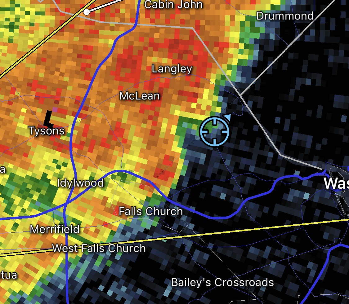
A “bow echo” seen on the radar just before the Tornado Warning was issued
Update at 9:20 p.m. — There are Metro delays after a tornado might have touched down in the Tysons area.
Silver Line Delay: Trains are single tracking btwn McLean & Tysons Corner due to a track obstruction at Tysons Corner. Expect delays in both directions.
Update at 9 p.m. — The Tornado Warning has been cancelled, according to NBC 4’s Doug Kammerer.
Update at 8:50 p.m. — Part of North Arlington is now under a Tornado Warning.
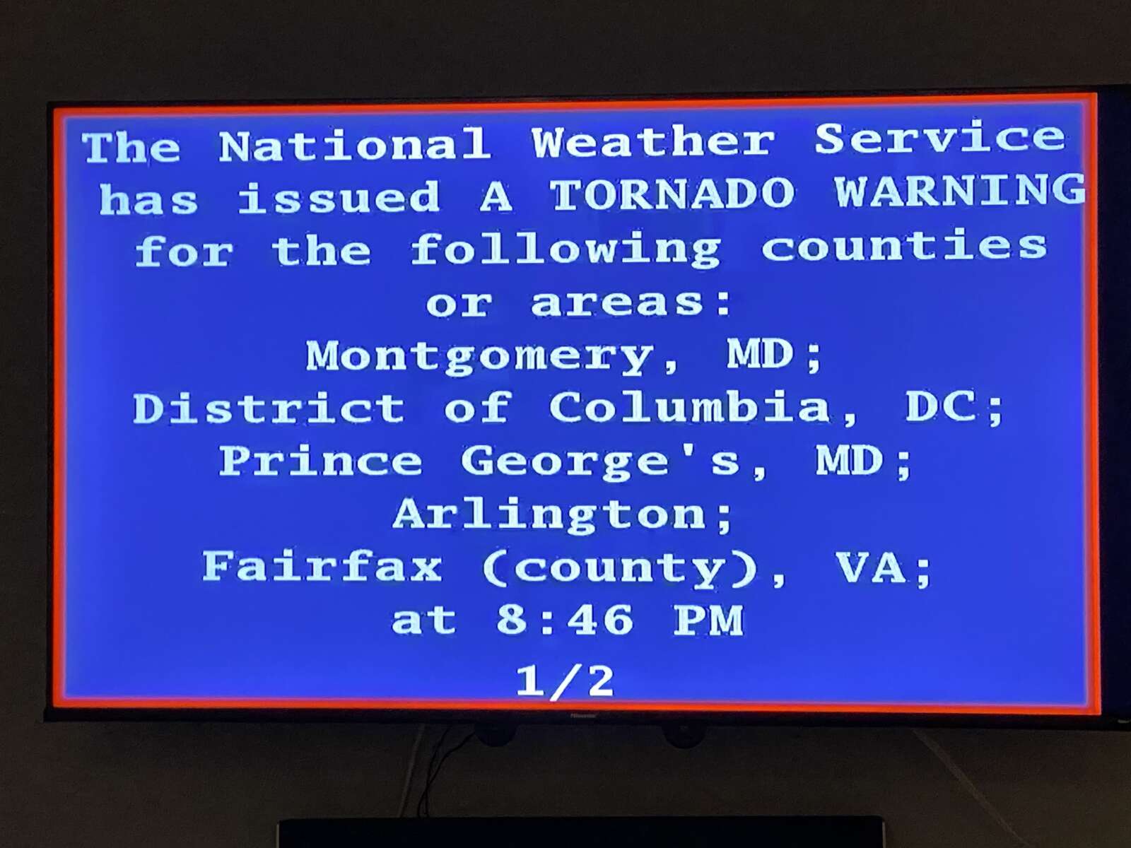
BULLETIN – EAS ACTIVATION REQUESTED
Tornado Warning
National Weather Service Baltimore MD/Washington DC
846 PM EDT Thu Mar 31 2022
The National Weather Service in Sterling Virginia has issued a
* Tornado Warning for… The northern District of Columbia… Southeastern Montgomery County in central Maryland… Northwestern Prince Georges County in central Maryland… North central Arlington County in northern Virginia… Northeastern Fairfax County in northern Virginia…
* Until 915 PM EDT.
* At 846 PM EDT, a severe thunderstorm capable of producing a tornado was located over Mclean, moving east at 30 mph.
HAZARD…Tornado.
SOURCE…Radar indicated rotation.
IMPACT…For those in the direct path of a tornado touchdown, flying debris will be dangerous to those caught without shelter. Damage to roofs, siding, and windows may occur. Mobile homes may be damaged or destroyed. Tree damage is likely.
* This dangerous storm will be near… Arlington around 855 PM EDT. Bethesda, Martin`s Additions, American University, Friendship Village and Georgetown around 900 PM EDT. Fort Totten and Chevy Chase around 905 PM EDT. Langley Park, Takoma Park and Hillandale around 910 PM EDT. Hyattsville and Adelphi around 915 PM EDT.
Other locations impacted by this tornadic thunderstorm include Rivercrest, Little Falls, Brentwood, West Mclean, Chevy Chase Village, Catholic University, Langley, North Brentwood, Chillum and National Zoo.
PRECAUTIONARY/PREPAREDNESS ACTIONS…
TAKE COVER NOW! Move to a basement or an interior room on the lowest floor of a sturdy building. Avoid windows. If you are outdoors, in a mobile home, or in a vehicle, move to the closest substantial shelter and protect yourself from flying debris.
Earlier: Part of Arlington is now under a Severe Thunderstorm Warning.
A Tornado Warning has also been issued for parts of Fairfax County, including neighboring McLean.
More from the National Weather Service:
818 PM EDT Thu Mar 31 2022
The National Weather Service in Sterling Virginia has issued a
* Severe Thunderstorm Warning…
* Until 900 PM EDT.
* At 818 PM EDT, a severe thunderstorm was located over Centreville, moving east at 50 mph.
HAZARD…60 mph wind gusts.
SOURCE…Radar indicated.
IMPACT…Damaging winds will cause some trees and large branches to fall. This could injure those outdoors, as well as damage homes and vehicles. Roadways may become blocked by downed trees. Localized power outages are possible. Unsecured light objects may become projectiles.
* Locations impacted include… Arlington, Centreville, Bethesda, Reston, Annandale, College Park, Greenbelt, Fairfax, Langley Park, Beltsville, Vienna, Falls Church, Largo, Coral Hills, Bladensburg, Mantua, Pimmit Hills, Mclean, Fedex Field and American Legion Bridge.
PRECAUTIONARY/PREPAREDNESS ACTIONS…
For your protection move to an interior room on the lowest floor of a building.
ART bus in traffic in Ballston (staff photo by Jay Westcott)
Crashed Car Still Along Riverbank — “Two months after a man’s car careened two hundred feet off George Washington Parkway in Virginia, the National Park Service is developing a plan to remove the vehicle from an embankment next to the Potomac River… Police tape surrounds the car, which remains resting upside down. The driver’s papers and personal belongings are still scattered next to the car, which has graffiti painted on it.” [Patch]
February Rents Up Slightly — “The median monthly rental for an apartment in the county last month was $1,982 for a one-bedroom unit and $2,399 for two bedrooms, according to data reported March 1 by Apartment List. Compared to the period immediately preceding the arrival of the pandemic in March 2020, Arlington rents are up 0.5 percent.” [Sun Gazette]
Clarendon-Based Axios Expanding — “This year, Axios is pouring $30 million into expanding its footprint, said Jim VandeHei, the chief executive. It is spreading into cities (Axios Local), industries (Axios Pro) and workplaces (Axios HQ)… It now has more than 400 employees, with 150 in its newsroom in Arlington, Va., and 2.2 million subscribers across its 34 national and global newsletters.” [New York Times]
Arlington Man Arrested for Abduction — “Victim One stated that she had been at an establishment in the 500 block of 23rd Street S. with the known suspect when they became involved in a verbal dispute. When Victim One attempted to leave with Victim Two and another witness, the suspect approached Victim One and allegedly began physically assaulting her before being separated by additional witnesses. The victims then went to retrieve Victim One’s vehicle from a garage in the 500 block of 12th Road S., when the suspect approached them, brandished a firearm and made threatening statements… A struggle ensued, during which the suspect attempted to prevent Victim One from leaving.” [Arlington County]
Comcast Upping Broadband Speeds — “Comcast announced today that it has increased speeds for its most popular Xfinity Internet tiers, providing an extra boost for millions of residential customers across 14 northeastern states from Maine through Virginia and the District of Columbia.” [Comcast]
Va. Tornado Drill Today — “Join us for the Statewide Tornado Drill TOMORROW at 9:45 AM! Practice sheltering from a #tornado: Go to a lower level of your home or office, away from windows. Get under sturdy shelter like a desk if you can.” [Twitter]
Record High Temperature Set — “For the second day in a row, record highs were set across the area. Highs of at least 80 in Washington, 76 at Dulles, and 78 at BWI are all records for the date. That 80-degree reading in the city is 10th-earliest on record.” [Capital Weather Gang]
It’s Tuesday — Mostly cloudy throughout the day. High of 56 and low of 41. Sunrise at 6:31 am and sunset at 6:10 pm. [Weather.gov]
Today, a new mystery: why is there a cheap plastic chair resting in a treetop in a Rosslyn park? A reader sent us the photos above, showing the chair lodged in some tree branches well above a pedestrian pathway.
“There is a plastic garden chair stuck in a tree about 40 feet off the ground at Hillside Park in Rosslyn,” writes John Thomas. “It might make an interesting story to speculate how it got there. Tornado? Cicadas?”
Trebuchet testing and aircraft door mishap are perhaps some other options that could explain it.
With the caveat that we have yet to contact Arlington’s Dept. of Parks and Recreation or the National Weather Service for official comment about what happened, the tornado hypothesis might actually make some sense.
On July 1, an honest-to-goodness EF-1 tornado touched down in Arlington, doing most of its damage in the Waverly Hills, Cherrydale and Lyon Village neighborhoods, before crossing the Potomac and snapping trees on the west end of the National Mall. The damage path finally ended near the South Lawn of the White House.
Between Lyon Village and the Mall, however, the path of the tornado did take it over Rosslyn and… Hillside Park, which is located at 1601 N. Pierce Street.
To better illustrate, here’s a line drawn between Woodstock Park in Arlington, where the tornado damage started, and where it ended. The pin in the center shows Hillside Park.
So unlike the deodorant mystery, which to this day remains unsolved (though a local bar employee’s comment that “people get drunk on the weekends, that would be my best guess,” seems as plausible as anything) it appears that the twister take is a definite maybe for Arlington’s latest head scratcher.
Have any alternative theories? Anything to disprove the tornado hypothesis? Let us know in the comments.
Forecasters say conditions are favorable for the formation of tornadoes, though any such storms should be isolated. Severe thunderstorms are also possible.
A Tornado Watch has been issued for our whole area. Rotating supercells from remnants of Fred may lead to Tornadoes this afternoon. Tornadoes will be brief, but may cause some damage. Stay Safe Out There! pic.twitter.com/iKZzzP6yZ7
— Washingtonian Weather Geeks (@WashingtonianWx) August 18, 2021
Arlington is no stranger to tornados, though twisters are a relatively uncommon occurrence.
Last month an EF-1 tornado caused damage across several neighborhoods near Lee Highway. In April 2017, an EF-0 tornado chopped trees in half at Army Navy Country Club and caused some damage at the Macy’s in Pentagon City. Before that, a long-lived EF-1 twister struck Arlington, Alexandria, Fairfax County and D.C. in 2001.
More from the National Weather Service:
A FLASH FLOOD WATCH REMAINS IN EFFECT THROUGH 10 PM FOR AREAS ALONG THE INTERSTATE 95 CORRIDOR. ISOLATED INSTANCES OF FLASH FLOODING ARE POSSIBLE AS TROPICAL MOISTURE OVERSPREADS THE REGION.
A TORNADO WATCH IS IN EFFECT UNTIL 8 PM. ISOLATED TORNADOES AND DAMAGING THUNDERSTORM WIND GUSTS ARE THE THREATS.
As Tropical Depression Fred passes off to the west, there will be a threat for isolated tornadoes, damaging winds, as well as flash flooding. The risk for severe thunderstorms may come as early as the mid-morning. Otherwise, conditions should improve by late this evening. pic.twitter.com/wAnqAVAqdi
Another Rosslyn Redevelopment Planned — “Rosslyn’s aging Xerox Building could soon be replaced with a massive new apartment complex, as the neighborhood’s older properties continue to steadily redevelop. The investment advisory firm TIAA, which owns the building, and its real estate arm, Nuveen, filed plans in Arlington County last month calling for the full overhaul of the property at 1616 Fort Myer Drive. In its place, the companies hope to build a 691-unit apartment building reaching up to 30 stories tall.” [Washington Business Journal]
Arlington History Museum Reopens — “Having reopened its museum to the public on the nation’s 245th birthday, leaders of the Arlington Historical Society are now looking ahead to completing a top-to-bottom renovation and reimagining of the facility in time for the nation’s 250th… The museum is located in the 19th-century Hume School, located on Arlington Ridge Road. It came into the society’s possession 60 years ago, and is showing its age.” [Sun Gazette]
Last Week’s Tornado, As Seen from D.C. — “Lightning softly flickered inside the body of the storm. The shelf cloud, a smoothed and rounded arc fanning outward just above the ground, was lit from below as it tumbled over the urban glow of Ballston, Clarendon and Rosslyn… I began fixating on a ringed, collar-shaped cloud above the curtains of rain. Shortly before 9 p.m., the lowest portion of the cloud appeared to be curling inward, deviating from the storm’s heading.” [Capital Weather Gang]
Local Swim Club Update — “The Overlee Flying Fish defeated the Donaldson Run Thunderbolts in a rare all-Arlington matchup in the Northern Virginia Swimming League. Overlee won, 236-184, on July 3, keeping the Flying Fish tied for first with the Tuckahoe Tigers at 3-0 in Division 1. Donaldson Run fell to 0-3.” [Sun Gazette]
Nearby: Alexandria Removes SROs — The Alexandria City Council has voted to remove School Resource Officers from city schools, despite opposition to the move from the School Board. Last month the Arlington School Board voted to move SROs off school grounds. [ALXnow]
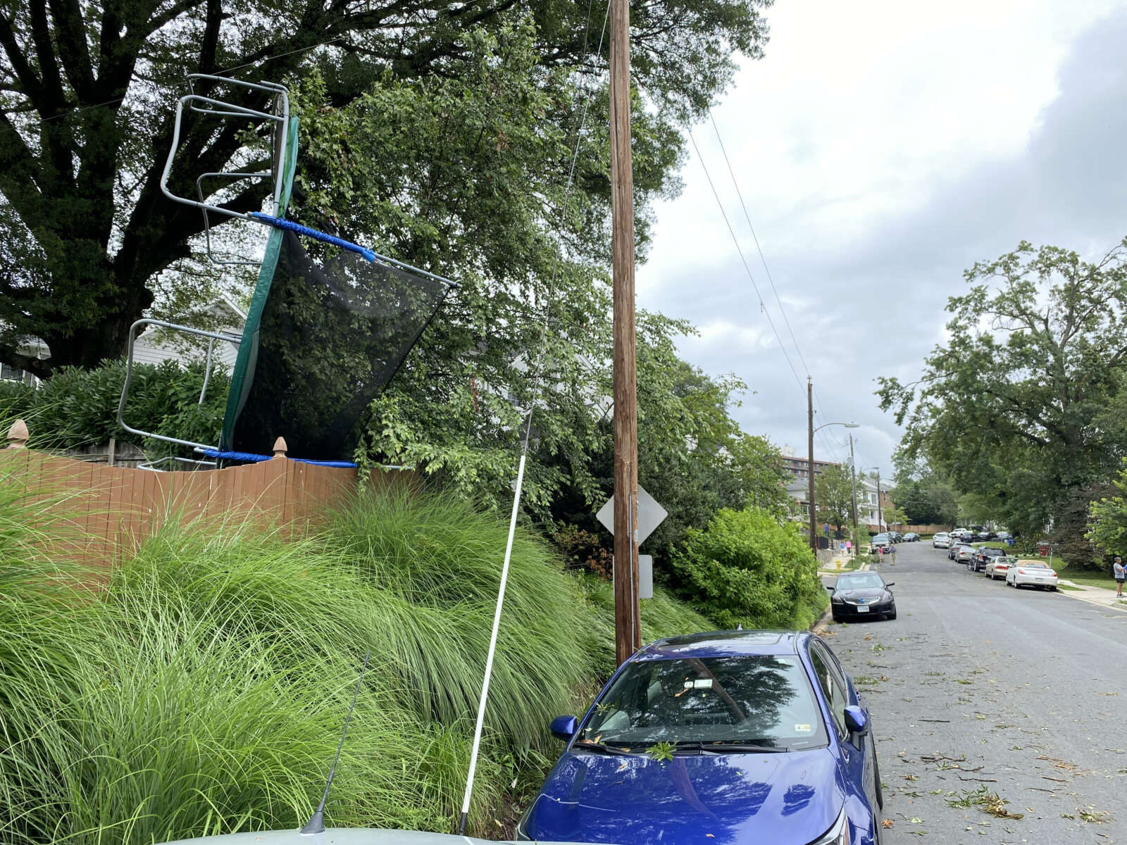
Trampoline stuck in a tree in Waverly Hills after a tornado
Trampoline stuck in a tree in Waverly Hills after a tornado in 2021 (staff photo)
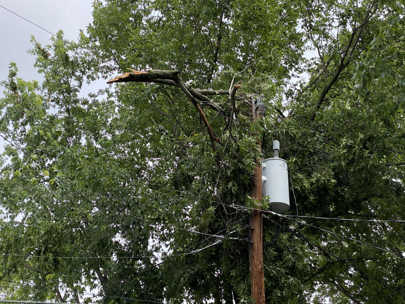
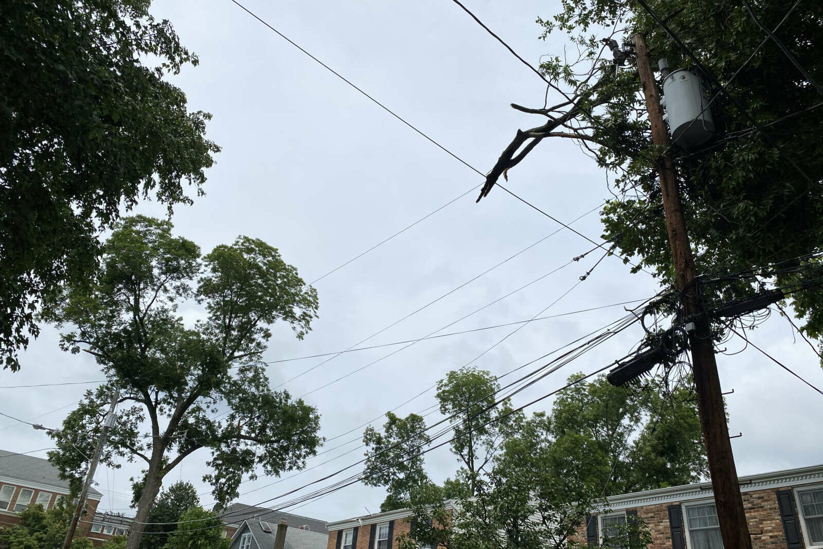
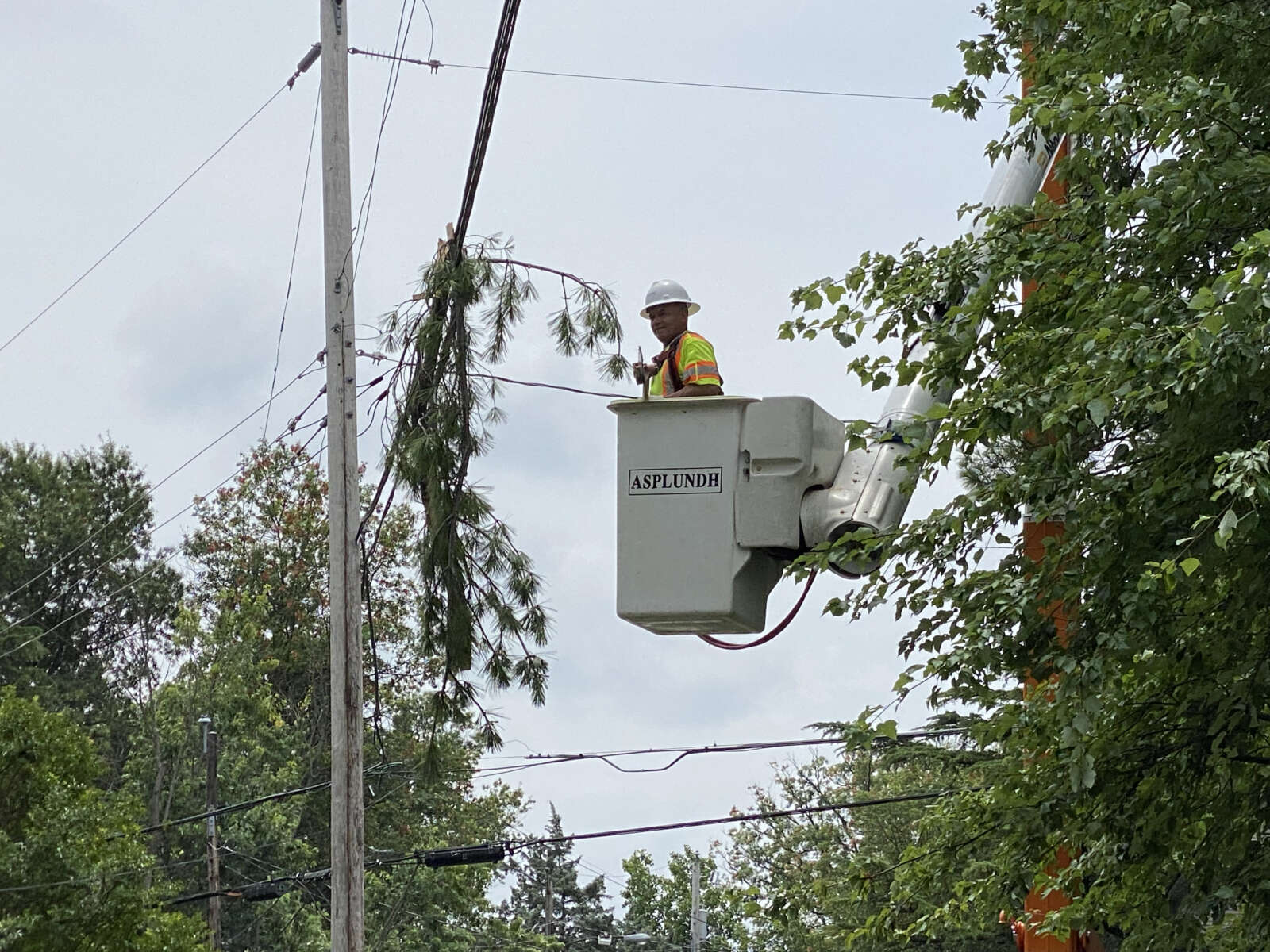
Tree limb that javelined a power transformer in Cherrydale
Tree limb that javelined a power transformer in Cherrydale, with the tree it is believed to have broken off of in the background
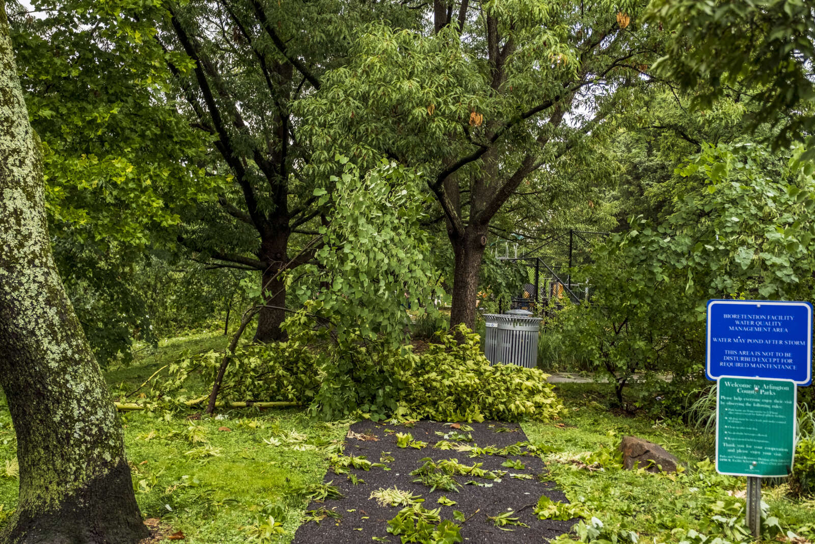
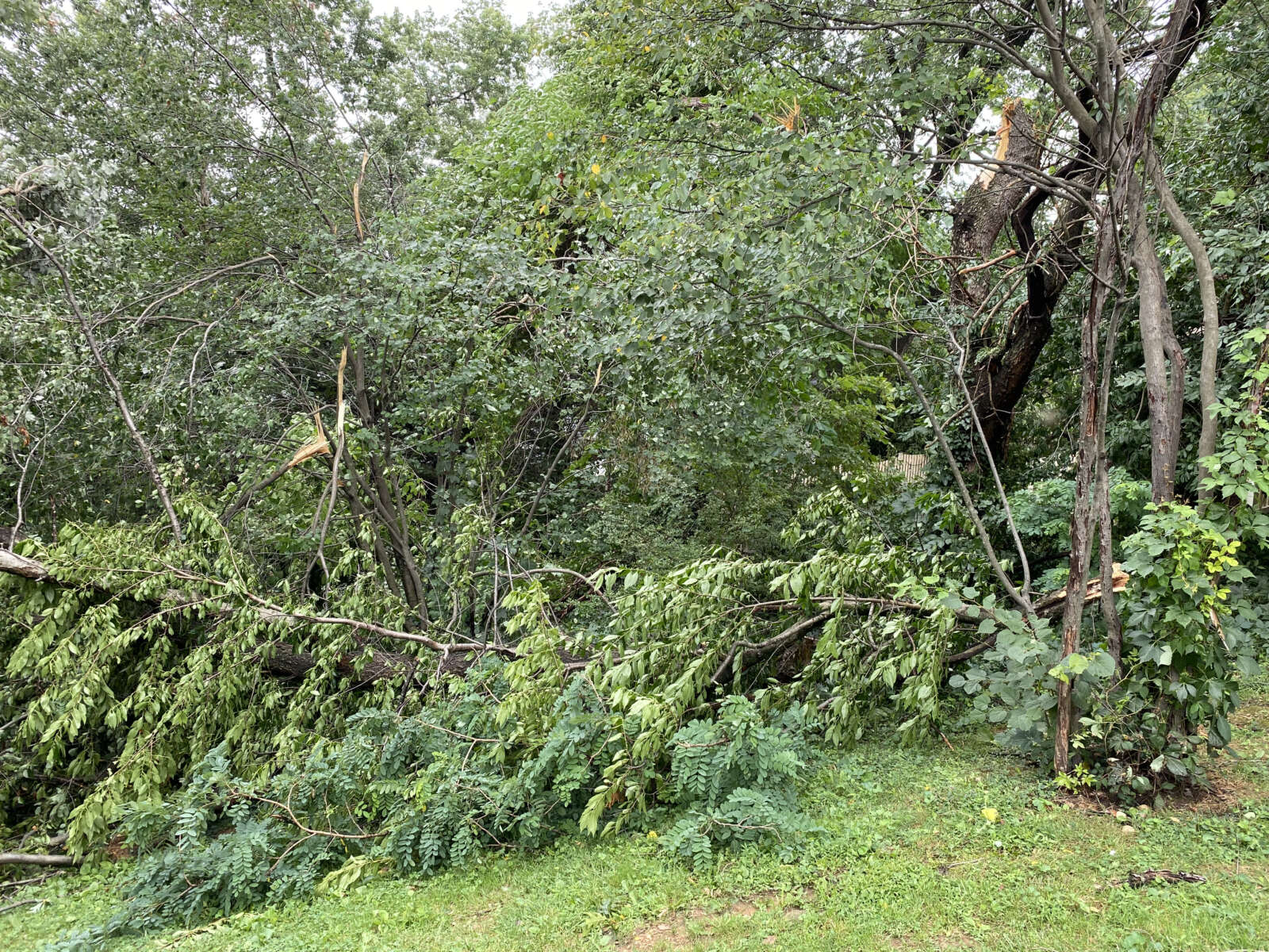
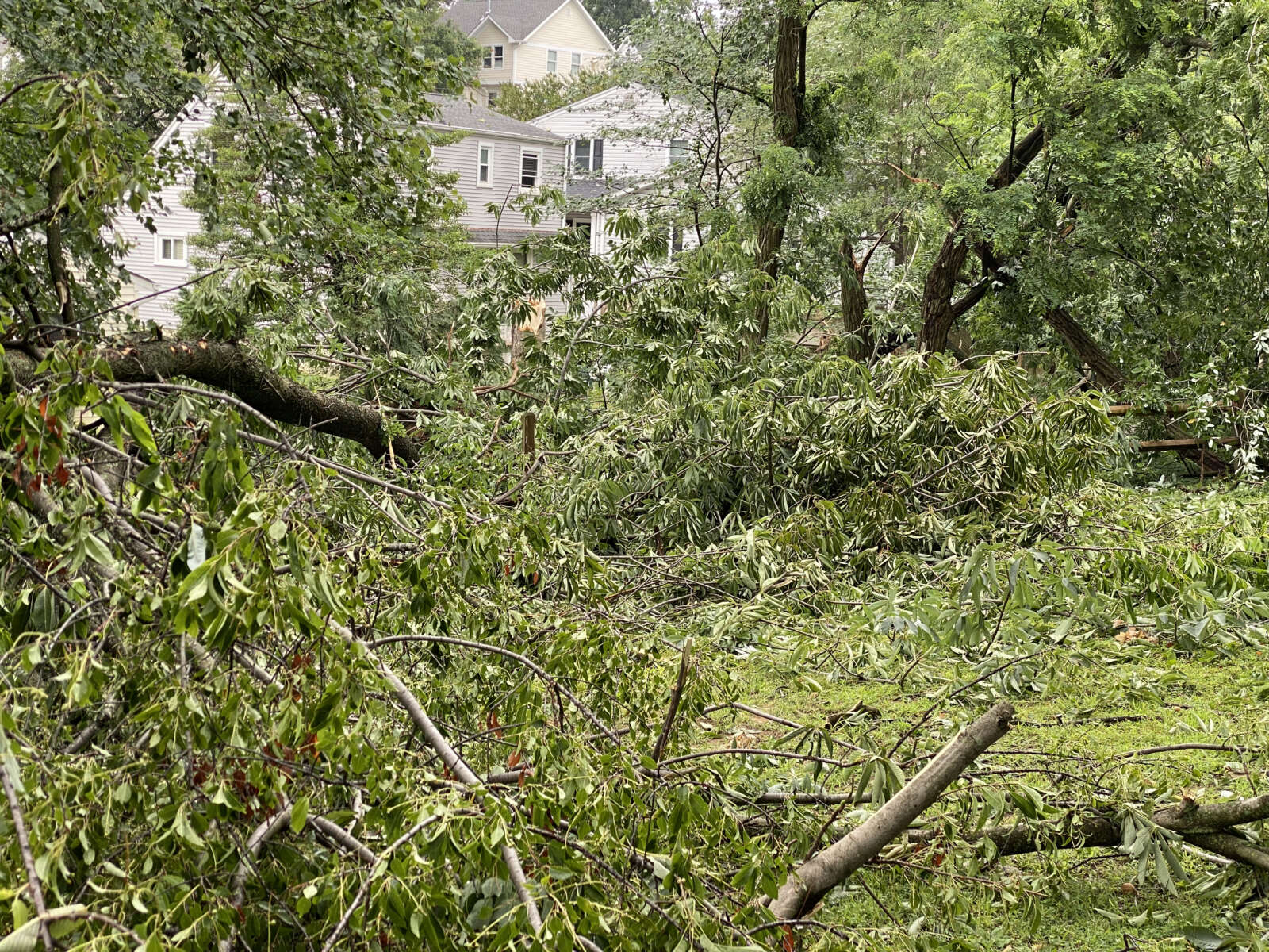
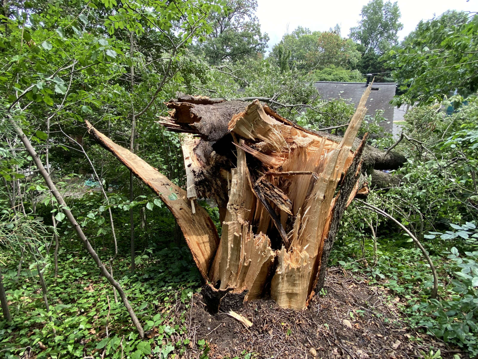
Storm damage in Woodstock Park (staff photo by Jay Westcott)
Storm damage and downed wires along N. Utah St. in Waverly Hills (staff photo by Jay Westcott)
Storm damage in Woodstock Park (staff photo by Jay Westcott)
Trees toppled in Woodstock Park (staff photo by Jay Westcott)
Storm damage in Woodstock Park (staff photo by Jay Westcott)
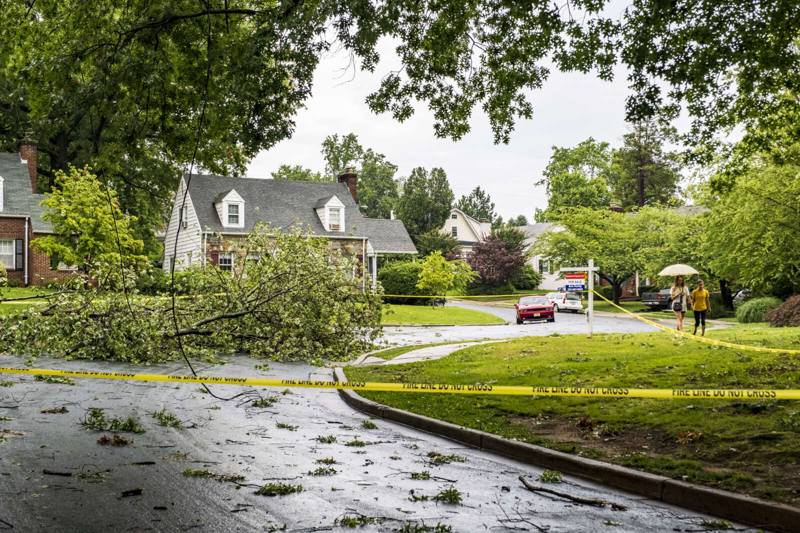
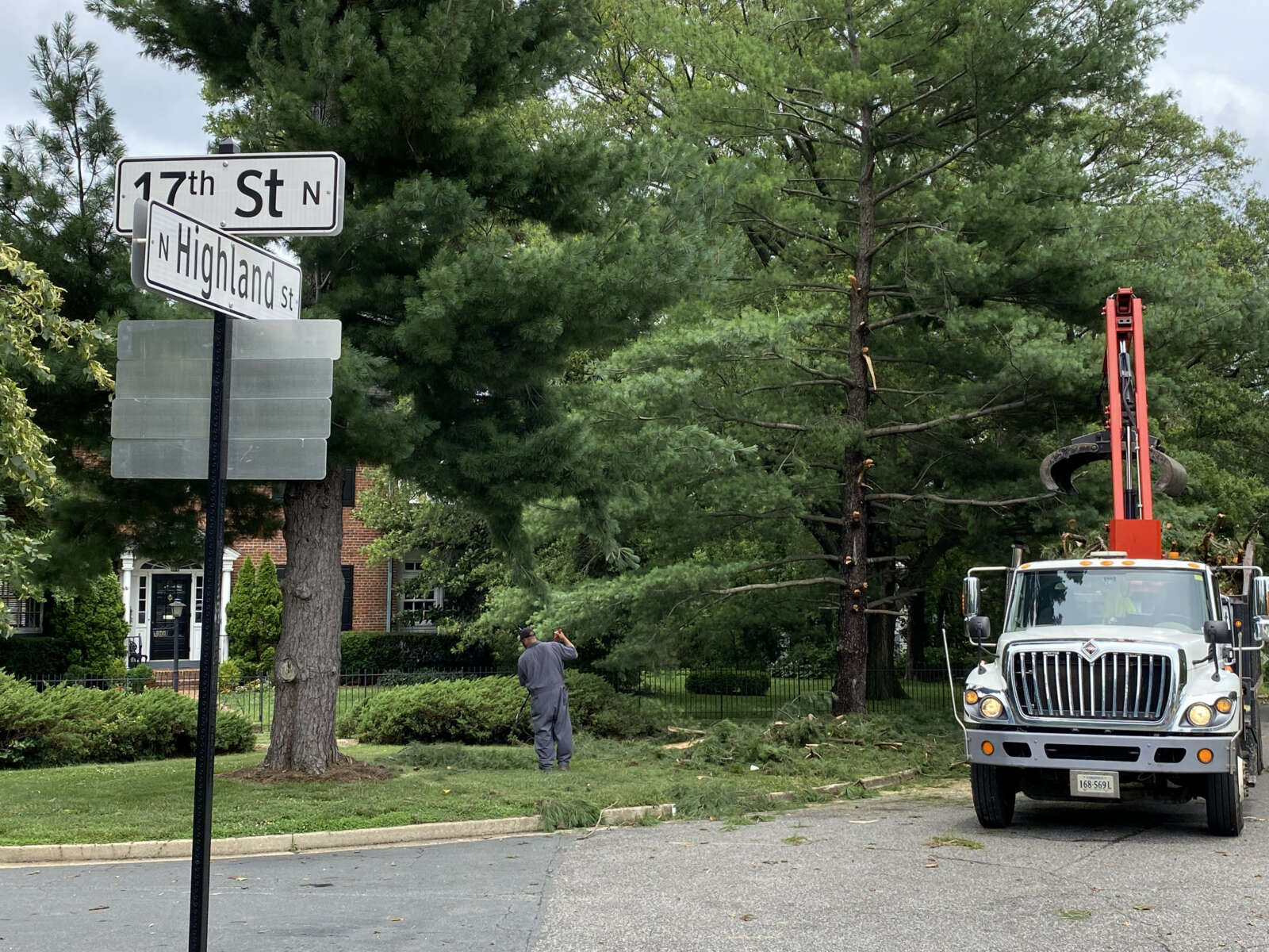
Storm damage on N. Highland Street in Lyon Park (staff photo by Jay Westcott)
Storm damage in Woodstock Park (staff photo by Jay Westcott)
Storm damage in Woodstock Park (staff photo by Jay Westcott)
Storm damage along N. Vermont Street (staff photo by Jay Westcott)
Storm damage in Woodstock Park (staff photo by Jay Westcott)
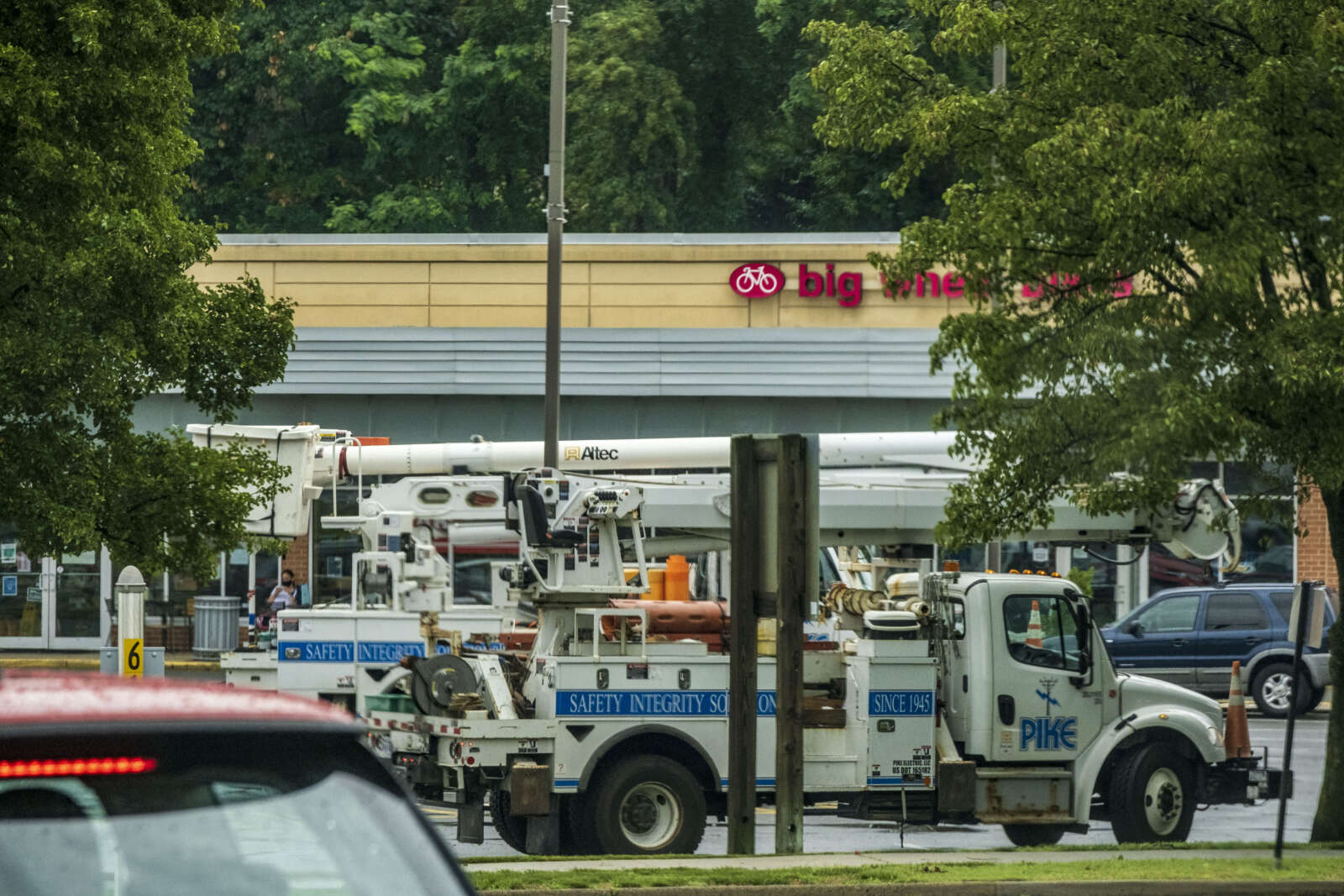
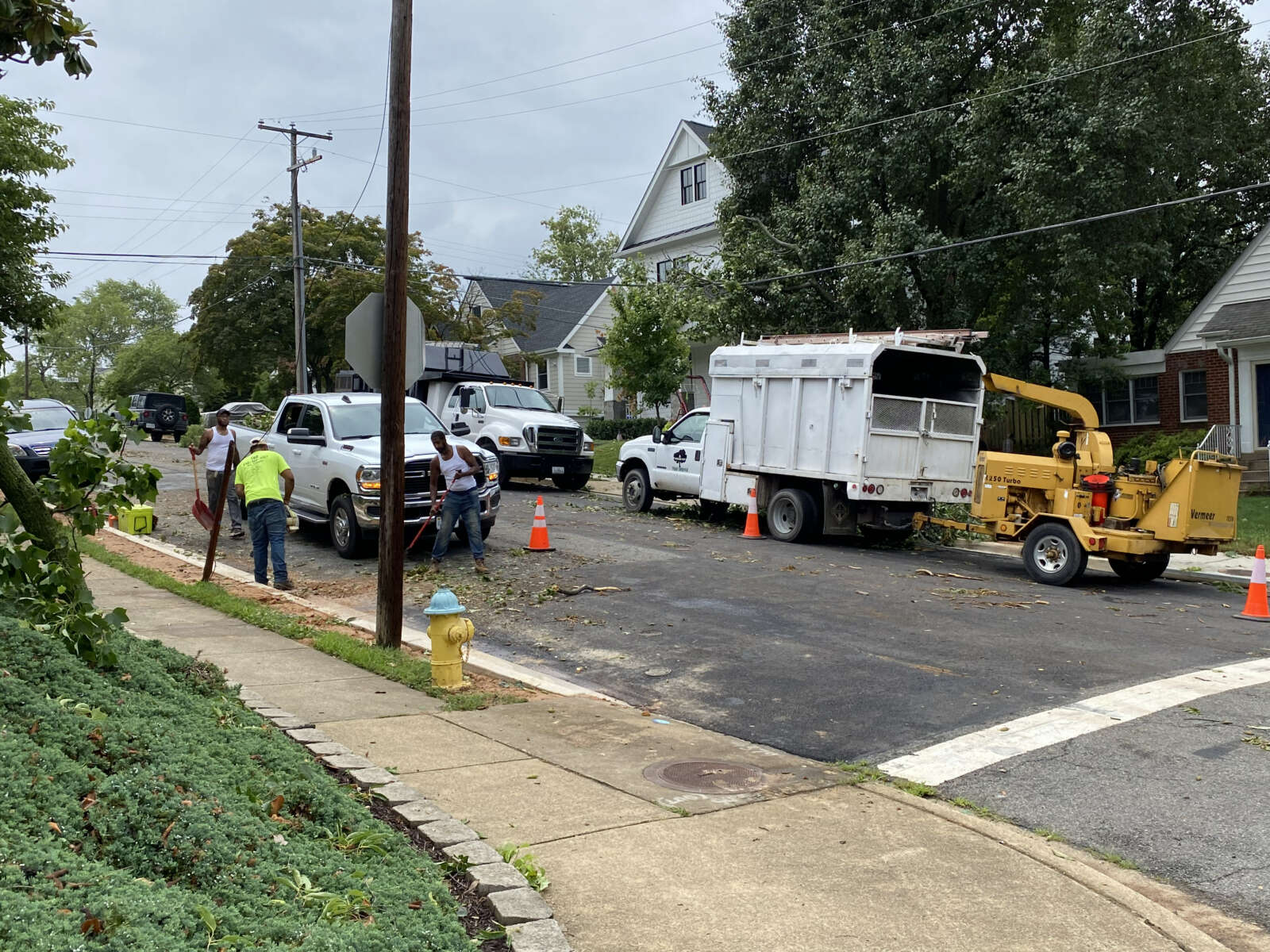
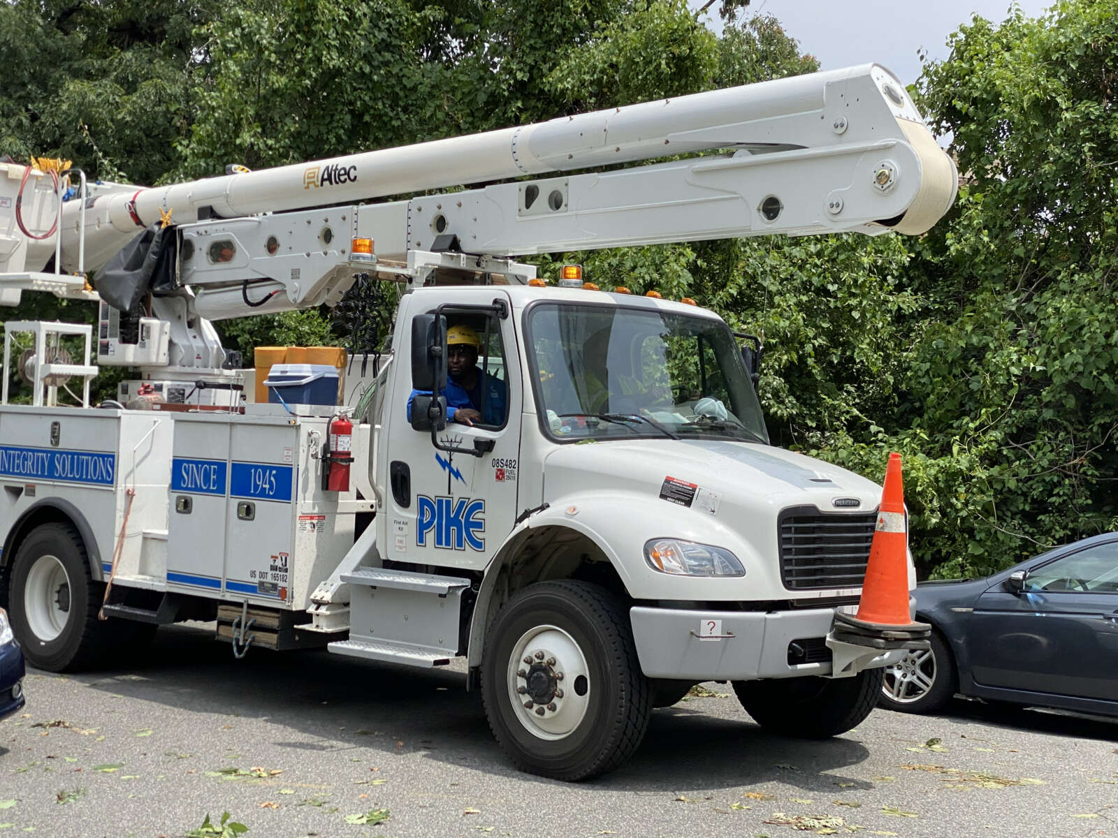
Bucket trucks stage at the Giant shopping center along Spout Run Parkway and Lee Highway (staff photo by Jay Westcott)
Storm damage along Lee Highway near N. Highland Street (staff photo by Jay Westcott)
Storm damage along Lee Highway (staff photo by Jay Westcott)
Weather radar with Tornado Warning at 9 p.m.
Crews cleaning up storm damage on N. Stafford Street in Cherrydale
Storm damage in Woodstock Park
Storm damage in Woodstock Park
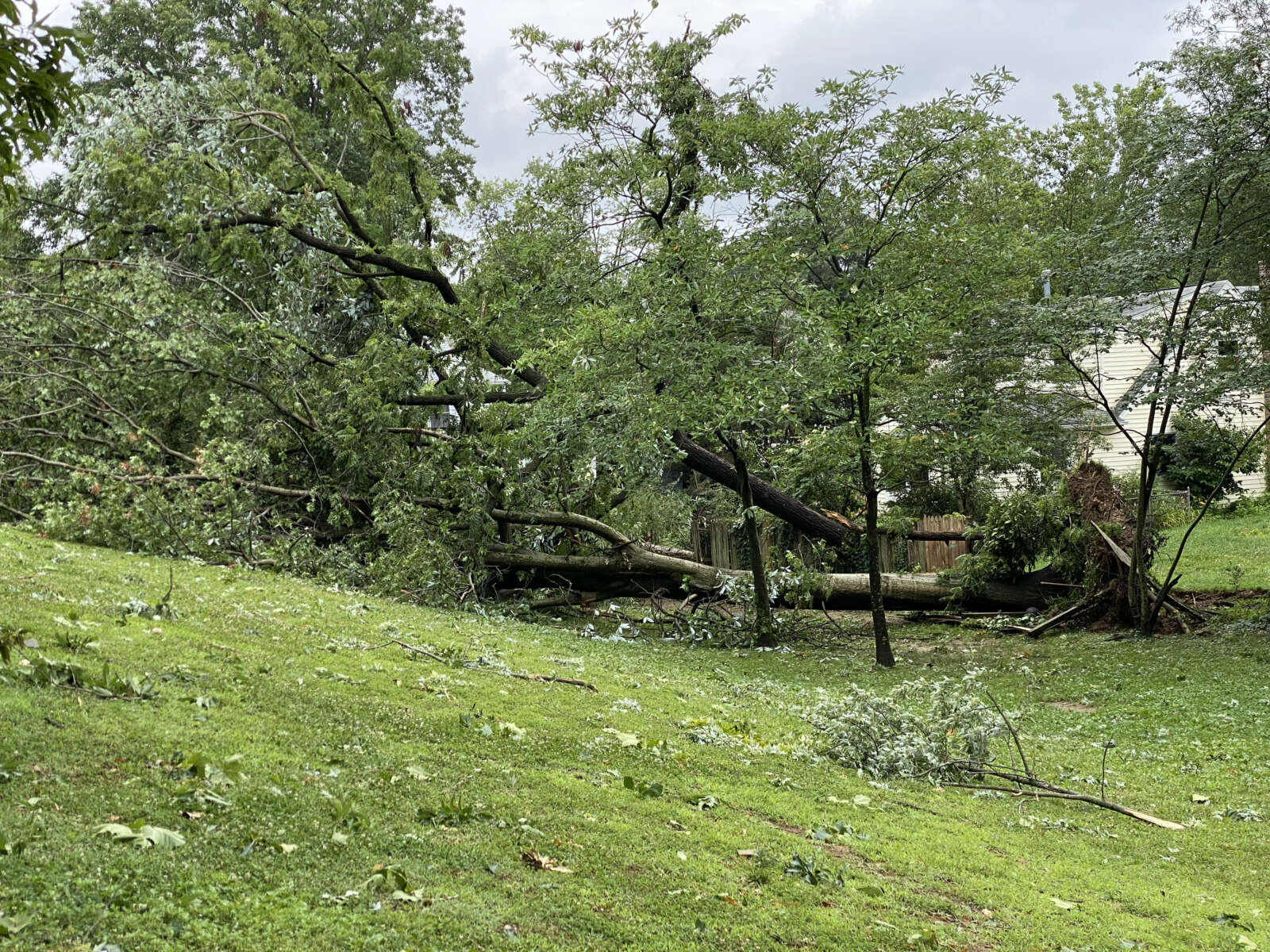
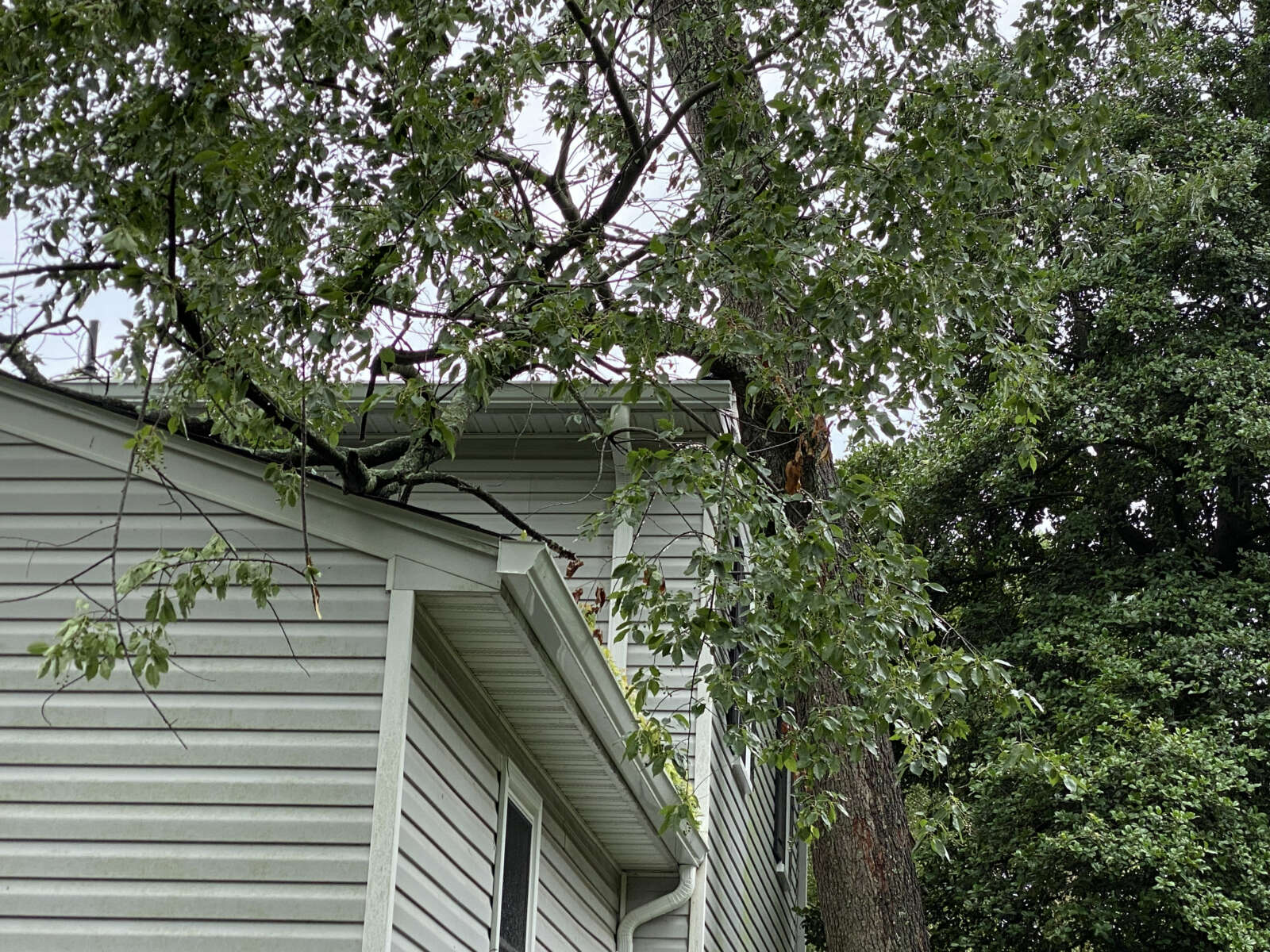
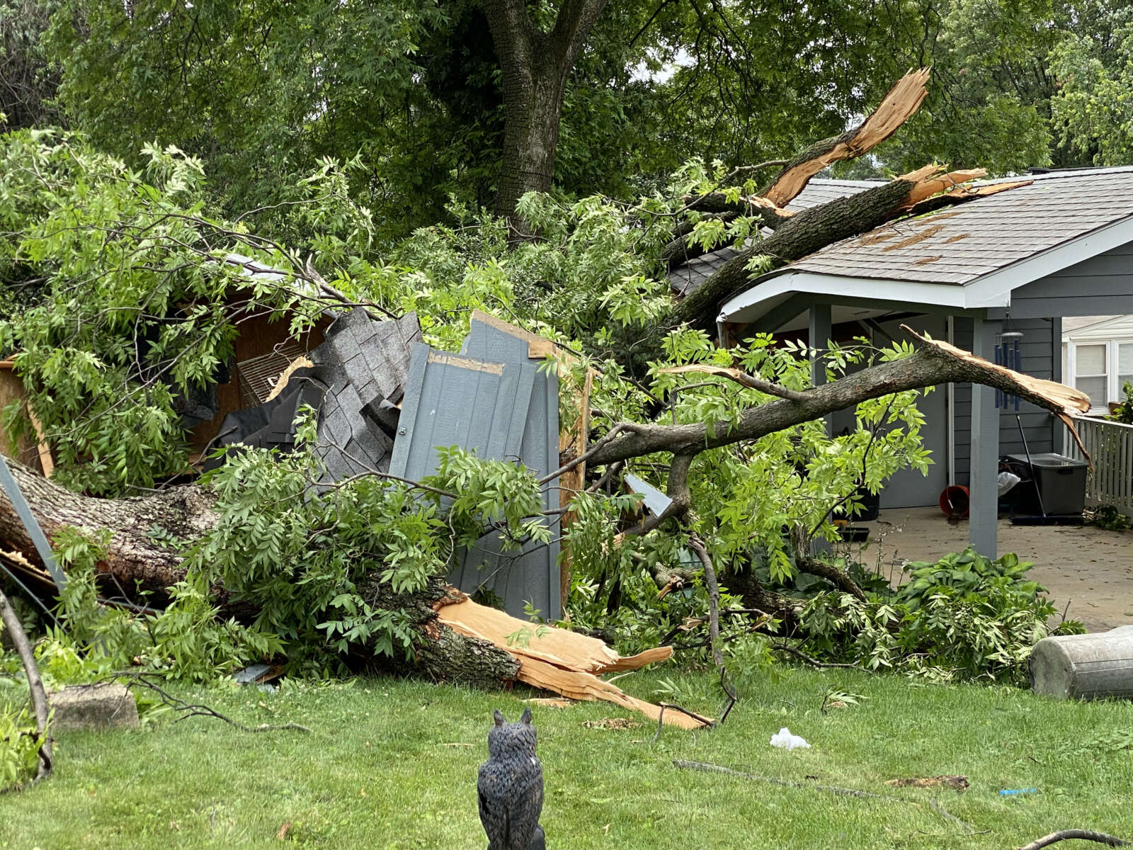
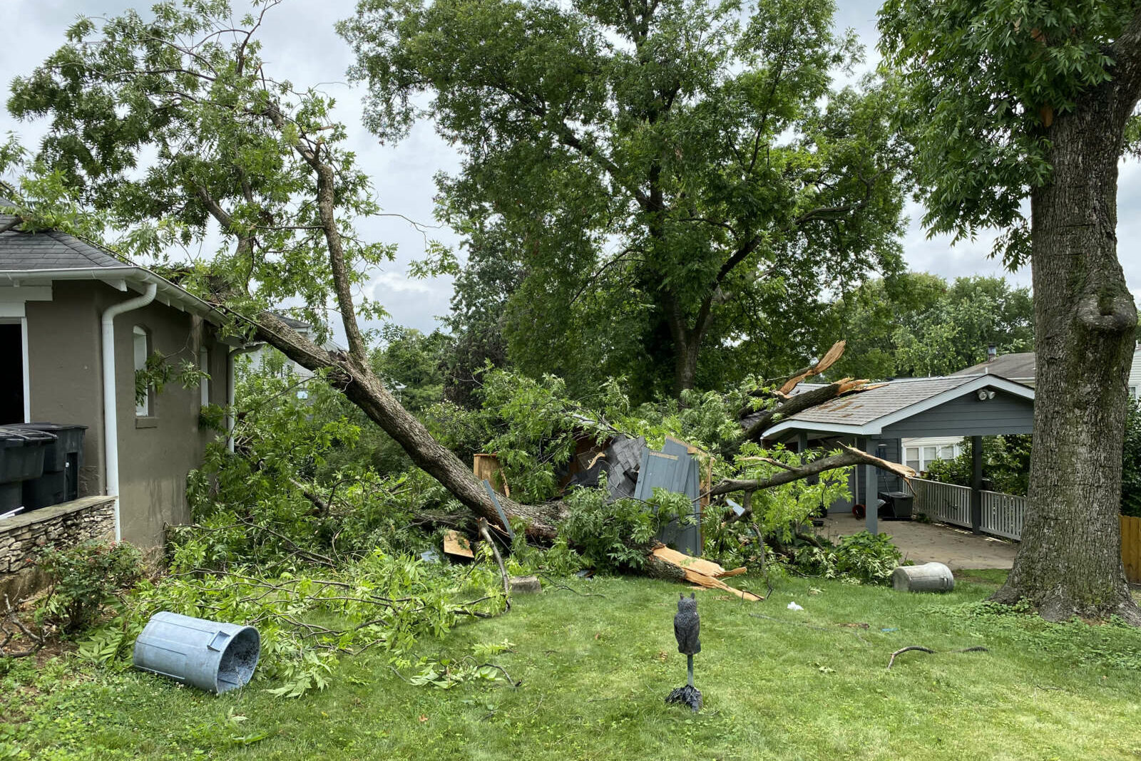
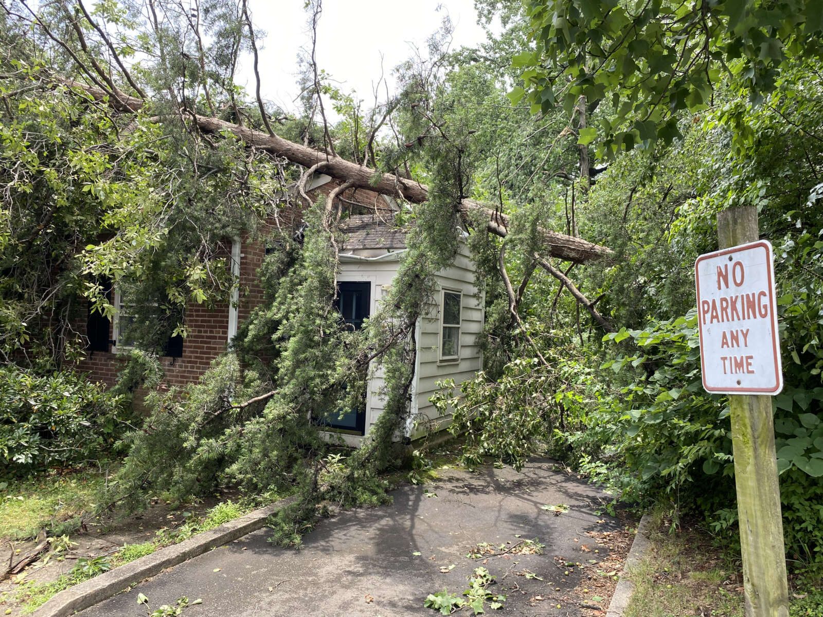
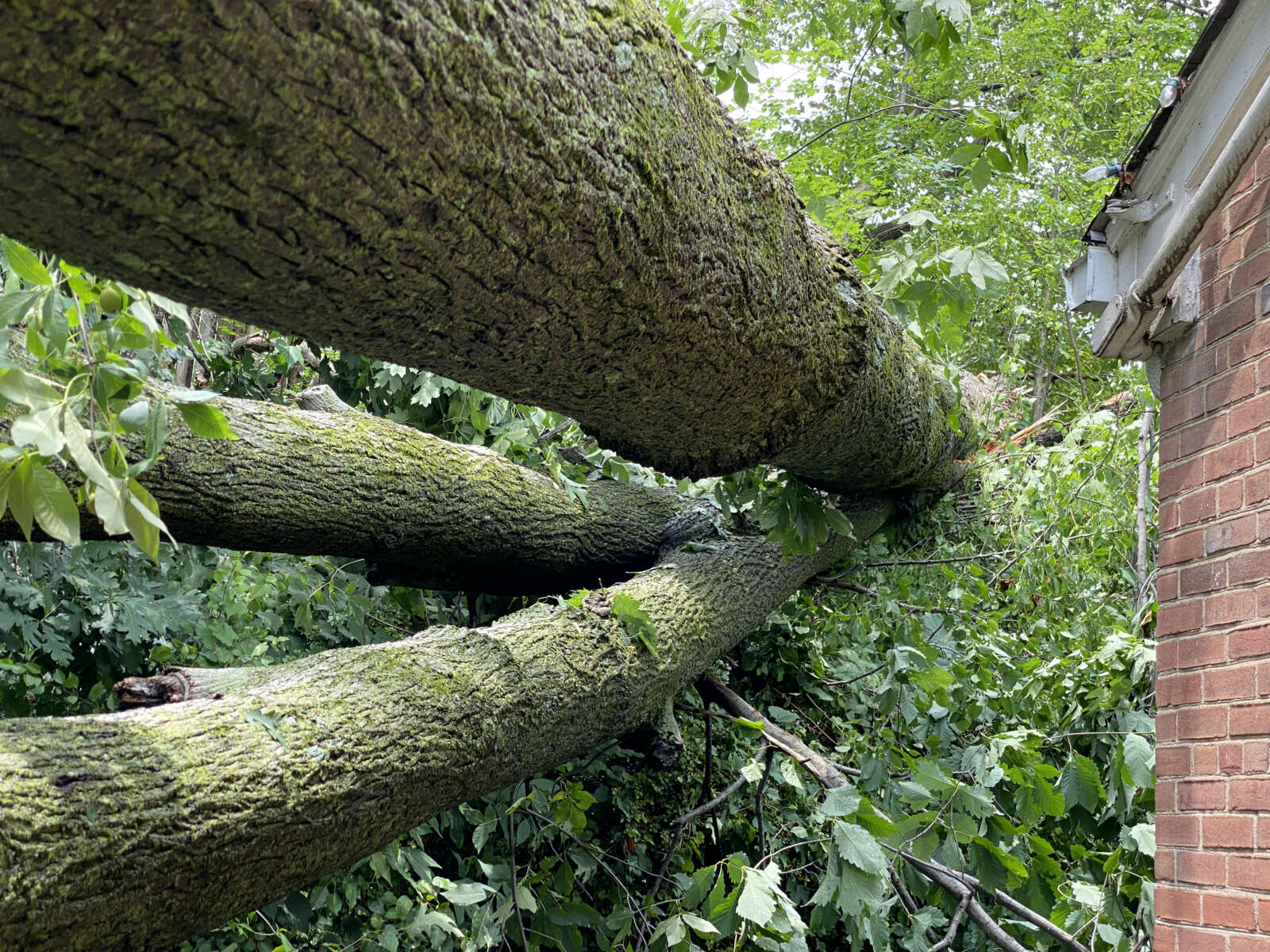
Tree leaning against a house near Woodstock Park
Damage from the presumed tornado Thursday night
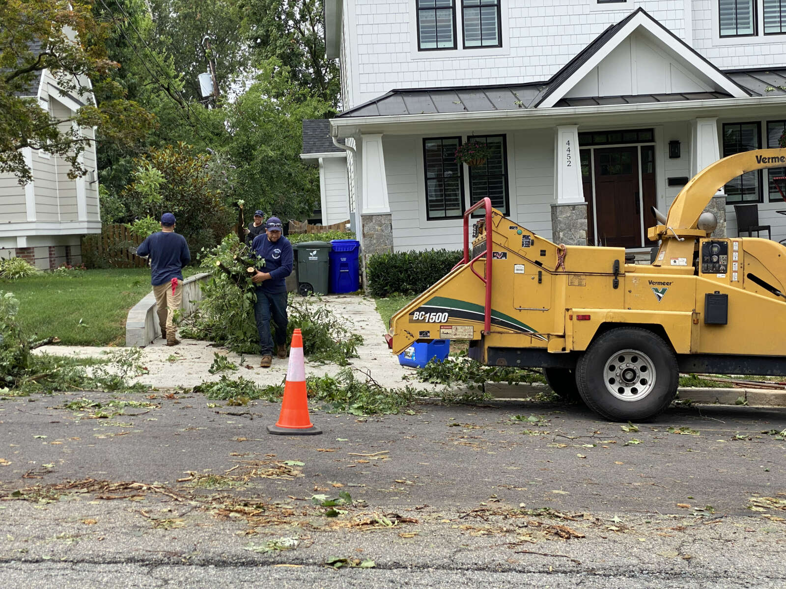
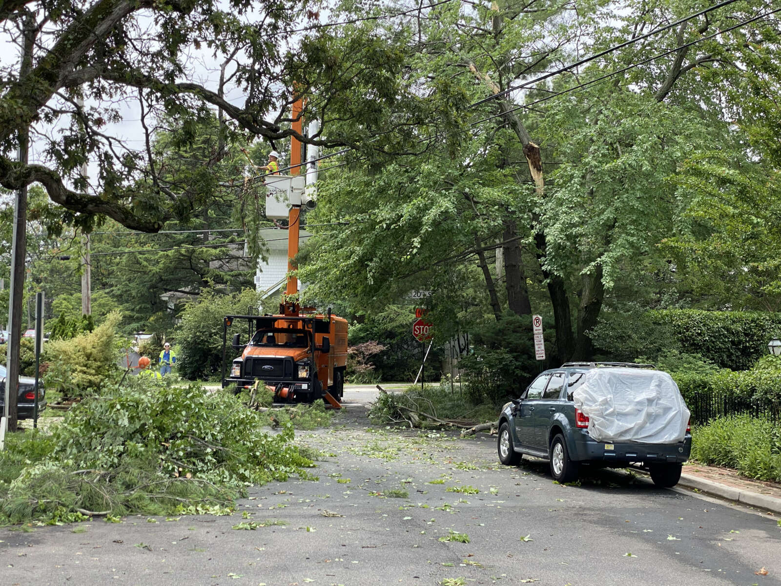
Tree crews cleaning up along 20th Road N. in Waverly Hills
Tree crews cleaning up along 20th Road N. in Waverly Hills
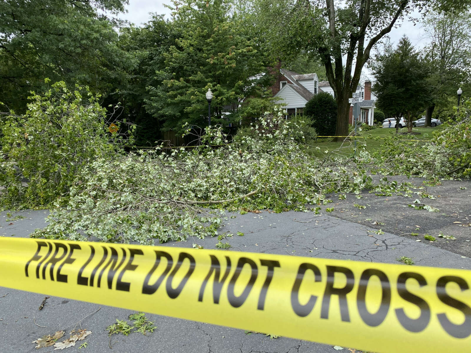
Tree blocking N. Utah Street in Waverly Hills
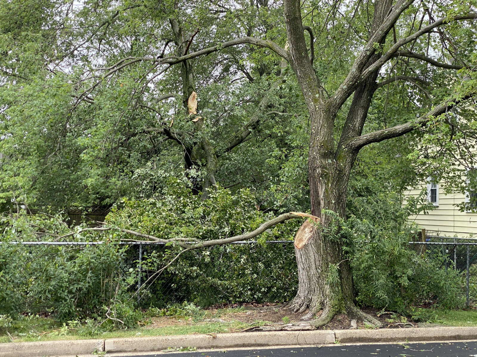
Tree damage in Waverly Hills
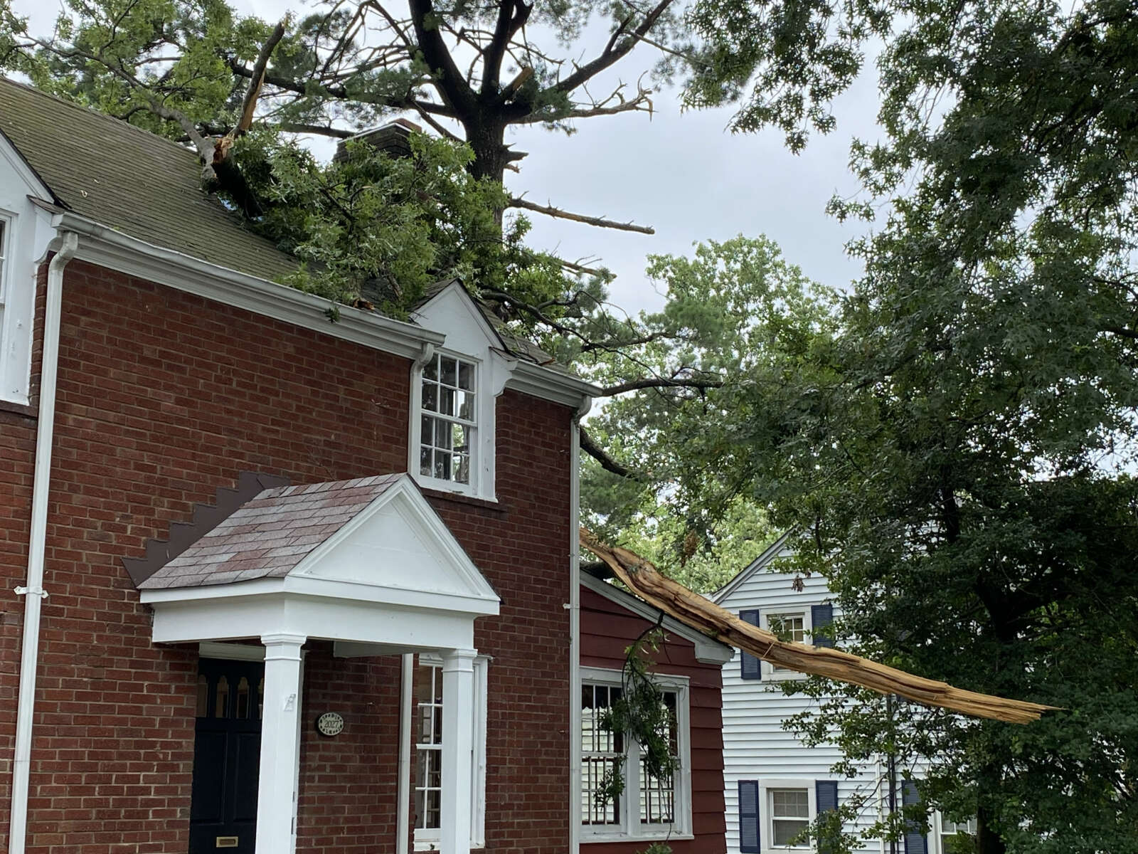
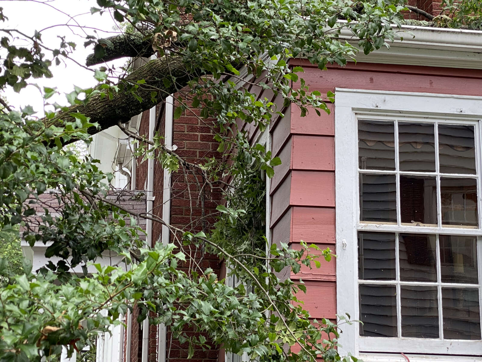
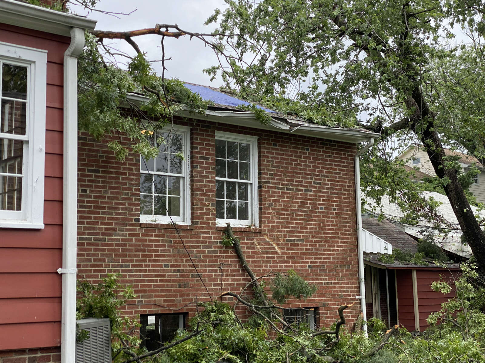
Trees on a house in Waverly Hills after the tornado (staff photo)
Trees on a house in Waverly Hills
Trees on a house in Waverly Hills
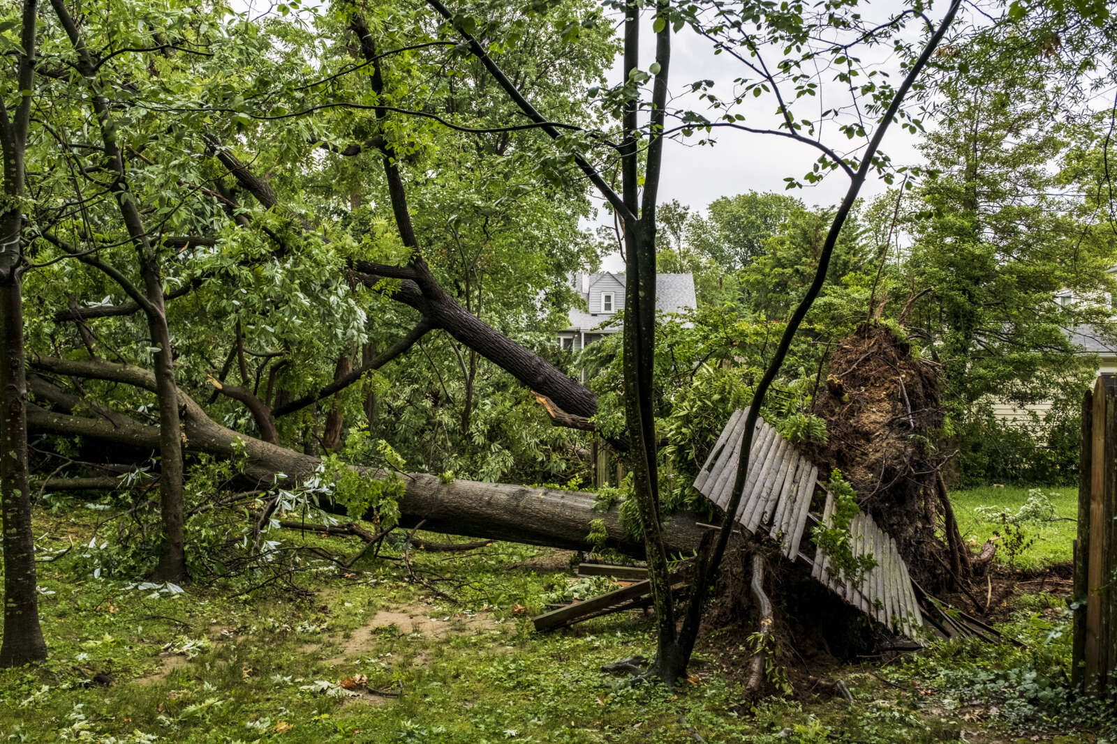
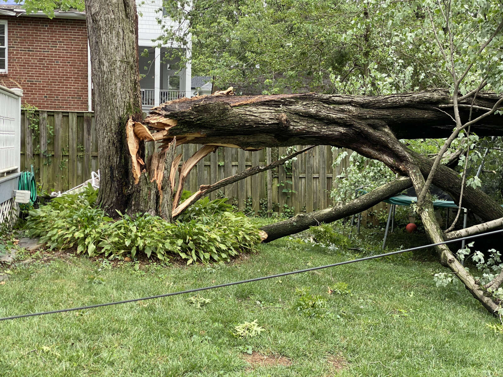
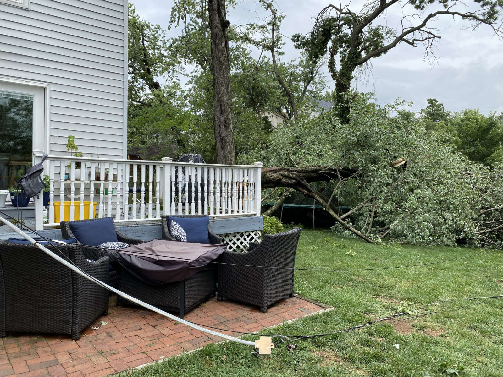
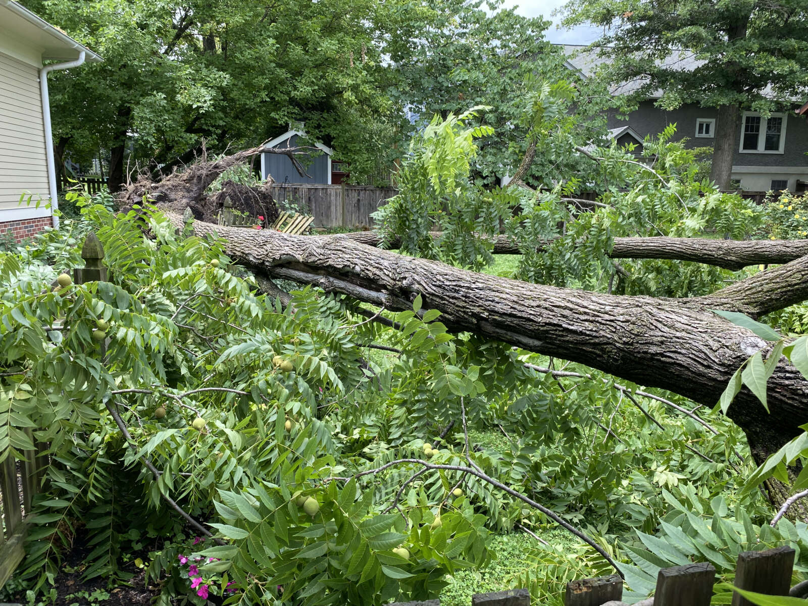
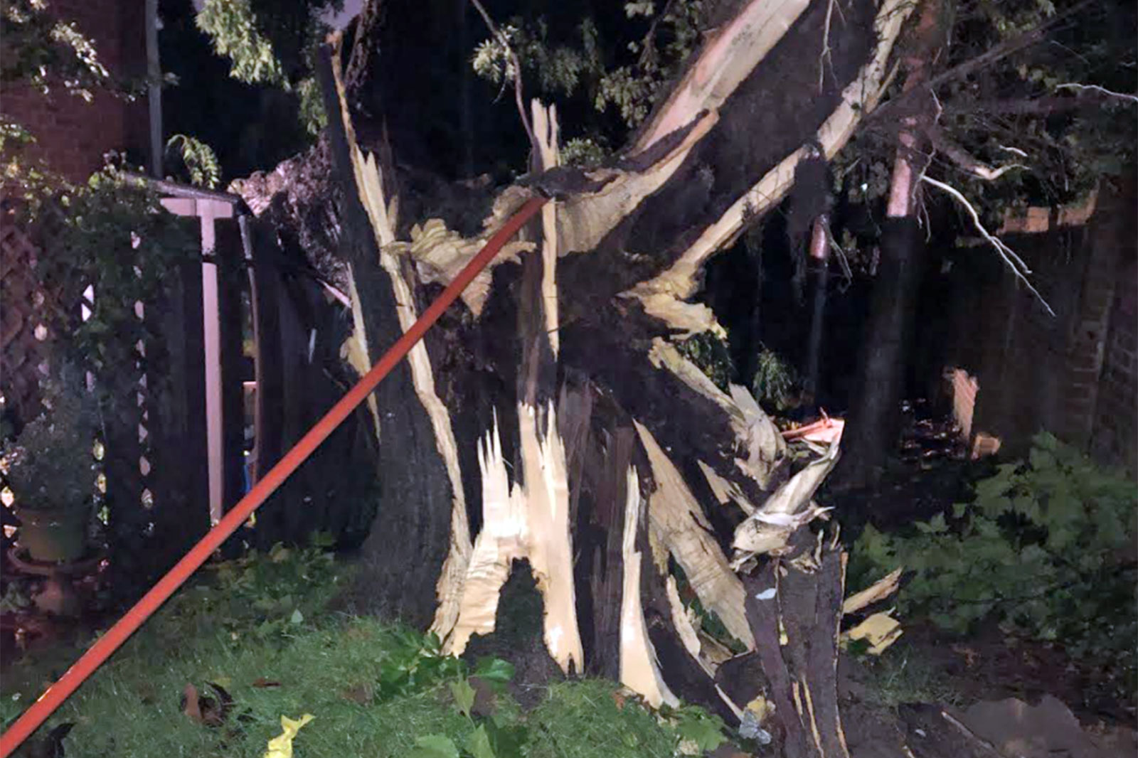
Downed tree in a backyard in Waverly Hills
Downed tree in a backyard in Waverly Hills
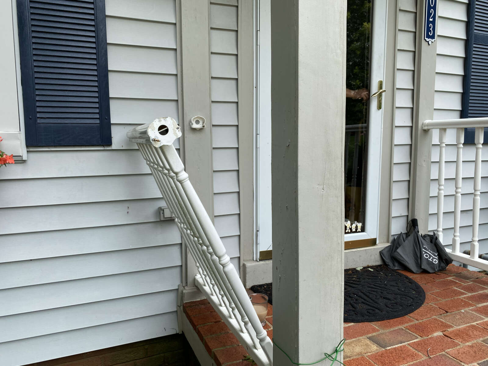
Railing damaged by a storm door that swung open in Waverly Hills
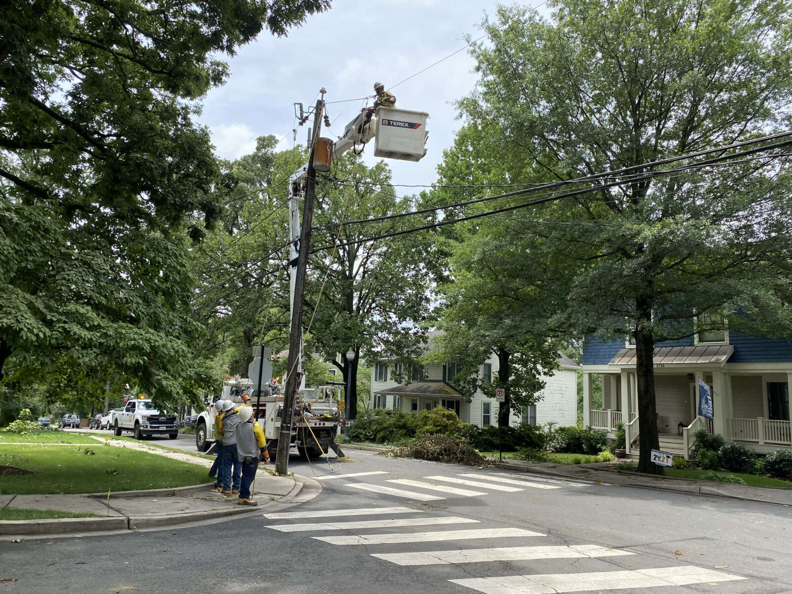
Crews working on utility lines in Cherrydale
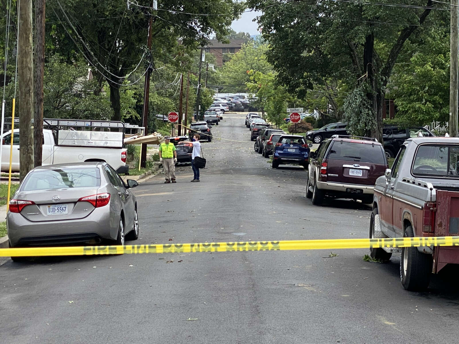
Road closed due to storm damage in Cherrydale
Door ripped off hinge behind Dunkin Donuts in Cherrydale
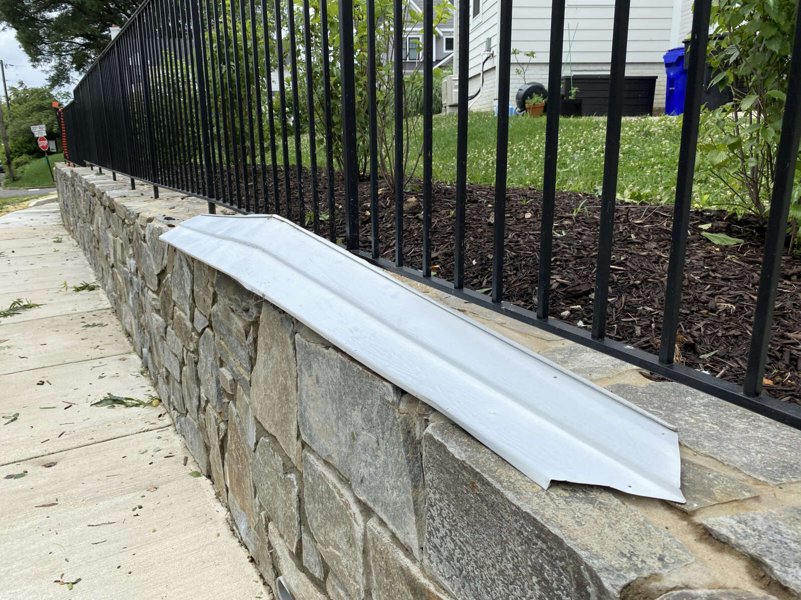
Shingles blown off the roof of a house by a tornado in Cherrydale earlier this summer (staff photo)
House damaged by large falling tree limb in Cherrydale
House damaged by large falling tree limb in Cherrydale
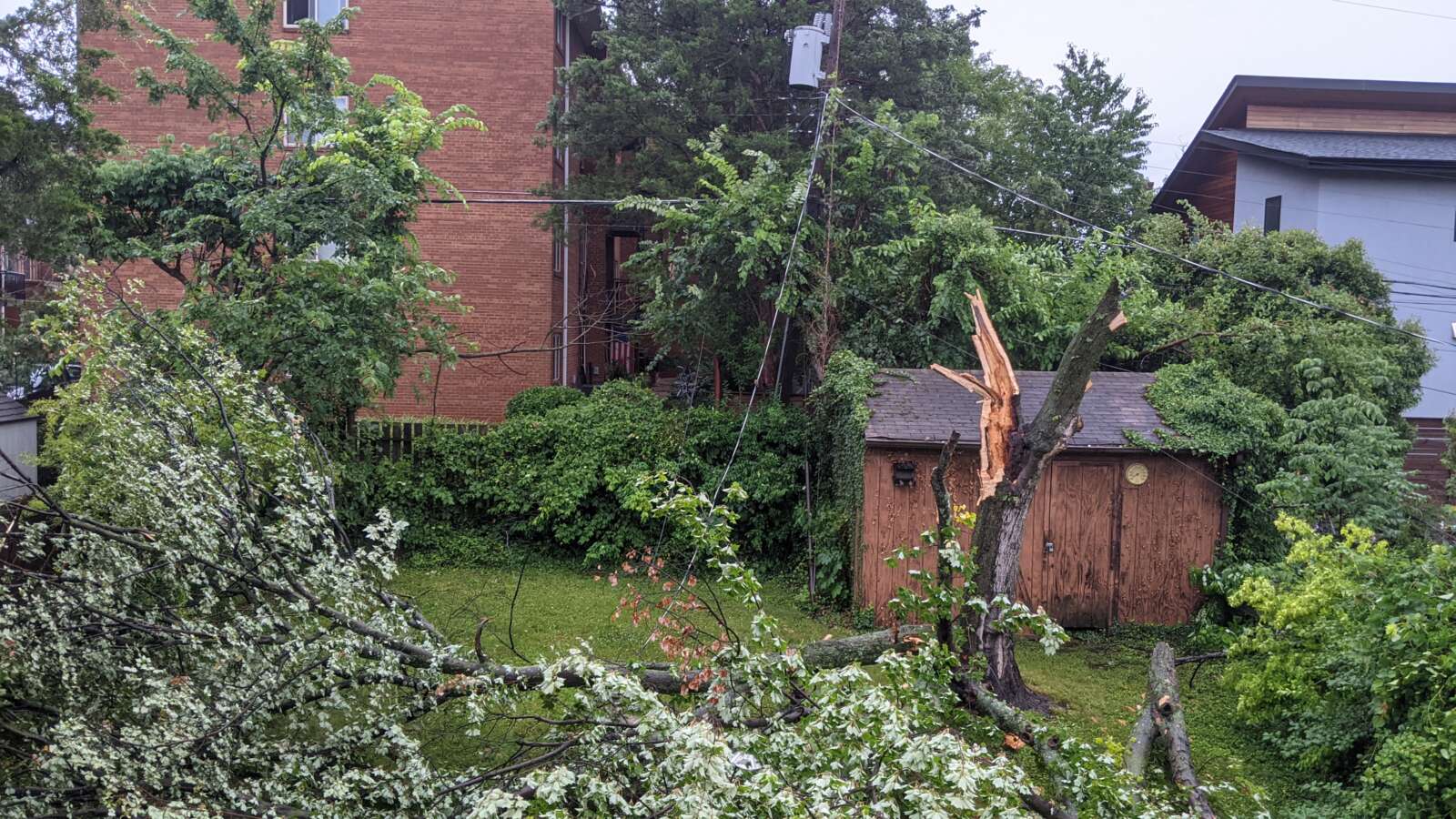
Destroyed shed and carport in Cherrydale
Destroyed shed and carport in Cherrydale in 2021 (staff photo)
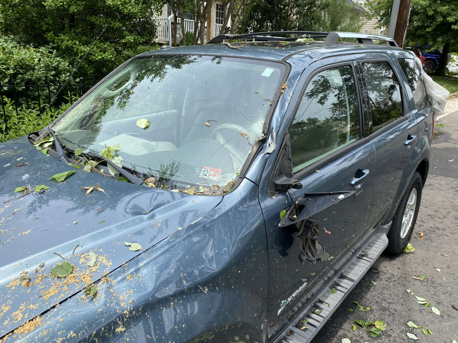
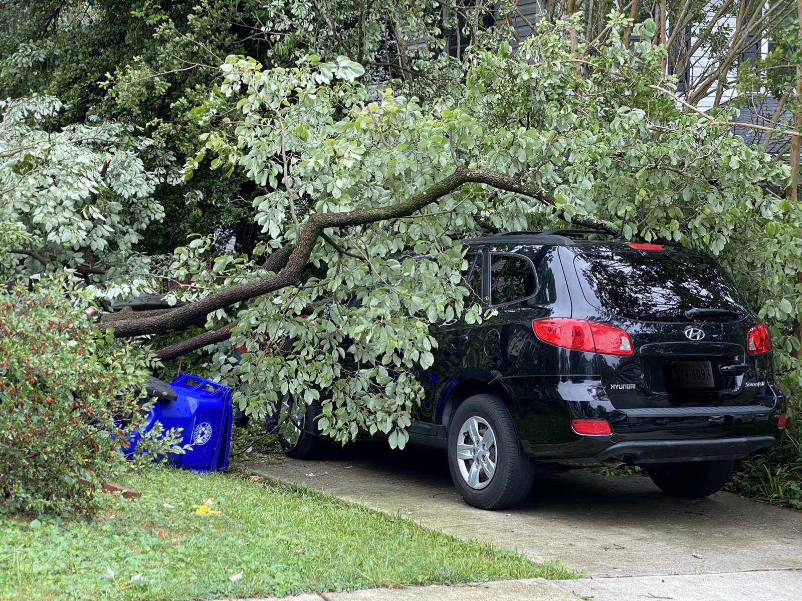
Car damaged by falling tree limb in Cherrydale
Siding blown off a house in Waverly Hills
Power crew in Lyon Village
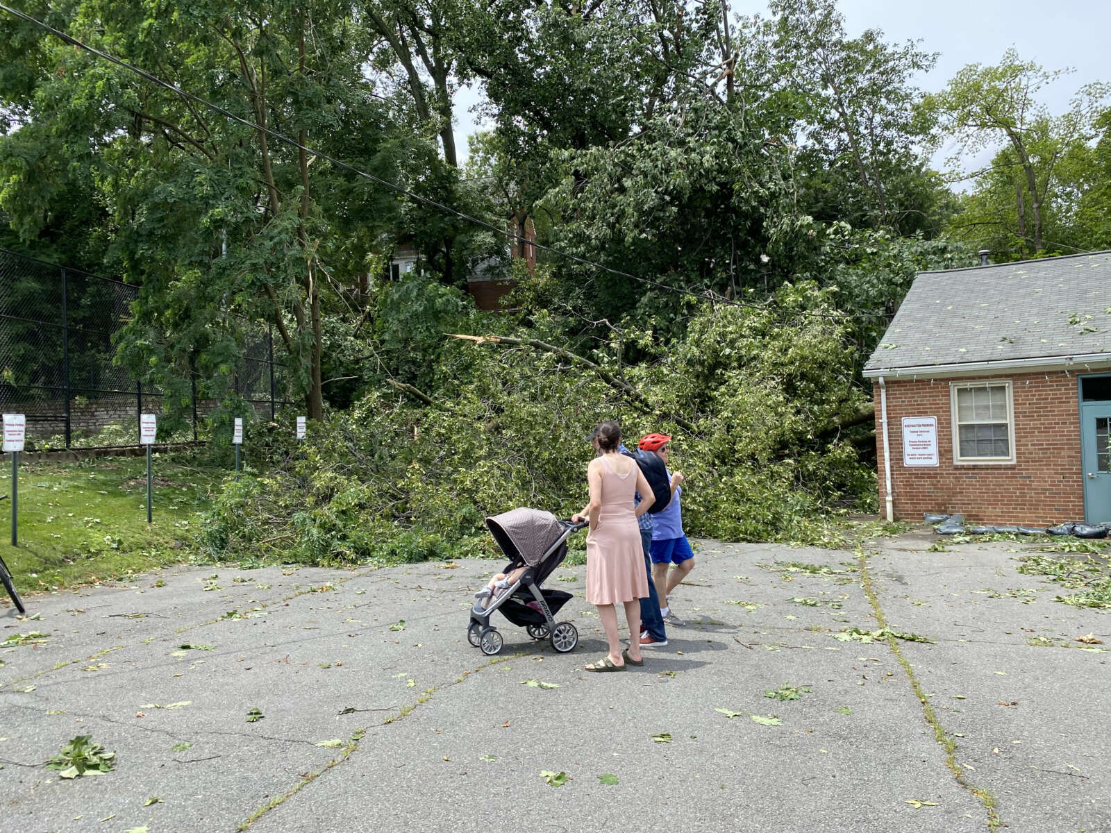
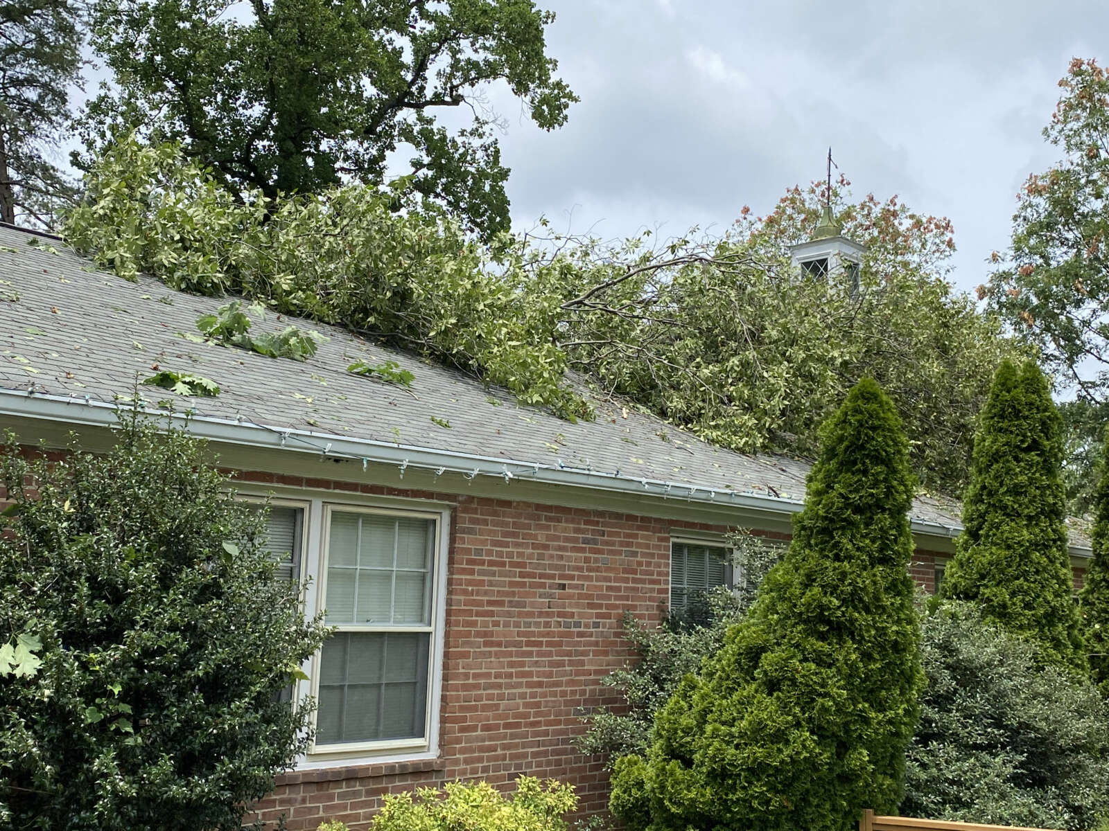
Trees fell onto the Lyon Village Community Center, causing damage
Trees fell onto the Lyon Village Community Center, causing damage
Trees fell onto the Lyon Village Community Center, causing damage
Trees fell onto the Lyon Village Community Center, causing damage
Trees fell onto the Lyon Village Community Center, causing damage
Trees fell onto the Lyon Village Community Center, causing damage
Tree branches down along N. Kirkwood Road
Crew clearing branches from utility lines in Cherrydale
Tree damage in Lyon Village
Crew clearing branches from utility lines in Cherrydale
Tree down in a yard in Cherrydale
Tree down on a car in Waverly Hills
Tree shattered in backyard of a home on N. Vermont Street in Waverly Hills (courtesy of Mike Gardell)
(Updated at 9:30 p.m.) The National Weather Service has confirmed that a tornado caused the widespread damage seen in several North Arlington neighborhoods today.
The tornado struck around 9 p.m. Thursday night, touching down near the intersection of Lee Highway and N. Glebe Road. It was rated as an EF1 — the second-lowest on the Enhanced Fujita scale — and cut a 125 yard-wide path of damage as it made its way east through several neighborhoods, before moving into D.C. Maximum winds were estimated at 90 mph.
The twister’s 4.4 mile path ended on the National Mall, between the Washington Monument and the White House. A second tornado, rated EF0, struck near H Street NE in the District, according to forecasters.
Tornado path (via National Weather Service)
In Arlington last night, the tornado uprooted trees, tore siding and shingles off houses, and turned trampolines and branches into projectiles.
Residents tell ARLnow they had just seconds from when their phones started blaring the Tornado Warning, shortly before 9 p.m., and when the rotating storm struck and caused havoc.
Much of the reported damage happened along the well-defined, roughly west-to-east line from the City of Falls Church and through Tara-Leeway Heights, Waverly Hills, Cherrydale and Lyon Village, before crossing the Potomac into D.C. along the National Mall.
Waverly Hills and Cherrydale suffered the worst of the storm’s fury, starting around Woodstock Park and moving along an easterly route just south of Lee Highway. The extent of the damage was evident this morning after the sun came up and chainsaws started buzzing over a large stretch of the neighborhoods.
At Woodstock Park this morning, children were playing despite the tree carnage that littered the park with fallen trees, branches and leaves. Jill Rabach was out surveying the damage to her house, just south of the park. An oak tree was leaning on her home’s roof and her next door neighbor’s fence was crushed by multiple falling trees.
“We heard the Tornado Warning and went to the basement,” Rabach recounted. “About 15 minutes later when all the noise died down we came upstairs and saw a little bit of damage not much. Power was out. By morning it was clear there was much more damage. All the houses on the street lost significant trees.”
“We’ve lived here for 15 years and there haven’t been many storms that blow that hard, that fast,” she added.
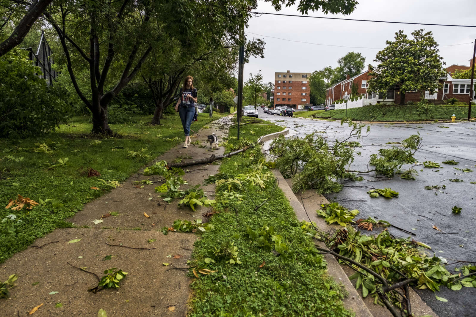
The damage continued along 20th Road N., east of the park, with tree crews hard at work clearing branches. Turning right onto N. Utah Street, the road was still blocked by a large fallen tree at 19th Road N.
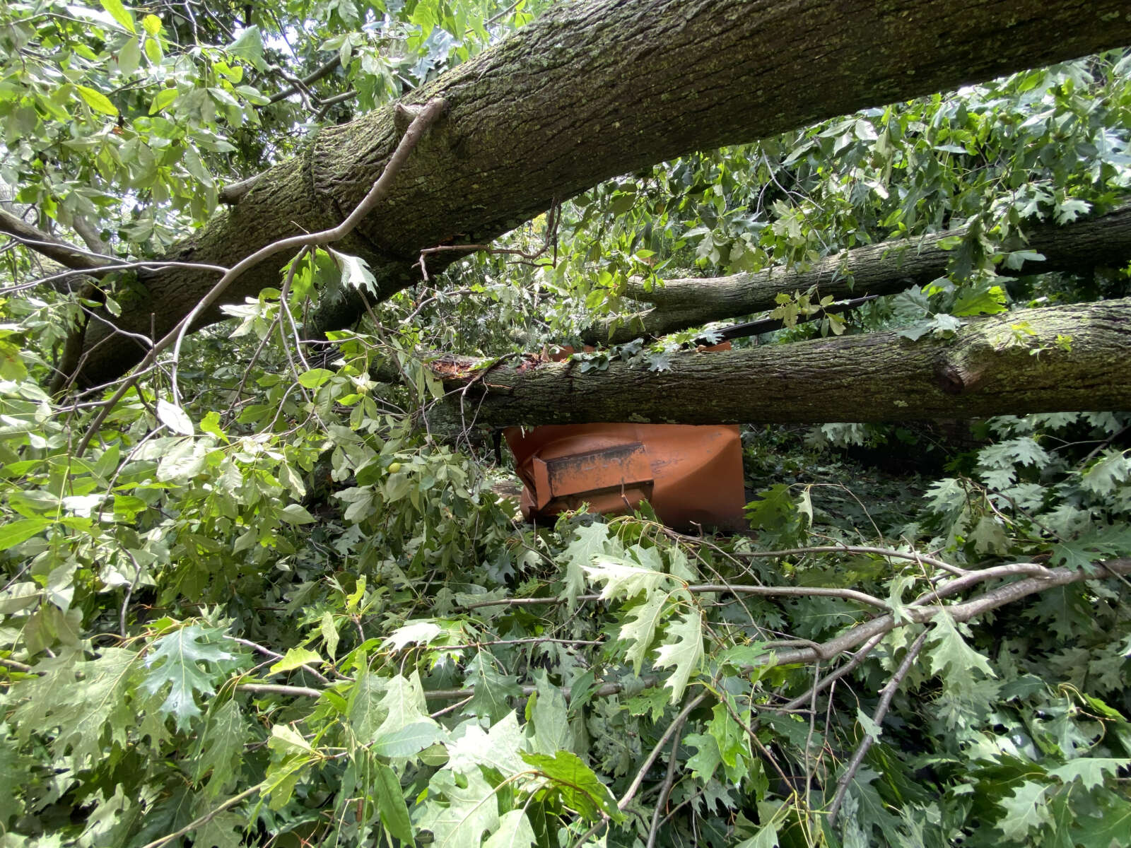
Heading back up the street, more signs of a violent storm: Multiple downed trees damaged roofs, broke windows and crushed fences; siding from an unknown house lay next to a sidewalk; trash cans were lifted up and blown into neighboring yards. And stuck in a tree near the road was an unusual sight — a large trampoline.
A family in the area said their storm door swung upon so violently it became lodged into and damaged a railing.
“We got the Tornado Warning and within 30 seconds, our front door burst open. And the whole house shook and rattled,” said René Madigan. “Like it all had to have all happened at once. It pulled down all of our power lines… the house next door, it blew their door wide open, too. They have a lot more damage to their home than we have. We were blessed.”
Madigan recounted the sound of the storm as it struck the normally quiet residential neighborhood.
“I heard a horrible sound. Like it was a really horrible sound. And then the whole house just was doing this,” she said, shaking her arms. “And it just happened so fast.”
“Tornado! Get in!” Madigan recalled shouting as the family took cover.
“I heard it and I was in the basement,” Madigan’s husband said of the noise. “First I thought like a big china cabinet fell down. It sounded like… a really loud explosion.”
One street over, and also to the east, residents were out cleaning up. One house had a blue tarp on the roof, but a neighbor said nothing fell on it — shingles were ripped off at the height of the storm.
Over on N. Stafford Street, Jeff Jackson was picking up tree branches across the street from St. Agnes Catholic School in Cherrydale. The Arlington native now lives in Portland, Oregon, but is home taking care of his mother. He was at a friend’s house nearby as the storm approached.
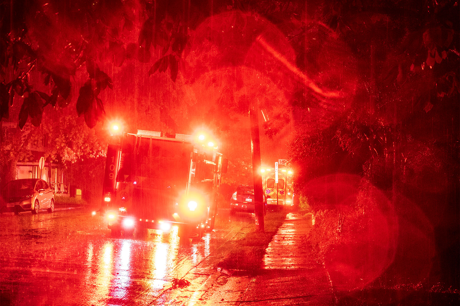
Earlier: The Arlington County Fire Department responded to “multiple calls for service” after a Tornado Warning was issued for parts of the county.
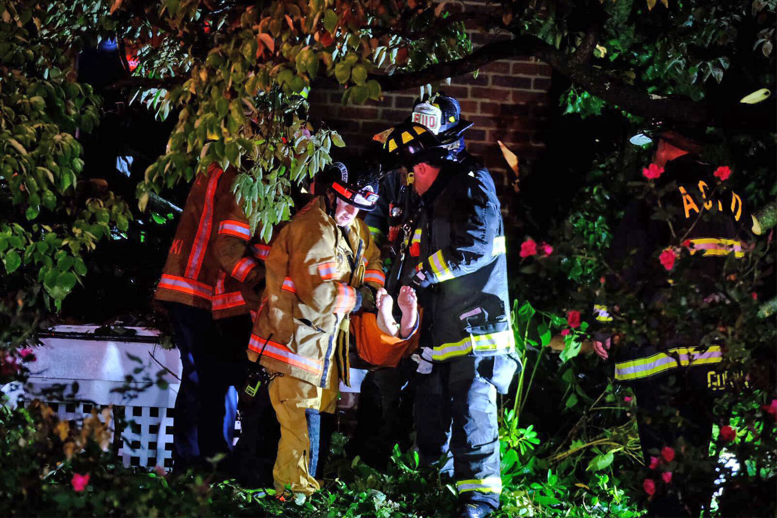
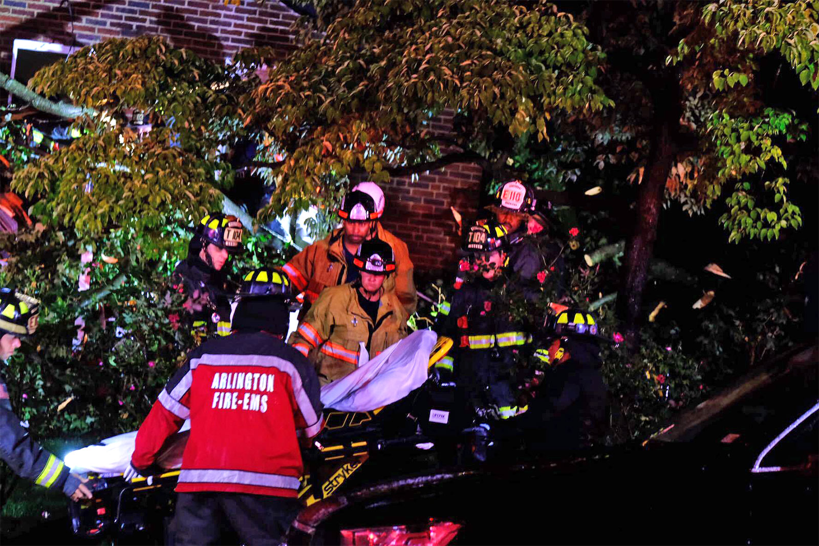
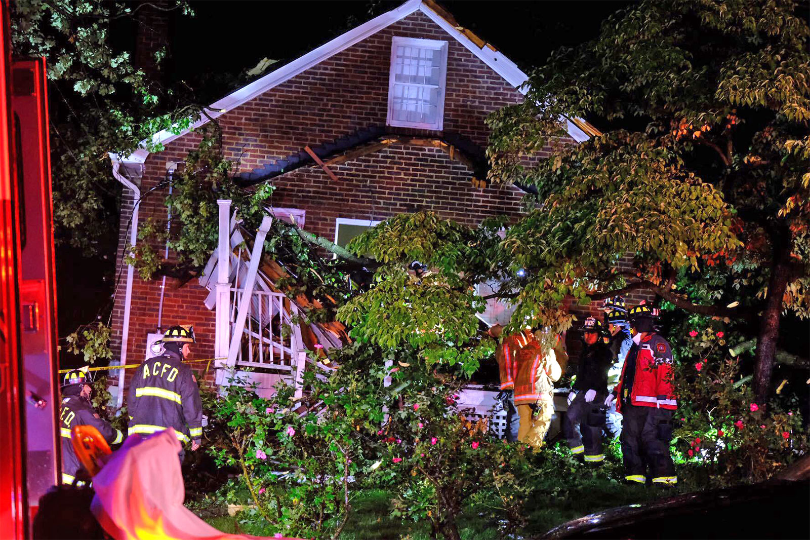
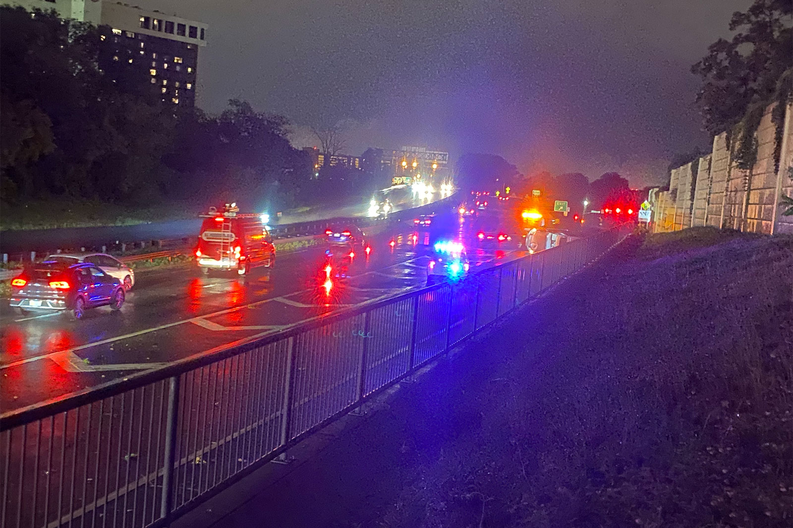
The fire department said shortly after 9 p.m. that it was swamped with calls and was “prioritizing life threatening emergencies.” Among the most serious calls were a man trapped after a tree fell on his house and an overturned vehicle near Columbia Pike.
“Calls for downed trees, stuck elevators and downed power lines are being addressed as units are available,” ACFD said on social media.
The National Weather Service says it will be surveying storm damage in Arlington to determine whether a tornado touched down.
“The National Weather Service will conduct a preliminary, first-look storm survey tonight in Arlington the District of Columbia and Prince George’s County,” NWS said in a statement. “We will perform a preliminary assessment to determine whether wind damage that occurred… was caused by a tornado or straight line winds.”
The final assessment is expected to be released on Friday.
The storm caused widespread damage and power outages in the county, mostly north of Route 50. As of 11:15 p.m., over 11,000 Dominion customers were still without power in Arlington, according to the power company.
Power outages in Arlington as of 10 p.m. (via Dominion)
Among the reported incidents first responders were dispatched to tonight were a tree down on a house with a man trapped on 16th Street N., several blocks from Washington-Liberty High School; an overturned vehicle on Washington Blvd north of Columbia Pike; and a tree on a car on Route 50 and N. Fillmore Street.
The person pinned in the house by the fallen tree has been rescued and brought to the hospital with non-life-threatening injuries, the fire department said. Two other people were reportedly in the house at the time but made it out okay, according to scanner traffic.
Two people were reported to have suffered significant injuries in the crash involving an overturned vehicle on Washington Blvd, near the Columbia Pike exit ramp. The crash happened around the same time as the storm struck. The two injured people were transported via ambulance to a local trauma center.
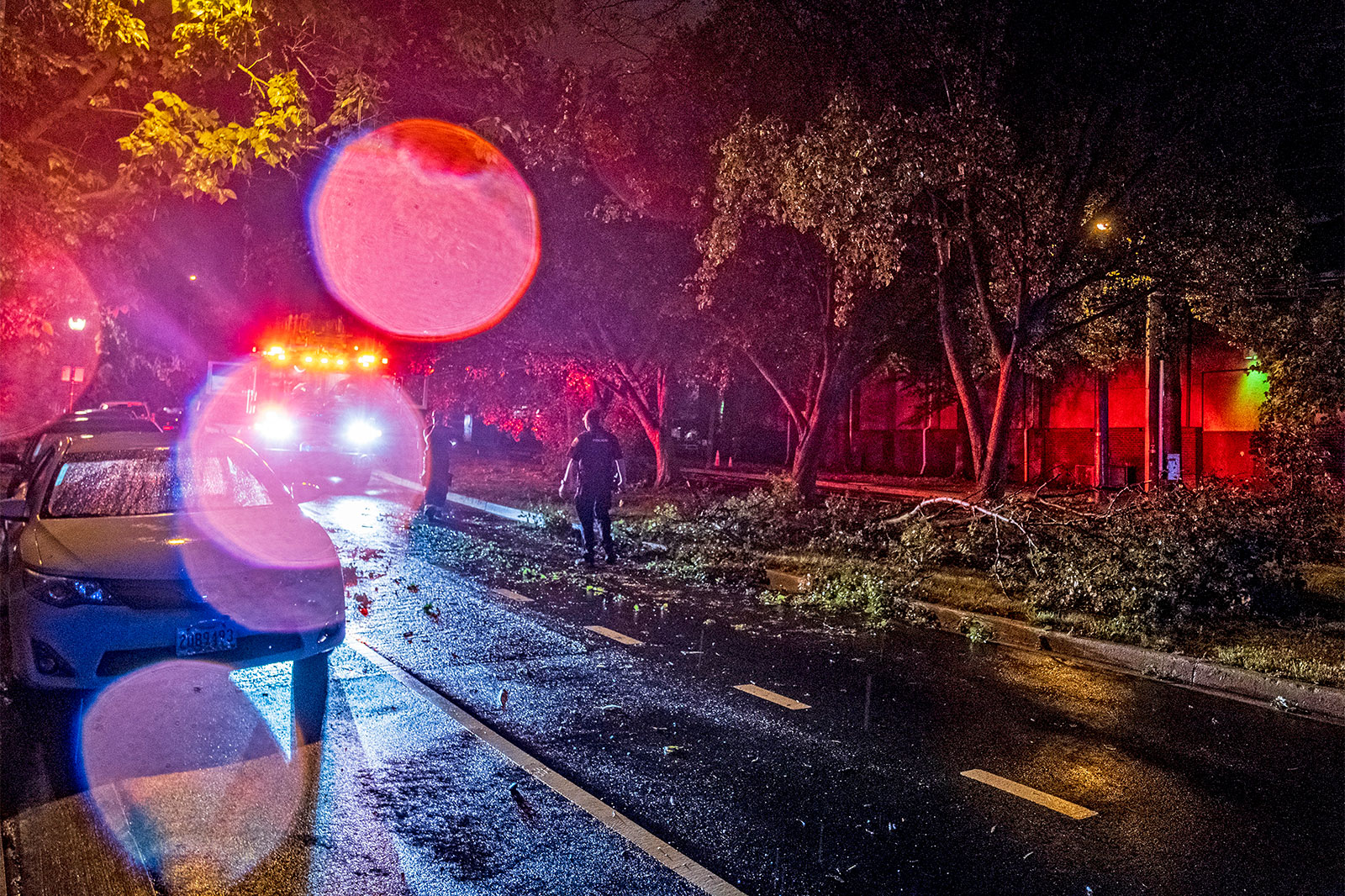
There were numerous other reports of trees, light poles and utility lines down, including at:
N. Kirkwood Road and 13th Street N.
Washington Blvd and Route 50
N. George Mason Drive and 22nd Street N.
N. Utah Street and 20th Street N.
N. Buchanan Street and 22nd Road N.
N. Upton Street and 20th Road N.
Columbia Pike and S. Adams Street
McKinley Road and 9th Road N.
N. Illinois Street and 22nd Street S.
N. Highland Street and Key Blvd
21st Street N. and N. Nottingham Street
Spout Run Parkway at Lorcom Lane
1500 block of S. Clark Street
The likely tornado path, based on weather radar and damage reports, would have taken it east from the Falls Church area, to the Waverly Hills neighborhood and the area around Washington-Liberty High School, and finally over into central portions of the District including the National Mall and Nationals Park.
Tornado Warned storm left rotation track right through the middle of Washington, D.C. around 9:10 PM! Trees down in Falls Church, winds gusted >50 southeast of DC! #DCwxpic.twitter.com/l83k7kiia6
Residents are being encouraged to stay home or take “extreme caution” if out tonight due to the storm damage.
If you are in Arlington, DC, or nearby in the greater metro area: use extreme caution if out and about tonight. There are likely lots of hanging branches and leaning trees from earlier storms which may fall overnight. Avoid wooded areas, downed wires, and flooded or closed roads.
— NWS Baltimore-Washington (@NWS_BaltWash) July 2, 2021
The urgent alerts for the Tornado Warning sounded just before 9 p.m. as a line of strong storms approached. Arlington was also currently under a Severe Thunderstorm Warning and a Flash Flood Warning.
The original warning, from the National Weather Service:
THE NATIONAL WEATHER SERVICE IN STERLING VIRGINIA HAS ISSUED A
* TORNADO WARNING…
* UNTIL 930 PM EDT.
* AT 858 PM EDT, A SEVERE THUNDERSTORM CAPABLE OF PRODUCING A TORNADO WAS LOCATED OVER BALLSTON, OR OVER ARLINGTON, MOVING EAST AT 35 MPH.
HAZARD…TORNADO.
SOURCE…RADAR INDICATED ROTATION.
IMPACT…FOR THOSE IN THE DIRECT PATH OF A TORNADO TOUCHDOWN, FLYING DEBRIS WILL BE DANGEROUS TO THOSE CAUGHT WITHOUT SHELTER. DAMAGE TO ROOFS, SIDING, AND WINDOWS MAY OCCUR. MOBILE HOMES MAY BE DAMAGED OR DESTROYED. TREE DAMAGE IS LIKELY.
* THIS DANGEROUS STORM WILL BE NEAR… CRYSTAL CITY AROUND 905 PM EDT. NATIONALS PARK, REAGAN NATIONAL AIRPORT, GALLAUDET UNIVERSITY, ANACOSTIA AND US CAPITOL AROUND 910 PM EDT.
Video footage from around the time of the warning shows dark clouds bearing down on the county as very strong winds whip up, and the shadowy outline of what looks somewhat like a funnel cloud.
Hope you don’t mind my cropping. It might just be shadows playing tricks… But lowering (and twist?) from dark area in middle of frame sure looks suspicious. Good correlation to radar velo (by my estimate). Hope Twitter video compression doesn’t kill. pic.twitter.com/bkNRRbSX1s

")
")
")
")
")
")
")
")
")
")


")