Tornado Drill Today — “Virginia’s annual Statewide Tornado Drill will occur on Tues., March 16 at 9:45 a.m. If widespread severe weather threatens the Commonwealth on that date, the drill will be rescheduled for Wed., March 17, at 9:45 a.m. The Statewide Tornado Drill is an opportunity to prepare Virginians for tornado threats and to test public warning systems.” [Va. Dept. of Emergency Management]

Pentagon Row Harris Teeter’s Future in Flux — “Despite concerns from nearby residents, Arlington County Board members on March 20 could give the owner of Pentagon Row the ability to, potentially, significantly downsize grocery-store operations… Located on a 15-acre parcel in Pentagon City, the site has long included a Harris-Teeter supermarket. But that initial lease term is expiring, and there is no guarantee the supermarket chain will want to stay in the existing space.” [Sun Gazette]

Coronavirus Tests Available at DCA — “Coronavirus testing launched Monday at Reagan National and Washington Dulles International airports, which became the latest airports across the country to offer the tests. The centers are outside the security checkpoints at both airports and are operated by XpresCheck, which runs centers at a number of U.S. airports.” [Washington Post]

New Building to Have Temporary Hotel Rooms — “Arlington County Board members next month are expected to allow another developer to temporarily convert apartment space to hotel use. The developer of the 809-unit property at 1555 Wilson Blvd. is asking permission to use 100 of the residential units as hotel space starting in late summer. Eventually, the units would revert to their originally intended purpose.” [Sun Gazette]

Cherry Blossom Sculptures Arrive in Arlington — From the National Landing BID: “Two official @CherryBlossFest sculptures have landed! One at the Esplanade at Long Bridge Park and one at the Crystal City Water Park. They will be up through May 31.” [Twitter]

Bill Would Allow 15 MPH Speed Limits in Va. — “Currently, any city or county looking to slow traffic in a busy shopping district or on a quiet residential street can go no lower than 25 mph. A bill passed during this year’s General Assembly session, however, would change that, permitting posted speed limits to drop as low as 15 mph. A ten miles per hour difference may not seem huge, but for pedestrian safety advocates and the families of victims of traffic collisions, the change could mean the difference between life and death.” [Greater Greater Washington]


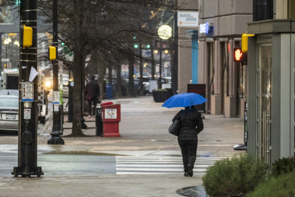
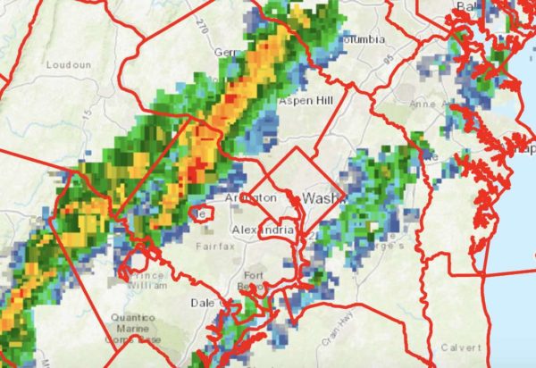
Arlington and much of the region is under a Tornado Watch from now through 10 p.m.

Forecasters say storms now forming to the west could pack strong winds and even some tornadoes. Those in the watch zone are urged to keep an eye on the sky, and to take cover if necessary.

More from the National Weather Service:

URGENT – IMMEDIATE BROADCAST REQUESTED
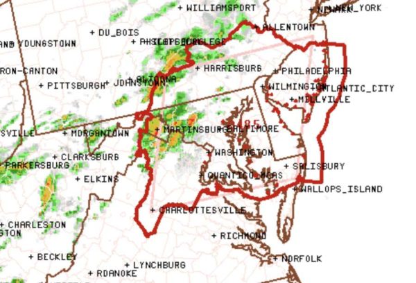
Tornado Watch Number 485
NWS Storm Prediction Center Norman OK
340 PM EDT Thu Sep 3 2020

The NWS Storm Prediction Center has issued a

* Tornado Watch for portions of District Of Columbia, Delaware, Maryland, Southern New Jersey, Southeast Pennsylvania, Northern Virginia, Eastern West Virginia Panhandle, Coastal Waters

* Effective this Thursday afternoon and evening from 340 PM until 1000 PM EDT.

* Primary threats include… A few tornadoes likely. Scattered damaging winds likely with isolated significant gusts
to 75 mph possible.

SUMMARY…Multiple supercells will likely develop near and north of the greater Washington D.C. area and spread east as a cluster across the coastal plain through mid-evening. A few tornadoes and swaths of damaging winds are likely.

The tornado watch area is approximately along and 85 statute miles east and west of a line from 45 miles north northwest of Wilmington DE to 30 miles west southwest of Patuxent River MD…

PRECAUTIONARY/PREPAREDNESS ACTIONS…

REMEMBER…A Tornado Watch means conditions are favorable for tornadoes and severe thunderstorms in and close to the watch area. Persons in these areas should be on the lookout for threatening weather conditions and listen for later statements and possible warnings.


Arlington and most of the metropolitan D.C. area are now under a Tornado Watch.

While a Wind Advisory remains in effect until 6 p.m., the National Weather Service has added a Tornado Watch on top of it, also through 6 p.m.

Winds are expected to start whipping up this afternoon, and some tornados may spawn as a storm system makes its way through the Mid-Atlantic and up the East Coast.


A Tornado Watch has been issued for Arlington and the D.C. region as severe storms threaten dangerous conditions amid tonight’s Halloween festivities.

The Tornado Watch is in effect until midnight.

Forecasters warn that a line of storms packing rain and gusty winds will reach Arlington around 9 p.m. Trick-or-treaters and Halloween partiers should seek shelter ahead of the storms.

The National Weather Service issued a special statement about the storm threat:

…DAMAGING LINE OF THUNDERSTORMS LIKELY TO MOVE EAST ACROSS THE AREA BETWEEN MID AFTERNOON AND MIDNIGHT…

A LINE OF THUNDERSTORMS IS EXPECTED TO MOVE EAST ACROSS THE REGION. THESE STORMS WILL BRING THE POSSIBILITY OF DAMAGING WIND  GUSTS AND ISOLATED TORNADOES. PLEASE BE SHELTERED WHEN THESE  THUNDERSTORMS PASS THROUGH YOUR AREA.

THE MOST LIKELY TIMING OF THE LINE RANGES FROM MID TO LATE AFTERNOON FOR THE POTOMAC HIGHLANDS, TO THE EVENING FOR THE BALTIMORE/WASHINGTON METROS, TO BETWEEN 9PM AND MIDNIGHT FOR AREAS EAST OF I-95 TO THE CHESAPEAKE BAY. THE STORMS WILL LIKELY LAST AN HOUR OR LESS IN MOST AREAS.

STAY INFORMED. FOR MORE EXACT TIMING FOR YOUR LOCATION, CONSULT THE FORECAST FOR YOUR COMMUNITY AT OUR WEBSITE WEATHER.GOV OR OUR FACEBOOK OR TWITTER FEEDS FOR NATIONAL WEATHER SERVICE BALTIMORE/WASHINGTON.

More via social media:


Update at 2:50 p.m. — The Severe Thunderstorm Warning has been cancelled by the National Weather Service.

Update at 2:30 p.m. — A Severe Thunderstorm Warning has been issued for Arlington.

THE NATIONAL WEATHER SERVICE IN STERLING VIRGINIA HAS ISSUED A * SEVERE THUNDERSTORM WARNING FOR… THE DISTRICT OF COLUMBIA… SOUTHEASTERN MONTGOMERY COUNTY IN CENTRAL MARYLAND… NORTHERN PRINCE GEORGES COUNTY IN CENTRAL MARYLAND… THE NORTHEASTERN CITY OF FAIRFAX IN NORTHERN VIRGINIA… ARLINGTON COUNTY IN NORTHERN VIRGINIA… THE CITY OF FALLS CHURCH IN NORTHERN VIRGINIA… NORTHEASTERN FAIRFAX COUNTY IN NORTHERN VIRGINIA… THE CITY OF ALEXANDRIA IN NORTHERN VIRGINIA… * UNTIL 315 PM EDT. * AT 225 PM EDT, A SEVERE THUNDERSTORM WAS LOCATED OVER HUNTINGTON, MOVING NORTHEAST AT 45 MPH. HAZARD…60 MPH WIND GUSTS AND QUARTER SIZE HAIL. SOURCE…RADAR INDICATED. IMPACT…DAMAGING WINDS WILL CAUSE SOME TREES AND LARGE BRANCHES TO FALL. THIS COULD INJURE THOSE OUTDOORS, AS WELL AS DAMAGE HOMES AND VEHICLES. ROADWAYS MAY BECOME BLOCKED BY DOWNED TREES. LOCALIZED POWER OUTAGES ARE POSSIBLE. UNSECURED LIGHT OBJECTS MAY BECOME PROJECTILES… REMAIN ALERT FOR A POSSIBLE TORNADO! TORNADOES CAN DEVELOP QUICKLY FROM SEVERE THUNDERSTORMS. IF YOU SPOT A TORNADO GO AT ONCE INTO THE BASEMENT OR SMALL CENTRAL ROOM IN A STURDY STRUCTURE. FOR YOUR PROTECTION MOVE TO AN INTERIOR ROOM ON THE LOWEST FLOOR OF A BUILDING. TO REPORT SEVERE WEATHER, CONTACT YOUR NEAREST LAW ENFORCEMENT AGENCY. THEY WILL SEND YOUR REPORT TO THE NATIONAL WEATHER SERVICE OFFICE IN STERLING VIRGINIA. && TORNADO…POSSIBLE HAIL…1.00IN WIND…60MPH

Earlier: A Tornado Watch has been issued for Arlington and much of the D.C. region.

The watch, which is in effect until 9 p.m. tonight, was issued ahead of the arrival of a line of storms packing heavy rain and strong winds.

More from the National Weather Service on Twitter:

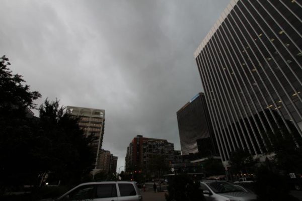
Flickr pool photo by Kevin Wolf


(Updated at 1:25 p.m.) Arlington and the D.C. region is now under a Tornado Watch.

The watch is in effect until midnight tonight. Forecasters say the storms approaching the area may spawn isolated tornadoes.

The region is also under a Flash Flood Watch, with heavy rain expected this afternoon and evening. The expected stormy weather has prompted airlines to allow travelers at Reagan National Airport to change their flights without additional fees.

More from the National Weather Service:

MULTIPLE ROUNDS OF SHOWERS AND THUNDERSTORMS ARE EXPECTED THIS AFTERNOON AND EVENING. SOME OF THE STORMS WILL LIKELY BE CAPABLE OF PRODUCING DAMAGING WIND GUSTS AND ISOLATED TORNADOES.

A FLASH FLOOD WATCH IS IN EFFECT FROM NOON TODAY THROUGH MOST OF TONIGHT FOR THE ENTIRE OUTLOOK AREA.

GALE CONDITIONS ARE POSSIBLE OVER THE WATERS TONIGHT.

With flooding and power outages possible, Arlington County Police are reminding motorists to take extra precautions on the roads.


Woman Injured When Scooter’s Brakes Fail — “An Arlington, Virginia, woman says she had to jump off of an electric scooter moving 15 mph to avoid oncoming traffic because the rented scooter’s brakes weren’t working.” [NBC 4]

Could Goody’s Challenge Sign Rules? — Goody’s restaurant in Clarendon painted over its outdoor mural after running afoul of Arlington’s sign ordinance, but one attorney says a 2015 Supreme Court ruling may point to an avenue to challenge the county’s regulations. [Reason]

Refugees Get Car from Arlington Diocese — “A Catholic family fleeing religious persecution in their native Pakistan [received] a car Monday in Arlington.” [WUSA 9]

Tornado Drill Today in Va. — Updated at 8:55 a.m. — Virginia is conducting its annual statewide tornado drill today at 9:45 a.m. [Virginia DEM, Twitter]

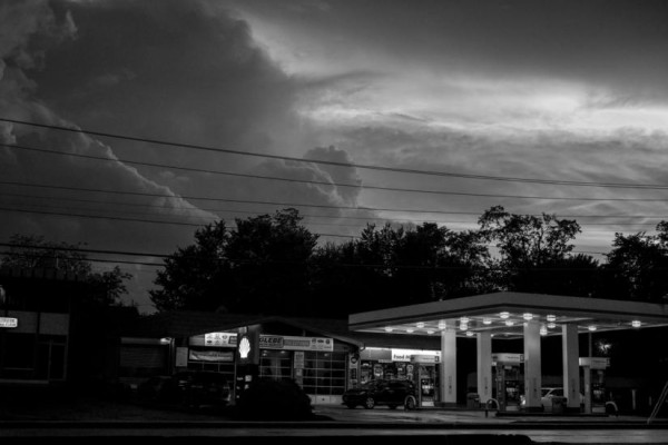
Flickr pool photo by Kevin Wolf


Arlington County is now under a Tornado Watch in addition to the earlier Flash Flood Watch.

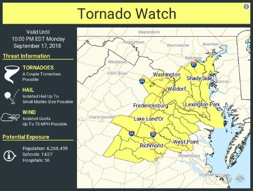
With the remnants of Hurricane Florence moving past the area, conditions are favorable for the development of tornadoes. Within the past half hour, a possible tornado was reported near Fredericksburg.

The Tornado Watch is in effect until 10 p.m.


Flash Flood Watch Remains, Though Rain is Subsiding — Weather watchers warn that a risk of floods remains through this afternoon, but things are set to get steadily dryer as Thursday and Friday get closer. [NWS]

Are Tolls Worth It on Virginia’s HOT Lanes? — A new study shows it’s a bit of a mixed bag for commuters, though anyone hopping on I-66 instead of Route 29 or Route 50 is probably getting their money’s worth. Researchers don’t see those arterial roads as viable alternatives, given the time savings 66 still offers during rush hour. [WTOP]

Metro Remains Less-Than-Ideal for Blind Riders — Months after a blind woman fell off a platform due to problems with Metro’s new 7000-series trains, the transit service is still scrambling to improve conditions for the visually impaired. [Washington Post]

Nearby: A Tornado Touched Down Near Thomas Jefferson High School — Officials believe a twister made a roughly one-minute-long appearance near the school, around the border of Alexandria and Annandale. [Washington Post]

Flickr pool photo via wolfkann


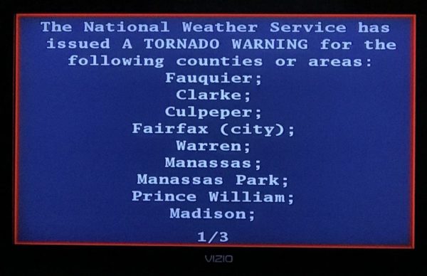
Throughout Virginia today, TVs and weather radios broadcast a test Tornado Warning as part of the annual Statewide Tornado Drill.

Anyone watching cable TV saw programming interrupted by Emergency Alert System message. A computerized voice said the Tornado Warning was just a test, but in a real weather emergency anyone seeing the EAS message should get to a basement or other secure location.

More from Virginia Dept. of Emergency Management:

The Statewide Tornado Drill is a yearly opportunity to prepare Virginians for tornado emergencies and to test public warning systems.

Save the date! The 2018 Statewide Tornado Drill will take place on Tornado Preparedness Day, Tuesday, March 20, 2018, at 9:45 a.m. (If widespread severe weather threatens the Commonwealth on that date, then the drill will be on  Wednesday, March 21, at 9:45 a.m.)

At approximately 9:45 a.m., the National Weather Service will send a test tornado warning over NOAA Weather Radios. This test signal will sound a tone alert, show a test message or flash to indicate a message, simulating what people would hear or see during an actual tornado warning. Local radio stations, TV stations and cable outlets will also broadcast the test message via the Emergency Alert System.

The drill takes place annually on the first day of spring.

The Arlington Dept. of Public Safety Communications & Emergency Management also participated in the drill and live tweeted it.

https://twitter.com/ReadyArlington/status/976092550674214913


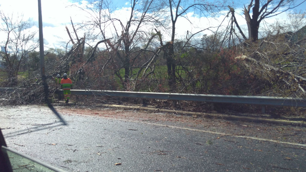
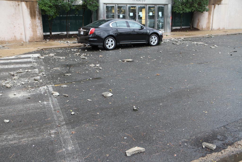
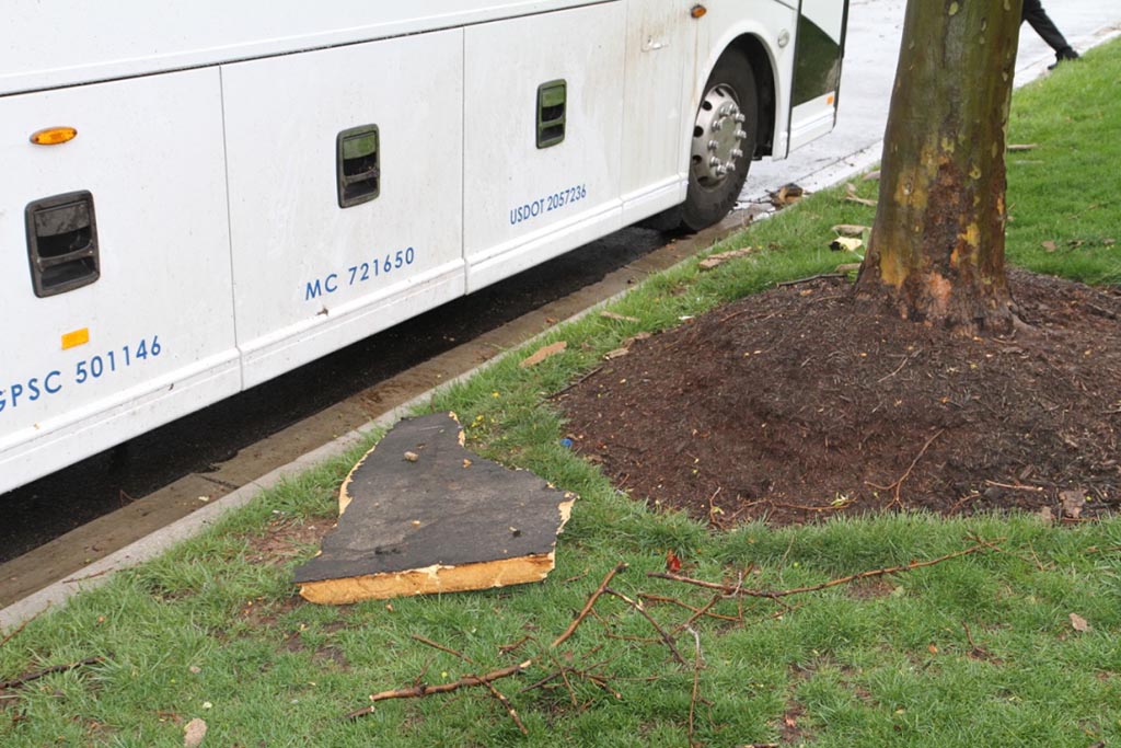
There’s been a lot of clean-up in Arlington following last Thursday’s strong storms that produced a weak tornado.

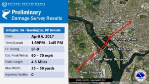
The National Weather Service says the tornado formed adjacent to the Army Navy Country Club and lasted for six minutes on its 4.5 mile journey through Pentagon City and into Washington, D.C. The F-0 tornado had peak winds of 60-70 miles per hour.

The Army Navy Country Club property experienced quite a bit of damage, and a spokesperson issued the following statement to ARLnow on Monday:

“The tornado did interrupt some of the Club’s golf operations, as we had to close 18 of the 27 holes of golf in the Club’s Arlington location. Due to the tornado, we lost dozens of trees, several water coolers, trash cans, and benches on the course. We are fortunate that the path of the tornado did not cause any injuries or damages to the buildings.”

The last time a tornado was recorded in Arlington was on September 24, 2001, when an F-1 that originated in Fairfax County traveled northeast for 15 miles through Alexandria and Arlington, then it crossed the 14th Street Bridge into the District. It caused extensive damage and injured two people in south Arlington.

The scene was different for Thursday’s tornado in Arlington and the two others confirmed in the region that day, said Chris Strong, a warning coordination meteorologist with NWS Baltimore/Washington. Not only were the tornadoes weaker, but they also formed in a different manner.

“These weaker ones last week were basically eddies along a gust front, rather than more classic supercell thunderstorm tornadoes,” Strong says. “Those eddies produced small whirls of wind that in narrow corridors snapped some trees and caused siding and roofing damages.”

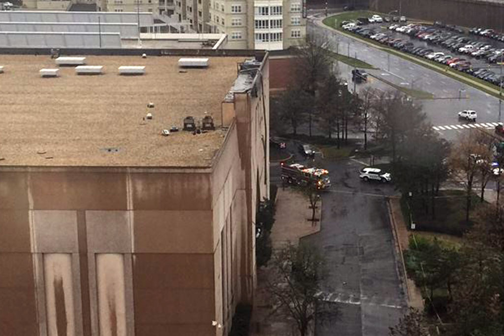
Some of that damage occurred when a portion of the facade and roof of the Macy’s at the Pentagon City mall ripped off and fell onto a car, resulting in one minor injury.

Technological advances have prompted changes in how local emergency managers warn the public about tornadoes and other weather emergencies. Some parts of the country, especially those that are more prone to tornadoes, use sirens as a warning. But sirens aren’t necessarily as effective in Arlington and the District, partially because of the dense buildings and foliage.

“Tornado sirens are not used much in this region of the country,” Strong said. “One of the reasons they work better in tornado alley is the wide open spaces with lack of trees that allows the sound to travel well.”

(more…)


View More Stories