Drunk driving — the alleged reason why a woman was killed in a hit-and-run last month — is on the rise in Arlington.

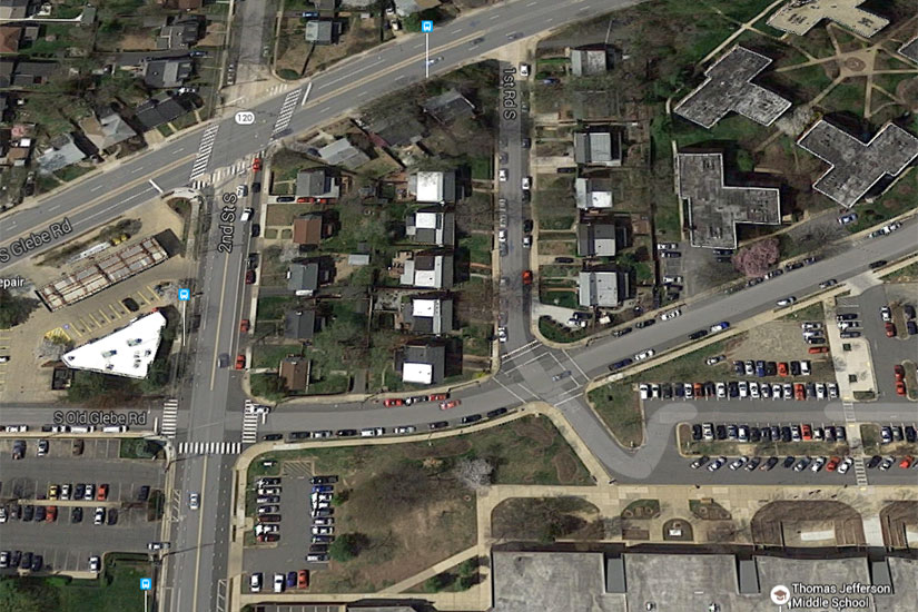
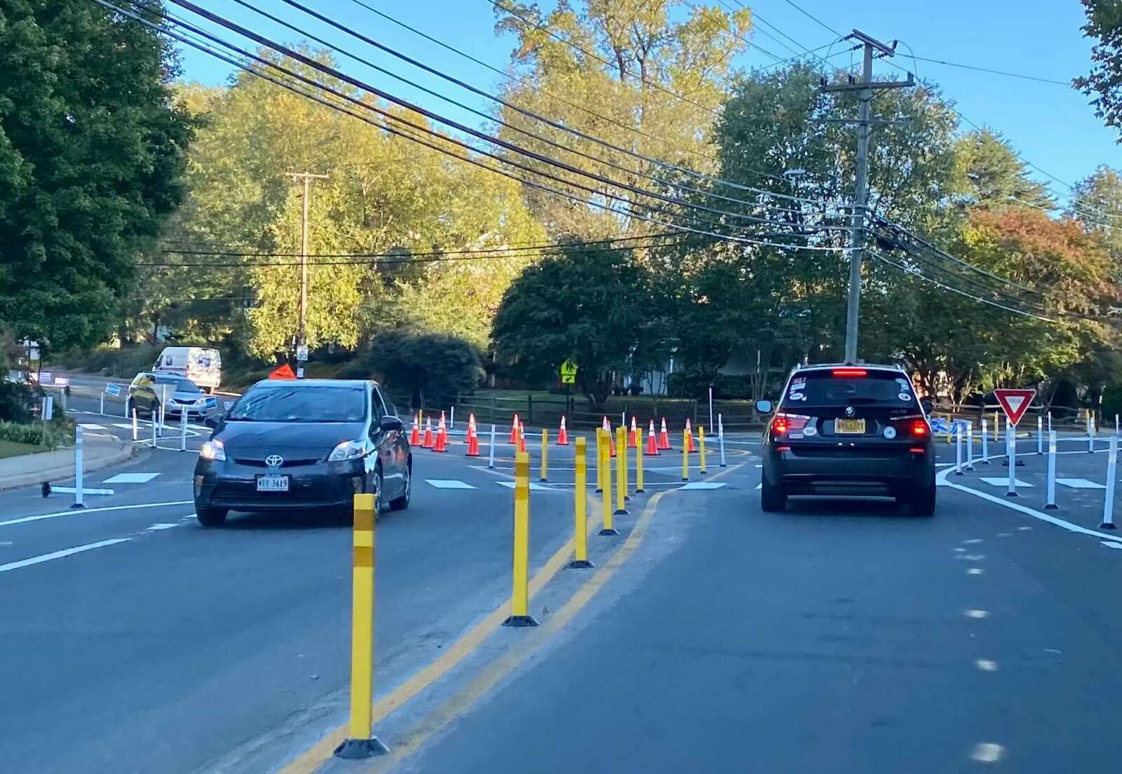
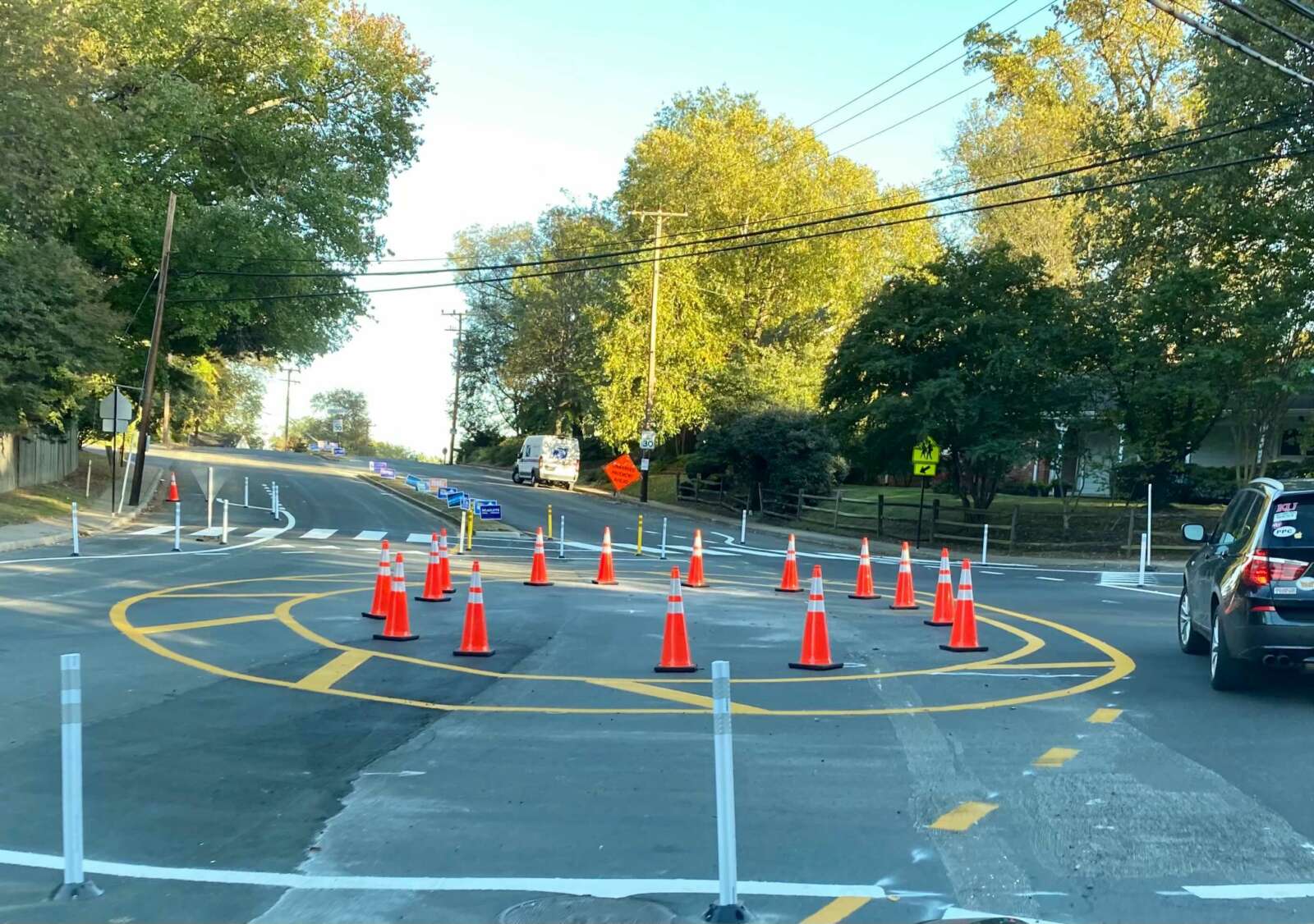
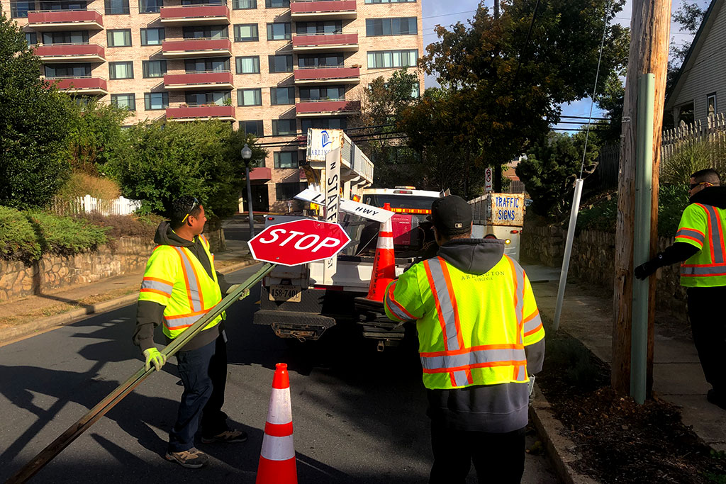
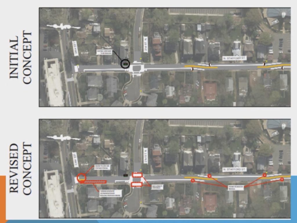
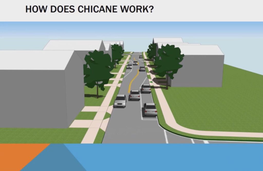
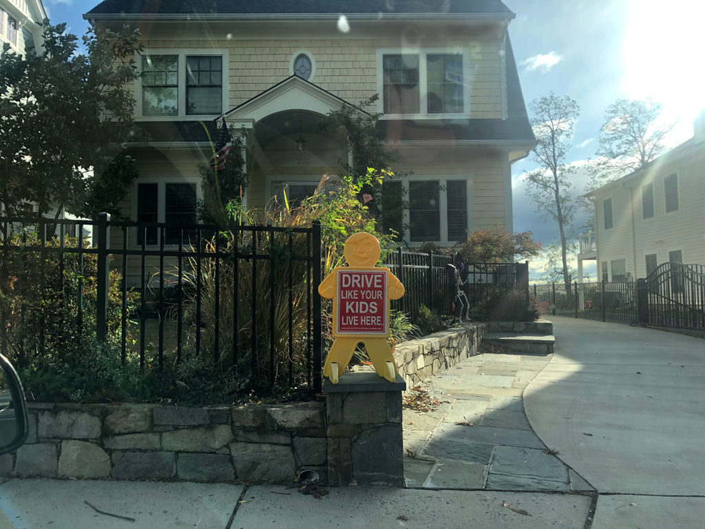
The fatal crash in the Arlington Heights neighborhood has county leaders considering greater emphasis on curbing drunk driving. Neighbors, meanwhile, are asking the county to add more traffic calming measures to combat risky driving, particularly near Alice West Fleet Elementary School and Thomas Jefferson Middle School.

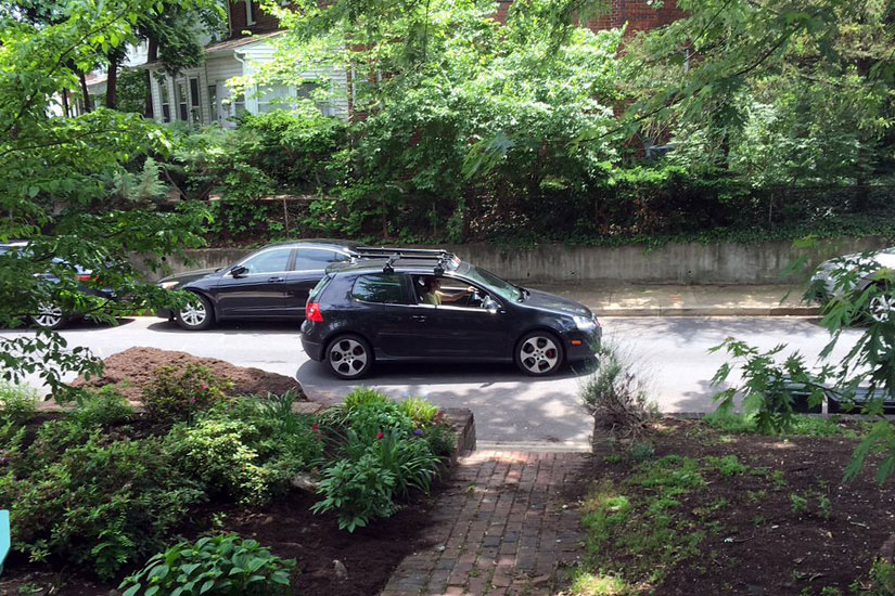
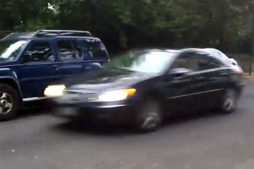
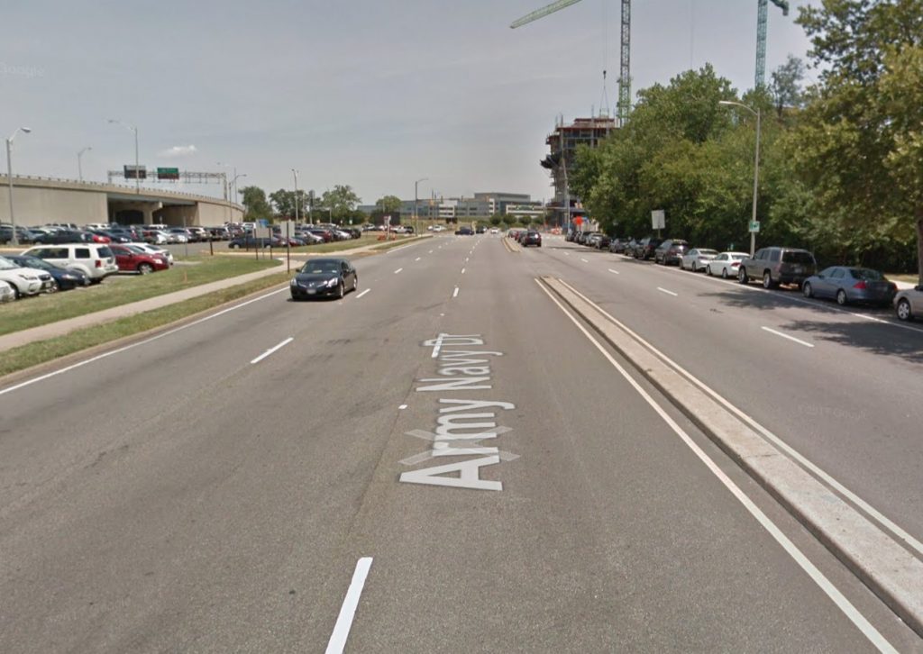
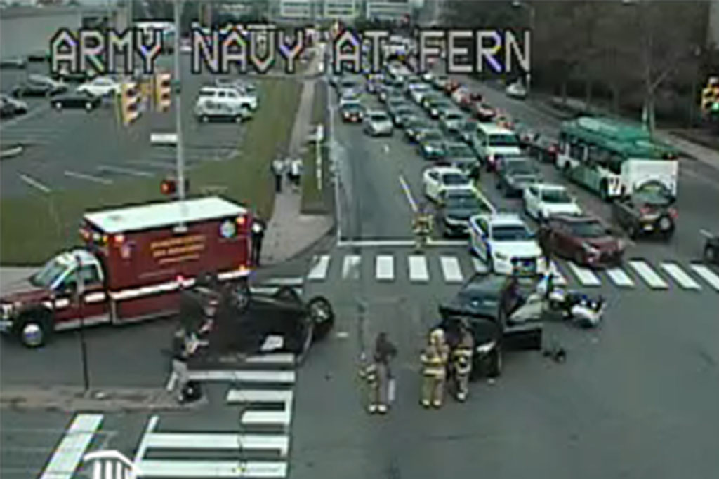
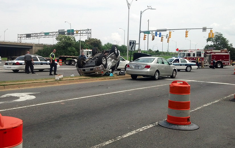
On Aug. 1, a driver hit Viviana Oxlaj Pérez while she was walking near the Thomas Jefferson Community Center at 3501 2nd Street S. She was treated at the scene and transported to the hospital, where she died.

The Arlington County Police Department arrested Julio David Villazon at his home on Aug. 2 and charged him with involuntary manslaughter, hit and run, driving under the influence and driving on a revoked license.

There has been an uptick in alcohol-involved crashes in Arlington. Last year, ACPD recorded 143 alcohol-involved crashes, up nearly 49% increase from 96 in 2020, according to its 2021 annual report. In 2022, ACPD has recorded 116 alcohol-involved crashes, says police spokesman Ashley Savage.

Bicycle, pedestrian and alcohol-involved crash statistics in Arlington County from 2017 to 2021 (via Arlington County)

Driving under the influence is one of the top contributing factors to a “disproportionate” number of critical and fatal crashes in the county, says Dept. of Environmental Services spokeswoman Katie O’Brien. The others are speeding, turning left at an intersection, turning right across bicycle lanes and failing to yield to pedestrians.

Each of these behaviors is being addressed during an ongoing “Critical Crash Mitigation Campaign” through December.

The recent rise in alcohol-related crashes chips away at what had been a broader downward trend in drunk driving. Arlington County Board Chair Katie Cristol attributed this initial decrease to efforts, such as the ACPD Arlington Restaurant Initiative and the Washington Region Alcohol Program, as well as the growing popularity of ride-sharing services — which have been getting more expensive.

“Now, however, national trends are indicating major increases in alcohol-related traffic fatalities during the pandemic (regional data is lagging but reasonable inference suggests our local trends may be similar),” Cristol said in an email to ARLnow. “This indicates to me that there is a greater role for the County Board in public education about the threat that drunk driving poses to our own community.”

Alcohol-related traffic injuries in the D.C. area from 2013 to 2020 (via Metropolitan Washington Council of Governments)

Cristol said the most important message she can communicate about last month’s crash is that “there is no safe way to drive drunk.”

“In this situation, the driver was impaired, and there is no ‘safe’ BAC above zero to get behind the wheel. Any intersection or roadway — irrespective of the physical safety improvements, visibility interventions, or other designs to the built environment — is unsafe when a drunk driver is present,” she said.

The DUI is Villazon’s second driving offense within the last 10 years, according to court records. He was previously found guilty of “improper driving” in the Arlington General District Court. Under state code, the misdemeanor charge of reckless driving can be knocked down to improper driving if either the judge or the prosecutor find that the offense was not serious.

His next court date is in February 2023.

The crash that killed Oxlaj Pérez is being examined by a broad swath of local agencies, including Arlington’s transportation staff, the police and fire departments, Arlington’s Dept. of Human Services, Virginia State Police and the County Manager’s office.

But neighbors say the problem is not hard to understand. They say drivers, particularly during school drop-off and pick-up times, speed down S. Glebe Road and Arlington Blvd (Route 50), run red lights, roll stop signs, make illegal U-turns, block crosswalks and go the wrong way on 1st Road S., a one-way street — and they’re not drunk.

“I understand the tragedy that occurred a few weeks ago involved alcohol and likely wouldn’t have been prevented with traffic changes,” said one neighbor, Kelly Cherry-Leigh Davison. “But we have brought up these safety issues numerous times to everyone we can think of and are getting nowhere. I’m worried every day another tragedy is going to occur and we could be preventing it.”

(more…)


A longtime project to make pedestrian, cycling and transit upgrades to Army Navy Drive has taken the next step forward.

Arlington County has sent the project out for bidding by contractors, while staff continue to acquire the easements needed for construction.

“Project staff expect the easement process to be wrapped up by the time the construction contract appears before the County Board for approval — anticipated later this summer,” Dept. of Environmental Services spokesman Nate Graham said.

Construction could start this fall and be completed in the summer of 2025, according to the project webpage. Initially, the county had expected construction to begin in spring 2020 and be complete this spring, but extra tasks required to receive federal aid dragged out the planning process by a few years.

A coalition of local transit advocates celebrated the news, which has been seven years in the making.

Crashes are a frequent occurrence along Army Navy Drive. The $16.87 million project aims to reduce conflicts among cars, buses, bikes and pedestrians with narrower lanes — to slow down vehicle traffic — as well as bus-only lanes, protected left turns and signalized right turns, clearer sidewalks and shorter crosswalks.

The south side of Army Navy Drive will have a two-way bike lane protected by a line of trees. This will link to a future two-way bicycle lane planned for S. Clark Street, between 12th Street S. and 15th Street S. and the planned protected bike lanes on S. Eads Street, which will run past both phases of Amazon’s HQ2.

Bike lanes on Army Navy Drive are visible in this 2021 rendering of Amazon’s HQ2 Phase 2 campus (via NBBJ/Amazon)

“The project will rebuild Army Navy Drive within the existing right-of-way as a multimodal complete street featuring enhanced bicycle, transit, environmental and pedestrian facilities,” the county says. “The goal of the project is to improve the local connections between the Pentagon and the commercial, residential and retail services in Pentagon City and Crystal City.”

The new Army Navy Drive will be reduced to two through lanes in each direction, narrowing to one lane east of S. Eads Street.

The reduction will accommodate a bus lane between S. Joyce Street and S. Hayes Street so that buses will not block traffic while loading passengers. This dedicated transit lane will help extend an existing network of bus lanes from the City of Alexandria to Crystal City into Pentagon City.

Plans for Army Navy Drive (via Arlington County)

Additional improvements include replacing raised medians with planted ones and planting greenery to reduce stormwater runoff. Five intersections will get new traffic signal equipment.

The project’s early phases kicked off in the summer of 2015 with a traffic analysis evaluating how biking, walking, scooting and driving conditions would be impacted in 2020 and 2040 by the ongoing redevelopment of Pentagon City and Crystal City. That has since been expedited by the ongoing construction of HQ2.


(Updated at 1:30 p.m.) There’s a new temporary traffic circle along Military Road aimed at improving safety where it intersects with Nelly Custis Drive.

Where there used to be a stop sign for traffic on northbound Military Road, the county has added paint lines, bollards and raised temporary curbs, and partially demolished a median. The work was completed Saturday, according to a spokesman with the Arlington Department of Environmental Services.

The one-lane roundabout at the intersection in the Donaldson Run neighborhood was completed after the county resurfaced Nelly Custis Drive as part of its annual street maintenance program.

“This pilot project, in conjunction with the Vision Zero transportation safety program, will test the effectiveness of a roundabout for improving pedestrian safety and reducing vehicle speeding at the intersection,” according to the county. “It will be in place for one year to allow data collection of real-world conditions, and since it’s temporary, it can be adjusted as needed or removed easily if it doesn’t work.”

The county will study traffic patterns to determine whether to keep the roundabout or install a lighted intersection, per a county webpage on the project.

“Military Road and Nelly Custis Drive intersection safety improvements will focus on driver yield rates, shortening crossing distances for people walking through the intersection, providing predictable turning movements [and] reducing vehicle speeding,” the website says.

Some neighbors are displeased with the new traffic configuration. An October newsletter from the Old Glebe Civic Association called the changes “unwanted.”

The civic association said it has repeatedly expressed its opposition to the potential project for four years, and it would like to see the old traffic pattern restored after the study.

“OGCA pledges continued opposition to the roundabout,” it said. “Other civic associations have concurred with OGCA that the project is overly expensive, will not improve traffic safety, and will unnecessarily slow movement along Military Road.”

Per DES data, about 11,000 vehicles pass through the intersection daily. In a presentation this summer, county staff said conversions to roundabouts reduce pedestrian crashes by 27%, and conversions from stop-controlled intersection reduce injury crashes by 82%.

But OGCA argues that crash data for the intersection doesn’t merit the change.

“In August, OGCA argued that the… construction cost was unjustified given little evidence of any safety concerns,” the newsletter continues. “Only three accidents have occurred over the past eight years (two involving bicycles) out of the approximately 32 million vehicles that passed through the intersection during that period. Our letter also said removal of the stop sign and bike lane increases danger for pedestrians — particularly school children during morning rush hour — and also for bicyclists.”

Bike lanes were converted to “sharrows,” or arrows reminding drivers to share the road with cyclists, per a planning document.

The Military Road and Nelly Custis Road intersection roundabout (via Arlington County)

This is the last of three intersections — including those at Marcey Road and 36th Road N. — to be changed as part of a project aimed at improving safety along Military Road.

“These intersections were identified in a 2004 Arterial Transportation Management Study that suggested several recommendations to improve safety for all modes of transportation in the Military Road corridor,” according to DES.

Some local residents said in public comments that they supported the roundabout.

“As 25-year residents who live one block from this intersection and who walk, ride bikes, commute, and use the ART bus, we believe that a safer solution is needed due to excessive speed; drivers who fail to yield to pedestrians; and increased traffic volume,” said one couple.

The county website says the key takeaways for traveling through a roundabout are:

  • Always yield to pedestrians and cyclists at the crosswalks
  • When entering the roundabout, yield to vehicles and cyclists inside the roundabout
  • Signal when exiting the roundabout

Arlington County’s transportation division is kicking off its ambitious plan to eliminate traffic deaths with a series of relatively quick safety projects.

For now, most of those projects appear to be in North Arlington. 

Four months ago, the Arlington County Board adopted a five-year action plan that aims to eliminate traffic fatalities and severe injuries, known as “Vision Zero.” The plan lays out a systematic approach to safety improvements, addressing the most urgent needs through data analysis, equity and community engagement.   

These improvements vary in scope: “quick-build projects” address immediate needs quickly using low-cost materials, while larger-scale projects require funding from the county’s Capital Improvement Program or grants. Others include pilot projects and regular maintenance work. 

“We’re focusing initially on small-scale operational improvements… a small but important part of program,” said Dennis Leach, the director of transportation for the Department of Environmental Services.  

Residents will see upgrades such as curb and median extensions, improved bus stops, curb-and-gutter repairs, new ramps and new high visibility crosswalks. DES has already completed eight “quick-build” projects and 11 are underway, according to its website.

Staff identify projects by analyzing crash data and considering reports by police, Arlington Public Schools and community members. They are constructed on a rolling basis.

For example, this month, staff completed a new mid-block crosswalk across N. Ohio Street that will improve access to Cardinal Elementary School and Swanson Middle School School. Staff are now installing a crosswalk with accessible curb ramps over Sycamore Street for better access to Tuckahoe Park and Tuckahoe Elementary School. 

Of the 19 completed and under-construction projects, only three appear to be in South Arlington. One Twitter user mapped out the geographic spread of these projects, raising questions about how these projects are chosen and when DES will make its way south, given that equity is a core tenant of Vision Zero. 

Leach said that could be because there are a number of older community and school requests being worked through. 

“I think there’s an issue of a pipeline of small projects that may have gotten their start in early years,” Leach said. “What you see in the pipeline of quick-build projects has been built up over years… These projects may have gotten their start before Vision Zero was adopted.” 

Transportation and Operations Bureau Chief Hui Wang said these projects are “a very small, skewed piece of the transportation program” because they don’t show large-scale investments, such as those on Columbia Pike.

“When we’re talking about balance, equity, we have to make sure that we’re not looking at it through a shaded lens,” she said.  

Leach agrees. 

“[Columbia Pike] is our single largest focus areas, as it has some of our oldest infrastructure,” he said. “In other parts of the county, like the Rosslyn-Ballston corridor, private development builds a lot of the infrastructure. In Columbia Pike, until recently, there’s been little private development — there’s more now — but it’s been left to county to actually make those investments in advance of redevelopment.”

When asked if certain communities generate more traffic reports than others, Wang said DES doesn’t map out community reports because it’s hard to categorize them and her team doesn’t have the resources for that. 

“My team is focused on the engineering part — our goal is trying to get things done,” she said. 

The data-based approach helps weed out what is a perceived safety risk versus actual safety risks, Wang noted.

“We use crash data to identify real problems,” she said. “We’re using data as a guiding force, focusing on high-injury networks.” 

Chris Slatt, who is president of transportation advocacy group Sustainable Mobility for Arlington County, said it’s not surprising that initial projects will skew toward North Arlington. 

“Complaint-driven processes are well-known to reflect the biases of whom within the community is best equipped to spend precious time and energy complaining, so we would fully expect that method of identifying projects to skew toward the more affluent areas of Arlington unless staff works intentionally to correct that bias,” he said.

(more…)


After five years, Arlington County is putting finishing touches on its Complete Street plan to improve walking, biking and driving conditions along a stretch of Army Navy Drive in the Pentagon City area.

The updated plans — which are 90% complete — were presented in a virtual public hearing on Wednesday. County staff are taking public comments via email on this version until Dec. 4, and the final plans will be submitted next summer. Construction on the section of road from S. Joyce Street to S. Eads Street is slated to begin in 2022.

The $16.87-million project aims to reduce conflicts among cars, buses, bikes and pedestrians with narrower lanes, stretches of bus-only lanes, protected left turns and signalized right turns, clearer sidewalks and shorter crosswalks. The south side of Army Navy Drive will have two-way bike lane protected by a line of trees.

“A lot of the signalizations will improve safety, prevent fatalities, reduce collisions, things like that,” Jon Lawler, the project manager, said during the meeting.

Crashes happen frequently in its intersections: Staff said the S. Hayes St/I-395 off-ramp intersection had the second-most collisions of any Arlington intersection in 2016.

The measures mean the new Army Navy Drive will be reduced to two through lanes in each direction, narrowing to one lane east of S. Eads Street.

“This segment has much lower traffic volumes than the other four blocks of the project corridor,” Lawler said in an email.

Reducing a lane of traffic to accommodate a bus lane between S. Joyce Street and S. Hayes Street will actually improve flow because buses will not block traffic while loading passengers, he said.

Traffic lanes will be narrowed to slow down cars, but staff are not planning to propose a lower speed limit, which is 35 miles per hour, Lawler said during the meeting.

Construction is still a ways off. Staff expect construction to begin in the spring of 2022. With work scheduled block by block to minimize disruptions, it could last until the fall of 2024. Original plans had construction starting in 2020 and ending in 2022.

Lawler attributed the delays to the additional tasks needed for a project receiving federal aid.

“For this project, it took much longer to receive our National Environmental Policy Act document approval than we had envisioned,” he said in an email.

Staff skipped the 60% design phase to make up for lost time, he said.

After the medians are removed, work will start on the south side of Army Navy Drive, beginning with the area where Amazon HQ2 will be, along S. Eads Street, and moving west. Once the medians are replaced, the road will be repainted and striped, concluding the project.

Lawler said in the meeting that “we won’t have any conflict” with Amazon construction.

Community feedback led to two major changes, he said. First, another block of protected bike lane was added to connect the bike lane west of S. Lynn Street with the planned protected bike lane starting at S. Joyce Street.

“This way we don’t have a missing link in the system,” Lawler said in the meeting.

Staff could not insert this change into this project, as it is receiving federal funding, so they created a separate capital improvement project to address it, he said.

From S. Lynn Street — near Prospect Hill Park — to S. Eads Street, Army Navy Drive is “pretty uncomfortable to use scooters and bikes on,” Lawler told ARLnow after the meeting. “The changes will provide them a safer route for them to use.”

With the changes, bicyclists on Army Navy Drive will be able to use the major east-west link more easily to connect with the Mount Vernon Trail and get to Washington, D.C., he said.

Another change was to align the bumpy pedestrian ramps with the crosswalk. Initially, the ramps were perpendicular to the crosswalk, which advocates said directs vision-impaired pedestrians into harm’s way.


Arlington is planning to host an open house to mark the start of the development of the county’s Vision Zero Action Plan.

Last July, the County Board directed County Manager Mark Schwartz to develop goals and an action plan for a comprehensive analysis of traffic safety in Arlington as part of the County’s Vision Zero goals — the name for a series of initiatives aimed at eliminating traffic fatalities.

Details on the plan were vague at the time, though similar plans have been enacted in Alexandria, where some changes like traffic calming measures and lane reductions have been famously controversial.

The open house is scheduled for Tuesday, Jan. 28, from 5-8 p.m. at Washington-Liberty High School (1301 N. Stafford Street). An event listing said visitors will be able to learn more about current Vision Zero plans and share their priorities for improving transportation safety in Arlington.

Staff photo by Vernon Miles


The county has kicked off its four-block traffic calming project along N. Stafford Street, north of Washington-Liberty High School.

The project, between Lee Highway and 15th Street N. in Cherrydale, is part of the county’s “Neighborhood Complete Streets” program.

A key feature of the project is the implementation of a “chicane,” or curved design, on the street. The Institute of Transportation Engineers suggests curving a street slows traffic by forcing drivers to “steer back and forth instead of traveling a straight path.”

The traffic calming is necessary because the current road design allows drivers to speed down it.

“The existing roadway is long and straight, has a lot of topography which creates a lot of slope, and these are characteristics of the road that allow vehicles to pick up speed,” said an Arlington Dept. of Environmental Services (DES) official at a recent meeting about the project.

The official noted that observed speeds on the road were not enough to justify “vertical” traffic calming measures like speed bumps, but did call for something “less obtrusive,” like the chicane.

The county is planning to remove remove three to five parking spaces to make room for the chicane changes.

The project includes other upgrades and changes.

Crews could be seen yesterday (Thursday) replacing the stop signs at the intersection of N. Stafford Street and Lee Highway. One worker noted the sign was “rusty and outdated,” and the replacement sign would have “better reflectivity so drivers know to stop.”

Workers will also soon be installing a new curb ramp at the intersection of 19th Street N. and N. Stafford Street, plus a new all-way stop at the intersection of 17th Street N. and N. Stafford Street, according to DES spokesman Eric Balliet.

The traffic-calming project is intended to:

  • Slow vehicle speeds
  • Reduce/eliminate crashes
  • Meet engineering best practices
  • Provide a better pedestrian experience

Arlington officials picked N. Stafford Street for the project after asking for public nomination of dangerous streets across the county. According to the project page, it was the “top ranked street from the first round of [Complete Streets] applications.”

In a public survey by DES, 41% of responders said they would feel “safer” with the proposed changes on N. Stafford Street, while 11% said they would feel “much safer.”

A spokeswoman for the Arlington County Police Department said police have not recorded any crash at the intersection of N. Stafford Street between Lee Highway in the last four years.

The N. Stafford Street improvements are being considered a pilot project. County staff will observe and measure conditions on the street for at least one year, per the project website.

The project will cost an estimated $20,000 for striping, signage, and concrete work. Funding was allocated in the county’s FY 2019-28 Capital Improvement Plan.

Photos via Arlington County


Transportation officials are proposing a host of safety improvements for Memorial Circle, a confusing confluence of roads connecting Arlington National Cemetery to the Arlington Memorial Bridge.

The circle has long been the site of all manner of dangerous crashes, particularly those involving cyclists and pedestrians looking to access the nearby Mt. Vernon Trail or cross into D.C. But the National Park Service has drawn up a series of changes for the roads in the area designed to address the issue, including traffic pattern changes to transform the circle into something more like a traditional roundabout.

“The project area is at a major convergence of regional roadways and modes that interact through a complex series of roadway merges (on-ramps), weaves, diverges (off-ramps), and intersections, resulting in traffic congestion and crashes,” NPS planners wrote in a November environmental assessment. “The proposed action would change the way area users access and circulate through the area by car, bicycle, or foot.”

Officials estimate that the area saw approximately 600 crashes between 2006 and 2012. Lawmakers previously secured some safety improvements for the G.W. Parkway and the circle to try to address the issue. The new NPS proposal would address not only the circle itself, but also the roads approaching the area from both the north and south: S. Arlington Blvd and Washington Blvd.

Perhaps the most substantial change park officials are proposing would be cutting back on one lane of traffic in the circle, in order to “allow the circle to function more like a modern roundabout,” the NPS wrote. That means that drivers in the circle would have the right of way, and anyone entering the circle would need to yield to them.

The NPS also plans to split up an island on the east side of the circle, near where it meets the Memorial Bridge, allowing two westbound lanes coming from the bridge to “bypass the circle and head north onto S. Arlington Boulevard” and one lane of traffic to proceed and enter the circle.

For roads north of the circle, officials are proposing some improved signage at the various intersections, including “fluorescent yellow advance pedestrian crossing warning signs” at some and “rapid flashing beacon” signs at others.

But they’re also envisioning more dramatic improvements, like reducing Washington Blvd down to one lane, and removing both the “existing southern exit ramp connecting S. Arlington Blvd and S. Washington Blvd” and “the existing far left exit lane of S. Arlington Blvd.”

As S. Arlington Blvd exits the circle, the NPS also envisions reducing the road from three lanes down to two leading up to the crosswalk. The existing far left lane leading onto a ramp to S. Washington Blvd is slated to be removed, as is the exit ramp itself.

The NPS is planning similar pedestrian sign improvements for intersections south of the circle, as well as other lane reductions.

One major change would be the construction of a new concrete island where Washington Blvd enters the circle to its south, allowing two lanes of the road to bypass the circle and reach the Memorial Bridge, and one lane to enter the circle. That would require a slightly widening of the road in the area, the NPS wrote.

The plans also call for Washington Blvd to be reduced from four lanes to three south of the circle “in order to simplify merging patterns,” while the G.W. Parkway would be widened “to add an acceleration lane allowing traffic from Arlington Blvd to enter the parkway in its own dedicated lane before merging onto the two-lane parkway.”

Additionally, the NPS envisions relocating two bike and pedestrians crossings south of the circle. One, located as a trail crossing Washington Blvd, “would be relocated closer to the Circle, to allow pedestrians and bicyclists to cross where vehicle speeds are slower and where drivers are anticipating conflicts.” The other, designed to help people cross the parkway to the southeast of the circle, would be moved slightly further north of the parkway.

The NPS traffic analysis of these proposed changes suggest they’d generate “an overall improvement” in congestion on the roads, in addition to substantial safety upgrades.

People in the bicycling community are pretty skeptical of the latter assertion, however.

The NPS is accepting comments on the plans through Dec. 29.


Arlington Heights Gets New Stop Sign — “The Arlington Heights neighborhood became a safer place for students and other pedestrians on Oct. 30,” after the neighborhood got a new all-way stop sign at the intersection of 2nd Street S. and S. Irving Street. Residents collected some 500 petition signatures in support of adding the stop sign. [InsideNova]

Reminder: Daylight Saving Time — Early Sunday morning is the time to “fall back” as Daylight Saving Time ends and clocks get set back an hour. [USA Today]

Clean Air in N. Va. — “This past summer’s air was among the healthiest in memory across the commonwealth. The summer months were the cleanest in terms of ground-level ozone in at least 20 years, the Virginia Department of Environmental Quality reported on Oct. 31.” [InsideNova]


In past years, Arlington has been ranked as having some of the worst drivers in the nation. That doesn’t surprise Brian Meenaghan, who has started a Twitter account to document what he views as a never-ending parade of bad drivers on his block.

Meenaghan, an Arlington Heights resident, started the Twitter account @BadDriversof1stRdS at the end of April. The account focuses on the worst offenders on the 3600 block of 1st Road S., a one-way street located in a high traffic area around S. Glebe Road, Route 50 and the Thomas Jefferson middle school and community center.

“I started this account as a cathartic thing because we’ve had a lot of frustrations on our little block. We’re about 400-450 feet long as a block and we dead end at a middle school,” said Meenaghan. “We have people whipping up this block and people coming the wrong way from the middle school. Because of the oddity of the exit for Route 50 around Glebe Road, we also have a lot of people turning around in driveways and going back up the wrong way, trying to go back to 50.”

Meenaghan’s main concern is drivers going the wrong way on the one-way street (traffic is supposed to only flow from S. Glebe Road to Old Glebe Road). From cars to school buses and even Metrobuses, Meenaghan has caught all types of drivers driving the wrong way or speeding — or both — on the narrow street. Photos and video posted to the Twitter account document the broken traffic laws. (See some of the tweets, below.)

“I work downtown and I’m not here physically during the day all that much and I personally see three or four people turning around every day. I’m probably outside maybe 45 minutes to an hour before dinner with my daughter and I see in just that short amount of time a lot of people going the wrong way,” said Meenaghan.

The Twitter account is a joint venture with his neighbors, who often supply the photos he uploads to the website. Meenaghan said he and his neighbors have been trying for years to convince Arlington County to implement traffic calming measures on the block.

“My neighbors are all very involved in this,” said Meenaghan. “I’m not here that much so I’m not here to take a lot of these pictures. You miss a lot of them because they happen so quickly. Probably six of my neighbors have given me photos over the last couple of weeks. It’s kind of a group-wide effort.”

Part of the impetus for the effort is that the block is now chock full of children.

“We now have 15 kids on this block. There are only 23 houses and there are 15 kids under the age of 10. There have been five kids born in the last six months,” said Meenaghan. (One could perhaps see the block as a microcosm of the challenges with burgeoning enrollment facing Arlington Public Schools.)

Along with the kids living on the block, the presence of Thomas Jefferson Middle School at the end of the block means that there is a constant stream of kids on the block during the school year. It’s only set to become busier, with continued growth at the middle school and the construction of a new elementary school on the middle school’s former parking lot.

(more…)


1812 N. Moore Street skyscraper under construction in Rosslyn

Suspicious Package Shuts Down Va. Square Metro — A suspicious package shut down the Virginia Square Metro station yesterday for part of the evening rush hour. The package was determined to be non-hazardous, according to police.

Traffic Calming Coming to Two Streets — Two Arlington streets — S. Hudson Street between Arlington Blvd and 2nd Street, and 7th Road S. between Carlin Springs Road and Greenbrier Street — will be receiving traffic calming measures. The measures include a narrowing of an intersection, a radar speed display, bike lane markings and additional signage, but no speed bumps. [Sun Gazette]

Sequester Could Be Costly for County — The federal budget sequester, set to take effect tomorrow, could cost Arlington County government between $2 and $3 million in direct federal aid. [Sun Gazette]

Support Website for Arlingtonian Accused of Murder — A support website has been set up for Chris Deedy, an Arlington resident and State Department security agent who is accused of second degree murder in the 2011 shooting of a man in McDonald’s restaurant in Hawaii. Deedy’s lawyer says his client was protecting others when he fatally shot the 23-year-old Hawaiian. “Law enforcement officers shouldn’t be treated like murderers when they protect the public,” says the website. [DeedySupport.com]

Interview with Kanninen — The Democratic website Blue Virginia interviewed Barbara Kanninen, who’s running for the Democratic endorsement for Arlington School Board against incumbent James Lander. Asked why she’s running, Kanninen said: “If we don’t have competition, we don’t have anyone even trying to prove that they’re going to be a good School Board member.” [Blue Virginia]


View More Stories