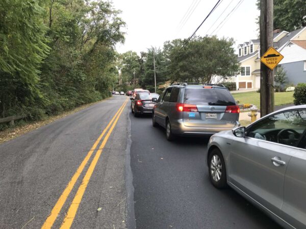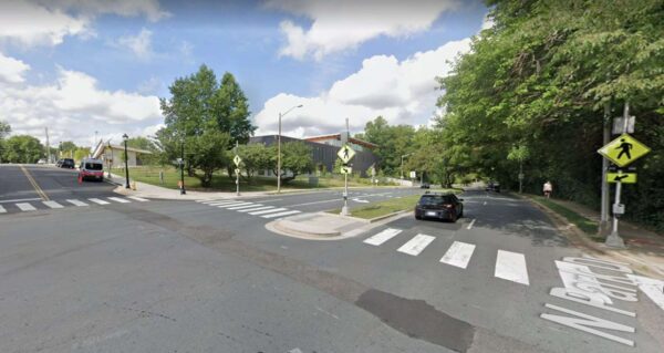
N. Park Drive and N. George Mason Drive intersection near Lubber Run Community Center (image via Google Maps)

Safety signage and markings are coming this spring to a long-troubled intersection near Lubber Run Community Center.

The intersection of N. Park Drive and N. George Mason Drive in the Arlington Forest neighborhood will be getting updated signage and street markings reading “SLOW SCHOOL XING” within the next few months, a county official has confirmed to ARLnow.

“Marking should be installed this spring, depending on the weather,” Dept. of Environmental Services (DES) spokesperson Claudia Pors wrote in an email.

The county is also aiming to get a traffic signal installed there, said Pors, but it would have to be funded in the next Capital Improvement Plan. There’s not yet a timeline for when that could happen and when a signal might be installed.

This is all in addition to the Rectangular Rapid Flashing Beacons that were installed there about two years ago.

The N. Park Drive and N. George Mason Drive intersection has long concerned neighbors due to the high rate of crashes there.

In October, residents told ARLnow that speeding drivers and the four-lane expanse made the intersection particularly dangerous. It’s also tricky for drivers on N. Park Drive — including those going to and coming from the Lubber Run Community Center — trying to cross or turn left on George Mason.

That’s in addition to the presence of Barrett Elementary School and hundreds of students one block away.

In the fall, neighbors provided testimony and photos to ARLnow that showed cars jumping curbs, vehicles ending up in the woods, and a near-miss between a bus and a motorcycle at the intersection.

DES said at the time that since the intersection had not been identified as part of its Vision Zero High-Injury Network corridor or Hot Spot program, it wasn’t eligible for any further safety upgrades beyond the flashing beacons. DES did promise to investigate further the possibility of adding more, though.

Data collected by the county since then has confirmed the concerns of neighbors and led to the addition of these new features at N. Park Drive and N. George Mason Drive.

“Crash analysis revealed there were four visible injury angle crashes within 18 months (April 2021 – Oct 2022) at this intersection, which escalated the importance of safety improvements,” Pors said.

The intent was always to review “the safety and operations of this intersection post completion of the Lubber Run Community Center,” she also noted.

The news of the updated signage, markings, and, potentially, a traffic signal was included in a recent edition of the Arlington Forest Civic Association newsletter, a reader shared with ARLnow.

“That’s huge for the neighborhood. I was surprised they didn’t put one in when they built the new community center,” the reader said.

Hat tip to Henry Grey


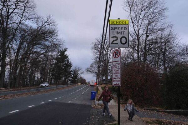
20 mph signage near Bishop O’Connell High School (staff photo by Jay Westcott)

Lower speeds near schools could soon become countywide policy in Arlington.

On Saturday, the Arlington County Board is set to consider an ordinance to lower speed limits to 20 miles per hour on streets within 600 feet of a school property or pedestrian crossing in the vicinity of the school. This would expand on slow zones around 13 schools instituted last year.

The county says in a report that the proposed slow zones respond to positive community feedback from the first round of school zones and are part of its efforts to eliminate traffic-related serious injuries and deaths by 2030, also known as “Vision Zero.”

The ordinance comes as Arlington County appears to have ended 2022 with fewer severe injury crashes than 2021 — when the County Board approved a Vision Zero plan — but the same number of fatal crashes.

In 2022, there were 44 severe and four fatal crashes, including two fatal pedestrian-involved crashes, per county data available through Nov. 23, 2022. The year before, there were 61 severe and four fatal crashes, none of which involved a pedestrian.

If approved, the Dept. of Environmental Services will lower the speed limit on 36 road segments starting next month, according to spokesman Peter Golkin.

“We expect signs to start posting the new speed limit in February-March,” he said. “We will follow up with additional pavement markings in the spring once weather permits.”

When complete, drivers will notice treatments such as high visibility crossings and school zone signage within the school zone, as well as appropriate speed limits on the school’s beaconed arterial roadways, per a December Vision Zero newsletter.

The new, lowered speed limit of 20 mph, applicable at all times of day, will be in effect and enforceable “as soon as the new speed limit signs are posted,” Golkin said.

To remind drivers of the change, the county will send public announcements during February and March through county email lists, civic associations, APS channels and social media, he said, noting that “news coverage like ARLnow’s will also be a great help.”

In addition, he said, the signs themselves will be a notification.

“Drivers should always be cognizant of the speed limit when driving,” the DES spokesman said. “They also have a bright neon yellow SCHOOL symbol on top of them, which should generate extra attention.”

The Arlington County Board last year took another step to reduce speeds, approving the installation of moveable speed cameras in school and work zones. In response to a rash of critical crashes, including a fatal pedestrian fatally struck near Nottingham Elementary School in October, Board members put more pressure on staff to respond more quickly.

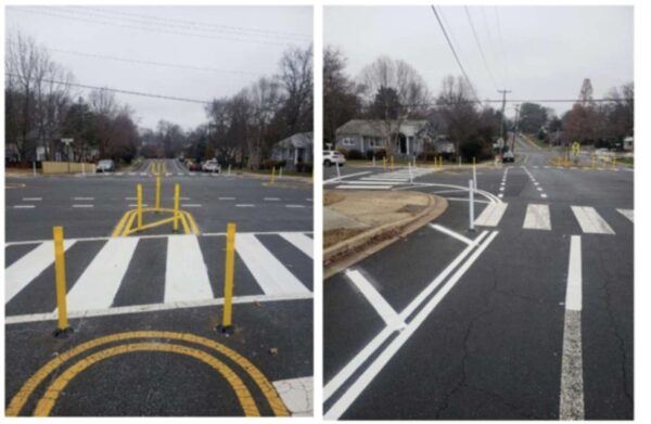
Around where the pedestrian was struck on Little Falls Road, Arlington County police issued 10 traffic ticket in one hour during a one-day enforcement effort last month. Also in mid-December, some “quick-build” improvements were installed along the road, between John Marshall Drive & N. Kensington Street, per the December Vision Zero newsletter, below.

The improvements at John Marshall Drive include:

  • Addition of a high visibility crosswalk on the south crosswalk
  • Tactical curb extensions to sharpen/slow down turning vehicle turns and reduce crossing distances
  • Additional signage

Improvements at N. Lexington Street include:

  • Bus stop/sharrow markings
  • High visibility crosswalks
  • A tactical curb extension to sharpen/slow down turning vehicle turns and reduce crossing distances.

Improvements at N. Kensington Street (north side) include:

  • High visibility crosswalks
  • Tactical curb extensions to sharpen/slow down turning vehicle turns and reduce crossing distances
  • Enhanced signage at the crossing over Little Falls Road
  • Changing the yield to a stop sign (south side)

These improvements are currently in progress and will ultimately encourage slower vehicle speeds, and improved pedestrian and transit maneuvers.

Additionally, DES is conducting an all-way stop evaluation and is collecting footage of the Little Falls Rd and John Marshall Dr intersection to monitor operations between all road users. These evaluations will be considered as DES plans for permanent intersection improvements.

‘Quick-build’ changes to John Marshall Drive (via Arlington County)

20 mph signage near Bishop O’Connell High School (staff photo by Jay Westcott)

Arlington is proposing to lower speed limits near schools across the county to 20 mph as the county’s second year of Vision Zero enters the rear-view mirror.

This Saturday, the Arlington County Board is set to hear a proposal to expand these slow zones to all schools, after many people said they felt safer walking, biking and driving in 13 school zones where the speed limit has already dropped to 20 mph.

If the Board approves the changes, school zones will all get permanent signs with the new speed limits. The county says this is cheaper and more broadly applicable than flashing beacons, which will only be used on arterial streets within 600 feet of schools during arrival and dismissal times.

This change follows the approval earlier this year of moveable speed cameras to be installed in school and work zones, as well as calls from the Arlington County Board for a quicker staff response to critical crashes, after a driver fatally struck a pedestrian in an intersection near Nottingham Elementary School.

Schools have figured into other notable crashes, including a fatal crash involving a motorcyclist and a school bus in front of Drew Elementary in 2021 and a crash involving a drunk driver who killed a pedestrian near Thomas Jefferson Middle School this summer. In a less serious crash this fall, a driver struck an adolescent cyclist near Kenmore Middle School.

Lowering speeds is one action the county has taken over the last year and a half to work toward its goal of eliminating traffic-related fatalities and serious injuries by 2030, a plan known as Vision Zero.

“There are no corridors on county-owned roads that have a speed limit higher than 30 miles per hour, which is a big improvement. We’re very excited to say that,” Arlington Vision Zero coordinator Christine Sherman Baker said in a meeting last week.

In addition to lower speeds, the county has set up temporary school walking routes and roundabouts, completed 13 quick-build projects and made improvements to six critical crash sites and 14 crash “hot spots.” Staff are working on procuring speed cameras for school and work zones and red light cameras for six more intersections, which could be installed in 2023.

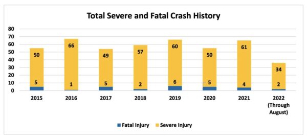
Amid the flurry of work, preliminary data from the first nine months of 2022 indicate crashes are down overall, according to a Vision Zero report released last month. As of Aug. 30, there were 1,313 crashes in Arlington, of which two were fatal and 34 were severe. (We’ve since reported on two additional fatal crashes.)

Historical severe and fatal crashes in Arlington (via Arlington County)

Pedestrian-involved crashes and crashes in intersections are both slightly lower, while bike crash figures are consistent with previous years. There has yet to be a crash in a work zone.

Alcohol and speed prove to be some of our biggest challenges on our roadways,” Baker said in the meeting.

But some people say the county needs to be clearer in communicating if and how its work is reducing crashes as well as the dangers of driving.

(more…)


A proposed left-turn lane off of N. Glebe Road in Ballston could be the smallest, yet most scrutinized traffic change in 10 years.

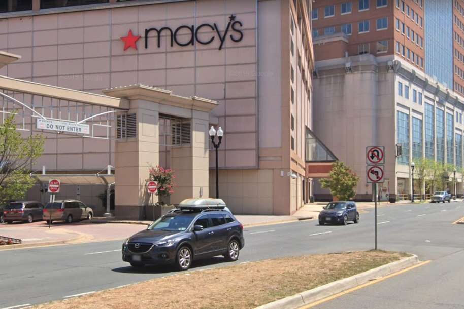
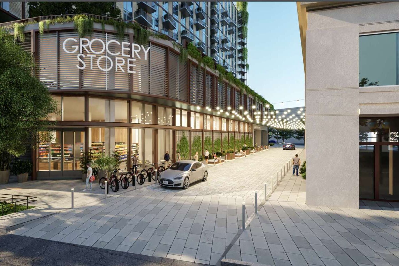
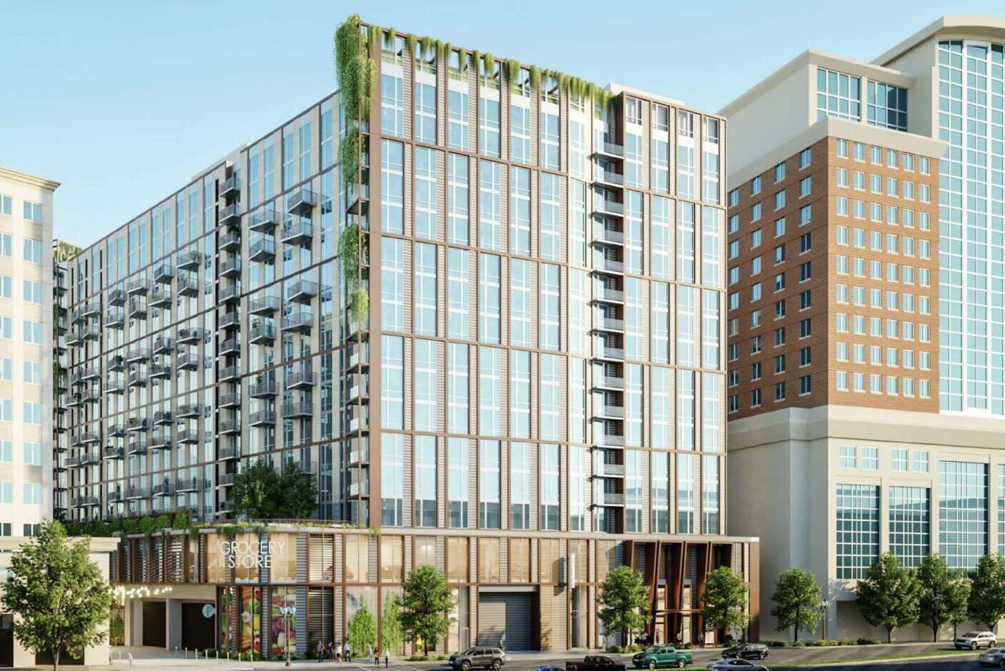
As part of the planned redevelopment of the Ballston Macy’s, Insight Property Group proposes to add a left-turn option at the intersection of 7th Street N. and N. Glebe Road. It will be for drivers going southbound on Glebe who want to turn onto a proposed private drive abutting the planned grocery store, which will be located at the base of Insight’s proposed 16-story, 555-unit apartment building.

“It was the most thoroughly vetted transportation scenario in the time that I’ve been with Arlington County,” transportation planner Dennis Sellin, who has worked with the county for 10 years, told the Planning Commission last night (Monday).

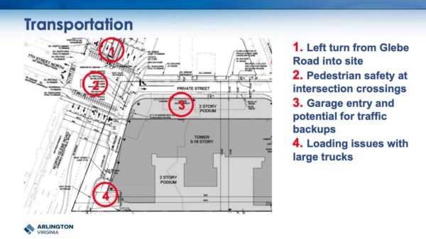
Transportation changes for the Ballston Macy’s development (via Arlington County)

During the meeting, the Planning Commission gave a green light to the redevelopment, which will go before the Arlington County Board for approval later this month.

After the Transportation Commission voted to defer the project solely on the basis of the left turn, Planning Commission members supported a condition for the project that county staff work with Insight and the Virginia Department of Transportation to come up with more pedestrian-oriented options for the intersection.

“I do not think it’s reasonable to hold up the project for this, given that there’s apparently continued good faith work on the intersection to improve its pedestrian-friendliness,” Commissioner Jim Lantelme said. “I want to make clear that the Planning Commission… expects that any option possible to make this intersection more pedestrian-friendly will be pursued.”

Sellin said a half-dozen staffers, including two top transportation officials, have thoroughly vetted the left-turn lane. They published a 64-page memo justifying the turn lane and will study how the grocery store changes traffic before adding any pedestrian mitigation measures.

“There’s a recommendation to not allow any right turns on red at any of the lights in the intersection,” he said. “That’s a movement we’ll take under further consideration. Our primary concern is safety, our secondary concern is operations.”

The left-turn lane is a non-negotiable for the grocer, who has otherwise been “insanely flexible” as the project has changed throughout the public process, according to Insight’s Managing Principal Trent Smith.

“We’ve shrunk their store, changed their ramps, taken away their parking… we changed their loading, we’ve done eight or nine things that took all sorts of reworking and they’ve stuck with us and have been great, reasonable partners throughout,” Smith said.

Insight’s attorney, Andrew Painter, says the unnamed grocer required the left turn based on “decades of experience in urban configurations.” He added that for a decade, the grocer has desired to be in Ballston, which already has a Harris Teeter nearby on N. Glebe Road, a quarter-mile away.

Some Planning Commissioners noted their regret that the project does not do more to provide on-site affordable housing.

“This space here, in the heart of Arlington, in Ballston, where there’s access to transit, and now a grocery store, we have nothing,” Commissioner Devanshi Patel said.

(more…)


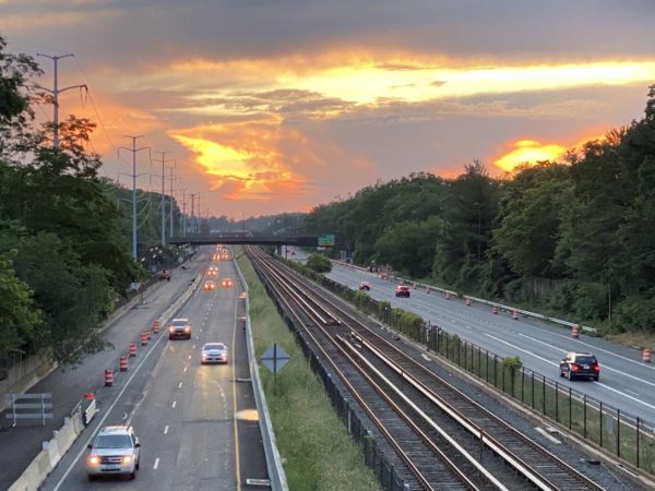
I-66 at sunset

If you plan on driving on I-66 during peak hours next month, make sure there are at least two other people in the car with you to avoid paying a toll.

I-66 is shifting from HOV-2 to HOV-3 in early December, the Virginia Department of Transportation (VDOT) recently announced. Starting Dec. 5, only those with traveling with three or more people will be eligible to avoid the tolls, which apply inside the Beltway during peak travel times and directions.

Single riders or those traveling with just two passengers will now have to pay a toll, at a price based on traffic volume — known as “dynamic tolling.”

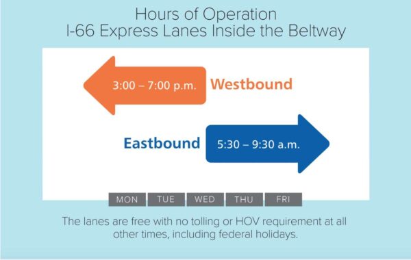
The inside the Beltway I-66 tolling takes place on non-holiday weekdays from 3-7 p.m. westbound and 5:30-9:30 a.m. eastbound.

Hours of operation for I-66 Express Lanes inside of the Beltway (image via screenshot/VDOT)

VDOT also notes that in order to use the lanes during these rush hours, drivers need to have an E-ZPass transponder. The state transportation agency said in a press release that the new requirements are “consistent with HOV requirements on the other express lanes in Northern Virginia.”

The I-66 tolling inside of the Beltway started five years ago, accompanied by a g ood amount of griping about the high toll prices. Previously, the lanes could only be used by high occupancy vehicles during peak times, with no options for paying a toll.

Construction is now complete on the 22-mile section of Express Lanes outside of the Beltway that runs from Fairfax County into Prince William County, after about six years of work. The eastbound lanes are opening this weekend with the westbound lanes opening by the end of the month, both a few weeks ahead of schedule.

More from the press release:

Motorists can choose to use the 66 Express Lanes, which are adjacent to general purpose lanes on I-66, by paying a toll. Toll prices are dynamic, and fluctuate depending on traffic volumes and speed in order to manage demand for the lanes and keep traffic flowing. Eligible High Occupancy Vehicles (HOVs) can use the 66 Express Lanes toll-free but must have an E-ZPass Flex set to the “HOV On” mode.

Currently, vehicles must have two or more occupants to qualify as HOV on I-66. Starting Monday, Dec. 5, vehicles will need to have three or more occupants to qualify as HOV on I-66 and travel the express lanes without paying a toll. This change from HOV-2+ to HOV-3+ will apply across the entire I-66 corridor including the 22.5-miles of 66 Express Lanes located outside the Beltway, as well as the nine miles of 66 Express Lanes located inside the Beltway between I-495 and Route 29 in Rosslyn, which operate on weekdays during peak periods in peak commute directions. This HOV-3+ requirement is consistent with HOV requirements on the other express lanes in Northern Virginia.

This change from HOV-2+ to HOV-3+ also will take effect on the stretch of I-66 west of the express lanes between Haymarket and Gainesville where there will continue to be a traditional HOV lane that operates during peak travel periods.


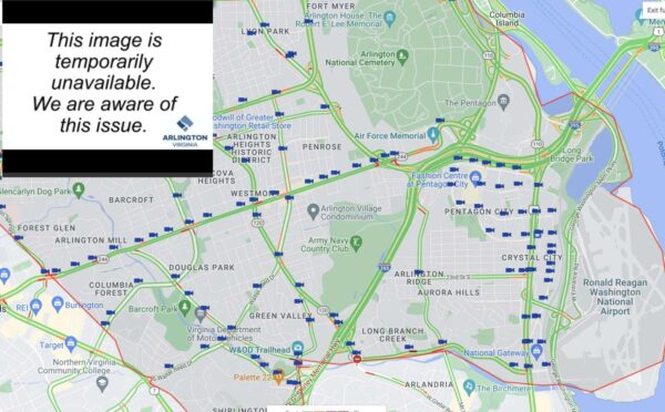
Traffic camera locations and the image of a feed when it is out (via Arlington County)

Arlington maintains a sizable network of traffic cameras, but a significant portion of those cameras have been “temporarily unavailable” in recent weeks.

It’s a problem that the county county is promising to fix.

The publicly viewable feeds of conditions on Arlington’s main roads help with real-time reporting on breaking news of crashes or hazardous driving conditions, such as heavy snow. The feeds also allow residents to check conditions before heading out.

Arlington County has more than 200 traffic cameras trained on its roads. As of last weekend, at least two dozen were out. A few weeks ago, in Pentagon City and Crystal City alone, about 40% of cameras were out, according to public safety watcher Dave Statter.

Residents noted outages were an issue when the county moved the feeds from Trafficland.com to an in-house website back in 2015.

The outages have a variety of explanations, but the county is working on addressing them, according to the Dept. of Environmental Services.

“A camera feed can stop working for several reasons like equipment failure, communications issues, or planned construction,” spokesman Peter Golkin said. “Sometimes only a camera’s public feed is impacted while the internal feed continues. Although a single camera supplies both feeds, they can be independently impacted — especially in older analog cameras.”

Public feeds are produced by the DES Transportation Engineering & Operations (TE&O) Bureau. Feeds are also shared internally with the county’s emergency services agencies.

He said while TE&O’s first priority is maintaining the internal feeds that support critical county services, given limited staff and resources, the bureau is “still stepping up its checks of the public feeds.”

“Many public feeds have been restored in recent weeks,” Golkin said. “To avoid confusion, staff are looking at ways to differentiate long-term, planned outages from temporary outages on the public website.”

The outages compound another issue: the county’s policy of censoring public feeds during incidents — from minor crashes to major public safety incidents. Turning off the feeds makes real-time reporting more difficult for ARLnow and other news outelts.

Arlington says it controls what is relayed via traffic cameras during certain incidents to protect privacy.

“Arlington County upholds its values of transparency with public safety information beyond camera footage, including daily crime reports, press releases, emergency alerts, and EMS/fire event summaries,” the county said in a statement. “Camera access furthers our transparency but must be balanced with community privacy concerns.”

ARLnow was provided the following criteria that go into evaluating when to stop publicly broadcasting a traffic scene.

Cameras are diverted to protect:

  • Health information: This includes identifiers related to a potential patient, like their face, demographics, and health condition. This is all protected information until the person is determined to no longer be a patient, which occurs after they sign a refusal to be assessed or transported.
  • Law enforcement tactics and officer identity: The County protects the identities of law enforcement personnel who serve in plain clothes or undercover roles. Cameras may also be diverted during an active incident, such as an Emergency Response Team (ERT) response, to safeguard tactical information and ensure the safety of all present.
  • Victim and witness privacy: Victim and witness privacy protection is always central, but especially if there are juveniles present — something responders wouldn’t know for sure until arriving at a scene. The County also seeks to protect victim and family privacy and dignity by diverting footage in a medical incident, especially when next of kin must be notified of a significant event.

It’s unclear how much identifiable information can be obtained, however, given the relatively lower resolution of the feeds.

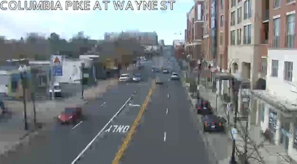
Traffic camera footage of Columbia Pike at S. Wayne Street (via Arlington County)

(more…)


Neighborhood cut-through traffic near Duke Street in Alexandria (courtesy Jill Hoffman)

Cut-through traffic may not make many headlines here in Arlington, but it has been a big topic of conversation in our neighbor to the south.

Alexandria communities, particularly those along Duke Street, have long complained about drivers trying to beat the traffic on the main road by taking neighborhood streets. The city has even implemented a pilot program intended to cut down on cut-through traffic, which some residents say is made worse by navigation apps steering people around traffic congestion.

Outwardly, there has not been a similar outcry here in Arlington. In fact, the county — at least as of a few years ago — has actually seen traffic volumes decline on many major roads despite population growth.

But that doesn’t mean that cut-through traffic is not a concern for some. Last month a proposed new road segment in Douglas Park was put on hold, in part due to worries about cut-through traffic. Last year, cut-through traffic was brought up as VDOT considered various plans to turn Route 1 in Crystal City into an “urban boulevard,” which raised the possibility of some existing traffic spilling onto neighborhood streets.

In 2017, meanwhile, an Aurora Hills resident said in a letter to the editor that changes to S. Eads Street resulted in cut-through traffic in her neighborhood. (To our knowledge, that particular concern has faded in recent years.)

Typically, when traffic on local roads becomes a significant safety concern in Arlington, the go-to action for the county government is to slow rather than restrict traffic, by implementing traffic calming measures, like speed bumps, narrowed lanes and reduced speed limits. But there are still examples of local streets near schools, for instance, with restrictions intended to prohibit cut-through drivers, as well as other instances in which a road was split into two dead-end sections for similar reasons.

This morning we’re wondering whether, in 2022, Arlington residents consider cut-through traffic to be a significant problem here.


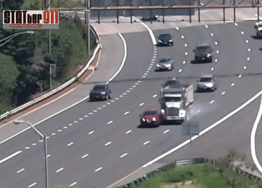
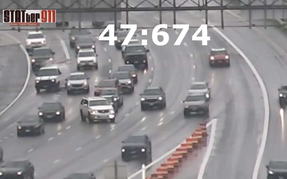
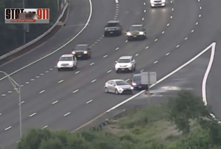
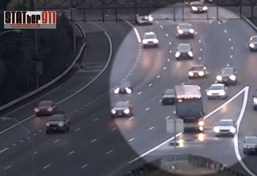
Wonky GPS directions and old road design are some of the factors that have led some drivers to haphazardly cross several lanes of highway traffic at an I-395 exit, leading to multiple crashes.

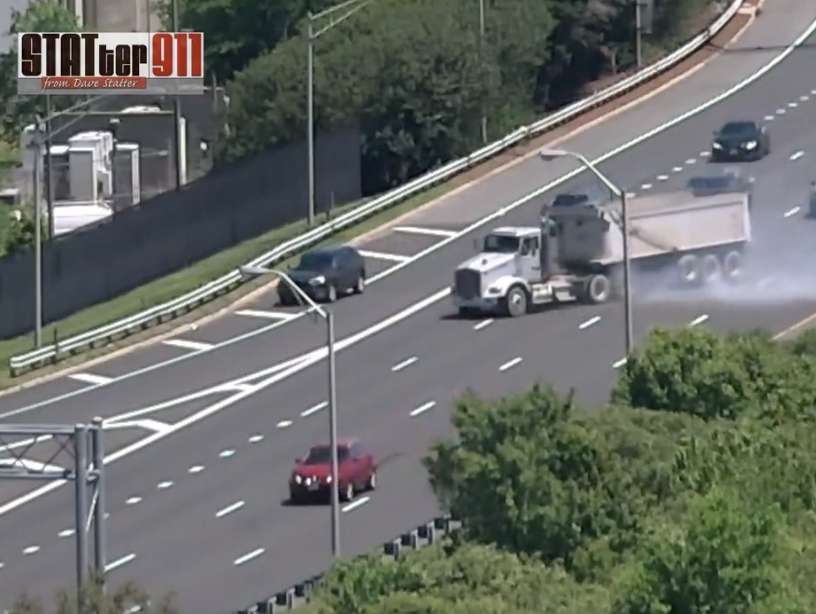
Videos, captured from a Crystal City high-rise apartment by former local news reporter Dave Statter, show drivers consistently and dangerously moving across four lanes of southbound I-395 traffic specifically to make the lefthand Route 1 exit (8C).

The situation is at its most perilous when a driver is coming from Boundary Channel Drive, takes the I-395 southbound on-ramp, and realizes the exit to Pentagon City, Crystal City and Alexandria is only a few hundred feet on the left. Meaning, in order to take it, the driver has to move their car over four lanes of high speed highway traffic in a very short distance.

Some of the numerous videos Statter posts look something like a real-life game of Frogger.

“Watching these people doing this crazy dance to get to the left hand exit,” Statter says. “It’s just a constant, constant thing.”

Even when we are talking, Statter spots two more drivers attempting to make the same maneuver, despite the fact that VDOT had recently put up a line of orange barrels in an attempt to prevent it.

He also seen plenty of drivers entering I-395 southbound from further down, like the onramp from the GW Parkway, but still realizing too late that they need to take exit 8C on the left.

Since Statter started training his cameras on this section of I-395 back in November, he says he has caught upwards of 18 accidents. All of which involve drivers trying to quickly take the left hand exit.

Statter says that part of the issue here is the design of the roads and the Pentagon, which was built nearly 70 years ago.

“There’s a lot of on-ramps in such a short period of time,” he says. “[It’s my impression] that’s not the standard for interstate highways of today.”

But a culprit also appears to be modern technology. At least until recently, app-based GPS directions like Google Maps and Apple Maps were telling drivers to engage in this dangerous lane-shifting.

(more…)


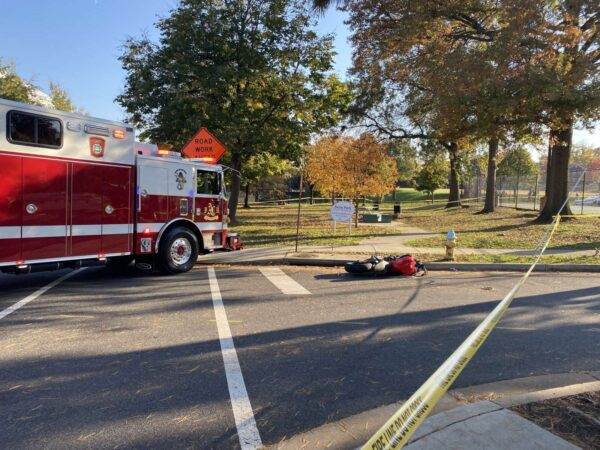
Scene of a fatal crash involving a school bus and a motorcyclist in Green Valley (staff photo by Matt Blitz)

Four people died in crashes in Arlington during 2021, the first year of the county’s initiative to eliminate traffic fatalities and injuries.

That’s in addition to 61 severe crashes, according to the first annual report evaluating the transportation safety initiative Vision Zero.

Arlington County is measuring the effectiveness of its five-year action plan by tracking the severity of crashes and factors involved, such as speed, alcohol and whether a pedestrian or bicyclist were injured.

This month marks the kickoff of the initiative’s second year, which will feature awareness campaigns around behaviors that lead to serious crashes. The campaign will run through December and concentrate on different behaviors each month, starting with bike awareness.

The overall number of crashes in 2021 — 1,785 — decreased by about 30% compared to previous years, but that was attributable to lower traffic levels compared to pre-pandemic years, according to the report.

All four fatal crashes occurred at intersections, and did not involve a pedestrian or bicyclist. In 2020, there were four fatal crashes and 50 that caused severe injury, according to the county’s crash analysis dashboard.

The report noted the 174 alcohol-related and 487 speed-related crashes in 2021 marked a slight uptick. Speed was a factor in one of the fatal crashes.

Lessons learned

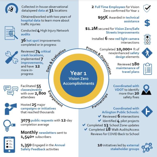
Many of the more than 90 action items the county lists in the framework have been checked off. Arlington has completed or started 36 small-scale safety projects, finished an analysis of 69 crash hot spots, and facilitated 55 transportation safety classes and events, among other tasks.

A graphic shows some of the county’s accomplishments in the first year of the Vision Zero plan (via Arlington County)

Some of the lessons learned in year one include a need to amp up community engagement, and decrease the frequency of crash hot spot analyses from once a year to every two years.

Two walkability routes that were piloted saw opposite outcomes. A pilot on Lorcom Lane in residential North Arlington was extended and county staff are looking to fund a permanent sidewalk there in the upcoming Capital Improvement Plan.

The report noted the Lorcom Lane path “showed high usage, positive community feedback, and observed benefits from separating cars, bikes, and pedestrians.”

But the county halted a similar effort — temporary bollards and wheel stops on S. Carlin Springs Road — months after placement. Arlington Public Schools, Arlington police and community members raised concerns with the pilot after observing “erratic driving around the barriers.”

That area of S. Carlin Springs Road has narrow sidewalks, little or no pedestrian buffer and a history of crashes. The goal of the pilot was to create a safer walking path for students at Campbell Elementary School, Carlin Springs Elementary School and Kenmore Middle School.

County staff will continue to assess options for “enhancing sidewalks and access along the corridor, including connectivity options when the County redevelops the Virginia Hospital Center site,” according to the report.

Several other efforts to increase safety, particularly around schools, advanced in the first year of Vision Zero. The installation of 20 mph school slow zones around 13 schools in early 2022 is under evaluation and could be extended to all schools in the county.

In January, the County Board approved speed cameras in school and work zones, heralding them as a step toward the Vision Zero goal.

In the upcoming year, the report says, there are two full-time employees confirmed to work on Vision Zero and some studies will be completed, such as the evaluation of roadways that have speed limits above 30 mph.


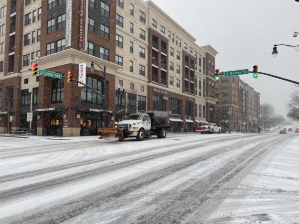
A snow plow driving down Columbia Pike (staff photo by Matt Blitz)

The National Weather Service issued a Winter Weather Advisory for Thursday morning, saying it expects between up to 2 inches of snow.

The advisory is set for between 6 a.m. and 1 p.m. NWS forecasts rain and snow before noon, followed by a chance of snow between noon and 3 p.m. as temperatures fall to around 30 by 5 p.m.

The snowfall could bring closures, as Fairfax County schools already announced a virtual learning day.

The Capital Weather Gang says the timing of the expected snow could lead to a bad morning commute.

“As a strong cold front pushes south, rain will change to snow, which could be heavy for a time between about 7 and 10 a.m.,” according to the Capital Weather Gang. “It will probably too warm for the snow to stick at first. But, as temperatures fall, slick spots could develop, especially in our colder areas north and west of the Beltway.”

See the full advisory below.

…WINTER WEATHER ADVISORY IN EFFECT FROM 6 AM TO 1 PM EST
THURSDAY…

* WHAT…Snow. Snow accumulations of up to two inches with locally
higher amounts around three inches possible.

* WHERE…The District of Columbia, portions of central, northern
and southern Maryland, and central and northern Virginia.

* WHEN…From 6 AM to 1 PM EST Thursday.

* IMPACTS…Plan on slippery road conditions. The hazardous
conditions will impact the morning commute.

* ADDITIONAL DETAILS…Precipitation will start as rain and then
switch over to snow during the Thursday morning commute.
Instructions: Slow down and use caution while traveling. When venturing outside, watch your first few steps taken on steps, sidewalks, and driveways, which could be icy and slippery, increasing your risk of a fall and injury.
Target Area:
Arlington, Falls Church, Alexandria
Fairfax
Prince William, Manassas, Manassas Park
Southern Fauquier
Spotsylvania
Stafford