Update on 12/5/23: The suspect, now officially identified as James Yoo, is presumed dead following the explosion, police say.

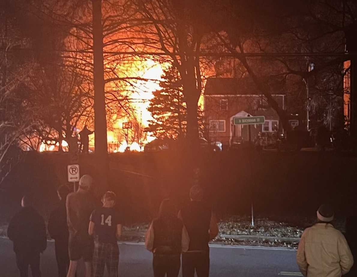
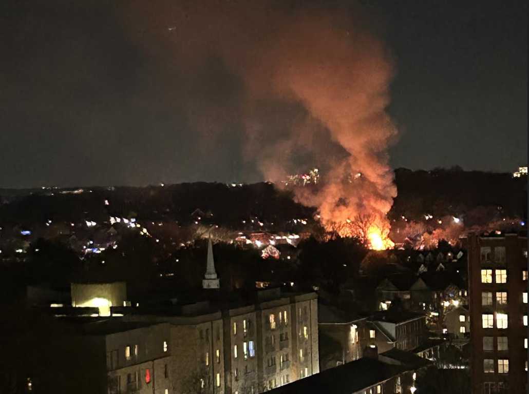
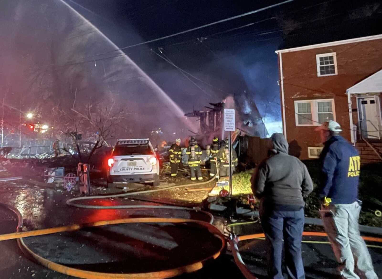
(Updated at 11:30 p.m.) A large explosion, heard throughout Arlington, has rocked the Bluemont neighborhood after a police standoff.

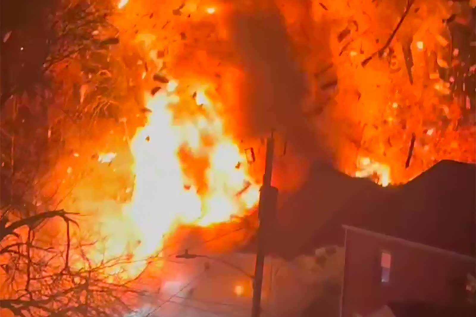
A duplex, where a suspect was involved in an ongoing incident with police, exploded in a massive fireball as police, including a SWAT armored vehicle, moved in. It followed the suspect repeatedly firing a flare gun over nearby Fields Park.

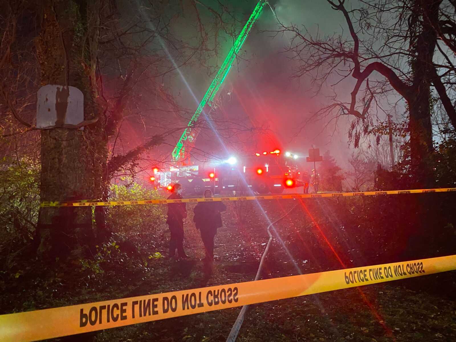
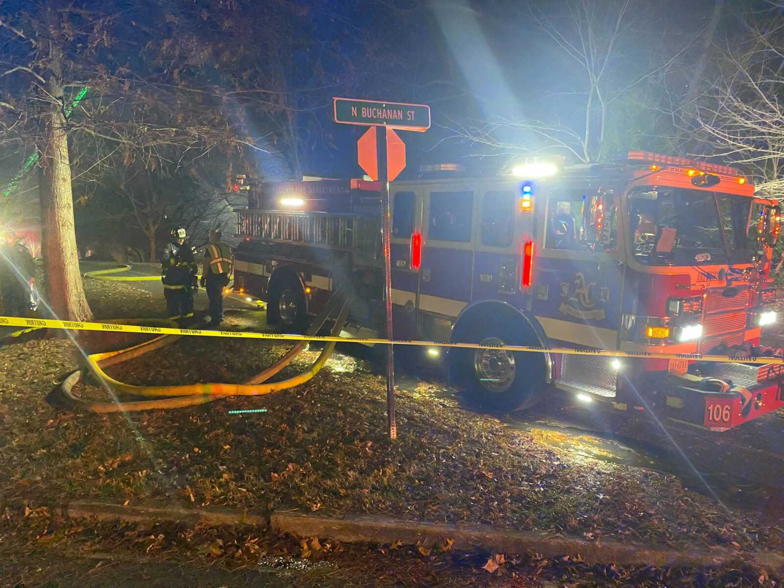
Residents in the area were being instructed to shelter in place, while others were evacuated by police.

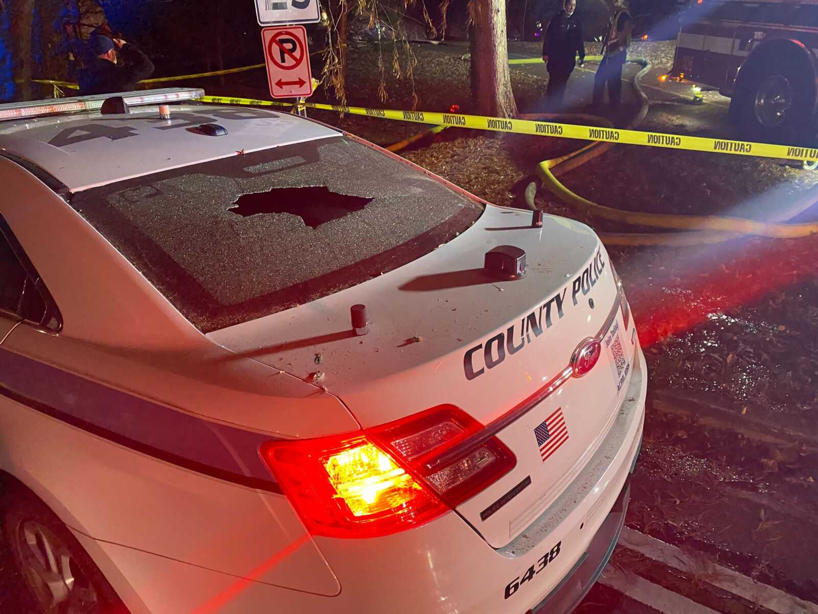
Arlington County police said the person inside the house fired shots as officers tried to enter the home, just before the explosion. A video, below, shows the explosion (the video contains strong language and disturbing imagery.)

“As officers were attempting to execute a search warrant at the residence, the suspect discharged several rounds inside the home,” said ACPD. “Subsequently, an explosion occurred at the residence and officers continue to investigate the circumstances of the explosion.”

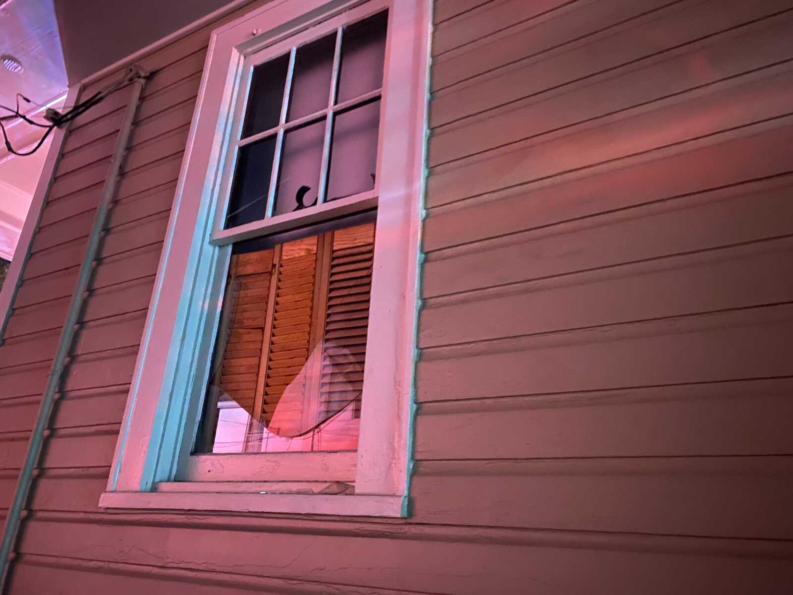
“I think it blew up the entire duplex,” one neighbor told ARLnow in the immediate aftermath. “I’m sure the family next door was evacuated before it blew up but they lost their home.”

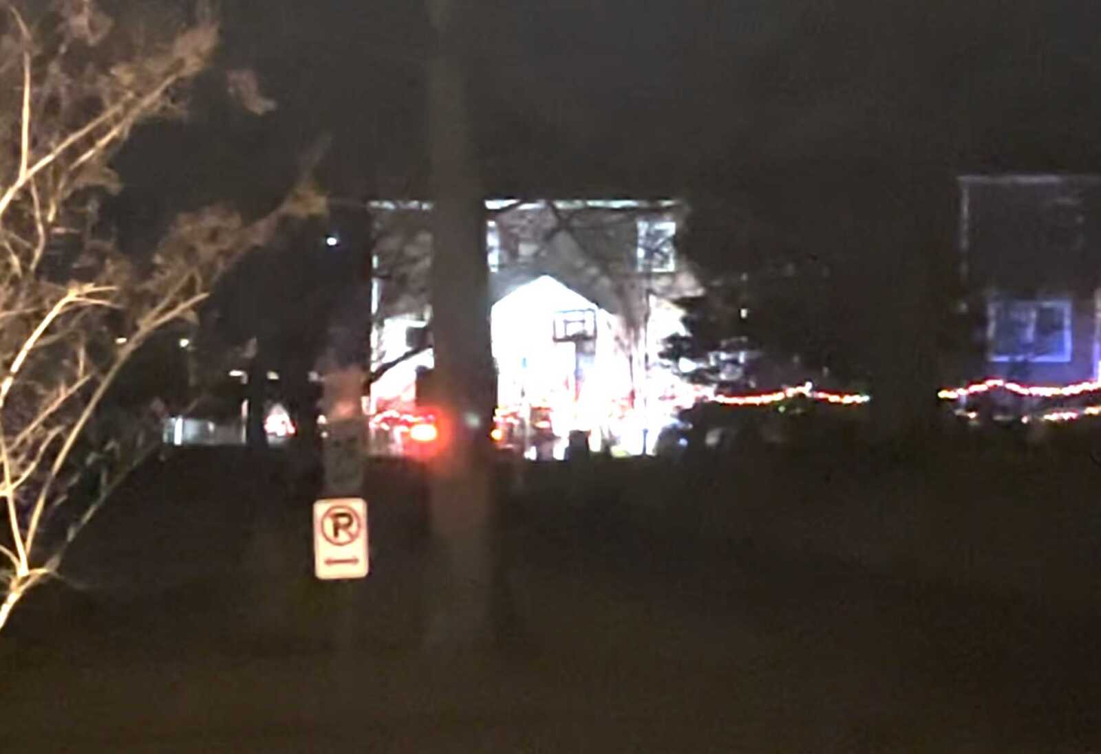
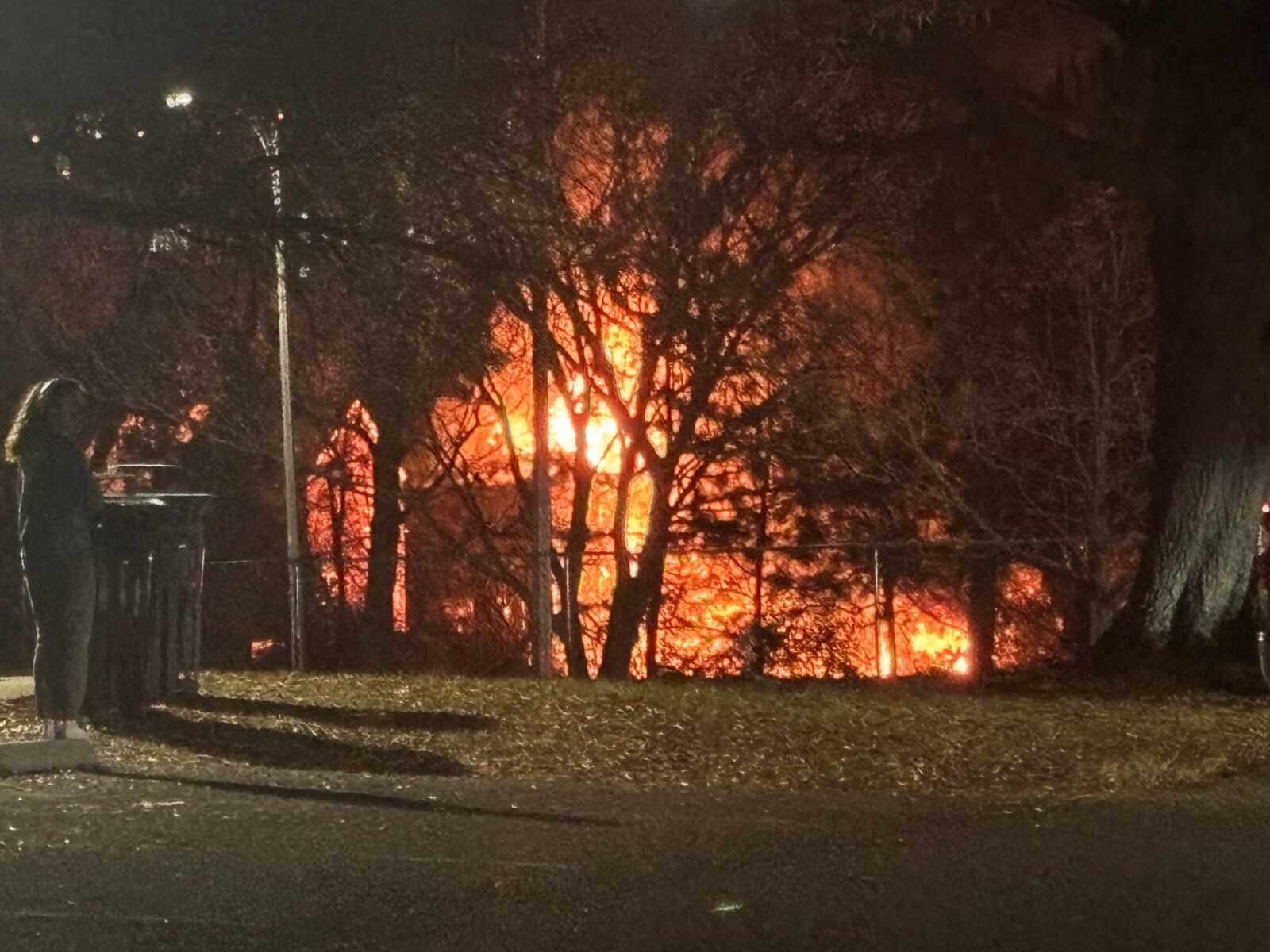
Firefighters were still working to extinguish small residual fires from the resulting blaze as of 11:30 p.m., three hours after the explosion. Investigators — including from the federal Bureau of Alcohol, Tobacco, Firearms and Explosives — are on scene.

Paramedics were initially told to expect “multiple burn patients” after the explosion, but police said around 9:30 p.m. that officers on scene only “reported minor injuries with no one transported to the hospital.”

Numerous residents described the shock of the huge blast to ARLnow.

One said the explosion “literally shook my bed” and described an “acrid stench” afterward.

Another said he was in the shower at the time.

“It shook my entire house and I didn’t know what it was at first,” said Dave Tran. “So I ran outside and I saw… the entire house was just leveled.”

Alex Wilson, the neighbor who took the video seen above — and shared worldwide on social media tonight — told ARLnow that the resident of the home was firing a rifle at police as they used the SWAT vehicle to try to get inside.

“When they rammed the front door he started firing an AR back at them,” he said. Wilson said he saw at least one officer injured following the explosion.

“He was able to walk but he was like holding his head,” said Wilson.

(more…)


Arlington County is in the early stages of designing a multi-use trail facility along Long Bridge Drive.

Now through mid-October, the county is gathering input on how people currently use this corridor, which will inform designs set for public review next spring.

The trail would connect a bike network through Crystal City to the future Long Bridge Rail Project: a planned $2.3 billion bridge over the Potomac River set to double rail capacity and provide an adjacent bike and pedestrian bridge between Crystal City and the Southwest Waterfront area of D.C.

This trail, expected to cost $7.8 million, will be a better connection to the entrance of the proposed bridge, behind the Long Bridge Aquatic Center, than the existing bike lanes along Long Bridge Drive and Long Bridge Park Esplanade, according to the county.

“Preliminary planning work has identified a need for a minimum 12′-wide multi-use trail between the new bridge and Crystal City, as this route is expected to become a major multimodal commuter route between Arlington and D.C.,” per the project webpage.

“Without this project, most commuters will likely attempt to navigate the Long Bridge Park Esplanade and walking trail, which is not intended for use as a commuter cycling route,” the site continues.

Proposed Long Bridge Drive trail (via Arlington County)

The proposed trail will link to a half-mile shared-use path on Boundary Channel Drive, being built by the Virginia Dept. of Transportation, connecting the Mount Vernon Trail to the Pentagon and Long Bridge Park.

Headed toward Crystal City, the trail will connect with a planned multi-use trail at 12th Street S. and forthcoming cycle track along Army Navy Drive.

When complete, Long Bridge Drive trail will help meet demand for more active transportation connections amid current and expected growth in Crystal City and Pentagon City, the county says. These areas are seeing significant redevelopment — largely residential — in part spurred by Amazon’s second headquarters.

“A direct link from Long Bridge Park to the Mt. Vernon Trail will dramatically improve multi-modal connections both for the immediate vicinity and for links between the regional activity centers of Crystal City, Pentagon City, [the] Pentagon, Potomac Yard and the regional trail network,” it says.

The county has set aside $7.8 million in local funds designated for infrastructure improvements in Crystal City. The project was identified for funding in the adopted 2023-32 Capital Improvement Program.

Arlington County says the trail would advance its goals to improve connections to public spaces, neighborhoods, schools and transit stations and improve safety for all road users.

“Providing a multi-use trail that fully separates people walking and biking is an essential safety tool for a corridor that provides motor vehicle access to a major interstate, especially when we anticipate a significant increase in bicycle and pedestrian traffic along the corridor in the coming years,” the county says.


Reconstruction of Sparrow Pond is currently underway.

Last Thursday, part of the Four Mile Run Trail closed while a new pipe from Four Mile Run up to Sparrow Pond is built. A detour is in place for the 6-7 weeks this work is expected to take place.

“Please use caution on the South Park Drive trail connector as the spur is shared between pedestrians, cyclists and construction equipment,” Dept. of Environmental Services Stormwater Communications Manager Aileen Winquist said.

In late November or early December, there will be a 6-7 week closure of the W&OD Trail with a detour to the Four Mile Run Trail.

“Thank you to the neighbors and trail users for your patience and understanding during the pond work, outfall construction and trail closures,” Winquist said.

Four Mile Run Trail detour to W&OD Trail (via Arlington County)

The pond was initially built in 2001 and has since filled with sediment. Restoration work includes removing the sediment, creating deeper pools and making other habitat improvements for wildlife.

“As heavy storms continue to bring silt into the pond, remaining water pools have filled in,” the project website says. “Most turtles and other wildlife have already moved to other areas along Four Mile Run… Once the project is complete, we look forward to drawing them back with deeper pools and good habitat.”

A new sediment collection area is intended to make future maintenance and sediment removal easier.

The need for the restoration project was identified a decade ago and design funding was set aside in 2018. Hammering out designs took three years and construction funding was approved this summer.

Construction began in August with construction site preparations and set up. Tree removal, to make room for the new sediment collection area and expanded pools, is ongoing.

Construction is expected to continue through next August.


Bluemont Junction Trail (staff photo by Jay Westcott)

This weekend, the Arlington County Board is set to consider a proposal to funnel nearly $400,000 into the second phase of the Bluemont Junction Trail safety project.

Phase 2 includes moving and updating three trail connectors to be accessible to people with disabilities and improving cyclist and pedestrian intersections between the W&OD Trail and the Four Mile Run Trail on both sides of Wilson Blvd, per a county report.

The plan also calls for resurfacing a 480-foot segment of Four Mile Run Trail and repairing a nearby pedestrian bridge.

The project is part of a multi-year county effort to address poor visibility between trail users and drivers along the Bluemont Junction Trail, which crosses the Bluemont neighborhood and connects Ballston to the W&OD Trail at Bluemont Park. Plans were developed by the county with input from the public and the Bluemont Civic Association, the Bicycle Advisory Committee and the Pedestrian Advisory Committee

In the project’s first phase, which spanned the fall of 2021 to last summer, the county and the Virginia Dept. of Transportation made upgrades to roughly 4,500 linear feet and 13 connector trails, the report said. This included reconfiguring the trail’s intersections with N. Emerson Street and N. Kensington Street.

The second phase, however, demands more “in-depth engineering” than the milling and repaving carried out in the first phase, the report said.

Rep. Don Beyer has earmarked $325,000 in federal funds for the second phase of the project, which has an estimated total cost of $711,662.

The community will have an opportunity to provide input on the designs and proposed improvements if the funds are allocated, a county staff report notes.


Map showing approximate location of sexual battery incident on trail (via Google Maps)

Arlington County police are looking for a man who sexually abused a boy on a local trail.

The incident happened around 9 a.m. Sunday morning, on a trail near the intersection of Route 50 and Carlin Springs Road. That’s near Kenmore Middle School, Bluemont Park and the W&OD Trail.

“At approximately 9:09 a.m. on July 30, police were dispatched to the report of an assault just occurred,” Arlington County police said today in a crime report. “Upon arrival, it was determined the juvenile victim was walking on the trail when he was approached by the unknown male suspect. The suspect engaged the victim in conversation before touching him inappropriately and fleeing the scene on foot.”

“Officers canvassed the area for the suspect yielding negative results. No injuries were reported,” the crime report continues. “The suspect is described as a heavy-set Hispanic male in his 40’s with gray hair, approximately 5’7” wearing a red shirt and dark sweat pants. The investigation is ongoing.”

Map via Google Maps


Scooting along near Arlington National Cemetery (staff photo by Jay Westcott)

The third time could be the charm for Arlington County, which is applying for federal funding to improve cycling and walking connections around Arlington National Cemetery.

On Saturday, the Arlington County Board is scheduled to review the county’s third application for funding from the Rebuilding American Infrastructure with Sustainability and Equity (RAISE) Program.

The money would partially fund the construction of a long-proposed Arlington National Cemetery (ANC) Wall Trail along Washington Blvd, which would connect Columbia Pike and the Pentagon City area with Memorial Avenue and the Arlington Memorial Bridge into D.C.

“Connectivity for bike-ped users across this part of the County is complicated by the combined barrier effects of secured federal facilities such as ANC, Joint Base Myer-Henderson Hall, and the Pentagon Reservation” and “a high-volume roadway network” comprised of Arlington Boulevard, Washington Blvd, Route 1 as it runs through Pentagon City, I-395 and the GW Parkway, the county notes in a report.

The new trail would run along the western side of Washington Blvd. An existing trail on the opposite side gets dicey near Memorial Circle for pedestrians and cyclists looking to connect to the Mt. Vernon Trail or cross into D.C.

The Federal Highway Administration is designing this multi-use trail in conjunction with the realignment of Columbia Pike. This work is being done to accommodate the 50-acre southern expansion of the ANC, which will add about 80,000 burial sites, allowing burials through the 2050s.

Arlington County has unsuccessfully applied for RAISE funding in the 2021 and 2022 fiscal years. This fiscal year, the federal program has nearly $2.3 billion to dole out “for investments in surface transportation that will have a significant local or regional impact,” per the notice of funding opportunity.

“RAISE is a cost reimbursement program and not a lump sum grant award,” the county report notes. “Previous programs have been highly competitive.”

The Arlington Memorial Trail will run west along Washington Blvd and Richmond Hwy, starting at the eastern end of a realigned Columbia Pike to Memorial Avenue, immediately adjacent to the Arlington Cemetery Metro station.

It will link up to an existing trail along the west side of Richmond Hwy, which provides a connection to the Iwo Jima Memorial, to Rosslyn and to the larger network of bicycle and pedestrian trails along the Rosslyn-Ballston corridor.

Renderings of Arlington National Cemetery expansion and Columbia Pike reconfiguration project (via National Capital Planning Commission)

The estimated cost of the Arlington Memorial Trail in the approved 10-year capital improvement plan is $25 million. If the federal government green lights the full $15 million, the county would cover the remaining $10 million through a mix of the commercial and industrial tax and funding it receives from the Northern Virginia Transportation Authority for local projects.

Projects can receive $5 million to $25 million. A single state cannot receive more than $225 million and awards must be split evenly between urban and rural areas.

Selected projects will be announced by the end of June.


A cyclist and pedestrians near Route 50 (via Google Maps)

A number of options have emerged for upgrading an iffy portion of the Arlington Blvd Trail.

Engineers found it would be possible to accommodate a trail up to 11 feet wide with buffers and guardrails, between the bridge to Thomas Jefferson Middle School and George Mason Drive. That could be accomplished by narrowing a few on- and off-ramps, closing slip lanes and reducing the number of thru-lanes and turn lanes in some places.

This summer, Arlington County asked trail users how they feel navigating the 1.3-mile stretch of the trail, which runs along the busy and congested six-lane Route 50. Many said they feel unsafe due to bicycle, pedestrian and vehicle conflicts and the lack of buffer between the trail and vehicle travel lanes.

“It’s not very welcome to users. It feels narrow, it’s not continuous and there are poor pavement conditions,” Arlington County transportation planner Bridget Obikoya said in a Nov. 17 meeting. “We want to develop design concepts that improve the existing conditions, such as widening key pinch points and removing barriers and obstructions, improving connectivity and making the trail overall a much more pleasant place to be.”

Over the years, several plans have recommended improvements to the Virginia Department of Transportation-owned trail, which runs east-west from D.C. through Arlington to Fairfax County and bisects a 16-mile bike loop ringing the county.

The 2022-24 Capital Improvements Plan allocated $200,000 to study potential intersection improvements and accessibility upgrades to the area, which has a number of destinations: Thomas Jefferson Middle School and community center, Fleet Elementary School, the National Foreign Affairs Training Center, the Columbia Gardens Cemetery and several churches.

Despite these features, there isn’t much of a trail, and sidewalks are not continuous, says Jim Sebastian, an engineer with Toole Design, a firm that studied the corridor and developed the proposed changes.

“It is challenging, but it’s also exciting thinking about some of the improvements we can make to allow biking and walking to be a little more safe and comfortable,” Sebastian said.

The 1.3-mile stretch was broken into seven segments, four on the north side of Route 50 and three on the south side.

Segments of the Arlington Blvd Trail that could get upgrades (via Arlington County)

All but one segment has two proposed alternatives, and details of these proposed alternatives can be found in a presentation and explained in a recorded online meeting.

Residents can share their feedback on the proposed alternatives through Monday, Dec. 5. There will be pop-up events along the trail corridor, hosted by the county and local churches and other community destinations.

“This is extremely preliminary,” Nate Graham, a DES public engagement specialist, said in the Nov. 17 meeting. “This is an opportunity… to hear what parts you prefer and develop some combination of first and second alternatives between these seven segments to meet the goals of this project and serve the needs of the community.”

The study found that accommodating the trail, along some segments, could require changes to vehicle traffic.

For instance, between Glebe Road and George Mason Drive, one alternative calls for the closure of the off-ramp slip lane west of N. Thomas Street. The connection between the service road and George Mason Drive would also be closed, with traffic rerouted up to N. Trenton Street.

(more…)


Map showing donated parcel of land in the Donaldson Run area (via Arlington County)

The Arlington County Board voted Saturday to accept a donation of land that will become an addition to the county’s park system.

The parcel that has been offered to the county is 40,024 square feet, subdivided from the lot of a home located near Marymount University and the intersection of 26th Street N. and N. Wakefield Street. The Terborgh parcel, as it is being called, is also located near the 44-acre Zachary Taylor Park and is adjacent to the Donaldson Run Trail.

The parcel was offered to the county by the executor of the estate of Anne Terborgh, who passed away in June 2021. The gift of the parcel to the county was recorded in Terborgh’s last will and testament.

A condition of the transfer of ownership to the county is that the land remain in a natural, undeveloped state, according to a restrictive covenant.

The covenant does allow for upkeep of the land by the county, which would include the control and removal of invasive species. It also allows access to the land by the public and the addition of a park bench or sign that acknowledges the property’s rules and the gift of the land by Terborgh.

The county expects to spend $3,000 on the acquisition of the parcel, including the costs of examination of the title, title insurance, recording fees, and other closing costs. The funds for the closing costs would be allocated from the county’s park land acquisition fund.

It was not immediately clear when or how the parcel will eventually be opened to the public.

Another parcel is slated to be donated to a land trust.

“Because Ms. Terborgh’s will directs one of the other lots in the resubdivision to be conveyed to the Northern Virginia Conservation Trust (NVCT), staff has also communicated with staff from NVCT about the proposed conveyances,” said the staff report to the County Board.


The W&OD Trail in Green Valley on Tuesday, Sept. 10, 2019 (staff photo by Jay Westcott)

The Northern Virginia Regional Park Authority is looking to expand the W&OD Trail in Arlington, potentially by 2027.

The organization, also known as NOVA Parks, released its five-year strategic plan on Tuesday. The plan includes proposed upgrades to Arlington’s section of the Washington & Old Dominion (W&OD) Trail, including the addition of a dual-use trail.

Sometimes called “the skinniest park in Virginia,” the old railroad-turned-trail actually starts in Arlington, with mile marker zero in Green Valley near the intersection of S. Four Mile Run Drive and Shirlington Road. It extends about five miles running northwest through the county to Benjamin Banneker Park, continuing into Falls Church, and beyond.

About 2 to 3 million people use the trail each year.

NOVA Parks says it is aiming to “design and expand the capacity of the W&OD Trail in congested urban areas” including the Arlington section of the trail. That could mean a widening of the trail.

The design work for this expansion is expected to be completed within the next two years, per the plan. The work will be done in collaboration with the Northern Virginia Transportation Authority.

Plans will also be developed for sections of dual trail along the W&OD in Arlington, like what was completed in Falls Church last fall. Dual trails allow for separate pathways for bicyclists and pedestrians.

The idea was first brought up at the Falls Church ribbon-cutting in October 2021 and was embraced by many who bike, run and walk on the trail, which can get crowded during peak usage times.

There was some opposition to expanding the trail, however, including from current County Board candidate Audrey Clement, who decried a “massive uprooting of vegetation” and runoff from additional paved surfaces.

The expanded W&OD Trail, with separate cycling and walking paths, in Falls Church (courtesy of NOVA Parks)

NOVA Parks Executive Director Paul Gilbert told ARLnow in an email that there’s grant money available to design something in Arlington that is similar to what’s now in Falls Church.

“The goal would be to do like we did in Falls Church and, where possible separate cyclists from walkers with parallel paths,” Gilbert said. “There may be areas where we just have room to make the single existing trail a little wider and other areas where users can have separate paths.”

In terms of when this might be built, that’s not clear with design work still needing to be completed. The hope is to bring those designs back to the community for feedback by 2024 and begin construction “when permits are approved.”

Overall, NOVA Parks is pledging to spend more than $6 million on creating and improving trails across the region over the next 5 years.

As the only regional park authority in Virginia, NOVA Parks encompasses 34 parks and manages 12,335 acres of land in six Northern Virginia jurisdictions, including Alexandria, the City of Fairfax, Falls Church, Fairfax County, Loudoun, and Arlington.

The strategic plan also promises a number of improvements, big-ticket projects, and expansion of Northern Virginia parkland over the next half-decade.

NOVA Parks is committing to planting 50,000 more trees, restoring native plantings to at least ten new areas, reducing parks’ carbon footprint by 2%, and expanding solar energy to three additional parks, all by 2027. The plan is also to start introducing electrical vehicles and mowers into its fleet by 2024.

Additionally, there are several big money items on the agenda. NOVA Parks is looking to acquire at least five new properties by 2027, as well as build a W&OD Trail Visitors Center.

The center is likely to be built in Loudoun County, Gilbert told ARLnow, near where a trail maintenance facility is currently located.


Wilson Blvd in Ballston on a rainy day (staff photo by Jay Westcott)

Some 7000 Series Trains Return — “Metro today completed final review of its plan to return eight 7000-series trains to passenger service. Customers can expect service to start [on Thursday]… The popular 7000-series trains will first appear on the Green and Yellow Lines.” [WMATA, DCist]

Shuttle Buses to Run During Major Metro Work — “Starting Saturday, Sept. 10, Metro will begin work to connect the future Potomac Yard Station with the mainline rail system and to rehabilitate the Yellow Line tunnel and bridge between Pentagon and L’Enfant Plaza stations. The projects will impact Blue and Yellow line service in two phases over eight months, and free shuttle bus service will be available for customers throughout the duration.” [WMATA]

Groundbreaking for Bus Facility — “Arlington’s ART transit system is now rolling toward a much-anticipated destination: a new centralized Operations and Maintenance Facility for its buses. County officials, joined by regional transportation administrators, advocates and community leaders, broke ground Wednesday, June 15, 2022, on the 3.5-acre site in the Green Valley neighborhood.” [Arlington County]

Shirlington Eatery Makes ‘Top Taco’ List — “Graham Bartlett [of Taco and Pina in Shirlington] calls it a deconstructed chile relleno, but his taco is more an abstract take on the Puebla dish, kind of like the final drawing in Picasso’s bull series, in which the beast has only a passing resemblance to the real thing… It’s a brilliantly conceived taco, which would mean nothing, of course, if it weren’t also delicious.” [Washington Post]

Foundation Awards Scholarships — “Arlington Community Foundation (ACF) awarded new college scholarships totaling nearly $600,000 to 92 students who will attend college next year. An additional 116 scholarships were given to renewal students. More than 60 scholarship funds support these student awards, each with their own eligibility criteria, with many of them designed to support students facing significant financial barriers to higher education.” [Arlington Community Foundation]

Contamination Pushes Up Trail Cost — “Unexpected levels of contaminated soil are pushing the cost of a trail-connection project ever higher. Arlington County Board members on June 18 are expected to approve an increase from $559,000 to $939,000 in the contract for the Potomac Yard-Four Mile Run Trail connection project… The funding was designed to provide a new 10-foot-wide concrete trail connector between the two existing trails.” [Sun Gazette]

It’s Thursday — Rain and storms in the morning and also later in the evening. High of 86 and low of 70. Sunrise at 5:44 am and sunset at 8:37 pm. [Weather.gov]


A slide from a county presentation showing where a trail would connect Arlington View to Army Navy Drive (via Arlington County)

Nearly 30 years in the making, the Army Navy Country Club Trail Connector is closer to becoming a reality.

Construction on the long-proposed trail, a design for which has not yet been finalized, is expected to begin in spring 2024, officials say. Work could be completed the following spring, according to a recent county presentation.

The path for cyclists and pedestrians would run from a point near Hoffman-Boston Elementary and 13th Road S., in the Arlington View neighborhood, to Army Navy Drive near the I-395 overpass and the entrance to the club. It would provide a new way to get from Columbia Pike to Pentagon City.

The county is seeking community feedback on two preliminary concepts for the trail, which can be provided through the project’s website.

Final design will be completed in spring 2023, then there will be another opportunity for public feedback. By winter 2023, a contract should be awarded and an official construction timeline will be released, Project Manager Mark Dennis said.

Two preliminary concepts are being considered. One features high walls and a steep trail, which could cost $11 million. The other is defined by stairs and a runnel, and could cost $5 million.

A slide depicting one Army Navy Country Club connector trail concept under consideration, featuring high walls and a steep trail (via Arlington County)

This first concept includes a 10-foot-wide, multi-use trail with a steep, 12% slope centered between retaining walls. The walls would run approximately 16 feet apart, and could be up to 16 feet in height.

Further design of Concept 1 would have to address the transition at Memorial Drive — the connector road leading to the club — where cyclists would have limited visibility to react to vehicular traffic.

Dennis compared the high walls and steep trail concept to the Custis Trail, which also has a 12% slope in some sections, he said.

“Any users out there who have taken the Custis Trail, you know what this feels like, it’s a great workout for those who are up to it,” he said. “It can be a little bit of a challenge for people who are just out for a simple walk or just want to get from A to B and not have such a vigorous bike ride.”

The second concept is a series of stairs and landings to manage the steep slope, and would feature a runnel, or wheel channel, for bicycles that could also accommodate strollers or carts.

A slide showing the concept for the Army Navy Country Club trail that features stairs and a runnel (via Arlington County)

Several people raised concerns about accessibility for both concepts. Neither design features a winding, gradual slope, but the county has to work with what it’s got, Dennis said.

“The country club has very carefully considered our previous requests to expand the easement to grant more easement and they have respectfully declined,” Dennis said. “We are limited by the easement that we have and we have sufficient easement to accommodate concepts like the two I’ve presented.”

Those who have followed the project’s iterations may notice the easement’s shape has changed. After Arlington public safety officials rejected the emergency access road idea that was originally part of the project, the path’s endpoint near Hoffman-Boston shifted from S. Queen Street to the other side of the school, near the tennis and basketball courts, Dennis said.

Dennis said the project won’t be “all things to all people,” but the narrow, steep property will probably draw a “sort of self-selecting group of users,” he said.

“We hope it’ll be accessible for anyone who can climb stairs, we hope to be accessible for anyone who rides most kinds of bikes,” he said. “But we’re going to look at that very carefully in design and try our best to accommodate the broadest range of potential users.”

The project has been discussed since the early 90s and overcome many hurdles, including obtaining an easement from the country club, a resulting lawsuit from club members, the elimination of the emergency service road, and delays due to funding constraints.


View More Stories