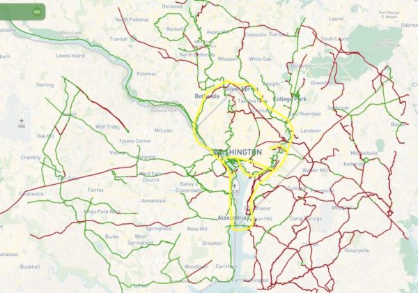
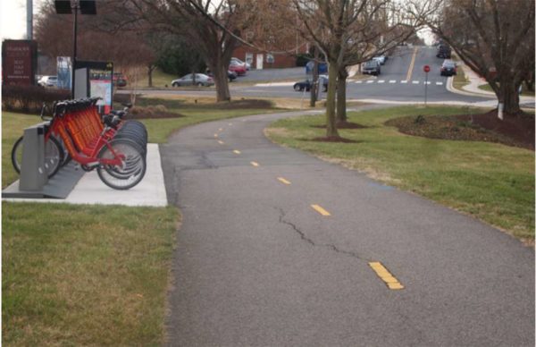
Transportation planners are sketching out a vision to build out a fully connected regional bike trail network by 2045, linking a “Bike Beltway” around D.C. to the rest of the suburbs surrounding the capital.

The Metropolitan Washington Council of Governments’ Transportation Planning Board voted late last month to endorse a vision for a “National Capital Regional Trail Network,” expanding its long-range plans for cycling infrastructure throughout the region. Though the actual funding and construction of the trails involved remains up to the individual localities, the map represents a potential path forward for the D.C. area’s elected officials to follow in the coming years.

The newly adopted trail network includes the 842 miles of bike paths identified by the Capital Trails Coalition, a group of both local government transportation agencies and a host of advocacy organizations, as ones that regional leaders should pursue to make cycling around the area a bit easier.

The group has been pushing the idea of a more interconnected region for years now, particularly the “Bike Beltway” circling the city. Former Arlington County Board member Jay Fisette was a key backer of the concept, envisioning a loop of trails from the county’s border with D.C. down to Alexandria, then running around the city into its Maryland suburbs.

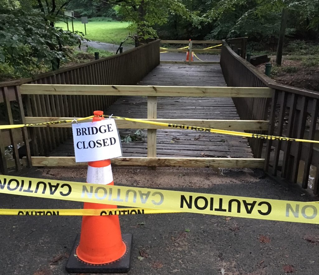
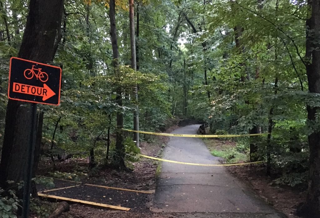
But with that trail nearly finished, this latest move envisions connecting that “Beltway” with trails in more far-flung jurisdictions, like Prince William and Loudoun counties.

“The Capital Trails Coalition is pleased to see the coalition’s two years of research and mapping make its way into this important regional transportation plan,” Coalition Chair Jack Koczela wrote in a statement.

The National Park Service has embraced the plan as well, and regional planners hope this latest move can help all the jurisdictions involved in crafting the trail network secure funding to make it a reality.

“There has been great interest among the region’s jurisdictions, agencies, and advocacy groups to build on the National Capital Trail, as endorsed by the TPB and adopted by the NPS,” the Transportation Planning Board’s staff wrote in a blog post.

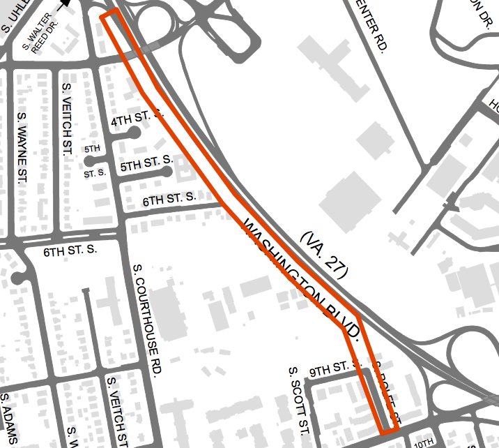
Arlington officials are currently working on their own update of the county’s guiding documents for future cycling infrastructure improvements, set to wrap up in the coming months. The county’s budget squeeze, however, will make it a challenge for the Board to find finding for many bike projects, at least in the near term.

Photo courtesy of the Capital Trails Coalition


Arlington transportation planners are weighing major revisions to the guiding document for the future of the county’s bike infrastructure, sketching out a wish list of new trails and bike lanes they want to see over the coming years.

County officials have recently begun circulating a draft version of an updated “bicycle element” to Arlington’s “Master Transportation Plan.” The document was last updated a decade ago, and a working group has spent more than a year crafting potential changes for the plan.

In all, it contains 26 new pieces of cycling infrastructure from the last time the plan was revised, including a bevy of new trail segments, additional on-street lanes and trail renovations. The county is now soliciting public feedback on the draft in the form of a community survey, with additional engagement efforts to come.

But the document also includes some broad goals for county officials to pursue to meet the needs of cyclists over the coming decades, with a special focus on how Arlington can make people feel safer while riding their bikes on local streets.

“Many residents have identified that they do not have suitable bicycle facilities within their neighborhoods or ones that connect to the local destinations that they want to travel to,” the draft document reads. “Other bicyclists do not feel comfortable riding with or amongst motor vehicle traffic and they feel that some on-street bikeways do not provide sufficient separation from motor vehicles. While the County has developed many on-street bikeways in recent years, their distribution and connectedness across the Arlington is currently uneven.”

To that end, the updated plan calls for plenty of infrastructure improvements to meet that goal. The county’s budget squeeze, however, will make it a challenge for the County Board to find finding for many of these projects, at least in the near term.

But the document does identify several improvements that have already been funded in the county’s long-term construction plans, including three additions from the plan’s last update. Those include:

McKinley Road Buffered Bicycle Lanes – Revise the roadway markings on McKinley Road between the Custis Trail and Wilson Boulevard to include buffered bicycle lanes. Undertake the roadway marking along with construction of crossing enhancement to provide for improved access to McKinley Elementary School and the Custis Trail.

S. Clark Street Cycle Track – Construct an off-street cycle track that connects the planned Army Navy Drive protected bicycle lane at 12th Street South to 18th Street S. and the Crystal City Metrorail station.

Shirlington Road Bridge – Reconstruct the Shirlington Road bridge, and adjacent sidewalks, to provide an enhanced, wide bicycle and pedestrian path along the west side of the roadway that links the W&OD and Four Mile Run trails.

As for the rest, some the new planned changes only impact small sections of trails or roadways, requiring only small funding commitments. Others are substantially more ambitious.

Among the bigger asks are requests for the renovation of the entirety of the W&OD Trail as it runs through Arlington, and the portion of the Four Mile Run Trail south of W. Glebe Road, totaling about 5.5 miles in all.

“Improvements may include: trail widening, minor realignments, new pavement markings, wayfinding signage and consideration of the addition of trail lighting,” the document reads.

When it comes to new and improved trails, other planned projects include upgrades for the entirety of the Bluemont Junction Trail and and the construction of a new, half-mile long bike and pedestrian trail connecting the site of the former Northern Virginia Community Hospital in Glencarlyn to the nearby Forest Hills neighborhood.

Some of the plan’s more substantial on-street projects include the construction of bike lanes and other improvements along “the entirety of S. George Mason Drive,” stretching about 2.1 miles in all. The document also envisions new bike lanes along N. Highland and N. Herndon streets, between Key Boulevard and 7th Street N., to allow for easier access to the Clarendon Metro station.

Additionally, the document recommends the creation of some new “bike boulevards,” or coordinated infrastructure improvements to give cyclists an alternative to bypass busy roads for quieter side streets.

The county’s previously constructed some off Columbia Pike, and the plan envisions one along the Rosslyn-Ballston corridor (on Key Boulevard, N. Jackson Street and 13th Street N. between N. Rhodes and N. Quincy streets) and another connecting Ashton Heights and Lyon Park (on 5th, 6th, 7th and N. Fillmore streets to connect Henderson Road to Pershing Drive as it meets Washington Blvd).

The county is planning an open house to collect in-person feedback on the new bicycle element on Jan. 14 at Phoenix Bikes (909 S. Dinwiddie Street), set to run from 6-7:30 p.m.

Photo via Arlington County


(Updated at 12:22 a.m.) Arlington County is set to celebrate the opening of a new section of the Washington Blvd Bike Trail today (Nov. 30).

The event will take place from 1 p.m. to 2 p.m. along the new bike trail on the east side of Towers Park (801 S. Scott Street). Capital Bikeshare bikes will be available for attendees to try out the trail after remarks from the speakers.

Construction on the trail began in January. Work zipped along over the last few months to complete it before the end of fall.

The new 10-foot-wide trail runs between Towers Park and 2nd Street S. in Penrose, to provide more seamless access for cyclists and pedestrians to a previously constructed trail between Arlington Blvd and Walter Reed Drive.

https://twitter.com/BikeArlington/status/1064897660421758977

This story has been updated


The Army is now set to build a two-mile-long, eight-foot-high security fence along the border of the Arlington National Cemetery and Joint Base Myer-Henderson Hall.

The National Capital Planning Commission, a regional planning body focused on projects on federally owned land, unanimously signed off on designs for the new fence at a meeting last month. The project, commissioned to replace a four-foot-high fence currently separating the base from the cemetery, will also include a five-foot-wide walking trail along the perimeter of the burial ground and a new parking lot to replace some spaces to be eliminated by the construction.

The Army proposed the new fence in the first place over concerns that the existing wall is “no longer adequate to protect the employees on the installation,” according to a report prepared by the commission’s staff. The fence will include four gates to allow access between the base and the cemetery — the fence itself will be “anti-climb and the gates will be both anti-climb and anti-ram,” according to staff.

The gates were a particular point of concern for some members of the commission, who pressed the Army to to reconsider designs at the Selfridge and Memorial Chapel gates, in particular. However, the fence’s designers said they couldn’t quite manage to find a design that would simultaneously meet the Army’s design concerns and the aesthetic issues the commission identified.

“[At] Selfridge, I think we’ve proven that beauty and elegance is gone from our minds,” Commission Vice Chairman Thomas Gallas said during the Oct. 4 meeting. “And I guess I’m disappointed, because I know everybody, everybody, all the stakeholders appreciate what that gate feels like as you approach it. It really is something powerful, as we went there to see it, it moves you. And it won’t move you anymore. Nothing’s going to move there. It’s constipated, I guess you could say.”

The Army does plan to add more shrubs and landscaping at the gates to help address some of those concerns, according to the staff report.

The project will also include a trail, which “follows the path of countless runners and walkers” and “will be made from permeable pavement.” The Army also hopes to add “small seating areas with benches and detailed planting along the trail,” the report says.

The cemetery is set to see a bevy of other changes in the coming years, with plans for a massive expansion of the burial ground and a realignment of many nearby roads.


A coalition of businesses, neighborhood groups and transportation advocates are urging planners to include a bike and pedestrian trail along the long-planned replacement for the Long Bridge, a key railroad connection from Virginia into D.C.

A total of 15 organizations from Arlington, the District and the rest of the metropolitan Washington region penned a new letter last Thursday (Nov. 1) to both local and federal transportation officials working on the project, calling the inclusion of a trail alongside the bridge part of “a once in a generation opportunity to transform our regional transportation network.”

Planners are still sorting out exactly what the new bridge might look like. The original structure, which runs from near the Pentagon in Arlington to Southwest D.C., was built back in 1904, and officials from around the region have viewed replacing it as a necessary step for improving freight and passenger rail service between D.C. and Northern Virginia.

However, the prospect of including a trail alongside the new Long Bridge was not formally included in the various assessments of potential designs of the project. Accordingly, the group penning the letter sought to emphasize the benefits such a trail could have for the region’s commuters, and its economy.

The organizations — which include the Crystal City Civic Association, Friends of Long Bridge Park, the Washington Area Bicyclist Association, and Greater Greater Washington — stressed that any new trail crossing the Potomac River would provide “crucial links to several important regional trails.” The current crossing along the 14th Street Bridge does not offer a connection to the regional trail network on the D.C. side. of the bridge, and the friends group supporting the Mt. Vernon Trail co-signed the letter.

The groups also stressed that such a trail would spur economic development “by linking two key activity nodes in Southwest D.C. and Crystal City.” That goes doubly so if officials also follow the groups’ recommendation that the trail “connect to the esplanade in Long Bridge Park” and “extend as far towards L’Enfant Plaza as physically possible” on the D.C. side.

Perhaps most importantly, the letter urges that the trail “be funded and constructed concurrently with the rail component of the Long Bridge project,” and that it “should be incorporated into the design of the broader project in a way that optimizes the achievability of the project with regard to cost and complexity.”

In a draft of an environmental impact statement prepared in late June, federal and local planners stress that any trail is “not part of the purpose and need” of the project. Even still, they agreed to include the study of four potential trail crossings in more detailed studies of the project to be completed over the coming months.

Planners have so far narrowed potential designs of the bridge replacement down to two options; both involve building a new, two-track bridge alongside the existing structure, but one alternative calls for the current bridge to stay in place and the other would involve fully replacing it.

Two of the trail designs call for building the crossing alongside the new bridge. Two others call for building the trail along its own, independent bridge: one proposal envisions it being upstream of the new two-track bridge, another would be downstream.

The transit advocates at Greater Greater Washington have expressed doubts about these proposals in the past, arguing that the designs “do the bare minimum” and represent a missed opportunity for planners. However, officials did agree to examine trail crossings over the Long Bridge Park side of the G.W. Parkway, “with an evaluation of connections to the Mount Vernon Trail and Ohio Drive S.W.,” two features that were previously championed by Greater Greater Washington.

Even still, there remains no guarantee that the trail will indeed be included in the project — the June report notes that Virginia rail officials noted “noted that the primary focus of the project is increasing rail capacity, and expressed significant concerns regarding safety and constructability of any combined-mode structure.”

Planners are still a long ways off from finalizing designs, however. The first step is settling on a single “preferred alternative” to examine in more detail, which planners hope to do within the next two months.

Officials then hope to have engineering and environmental analyses drawn up by summer 2019, and the project still needs additional funding. Virginia officials and the rail company CSX, which owns the bridge, have committed to chip in a total of $30 million for the effort, though there’s no telling just how much the bridge replacement might ultimately cost.


Plans to make Rosslyn a bit easier to navigate for pedestrians and bicyclists are coming together, though county officials are concerned that some of the proposed changes might further snarl traffic in the area.

The county unveiled its latest designs for future of the “Core of Rosslyn” at a public meeting last Tuesday (Oct. 2), which includes plans to convert several streets around the Rosslyn Metro station into two-way roads, remove the Fort Myer Drive tunnel under Wilson Blvd and add a host of new connections for cyclists and walkers.

However, transportation planners worry that these alterations will produce “significant increases in gridlock” over the next decade or so, according to meeting documents.

In all, they’re projecting that the proposals will increase wait times at intersections in the neighborhood by a total of 19 minutes during the morning rush hour (with especially acute problems at the already jammed intersection of the Key Bridge, G.W. Parkway and Lee Highway) and a total of six minutes during the evening rush. They’re hoping to refine these designs in the coming months to address those issues, while maintaining the positive parts of the plan.

Certainly, planners expect the changes will result in substantial improvements in Rosslyn’s offerings for people who aren’t relying on cars to get around. The designs included 14 new or improved crosswalks for pedestrians, and more than 1.3 miles of new protected bike lanes included in the design. The lanes, largely set to run along Fort Myer Drive, N. Moore Street and N. Nash Street, are designed to ease bike connections to the Key Bridge and Mt. Vernon and Custis Trails.

The plans also keep alive the county’s long-considered possibility of building a car-free, “pedestrian corridor” running from 18th Street N.’s intersection with N. Oak Street to N. Kent Street, a change that would replace the Rosslyn skywalk system to make the Metro station more accessible.

Yet the county expects that this design would create some new challenges for walkers and cyclists as well. In particular, allowing two-way access on roads like N. Fort Myer Drive, N. Lynn Street and N. Kent Street will create a host of new “conflict points,” where cars are turning across crosswalks, prompting further delays for all involved.

That’s why Arlington officials are still accepting feedback on tweaks to the design.

Among the questions they want answered is whether people actually want to see the Fort Myer Drive tunnel filled in and transformed into a regular, signalized intersection with Wilson Blvd. The change would prompt additional delays at the intersections, and would involve “extensive construction costs and [a] long timeframe,” but could make it substantially easier for people to access the Rosslyn Metro station.

Similarly, planners want to know if making N. Lynn Street a two-way road is worth the extra traffic headaches it might entail. The county projects that the change “reduces confusion and allows for more direct routing” if it’s put in place, but it would also force officials to find new access points to the G.W. Parkway, I-66 and the Key Bridge.

The county plans to finish collecting feedback by Friday (Oct. 12), then unveil revised designs in the coming months. Officials hope to have final study recommendations for the area ready by sometime this winter.


Arlington County is working on some modest improvements to the Arlington Boulevard Trail in Lyon Park, renewing hopes among cycling advocates that the trail will someday provide a fully contiguous alternative to Route 50.

The county is currently planning a series of changes on the trail as it runs near Arlington Boulevard’s intersection with N. Pershing Drive, near the Day’s Inn hotel in the area. Arlington’s Department of Environmental Services says it hopes to complete the following alterations sometime this fall:

  • Construction of a new, ADA-accessible curb ramp at the corner of N. Pershing Drive and Wainwright Road (the frontage street between Arlington Blvd and the Days Inn hotel)
  • Addition of on-street markings along the eastern portion of Wainwright Road to separate trail users from motorized traffic.
  • Removal of parking on the eastern portion of Wainwright Road.
  • Connection of the Wainwright Road on-street trail to the existing Arlington Boulevard Trail as it approaches 2nd St N.

The county envisions the new curb ramp connecting the trail to the new on-street trail along Wainwright Road, which will then connect to the rest of Arlington Boulevard trail running past the Washington and Lee Apartments.

“Arlington County expects that the markings/bollards used to delineate the trail along Wainwright Road will be short-term,” the county wrote in a NextDoor post. “Given the availability of funding, Arlington County plans to build out a curb separated trail adjacent to Wainwright Road to further increase the safety of this portion of the trail.”

The cycling advocacy blog WashCycle noted that these changes come a few months after Washington Gas replaced a pipeline in the area, leading to the repaving of the trail and the removal of some bollards nearby.

The blog hailed these latest proposed changes, noting that the trail is currently “discontinuous and below standard” and referred back to the Washington Area Bicyclist Association’s proposal to someday add three miles worth of trail along Arlington Boulevard as evidence of the trail’s potential for growth.

“The boulevard trails, like the ABT, MacArthur Boulevard Trail and the planned or under-construction South Capital and Washington Boulevard Trails, don’t get quite the coverage that the rail or stream trails get; but they’re [arguably] more important for transportation as they go right through the areas where people live and work,” WashCycle wrote. “The ABT has a long history and, as WABA points out, plenty of potential. It can, or already does, connect to eight trails including Rock Creek, Mt Vernon, W&OD and Cross County. As proposed by WABA, it could be a real backbone for Arlington County biking. It would be great to see this once again become a must-see trail.”


A coalition of bicycling and transit advocates has drawn up a new map of the entire D.C. region’s bike trails, in a bid to promote a more holistic view of the area’s biking options.

The Capital Trails Coalition released the “diagrammatic map” today (Monday), displaying not only the 436 miles of existing trails across the region but also another 302 miles of planned paths that will someday create even more connectivity for cyclists.

The coalition, which includes both local government transportation agencies and a host of advocacy groups, included bike trails in six jurisdictions around the region on the map: Arlington County, Alexandria, D.C., Fairfax County, Montgomery County and Prince George’s County. Coalition Chair Jack Koczela hopes that will help people to see cycling as a viable option no matter where they live around the D.C. region, laying out a clear, unified guide to easily bikeable trails for commuting and recreation alike.

“We hope this comes to have the feel of the iconic Metrorail map,” Koczela told ARLnow. “This is so people can get an idea of what it is we’re talking about in terms of actual trails available to everybody around the region.”

Koczela says the coalition has spent more than two years now drafting the map, as the group sought to work with cyclists to identify trails that are both easy to ride and provide good access to the region’s activity and transit centers.

He’s hoping that the map will prove particularly useful to D.C. suburbs like Arlington. If commuters currently rely on cars or public transit to get to work because they aren’t sure how a trail that starts in Arlington connects with one in D.C., or even Maryland, he foresees this map being a vital resource to provide alternatives.

“A lot of people’s experience on trails is really hyperlocal, and a lot of people aren’t thinking of these trails as a way to connect them to other areas of the region,” said Carm Saimbre, communications coordinator for the Washington Area Bicyclist Association, a coalition member. “The vision with this is to create connections and fill gaps in the network, so it becomes just as established as getting around the Beltway by car.”

With so many planned trails included on the map, Koczela notes that the document is certainly an aspirational one in many respects. In Arlington alone, the map includes not only trails currently under construction, like a new section of trail alongside Washington Blvd, but also ones still in the planning stages, like the extension of the Mt. Vernon Trail from Theodore Roosevelt Island.

But by showing just how adding more trails could better connect the region, Koczela thinks the map will be a valuable tool as his coalition lobbies for more funding for bike infrastructure going forward.

“Our goal for the next year is to increase awareness and get the political community engaged, thinking about the trails as a network,” Koczela said.

Photo via the Capital Trails Coalition


A bridge for walkers and cyclists in Lubber Run Park is now closed, at least temporarily.

An alert on the county’s website says the bridge, closest to N. George Mason Drive as a trail runs over Lubber Run itself, will be closed “until further notice.”

A tipster first notified ARLnow about the closure on Friday (Aug. 3). County parks spokeswoman Susan Kalish says workers checked on the bridge while doing some park maintenance, and subsequently decided to close it.

“Our crew was concerned with the bridge but they aren’t bridge experts,” Kalish wrote in an email. “They closed the bridge and have scheduled a bridge expert to check it out.”

Kalish expects the county is “erring on the side of caution” with the closure, but she stressed that “safety is our number one concern.”

The county’s posted detour signs for anyone using the trail, and is directing walkers and bicyclists away from the bridge while work continues.

The park, located at 200 N. Columbus Street, was recently the site of a community gathering to pay tribute to the soon-to-be torn down Lubber Run Community Center.


Work is speeding ahead on a new bike trail running alongside Washington Blvd as it meets I-395, with construction set to wrap up this fall.

The county has spent close to a year constructing a new 10-foot-wide trail as the road runs between Towers Park (801 S. Scott Street) and 2nd Street S. in Penrose, in a bid to provide more seamless access for cyclists and pedestrians to a previously constructed trail between Arlington Blvd and Walter Reed Drive.

Over the course of the last month, the county says workers have finished “two sections of retaining wall” and the “installation of the abutments for the bridge over the Doctor’s Run stream,” as well as the construction of some storm drains.

Now, work will shift onto property owned by the U.S. Navy at 701 S. Courthouse Road, just near Towers Park, as workers install the trail’s stone and asphalt base.

The county hopes to have work wrapped up by sometime in the “late fall.” In the meantime, some construction will continue along Washington Blvd. More details from the county’s website:

  • Work hours are Monday through Friday, 9 am to 3 pm.
  • Night work is expected throughout the project and will take place between 10 pm and 5 am (these hours will occasionally be extended).
  • Partial lane closures will be in place at night, reducing traffic on Washington Boulevard to one lane in the southbound direction. There will be no impacts to northbound traffic.

A section of the Custis Trail running alongside I-66 near Rosslyn is set to close for the next month.

Starting today (Monday), workers will start repairing the trail as it runs between N. Adams Street and McCoy Park to make it a bit more hospitable to cyclists. Construction is set to last through Aug. 24.

Specifically, Arlington’s Department of Parks and Recreation and its contractors will focus on “a series of bumps, or undulations, on the trail surface near the pedestrian flyover bridge over I-66,” according to a blog post by Bike Arlington program manager Erin Potter.

“This part of the Custis Trail is too narrow (between a retaining wall and I-66) to allow repair work to happen while the trail is open,” Potter wrote.

The county plans to post signs for detours for both pedestrians and cyclists near the closed section of the trail. Walkers and runners will be redirected down N. Adams Street and then along Lee Highway to bypass the construction, while bicyclists have their choice of three different options.

Bike Arlington has full details on the detours posted on its website.


View More Stories