Arlington residents may see improved sidewalks and pedestrian crossings in a few neighborhoods in the near future.

The County Board approved funding for four projects at its meeting on Saturday (June 18).

Among the projects:

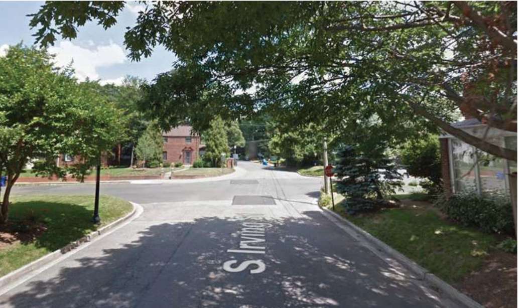
  • Constructing one block of missing sidewalk on S. Irving Street between 6th and 7th Streets S.
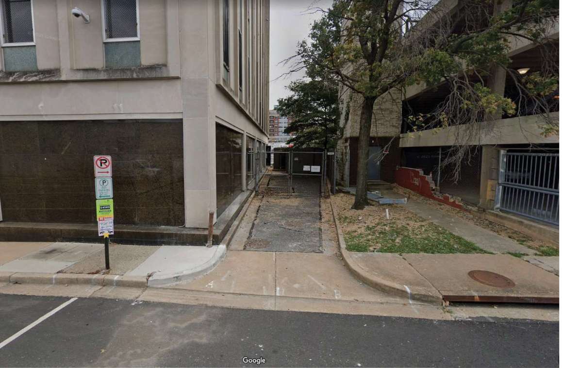
  • Constructing a section of accessible sidewalk at the service alley entrance of the AT&T building on 9th Street S. between S. Walter Reed Drive and Highland Street, near Columbia Pike.
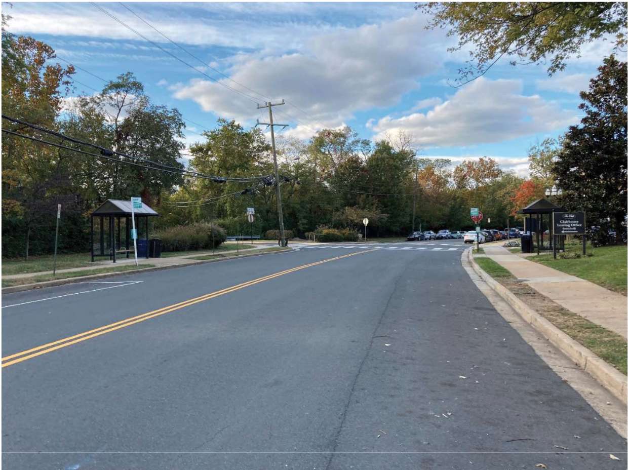
  • Constructing new transit stops, intersections, mid-block pedestrian crossing and bicycle racks at three pedestrian crossings on 28th Street S. between S. Meade Street and 26th Street S.
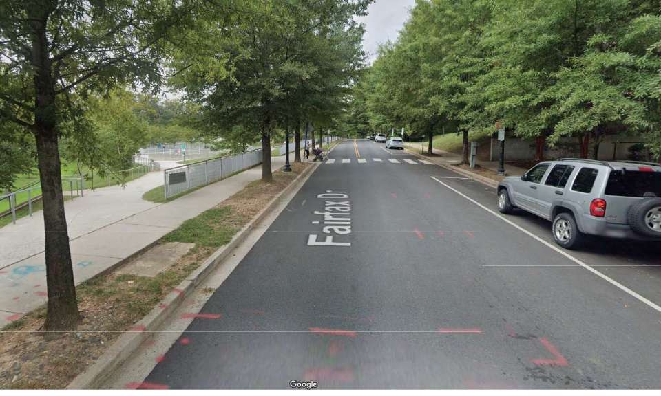
  • Constructing pedestrian crossings on N. Fairfax Drive between Arlington Blvd. and N. Barton Street, near Rocky Run Park.

The four projects are projected to cost around $1.7 million in total, according to a board report.
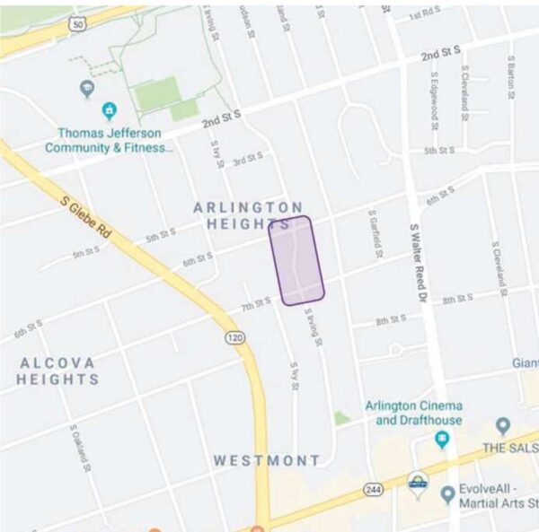
A Google map showing the proposed project area on S. Irving Street (via Arlington County)

The proposed project on S. Irving Street is set to build a continuous accessible sidewalk on one side of the road, between 6th Street S. and 7th Street S., which includes accessible curb ramps, existing streetlamps and on-street parking.

A little over 50% of local survey respondents believed the proposed project would make them feel “much safer” while walking there. Some expressed concern about the distance and visibility of crossing 7th Street S., according to the project’s community engagement summary.
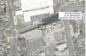
A map showing the proposed project area on 9th Street S. (via Arlington County)

The proposed project on 9th Street S. would modify the driveway to the AT&T building so that its curbs can be in an accessible sidewalk condition compliant with federal law. The county collaborated with the company for the design plan.

“This project will support a safe walking environment adjacent to the AT&T building, where there is high traffic volume and children at play in the area,” AT&T Mid-Atlantic Region Operations Manager Robert Weaver stated in a letter of support.
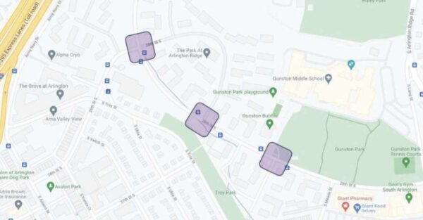
A map showing the proposed project area on 28th Street S. (via Arlington County)

The proposed project on 28th Street S. aims to reduce speeding and shorten the distance of pedestrian crossing by narrowing the roadway. This location was high on the county’s list of potential reconstruction because it has a history of car crashes and speeding.

Thirty percent of respondents who walked in that area believed the proposed project would make them feel “much safer.” Many respondents also expressed concern for cyclists along that road. However, the county determined that the road is too narrow for a bike lane, according to the project’s community engagement summary.
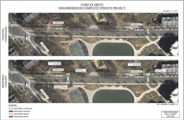
A map showing the proposed project on N. Fairfax Drive (via Arlington County)

The proposed project on Fairfax Drive, near Rocky Run Park, aims to increase the visibility of pedestrians crossing the street and shorten the crossing distance. It also proposes removing the mid-block crossing closest to the intersection with N. Barton Street.

Many people who gave feedback to the county raised concerns with the crossing removal, however. Almost 20% of survey respondents who walked in the said the proposed changes would make them feel less safe when walking, according to the project’s community engagement summary.

But the county will still remove it because it is less than 100 feet away from a crosswalk controlled by a “All Way Stop” sign.

All four projects were part of the Neighborhood Complete Streets Program, which aims to “make streets safe for all users of all ages and abilities” and “preserve or enhance neighborhood character,” according to its commission’s website.

The Arlington County Transportation Commission earlier voted unanimously to support the projects, but opined that the Irving Street could have been better.

More from a letter sent to the Board by the Transportation Commission, below.

(more…)


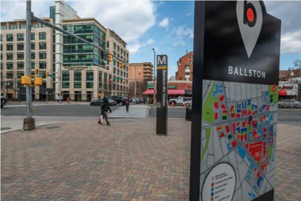
Arlington County is applying for a $4.5 million grant to further offset a proposed west entrance to the Ballston Metro station.

On Saturday, the County Board is set to approve this request for funding from the Northern Virginia Transportation Commission (NVTC), which would come from I-66 toll revenues.

This is the latest application from the county, which is trying to offset the $140 million project with regional and state dollars even as some of these sources have dried up due to the pandemic.

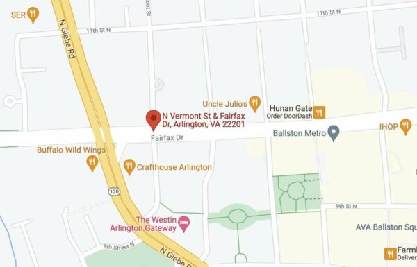
The entrance would be located at N. Fairfax Drive and N. Vermont Street, almost a quarter of a mile west of the existing entrance. The county previously said this second entrance would greatly expand access to the station, increase Metro’s capacity and make it more efficient.

Map showing potential location of new Ballston Metro entrance (via Google Maps)

If all the funding comes through, designs could be completed next year and construction could start in 2024 and end in 2027, Department of Environmental Services spokeswoman Claudia Pors tells ARLnow.

“The team is looking to finish the 35% design update this year and procure design-build services in 2023, pending funding from NVTA,” Pors said. “Construction is projected to start in 2024 and we anticipate a construction period of 3 years.”

The $4.5 million represents a revised request to the NVTC. Arlington had previously applied for $10 million from the same program in January 2020 but — despite being “the top scoring project” — the project was cut from the funding round due to a drop in toll revenue caused by COVID-19.

“Following a request from NVTC staff, the County withdrew its application for the Ballston-MU West Entrance in August 2020,” the report said. “I-66 Commuter Choice Program revenues have still not fully recovered from the effects of the pandemic, and so for Round Five the County has lowered its funding request from $10 million to $4,500,000.”

And while available funding is scarce, the cost to build the second entrance is increasing. A 2019 estimate put the project at $130 million; a 2021 estimate puts the project at $140 million.

“The use of the known information on items such as station entrance layout and elevator location from the design updates instead of previous assumptions in the 2019 cost estimate, along with the impact of inflation, are the two drivers of the cost increase,” the report said.

More than half of the project’s costs could come from a pending application with the Northern Virginia Transportation Authority (NVTA) for $80 million. The county says this sum would cover the rising costs as well as the loss of funding from NVTC and the Virginia Department of Rail and Public Transportation, which also lost revenue for new projects during the pandemic.

Pors said the NVTA will make a funding decision later this spring or in the early summer months.

Meanwhile, Arlington County intends to increase how much it’s budgeting for the project, from $25 million to $30 million.

Arlington’s Transportation Commission — while supportive of the project — is sounding the alarm on the $5 million increase at the local level.

“The Commission is concerned specifically about: 1) The appropriateness of making a change this large in how capital funding is being allocated completely outside of the CIP process and seemingly hidden within grant applications,” chairman Chris Slatt said in a letter to the County Board. “2) The high overall cost of the project and whether it still represents a good ‘bang for our buck’ in increasing access to transit for Arlington residents.”

He said $30 million could be used locally to bring every bus stop in Arlington into full compliance with the Americans with Disabilities Act, increase Capital Bikeshare’s 10-year capital budget or cover the costs to design and build more local projects intended to lower traffic congestion and improve public transit.

Map via Google Maps


Even as officials and advocates continue to hail the Crystal City-Potomac Yard Transitway as forward-thinking, there’ve been literal instances of backwards driving.

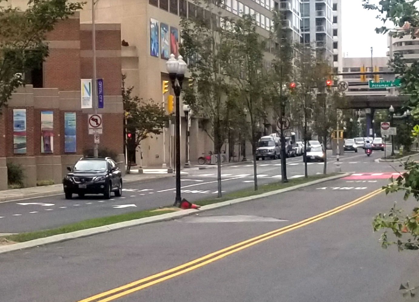
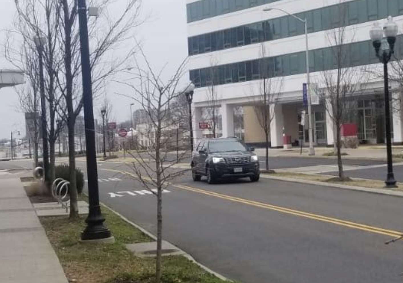
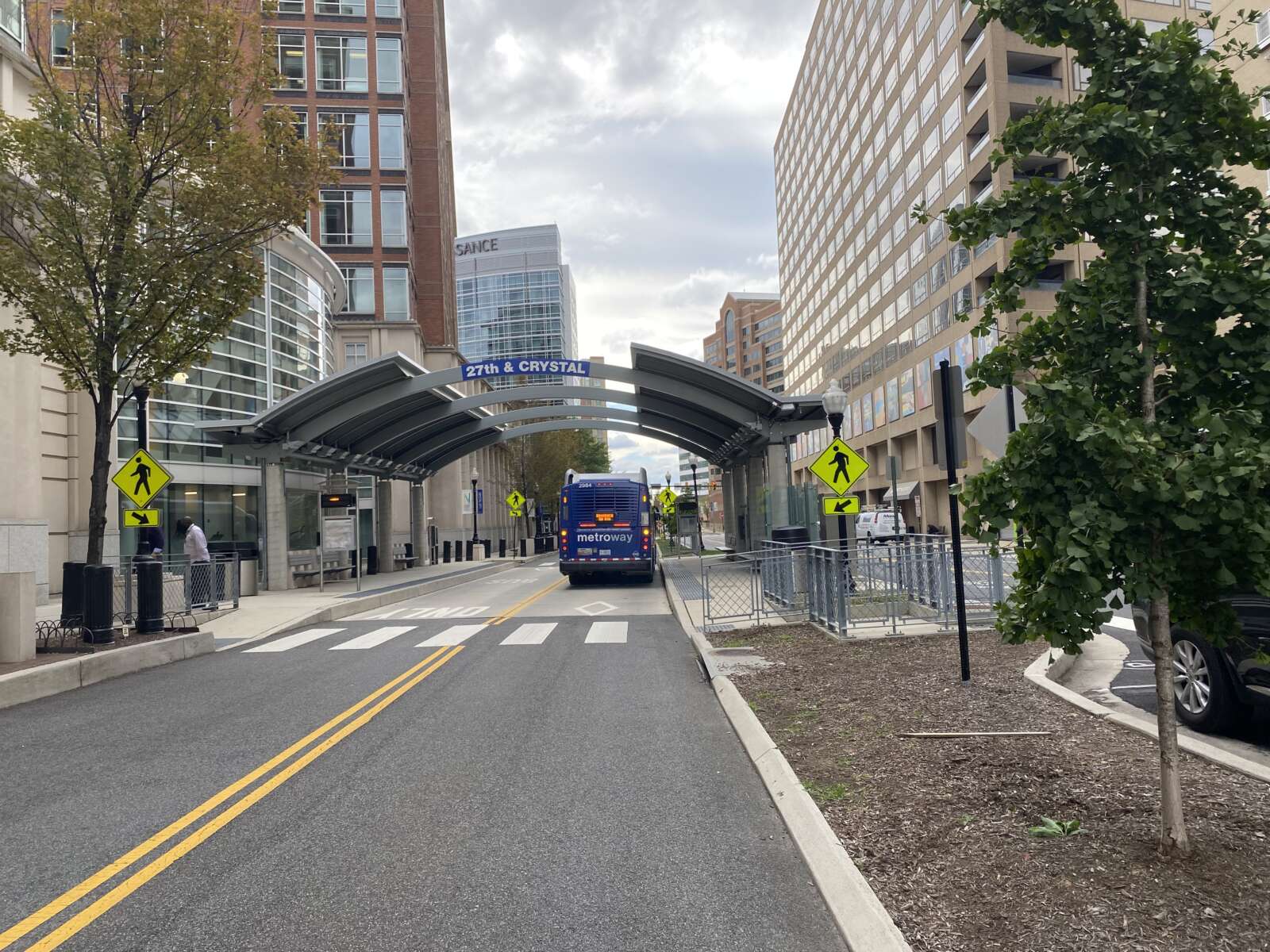
ARLnow has received reports of cars entering the Transitway’s bus lanes, often even driving the wrong direction in the lanes, which parallel Crystal Drive for about a mile. It seems to mostly stem from confusion over the roadway configuration.

Mark Stack lives in the Concord Crystal City apartments, directly across from a Transitway bus station at 27th Street S. and Crystal Drive. From the high-rise building he can see cars in the lanes that are intended only for Metroway buses.

Just today, [there was] one car on the wrong side of the road and two other vehicles traveling down the bus lane,” he told ARLnow. “It’s a daily, hourly occurrence. It’s not like once or twice. It happens pretty often.”

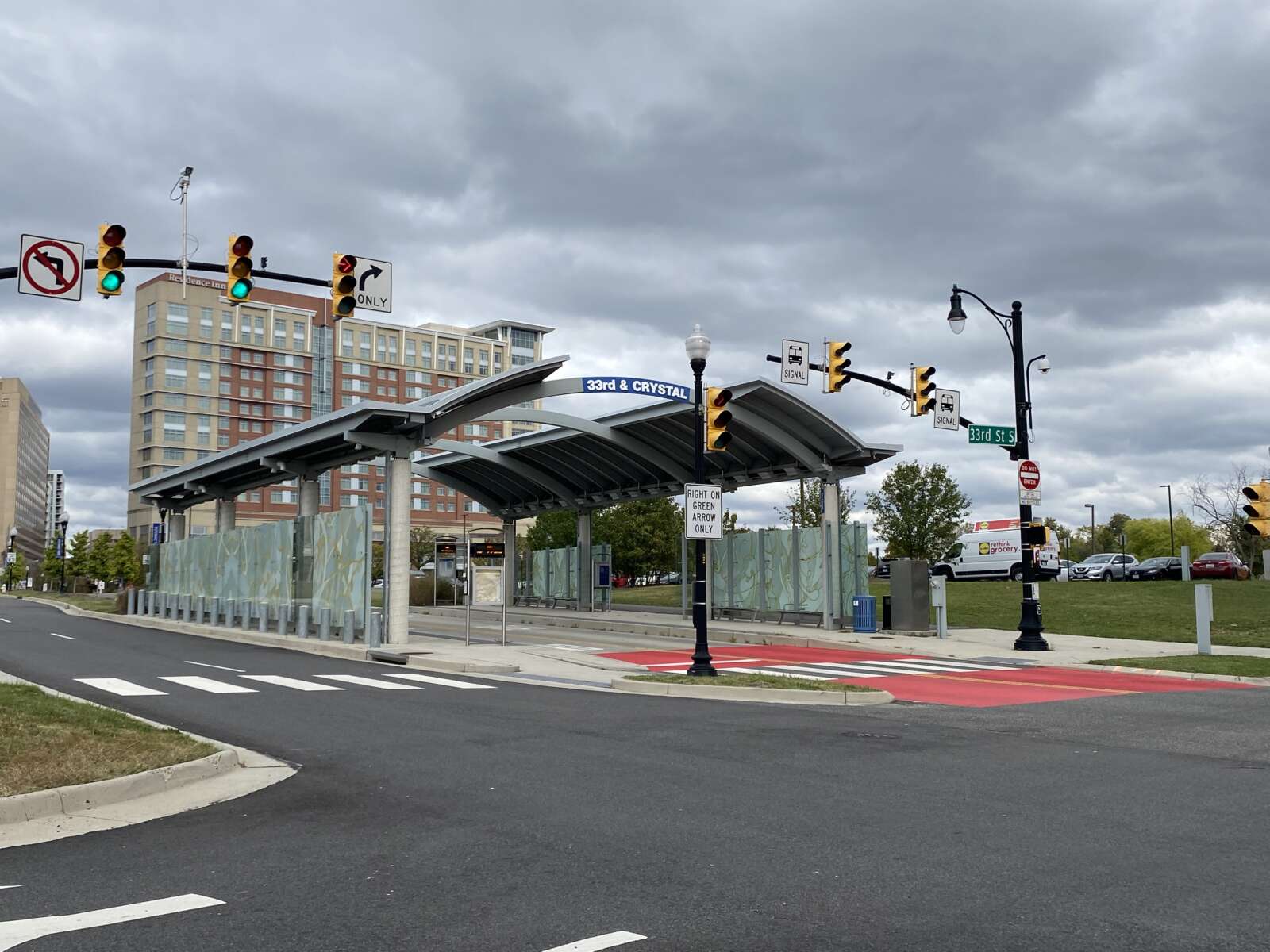
Walking in his neighborhood, Stack has also seen cars entering the lanes near the bus stops located 33rd Street S. and 26th Street S. along Crystal Drive. He’s fearful that drivers going the wrong direction will hit buses head-on or kids bicycling, which he also sees often in the lanes (which, technically, is also not allowed).

“I’m just surprised there’s never been any accidents,” Stack said. “It’s a miracle.”

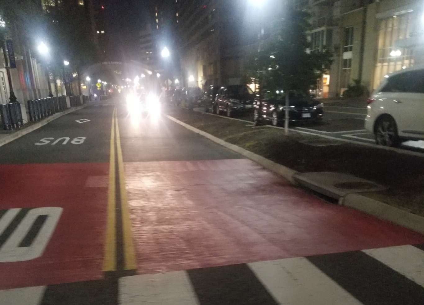
ARLnow also checked out several of the intersections and Transitway bus stops that Stack spoke about. While no unauthorized vehicles were observed in the lanes at the time, it’s evident confusion could be possible, particularly at night.

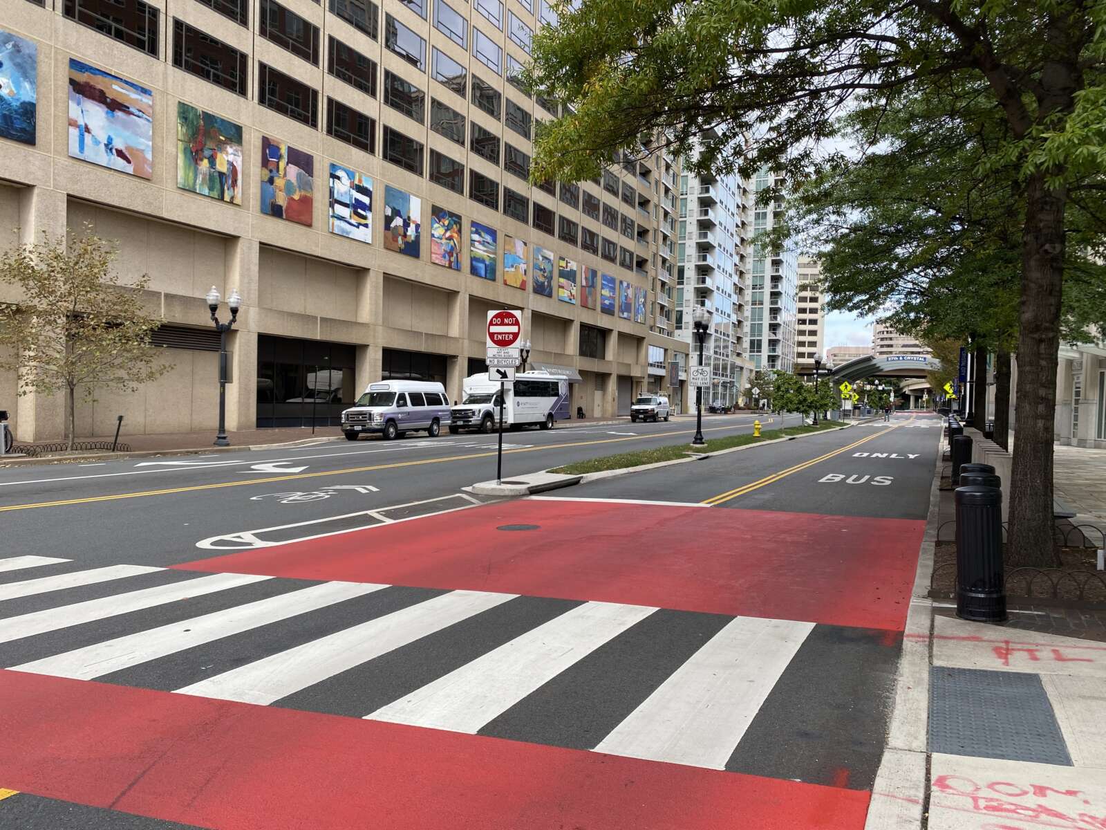
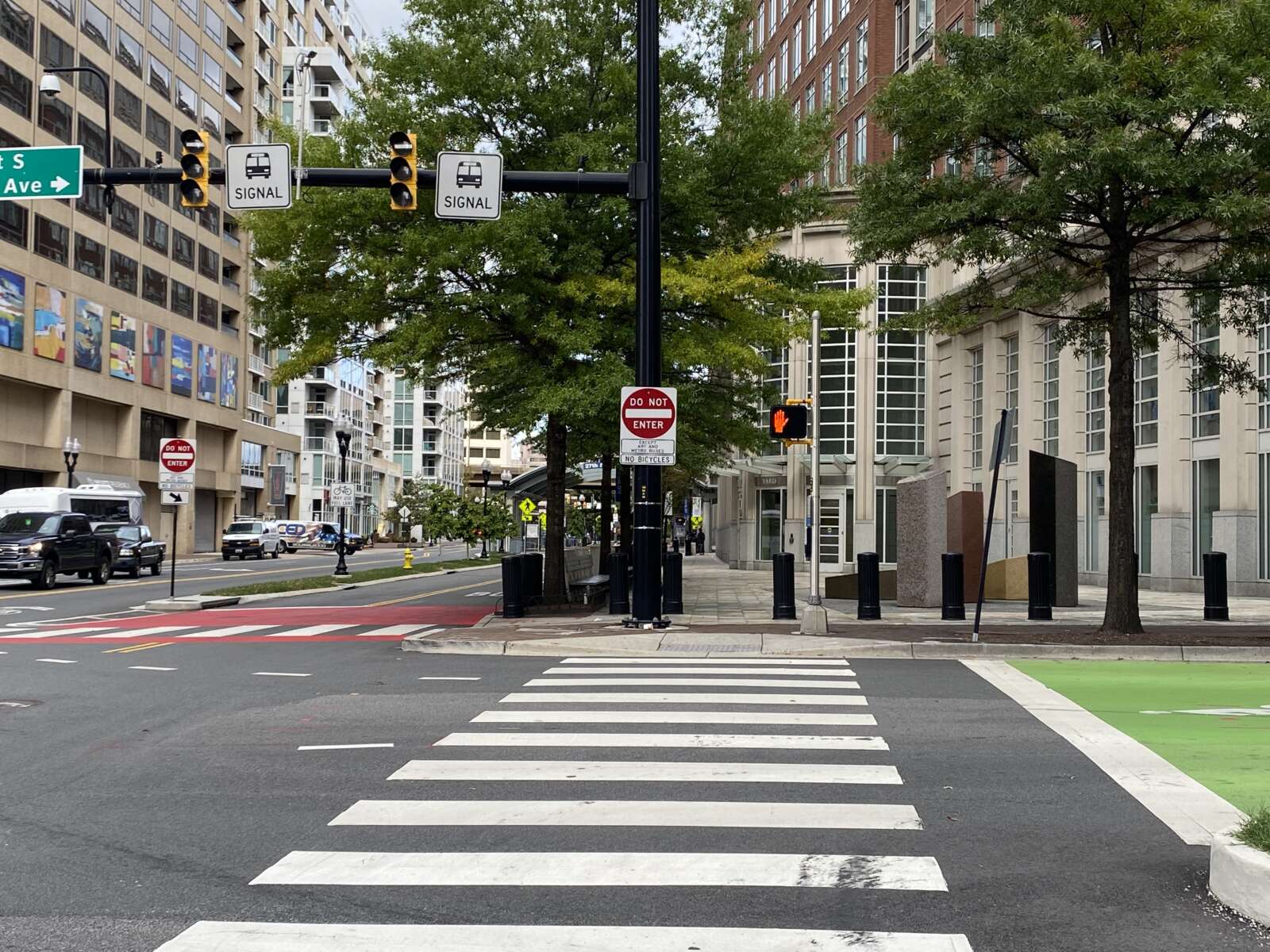
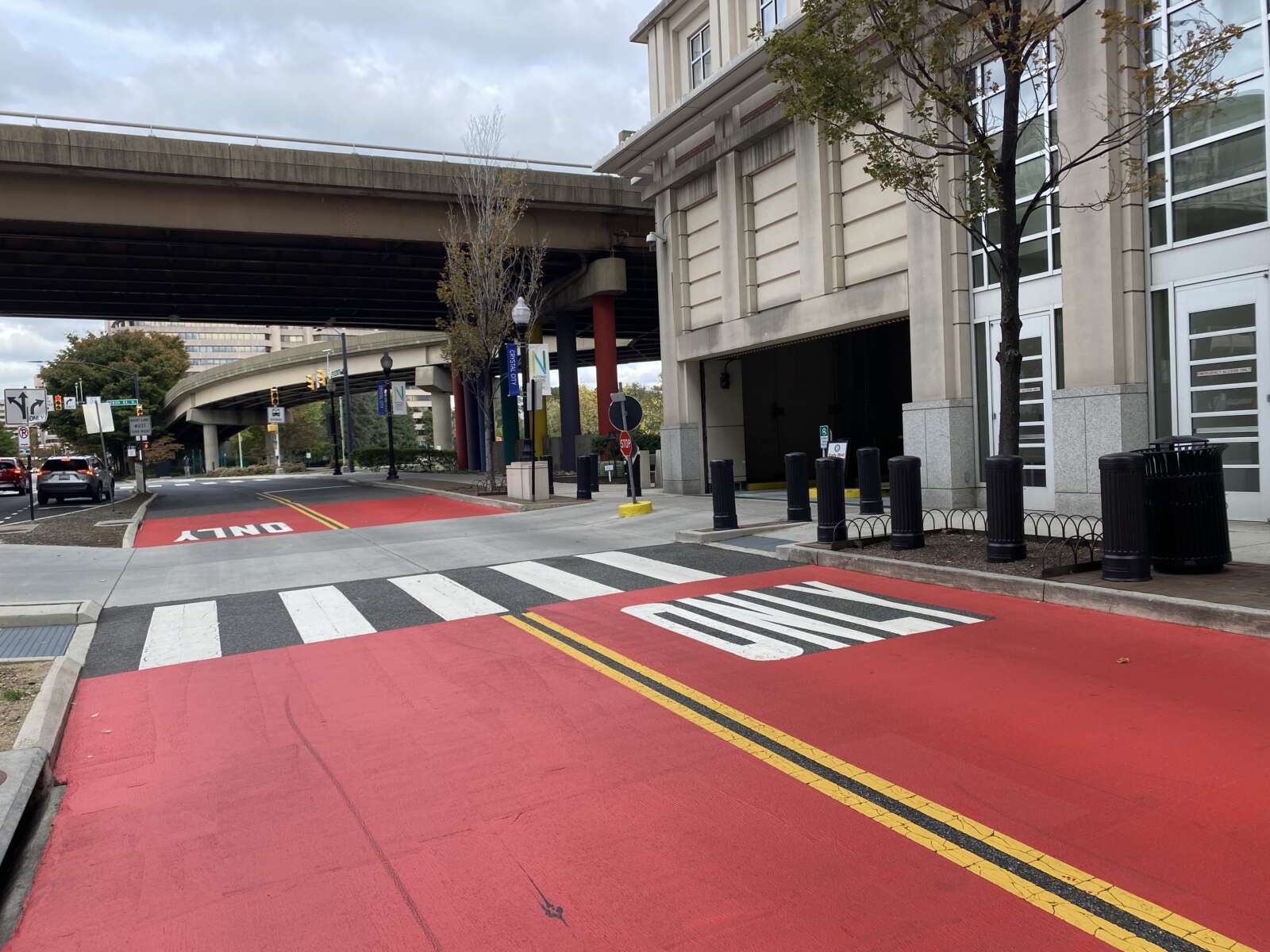
There are right and left turn lanes leading directly into the bus lanes, as well as dark red markings that may not be clearly visible at night. There are, however, “do not enter” signs and medians that do prevent mingling of traffic.

Darren Buck, a member of Arlington County’s Transportation Commission, also has seen unauthorized cars going into the dedicated bus lanes. While the danger does concern him, he additionally worries that drivers are intentionally entering them to bypass traffic

“If that’s the case, the success of the Transitway is at risk,” he says, since one of the major selling points of rapid bus transit is that it removes buses from car traffic. “[There] probably needs to be a broader conversation about enforcement in bus-exclusive facilities.”

The county acknowledges that unauthorized vehicles using the bus lanes, intentionally or not, is an ongoing issue that dates back to the Transitway’s opening.

“[Arlington Department of Environmental Services] staff have been made aware of issues with operations on the Crystal City – Potomac Yard Transitway, specifically regarding private vehicles using and misusing the dedicated transit lanes in 2016,” DES spokesperson Nathan Graham wrote in an email to ARLnow. He  noted that they have received reports of this happening recently.

In response, transportation staff earlier this year applied red pavement markings to highlight the bus-only lanes at several of the Transitway segments, Graham said, including at 27th Street S. and Potomac Avenue, 33rd Street S. and Crystal Drive, and 26th Street S. and Crystal Drive.

“Moving forward, we will enhance this practice of clearly denoting entry points for bus-only lanes and at areas where there are reports of driver confusion with additional paint and signage, as appropriate,” wrote Graham. “We will also reach out to our colleagues at ACPD to review options for enforcement at these locations.”

All of these are issues that the county will keep in mind as the build-out for the extension to Pentagon City begins next year.

(more…)


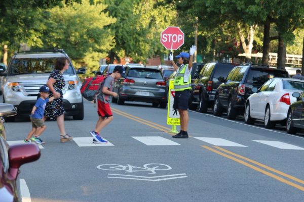
Abingdon Elementary School students cross the road on the first day of school (file photo)

(Updated at 9:35 p.m.) Arlington County is looking to lower speed limits near schools as part of its ambitious Vision Zero initiative to eliminate serious traffic-related injuries and deaths by 2030.

This Saturday, the County Board is set to decide whether to authorize a public hearing next month to discuss and potentially approve creating “slow zones” on residential streets near 13 schools.

The proposed 58 zones, with a speed limit of 20 mph, will be near 11 Arlington public schools and well as Bishop O’Connell High School and St. Thomas More Cathedral School.

“Attempts to reduce or eliminate fatal and critical crashes can be achieved by regulating unsafe speeds on our streets with measures such as signage and pavement markings,” a county report said. “Lowering the speed limit can be a basic and powerful tool for reducing vehicle speeds.”

Traditionally, Arlington has installed flashing beacons to encourage drivers to adhere to reduced speed limits near schools. The report said these signs are inconsistently installed and are costly to maintain, while “static signage” and pavement markings, reminding drivers the speed limit is always 20 mph, are cheaper and easier to install.

The signage and markings will be tested out at these 13 sites before they’re installed across Arlington.

“Slower speeds around schools is a no-brainer, and are beneficial for everyone,” Vision Zero program manager Christine Sherman Baker told the Transportation Commission earlier this month. “We want to prioritize safety in school zones because children are still learning how to travel safely: how to cross the street, how to ride a bike. They’re some of our most vulnerable users.”

And they’re learning these skills in risky areas: according to the report, 10 or more speeding-related crashes annually happen within 600 feet of a school in Arlington.

Some schools were chosen because they’re new or have existing infrastructure in need of upgrades, she said. Hoffman-Boston Elementary, Drew Elementary and Gunston Middle schools were chosen because they’re near high-injury networks — and including them would help meet Vision Zero’s equity component.

This fall, Arlington County Police Department has been collecting speeding data that will be compared with new data collected next spring to see if these zones are effective, she said.

The community can provide feedback in March and April of next year, ahead of the county-wide roll out, she added.

The proposal was met with enthusiasm from Transportation Commission members and some members of the public.

“Bravo,” Transportation Commission Chair Chris Slatt said. “I think it’s fantastic.”

Representing local advocacy group Arlington Families for Safe Streets, Gillian Burgess voiced her support for the program during the meeting.

“Slower speeds around schools are not only great for the safety of vulnerable road users, but it also encourages activity, which addresses both child health and health equity,” she said. “It improves air quality and noise pollution around schools… and it promotes mental health and social inclusion.”

ACPD should also “commit publicly” to enforcing speeding near schools, preferably via speed cameras and not just for speeds 10 mph or more above the limit, while the county should consider closing streets in front of schools to cars, Burgess added.


A discussion about improving Georgetown-Rosslyn connectivity last night was not supposed to be about the controversial yet ironically beloved gondola.

But the gondola — which 47% of respondents to a recent, unscientific ARLnow poll said they support — was nonetheless on Arlington transportation commissioners’ minds during their Thursday meeting.

The same coalition of D.C. nonprofits and organizations that studied the feasibility of the gondola five years ago is now embarking on a study of other ways to improve transit in and out of Georgetown. Last night, Federal City Council (FC2), a nonprofit dedicated to advancing life in the District, presented the scope of the study to the Transportation Commission.

“I think it’s important to start by saying that tonight, I’m not here to talk to you about the gondola,” said FC2 representative Laura Miller Brooks.

A few commission members had to ask just to be sure. The gondola resurfaced this summer when the D.C. Council approved $10 million in 2022 budget to purchase the old Exxon gas station in Georgetown, a location the could work well as a gondola terminus.

“Is this truly a broad look at transit connectivity between Georgetown and Rosslyn, or [are we] all just doing that wink-wink thing where we pretend it could be anything but everyone knows what’s going to come out at the end?” asked commission Chair and ARLnow opinion columnist Chris Slatt.

Commissioner Richard Price warned against re-exploring the gondola. He endorsed an extension of the Blue Line recently proposed by Washington Metropolitan Area Transit Authority, which would include a second Rosslyn Metro station tunnel and a new Georgetown Metro station.

“Don’t run down a rabbit hole with the gondola — that’s going to make us a laughing stock,” he said. “We need a second Rosslyn tunnel. We need a station in Georgetown. That is the future.”

The $250,000 study is a partnership among FC2, the District Department of Transportation, the Georgetown Business Improvement District and Georgetown University. While the gondola seems off the table, it is why these organizations originally came together in 2016 and partnered with Arlington County. The need for better connectivity remains, study organizers said.

“The core question from the gondola feasibility study — can transit access to Georgetown be improved, especially access to jobs? — still has not been met,” Brooks said.

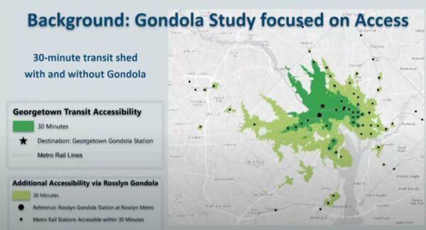
With 23,000 jobs, Georgetown is one of region’s largest employment centers without convenient Metro access, she said. Better transit would enhance access to jobs, healthcare, hospitality, retail and education for D.C. area residents, putting more people within 30 minutes of a Metro station.

How transit access would improve with a Rosslyn-Georgetown gondola (via Arlington County)

Commissioner Jim Lantelme countered that the proposed gondola would only get folks to the old gas station, leaving them to walk uphill to get to Georgetown University, its hospital, M Street retail or to the West End.

“I always look at that map as being a little disingenuous,” he said.

In addition to encouraging the group to study destinations within Georgetown, commissioners said the group should look into “low-hanging fruit” such as exclusive bus lanes on the Key Bridge and enhanced DC Circulator bus service.

“There are so many more improvements that could be made in terms of frequency, reliability, and customer service,” said commissioner Donald Ludlow.

As for Arlington’s involvement in the new study, Brooks said some transportation staff members are providing input, and FC2 will occasionally present to the Transportation Commission and the County Board.

The public can weigh in now through next Friday to inform the drafting of the study. People will have another opportunity, later on, to provide input on proposed solutions.

Brooks told the commissioners that FC2 sees the study and its possible outcomes as beneficial for Arlington. It will help the county understand how current congestion levels affect bussing, cycling, walking and ride-sharing, she said.

“It will also… hopefully provide a new platform for imagining how Arlington County can connect with Georgetown and create a bigger corridor that benefits economic development, place-making initiatives and creates more cohesive Rosslyn-Ballston, Rosslyn-National Landing, Arlington-Georgetown connections,” she said.


By 2030, Arlington County aims to have zero transportation-related deaths and serious injuries on its streets and trails.

The County Board took its first step toward this ambitious goal in July 2019, the same year that Arlington registered six fatal crashes, according to county data. The board adopted a “Vision Zero” resolution that, at the time, offered few details. Its second step was to draft a five-year action plan.

After more than a year of work by county staff and review by advisory commissions, the final draft of the first five-year Vision Zero Action Plan, with those long-awaited details, is set to be reviewed by the County Board next Saturday (May 15).

This plan — informed by local crash data, public engagement and talks with other Vision Zero communities — lays out one-time and ongoing projects aimed at improving public safety. These range from installing automated traffic enforcement cameras and lowering speed limits to maintaining a crash data dashboard and educating children about safety with help from Arlington Public Schools.

If adopted, the plan will result in a number of changes locals will see and experience, Principal Planner Christine Baker told the Arlington Transportation Commission in February.

She said these will include enhanced intersections (shown below) and improved warning signs, as well as more education programs and messaging from the Arlington County Police Department.

“It’ll take time to see these improvements on every single street in the county, but in the meantime, we’re going to be reporting our progress on the program,” Baker said. “We’re really excited to be diving into this program.”

The county will update its website and send emailed updates telling people “when they’ll be able to recognize Vision Zero is on the streets,” she said.

Folks may be seeing some recent changes made in the spirit of Vision Zero: Over the last year, the county has sought lower speed limits while raising fines along 11 mostly residential streets in Arlington.

The County Board also made installing speed cameras a legislative priority in the 2021 General Assembly assembly session, a move toward more equitable law enforcement that also would reduce public interactions with police officers.

According to the action plan, there are a dozen target areas to tackle, from pedestrian safety and intersections to drunk or distracted driving and speeding.

Pedestrian safety is the most at risk, according to county data. One-quarter of serious crashes and more than half of fatal crashes involved a pedestrian, though pedestrian-involved crashes account for 5% of total crashes. Bicyclists and motorcycles comprise 2% and 1%, respectively.

The plan also cites data indicating that speeding and turning-related crashes are more common than alcohol-related ones, but almost half of all fatal crashes involved alcohol and more than half occurred at night.

(more…)


Thanksgiving County Closures — “Arlington County Government offices, courts, libraries & facilities will be closed on Thursday, Nov. 26 & Friday, Nov. 27 for Thanksgiving. Courts will close Wednesday Nov. 26 at noon… Metered Parking: Not enforced on Thurs. Nov. 26 or Fri., Nov. 27.” [Arlington County]

Development Plan for Silver Diner Site — “The Donohoe Cos. is targeting Clarendon’s Silver Diner for a major redevelopment. The company has yet to file specific plans with Arlington County for the triangular parcel at 3200 Wilson Blvd., a block from the Clarendon Metro station, but it has outlined a mixed-use vision for the newly dubbed ‘Bingham Center’ on a project page on its website. Specifically, the developer envisions 286 apartments, a 224-room hotel, 15,000 square feet of ground-floor retail, a public park and ‘a new public street designed with the principals of a woonerf (a curbless pedestrian-friendly street).'” [Washington Business Journal]

The End of Snow Days? — “Superintendent Francisco Durán of Arlington County Public Schools said that shifting classes online for snow days was a ‘possibility’ but that he doesn’t expect it to happen often.” [Capital Weather Gang]

Commission Calls for Renaming Powers — “The Arlington Transportation Commission is asking County Board members to seek legislative approval from Richmond to give the county government power to rename the highways and byways within its boundaries. Currently, some (though not all) Virginia cities have broad power on street and highway naming, but counties are much more restricted.” [InsideNova]

Last-Minute Thanksgiving IdeasUpdated at 8:35 a.m. — Here are a few local Thanksgiving options, including for takeout dinners, for those seeking last minute ideas. Check with the restaurant first to confirm they are still accepting orders or reservations. [Twitter, StayArlington]

Nearby: Flurry of Fs at Fairfax Schools — ” Stunning data for Fairfax County, VA’s largest school system, shows HUGE academic cost of online learning — Fs up by 83% this year. Vulnerable children struggling most: Fs for students w/ disabilities up by 111%, for English learners up by 106%.” [Washington Post, Twitter]


The Arlington Transportation Commission voted 8-2 at its meeting last week to not recommend that the County Board submit a funding application for proposed changes to Route 50.

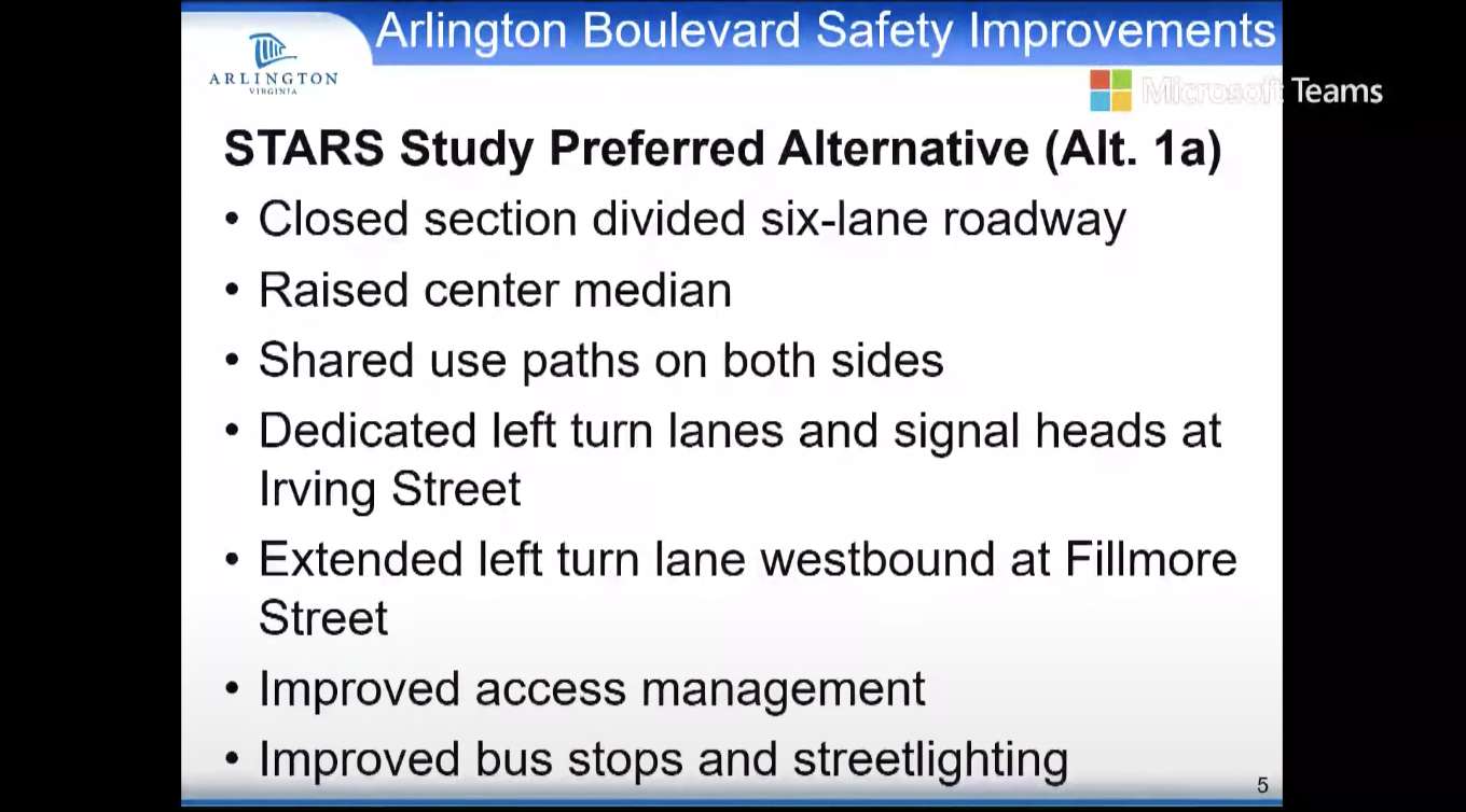
The project would, among other changes, widen the roadway to add dedicated turn lanes.

The application requests $25.1 million from the Virginia Department of Transportation‘s (VDOT) SMART SCALE funding program to make improvements to Route 50, also known as Arlington Blvd, where it runs between Glebe Road and Fillmore Street.

This stretch of road, according to VDOT, had 247 crashes on it with 61 total injuries between 2014 and 2018.

“This segment of Route 50 experiences congestion in the morning and evening peak periods and a high number of crashes,” VDOT said in an April presentation. “Route 50 averages 62,000 vehicles a day within the study limits.”

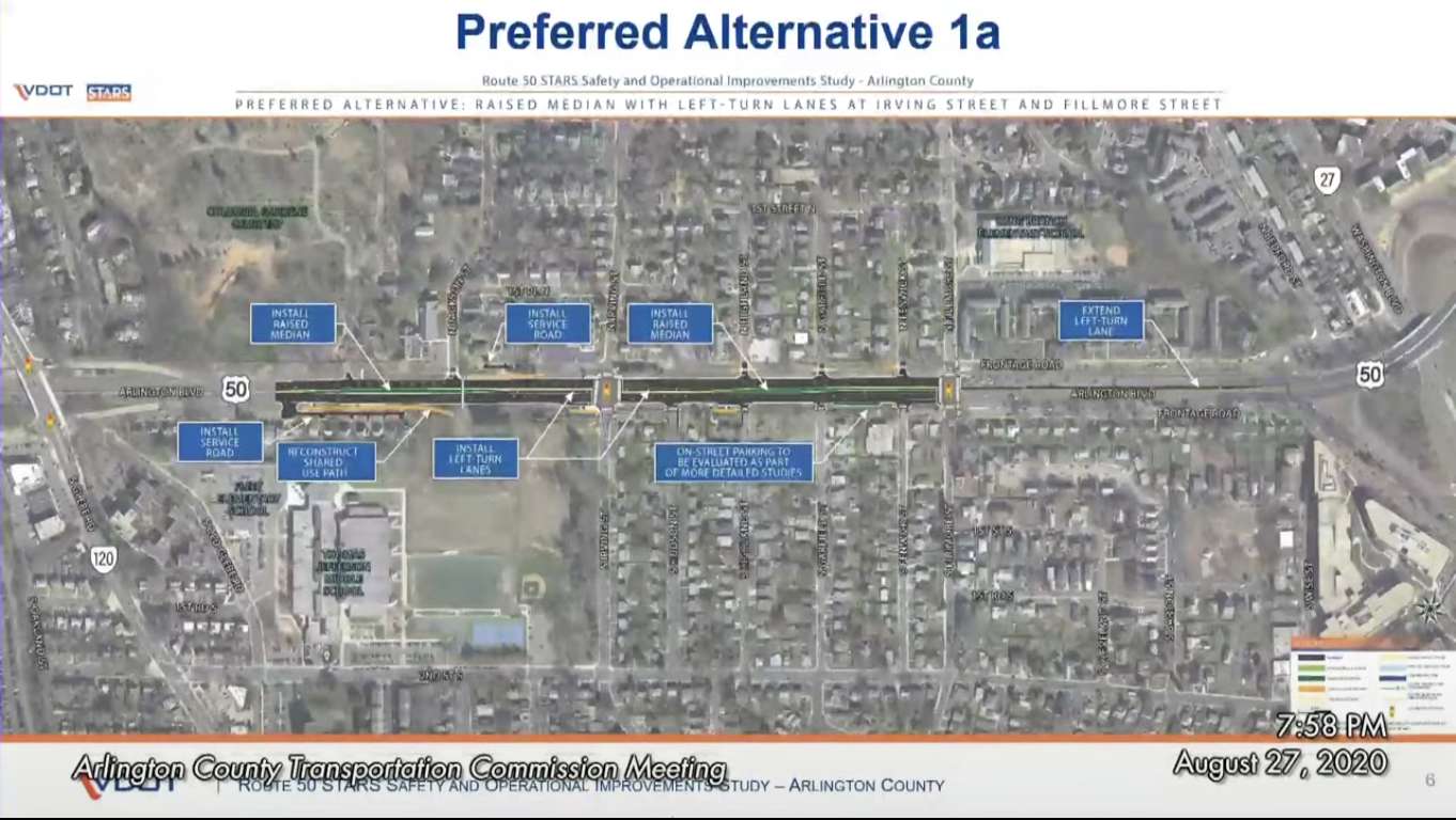
Potential changes would come from recommendations made in a yearlong VDOT study of this area. These include adding new left-turn lanes and expanding current ones, as well as installing raised medians in certain high crash areas.

Constructing a new service road where Route 50 runs eastbound between Glebe and N. Jackson Street, and reconstructing a shared-use path in the section, were also recommended by VDOT.

The commission did pass a motion to recommend the County Board direct the County Manager to lay plans for a Route 50 corridor study between Roosevelt Bridge and Fairfax County.

Members voting against VDOT’s recommendation cited issues with the department’s study — including what they said was a limited scope, a failure to consider how changes would impact speed in this section of road, and a failure to account for more cars driving this road — as reasons for their vote.

Commissioner Darren Buck, the most outspoken critic of VDOT’s recommendations during the meeting, said the fact that VDOT’s study only looked at the area between Glebe and Fillmore and not Route 50 as a whole was among his greatest concerns about supporting the plan.

“I do not want to apply to fund this fundamentally flawed project to fill pressing local needs when a more comprehensive study of the corridor is pushed off indefinitely,” Buck said. “I do not think [the state should be] sinking $25 million into a spot improvement that basically determines how the rest of the corridor is going to look when we still haven’t addressed that long-standing open community question of how the rest of the corridor should look and operate.”

Commissioner Margarita Brose, as one of two commissioners voting for recommending the funding application, said the already high number of crashes in the section outweighed concerns over the project’s cost and a widening of the roadway.

“The safety concerns really weigh heavily on me,” Brose said. “I understand it’s a lot of money for a short period but we’ve seen the statistics on the number of cars that go through there and the crashes.”

VDOT said the study’s recommendations were primarily focused on improving the road’s safety.

“The safety aspect is one of the key things that led us to try and find a solution or a way to reduce those crashed,” VDOT said. “That’s one of the key motivating things that got us to start the study and to come up with the alternatives that we reviewed.”

Still, commission members questioned the actual safety added by VDOT’s recommendations.

“We are adding lanes for cars and making the highway more divided so that cars will go faster,” Commissioner Taylor Reich said. “As a result of this, I am unconvinced this project will improve safety, especially for pedestrians.”

VDOT said its plan leaves three through lanes in each direction on Route 50, which is similar to its current state. The road widening, she said, is to allow room for new left turn lanes.

If the County Board approves a SMART SCALE funding application, there is no guarantee the project would receive the money. VDOT describes SMART SCALE funding as highly competitive.

Images via Arlington County


Arlington prides itself on citizen participation in government, but public engagement is taking a backseat to practical necessity during the coronavirus crisis.

On Wednesday, members of Arlington’s galaxy of advisory commissions and boards were told that their meetings have been put on hold for the foreseeable future.

“As you may know, we issued a continuity of operations ordinance that offers some flexibility for the County Board and other appointed bodies to meet virtually — but only for decisions directly related to the Coronavirus (COVID-19) and other essential continuity of business matters,” Arlington County Board Chair Libby Garvey said in an email.

“While commissions and advisory boards do important work, it is not necessarily essential to the crisis in front of us, which is our key priority at this time; and which is the only kind of work legally covered under the ordinance we adopted,” she continued. “As of March 31, 2020, ALL Commission, advisory boards, workgroup and subcommittee meetings are cancelled until further notice. However, there may be a few exceptions that will require some additional review and approval prior to taking any actions.”

“The Arlington Way has been killed by COVID-19,” one tipster told ARLnow in response to the mass meeting cancellation.

Garvey’s email went on to outline how commission chairs can request in writing the scheduling of a virtual meeting for an item involving “business essential for addressing the coronavirus or the continuity of business operations for the County.”

The “continuity of business operations” includes “the adoption of the budget, the approval of tax rates and fees, and appropriations of funds necessary to keep government running,” Garvey clarified, in response to a series of questions from ARLnow.

Asked whether the temporary halt to commission meetings — including key bodies like the Planning Commission and Transportation Commission — will delay development approvals before the County Board, Garvey said it depends.

“The Board will assess pending applications to determine whether they should be considered or can be delayed,” she said. “If the proposals are considered, the public process for development proposals will occur to the extent possible and consideration by advisory commissions, such as the Planning Commission, will occur.

The County Board chair said that the county’s actions are consistent with an opinion issued by Virginia Attorney General Mark Herring two weeks ago, in response to concern from elected officials that they were unable to comply with both the governor’s order to limit public gatherings to 10 people or fewer — and freedom of information laws that require in-person meetings that are open to the public.

“The cancellations are primarily to protect the health of commission members, staff, and the public,” said Garvey. “Matters that can be delayed are being delayed. The AG’s guidance has been considered in determining whether important matters that cannot be delayed can be considered electronically.”

“We are all learning how much FOIA and other regulations were put in place at a time when no one contemplated 21st century technology or a pandemic,” Garvey wrote in her letter to commission members.


Thanks to some push from local advocates and the county’s Transportation Commission, a new mixed-use development at 1900 Crystal Drive could be required to include protected bike lanes on Crystal Drive, a long time sore spot for bicyclists in the area.

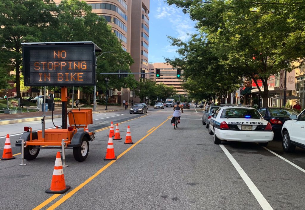
There are bicycle lanes on Crystal Drive, but motorists notoriously ignore the lane markers and drive or park in the lanes designated for bicycle traffic.

“It’s almost a hoax on bicycle riders to say there’s a bike lane here when as a practical matter there isn’t,” said Transportation Commissioner Jim Lantelme.

At the Transportation Commission meeting Thursday night, the Commission recommended that developer JBG Smith be required to turn the existing bicycle lanes into protected lanes while adding new protected bike lanes to 18th Street S.

“First the Commission recommended that the County Board require JBG Smith to build protected bike lanes on 18th Street either as part of their upcoming 1900 Crystal Drive development or as part of the already-approved Central District Retail development,” Transportation Commission Chair Chris Slatt said in a press release. “Furthermore the Commission recommended that the County Board direct staff to study an appropriate cross-section for Crystal Drive that would safeguard those on bikes and scooters and, if schedules permit, incorporate the results of that study into the public space designs for 1900 Crystal Drive and any other unbuilt development approved along the Crystal Drive corridor.”

The last recommendation from the Transportation Commission was that the County and JBG develop a temporary southbound protected bike lane on Crystal Drive if the public process isn’t completed in time to be incorporated into the 1900 Crystal Drive plans.

County staff said in their report that making the lanes protected would require further traffic studies and analysis, with staff noting that a new bike lane would carve out part of the street and would have an impact on open space, traffic, or parking. That kind of impact would require a public process that would take additional time.

The developer said they hope to start construction at the end of March, with the streetscape being one of the last parts of the project to be completed.

“I worry there is the possibility we would not have a final decision-ready on Crystal Drive ready before this window closes,” Slatt said.

“There’s a lot of good, new information heard tonight,” said Gillian Burgess, chair of the Bicycle Advisory Committee. “Crystal Drive bike lanes are blocked so often that they’ve become the test case for new apps and data collection that seek to test how often bike lanes are blocked.”

With three site plans in the area, Burgess said the County has a rare opportunity to improve the conditions for cyclists and other road users there.

The 1900 Crystal Drive proposal is set to be discussed by the Planning Commission tonight (Monday).

Photo via Google Maps


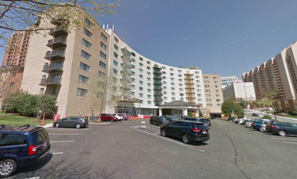
A plan is currently in process to transform the Arlington Court Suites hotel into an apartment complex, but at a Transportation Commission meeting last week the project hit a small snag as commissioners unanimously agreed the project might have too much parking.

The plan would convert the 187 hotel rooms in the Arlington Court Suites into a 180-unit residential property called Park Arlington at Courthouse. The current plans do not call for any major demolition work and staff said the proposed residential units would likely be less expensive than new construction at the same site.

The applicant could maintain as hotel use, staff said, but this project would help meet the demand for mid-rise housing at a middle-income level.

While the project is only two blocks south of the Court House Metro station, the parking ratio would increase in the new plans. Currently, there are 153 parking spaces and the proposal would elevate that to 171 spaces. Many of those would be located on a surface parking lot, with the rest in a garage under the building. The plan also calls for 76 bicycle parking spaces.

Transportation Commission member Audrey Clement, who earlier in the meeting had expressed opposition both the Veitch Street redevelopment and the Missing Middle housing study, shared her general support for the Park Arlington project, with one main objection.

“I really do support this project,” Clement said. “This is right up my alley. It does not involve the demolition of an existing property… I’m very impressed with this project, but in one respect it is not consistent with County policy, and that is the parking ratio.”

In 2017, the county adopted a new policy that said the parking ratio should be reduced from one space per unit to as low as 0.2 spaces per unit in certain areas near Metro stations.

“I do believe this project would be more consistent with county policy if it reduced the number of parking spaces and what I’m particularly interested in is the surface parking. Has the developer considered replacing some or all of the surface parking with green space? This would be a benefit to the residents of this facility.”

“It is a huge parking lot and the only way to get into the building is through the parking lot,” said Transportation Commission member Jim Lantelme. “It’s still way too auto-oriented… This parking lot is just enormous and it really doesn’t work for me. There’s nothing like this site anymore. If we’re going to have adaptive reuse, we have to adapt it to the current requirements.”

The agreement on the Transportation Commission took some of the members by surprise.

“I never thought I would hear myself say this, but I 100% agree with everything you just said,” said Transportation Commission member Richard Price. “I never thought I would hear myself say this, but Commissioner Clement hit it right on the head… All I see is ugly surface parking and I’m glad you’re going to address it. There are lots of sites that all you have to get the front entrance is walk through a parking lot. That is disturbing and that needs to change, and it needs to start changing now.”

Others said that along with the parking lot reduction, the sidewalk needs to be widened.

The developer said that an alternative plan could eliminate the surface parking, but more market research needs to be done. If the building winds up as condos, the developer said there would be a higher demand for parking. The developer noted that the widening the sidewalk on N. Courthouse Road, however, is complicated by things like utilities and a retaining wall.

Photo via Google Maps


View More Stories