Parking meter in a performance parking zone in Ballston (staff photo)

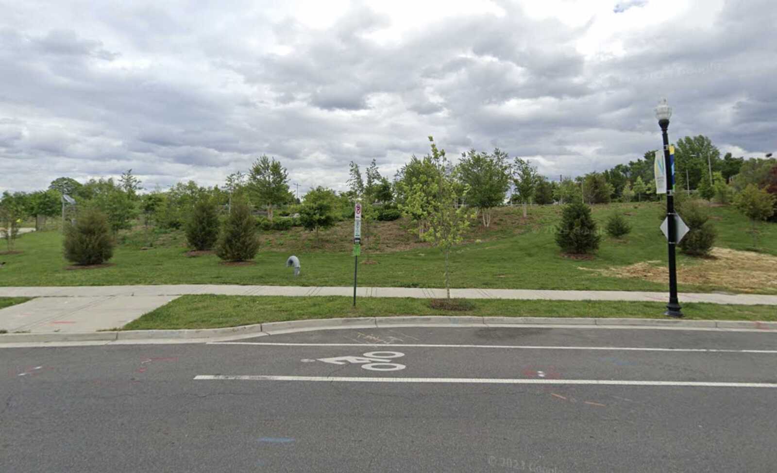
The cost to park in many of Arlington’s busiest neighborhoods could change March 1.

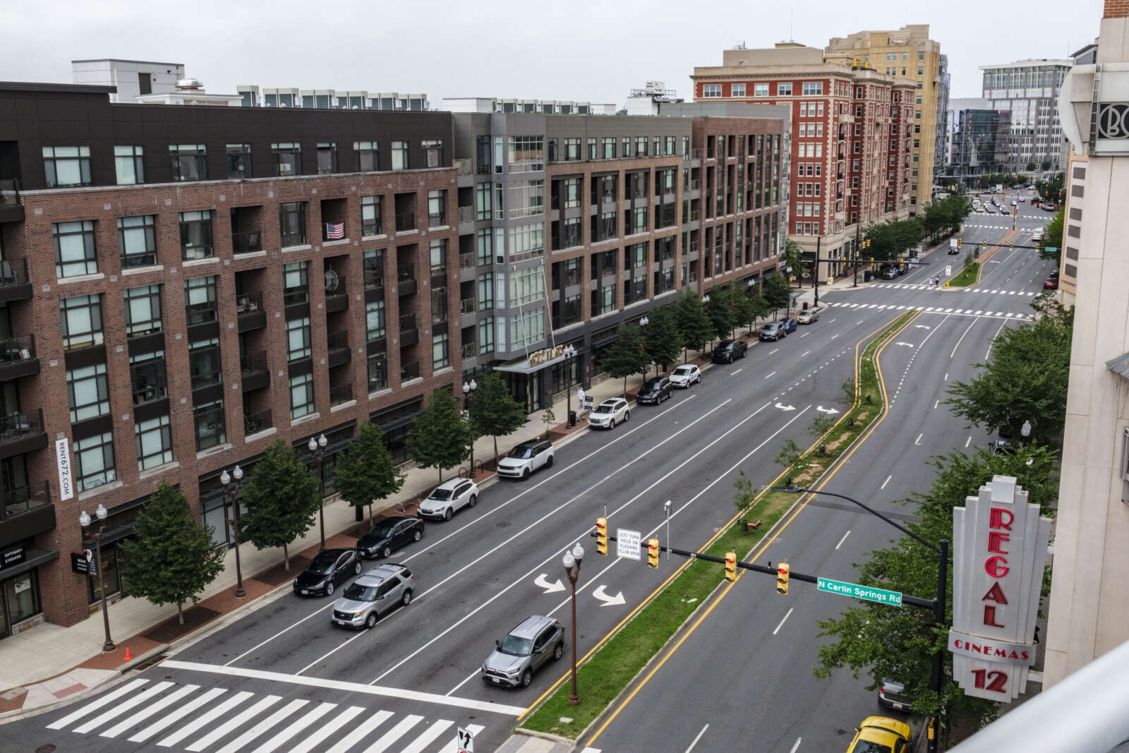
The most popular places to park along the Rosslyn-Ballston and Route 1 corridors could ultimately cost up to $5 per hour, according to a county report. Less popular spots, meanwhile, could become less expensive than the current rate.

These changes are part of a state-funded “performance parking” pilot project that seeks to make it easier to find a parking spot in Arlington by incentivizing drivers to park in underused areas.

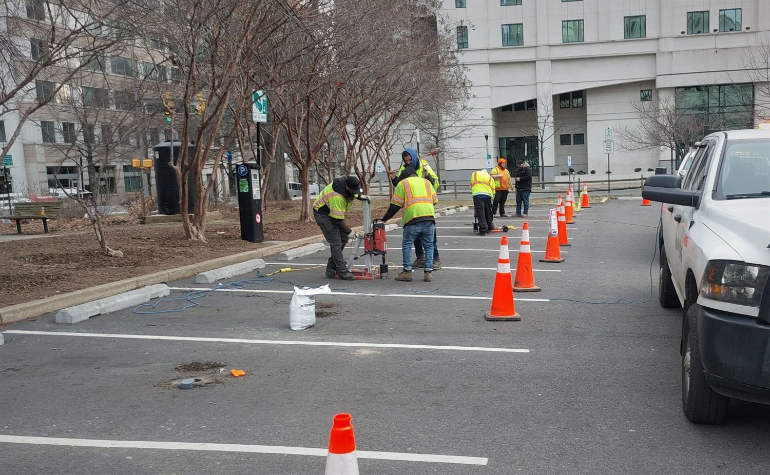
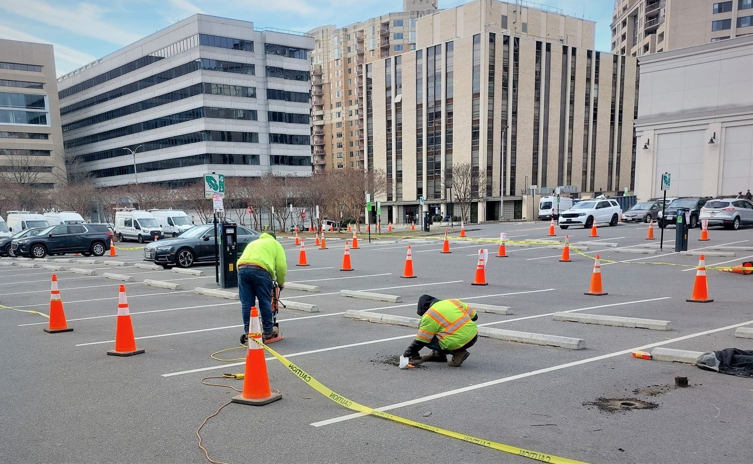
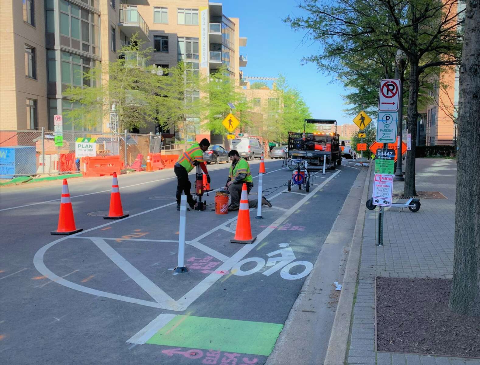
Arlington County kicked off the project earlier this year, installing sensors to collect data on parking behavior and determine what streets and neighborhoods should see higher and lower prices.

“These goals relate to improving the experience with parking at the curb, as well as reducing the negative impacts associated with inefficient or unsuccessful search for parking,” the report says.

On Saturday, the Arlington County Board voted to hold a public hearing about a proposed ordinance on Feb. 24. If it is approved next month, the pilot program would last until March 2026.

Parking rates could change up to once every three months but large, sudden changes are unlikely, according to the report.

Although costs could vary based on the time of day and length of stay, the project would not involve surge pricing or an across-the-board rate hike. Instead, each rate change would probably bring a roughly $1 increase to parking rates at some spots and a $0.25 decrease to other spots.

Arlington’s parking rates are currently capped at $1.75 per hour at short-term meters and $1.50 per hour at long-term meters.

A map of areas included in the performance parking pilot (via Arlington County)

While county staff would set the rates, they could never charge more than $5 per hour without the County Board’s approval, per the proposed ordinance.

The pilot program would follow in the footsteps of similar initiatives in major cities including D.C., Boston and San Francisco.

“These pilots have generally shown measurable changes in drivers’ parking behavior, reductions in negative impacts, and more efficient use of available space,” the report notes.

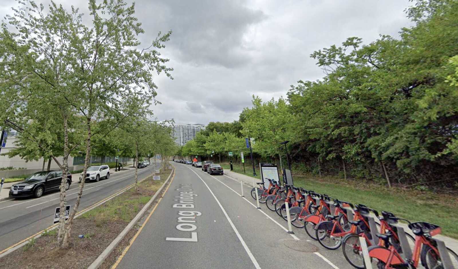
County staff would track this project’s effectiveness using some 4,500 sensors installed in parking spaces in the Rosslyn-Ballston and Route 1 corridors. The county has already begun investigating where and when parking is most readily available in these areas — along with how often drivers pay for parking.

A recent analysis found that on average, only a third of vehicles parked at meters in these areas had actually paid to be there, which will inform how the county uses its limited cadre of parking meter enforcers.

Parking compliance in October 2023 (via Arlington County)

Although similar programs have tended to increase revenue, the report says this project is primarily designed to improve parking conditions for drivers — not to extract more money from them.

“Intentionally, there is no project goal regarding revenue impact,” the report says. “This is because the project goals are about curb space performance from the community and customer perspective.”


Passengers board an ART bus on Columbia Pike (file photo by Jay Westcott)

This reporting was supported by the ARLnow Press Club. Join today to support in-depth local journalism — and get an exclusive morning preview of each day’s planned coverage.

(Updated at 4:15 p.m.) In the half-decade leading up to 2017, ridership on Arlington Transit, or ART, had risen 34%, or nearly 1 million rides.

Then, in 2018, ridership started trending down, a decline that Covid only sped up — despite the essential workers who continued riding the bus and insulated ART from the pandemic hit Metro sustained.

Today, ridership is on the upswing but still far lower than the 2017 highs. Arlington County is trying to change that — outlining several service changes in a new 10-year strategic plan — all while studying how best to make more expensive investments: buying zero-emission buses.

As for ridership, Joan McIntyre — chair of Arlington’s Climate Change, Energy and Environment Commission, or C2E2 — attributes low numbers to the length of time it takes to reach many destinations in Arlington by bus versus by car.

“Even before the pandemic, ridership of ART and other public transit was largely stagnant,” she told the County Board last month in November. “The reality is that for many in Arlington, you simply can’t get there from here via public transit.”

Arlington Transit ridership numbers since 2014 (via Arlington County)

Surveyed as this plan was coming together, Arlingtonians said the bus needs to arrive more frequently, run for more hours and connect them to more destinations. A 2019 study diagnosing ART’s declining ridership found riders wanted more frequent service, better real-time information and more on-time performance. A 2022 survey had similar findings.

Arlington was not alone in seeing a pre-Covid ridership slump and national studies found contributing factors included the rise of telework, online shopping and ride-hailing services, lower gas prices and higher fares, and in New York and D.C., maintenance service disruptions. (Arlington’s 2019 survey likewise found ride-hailing siphoned off some 19% riders while 51% only rode for work, suggesting telework could be a limiting factor today.)

Arlington cannot control for telework and ride-hailing, but it can make service changes. Areas with growing ridership, Columbia Pike and Route 1, are set to see more frequent service, with more weekend trips and new destinations, such as Long Bridge Park.

Expensive, low-performing routes primarily serving North Arlington will be discontinued or redrawn to connect high-ridership neighborhoods and destinations, such as Waverly Hills and Virginia Hospital Center. Where service is discontinued, it intends to pilot an on-demand “microtransit” option.

On-time performance, however, has more external factors to consider. Recently, this includes public and private construction on Columbia Pike and near the Pentagon, which the county considers “temporary disruptions for long-term gain.” Other factors are traffic congestion on I-395 and in Pentagon City and, for a more positive spin, increased ridership on several routes.

On-time performance (courtesy Arlington County)

To make every change outlined in the 10-year plan, Arlington County would need to spend some $10 million, according to Transit Bureau Chief Lynn Rivers.

This is a fraction of the $130-$180 million estimate from a consulting firm that analyzed the potential cost to convert the entire ART bus fleet to battery electric or hydrogen fuel cell electric buses, though advocates say up to two-thirds of purchase costs could come from state and national funds.

High-dollar investments in buses are not without their controversies. A decade ago, Arlington and Metro embarked on installing new stops on Columbia Pike, leading with the memorable $1 million Pike “Super Stop” plagued by poor inter-agency communication and design flaws.

Pilot projects like free fares, currently being tested out on all routes in peak directions, are also not guaranteed successes. Arlington is currently piloting the change on the heels of some U.S. cities. Earlier European adopters, meanwhile, have reported ridership increases after going fare free but only marginal declines — and in some cases increases — in car use.

(more…)


Arlington Public Schools is poised to tie planned S. Walter Reed Drive upgrades into its $180 million Arlington Career Center project.

This past Saturday, the Arlington County Board approved a memorandum of agreement permitting APS to appoint the same contractor for the Career Center’s construction to handle the road improvements — part of the county’s Neighborhood Complete Streets program — from 5th Street S. to Columbia Pike.

Next, the agreement will head to the Arlington School Board for approval in January.

The upgrades to S. Walter Reed Drive will include new trees, protected bike lanes, a traffic light at the 9th Street S. intersection and improved bus stops. The community broadly supported these enhancements following a series of public feedback sessions held from fall 2020 to spring 2021, per a county staff report.

Currently, construction of the five-story Career Center at 816 S. Walter Reed Drive, slated to start next spring, is set to overlap with the road work. County and school officials agreed to merge the two projects to avoid traffic congestion and construction snags.

“So, essentially, when you have two contractors trying to work in the same place at the same time, somebody gets delayed,” APS Director of Design and Construction Jeffrey Chambers told School Board members during their meeting last Thursday.

Under the plan, the county will foot the bill for the road work, estimated at $7 million, and reimburse APS for any extra administrative costs, the report said.

APS is not required to contribute financially to the road improvements. Still, it must inform the county of any additional expenses due to construction delays. Should the road work exceed its budget, APS must obtain county approval before proceeding.

The bulk of the road work is expected to be completed within the first year of construction, with the final paving and overlay scheduled just before the Career Center opens in August 2026, Chambers said last week.

The funding for the S. Walter Reed Drive road improvements has already been earmarked in the county’s Capital Improvement Plan.

APS is still in the process of securing a contractor for the Career Center, which will host up to 1,619 students and include a four-story parking garage.

Officials plan to present the combined bids for the Career Center construction and road improvements to the County Board in early 2024. The Board will then approve the fund transfer and any additional construction financing.


To find a parking spot in Ballston, go during the daytime, avoid Wilson Blvd and Fairfax Drive, and consider parking in nearby Virginia Square, which has many empty blocks.

To park in Clarendon, good luck finding a spot on Saturdays between 11 a.m. and 8 p.m. Generally, there are more spots south of Washington Blvd but be on the lookout: spots can open up quickly as people do not stay parked in Clarendon for long.

These are some tips to glean from new county data collected in the first phase of a state-funded performance parking pilot study. But the data, collected from some 4,500 sensors in parking spaces along the Rosslyn-Ballston and Richmond Hwy corridors, does more than help people find parking spots on busy weekends.

It also demonstrates that, on average, only a third of people pay for parking when they come to these corridors. The county says this information will help it pinpoint the neighborhoods with the lowest parking compliance and focus its limited parking attendants there.

Parking compliance in October 2023 (via Arlington County)

The installation of sensors and data collection made up the first phase of a pilot program that will eventually use variable pricing and data to improve the availability of metered parking. County staff used these sensors to find differences in parking availability by hour, block, day of the week and neighborhood.

“These differences we need to take into consideration when we are making our pricing recommendations,” says Marietta Gelfort, a planner with the county’s parking and curb space management team in a recent video.

The next phases of the project will see actual changes in parking prices. These changes will happen once every three months but, the county emphasizes, will not trigger across-the-board meter rate hikes or surge pricing.

For the pilot to move forward, next county staff need Arlington County Board to change prices along the study corridors administratively — without County Board permission each time. They are gearing up to request this authority early next year for the duration of the pilot, set to end in early 2026.

A request to advertise hearings on this proposal could come this January, followed by a public hearing by the spring of 2024, Dept. of Environmental Services Parking and Curbspace Manager Melissa McMahon told ARLnow.

Once staff have this permission to alter prices, they will communicate changes to the public whenever those changes occur.

Price differences already influence parking behavior in Arlington, according to Dept. of Environmental Services communications specialist Nate Graham.

“Sunday occupancy is highest across the board, which illustrates that even today’s metered prices shape demand and behavior to some extent,” he tells ARLnow.

Transportation commissioners are “very supportive” of the pilot but, on the topic of pricing, suggested recommended stepped up enforcement of accessible parking spaces if these prices differ from non-accessible spaces.

“The greater the discrepancy in pricing between ADA and non-ADA spaces, the more drivers use fake ADA
tags,” the commission said in a letter to the County Board last month.

Eventually, as part of the pilot, the county will make parking spot and pricing data available on two mobile-friendly tools so people can research spots and costs in real time.

There will also be signs showing where spots are available, how many and for how much.

Third-party parking apps showing available spaces using county sensor data (via Arlington County)

Langston Blvd headed eastbound from N. Veitch Street to N. Lynn Street (via Google Maps)

Arlington County has scrapped plans to make a dedicated high-occupancy vehicle and bus-only lane on Langston Blvd.

Instead, it will take a new tack to improve bus reliability on the corridor, says Arlington Dept. of Environmental Services spokeswoman Claudia Pors.

This winter and spring, the county will reprogram select traffic signals to give buses more time to clear an intersection, known as transit signal prioritization.

The county would deploy technology that detects when buses are approaching an intersection. If a bus arrives at a red light, the signal will turn green sooner; if it arrives just before the signal turns yellow, it will stay green longer.

Arlington had long mulled building a dedicated bus and HOV lane on Langston Blvd. It would have run eastbound from N. Veitch Street, near Courthouse, to N. Lynn Street in Rosslyn during peak morning hours and westbound from N. Oak Street to N. Veitch Street during the evening peak period.

When the county dug into the finer details, however, staff found that the Northern Virginia Transportation Commission (NVTC) grant it received two years ago to fund the work would not be enough.

“The funding awarded from NVTC’s Commuter Choice grant program wasn’t enough to cover both the analysis required to reassign a VDOT lane and the implementation costs,” Pors said. “We have returned the money to NVTC.”

The transit bureau of DES instead pivoted to transit signal prioritization. Public transit advocates point to this type of upgrade as low-cost, yet high-impact, increasing bus speeds up to 15%.

With a few months before work starts, county staff are picking which intersections should have longer or earlier green lights, says Pors. The county could switch between the two, depending on how reprogramming the lights impacts traffic patterns.

Transit signal prioritization is one mechanism the new Plan Langston Blvd initiative says will improve bus speeds, reliability and convenience — encouraging ridership on the car-centric road.

The goal of Plan Langston Blvd, which ramped up in the last two years, is to articulate a long-term vision for how the corridor develops.

The plan describes how the county can achieve affordable housing, sustainability and transportation goals along the corridor through policies, private redevelopment and county-led projects.

This month, the Arlington County Board is teed up to approve a request to advertise hearings on the comprehensive plan for neighborhoods along Langston Blvd, also known as Route 29. If approved, hearings by the Planning Commission and County Board would be held on Monday, Oct. 30 and on Nov. 11, respectively.

If and when the plan is adopted, Pors says the transit bureau will take another look at the corridor and the plan’s recommendations before determining next steps for improving bus reliability.


Arlington County is in the early stages of designing a multi-use trail facility along Long Bridge Drive.

Now through mid-October, the county is gathering input on how people currently use this corridor, which will inform designs set for public review next spring.

The trail would connect a bike network through Crystal City to the future Long Bridge Rail Project: a planned $2.3 billion bridge over the Potomac River set to double rail capacity and provide an adjacent bike and pedestrian bridge between Crystal City and the Southwest Waterfront area of D.C.

This trail, expected to cost $7.8 million, will be a better connection to the entrance of the proposed bridge, behind the Long Bridge Aquatic Center, than the existing bike lanes along Long Bridge Drive and Long Bridge Park Esplanade, according to the county.

“Preliminary planning work has identified a need for a minimum 12′-wide multi-use trail between the new bridge and Crystal City, as this route is expected to become a major multimodal commuter route between Arlington and D.C.,” per the project webpage.

“Without this project, most commuters will likely attempt to navigate the Long Bridge Park Esplanade and walking trail, which is not intended for use as a commuter cycling route,” the site continues.

Proposed Long Bridge Drive trail (via Arlington County)

The proposed trail will link to a half-mile shared-use path on Boundary Channel Drive, being built by the Virginia Dept. of Transportation, connecting the Mount Vernon Trail to the Pentagon and Long Bridge Park.

Headed toward Crystal City, the trail will connect with a planned multi-use trail at 12th Street S. and forthcoming cycle track along Army Navy Drive.

When complete, Long Bridge Drive trail will help meet demand for more active transportation connections amid current and expected growth in Crystal City and Pentagon City, the county says. These areas are seeing significant redevelopment — largely residential — in part spurred by Amazon’s second headquarters.

“A direct link from Long Bridge Park to the Mt. Vernon Trail will dramatically improve multi-modal connections both for the immediate vicinity and for links between the regional activity centers of Crystal City, Pentagon City, [the] Pentagon, Potomac Yard and the regional trail network,” it says.

The county has set aside $7.8 million in local funds designated for infrastructure improvements in Crystal City. The project was identified for funding in the adopted 2023-32 Capital Improvement Program.

Arlington County says the trail would advance its goals to improve connections to public spaces, neighborhoods, schools and transit stations and improve safety for all road users.

“Providing a multi-use trail that fully separates people walking and biking is an essential safety tool for a corridor that provides motor vehicle access to a major interstate, especially when we anticipate a significant increase in bicycle and pedestrian traffic along the corridor in the coming years,” the county says.


A rendering of a bus rapid transit station pulled from a similar project in Seattle (via Northern Virginia Transportation Commission)

One day, a new bus rapid transit line could connect East Falls Church to Alexandria and Tysons Corner.

But the planning effort for the bus line, Envision Route 7, needs more studies and outreach, according to Northern Virginia Transportation Commission, or NVTC, which is leading the planning effort.

Although it received federal and state funding, NVTC appealed to the jurisdictions served by the bus line — including Arlington — for additional local funding to advance that work. This weekend, the Arlington County Board approved chipping in $70,000 over two years.

The bus rapid transit line would run between the Mark Center in Alexandria and the Spring Hill Metro station in Tysons, mostly making stops along Leesburg Pike in Bailey’s Crossroads and the City of Falls Church. Along the way, it will briefly pass through Arlington via the East Falls Church Metro station.

Envision Route 7 route (via NVTC)

Envision Route 7 is now in its 10th year of planning and its fourth planning phase.

During this phase, NVTC will study traffic and environmental impacts and conduct extensive public outreach.

To do that work, it received $2 million in federal funds, requiring $500,000 in non-federal match. It then received $500,000 this fiscal year from the state Department of Rail and Public Transportation, requiring local match of $500,000.

Arlington previously contributed into earlier planning stages, which helped to decide on using bus rapid transit along the corridor.


Bluemont Junction Trail (staff photo by Jay Westcott)

This weekend, the Arlington County Board is set to consider a proposal to funnel nearly $400,000 into the second phase of the Bluemont Junction Trail safety project.

Phase 2 includes moving and updating three trail connectors to be accessible to people with disabilities and improving cyclist and pedestrian intersections between the W&OD Trail and the Four Mile Run Trail on both sides of Wilson Blvd, per a county report.

The plan also calls for resurfacing a 480-foot segment of Four Mile Run Trail and repairing a nearby pedestrian bridge.

The project is part of a multi-year county effort to address poor visibility between trail users and drivers along the Bluemont Junction Trail, which crosses the Bluemont neighborhood and connects Ballston to the W&OD Trail at Bluemont Park. Plans were developed by the county with input from the public and the Bluemont Civic Association, the Bicycle Advisory Committee and the Pedestrian Advisory Committee

In the project’s first phase, which spanned the fall of 2021 to last summer, the county and the Virginia Dept. of Transportation made upgrades to roughly 4,500 linear feet and 13 connector trails, the report said. This included reconfiguring the trail’s intersections with N. Emerson Street and N. Kensington Street.

The second phase, however, demands more “in-depth engineering” than the milling and repaving carried out in the first phase, the report said.

Rep. Don Beyer has earmarked $325,000 in federal funds for the second phase of the project, which has an estimated total cost of $711,662.

The community will have an opportunity to provide input on the designs and proposed improvements if the funds are allocated, a county staff report notes.


A runner uses a rapid flashing beacon to cross N. Park Drive (staff photo)

The Arlington County Board is set to update the rules of the road to align with a new state law aimed at improving pedestrian safety.

This weekend, the Board is set to enact changes to local ordinances requiring drivers to stop for pedestrians in crosswalks. These changes were advertised this summer.

Currently, county code only requires drivers to yield to those crossing the street on foot, according to a county report. This conflicts with state code, which was amended this March to require drivers to “stop for” pedestrians.

In addition to being consistent with state law, the proposed changes support Arlington’s Vision Zero effort to eliminate traffic deaths and serious injuries by 2030, the report says.

“Pedestrians are one of our most vulnerable road users because their bodies are not surrounded with a metal frame and airbags,” the report says. “This law encourages drivers to look for, be aware of, and stop for pedestrians to help get to Arlington’s goal of Vision Zero transportation deaths or serious injuries by 2030.”

The report notes that, from 2018-2022, a third of all severe or fatal crashes in Arlington County involved a pedestrian.

A county data dashboard shows there were 82 pedestrian crashes in those years, spread fairly evenly over those years and located all throughout the county. The number of fatal pedestrian crashes reached a high of four in 2019.

Serious and fatal pedestrian crashes versus overall serious and fatal crashes, between 2018 and 2022 (via Arlington County)

Any driver who does not stop is guilty of a traffic infraction and can face a $100-$500 fine, according to the new law.

The county intends to notify residents of the change via a press release, emails and social media posts, per the report.

There will also be new signage, the Dept. of Environmental Services previously told ARLnow.


Three years after studying a crash-prone stretch of Arlington Blvd, the Virginia Dept. of Transportation is moving forward with plans to make some improvements.

There will be a virtual meeting this Thursday on changes coming for a nearly mile-long stretch of Route 50 between Glebe Road and Fillmore Street. Construction is scheduled to begin in early 2030, VDOT spokesman Mike Murphy tells ARLnow.

The changes, based on study recommendations made in 2020, include building a raised median along Arlington Blvd and adding eastbound and westbound dedicated left-turn lanes at Irving Street.

Difficulty making left turns and a lack of dedicated left-turn lanes were a top concern for surveyed members of the public, says VDOT. Other top concerns included “aggressive driving.”

Currently, this segment of Route 50 averages 58,000 vehicles a day and has a median that ends just east of the Glebe Road underpass. It also has a few tricky intersections where drivers can turn left, such as at Irving Street. During rush hour, drivers going straight can be seen jumping around those turning left to avoid waiting for them to turn.

Beyond adding left-turn lanes at Irving Street, VDOT also plans to:

  • extend the eastbound and westbound left-turn lanes at Fillmore Street
  • extend the eastbound service road to connect existing driveways between S. Old Glebe Road and Jackson Street
  • extend the westbound service road to connect existing driveways between Irving Street and Jackson Street
  • Reconstruct portions of the shared-use paths on both sides of Arlington Blvd

The state transportation department is also mulling new lighting between Irving and Fillmore streets, on-street parking between Garfield and Fenwick streets and bus stop improvements.

These recommendations came from VDOT’s 2020 Strategically Targeted Affordable Roadway Solutions study. This assessed safety and operational upgrades for this segment of Route 50, which VDOT says experiences congestion during rush hour and a high number of crashes.

Crashes on Arlington Blvd between Fillmore Street and Glebe Road (via VDOT)

Within four months of the release of recommendations, the Arlington County Board endorsed an application for $25 million in grant money to realize these upgrades.

In 2021, the Commonwealth Transportation Board approved $29 million in Smart Scale funding for this project, Murphy says.

But the plan did not sit well with members of the county’s Transportation Commission. Downvoting the application, they argued VDOT did not evaluate how high speeds contribute to crashes or consider how to lower speeds, such as by narrowing lanes. County staff, meanwhile, sought the commission’s approval retroactively.

In a column subsequently written for ARLnow, Transportation Commission Chair Chris Slatt said the following:

VDOT’s decision to select a costly, construction-intensive capital project to solve the safety issues in this stretch means our community will be stuck with six to eight years of additional crashes, injuries and even fatalities when VDOT’s own study makes it clear that a the majority of the safety benefit of their preferred alternative could be implemented in the short-term, with temporary materials and a much lower cost.

Residents and road users can provide feedback through Thursday, Sept. 14.


Plans to build the future pedestrian bridge from Crystal City to National Airport are firming up.

A new report outlines the impact the bridge could have on the environment. It also details how the project will relate to separate plans to redo roadways and add more parking, new car rental facility and office space.

The environmental assessment says the impact on scenic views for drivers on the GW Parkway, as well as vegetation removal, is expected to be relatively minimal. Up to 146 trees could be removed for construction and the area would later be replanted.

Now through Oct. 3, community members can comment online on the report, Arlington Dept. of Environmental Services spokeswoman Erin Potter tells ARLnow. They can also attend a public hearing on Sept. 19 at the Aurora Hills Recreation Center (735 18th Street S.).

Even with the pedestrian bridge, the Metropolitan Washington Airports Authority (MWAA), which governs DCA and Dulles International Airport, says it does not project reduced vehicle traffic to and from the airport. As such, it is designing significant upgrades for drivers.

“The overall number of passengers and employees shifting to the multi-modal access would not have a notable effect on the forecast traffic demand on the Airport roadway network or the demand for on-Airport passenger and employee parking,” a report for the MWAA project says.

While MWAA is not leading the bridge project, it did have input on where the pedestrian bridge could go, the report says. It notes that where the bridge goes and what angle it is at will not alter the project’s environmental impacts.

MWAA asked Arlington County and the Virginia Dept. of Transportation to move the bridge to reduce impacts on existing parking and accommodate a proposed elevated ramp west of the West Entrance Road, the report says.

“Arlington County and the CC2DCA project team have been working closely with MWAA staff to coordinate delivery of the safety and access improvements provided by both projects,” says Potter.

Construction on the CC2DCA bridge is expected to begin construction in late 2027 and last for two years, Potter said. Since MWAA is still finalizing a timeline for its road improvements, VDOT and Arlington are blocking off an area where the bridge could go and deciding on a final alignment later.

The new report describes how the preferred option marries two other alternatives: one that crossed the GW Parkway and Mount Vernon Trail at a significant angle and another that provided a straight shot. The new renderings also show that, of the two Mount Vernon Trail link options, a more curved path was chosen.

CC2DCA pedestrian bridge alternatives (by ARLnow)

As planning efforts continue for projects at DCA, the surrounding area is set to see changes, too.

An airport access road is set to be removed to make way for a redevelopment project proposed by JBG Smith. Near the Crystal City-side of the bridge, a second entrance to the Crystal City Metro station and a new Virginia Railway Express station and Amtrak platform are being built.

Meanwhile, the Mount Vernon Trail is set to be widened to 11 feet, a planned Crystal City bicycle network could be completed next year and the bus rapid transit network will be extended to Pentagon City.


View More Stories