Windy Day on Tap — After a windy night, more gusty winds are expected today. The gusts are expected to reach up to 40 miles per hour locally. [Twitter]

Lions Club Seeks County Lot for Xmas Tree Sale — “Christmas is coming early for the South Arlington Lions Club. Arlington County Board members on Oct. 19 are expected to allow, for the second year in a row, the service organization to use county-government property on South Four Mile Run Drive for its annual Christmas-tree sale.” [InsideNova]

Local Affordable Housing Group Expanding — “A leading affordable housing nonprofit in Arlington County is expanding its operations into Montgomery County, another sign of a growing regional focus on preserving or producing homes that lower-earning residents can afford.” [Washington Post, Press Release]

Earthquake Drill Today — “Participate in the world’s largest earthquake drill [today] at 10:17 a.m… Go to the lowest floor of the building, drop to your hands/knees, cover your head w/your arm, and hold on to shelter.” [Twitter]

VDOT Studying Changes to Route 50 West of Arlington — “The Virginia Department of Transportation is holding a public information meeting Monday, Oct. 21 on a study of potential safety and operational improvements for three miles of Route 50 (Arlington Boulevard) between Jaguar Trail and Wilson Boulevard.” [VDOT]


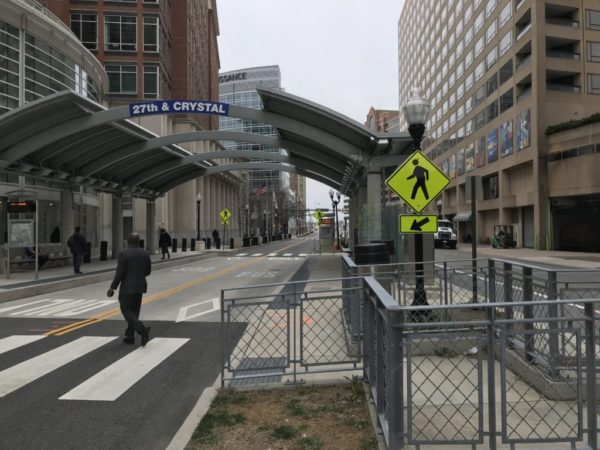
A pair of roads on the southern end of Crystal City opened to two-way traffic earlier today.

The new traffic pattern comes after several months of construction to facilitate the change. It’s the third phase in a multi-year process of opening former one-way streets in Crystal City to two-way traffic, through construction and and roadway restriping.

As we reported in 2011:

The first phase of the project will add a southbound lane to the portion of Crystal Drive between 12th Street and 15th Street, just north of the Crystal City water park. It will also convert a one-way section of S. Clark Street between 12th and 15th Streets to a two-way road. Construction on this phase of the project is expected to begin in the spring of 2012 and wrap up in winter 2012.

A second phase is expected to begin construction in fall 2012. That phase will add a southbound lane to the one-way portion of Crystal Drive between 23rd Street and 27th Street. Changes will also be made to 27th Street, which runs between the Courtyard by Marriott and the Hyatt Regency hotels.

“The Crystal Drive Two-Way Conversion project will begin to establish the street network needed to support future development and transit improvements planned by the Crystal City Sector Plan and Crystal City Multimodal Study,” Arlington County said on the project website. “The intent of the project is to improve the navigability of Crystal City by converting Crystal Drive and the surrounding street network from a one-way to a two-way directional roadway.”

In addition to converting traffic lanes, the project will also add new traffic signals, street trees, ADA-compatible intersection upgrades and a new southbound bicycle lane.

The vision of “future development and transit improvements planned by the Crystal City Sector Plan” mentioned in 2011 seems to be coming to fruition, with a new slate of major redevelopment projects announced this week; the removal of Route 1 overpasses being discussed; and the Crystal City-Potomac Yard Transitway expected to expand to Pentagon City in the near future.

More on today’s changes, from Arlington County’s website:

On Friday, Oct. 4, after the morning rush hour, Crystal Drive between 26th and 27th Streets South will be changed from one-way northbound to two-way traffic. 27th Street between Crystal Drive and South Clark Street also will be changed to two-way operations.

This section of Crystal Drive will have one travel lane in each direction. 27th Street will have two eastbound lanes to access Crystal Drive and Potomac Avenue, and one westbound lane providing direct access to the Hyatt and Route 1.

Police and the County’s construction team will be on-site throughout Friday to monitor the switch and help direct traffic. If possible, avoid this area during the changeover on mid-day Friday, and be prepared for the new traffic pattern when using these streets in the future.


Our reporting yesterday about plans to eliminate Route 1 overpasses in Crystal City and replace them with more urban-style, at-grade intersections was greeted with some skepticism.

Though the idea of making Route 1 — also known as Richmond Highway — more of an “urban boulevard” as Amazon moves in may seem appealing at first glance, the prospect of crossing the busy commuter route to get to and from the Crystal City Metro Station, as opposed to just walking underneath as one can currently on 18th Street, elicited some strong opinions.

https://twitter.com/janefgreen/status/1179021430450802688

There is, as some have suggested, another option, though it would be considerably more expensive: send Route 1 underground instead and build something pedestrian-oriented on top.

As seen in the illustration above, the original 2010 Crystal City Sector Plan actually presented a vision of Route 1 below grade, with roundabouts and some green space on top, at least at one intersection. It’s not an outdated concept — sending highways below ground and putting parks on top is a noted, recent urban design trend.

And it doesn’t need to be a park. Perhaps a pedestrian promenade surrounded by retail, restaurants and entertainment options — like the popular Third Street in Santa Monica — would work as the area grows. It could extend all the way from 12th Street to after 23rd Street, becoming a hub rather than a hindrance between the Crystal City and Pentagon City neighborhoods.

Undoubtedly, such a project would be expensive. And it would be disruptive in the short term. But would it be worth it, in your opinion?


Rosslyn’s Dark Star Park is growing and recently swallowed a nearby slip lane.

The park is notable for the somewhat strange concrete orbs and poles, designed to cast perfectly aligned shadows every August 1. The expansion of the park was planned as part of the Core of Rosslyn study, a project aimed at making Rosslyn’s street network more pedestrian- and cyclist-friendly.

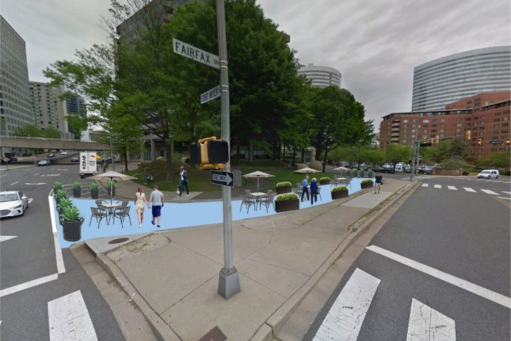
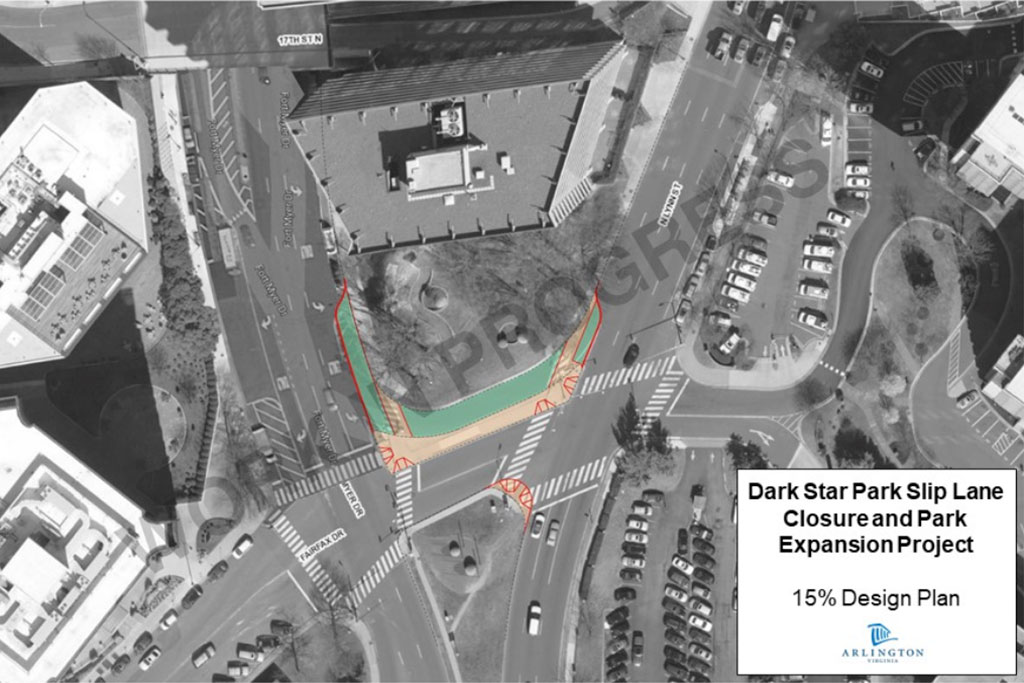
The first stage of the expansion is the closure of a slip lane between Fort Myer Drive and N. Lynn Street. The lane was closed last week and will now be used as park space, furnished with tables, chairs, and artwork.

According to the project website, the county government is hopeful that the community will use the new open space as a daily activity spot.

The next stage of the project will involve the expansion of Dark Star Park’s green space and sidewalks into the unutilized street space, but that expansion is still in the early design stages.

Funding for the second stage of the project is expected to be determined as part of the next Capital Improvement Plan (CIP) budget update.

Images via Arlington County


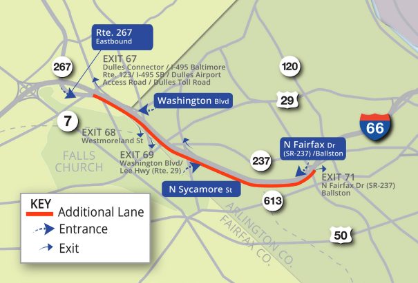
(Updated at 10:50 a.m.) A meeting is planned for Wednesday, July 10 in Arlington to provide an update on the I-66 widening project.

Work is underway to add a third travel lane to eastbound I-66 between the Dulles Connector Road and Fairfax Drive, according to the Virginia Department of Transportation (VDOT) website.

The meeting, scheduled from 6:30-8:30 p.m. at Yorktown High School (5200 Yorktown Blvd), will discuss a planned noise wall replacement, among other topics:

Work will begin in the coming months to add and replace noise walls in many locations along the project corridor as well as build a new ramp connection between two existing ramps at Route 7 to allow direct access from eastbound I-66 to the West Falls Church Metro Station. The open house will include a presentation and opportunity for attendees to view plans and talk with project team staff.

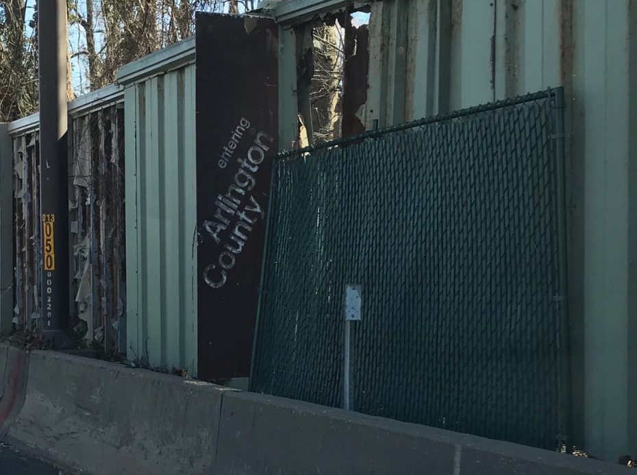
VDOT had previously announced plans to replace deteriorating sound walls along I-66 in Arlington as part of the widening project. A report in January noted that at least three segments of the wall were in a state of disrepair.

Photo (1) courtesy Del. Patrick Hope/Twitter, (2) via VDOT


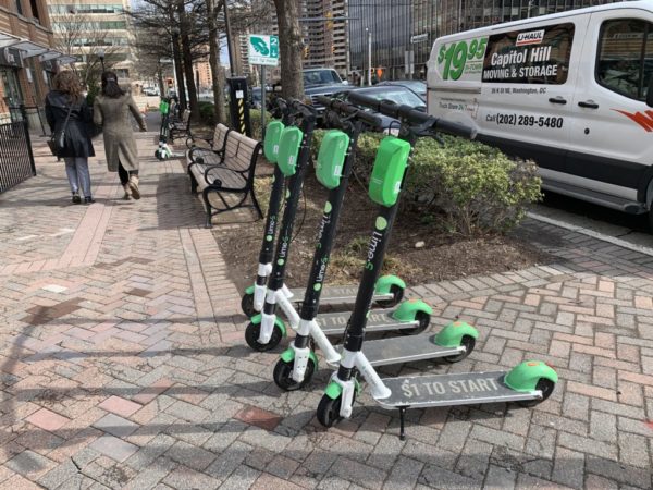
(Updated at 3:40 p.m.) Scooters are all the rage in Arlington now thanks to a newly-extended pilot program, but there are some places they can’t take you.

Geofencing is the limiting of where the scooters can ride or park. Certain areas are set as fenced off by Arlington County government as part of the Shared Mobility Devices (SMD) pilot, according to county transportation spokesman Eric Balliet.

“For now, the County is using geofencing to discourage users from ending their trip and parking these devices in certain areas,” Balliet said. “Based on agency input, the County has requested that SMD companies prohibit parking of their devices at federal lands such as the Pentagon, Arlington National Cemetery, National Park Service lands, and NOVA Parks.”

But enforcement of the geofencing is left to the companies running the scooters.

“SMD companies are handling the parking prohibition in a couple of ways, including charging a fine, suspending accounts for multiple infractions, as well as prohibiting riding through geofenced areas,” Balliet said. “We will soon be providing the companies a map to ensure each is using the same parcel data that accurately reflects the areas where parking is prohibited.”

Geofencing can result in scooters slowing down below a certain speed cap, stopping altogether inside certain boundaries, or not allowing the user to end their ride and park in certain areas, depending on the company’s policy.

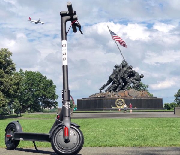
But while geofencing is designed to keep scooters inside authorized zones, it may be a contributor to the mysterious spate of abandoned scooters littering certain trails in Arlington. One tipster told ARLnow that the geofences near the U.S. Marine Corps War Memorial near Rosslyn forced him to abandon his scooter into a pile of other scooters at the border of the invisible barrier.

Another hot spot for abandoned scooters: along the Mt. Vernon Trail near Roosevelt Bridge and Gravelly Point.

Meanwhile, across the river, one government official is advocating for scooters to be allowed on one particular piece of federal land. Del. Eleanor Holmes Norton (D-D.C.) sent a letter today asking U.S. Capitol Police Chief Steven Sund to allow scooters on the Capitol grounds, where they are currently prohibited.

In her letter, Norton describes scooters as an “affordable, environmentally friendly and efficient mode of transportation relied upon by increasing numbers of Hill staffers, D.C. residents and visitors to our nation’s capital.”

Photo via Bird/Twitter


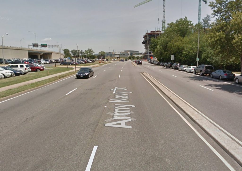
Proposed changes could help transform a major street in the Pentagon City and Crystal City area into a more pedestrian and bicycle friendly corridor, though it might make traffic a little more congested.

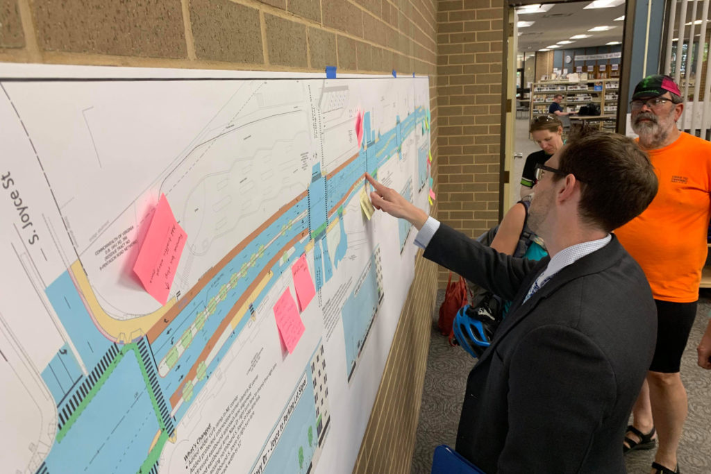
The Army Navy Drive Complete Street project would provide a physically-separated, two-way protected bicycle lane along the south side of Army Navy Drive from S. Joyce Street to 12th Street S. Changes would also make pedestrian crossings shorter and safer, with options to build dedicated transit lanes in the future.

According to the project website:

The project will rebuild Army Navy Drive within the existing right-of-way as a multimodal complete street featuring enhanced bicycle, transit, environmental and pedestrian facilities. The goal of the project is to improve the local connections between the Pentagon and the commercial, residential and retail services in Pentagon City and Crystal City.

The tradeoff for keeping all of this within the right of way is reduced motor vehicle lanes, with slowing traffic through the area billed as a feature rather than a detriment. For most of the route, traffic in each direction is at least two lanes wide, though east of S. Eads Street the plans call for it to narrow from two lanes to one in each direction.

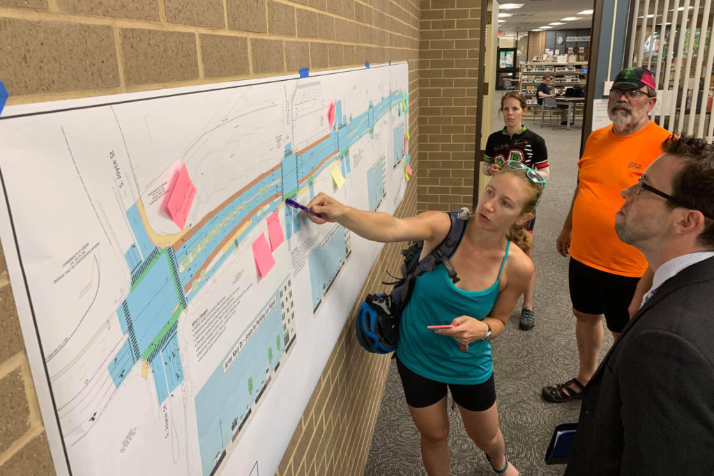
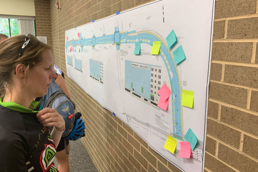
At an open house yesterday (Tuesday) at the Aurora Hills Branch Library (735 18th Street S.), most of those in attendance were local cyclists expressing enthusiasm for the project.

“This is an unspeakably huge improvement for cycling,” said Chris Slatt, chair of the Transportation Commission. “This is a critical piece for connecting bicycle infrastructure.”

Cyclists at the meeting also took the opportunity to note that the improvements planned here were still a stark contrast to plans to realign Columbia Pike near the Air Force Memorial. Cycling advocates at the open house said the Pike plans would turn the nearby intersection of S. Joyce Street and Columbia Pike, which feeds into Army Navy Drive and is already not ideal for bicycling, into a “death trap.”

Photo (3) via Google Maps, project map via Arlington County Department of Environmental Services


Arlington County is holding an open house Thursday night to discuss a road safety project in North Arlington.

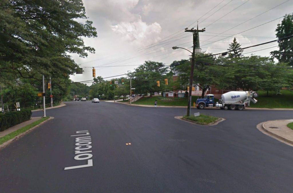
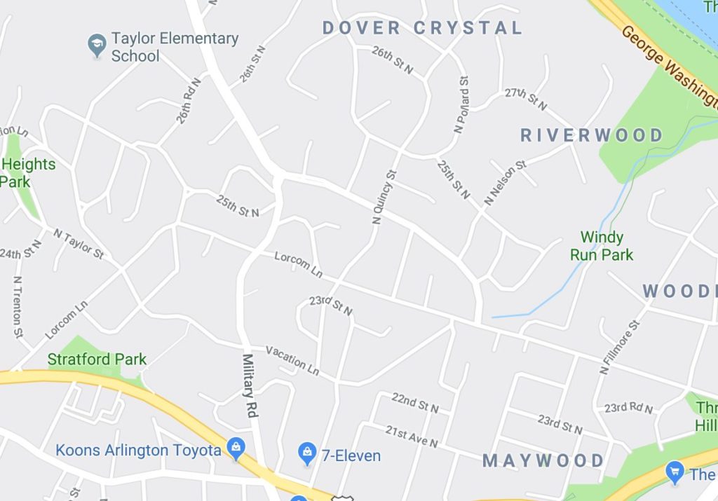
The project is set to re-stripe portions of residential Lorcom Lane and Military Road as “complete streets” with the goal of “reducing conflicts between people driving and people biking through enhanced pavement marking and signage designs.”

Per the county:

Help us improve safety on N Lorcom Lane and N Military Road!

This repaving and remarking project is located on N Lorcom Lane (from Lee Highway to Military Road) and on N Military Road (from Vacation Lane to Lorcom Lane).

Join us anytime between 6:00-7:30 pm to learn about the project and share feedback on design concepts.

The open house is being held at Cherrydale Branch Library (2190 N. Military Road).

Map and image via Google Maps


The Arlington County Board needs a little more time to see how it likes e-scooters and e-bikes.

At a County Board meeting yesterday (Tuesday), the Board voted to extend the e-scooter and e-bike pilot project through Dec. 31. to allow for continued public comment and additional time for analysis.

More than 300,000 trips have been taken on e-scooters and e-bikes since the pilot launched last October, according to a press release, with 21 reported injuries during scooter-related incidents. A total of 307,243 miles have been traveled through April, with the average trip length at little over 1 mile.

The extension will allow county staff to collect data for warmer months, showing year-round usage numbers.

Meanwhile, the County Board is weighing how to regulate the devices, after legislation signed by Gov. Ralph Northam in March authorized local governments to do so. The legislation also authorizes scooter use on sidewalks unless otherwise prohibited, though riding on the sidewalk is currently prohibited under the terms of Arlington’s pilot program.

“Great transportation options are an important feature of life in Arlington County,” County Board Chair Christian Dorsey said in the press release. “On a day-to-day basis, we are learning a lot about what’s working and what isn’t working with dockless scooters and bikes. Before this Board considers how to permanently regulate these devices in Arlington, we need a complete analysis from staff of information from operators, staff experience, adopted plans and policies, and feedback from our community.”

Seven companies have participated in the pilot program, each paying an $8,000 fee per mode of transit to assist with the cost of program administration. Scooters are capped at 10 miles-per-hour while e-bikes are capped at 20 miles-per-hour.

According to the press release, most trips have been in the Rosslyn-Ballston and Route 1 corridors, though some ambitious riders have taken the scooters out to Columbia Pike and other sites outside of the main transit corridors.

The county has received over 600 emails about the pilot so far, with complaints centering on use of the scooters on sidewalks, scooter parking that blocks pedestrian or vehicle traffic, erratic behavior and riders under 18-years old. Feedback can be submitted via email to [email protected] or by filling out an online form.

“Through June 30, the County is conducting a formal public feedback process for the demonstration project,” the press release notes. “Those who live, work and visit in Arlington are invited to complete the online feedback form to help the County gauge interest, issues and concerns around dockless e-bikes and e-scooters. All feedback is welcome, even if you have never used shared mobility devices in Arlington.”

In October, the analysis of the pilot and a recommendation is scheduled to be presented to the County Board. Ordinance changes are scheduled for November, with potential adoption in December.


Last Week of School — The 2018-2019 school year is concluding this week for Arlington Public Schools. Today is the last day of school for high schools, while Friday is the last day of school for middle and elementary schools. [Arlington Public Schools]

Park Service Advances Boathouse Plan — “Plans to establish a community boathouse on the Potomac River in Arlington just passed a major milestone. The National Park Service completed its Environmental Assessment (EA) with a Finding of No Significant Impact (FONSI), which sets up the project to move forward.” [Arlington County, Twitter]

State of the County Address — “Christian Dorsey began his State of the County address by thanking the Arlington Chamber of Commerce and the Arlington business community for their partnership ‘on specific issues from the transient occupancy tax, to dedicated funding for the Metro, to helping us put our best foot forward in the competition for  Amazon’s HQ2.'” [Press Release]

Arlington Public Safety Awards — “Following the State of the County address, awards were presented to honor Arlington County’s public safety personnel…  Stories of their heroic actions include two firefighters rescuing a person trapped inside a vehicle that was fully submerged in water, a detective dismantling a large, local cocaine trafficking organization with limited investigative leads, and a police officer saving two unresponsive passengers in an overturned, burning vehicle on the roadway.” [Press Release]

Fraud Alert from Arlington Police — “The Arlington County Police Department and Sheriff’s Office are warning the public about a telephone scam that uses the threat of arrest to extort money from potential victims.” [Arlington County]

Metro Studying Second Rosslyn Metro Station — “After decades of discussion, Metro kicked off a study this week of a new, second station at Rosslyn and other changes that could overhaul the way trains on the Blue, Orange and Silver lines run throughout the system.” [WTOP]

ACPD: No Plans for ‘Mass Deportation’ — “The Arlington County Police Department called the plan ‘political’ and said they have no intention on working with Immigration and Customs Enforcement to fulfill [President] Trump’s mass deportation plan. The Fairfax County Police Department said it doesn’t participate with ICE on civil enforcement either.” [Fox 5]

Photo courtesy Dennis Dimick


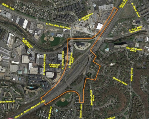
VDOT is planning a community meeting to discuss changes that might be coming to the “Shirlington Circle” interchange of I-395.

The somewhat labyrinthine interchange has been the scene of several notable crashes over the past few years. VDOT has been studying ways to improve it over the past few years.

The meeting is planned from 7-9 p.m. next Wednesday, June 12, at Drew Model School (3500 23rd Street S.). The transportation agency says it will reveal options for reducing congestion and crashes while soliciting public comments.

More from VDOT:

Join the Virginia Department of Transportation on Wednesday, June 12 to learn about and give input on alternatives identified by a study assessing safety and operational improvements at the I-395 Shirlington interchange (Exit 6), as well as at the following:

  • The ramp from South Glebe Road (Route 120) to southbound I-395
  • The intersection of South Shirlington Road and South Arlington Mill Drive
  • The intersection of Gunston Road and Martha Custis Drive

The study has collected data on traffic volumes and vehicle movements, and identified safety and operational issues. Learn more about the study’s identified alternatives, which aim to reduce congestion and crashes as well as boost the interchange’s overall performance. The study is being financed with federal funds and is expected to be finalized in fall 2019.

Residents are invited to stop by Drew Model Elementary School, 3500 23rd Street South, Arlington, VA 22206 between 7 p.m. and 9 p.m. to view displays and learn more about the study. A presentation will begin at 7:30 p.m. VDOT staff will be on hand to answer questions.

Give comments at the meeting, or e-mail or mail them by June 24, 2019 to Ms. Olivia Daniszewski, EIT, Virginia Department of Transportation, 4975 Alliance Drive, Fairfax, VA 22030.

Image via VDOT


View More Stories