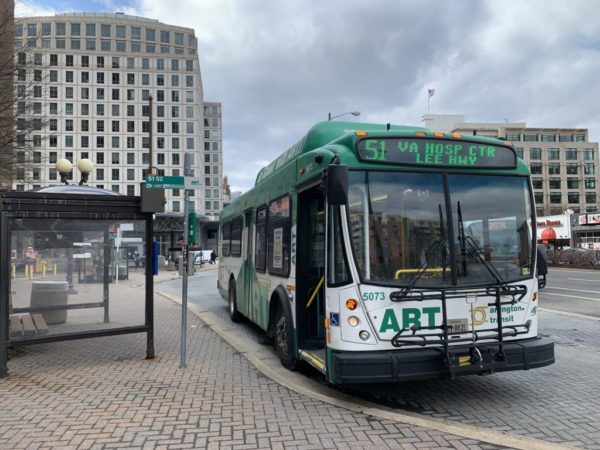
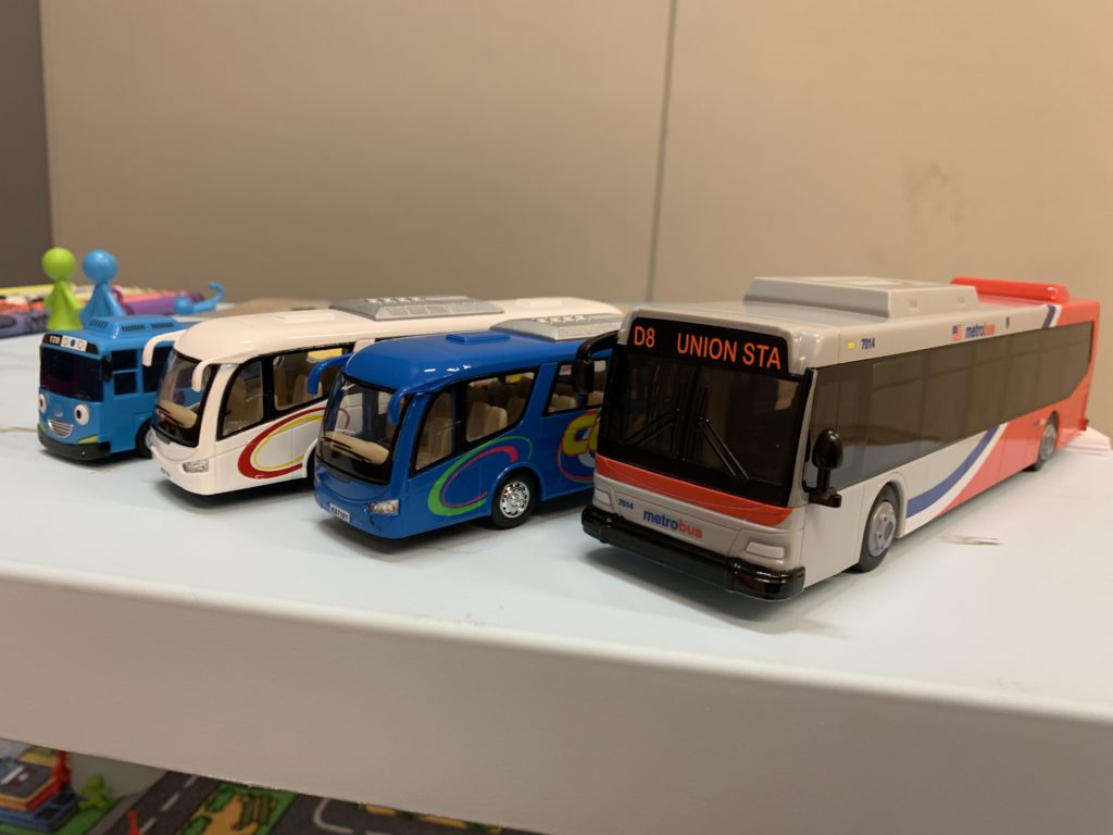
Within the next decade, a new transit group wants to make the bus the go-to transit option in the D.C. area

Earlier this year, the Washington Area Bus Transformation Project — which is backed by the Washington Metropolitan Area Transit Authority — released a draft strategic plan with a variety of short and long-term goals and strategies for improving the D.C. region’s bus network.

“The national capital region is adding 40,000-60,000 jobs and households each year,” the group said in its strategic plan. “But its transportation system is struggling to keep pace, leading to some of the longest commutes and worst traffic congestion in the nation.”

Potential ways to improve D.C. area buses and thus help alleviate traffic issues were broken into six categories, ranging in complexity and potential cost.

  • Ease of use: make simpler, consistent maps, naming conventions, and pricing. Another recommendation would be free transfers between Metrorail service and local bus lines.
  • Prioritizing buses on roads: potentially with bus-only lanes and traffic signal priority, though regional coordination will be needed.
  • Frequent, reliable, convenient service: overhaul existing routes to create a more efficient system and provide flexible, on-demand transit services for areas not well served by conventional buses.
  • Balance regional and local bus systems: develop a 10-year plan to allocate services between bus systems and applicable routes. The plan also includes a recommendation to “revise the cost local jurisdictions pay WMATA for local service to better match the actual cost to provide service.”
  • Streamline back-office functions: most of the recommendations in this category are behind-the-scenes improvements, like consolidating support functions and developing regional standards for bus data collection and analysis.
  • Centralizing regional bus networks: form a regional coalition of jurisdictional representatives with authority to implement strategy recommendations.

The bus system has a long way to go if it wants to turn its image around. Since 2012, bus ridership has fallen 13 percent across the region. The project will also require cooperation from the region’s nine bus service providers.

Much of the project also depends on local jurisdictions to implement strategies like restricting parking to facilitate better bus transit. This is why representatives from Arlington Transit and several Arlington County departments are in the group’s technical team and strategy advisory panel.

Meanwhile, most of the technical team and all of the leadership team are WMATA employees.

So far there are no cost estimates for the plan’s recommendations. Allison Davis, a member of the project team, said the price tag will come later in the process.

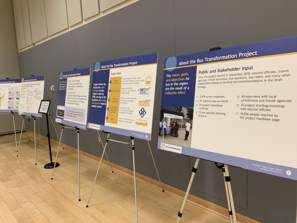
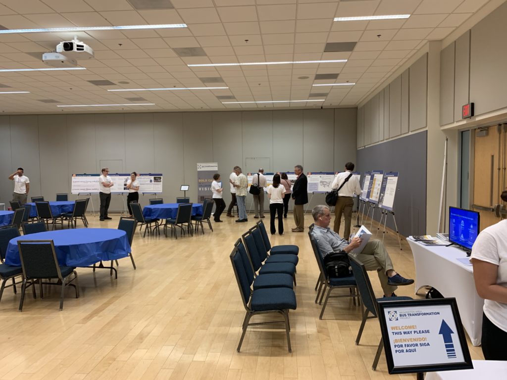
The project started in September. The group is currently in the middle of a public outreach campaign to sell the public on the idea and gather feedback. At an open house yesterday at George Mason University’s Arlington campus, the room was covered with boards for collecting thoughts on the project and the direction it should take. A survey is also available online.

The plan goes to the Northern Virginia Transportation Authority and the WMATA board this summer for review, with a roadmap planned for development in the fall.

“We’re trying to look at this from a customer perspective,” Davis said. “This [plan] is a tool we have to make better [transit] choices.”


Three safety and beautification projects are coming to western Arlington streets.

This Saturday the County Board is scheduled to vote on $2.8 million in construction contracts for Neighborhood Conservation projects. The three projects are all at the western edge of Arlington, near Falls Church.

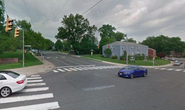
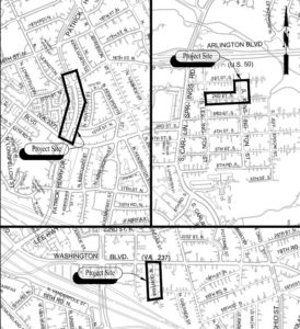
The project at Patrick Henry Drive near Westover Apartments will add dedicated bike lanes from Washington Boulevard to 16th Street N.

The other two projects — 2nd Street South at S. Kensington Street and N. Quintana Street — will add new sidewalks. The N. Quintana Street project will also add streetlights.

The projects are all planned to:

  • Improve pedestrian connectivity
  • Provide disability accessible routes
  • Rehabilitate existing roadways
  • Improve drainage

The projects are 32 percent more expensive ($883,379) than when they were first proposed in 2017, which staff attributed to inflation in construction costs and higher construction standards enacted by the county since then.

Photo via Google Maps


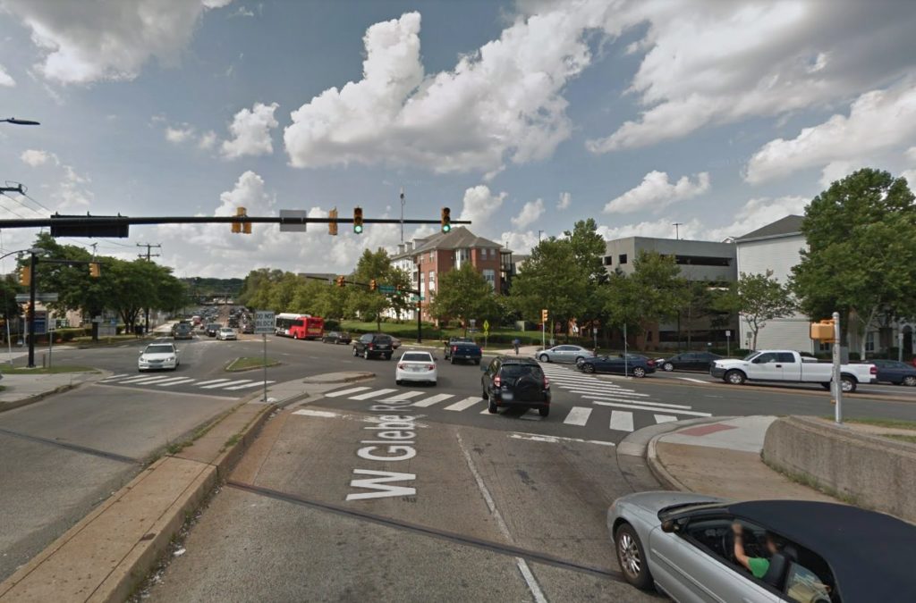
(Updated at 9:30 a.m.) Arlington County is considering a series of transportation improvements, including a fix to the complicated West and South Glebe Road intersection.

At Saturday’s County Board meeting the Board scheduled to vote on the approval of a series of grant requests for up to six projects with a total funding of up to $5.4 million.

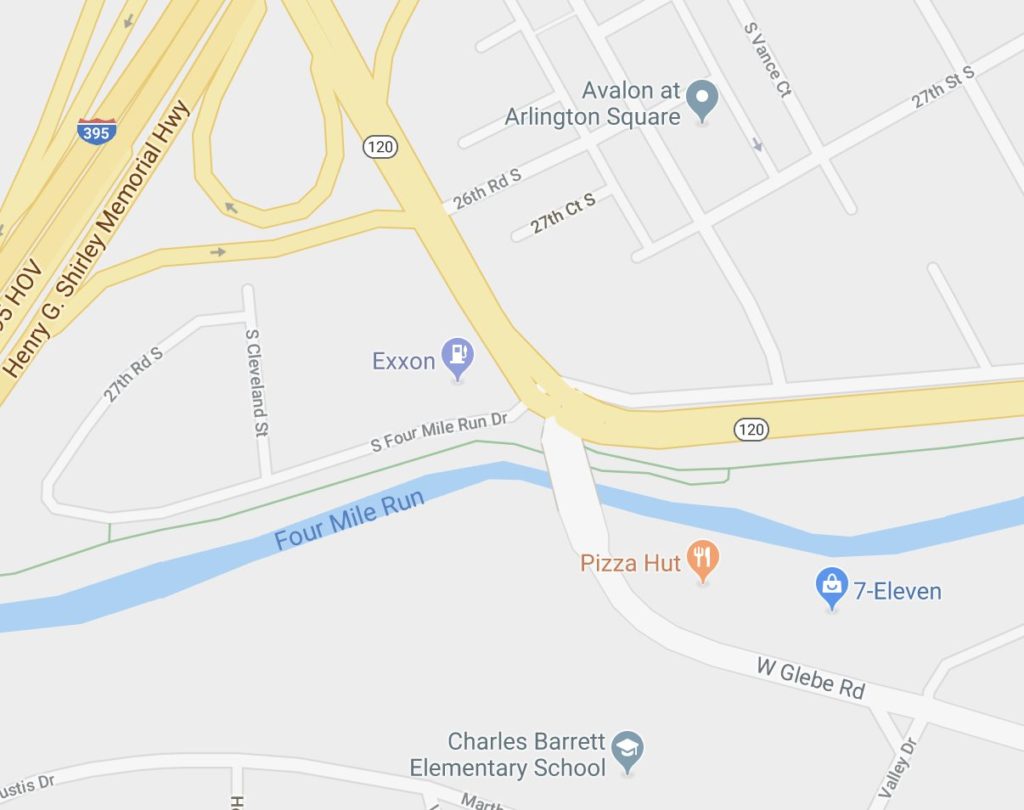
The most expensive of the projects would be cleaning up the somewhat crash-prone Glebe Road intersection for $3 million in grant funding. W. Glebe Road, S. Glebe Road and S. Four Mile Run Drive all feed into the same intersection. By adjusting the geometry and the lane configuration, the county hopes to reduce instances of crashes.

Staff also note in the proposal that adjusting traffic signal timing and turn movements on S. Four Mile Run Drive could alleviate congestion on northbound I-395 by reducing backups on the ramp to S. Glebe Road.

The grant requests also include a series of transit improvements. The report notes that motorists frequently violate the Potomac Yard Transitway travel restrictions in Crystal City. The planned fix would add red markings to the lanes to denote the entry points to the transitway.

Other improvements include reliability upgrades for the 22F and 16Y Metrobus lines, serving Pentagon-Shirlingt0n-Fairlington and Columbia Pike-Court House-Farragut Square, respectively.

The 7Y Metrobus route would also gain additional noon-to-midnight bus service starting in December.

Also included among the grant requests is a funding request for $211,962 to extend the Commuter Store operations at the Pentagon for another 12 months. The store sells transit passes and provides commuter assistance, serving approximately 1,800 customers per month according to the staff report. Current funding for operations is set to expire on March 31, 2020.

Photos via Google Maps


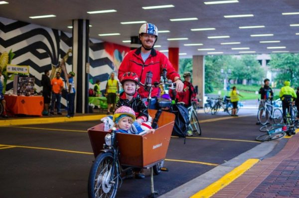
If the Avengers were a local enterprise, Chris Slatt would be the Guardian of the Arlington Transportation Galaxy.

Slatt serves as the Chair of the Transportation Commission and has a steel trap memory for county transportation projects — and the politicking behind why some never happened.

He’s weighted in on toll enforcement, infrastructure planning, and he’s organized everything from a protest for bicycle safety on the Pike to the cutest free library in Penrose with tools to fix your bike.

For this episode of the 26 Square Miles podcast, we sat down with Slatt to talk about why the Columbia Pike-Crystal City streetcar never took off, what Amazon means for local public transportation, and what it would really take to build safe bike routes across the county.

Listen below or subscribe to the podcast on iTunesGoogle PlayStitcher or TuneIn.

Photo via Jas Sanchez Photography


(Updated 10:05 a.m.) Arlington will soon release the results of a study on whether Uber and Lyft should replace some bus routes in certain areas of the county.

At the end of May officials are expected to conclude its “Parameters Study for Zone-Based Demand-Responsive (Flex) Transit Service,” per a county spokesman. The study will help officials weigh whether ride-hailing companies can replace some bus service in areas experiencing low bus ridership.

Ride-hailing services could connect riders heading to and from those areas with the nearest Metro station.

Taxi companies and paratransit providers are also being floated as possible service providers, county transportation spokesman Eric Balliet told ARLnow yesterday (Tuesday).

“We’re in the research phase right now, so no decisions have been made about [the] number of providers or where vehicles would pick up passengers,” Balliet said. “These would be looked at if we decide to move forward with this service concept.”

The areas being considered for this are identified in the county’s Transit Development Plan, which was approved in 2016:

  • The Douglas Park, Nauck, and Arlington Village neighborhoods which the plan aims to connect to transit along Columbia Pike.
  • The Rock Spring, Williamsburg Middle School, and Dominion Hills areas, which currently see only 10 passengers per hour on the ART 53 route. Those neighborhoods would be connected to the East Falls Church Metro station.
  • The Chain Bridge Forest, Rivercrest, Bellevue Forest, Gulf Branch, and Stafford-Albermarle-Glebe neighborhoods, which also only see 10 passengers per hour on the ART 53 route. Those neighborhoods would be connected to the Ballston Metro station.

“Each trip must either originate or end at that chosen destination,” the plan says. “This service will use smaller vehicles that may not be operated by or under the banner of ART and could include a separate fare system. Rides would be grouped and provided on a demand responsive basis.”

“In Arlington County there are several low-density neighborhoods which are served by low-frequency, low-ridership, costly-to-operate bus routes,” a 2018 description of the study says. “In these areas, it may be easier and cheaper to provide on-demand private-vehicle service for people needing to get to Arlington’s business and shopping districts than continuing to provide bus service.”

The county “sees this project as a potential model for other places which are facing similar issues with their bus systems,” said the study’s description.

County Manager Mark Schwartz said in a 2016 statement that the county’s “goal is to review a possible way to encourage transit ridership, increase efficiency and reduce costs,” and added that the county “must overcome many challenges and answer many questions before we could consider implementing this proposal.”

Montgomery County, Maryland is planning to test a similar transit program this summer where residents can request a shuttle pick-up using the Via app, WTOP reported.


Plans are coming together for a major transformation of Rosslyn’s streets, as county officials advance a series of proposals designed to someday make the neighborhood a bit more friendly to cyclists and pedestrians.

The county is holding a public meeting tomorrow (Wednesday) to unveil a newly revised design for the future of Rosslyn’s street network. Known as the “Core of Rosslyn” study, planners have been working since 2017 to finalize a redesign of the neighborhood that comports with the “Rosslyn Sector Plan” the County Board adopted in 2015.

Some of the proposed changes, revealed in detail last fall, are quite substantial.

Perhaps the largest one is the removal of the Fort Myer Drive tunnel under Wilson Blvd, transforming it into a traditional at-grade, signalized intersection. The county could also follow through on long-contemplated plans of building a car-free, “pedestrian corridor” running from 18th Street N.’s intersection with N. Oak Street to N. Kent Street, replacing the Rosslyn skywalk system to make the Metro station more accessible.

Another major change included in previous proposals was the conversion of N. Fort Myer Drive, N. Lynn Street and N. Moore Street into two-way streets. But officials are now rolling out a revised set of plans that would keep the latter two streets as one-way roads, after hearing feedback from the community on the study.

Planners have indeed seen Lynn Street as a particularly challenging option for opening up to two-way traffic. Though officials expect the change would make things a bit less confusing for drivers, it would also force the county to find new access points to the G.W. Parkway, I-66 and the Key Bridge.

Other proposed changes include 14 new or improved crosswalks for pedestrians, and more than 1.3 miles of new protected bike lanes. Those are largely set to run along Fort Myer Drive, N. Moore Street and N. Nash Street, and are designed to ease bike connections to the Key Bridge and the Mt. Vernon and Custis Trails.

The public meeting on the “Core of Rosslyn” plans is set for the Observation Deck at CEB Tower (1800 N. Lynn Street), located on the 31st floor of the massive office building, tomorrow from 4-7 p.m.

The county hopes to have final results of the study ready for consideration sometime this summer.

File photo


Arlington transportation planners’ latest attempt at crafting the future of the county’s cycling infrastructure has left neighbors, bicyclists and environmental advocates both pleased and disappointed.

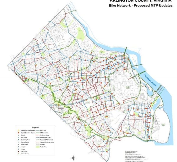
The first draft of the 5o-page document, known as the bicycle element of the county’s Master Transportation Plan, originally included 26 cycling infrastructure projects including new trails and on-street bikeways. Since then, county staff has cut a few bike trails from the document, including two major projects: the Arlington Hall trail in Alcova Heights and another connecting the former Northern Virginia Community Hospital in Glencarlyn to Forest Hills, which were chopped after outcry from neighbors and environmentalists.

Still, bike advocates expressed broad support for the plan, but some think the latest draft doesn’t go far enough to ensure pedestrian safety and combat climate change.

“We made a number of changes in response to what we heard,” said Richard Viola, the project manager for updating the plan at the transportation division of the Department of Environmental Services (DES) told ARLnow Thursday. “I don’t think it negatively affects the overall plan, but it certainly shows a little more consideration of our natural resources.”

The plan is a sort of guiding “wish list” for the county, which some refer to as the “Master Bike Plan.” Viola’s group has been revising the document for more than a year, with the final version expected to be adopted later this spring. The latest edition will be posted publicly next week, he said.

During this latest revision, the county dropped its proposal for an off-street, half-mile trail connecting 6th Street S. to S. Quincy Street in the Alcova neighborhood at S. Oakland Street. The trail became a point of controversy because it could mean 6th Street residents lose some backyard privacy, and the county would cut down some important trees.

“We heard from a number of people from that Alcova Heights neighborhood that they did not want to see the trail built,” said Viola. “And then later we heard from a number of people in the neighborhood who want to see the trail build.” Ultimately, his working group shelved the Alcova trail idea for another time.

Another nixed idea was to extend the Four Mile Run Trail a half mile to connect with Claremont Elementary and Wakefield High. The Audubon Society wrote a letter in January warning that the proposal could cause “potential harm” to the rare magnolia ecosystem in the area.

“It’s a useful connection,” Viola said of the proposed trail. “People walk it today. But it would not be a suitable bike route when we thought about it because of the steepness [of the trail] and the proximity to this magnolia bog natural preserve.”

Another plan that became bogged down was a Glencarlyn/Hospital Trail connecting Glencarlyn and Forest Hills neighborhoods via the old site of the Northern Virginia Community Hospital. The half-mile project was envisioned by Viola’s team as a “low-stress route” between Arlington Boulevard and Columbia Pike because it could link up with other bikeways on S. Lexington Street, S. Carlin Springs Road, and 5th Road S.

The Audubon Society wrote that a trail passing through the old hospital site would “destroy valuable natural resources” in the conservation area that protects Long Branch Creek.

As a compromise, Viola’s team suggested instead widening the sidewalk on the east side of Carlyn Springs Road, so bikes and pedestrians can share.

“There are other comments they did not address in their plan,” said Audubon Society member Connie Ericson, referring to the organization’s January letter. “But we are pleased that they took some of our suggestions.”

However, members of the Arlington County Transportation Commission were “not wild” about the sidewalk idea, according to Commission Chair Chris Slatt.

Slatt told ARLnow Friday morning that members felt a paved, woodsy trail was too rare an opportunity pass up.

“There aren’t a lot of places where you could jog or bike without cars next to you,” he said. “It would seem like a shame to give up on that.”

In general, the plan drew praise from Ericson, and other advocates like D.C.-based Wash Cycle who said they couldn’t “spot any holes in the plans” in a January blog post.

Bruce Deming, who runs the Law Offices of Bruce S. Deming, Esq. and is known as the “Bicycle Lawyer,” also praised the Master Bike Plan for being “very thorough” and having a “cohesive strategy.” But he also told ARLnow in a phone call that, when it comes to safety, the “sense of urgency should be greater” in the latest draft.

The plan contains no mention of speed cameras — something Deming admitted is “politically unpopular” but reduces the injury and mortality rates in crashes with pedestrians and cyclists.

Deming also critiqued the plan for not prioritizing more bike lanes protected from cars, something 64 percent of respondents surveyed by the county wish for according to the Master Plan.

“According to the latest version of the plan, we’ve got 29 miles of bike lanes and 10 percent are the protected bike lanes,” said Deming. “I’d like to see that percentage increase substantially.”

Viola told ARLnow that the plan has been updated to language about “traffic safety education.”

The updates to Arlington’s Master Bike Plan are the first in 10 years, and according to Viola, the county doesn’t expect to undergo the process again for another decade. This comes a few months after the U.N.’s report indicating humans have 12 years to cut emissions before global warming causes permanent ecological damage, and reducing trips by car is one way to do this.

The Master Bike Plan acknowledges this, writing that improving the county’s pledges to improve air quality and reduce its emissions “depend greatly on shifting more travel to energy-efficient travel modes such as bicycling and walking.”

For Slatt, this means ensuring the infrastructure is so good it makes people want to ditch cars for bikes — something that would be easier to figure out how to do if the county allocated more resources and invested in high-end data analysis.

“People don’t people pick their transportation option because it saves the planet,” he said. “People pick their transportation option because it works for them because it’s faster or cheaper or makes them happy.”


Crash Closes Part of Parkway — A serious crash has closed the northbound lanes of the GW Parkway between the Daingerfield Island marina and I-395. A crash investigation is underway. [Twitter]

False Report Prompts Big Police Response — “At approximately 2:30 p.m. on March 6, police were dispatched to the report of a man brandishing a firearm in the lobby of” the Days Inn hotel on Arlington Blvd. “The investigation determined that no disturbance had occurred and that the reporting party allegedly had an ongoing dispute with the hotel over a refund. A warrant for Filing a False Police Report was obtained for the suspect.” [Arlington County]

Garage Races Cancelled This Weekend — Updated at 9:35 a.m. — Crystal City’s Crosshairs Garage Races series will continue to bring fearless cyclists and spectators together for races through one of the neighborhood’s sprawling parking garages later this month. This year the series is being held on Saturdays in March, but this weekend’s scheduled races have been canceled due to a water main break. [Crystal City, Twitter]

Local Road Project ‘On the Bubble’ — “With tolls set to begin on Interstate 395 in October and already underway for more than a year on Interstate 66 inside the Capital Beltway, the Northern Virginia Transportation Commission is set Thursday to consider the next steps of how to spend part of the money… Arlington County plans for a High Occupancy Vehicle and bus-only lane on Lee Highway in Rosslyn would be on the bubble.” [WTOP]

Remember to ‘Spring Forward’ This Weekend — “On Sunday, March 10, at 2 am, daylight saving time begins. We’ll set our clocks forward one hour, and the change will push sunsets later into the evening hours and sunrises later into the morning hours.” [Vox]


The following feature article was funded by our new Patreon community. Want to see more articles like this, exploring important local topics that don’t make our usual news coverage? Join and help fund additional local journalism in Arlington. 

With Amazon hoping to open a headquarters in Arlington, Crystal City’s transportation network can’t seem to stay out of the spotlight.

Major redevelopment is coming whether or not local resistance turns the e-commerce giant away, but the attention-grabbing headlines and all-at-once infrastructure proposals don’t reveal how mobility investment is a gradual process – or how Crystal City has been steadily improving its transportation infrastructure since long before the HQ2 contest even began.

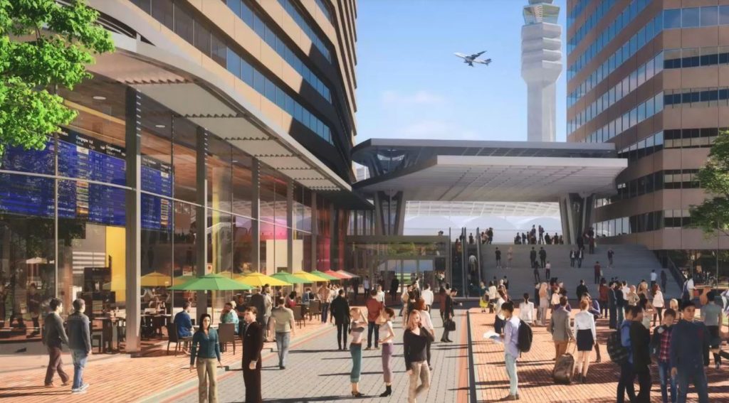
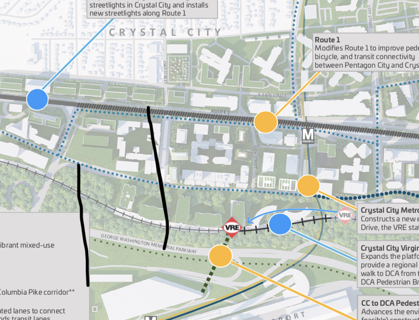
Crystal City has long been slated for some major transportation investments: Long Bridge reconstruction could enable MARC to bring commuters straight from Maryland to Crystal City and let people bicycle straight to L’Enfant Plaza. A new Metro entrance would make it much easier to connect to bus service. A remodeled VRE commuter rail station would enable larger and more trains, Metroway expansion will strengthen ties with Pentagon City and Alexandria, and a pedestrian bridge to the airport would take advantage of the fact that DCA is three times closer to Crystal City than any other airport in America is to its downtown.

These projects are big: big visibility, big impacts, big cost. They have all been in the pipeline for years, and Amazon is bringing them renewed attention and new dollars.

However, these major investments aren’t the only projects that will update Crystal City’s decades-old transportation infrastructure. Just as important as these headline-making proposals are the more incremental projects that, block by block, are making Crystal City an easier place to get around — and, just like their larger counterparts, these smaller projects have been given some extra weight by HQ2.

Old Visions, New Funding

One document has guided much of Crystal City’s development for the past decade: the Sector Plan. The Crystal City Sector Plan made many suggestions for possible improvements. Not all of them have yet come to fruition, but many have, and the plan continues to drive Arlington’s conversation about Crystal City.

That conversation has recently become a little more ambitious. Amazon’s HQ2 announcement brings not only attention, speculation and more than a little resistance — it will also bring very definite funding. Arlington and Alexandria, combined, “have secured more than $570 million in transportation funding” while the commonwealth of Virginia has committed to $195 million for the same.

This new funding flows mostly toward old designs, all of them focused on alternatives to the car. Arlington’s Incentive Proposal discusses 10 transportation “example projects.”  Five of them fall within Crystal City itself, of which all but one follow ideas that originated in the Sector Plan (the remaining project, VRE station expansion, isn’t new either).

Moving Block by Block

Most of Crystal City’s streets were built in the 1950s and 1960s, and followed the “modernist” school of city planning.

They separated pedestrians from cars as much as possible, often putting pedestrians in bridges or tunnels; located stores in malls rather than on sidewalks; and spaced out intersections widely so that cars could accelerate to highway speeds. The Sector Plan calls to convert these into “Complete Streets” that will “accommodate the transportation needs of all surface transportation users, motorists, transit riders, bicyclists, and pedestrians.”  

It can be easy to think of transportation investments as one-off projects. The CC2DCA pedestrian bridge to the airport, for example, is an all-or-nothing endeavor. Half of a bridge wouldn’t be very useful for anybody.

Because of its focus on the street level, the Sector Plan calls for gradual change. It endorses street transformation projects that can be completed incrementally — block by block, street by street, improving the area’s transportation network over time. It seeks “to balance any proposed investments in transportation infrastructure with improvements in the efficiency and effectiveness of the existing network, so that the maximum benefit can be delivered at the lowest cost.”  

This approach pairs well with Crystal City’s desirability for land developers. Most significant developments in Arlington are governed by the site plan process, through which the county negotiates with developers for community benefits — which might include a street renovation. Robert Mandle, chief operating officer of the Crystal City Business Improvement District, explained that “as a redevelopment plan, many [Sector Plan] improvements were anticipated as occurring in conjunction with opportunities presented from redevelopment.”

(more…)


Virginia Railway Express leaders think they’ve just about nailed down funding for a new and improved Crystal City station, a key component of the area’s impending transportation transformation with Amazon on the way.

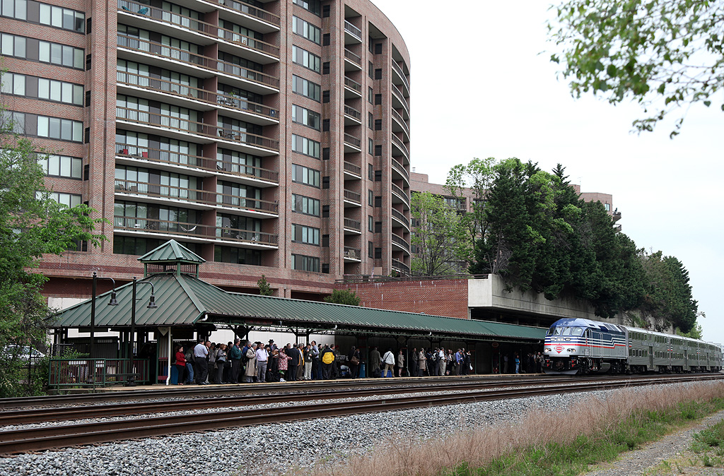
VRE officials have been eyeing improvements to its existing station, located at 1503 S. Crystal Drive, for years now, considering that its platform isn’t quite long enough for the commuter trains. Right now, anyone hoping to get off at the station needs to walk to one of their train’s first four cars, even though many are 10 cars long.

The station is also only set up to serve one train at a time, and sits a bit far away from the neighborhood’s Metro station, a challenge for commuters from Northern Virginia’s outer suburbs who use VRE to reach destinations in D.C. or elsewhere in Arlington. A new, relocated station could solve all of those problems at once.

The challenge, of course, is coming up with money to pay for the roughly $41 million project. But on that front, VRE officials seem to be nearing a solution, according to documents prepared in advance of the Northern Virginia Transportation Commission’s meeting tonight (Thursday).

The VRE is asking the NVTC, a collection of regional leaders that helps oversee the rail service, for permission to make a variety of budgetary moves, including strategies to fund the new Crystal City station. Primarily, the VRE plans to ask for a combined $30 million in state funding for the project: half would come from a grant from the state’s rail agency, half from gas tax revenues set aside for VRE capital projects as part of the dedicated Metro funding deal last year.

Notably, the station overhaul was not included among the promised transportation improvements designed to lure Amazon to the area. But, with the tech giant expected to bring 25,000 jobs to the neighborhood, VRE officials are ready to get moving on the project sooner rather than later.

“VRE’s commuter rail service will also be critical to serving these expected new workers, and the planned relocation and expansion of VRE’s Crystal City Station has taken on additional importance,” staff wrote in a report delivered to the NVTC.

The rail service previously won $4 million in regional transportation dollars to cover design and engineering costs, and is nearing completion on a final design for the station now, VRE staff wrote.

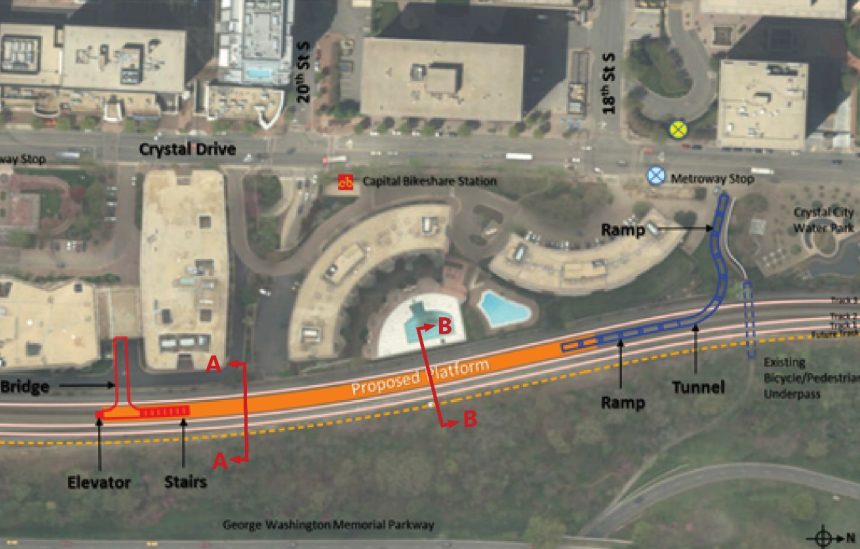
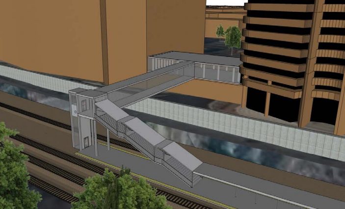
The Arlington County Board and VRE agreed on a new location for the station in fall 2017, selecting a site behind 2011 Crystal Drive. The new station will be accessible via a tunnel to 18th Street S. between the Crystal Place residential buildings and the Crystal City Water Park, in addition to a pedestrian bridge from the second level of 2121 Crystal Drive.

It will also sit across the street from a new second entrance to the area’s Metro station, set to be located at the intersection of Crystal Drive and 18th Street S. Considering that VRE estimates that about 18 percent of passengers headed to the Crystal City station then transfer to the Metro, county officials have long viewed improving the connection between the two rail services as a key way to boost transit ridership.

The station will also include an “island platform” to serve two tracks simultaneously, and work on the project is set to move in conjunction with the state-backed “Atlantic Gateway Initiative” to construct a new rail track between D.C. and Fredericksburg. The old station will eventually be demolished.

There are no firm dates for when the project might be completed, but VRE estimates suggest it wouldn’t be finished until 2023 at the earliest, depending on how quickly officials secure the necessary funding.


Transportation planners are sketching out a vision to build out a fully connected regional bike trail network by 2045, linking a “Bike Beltway” around D.C. to the rest of the suburbs surrounding the capital.

The Metropolitan Washington Council of Governments’ Transportation Planning Board voted late last month to endorse a vision for a “National Capital Regional Trail Network,” expanding its long-range plans for cycling infrastructure throughout the region. Though the actual funding and construction of the trails involved remains up to the individual localities, the map represents a potential path forward for the D.C. area’s elected officials to follow in the coming years.

The newly adopted trail network includes the 842 miles of bike paths identified by the Capital Trails Coalition, a group of both local government transportation agencies and a host of advocacy organizations, as ones that regional leaders should pursue to make cycling around the area a bit easier.

The group has been pushing the idea of a more interconnected region for years now, particularly the “Bike Beltway” circling the city. Former Arlington County Board member Jay Fisette was a key backer of the concept, envisioning a loop of trails from the county’s border with D.C. down to Alexandria, then running around the city into its Maryland suburbs.

But with that trail nearly finished, this latest move envisions connecting that “Beltway” with trails in more far-flung jurisdictions, like Prince William and Loudoun counties.

“The Capital Trails Coalition is pleased to see the coalition’s two years of research and mapping make its way into this important regional transportation plan,” Coalition Chair Jack Koczela wrote in a statement.

The National Park Service has embraced the plan as well, and regional planners hope this latest move can help all the jurisdictions involved in crafting the trail network secure funding to make it a reality.

“There has been great interest among the region’s jurisdictions, agencies, and advocacy groups to build on the National Capital Trail, as endorsed by the TPB and adopted by the NPS,” the Transportation Planning Board’s staff wrote in a blog post.

Arlington officials are currently working on their own update of the county’s guiding documents for future cycling infrastructure improvements, set to wrap up in the coming months. The county’s budget squeeze, however, will make it a challenge for the Board to find finding for many bike projects, at least in the near term.

Photo courtesy of the Capital Trails Coalition


View More Stories