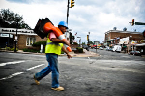
Il Radicchio on Clarendon Blvd

‘Republican’ Not Found on GOP Candidate’s Signs — Republican candidate Dave Foster, who’s running to represent the 48th District in the Virginia House of Delegates, has a notable addition and omission on his campaign signs. Foster’s signs include a union label, but do not include the word “Republican.” Foster will face Democrat Rip Sullivan in a special election on Aug. 19. [InsideNova]

Arlington Transportation ‘What Ifs’ — Three shelved transportation proposals could have had a big impact on Arlington over the past 50 years. One would have seen a new 22-mile Blue Line built through Arlington, under the Potomac via a new tunnel, to Georgetown and eventually to RFK stadium. Another would have converted Route 1 through Crystal City to “Interstate 595.” A third would have built a new bridge from Spout Run Parkway to Georgetown. [Washington Post]

Clarendon ‘Good Morning Guy’ Profiled — Robert Gordon, the Express newspaper distributor who excitedly wishes Metrorail commuters in Clarendon a good morning on weekdays, says his is “the best job I can ever have in the world.” [WJLA]

Blues and Brews in Crystal City TonightClarence “Bluesman” Turner is scheduled to perform in Crystal City tonight for the monthly summer “Blues and Brews” concert. The event, in the courtyard of 2121 Crystal Drive, also features a craft beer garden. [Crystal City]

Courthouse Square Survey — Arlington County is inviting the public to weigh in on the latest design concepts for the Envision Courthouse Square project. [Arlington County]

Flickr pool photo by Jason OX4


Metro logo on an Orange Line station(Updated at 9:45 p.m.) The long-stalled plan to build a western entrance to the Ballston Metro station is taking a small step forward thanks to new transportation funding.

On Tuesday, the Arlington County Board approved a funding plan for the county’s share of revenue generated by Virginia’s new transportation legislation. The plan, which will be submitted to the Northern Virginia Transportation Authority (NVTA), calls for $500,000 to be allocated to planning for the new Metro entrance during the current fiscal year.

The entrance is already partially designed. As proposed, it will be located at the intersection of N. Fairfax and Vermont Streets, allowing easier access to the new developments along Glebe Road in Ballston, the Bluemont neighborhood and other points west. The station will feature two street-level elevators and escalators, connecting to an underground passageway and mezzanine (with an attended kiosk) that will lead to the train platform.

“The County’s goal with the new funding is to advance the design of the West Entrance and proceed to construction,” said Arlington Dept. of Environmental Services spokeswoman Laura G. Smith. “In the next few months, the County will assemble [stakeholders] and reexamine the previous preliminary design.”

In another set of funding priorities submitted to NVTA, for fiscal years 2015-2017, the Board requested $56 million over those three years to cover 75 percent of the estimated $75 million cost of constructing the new entrance. Additional funds for the project are expected to come in the form of a $11 million developer contribution — tied to an approved but thus far unbuilt redevelopment project — and from other local and state sources.

The funding request would suggest that the entrance could be built by 2018, but the construction timeline does not appear to be set in stone.

“The Ballston Metro West Entrance Project has a lot of moving parts,” Smith noted.

Also included in the FY 2015-2017 priority list is $10 million for the planned realignment of the eastern end of Columbia Pike, between the Air Force Memorial and the Pentagon. Arlington is hoping to reach an agreement with the military on the realignment plan and a related land exchange “within the next six months,” said Smith.

Four Arlington transportation projects were approved by NVTA this summer. Other transportation funding requests made by the County Board on Tuesday include:

  • Clarendon Circle pedestrian safety improvements ($2 million)
  • Crystal City street improvements ($2 million)
  • New Arlington Transit bus maintenance facility ($2.25 million)
  • Streetcar project management ($2.5 million)
  • New traffic cameras and signals ($1 million)
  • Design of improvements to Glebe Road ($2 million)

Cherry blossoms on 15th Street S. in Pentagon City on 3/14/13

Free Taxi Rides on St. Paddy’s Day — As part of the SoberRide program, the Washington Regional Alcohol Program will be offering free taxi rides home on Sunday (St. Patrick’s Day) from 4:00 p.m. to 4:00 a.m. In order to get your fare (up to $30) comped, you must call 1-800-200-TAXI to book the cab. [Washington Regional Alcohol Program]

St. Patrick’s Day in Shirlington — Restaurants and stores in Shirlington are offering a number of specials food, drink and product this weekend in honor of St. Patrick’s Day. [Shirlington Village Blog Spot]

Arlington Touts Traffic Management — Despite a surge in population and employment in Arlington County since the 1970s, there has not been a corresponding significant increase in traffic levels on major county streets. According to a new blog post from the county’s Mobility Lab, Arlington County Commuter Services deserves some of the credit for that. The bureau — which operates Walk Arlington, Bike Arlington, and the Car Free Diet marketing campaign, among other “Transportation Demand Management” functions — says it kept 45,000 cars off county streets every work day in 2012. [Mobility Lab]

ACPD Officers to Participate in Bike Trek — Three Arlington County police officers will participate in the annual “Road to Hope” Law Enforcement United bicycle trek from Chesapeake, Virginia to Washington, D.C. The three day, 250-mile ride is organized “to honor the service and sacrifice of their law enforcement colleagues who have died in the line of duty” and to provide support for two law enforcement charities. [Arlington County Police Department]


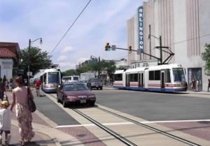
Arlington County’s own Transit Advisory Committee came close last night to passing a resolution supporting articulated bus service on Columbia Pike over the planned Columbia Pike streetcar project.

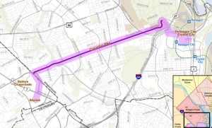
The resolution, proposed by committee member Joseph Warren, was ultimately defeated by a vote of 6-5, but not before a spirited debate among committee members. Citing a county-funded alternatives analysis, streetcar opponents on the committee made their case for why enhanced bus service — including higher-capacity articulated buses and a limited number of fixed stops along the Pike between Pentagon City and the Skyline section of Fairfax County — is a better option.

“Articulated bus [is] a practical and far more cost-effective alternative than the modified streetcar,” Warren said in his resolution, which his read aloud.

“Streetcar costs range from $249-261 million compared with $39-68 million for TSM 2 [articulated bus service]. The annual operating cost for the streetcar is $25.6 million compared to $22.1 million for the for the TSM 2 articulated bus,” Warren said. “Yet… [projected] streetcar ridership is only 4-6 percent greater than [articulated bus service].”

“Travel times of the modified streetcar and [articulated buses] are nearly identical and both operate in mixed traffic,” Warren continued. “However, since streetcars could not pass obstacles such as illegally parked cars and vehicles moving in and out of parking spaces, it is much more vulnerable to delays.”

Committee member John Antonelli, who lives along the Pike, echoed Warren’s concerns about the reliability of streetcar service.

“If we were talking about a Metro subway under Columbia Pike… my opinion on this issue would be very different than what it is today,” said Antonelli. “Instead we’re talking about a trolley on steel wheels… a system that can be brought down by ice, wind, snow… by one mis-parked car or road crew. The articulated bus won’t have all the strictures of steel wheels on steel rails. It can move around things. It can be had for a whole lot cheaper, with the same benefits.”

But committee member Franz Gimmler said helping people get from one place to another isn’t the only thing that should be considered when planning transit service. He said economic development and enhanced livability are two important benefits that will come with a Columbia Pike streetcar line, but not with enhanced bus service.

“There’s a growing recognition that transportation is not in and of itself the end,” Gimmler said. “The end is what transportation does to your community, what it provides in building a community.”

“Arlington County has been fortunate that an earlier generation of leaders had a vision for the county that led them to fight for Metrorail underneath Wilson Boulevard,” he continued. “As a result, the Rosslyn-Ballston corridor is a internationally-recognized example of the best of transit-oriented development. We are fortunate that our current leaders have learned from that transit project and have envisioned the same benefits for the Columbia Pike corridor.”

(more…)


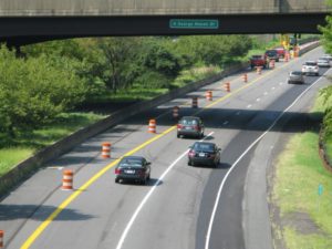
(Updated at 1:50 p.m.) The Northern Virginia Transportation Alliance, a persistent critic of Arlington County, is renewing its call for additional lanes on I-66 inside the Beltway.

The Alliance points to the nearly-complete I-66 “spot improvement” — which added a third westbound lane between Fairfax Drive and Sycamore Street in Arlington — as evidence that the county’s stated opposition to widening I-66 is misguided.

“Drive I-66 westbound past Ballston,” the Alliance said in a recent email. “Look to your right. Behold, a new 12-foot lane! Look again. What do you see? Same sound walls. Same trees. Same houses. Same bike path. The sky didn’t fall; the earth remains on its axis.”

“What is different is that soon a major regional bottleneck will be reduced along with travel times of tens of thousands of daily morning work trips, home commutes and weekend trips of all kinds,” the email continued, calling the improvement “a baby step.”

The Alliance says that VDOT should now work to add a third lane in both directions on I-66 from Spout Run to the Dulles Toll Road. Such a move would surely draw opposition from Arlington, which tends to support transit-oriented transportation policies that discourage car use and traffic congestion. Still, the Alliance says the state should push forward despite possible “obstructionism” from Arlington.

“Our region continues to rank #1 in congestion, not for lack of regional solutions, but because localities too often oppose them and the state too often defers to localities,” the group said.

VDOT recently kicked off a study of “multimodal and corridor management solutions (operational, transit, bike, pedestrian, and highway) that can be implemented to reduce highway and transit congestion and improve overall mobility within the I-66 corridor, between I-495 and the Theodore Roosevelt Bridge.”


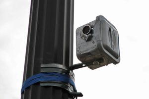
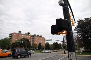
Over the past couple of weeks, people have been noticing mysterious, concealed video cameras mounted on lamp posts along Columbia Pike.

Some residents thought they were ingenious surveillance cameras in place for the 9-11 anniversary. Others thought they were part of some shady dealings, and called police to investigate.

In reality, however, the cameras are merely being used by Arlington County to monitor traffic patterns at intersections. According to Arlington Traffic Engineering and Operations Chief Wayne Wentz:

These are video cameras that are temporarily in place to collect intersection data. The videos will be viewed in the office and technicians will create vehicle turning movement counts. These data will be used for our periodic (every three years) traffic signal optimization effort.

As of yesterday evening, three cameras were in place at the intersections of Columbia Pike and S. Courthouse Road, S. Scott Street and S. Quinn Street.


Arlington Lauded in The Atlantic — “New data from Arlington County, Virginia, provide an in-depth look at how a jurisdiction known for great planning has leveraged excellent transit service and transit-oriented development into efficient transportation performance.” [The Atlantic, CommuterPage Blog]

Renovated Aurora Hills Library Holds Open House — The newly-renovated Aurora Hills branch library will hold a grand opening next week. Residents are encouraged to attend the open house, from 5:00 to 7:00 p.m. on Wednesday, Aug. 24. There will be several kid-friendly activities, including face painting, balloon animals and storytime. Among the new improvements is a spruced-up lobby and wireless internet access. [Library Blog]

Drainage Pipe Work on Route 50 — Crews are reportedly working to clear a backed-up drainage pipe along Route 50. [Ode Street Tribune]

Green Candidate for School Board — Independent Green candidate Andrea Ochoa has qualified to face off against incumbent Abby Raphael in November’s school board election. The Independent Greens of Virginia web site has Ochoa’s photo but no biography. [Sun Gazette, Independent Greens of Virginia]

Flickr pool photo by Airpolonia


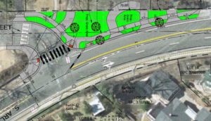
(Updated at 12:20 p.m.) Next week, construction is expected to begin on a number of controversial changes to Arlington Ridge Road from 23rd Street to Meade Street.

The four-week, $200,000+ construction project will eliminate a bus pull-off lane, will extend permanent curbing at the intersection of Arlington Ridge and Oakcrest Road, and will include various curb, gutter and sidewalk improvements — all in the name of improving pedestrian safety.

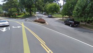
But one change in particular has prompted vocal protests from dozens of residents: the elimination of the slip lane from southbound Arlington Ridge Road to S. Meade Street.

The slip lane is used by residents who live in the neighborhood, and by parents dropping their children off at Oakridge Elementary School. Critics of the project — who are publishing a blog called Save Our Streets — say that eliminating the slip lane will actually make the area less safe by forcing turning traffic to stop on a steep downhill portion of Arlington Ridge Road, risking rear end collisions and making the sharp turn difficult during bad weather.

In response to a letter from the Arlington Ridge Civic Association (ARCA), which said the S. Meade Street portion of the project “is viewed as unneeded and potentially dangerous… with little or no gain for pedestrians,” county staff wrote that the elimination of the slip lane is “a major component of the project plan.”

“The existing slip lane allows vehicles to exit Arlington Ridge and enter S. Meade Street at a higher rate of speed,” staff said. “Requiring vehicles to slow to a safe maneuvering speed at the proposed singular entry site improves the safety for vehicles, bicyclists and pedestrians… The necessary reduction in speed for turning vehicles under the proposed plan is also supported by the current [25 mph] speed limit on Arlington Ridge, the lowering of which was heavily supported by ARCA.”

Arlington County Director of Transportation Dennis Leach reiterated that view in a recent WUSA9 story on the Arlington Ridge changes.

“Slip lanes actually encourage traffic to speed… it creates hazards for pedestrians,” Leach said.

The plan to turn the slip lane into an expanded sidewalk and green space is consistent with other county road projects that have eliminated slip lanes, including at the intersections of N. George Mason Drive and N. Frederick Street and S. Joyce Street and 15th Street. Another slip lane — at the bottom of a steep hill on S. Walter Reed Drive at the Four Mile Run access road — is also slated for removal this summer, and at least two slip lanes at Glebe Road and Fairfax Drive are slated for elimination in the next year or two.

Do you agree with the county’s approach to eliminating most slip lanes due to safety concerns, or do you agree with the ‘Save Our Streets’ citizens who argue that eliminating (at least certain) slip lanes is unnecessary and may actually have the opposite intended effect, safety-wise?


The issue is presented as a set of two mutually-exclusive options: either continue to support transportation policies that make it easy to own and drive a car, at the expense of bike and pedestrian safety; or support policies that make it easier and safer to walk and bike, at the expense of drivers.

Yesterday on the Arlington’s Commuter Page Blog, county Commuter Services Transportation Bureau Chief Chris Hamilton lauded Europe’s pro-pedestrian and anti-car policies, which have “reduced traffic and the number of cars in cities… re-conquering space for pedestrians.”

The policies, outlined in a New York Times article, include “making it harder and more costly to park… capping the number of parking spaces in new buildings rather than providing minimums… slowing cars down and closing streets to cars altogether and creating pedestrian plazas… synchronizing signal priority for people and transit, not cars… and giving people on foot the right to cross a street anywhere they like.”

“By following these examples we can make the Washington, DC region an even greater place to live,” Hamilton concluded.

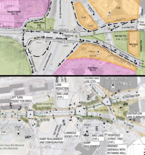
Arlington’s stated transportation policy is to focus future street improvements on facilities for pedestrians, bicyclists and transit riders. One example of this in action is the the proposed improvements to the Meade Street Bridge in Rosslyn. The current plan, as outlined at a public meeting last week, calls for the addition of dedicated bicycle lanes, the conversion of a free-flowing off ramp from westbound Route 50 to a square intersection and the addition of two traffic signals on either side of the bridge

If the choice is limited to pro-car or pro-bike-and-pedestrian policies — as opposed to policies that attempt to benefit both cars and alternative transportation choices — which would you support?


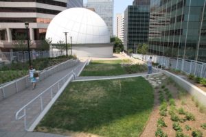
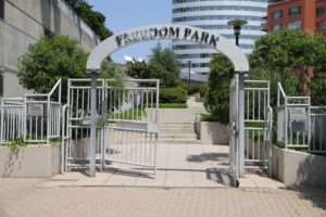
Greater Greater Washington ran an interesting article yesterday comparing Rosslyn’s Freedom Park to a newer, more well-known elevated urban park — New York City’s High Line.

The two are vastly different in terms of use, writer Dan Malouff concluded, but yet are similar in concept. For instance, the High Line was once a freight rail line designed to transport goods to and from the city more efficiently than ground-level rail. Freedom Park, on the other hand, was originally meant to be an elevated highway to help move commuters into the District more efficiently than Wilson Boulevard and N. Lynn Street.

For those who weren’t around in the ’70s, ’80s and early ’90s, the idea of Rosslyn’s “Loop Road Bridge” may seem a bit wacky. N. Lynn Street does get backed up at rush hour, but hardly enough to justify a whimsical, Disney World-esque elevated highway that ran in between skyscrapers and over existing roads, and which did nothing to alleviate traffic on the real bottleneck: the Key Bridge. At the time, however, transportation planners believed that the Loop Road Bridge was “the final piece to a road system that would reduce traffic in the Arlington high-rise district,” as Washington Post reported Charles W. Hall wrote in April 1993.

Nonetheless, after 20 years of planning, construction on the bridge abruptly stopped in 1990 when significant engineering problems were discovered. The county fired its construction contractor and a legal battle ensued. The bridge — unfinished and unfit for vehicle traffic — remained an eyesore until 1994, when the County Board finally voted to turn it into a park with the help of a developer.

Greenery, a fountain and covered dining areas were envisioned for the park. Concerts, events and food vendors were also part of the plan. Only part of the vision has materialized — Freedom Park does have planters and greenery, and is a somewhat popular destination for workers on their lunch breaks, when the weather is nice. But now, in 2011, the park can hardly be considered the vibrant destination that county leaders had hoped.

The fact that the Newseum moved from Rosslyn to D.C. in 2008 did not help matters. The museum made use of the park for some of its artifacts.

“The opportunity to create a park… is a substantial amenity for the community, and it links nicely to the Newseum, which is expected to bring millions of visitors to Arlington,” County Manager Anton Gardner told the Post in March 1994.

So far Artisphere, which opened in the Newseum space last year, has not utilized the park. More photos, after the jump.

(more…)


The county board has approved an overhaul to its Master Transportation Plan that will provide new guidance for the design, construction and usage of streets in Arlington County.

The plan focuses on making sure that Arlington’s streets are safe and accommodating to a number of modes of transportation, including walking, biking, transit and driving.

“Arlington’s goal is to create ‘streets for people,'” County Board Chairman Chris Zimmerman said in a statement. “Today’s action is the culmination of years of work by citizens and staff to craft County policies that will achieve our vision for ‘complete streets,’ streets that will support sustainable development and encourage healthier lifestyles.”

Under the new plan, streets will be classified into ten subgroups of arterial and local streets based on adjacent land use. The plan calls for all types of arterial streets to have a bike lane, a designated shared bike and vehicle lane or an adjacent trail. It also calls for “urban center local” streets to include a shared lane.

To improve safety, the speed limit on “downtown” streets will be reduced to 25 miles per hour. Speed limits would also be reduced in work zones. Meanwhile, pedestrian walkways will be improved through enhanced signage and high-visibility markings.

Street repaving will be done more frequently (on a 15-year cycle) and the quality of street repairs will be improved. Major streets and streets in poor condition will receive repaving priority, while streets lacking maintenance-saving improvements like gutters and curbs will be repaired instead of repaved.

The board approved the plan by a vote of 5-0. See more details here and here.

Flickr pool photo by Chris Rief


View More Stories