The Wild West of e-bikes and e-scooter parking is being tamed.

Last month, Arlington County began installing 100 special street parking spaces for shared and private micro-mobility devices. And shared transportation providers such as Bird, LINK and new arrival Veo are footing the bill.

Some locals have long complained that scooter parking blocks pedestrian and, at times, vehicle traffic. These “corrals” are intended to address this problem, now that Arlington permits the operation of up to 350 e-bikes and 2,000 e-scooters.

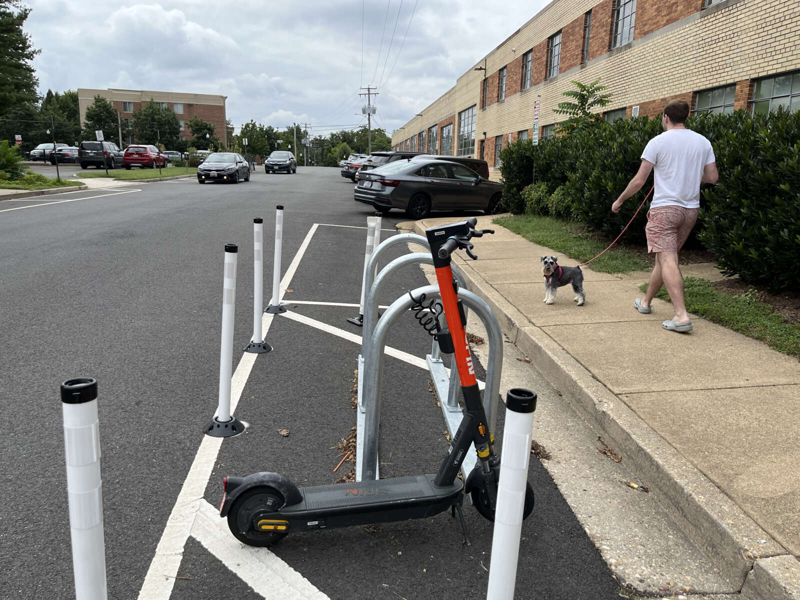
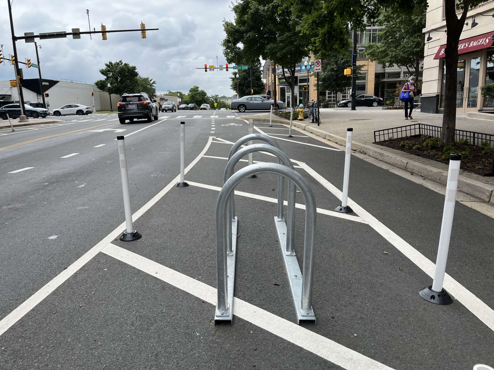
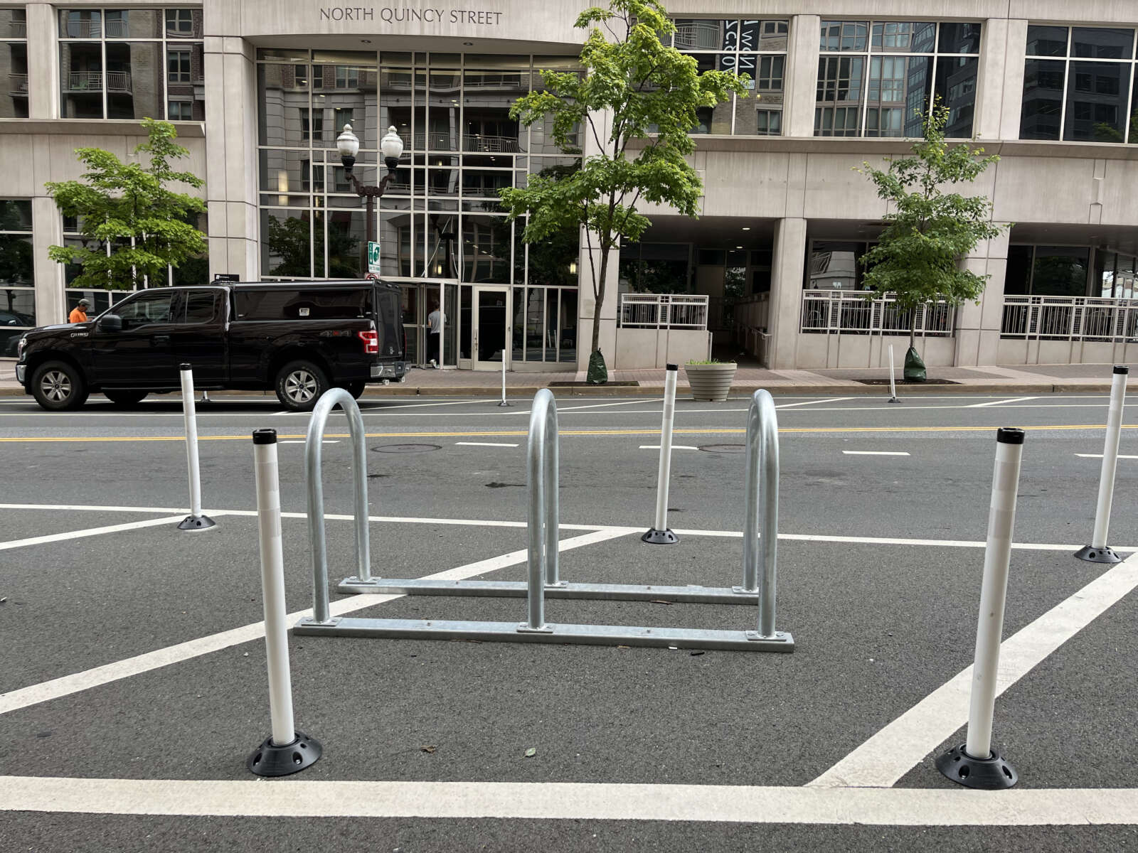
Each hitching post consists of three bike rack half-loops, which provide six parking spaces, surrounded by flex-posts that make the installation more visible to drivers.

“Scooter and bike corrals are designated parking spots in public areas for people to start and end rides safely,” said Arlington Dept. of Environmental Services spokeswoman Claudia Pors. “They are important to keep sidewalks clear for people walking, and aim to cutdown on tripping hazards and other risks for people sharing public spaces.”

About 20 existed in the county as of this past December. Planning and scouting for this new batch of corrals began last year, with the county on track to install 100 corrals by the end of this year and another 100 per year for the next three fiscal years, Pors said.

From start to finish, the process to choose a location and install a corral takes four months and costs about $1,000. The county is funding it with the $80 fee per device per year that micro-mobility companies pay to operate in Arlington.

These stations are being placed where cars are already restricted, such as curbs near intersections, to improve visibility.

“This particular example of placement also helps maintain visibility, so everyone traveling can keep a clear line of sight around high-traffic areas regardless of their mode of transportation,” she said.

As a bonus, drivers don’t lose street parking.

Of the corrals in place, most are located along the Rosslyn-Ballston and Route 1 (Crystal City/Pentagon City) corridors, where the bulk of rides have started since e-scooters and bikes arrived in 2018.

“The team is selecting corral locations throughout the county based on data showing where micro-mobility trips are being made,” Pors said.

The county, meanwhile, is taking suggestions for more locations — and maybe a different name, too.


Cycling advocate Gillian Burgess said in a tweet that she would like to see additional corrals in Arlington’s more suburban neighborhoods, where sidewalks are narrow and are easily blocked by bikes and e-scooters.

“They should put a corral by every crosswalk, to increase visibility,” she said. “They could start at [N. Nelson Street] at the crosswalk for the Custis Trail, which is also a hub stop.”

https://twitter.com/NeilBakesBikes/status/1567202084591747076

Although the corrals are placed where cars cannot park, one Twitter user observed that some drivers will just stop somewhere else — like a bike lane.

https://twitter.com/zacycles/status/1567267663084244999


Arlington residents have until the end of this month to tell the county what improvements they want to see on a portion of Arlington Boulevard Trail.

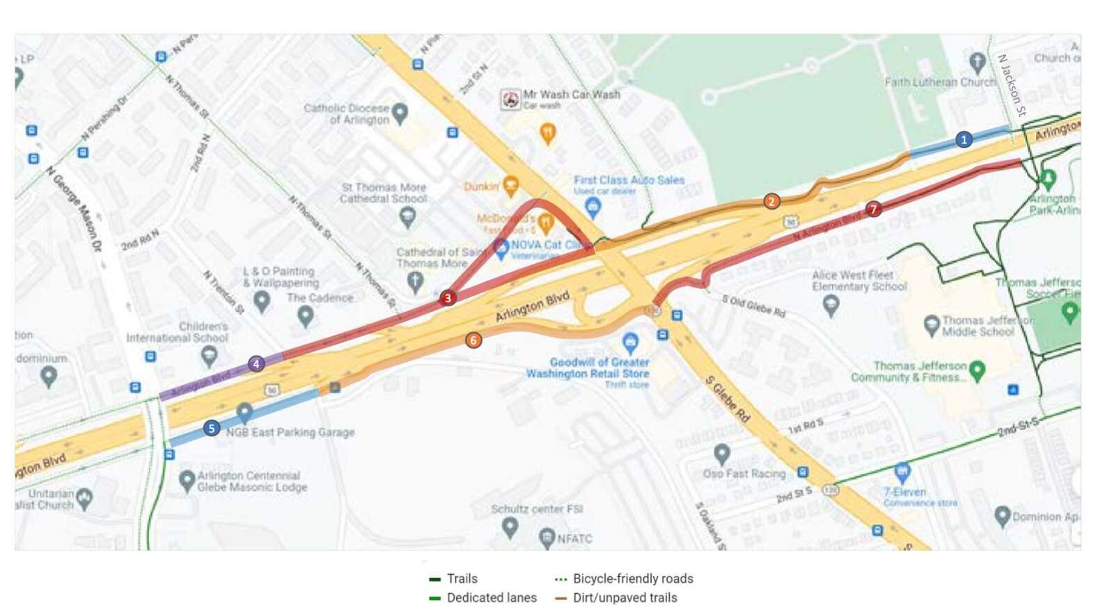
The community engagement portion of the Arlington Boulevard Trail Study, which looks to improve the trail between N. Jackson Street and N. George Mason Drive, started last week with an online kick-off meeting.

The study aims to “develop design concepts for improving existing sections of the trail” by increasing accessibility in compliance with federal law, widening the trail to at least 10 feet, removing barriers along the trail and providing direct path access where it is feasible, among other things, study manager Bridget Obikoya said.

“This is the time to talk about the things that you might like to see in the project corridor, not just changes to existing facilities, but also new connections,” county spokesperson Nate Graham said. “This is the wish list process.”

The public engagement form is open online through this coming Thursday, June 30, according to the study’s website. Respondents can leave their suggestions and comments on an interactive map of the trail being studied, Obikoya said.

There have been a total of 29 crashes along this portion of Arlington Blvd (Route 50) between 2018 and 2021, which makes it a part of the “High-Injury Network” in the county, according to a road safety audit.

“The High-Injury Networks are 7% of the 550 miles [of Arlington roadways], yet 78% of auto crashes happened on these networks,” she said.

Obikoya pointed out different problems — such as slow drainage, narrow trails and difficult crossings — along the 1.3 miles of trail, which was divided into seven segments in the study.

Other areas that could be improved include enhancing the crossings of highway ramps and building contra-flow facilities like bike lanes that allow cyclists to ride in the opposite direction of vehicle traffic on one-way service roads along the trail, according to the 2019 Master Transportation Plan — Bicycle Element.

There should also be more infrastructure to minimize conflicts between cyclists and pedestrians along the trail, while segments with serious traffic congestion should be widened or bypassed, according to the 2011 Master Transportation Plan’s Pedestrian Element.

Audience members at the meeting raised various questions after Obikoya’s presentation. One gave several suggestions, including the addition of sidewalks on the southern Arlington Blvd service road, while noting that cyclists are not able to see pedestrians when cycling on the on-ramp near the Goodwill on S. Glebe Road.

The County Board allocated $200,000 to the study in the board’s fiscal year 2022-24 Capital Improvement Plan.

A community design workshop is scheduled for the fall and the draft report for the study is set to be published at some point this winter, according to the presentation.


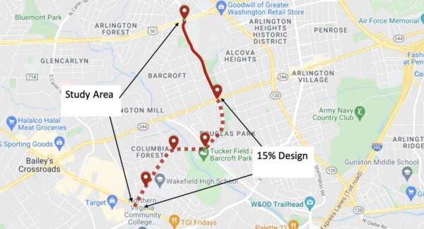
Arlington County will be studying a two-mile stretch of S. George Mason Drive, from Route 50 to the border with Fairfax County, to identify potential transportation improvements.

The study is happening now because the road is a solid candidate for grants that have applications due in the winter. But before they can apply, county staff need to examine current conditions and hear from locals about their biggest safety concerns, according to Leah Gerber, an county transportation planner.

She said one reason staff are optimistic about grant funding is because the upgrades would benefit residents of census tracts with high concentrations of ethnic minorities, or “equity emphasis areas,” according to the Metropolitan Washington Council of Governments.

Over the next two months, staff will analyze data such as transit ridership and traffic counts and develop concept plans for three segments of the road:

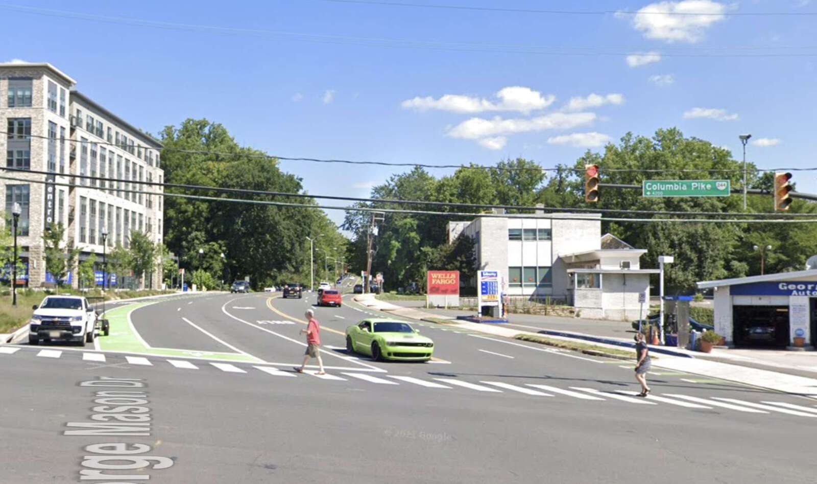
  • North Segment — Arlington Blvd to Columbia Pike
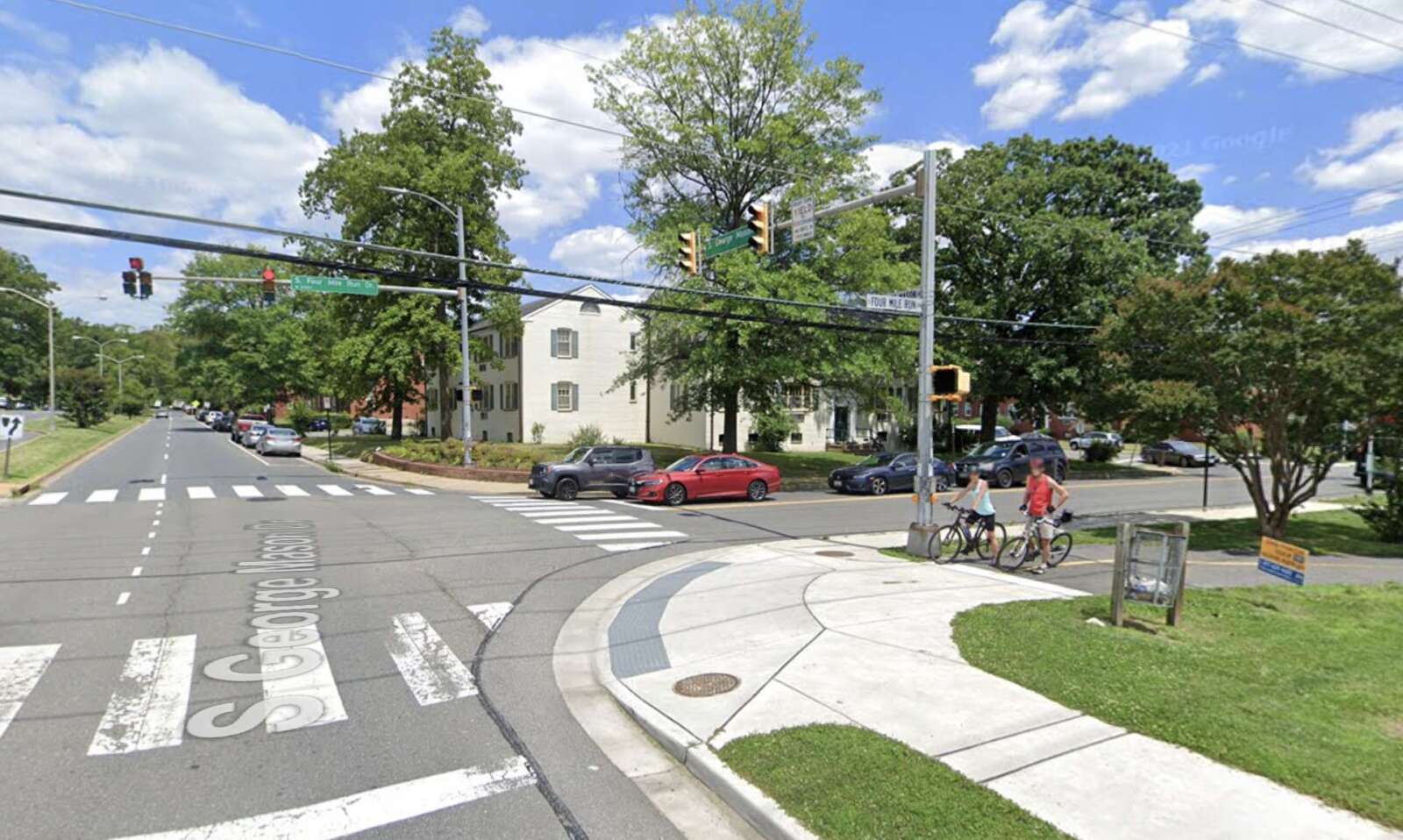
  • Middle Segment — Columbia Pike to S. Four Mile Run Drive
  • South Segment — S. Four Mile Run Drive to county line

Staff will also develop 15% designs for the Columbia Pike-county line segment.

“The southern portion we feel will really be eligible for grant funding,” said Valerie Mosley, the bureau chief of Transportation Planning and Capital Project Management for Arlingtons Department of Environmental Services.

The study is slated for commission and County Board review this fall, in time for applications to go out this winter.

“We’re working on a fairly truncated timetable for this study and we wanted to start by asking about your experience,” public engagement coordinator Nate Graham said during a community kick-off meeting last week. “That feedback from the community will help us, along with data analysis, plan a study and identify solutions that can resolve those issues.”

A survey, open through Sunday, May 1, asks respondents how safe they feel walking, scooting, driving and biking the road. People can signal their preferred upgrades from options such as protected bike lanes, sheltered bus stops, bus-only lanes and widened sidewalks. Using an interactive map, respondents can pinpoint specific locations they say need attention.

The segments of S. George Mason Drive being studied by the county (via Arlington County)

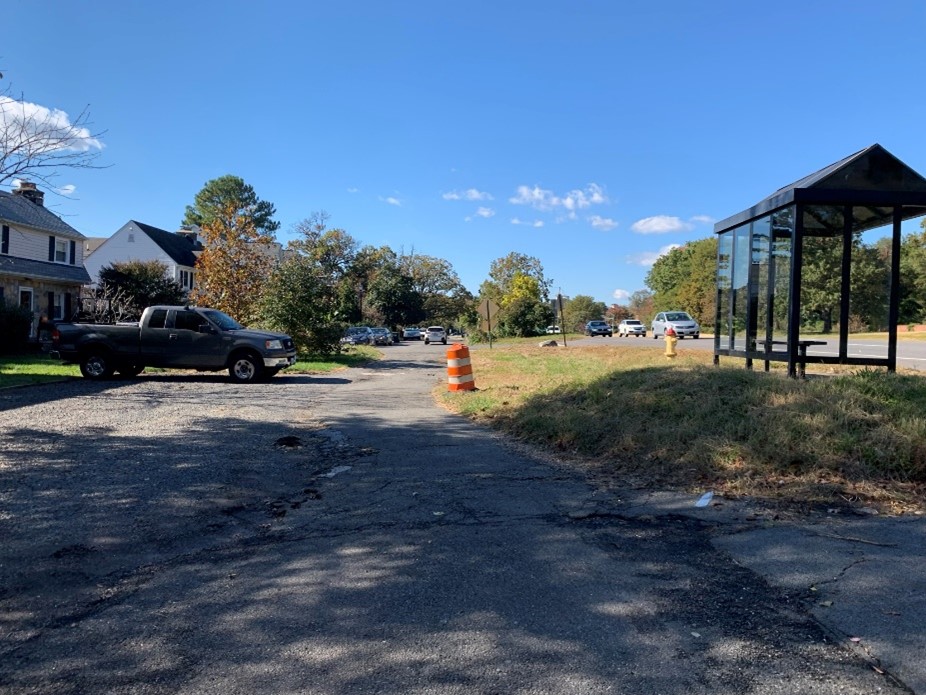
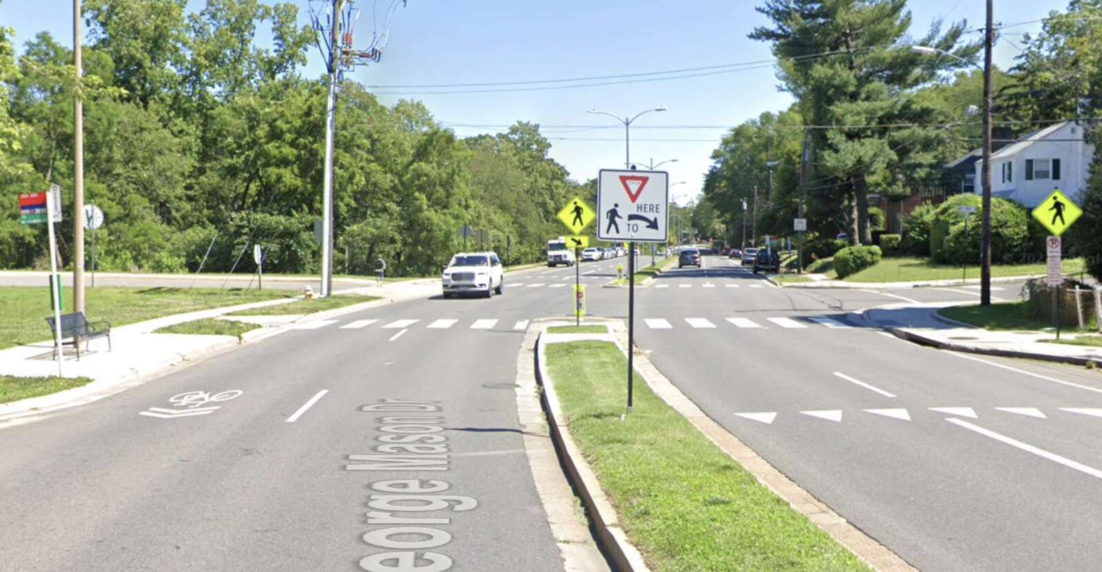
What staff members know so far is that some residents have long requested safer pedestrian crossings through improvements such as flashing beacons. One oft-cited intersection is with 6th Street S., near the National Foreign Affairs Training Center, where shrubbery and trees make it hard to see oncoming cars.

Some cyclists, meanwhile, have pointed out inconsistent bike infrastructure, with lanes that start and stop at random. Other residents say more parking enforcement is needed between Columbia Pike and S. Four Mile Run Drive, where large commercial trucks park despite being too wide for the parking spaces available.

(more…)


A longtime project to make pedestrian, cycling and transit upgrades to Army Navy Drive has taken the next step forward.

Arlington County has sent the project out for bidding by contractors, while staff continue to acquire the easements needed for construction.

“Project staff expect the easement process to be wrapped up by the time the construction contract appears before the County Board for approval — anticipated later this summer,” Dept. of Environmental Services spokesman Nate Graham said.

Construction could start this fall and be completed in the summer of 2025, according to the project webpage. Initially, the county had expected construction to begin in spring 2020 and be complete this spring, but extra tasks required to receive federal aid dragged out the planning process by a few years.

A coalition of local transit advocates celebrated the news, which has been seven years in the making.

Crashes are a frequent occurrence along Army Navy Drive. The $16.87 million project aims to reduce conflicts among cars, buses, bikes and pedestrians with narrower lanes — to slow down vehicle traffic — as well as bus-only lanes, protected left turns and signalized right turns, clearer sidewalks and shorter crosswalks.

The south side of Army Navy Drive will have a two-way bike lane protected by a line of trees. This will link to a future two-way bicycle lane planned for S. Clark Street, between 12th Street S. and 15th Street S. and the planned protected bike lanes on S. Eads Street, which will run past both phases of Amazon’s HQ2.

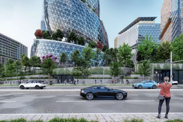
Bike lanes on Army Navy Drive are visible in this 2021 rendering of Amazon’s HQ2 Phase 2 campus (via NBBJ/Amazon)

“The project will rebuild Army Navy Drive within the existing right-of-way as a multimodal complete street featuring enhanced bicycle, transit, environmental and pedestrian facilities,” the county says. “The goal of the project is to improve the local connections between the Pentagon and the commercial, residential and retail services in Pentagon City and Crystal City.”

The new Army Navy Drive will be reduced to two through lanes in each direction, narrowing to one lane east of S. Eads Street.

The reduction will accommodate a bus lane between S. Joyce Street and S. Hayes Street so that buses will not block traffic while loading passengers. This dedicated transit lane will help extend an existing network of bus lanes from the City of Alexandria to Crystal City into Pentagon City.

Plans for Army Navy Drive (via Arlington County)

Additional improvements include replacing raised medians with planted ones and planting greenery to reduce stormwater runoff. Five intersections will get new traffic signal equipment.

The project’s early phases kicked off in the summer of 2015 with a traffic analysis evaluating how biking, walking, scooting and driving conditions would be impacted in 2020 and 2040 by the ongoing redevelopment of Pentagon City and Crystal City. That has since been expedited by the ongoing construction of HQ2.


Arlington County is applying for $15 million in federal funding to improve cycling and walking connections around Arlington National Cemetery.

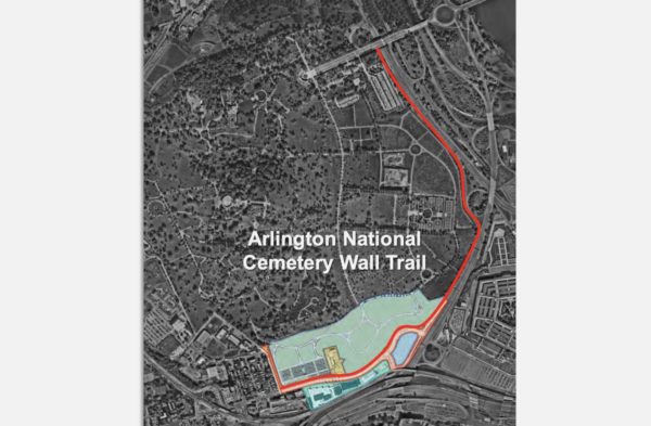
The money would partially fund the construction of a long-proposed Arlington National Cemetery (ANC) Wall Trail along Washington Blvd, which would connect Columbia Pike and the Pentagon City area with Memorial Avenue and the Arlington Memorial Bridge into D.C.

The Arlington County Board is scheduled to review the application on Saturday.

“The ANC Wall Trail will provide a missing link in the County and regional non-motorized network that will complete a bicycle and pedestrian connection between all three of the County’s major development corridors,” the county says in a report.

Right now, the cemetery is an “effective barrier to demand for non-motorized travel to and across Memorial Bridge,” according to the county, as security concerns after 9/11 led the Department of Defense to prohibit travel through the burial grounds.

The trail would run along the western side of Washington Blvd from Columbia Pike to Memorial Drive. Currently, there is a trail on the other side of Washington Blvd, a highway also known as State Route 27, but it gets dicey near Memorial Circle for pedestrians and cyclists looking to access the nearby Mt. Vernon Trail or cross into D.C.

Renderings of Arlington National Cemetery expansion and Columbia Pike reconfiguration project (via National Capital Planning Commission)

The Columbia Pike interchange with Washington Blvd is set to be modified as part of the ANC Defense Access Roads Project, which will also move Columbia Pike closer to I-395, realign S. Joyce Street, build a new S. Nash Street connector road, and remove part of Southgate Road.

This work, funded by the federal government and managed by the Federal Highway Administration, will facilitate the addition of 70 acres to the southern portion of the cemetery, making room for 60,000 burial sites and space for the 9/11 Pentagon Memorial Visitor Education Center.

Road work is underway, and early next year, road users can expect to be redirected from the Pike to side streets near Pentagon City. The new burial ground could open in late 2025.

New cycling and pedestrian facilities and grading for the connection to the future ANC Wall Trail are also included in the project. Part of its scope includes designing the trail, for which Arlington County agreed to pay $500,000.

The county expects final designs to be developed over the next year or so. The overall cost of the trail is estimated at $25 million.

Once the wall trail is built, cyclists and pedestrians will be able to connect to Pentagon City via S. Joyce Street at the southern end of the ANC Wall Trail. It will allow safer bike and pedestrian travel between Pentagon City and Columbia Pike to D.C. and the Rosslyn-Ballston corridor.

North of Memorial Avenue, cyclists and pedestrians would be able to link up to the existing trail alongside Route 110, which provides a connection to the Iwo Jima Memorial, to Rosslyn, and to the larger network of bicycle and pedestrian trails along the R-B corridor, the county says.

The $15 million, if awarded, would come from the U.S. Department of Transportation’s “Rebuilding American Infrastructure with Sustainability and Equity” (RAISE) program, which has $1.5 billion earmarked to reimburse localities for surface transportation projects.

The Transportation Department caps awards at $25 million, and one state can receive no more than $225 million. Awards must be split evenly between urban and rural areas.

There is a “low likelihood of a funding award compared with other external transportation capital funding programs,” the county report notes.

Arlington applied last year and was denied funding — along with every other application from Virginia, according to the report. Staff will be meeting with federal transportation staff to understand why and plan to use that information for the new application.


Arlington: a highly educated and affluent riverfront county looking over D.C. Some say it has a kindred spirit in Hoboken, New Jersey, described as a “vibrant, walkable” city with waterfront views of New York City.

What makes Hoboken walkable seems to also make it safe for pedestrians. For the last four years, the city has not logged a single pedestrian death.

The trend drew the praise of U.S. Transportation Secretary Pete Buttigieg, whose department released a national plan in January to reduce and eventually eliminate thousands of road deaths.

Arlington, like Hoboken, has adopted a Vision Zero plan to eliminate traffic-related serious injuries and deaths by 2030. The county saw seven deaths between 2018 and 2020, and — depending on the exact location on the D.C./Arlington dividing line — one death in 2021. So what can Arlington and its 26 square miles (population ~237k) learn from the “mile-square city” (population ~53k)?

Arlington crash data from 2013 through November 2021. Crashes involving vehicles are left and crashes involving pedestrians are right (via Arlington County)

Hoboken transportation planner Gregory Francese credits the city’s success to Mayor Ravi Bhalla’s top-down, interdepartmental approach that involves residents. He says Hoboken regularly tackles challenging roads with temporary fixes that are made permanent later.

But the city wasn’t always pedestrian-friendly, he said. Cars could park up to crosswalks, which were faded, and intersections were in poor condition.

Those conditions began to change through repavement projects under the last mayor, and the work accelerated under Mayor Ravinder Bhalla when he established a Vision Zero task force, made of department leaders and residents.

“A big part of Vision Zero is removing the silos between transportation, enforcement [and other departments],” Francese said. “It takes someone who can remove those silos to unite people around Vision Zero.”

Planners test out quick, cheap and temporary solutions to find creative solutions to Hoboken’s main challenge: fitting safety improvements on narrow roads while balancing driving and parking needs. He said this approach translates well to bigger cities.

Like Hoboken, Arlington’s Vision Zero initiative has improved county government-wide cooperation, project manager Christine Baker said.

“The Vision Zero program has truly allowed County staff to place a spotlight on safety for all transportation-related projects and programs,” said Baker. “Our staff are coordinating interdepartmentally in a way that we have not in the past, which has streamlined the ability to get safety improvements on the ground.”

County staff map crash locations and respond with quick-build or capital improvement projects and pilot programs. The Arlington County Board, meanwhile, is setting policy. It has voted to further limit speeds and install speed cameras around schools and road construction areas, as a change in state law recently allowed.

Local transit and safety advocates say the county is on the right track but can still take notes from Hoboken.

Bicycling enthusiast Gillian Burgess picked up on Bhalla’s top-down approach. She also said Hoboken has more concrete actions and deadlines that are easier for the public to find and read, and the city’s emphasis on encouraging drivers to be more careful is front and center.

“When you have good leadership and concrete plans, you get something done,” she said. “We need the County Manager and the County Manager’s office and leadership at the Department of Environmental Services to take more ownership.”

(more…)


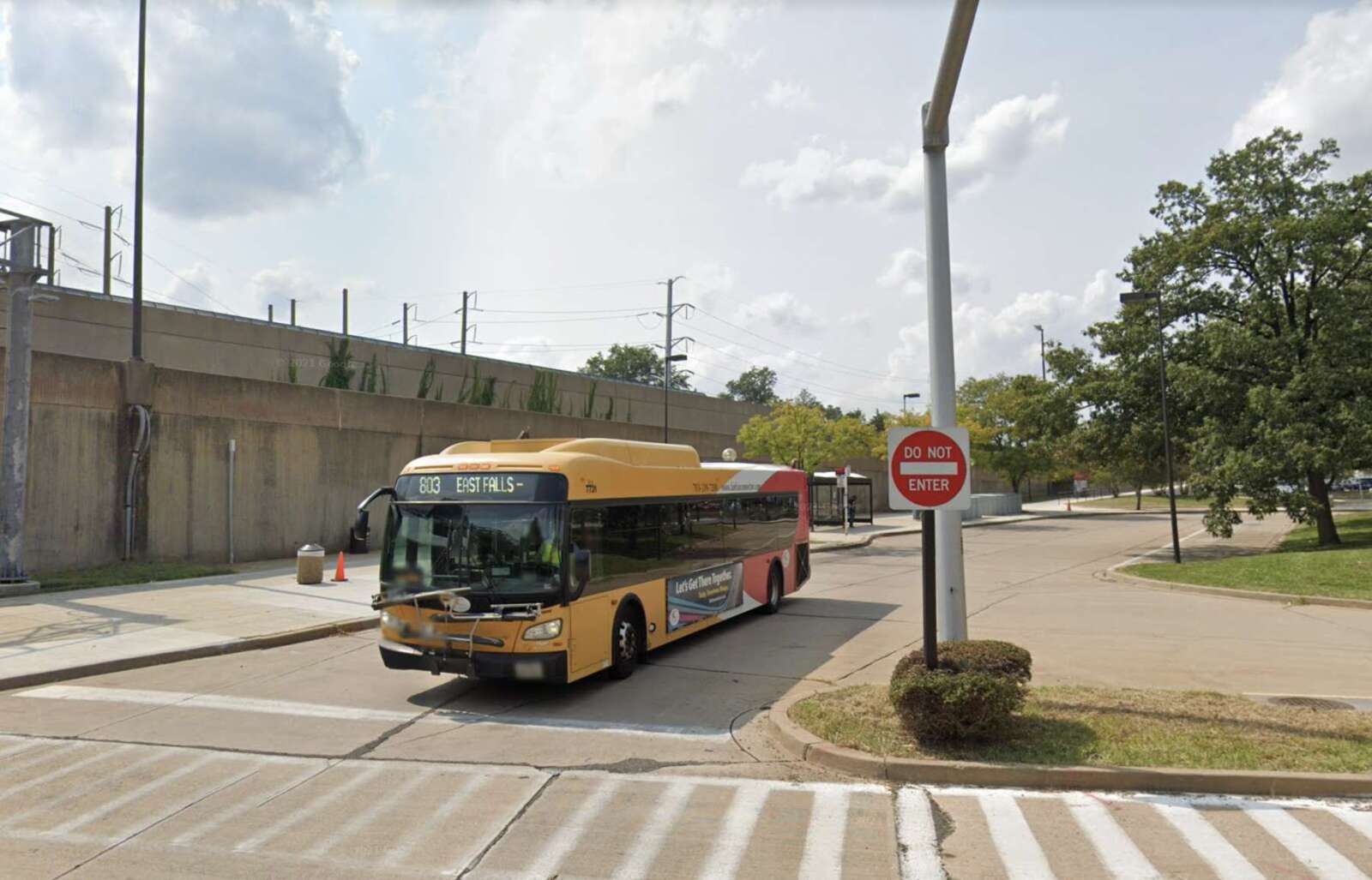
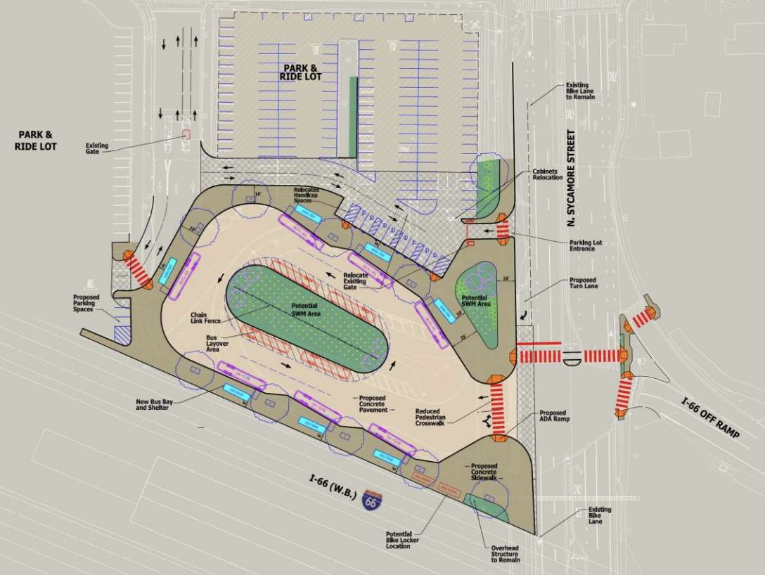
Arlington County is requesting feedback on partial designs for expanded bus bays and pedestrian safety improvements at the East Falls Church Metro station.

The $6.6 million bus bay expansion project, a capital improvement project approved last year, is part of a handful of near-term upgrades planned at and around the Metro station, the parking lot of which was frequently packed pre-pandemic.

Project and regional transit representatives say the expansion will allow for more regional bus routes without causing traffic jams while making walking from the park-and-ride lot safer. The existing bays currently serve nine Metrobus, Arlington Transit (ART) and Fairfax Connector bus routes.

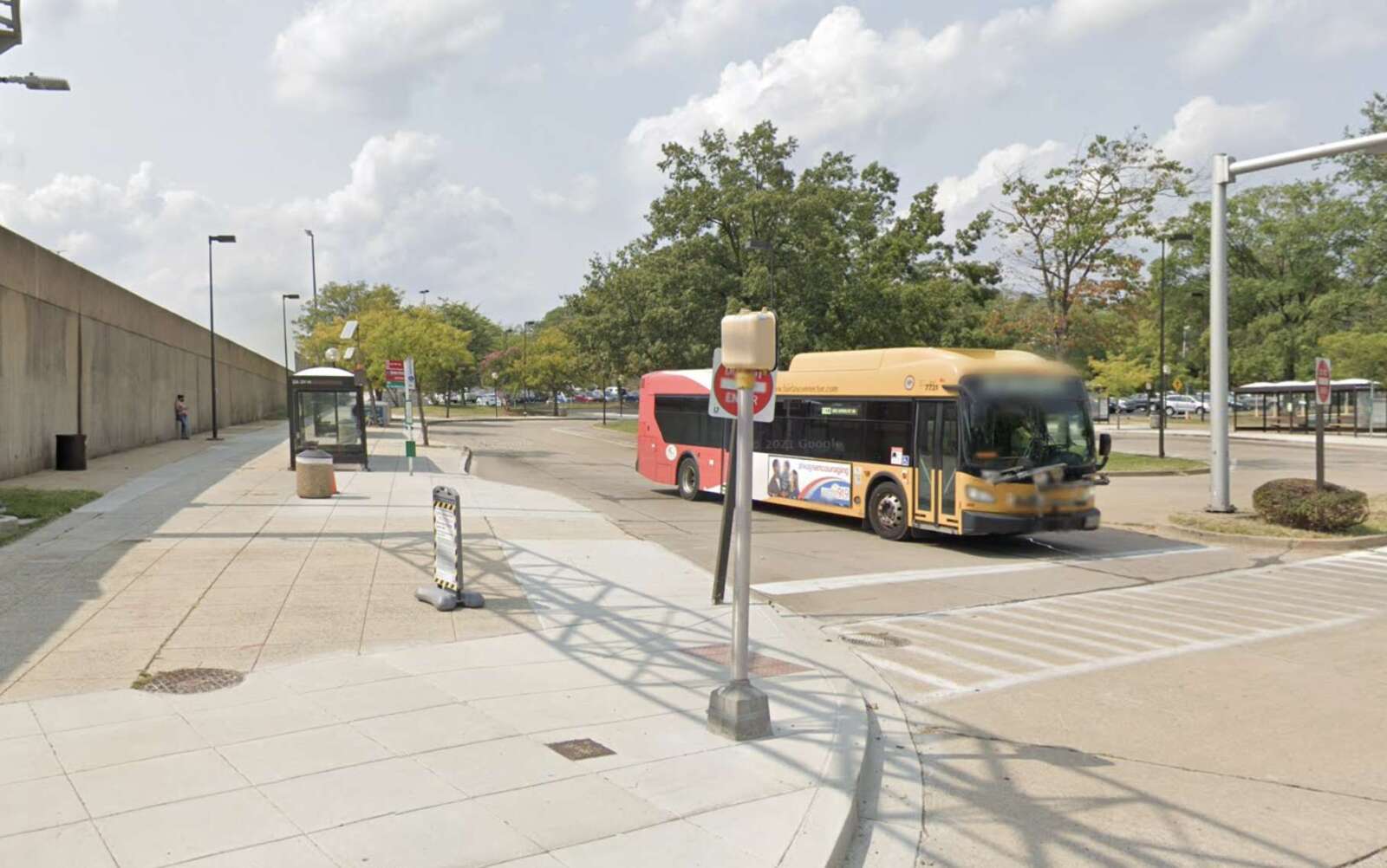
“The East Falls Church Metrorail station currently has four bus bays that are at maximum capacity,” according to the county. “The project will expand bus bay capacity by adding up to three new bus bays and replacing the existing shelters in the off-street bus loop at the East Falls Church Metrorail station.”

Arlington is leading and sponsoring the project, but Washington Metropolitan Area Transit Authority (WMATA) owns the Metro station, the bus loop and park-and-ride lot.

The county asks locals to say whether the proposed changes will make them feel safer walking, taking the bus, biking, scooting and driving. The survey, open through Sunday, March 20, includes an interactive map people can use to give location-specific feedback.


“What this expansion will allow us to do is get buses in and out of the bus loop more efficiently so we don’t have as much gridlock as we currently do at this time,” WMATA planner André Stafford said in a meeting Tuesday.

It may be awhile before more bus routes are added, county transit planner Paul Mounier said in the same meeting.

The county will install seven new bus shelters and is considering adding a new signal and crosswalk at the Washington Blvd entrance to the park-and-ride lot.

Arlington County staff identified this expansion project back in 2011. Four years later, staff found the biggest needs were increasing the capacity of the bus bays, adding refuges to the 150-foot crosswalk that passes in front of the bus loop, replacing the aging, hazardous cement and adding ramps accessible to people with disabilities.

After the expansion work, Arlington will make streetscape and signal upgrades to N. Sycamore Street, Arlington County project manager Kenex Sevilla said Tuesday. The street forms the eastern edge of the Metro parking lot and bus bays.

Meanwhile, both Arlington and the City of Falls Church are expanding Capital Bikeshare stations nearby. The station was once a popular station to ride to that is still recovering from the pandemic-era hit to commuting. A new $2 million, 92-spot bike facility to accommodate cyclists made its debut in August 2020.

This area is poised to see other development in the future, too. WMATA is studying the site for future transit developments while the Department of Community, Planning and Housing Development is studying it as part of the Plan Langston Blvd initiative. A second entrance to the station was put on hold in 2018.


Arlington County is applying for a $4.5 million grant to further offset a proposed west entrance to the Ballston Metro station.

On Saturday, the County Board is set to approve this request for funding from the Northern Virginia Transportation Commission (NVTC), which would come from I-66 toll revenues.

This is the latest application from the county, which is trying to offset the $140 million project with regional and state dollars even as some of these sources have dried up due to the pandemic.

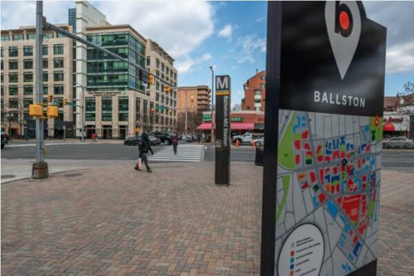
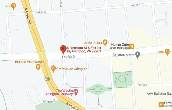
The entrance would be located at N. Fairfax Drive and N. Vermont Street, almost a quarter of a mile west of the existing entrance. The county previously said this second entrance would greatly expand access to the station, increase Metro’s capacity and make it more efficient.

Map showing potential location of new Ballston Metro entrance (via Google Maps)

If all the funding comes through, designs could be completed next year and construction could start in 2024 and end in 2027, Department of Environmental Services spokeswoman Claudia Pors tells ARLnow.

“The team is looking to finish the 35% design update this year and procure design-build services in 2023, pending funding from NVTA,” Pors said. “Construction is projected to start in 2024 and we anticipate a construction period of 3 years.”

The $4.5 million represents a revised request to the NVTC. Arlington had previously applied for $10 million from the same program in January 2020 but — despite being “the top scoring project” — the project was cut from the funding round due to a drop in toll revenue caused by COVID-19.

“Following a request from NVTC staff, the County withdrew its application for the Ballston-MU West Entrance in August 2020,” the report said. “I-66 Commuter Choice Program revenues have still not fully recovered from the effects of the pandemic, and so for Round Five the County has lowered its funding request from $10 million to $4,500,000.”

And while available funding is scarce, the cost to build the second entrance is increasing. A 2019 estimate put the project at $130 million; a 2021 estimate puts the project at $140 million.

“The use of the known information on items such as station entrance layout and elevator location from the design updates instead of previous assumptions in the 2019 cost estimate, along with the impact of inflation, are the two drivers of the cost increase,” the report said.

More than half of the project’s costs could come from a pending application with the Northern Virginia Transportation Authority (NVTA) for $80 million. The county says this sum would cover the rising costs as well as the loss of funding from NVTC and the Virginia Department of Rail and Public Transportation, which also lost revenue for new projects during the pandemic.

Pors said the NVTA will make a funding decision later this spring or in the early summer months.

Meanwhile, Arlington County intends to increase how much it’s budgeting for the project, from $25 million to $30 million.

Arlington’s Transportation Commission — while supportive of the project — is sounding the alarm on the $5 million increase at the local level.

“The Commission is concerned specifically about: 1) The appropriateness of making a change this large in how capital funding is being allocated completely outside of the CIP process and seemingly hidden within grant applications,” chairman Chris Slatt said in a letter to the County Board. “2) The high overall cost of the project and whether it still represents a good ‘bang for our buck’ in increasing access to transit for Arlington residents.”

He said $30 million could be used locally to bring every bus stop in Arlington into full compliance with the Americans with Disabilities Act, increase Capital Bikeshare’s 10-year capital budget or cover the costs to design and build more local projects intended to lower traffic congestion and improve public transit.

Map via Google Maps


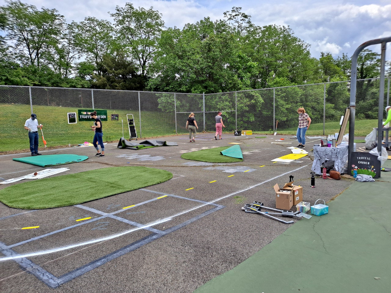
Arlington County is receiving $35,000 of assistance to design more “traffic gardens” to help kids learn about traffic safety.

Earlier this week, the National Capital Region Transportation Planning Board (TPB) awarded $250,000 of consulting services to five D.C.-area projects with the intention of improving “safety on the region’s roadways, especially for its underserved communities.”

One of those is a joint project from Arlington County and Prince George’s County to build traffic gardens at schools.

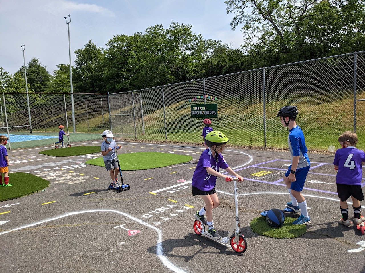
“Traffic gardens are miniature transportation networks with familiar roadway elements, in which children can walk, bike, and scoot to learn the rules of the road and practice their transportation safety skills,” principal planner Christine Baker for Arlington’s Department of Environmental Services writes to ARLnow.

The hope is that this project and the consulting services being granted will help develop universal guidance and templates so that schools can build its own gardens on “any budget” using a number of different materials and equipment.

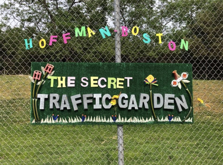
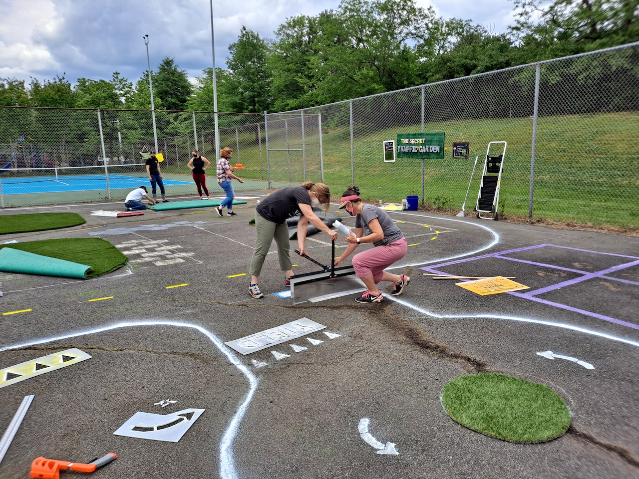
Arlington has had two recent examples of temporary school-based traffic gardens, one at Key Elementary School in the Bluemont neighborhood and the other at Hoffman-Boston Elementary School in Arlington View. Those schools used common, everyday materials — like spray bottles, measuring sticks, string, and chalk — to construct the roadway.

“We expect that schools will use the guidance to evaluate the traffic garden design possibilities for their own site,” says Baker. “Most schools take advantage of under-used hard surfaces outdoors, like blacktops, courts or other asphalt to create more permanent projects, while those with less capacity can retrofit gymnasiums with tape to create pop-up traffic gardens.”

Baker also notes that young students can take the lessons learned on these mini, safer roads and bring them back to their neighborhood.

“Traffic gardens not only help to educate children on the transportation system now but instill safety habits and transportation values that last a lifetime,” Baker says.

The TPB, which operates under the Metropolitan Washington Council of Governments (MWCOG), will in the coming months be hiring a consultant in the  that will be providing working with both counties on the project. It’s unclear at this point when the Arlington schools will have traffic gardens installed.

The initiative fits in with the county’s Vision Zero initiative, a plan to eliminate transportation-related deaths and serious injuries on county streets and trails within the next decade. This includes the recent implementation of “slow zones” near schools.

“Our Vision Zero transportation safety program is not just about engineering safety improvements on our roadways. There is a big emphasis on community engagement and education around safety,” says Baker. “Traffic gardens are an amazing way to educate our community members from a young age to embrace safe transportation practices.”

TPB approved four other projects for funding in nearby jurisdictions, all related to road safety and pedestrian improvements, including in the City of Alexandria, Fairfax County, Prince William County, and the City of Falls Church.


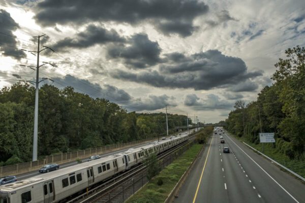
A Metro train heads east as traffic heads west along I-66 (staff photo by Jay Westcott)

Arlington County continues to be one of the top localities regionally and nationwide for residents using public transit to commute to and from work, recent census data shows.

Earlier this year, a trove of U.S. census data was released. While much of it remains in need of analyzing, some enterprising researchers are pulling from 2020 data sets to drill down on very specific questions, like which counties have the highest percentage of workers using public transportation to commute.

Arlington is No. 10 among U.S. counties, with 27% of residents using public transportation for work commuting, according to one researcher’s parsing of the data.

A county official said the data does line up with the county’s own findings.

“The numbers, overall, don’t surprise me because Arlington has been focused for a really long time on building a community that maximizes travel options and has really rebuilt itself around rail and more recently, focused on bus,” says Arlington’s Transportation Bureau Chief Dennis Leach.

However, he notes that 2020 data should be “approached with a lot of caution” due to COVID’s impact on public transit use and the challenging task of collecting data through the pandemic year.

In 2010, according to Census data, an estimated 28.5% of Arlingtonians used public transportation to commute to and from work. By 2019, that number ticked up slightly to 29.7%.

While preliminary 2020 data shows a nearly 3% decrease in public transit use by Arlington workers, Leach notes that it’s really hard to make an apples to apples comparison to previous years due to remote work, a shift in commuter patterns, and the lack of travel in general — all of which are related to the pandemic.

“I don’t think we’re actually to see really good [transit] data… until sometime in 2022 or even maybe as far out as a full year later, in 2023,” Leach says.

What is clear, according to Leach, is that Arlington is much less auto-dependent than other local jurisdictions.

While D.C. remains number one locally in terms of use of public transit, with more than a third of residents using it to commute, Arlington is number two, well above nearby localities like Alexandria, Fairfax County, and Montgomery County, Md.

Dr. Delario Lindsey, a professor at Arlington’s Marymount University who is studying urban development and equality, agrees that there’s been a considerable effort to make public transportation more accessible in Arlington in recent years. He says the county is currently doing a “decent job” in developing and building infrastructure that’s more accommodating to non-car-related travel, driven by the desires of a younger generation.

“There’s been an identifiable generational shift by millennials and post-millennials to not to be as car-dependent,” Lindsey says. “[They] want to live in communities that tend to be more accessible to public transportation, or be walkable, or bike-friendly.”

In Arlington, this is reflected in the immense growth of the Rosslyn-Ballston corridor over the last decade, which has a number of rail and bus transit options.

While Lindsey notes as well that 2020 and 2021 statistics won’t be able to tell a complete picture, he fully expects that the number of Arlingtonians using public transportation to commute to and from work will only grow over the next several years.

“I’d bet on that trend to keep going up,” he says.


Blue Jay in the fall (Flickr pool photo by Michael Coffman)

Route 1 Project Now Mostly Funded — “Virginia is making a huge financial commitment to the transformation of U.S. Route 1 as it runs through Crystal City, fulfilling a key promise officials made to Amazon.com Inc. to lure the tech giant to Arlington. The Commonwealth Transportation Board, a panel that manages state transportation funding and policy, voted unanimously Wednesday to allocate $134.4 million to fund the highway’s overhaul through 2028. The project, designed to bring at least some portion of the newly renamed Richmond Highway down to grade and make it more friendly to pedestrians, has a total estimated price tag of roughly $180 million.” [Washington Business Journal]

FAA Says Proposed HQ2 ‘Helix’ Is Okay — “The Federal Aviation Administration has no issue with the height of Amazon.com Inc.’s proposed Helix, the towering conical structure that will be a major part of HQ2’s PenPlace phase, closing the book on questions raised by the Metropolitan Washington Airports Authority.” [Washington Business Journal]

Arlington Says It’s Ready for Winter — “Despite predictions for another below-average snowfall this winter, the County can’t stray from a solid-if-not-frozen annual strategy: Prepare for whatever nature may drop. Commuters can take comfort knowing a big County response of almost 50 trucks – plus additional contractors – can roll in case forecasters are wrong at any point in coming months.” [Arlington County]

Ceremony for Re-elected County Board Member — “The public is invited to join the Arlington County Board at the swearing-in of County Board Member Takis P. Karantonis on Tuesday, Dec. 14, 2021. The ceremony will begin at 4:30 p.m. and will be followed by a brief reception outside the Board Room, Room 307 in the Ellen M. Bozman Government Center.” [Arlington County]

New Term for Electoral Board Member — “The three-member Arlington Electoral Board will have continuity for the coming year, with Republican Scott McGeary on Dec. 6 reappointed to a three-year term. Arlington Circuit Court Chief Judge William Newman Jr. signed the order of appointment, which was not a surprise – even though the Arlington County Republican Committee was expected to submit three names for the court’s consideration, McGeary (who has served on the body, on and off, for nearly 30 years) was anticipated to receive the nod.” [Sun Gazette]

New ‘Wish Catalog’ for Local Nonprofits — “Looking for a way to add more charitable giving to the season of giving while supporting your neighbors in need? For the second year in a row, Arlington Community Foundation is excited to host the Nonprofit Wish Catalog featuring grant ideas of 26 local nonprofits with wishes of up to $5,000 each.” [Arlington Community Foundation]

It’s Thursday — After a few snow flurries yesterday, today will also be cold, with increasing clouds and a high near 44. Sunrise at 7:15 a.m. and sunset at 4:46 p.m. Tomorrow there is a slight chance of showers after 1 p.m., otherwise Friday will be partly sunny, with a high near 54. [Weather.gov]

Flickr pool photo by Michael Coffman


View More Stories