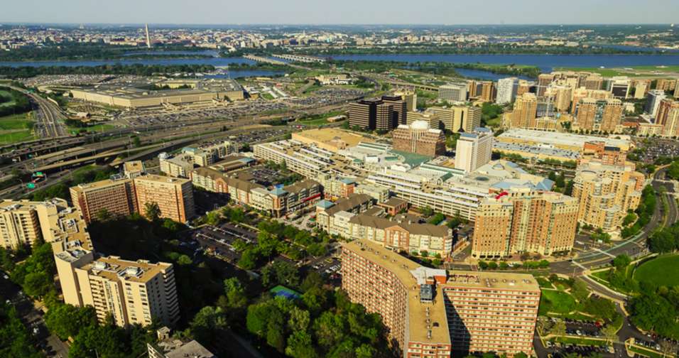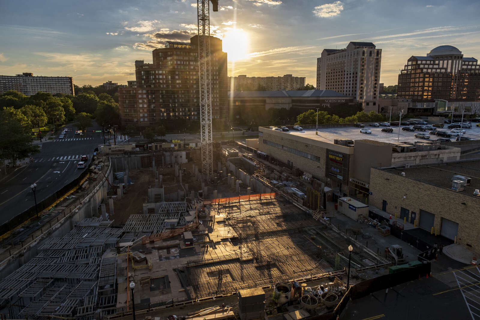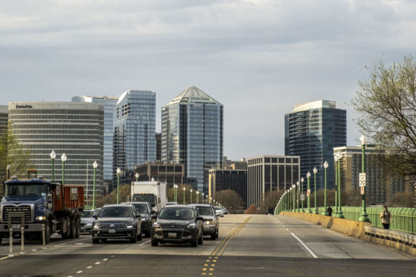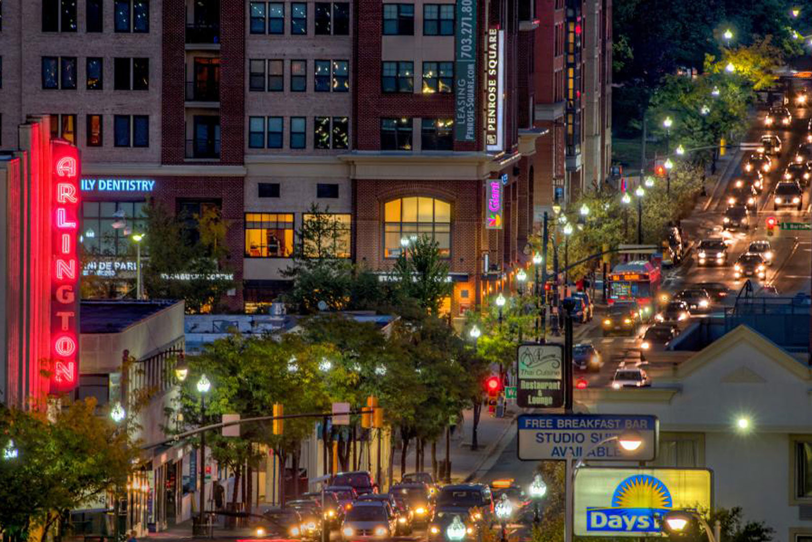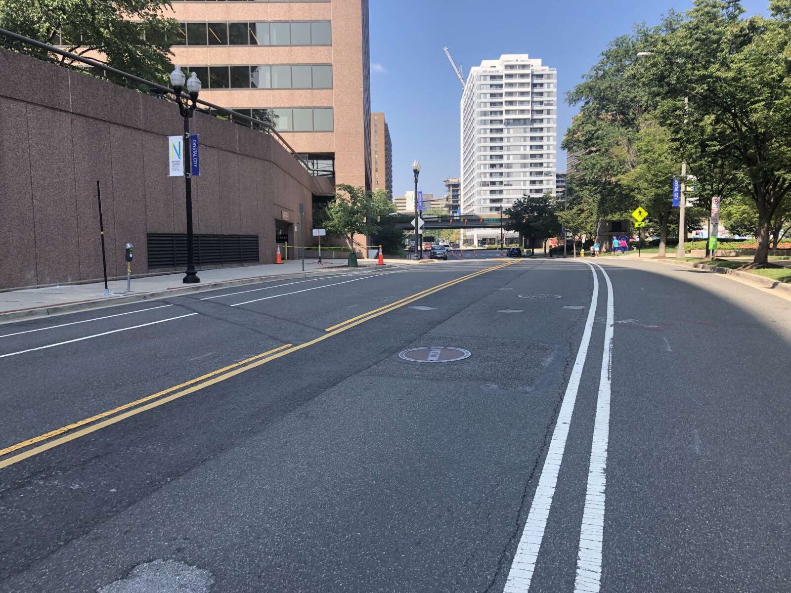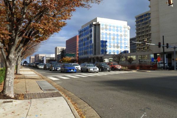
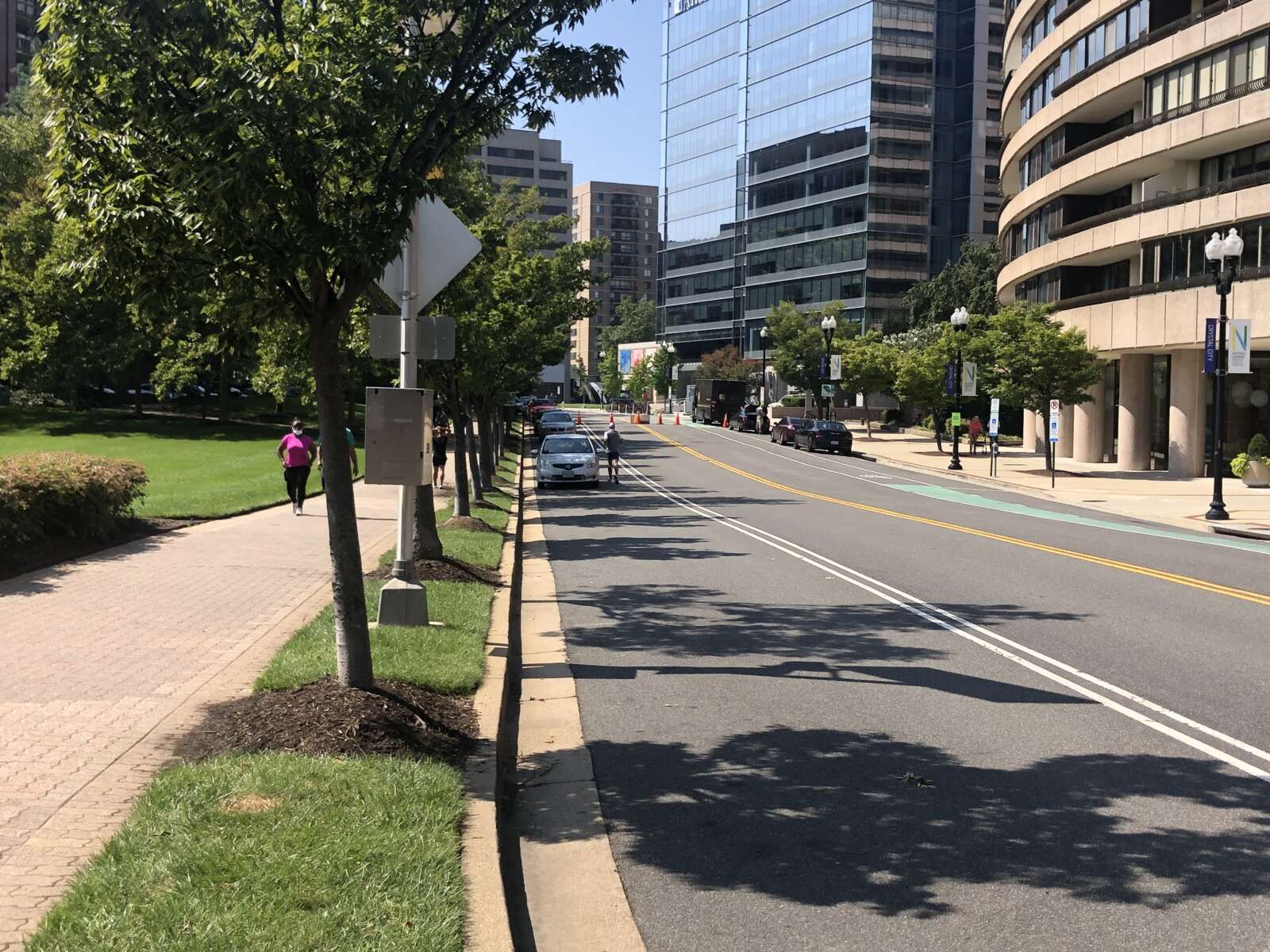
Current view of Route 1 (via National Landing BID)

The state’s idea to lower elevated segments of Route 1 through Crystal City could cause more injuries to pedestrians and chronic congestion, according to a new report.

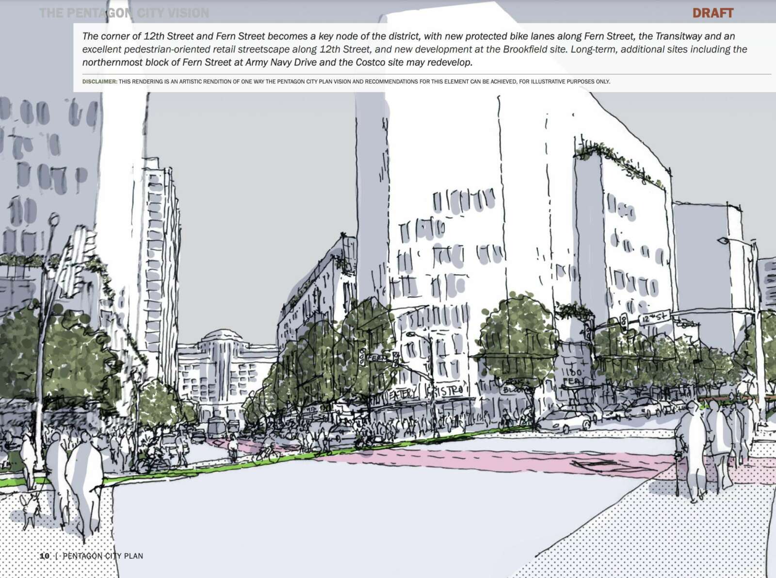
This summer, the Virginia Department of Transportation officially decided to turn Route 1, which is elevated over 12th, 15th and 18th Streets S., into an at-grade urban boulevard. It would feature wide buffered sidewalks on both sides, six to seven narrowed travel lanes, a 30-mph speed limit, wide crosswalks, landscaping and medians with pedestrian refuges.

The changes, which could cost $180 million, are aimed at making the corridor more pedestrian-friendly, but that may not actually be the case, according to the VDOT-commissioned report. Using Arlington County rush hour traffic forecasts, the report predicts pedestrian-involved crashes could increase.

Meanwhile, travel times could lengthen by up to 6 minutes for vehicles heading into Crystal City in the morning and heading out in the afternoon, due largely to delays for drivers turning left on Route 1 and several commuter bus stops getting rerouted.

Arlington County staff questioned how these negatives could square with VDOT’s preference for the concept, per a staff report. They suggested that the authors make the negative results of the traffic analysis clearer.

“An at-grade Route 1 has many operational challenges,” county staff said. “The short block lengths between parallel streets result in the need to coordinate signals and thus, the pedestrian delays will be increased on the minor parallel routes. The results point to negative impacts on the ability of transit to effectively serve the National Landing area. The at-grade scenario shown in the preferred alternative offers a more limited network connectivity while simultaneously introducing conflicts and sacrificing transit mobility.”

The report, prepared by engineering consulting firm Kimley-Horn, specifically recommends one at-grade option that allows all turns at 15th Street S., eliminates left turns at 18th Street S., and possibly includes a pedestrian underpass or overpass at 18th Street.

The state initially agreed to the study and changes to Route 1 as part of its 2018 agreement with Amazon to invest in transportation in the region.
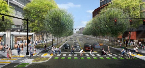
Rendering of potential changes to Route 1 (via National Landing BID)

Pedestrian safety 

As progress ramped up on the study, locals and organizations following the Route 1 project have kept pedestrian safety front and center.

When VDOT initially considered a nine-lane highway, advocates said that would be unsafe for pedestrians and the National Landing Business Improvement District (BID) created its own renderings for a tree-lined and pedestrian-friendly Route 1.

After VDOT revised its proposal and announced its intention to bring Route 1 at-grade, Livability 22202 — a coalition of three area civic associations — rejected the study for several reasons, chief among them that even the new six- to seven-lane highway would not, in their view, improve pedestrian safety.

Data in the report appears to bear that conclusion out. Over two decades, pedestrian traffic during peak afternoon hours could increase 2x to 5x current levels, and with that could come more crashes involving pedestrians.

(more…)


A busy street in the East Falls Church neighborhood is slated to get safer crossings for pedestrians and cyclists.

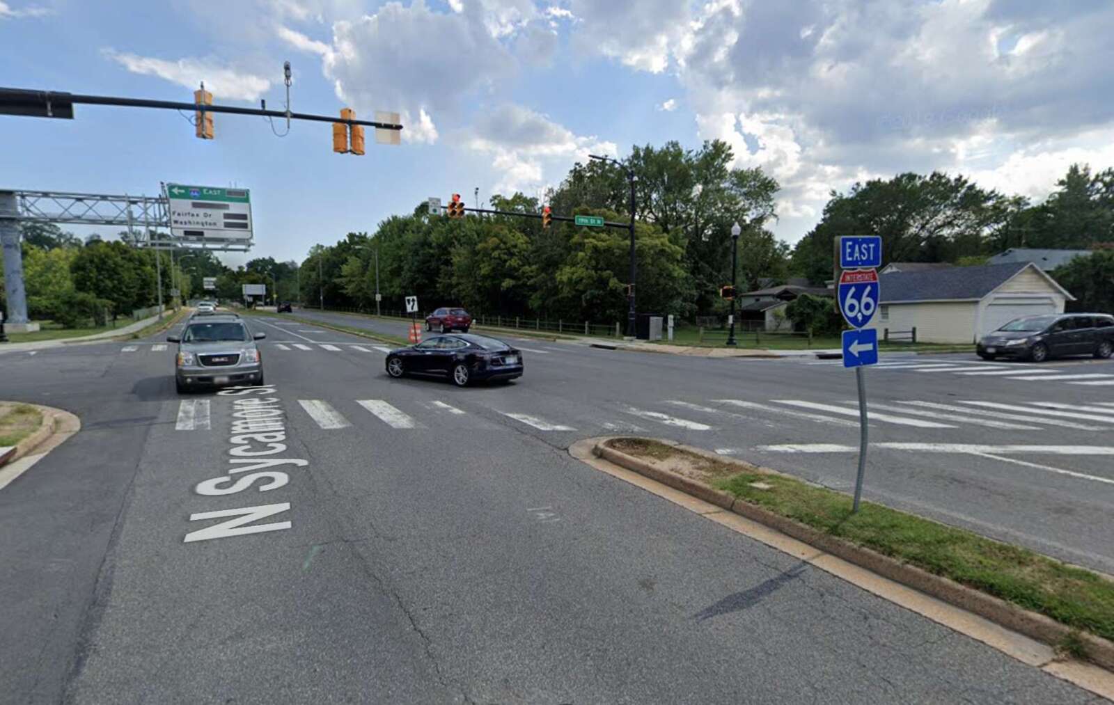
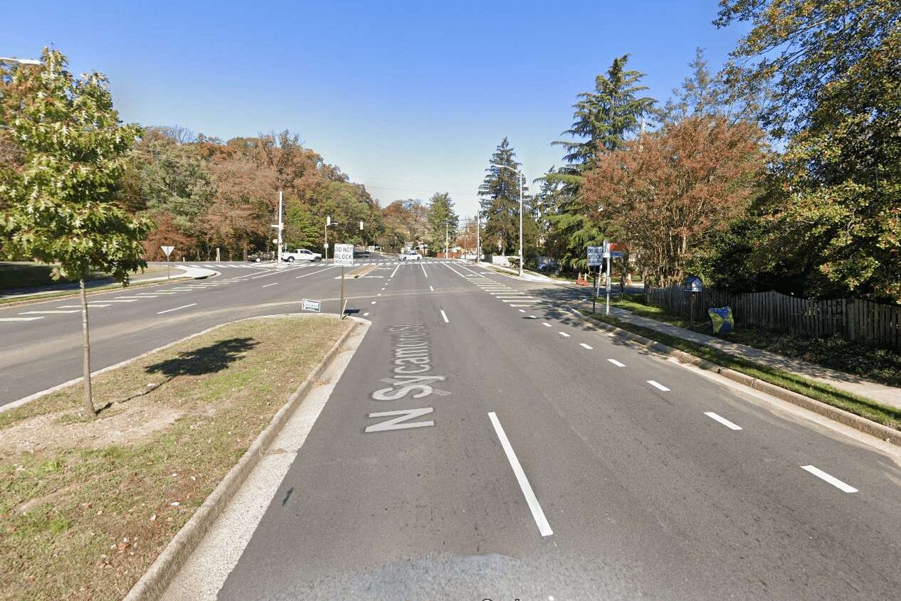
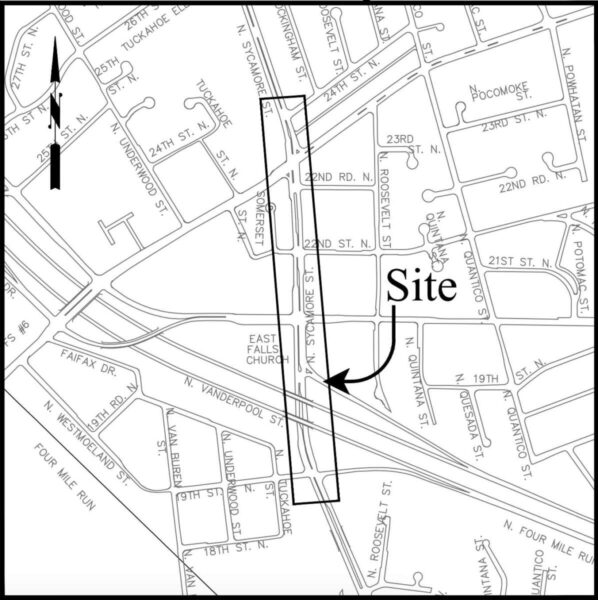
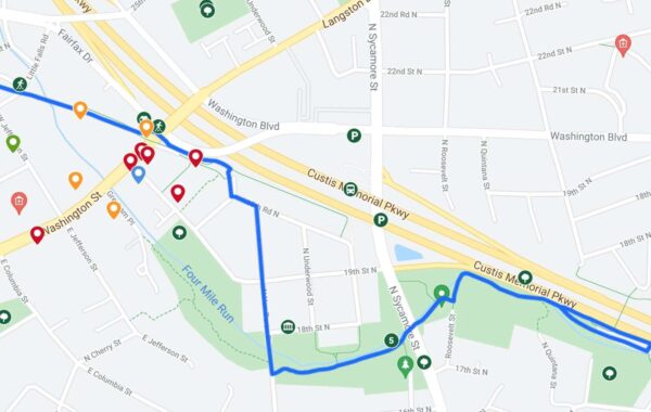
Arlington County has selected N. Sycamore Street between Langston Blvd and 19th Street N. — near the East Falls Church Metro station and not far from the W&OD Trail — as site of a new Complete Streets project. This segment “presents intersection crossing challenges for bicyclists and pedestrians,” according to the project webpage.

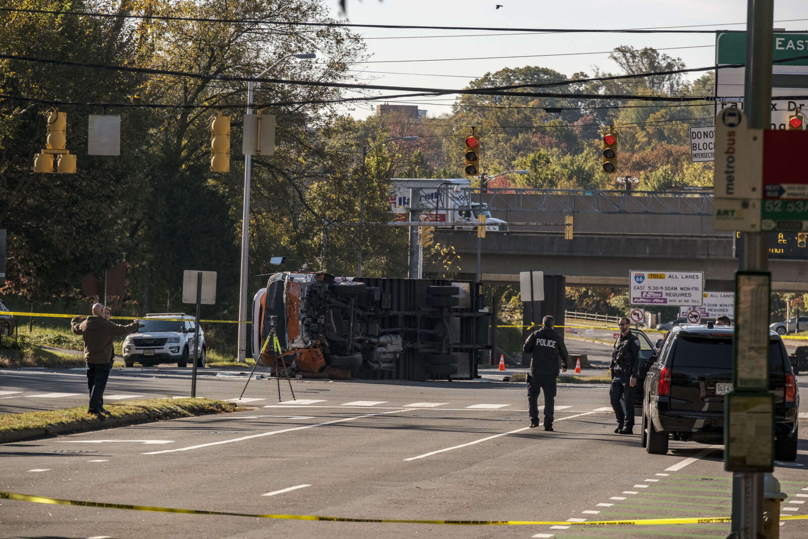
The intersection of N. Sycamore Street and Washington Blvd, within the project’s boundaries, was the site of a fatal crash last Wednesday. Prior to the crash, the street segment has seen one serious collision between 2013 and this summer: one with severe injuries in 2019, according to Arlington County crash data.

The webpage for the project went live two weeks ago, says Department of Environmental Services spokeswoman Kathryn O’Brien. County staff will soon solicit public feedback that will be used to develop a concept plan.

“Existing Conditions Feedback will kick off later in November,” O’Brien said. “This feedback, along with other data and planning guidance, will help staff formulate a concept design. Once staff have developed a community-informed concept, that concept will be shared for additional public feedback.”

The boundaries of the new N. Sycamore Street Complete Streets project (via Arlington County)

Funding for changes to N. Sycamore Street, first identified as having a need for safety upgrades in 2011, was included in the 2022-24 Capital Improvements Plan adopted this summer. It’s been a long road to get the project on the schedule, however.

Staff developed preliminary plans in 2015 and, in 2016, twice applied unsuccessfully for transportation grants for the 2018 fiscal year, O’Brien said.

In 2017, the county successfully applied for and received $250,000 in Virginia Department of Transportation revenue-sharing funds for the 2020 fiscal year. Then, the pandemic hit.

“This project was deferred as part of the FY 2021 CIP, due to revenue constraints because of COVID,” she said.

Since 2011, staff have studied the street twice and have some hypothetical designs on hand as a result.

In 2015, the county received a grant to study ways to improve pedestrian and cycling access to the East Falls Church Metro station, once a popular station to ride to that is still recovering from the pandemic-era hit to commuting. A new $2 million, 92-spot bike facility to accommodate cyclists made its debut in August 2020.

Four years later, the county received a grant to study a gap in the W&OD Trail, where trail users are routed through Benjamin Banneker Park and residential streets.

The gap in the W&OD Trail in East Falls Church (via NOVA Parks)

Improved crossings at 19th Street N. could be an interim solution to the gap, according to the project page.

Although this transportation project’s scope is bound by 19th Street N. and Langston Blvd, eventually, the county envisions improved bicycle amenities further up and down N. Sycamore Street.

“The 2019 adopted Bicycle Element of the Master Transportation Plan recommends N. Sycamore Street as an enhanced bicycle facility between Williamsburg Blvd and the East Falls Church line,” the project page says.

Arlington will be coordinating the project with planned stormwater improvements to Crossman Run as well as a project to add bus bays and improve bus circulation at the nearby Metro station.

The project is funded with a mix of Northern Virginia Transportation Authority, local and state funding, plus bond funds.

Hat tip to Stephen Repetski


Arlington County is applying for an $80 million grant to help pay for a proposed west entrance to the Ballston Metro station.

On Saturday, the County Board authorized the application to the Northern Virginia Transportation Authority (NVTA), which helped cover the cost to develop designs for the second Metro entrance in 2016.

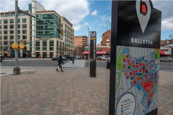
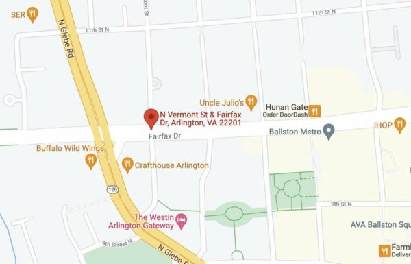
The entrance would be located at N. Fairfax Drive and N. Vermont Street, almost a quarter of a mile west of the existing entrance. A county report says the second entrance would greatly expand multimodal access to the station and provide greater capacity to, and efficiency for, Metro.

As part of the proposal, the county would build two street-level elevators and stairs connecting to an underground passageway, the report said. A new mezzanine with stairs and elevators would connect riders to the train platform.

Map showing potential location of new Ballston Metro entrance – via Google Maps

“This is an economic development application in addition to a transportation step,” Board Chair Matt de Ferranti said in the Saturday meeting. “This is a very important step as we continue to plan smart and build well for our community and future.”

The county unsuccessfully asked NVTA for $33.5 million for the project in 2019.

New cost estimates are firmer, and higher, than the 2019 proposal, according the report. The project is expected to cost $140 million, an increase of $10 million from 2019.

Rising costs can be attributed to inflation and having more detailed plans, the report said.

“The County’s funding plan for Ballston West Entrance has shifted since the onset of the COVID-19 pandemic and its associated impacts to local, regional, and state funding,” the county said.

In addition, the county is no longer relying on two additional funding sources that were both hit by the pandemic: Northern Virginia Transportation Commission’s (NVTC) I-66 Commuter Choice Program or the Virginia Department of Rail and Public Transportation.

NVTC grant funds are generated by toll revenues from I-66 inside the Beltway, which is down due to COVID-19, while the state rail department is focusing its resources on helping with transit maintenance and replacement projects.

“Therefore, a proportion of planned project funding for the Ballston West Entrance now unrealized from DRPT and NVTC is now being covered by the County’s application to the NVTA,” the county said.

The rising costs dismayed members of the Transportation Commission, according to a letter from Commission Chair Chris Slatt.

“While supportive of this project, multiple commissioners expressed great concern about the ballooning cost of these Metrorail second entrance projects and the large opportunity cost it presents,” Slatt said. “It is hard not to think about the other transportation projects that could be built for $140 million that would potentially move more people. That would build a lot of sidewalks, protected bike lanes or dedicated bus lanes.”

Arlington County plans to put the project into its next 10-year Capital Improvement Plan, which would begin in the 2022-23 fiscal year.

If approved, the grant and other regional transportation projects will be included in NVTA’s 2022-27 Six Year Program Update. The authority is slated to take action on that update, which will also have a schedule for each project, next July.

Map via Google Maps


With the construction of Amazon’s HQ2, a 45-year-old planning document guiding development in Pentagon City has reached the end of its useful life.

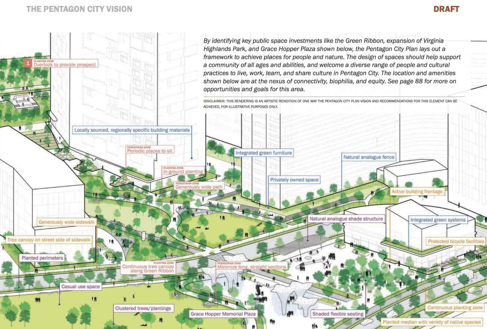
Now, Arlington County has to lay out a vision for the next 20 years of development. According to the most recent draft of the Pentagon City Planning Study, that will include a significant amount of redevelopment and infill development, with an emphasis on residential buildings. Two other priorities are increased green spaces and multimodal transportation upgrades.

The year-plus planning effort is set to wrap up later this fall, and currently, county planners are engaging with the community about their second draft plan.

Per the draft, Pentagon City could — if developers follow through — see about nine significant redevelopment projects over the next two decades.

“We have tried to continue to engage to get an understanding of what they’re thinking,” said Kathleen Onufer, of architecture firm Goody Clancy, which worked with the county on the plan. “The years are based on conversation with the property owners and their sense of interest.”

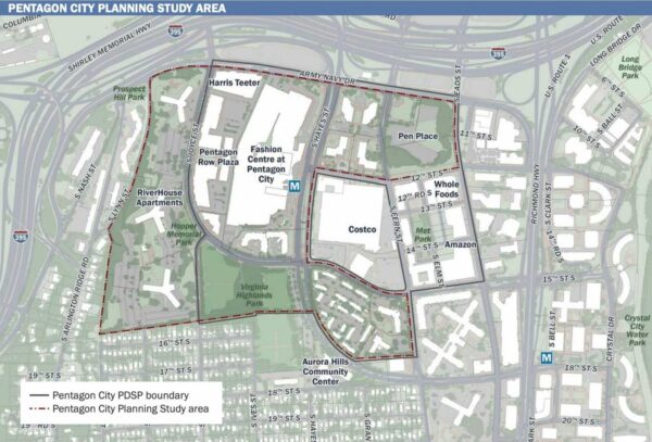
Pentagon City Planning Study Area (via Arlington County)

RiverHouse, one of the largest housing complexes in the D.C. area, is listed as having significant development potential. That’s why county planners included the apartments in the study, despite them being outside the document’s core planning area.

Adding more density to RiverHouse and its expanse of surface parking lots and green space — already a hot topic — prompted a strong reaction from attendees of an open house last night (Tuesday). A number of attendees expressed disapproval for the impact they believed it would have on property values, while a few were more supportive.

“There is plenty of room to build out mid- and high-rises west [on] Columbia Pike [and] south on Richmond Highway, Potomac Yard, and Arlandria,” former RiverHouse resident and attendee Tina Ghiladi said. “To think RiverHouse should absorb the majority of all this density is being expedient. We’re not being NIMBYs. We understand the need for additional housing, we just want height limits.”

After the meeting, Aurora Highlands Civic Association member Ben D’Avanzo told ARLnow he supports turning the tracts of parking spaces into additional housing.

“RiverHouse is a sensitive area, being both a transition to lower density neighbors and one of the somewhat affordable rental housing [options] available” in the area, he said. “Yet, as housing values and rents skyrocket, there are wide swaths of surface parking just blocks from the Metro that do not represent a livable version of our neighborhood. I think the Pentagon City final plan should, accounting for more detail needed on streetscape, open space, schools and other community needs, have a balance of new housing types at RiverHouse, with townhouses at the southern end and more density at the northern [end].”

Overall, the draft plan divides potential redevelopment opportunities into five phases, ranging between two and five years.

“Reality is not that convenient and neat, but it gives you a sense [of] what we can expect if these sites actually redevelop,” said the lead county planner on the project, Matt Mattauszek. “That’s not in our control, but at least organizing it this way gives people a sense of what’s more likely to redevelop sooner rather than later, and what that means for the addition of units and the impact on schools.”

The current and proposed mix of land-use in Pentagon City (via Arlington County)

The phases are as follows below.

(more…)


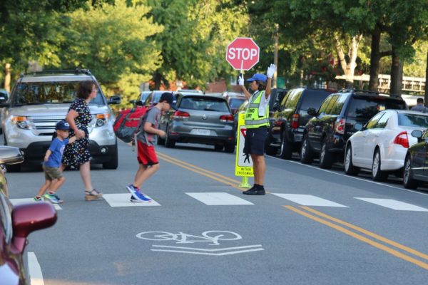
Abingdon Elementary School students cross the road on the first day of school (file photo)

(Updated at 9:35 p.m.) Arlington County is looking to lower speed limits near schools as part of its ambitious Vision Zero initiative to eliminate serious traffic-related injuries and deaths by 2030.

This Saturday, the County Board is set to decide whether to authorize a public hearing next month to discuss and potentially approve creating “slow zones” on residential streets near 13 schools.

The proposed 58 zones, with a speed limit of 20 mph, will be near 11 Arlington public schools and well as Bishop O’Connell High School and St. Thomas More Cathedral School.

“Attempts to reduce or eliminate fatal and critical crashes can be achieved by regulating unsafe speeds on our streets with measures such as signage and pavement markings,” a county report said. “Lowering the speed limit can be a basic and powerful tool for reducing vehicle speeds.”

Traditionally, Arlington has installed flashing beacons to encourage drivers to adhere to reduced speed limits near schools. The report said these signs are inconsistently installed and are costly to maintain, while “static signage” and pavement markings, reminding drivers the speed limit is always 20 mph, are cheaper and easier to install.

The signage and markings will be tested out at these 13 sites before they’re installed across Arlington.

“Slower speeds around schools is a no-brainer, and are beneficial for everyone,” Vision Zero program manager Christine Sherman Baker told the Transportation Commission earlier this month. “We want to prioritize safety in school zones because children are still learning how to travel safely: how to cross the street, how to ride a bike. They’re some of our most vulnerable users.”

And they’re learning these skills in risky areas: according to the report, 10 or more speeding-related crashes annually happen within 600 feet of a school in Arlington.

Some schools were chosen because they’re new or have existing infrastructure in need of upgrades, she said. Hoffman-Boston Elementary, Drew Elementary and Gunston Middle schools were chosen because they’re near high-injury networks — and including them would help meet Vision Zero’s equity component.

This fall, Arlington County Police Department has been collecting speeding data that will be compared with new data collected next spring to see if these zones are effective, she said.

The community can provide feedback in March and April of next year, ahead of the county-wide roll out, she added.

The proposal was met with enthusiasm from Transportation Commission members and some members of the public.

“Bravo,” Transportation Commission Chair Chris Slatt said. “I think it’s fantastic.”

Representing local advocacy group Arlington Families for Safe Streets, Gillian Burgess voiced her support for the program during the meeting.

“Slower speeds around schools are not only great for the safety of vulnerable road users, but it also encourages activity, which addresses both child health and health equity,” she said. “It improves air quality and noise pollution around schools… and it promotes mental health and social inclusion.”

ACPD should also “commit publicly” to enforcing speeding near schools, preferably via speed cameras and not just for speeds 10 mph or more above the limit, while the county should consider closing streets in front of schools to cars, Burgess added.


A discussion about improving Georgetown-Rosslyn connectivity last night was not supposed to be about the controversial yet ironically beloved gondola.

But the gondola — which 47% of respondents to a recent, unscientific ARLnow poll said they support — was nonetheless on Arlington transportation commissioners’ minds during their Thursday meeting.

The same coalition of D.C. nonprofits and organizations that studied the feasibility of the gondola five years ago is now embarking on a study of other ways to improve transit in and out of Georgetown. Last night, Federal City Council (FC2), a nonprofit dedicated to advancing life in the District, presented the scope of the study to the Transportation Commission.

“I think it’s important to start by saying that tonight, I’m not here to talk to you about the gondola,” said FC2 representative Laura Miller Brooks.

A few commission members had to ask just to be sure. The gondola resurfaced this summer when the D.C. Council approved $10 million in 2022 budget to purchase the old Exxon gas station in Georgetown, a location the could work well as a gondola terminus.

“Is this truly a broad look at transit connectivity between Georgetown and Rosslyn, or [are we] all just doing that wink-wink thing where we pretend it could be anything but everyone knows what’s going to come out at the end?” asked commission Chair and ARLnow opinion columnist Chris Slatt.

Commissioner Richard Price warned against re-exploring the gondola. He endorsed an extension of the Blue Line recently proposed by Washington Metropolitan Area Transit Authority, which would include a second Rosslyn Metro station tunnel and a new Georgetown Metro station.

“Don’t run down a rabbit hole with the gondola — that’s going to make us a laughing stock,” he said. “We need a second Rosslyn tunnel. We need a station in Georgetown. That is the future.”

The $250,000 study is a partnership among FC2, the District Department of Transportation, the Georgetown Business Improvement District and Georgetown University. While the gondola seems off the table, it is why these organizations originally came together in 2016 and partnered with Arlington County. The need for better connectivity remains, study organizers said.

“The core question from the gondola feasibility study — can transit access to Georgetown be improved, especially access to jobs? — still has not been met,” Brooks said.

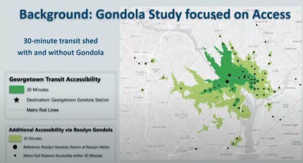
With 23,000 jobs, Georgetown is one of region’s largest employment centers without convenient Metro access, she said. Better transit would enhance access to jobs, healthcare, hospitality, retail and education for D.C. area residents, putting more people within 30 minutes of a Metro station.

How transit access would improve with a Rosslyn-Georgetown gondola (via Arlington County)

Commissioner Jim Lantelme countered that the proposed gondola would only get folks to the old gas station, leaving them to walk uphill to get to Georgetown University, its hospital, M Street retail or to the West End.

“I always look at that map as being a little disingenuous,” he said.

In addition to encouraging the group to study destinations within Georgetown, commissioners said the group should look into “low-hanging fruit” such as exclusive bus lanes on the Key Bridge and enhanced DC Circulator bus service.

“There are so many more improvements that could be made in terms of frequency, reliability, and customer service,” said commissioner Donald Ludlow.

As for Arlington’s involvement in the new study, Brooks said some transportation staff members are providing input, and FC2 will occasionally present to the Transportation Commission and the County Board.

The public can weigh in now through next Friday to inform the drafting of the study. People will have another opportunity, later on, to provide input on proposed solutions.
Brooks told the commissioners that FC2 sees the study and its possible outcomes as beneficial for Arlington. It will help the county understand how current congestion levels affect bussing, cycling, walking and ride-sharing, she said.

“It will also… hopefully provide a new platform for imagining how Arlington County can connect with Georgetown and create a bigger corridor that benefits economic development, place-making initiatives and creates more cohesive Rosslyn-Ballston, Rosslyn-National Landing, Arlington-Georgetown connections,” she said.


Arlington County’s transportation division is kicking off its ambitious plan to eliminate traffic deaths with a series of relatively quick safety projects.
For now, most of those projects appear to be in North Arlington. 
Four months ago, the Arlington County Board adopted a five-year action plan that aims to eliminate traffic fatalities and severe injuries, known as “Vision Zero.” The plan lays out a systematic approach to safety improvements, addressing the most urgent needs through data analysis, equity and community engagement.   

These improvements vary in scope: “quick-build projects” address immediate needs quickly using low-cost materials, while larger-scale projects require funding from the county’s Capital Improvement Program or grants. Others include pilot projects and regular maintenance work. 

“We’re focusing initially on small-scale operational improvements… a small but important part of program,” said Dennis Leach, the director of transportation for the Department of Environmental Services.  

Residents will see upgrades such as curb and median extensions, improved bus stops, curb-and-gutter repairs, new ramps and new high visibility crosswalks. DES has already completed eight “quick-build” projects and 11 are underway, according to its website.

Staff identify projects by analyzing crash data and considering reports by police, Arlington Public Schools and community members. They are constructed on a rolling basis.

For example, this month, staff completed a new mid-block crosswalk across N. Ohio Street that will improve access to Cardinal Elementary School and Swanson Middle School School. Staff are now installing a crosswalk with accessible curb ramps over Sycamore Street for better access to Tuckahoe Park and Tuckahoe Elementary School. 

Of the 19 completed and under-construction projects, only three appear to be in South Arlington. One Twitter user mapped out the geographic spread of these projects, raising questions about how these projects are chosen and when DES will make its way south, given that equity is a core tenant of Vision Zero. 

Leach said that could be because there are a number of older community and school requests being worked through. 

“I think there’s an issue of a pipeline of small projects that may have gotten their start in early years,” Leach said. “What you see in the pipeline of quick-build projects has been built up over years… These projects may have gotten their start before Vision Zero was adopted.” 

Transportation and Operations Bureau Chief Hui Wang said these projects are “a very small, skewed piece of the transportation program” because they don’t show large-scale investments, such as those on Columbia Pike.

“When we’re talking about balance, equity, we have to make sure that we’re not looking at it through a shaded lens,” she said.  

Leach agrees. 

“[Columbia Pike] is our single largest focus areas, as it has some of our oldest infrastructure,” he said. “In other parts of the county, like the Rosslyn-Ballston corridor, private development builds a lot of the infrastructure. In Columbia Pike, until recently, there’s been little private development — there’s more now — but it’s been left to county to actually make those investments in advance of redevelopment.”

When asked if certain communities generate more traffic reports than others, Wang said DES doesn’t map out community reports because it’s hard to categorize them and her team doesn’t have the resources for that. 

“My team is focused on the engineering part — our goal is trying to get things done,” she said. 

The data-based approach helps weed out what is a perceived safety risk versus actual safety risks, Wang noted.

“We use crash data to identify real problems,” she said. “We’re using data as a guiding force, focusing on high-injury networks.” 

Chris Slatt, who is president of transportation advocacy group Sustainable Mobility for Arlington County, said it’s not surprising that initial projects will skew toward North Arlington. 

“Complaint-driven processes are well-known to reflect the biases of whom within the community is best equipped to spend precious time and energy complaining, so we would fully expect that method of identifying projects to skew toward the more affluent areas of Arlington unless staff works intentionally to correct that bias,” he said.

(more…)


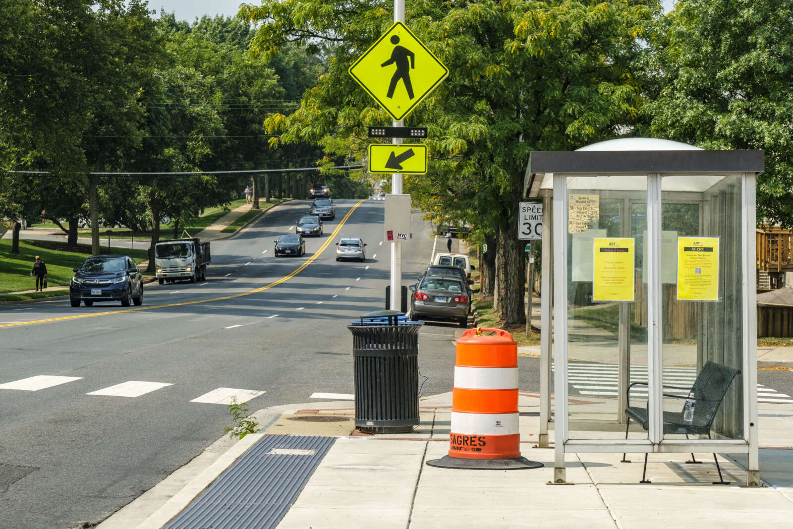
(Updated at 4:30 p.m.) A multi-year project to improve transit along Columbia Pike has been delayed by design problems associated with the proposed bus shelters.

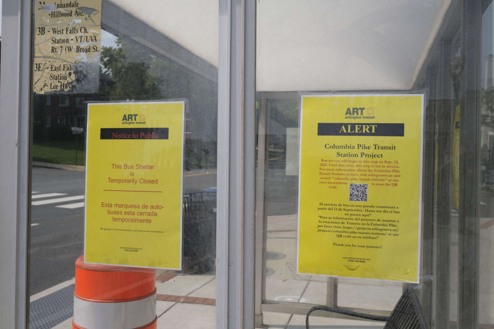
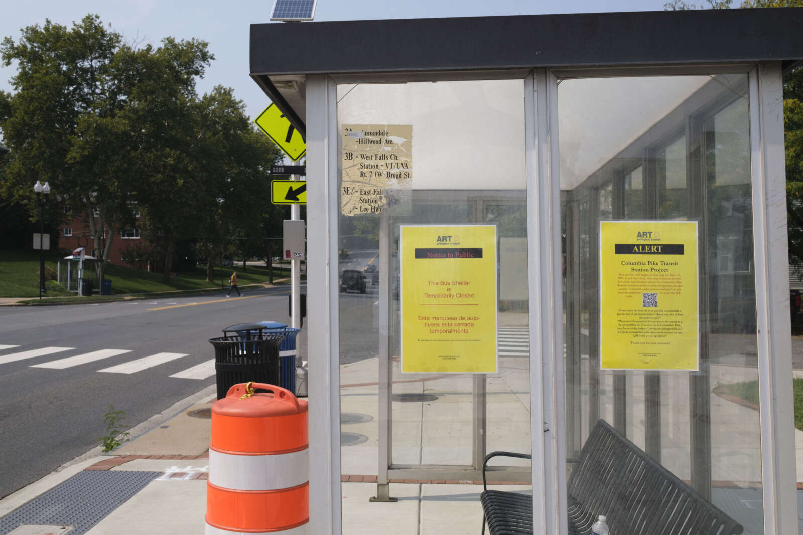
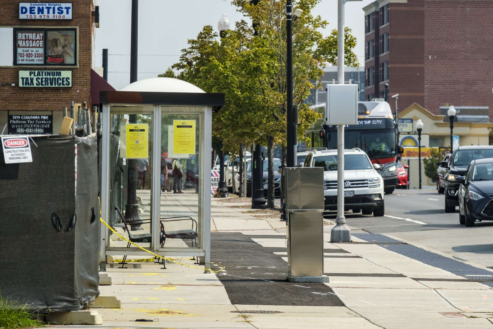
As a result, the first eight of 23 new transit stations, which the Department of Environmental Services was aiming to deliver this spring, will likely be installed next spring. In the meantime, temporary shelters have been installed at these locations, and bus service is set to return to half of them tomorrow (Friday).

The new stations comprise a $16.9 million project to transform the Pike into a “transit-oriented, pedestrian-friendly ‘Main Street,'” according to the county. The County Board approved the upgrades in the summer of 2018 as part of the 2019-2028 Capital Improvement Plan.

“New stations will make transit along the Pike easier, safer, more attractive and accessible — encouraging more people to use it,” the project webpage said.

The bus stop project dates back to the since-nixed plan for a Columbia Pike streetcar. A prototype stop, at the corner of the Pike and S. Walter Reed Drive, made national headlines after ARLnow revealed that it cost more than $1 million.

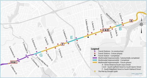
A map of completed, under-construction and planned changes to Columbia Pike for improved bus transit and multimodal experience (via Arlington County)

More recently, the station work has been stalled by structural flaws discovered with the bus shelters specially designed for the project, which feature a kit-of-parts design intended to cut down on costs compared to the custom-made $1 million “Super Stop.”

“Last November, our shelter fabricator, Future Systems, built a prototype of the shelter and identified stability issues with it,” said DES spokesman Eric Balliet. “After the design was revised, there were still concerns about its construct-ability and stability. These design issues were causing project costs to increase and further delays in delivery of the first stations.”

DES has opted to install prefabricated shelters from the same manufacturer, a decision supported by the County Board, which directed the department to finish these eight stations by the end of summer 2022. Choosing the prefabricated shelters will allow DES to finish those stations in spring 2022 instead of spring 2023, and will save more than $7 million, according to a recent report.

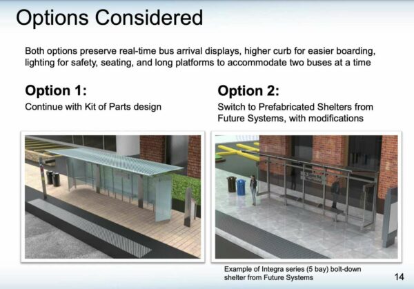
“Kit of parts” bus shelter vs. prefabricated bus shelter (via Arlington County)

“By the end of the year, we expect to receive the final shelter drawings from Future Systems, to be followed in early 2022 with a Notice to Proceed for production and delivery of the first eight station shelters,” Balliet said. “Installation of shelters and amenities for the first eight stations is expected in spring 2022.”

The prefabricated shelters maintain some of the original shelter’s features — glass finishing, protection against bad weather and real-time bus arrival displays — and will have equivalent or more seating. The shelters are also shallower, giving pedestrians more room.

When finished, the stations will be accessible to people with disabilities and will have platforms that can fit two buses.

(more…)


It looks like the Washington Metropolitan Area Transit Authority is not going to consider a Metro line through Columbia Pike any time soon.

For the last year and a half, there were some signs that such an expansion — which was part of initial Metro planning in the 1960s but was never built — was an actual possibility.

In December 2019, Metro mulled the idea for a Silver Line extension down Columbia Pike and up Route 7, connecting with the West Falls Church Station, as one of a handful of ways to address congestion in the Rosslyn Metro tunnel, system reliability and future ridership growth. News of President Biden’s $2 trillion infrastructure plan, which coincided with WMATA’s deliberations, further crystallized those hopes.

A new study posted this week, however, indicates this extension — which nearly 70% of ARLnow readers supported in an April poll — has been ruled out. That follows a cost-benefit analysis by planners, which favored four other routes — each starting with a second Metro station in Rosslyn and adding an underground Metro station in Georgetown — as well as two options that don’t involve new construction.

WMATA is looking for the next way to expand Metro on a scale similar to the Silver Line extension to Dulles International Airport, as it seeks to alleviate traffic and congestion in the Rosslyn tunnel and along the the Blue, Orange and Silver lines. In early 2019, it launched the Blue/Orange/Silver Capacity & Reliability Study (BOS Study) to identify a line that would do so.

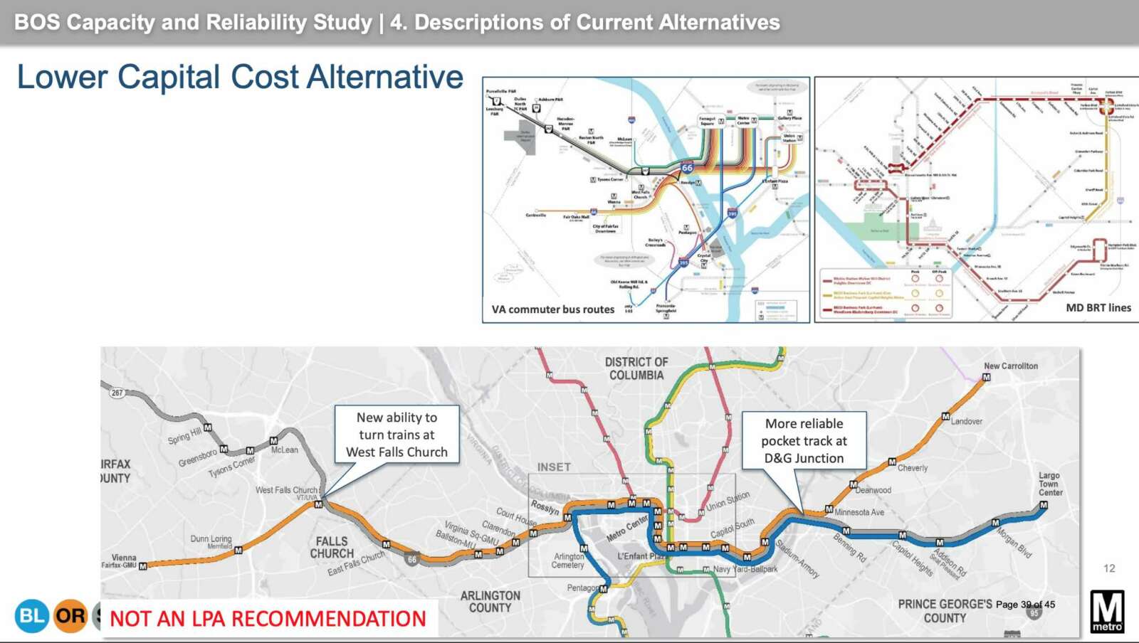
Metro planners outlined the four finalists, absent the Pike, in an update to the BOS Study that Metro posted this week. The four options use a second Rosslyn station to alleviate congestion at the existing station, and establish a long-discussed underground station in Georgetown, which has never had a Metro connection.

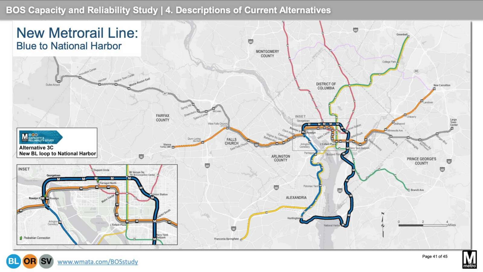
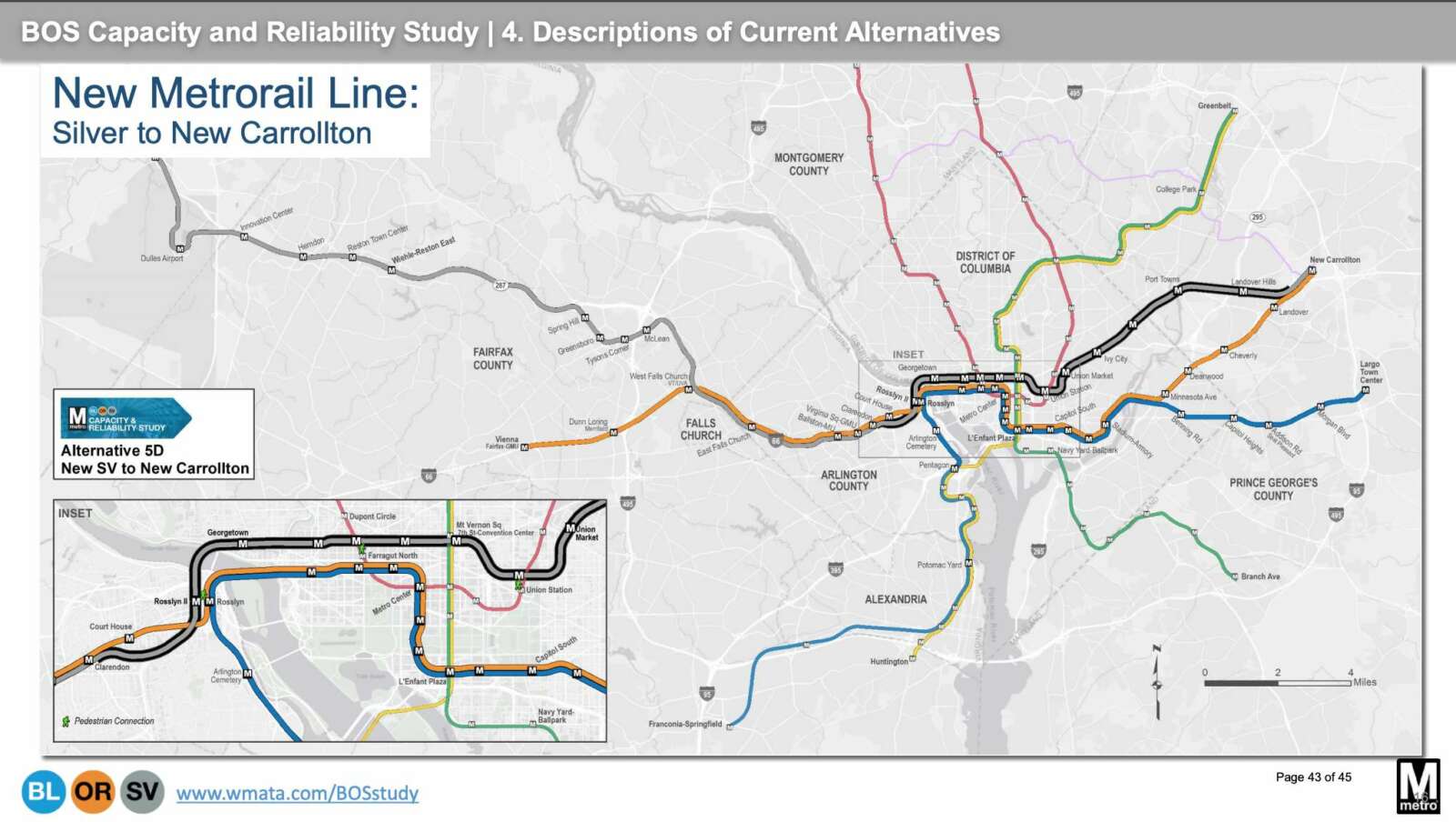
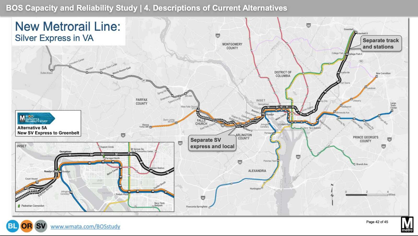
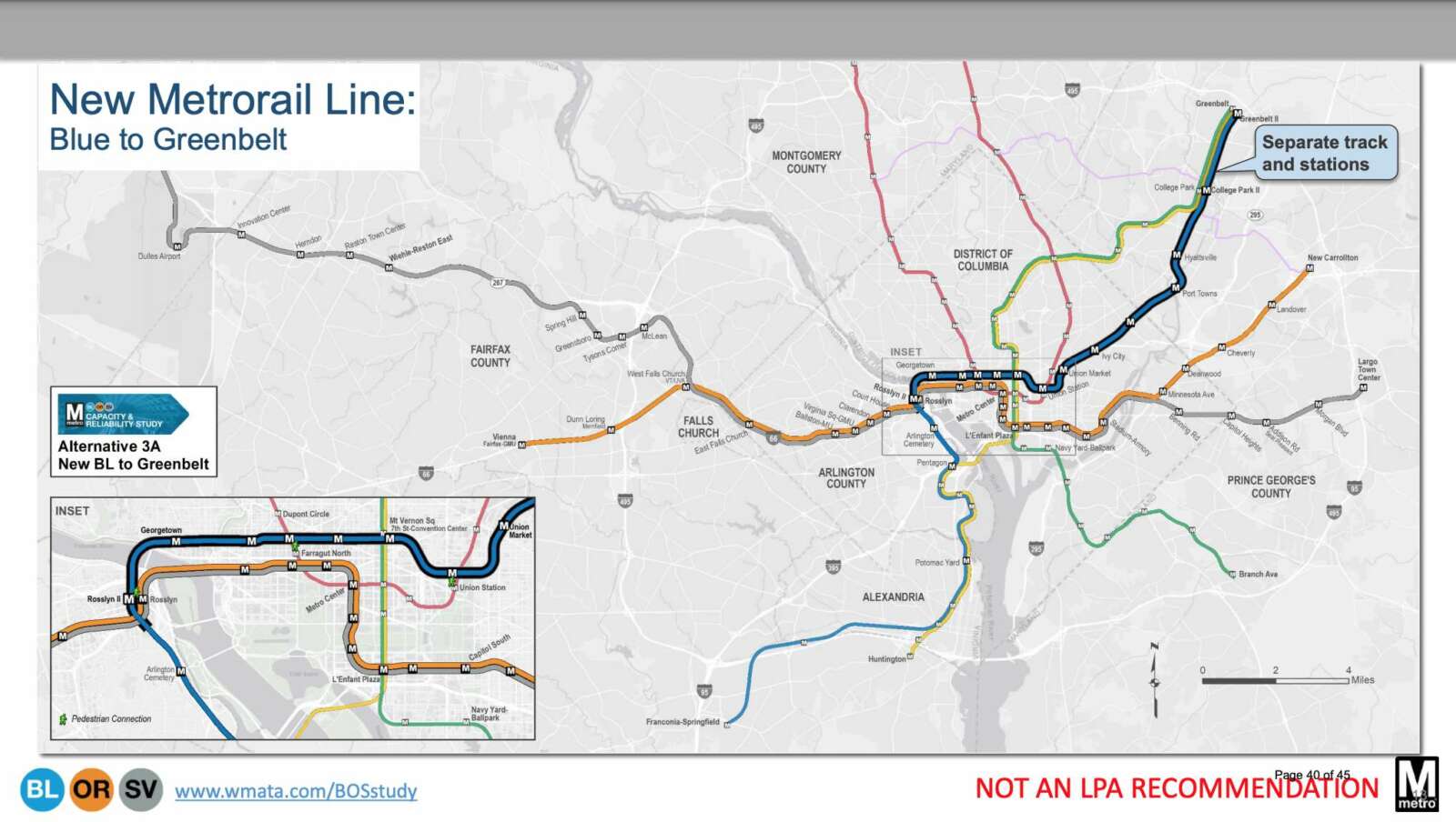
The possible projects, which would cost billions of dollars to build, include a Blue Line loop to National Harbor — which planners think would add the most new riders and revenue to the Metro system — as well as a Blue Line extension to Greenbelt, a Silver Line express tunnel option through Arlington, and a Silver Line to New Carrollton.

The express option “would create a separate tunnel and tracks for the Silver Line, starting at West Falls Church Station,” according to WMATA. A diagram suggests it would skip all Arlington stations except the second Rosslyn station and perhaps a second Ballston station.

“From WFC to a new second Rosslyn station, the new tunnel could support express service, local service or a mix of express and local service,” WMATA said. “From the second Rosslyn station, the Silver Line would travel through Georgetown…. to Greenbelt.”

(more…)


A dedicated bus lane and new bus stops are set to come for Crystal Drive and 12th Street S. as part of an expansion of the Crystal City/Potomac Yard Transitway to Pentagon City.

But progress on the project has elicited frustration from some local transit advocates, residents and community leaders.

The project will extend the Crystal City Potomac Yard Transitway north with a direct connection to the Pentagon City Metrorail station, while increasing trip frequency for bus riders. County staff say these changes will facilitate a “high frequency premium transit service” that will “add transportation capacity to support current and anticipated development in the area,” according to the county.

A meeting was held last night (Wednesday) to explain what residents and road users can expect in the first phase of the Transitway Extension project. People will also see changes to 12th Street S. during this phase of the project, as DES has decided to merge the extension work with “complete streets” improvements to 12th Street S., which curves south and becomes Crystal Drive near Long Bridge Park.

Those opposed say they are frustrated by the lack of community engagement when the designs were developed — last night’s meeting presented 100% complete designs — and say they have questions that have gone unanswered.

“I love the Transitway, and I’m eager to see it completed and see Metroway buses running more often, but I do not have confidence that DES has really done their best work on these plans, and am positive that they do not want to hear from the community,” Transportation Commission member Darren Buck tells ARLnow.

Transit advocates say the proposed configuration of the road and the sidewalk will not support the projected increase in folks living in the area, with the arrival of Amazon and other development concentrated in the area. Particularly, they say, the proposed 10-foot sidewalks will not provide enough space for bus riders and people traveling through the area on foot or scooter, as well as cyclists who will one day be able to connect to D.C. via Long Bridge Park’s esplanade.

County staff say the designs do respond to community comments and that the project cannot make changes that would disturb underground parking garages. Staff could not respond to follow-up questions before this article’s publication.

According to the staff presentation, the designs have been modified in response to concerns for pedestrian safety and circulation near the stations. The plans feature enough room for pedestrians to walk around the bus stations and to walk safely while buses make the sharp turn from Crystal Drive to 12th Street S, they said.

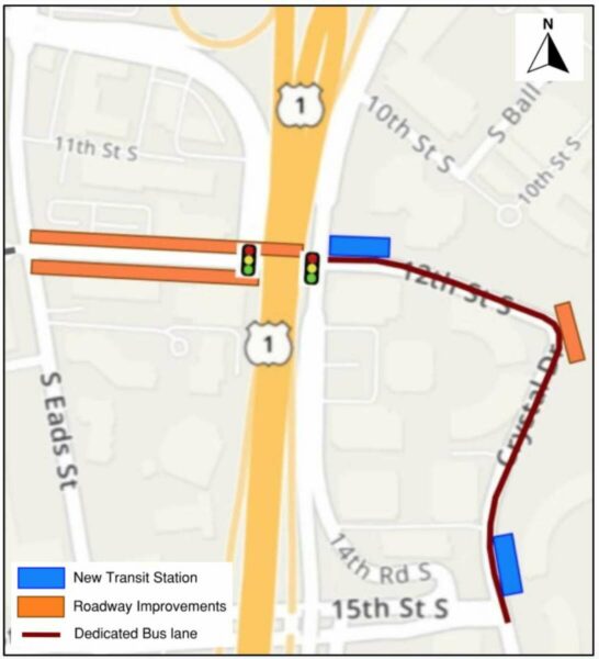
Two bus stations will be installed along the curb as part of the Transitway Extension. The road will be reconfigured to allow buses to take the curve at Crystal Drive and 12th Street S. safely within a dedicated transit lane.

The complete streets project, meanwhile, includes signal improvements and a new traffic signal at the intersection of 12th Street S. and Army Navy Drive. The roadway under Route 1 will be widened, and there will be sidewalk improvements from Army Navy Drive to S. Eads Street.

A map of improvements to 12th Street S. and Crystal Drive (via Arlington County)

According to the county, the new bus stations will have:

  • Real-time bus information
  • Benches, bike racks and bins for trash and recycling
  • Solar-powered lighting inside the shelters
  • Near-level boarding, with a raised curb for easy access
  • Concrete bus pads
  • Artwork consistent with other transitway bus stations

After last night’s meeting, some cyclists shared their dismay with the project and the meeting on Twitter.

(more…)


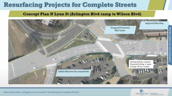
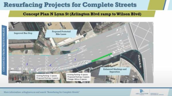
Part of the proposed resurfacing changes for N. Lynn Street (via Arlington County)

Arlington County plans to resurface a stretch of N. Lynn Street in Rosslyn to improve the driving and cycling experience.

The project is part of the county’s annual effort to resurface about 100 lane miles of roadway, prioritizing those in the most need of upgrades and those adjacent to development, schools or county-led capital projects. It is the second of two “complete streets” resurfacing projects proposed for 2021, the other being changes to Wilson Blvd in the Bluemont neighborhood.

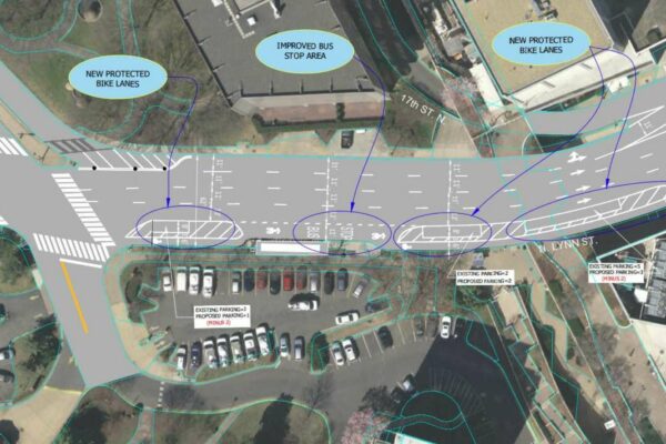
The plans for N. Lynn Street extend from the exit ramp for Arlington Blvd (Route 50) to Wilson Blvd. Proposed changes include adding “sharrows” — encouraging drivers to share the road with cyclists — connecting with existing bike lanes, plus buffering existing bike lanes, improving markings for a bus stop, and adding markings where drivers have to cross a bike lane to turn right.

This concept design accommodates the existing traffic by maintaining the same vehicular lane configurations, it adds additional separation between people driving and biking with protected and buffered bike lanes, it enhances the network connectivity with improved bike markings, and it improves visibility of right turn conflicts with the application of green markings,” said county transportation planner Catherine Seebauer during a recorded presentation.

A segment of N. Lynn Street that will be resurfaced (via Arlington County)

Right after the Arlington Blvd exit ramp, the county proposes adding northbound bike “sharrows” — markings indicating where cyclists and vehicles have to share the road — that will link up to the existing bike lane after the intersection with Fairfax Drive.

“That exit ramp is a VDOT-controlled road, so Arlington County is somewhat limited in what changes we can make there, but a reconfiguration of those on-off ramps is being looked at as part of [Core of Rosslyn Transportation Study], so long-term changes are in development for that intersection,” Seebauer said.

The vehicle lanes will be narrowed after Fairfax Drive, though they will still meet the county’s standard width of 11 feet, she said.

“The extra room allows us to provide more room for other facilities,” she said, including upgrading the existing bike lanes to be protected bike lanes. “They will be separated from vehicle lanes by parked vehicles and a small buffer strip.”

A segment of N. Lynn Street that will be resurfaced (via Arlington County)

Where the bike lane merges with an existing bus stop, the bus stop markings will be improved. Further up, close to the intersection with Wilson Blvd, green paint and bollards will alert drivers and cyclists about a conflict point, where drivers have to cross the bike lane to make a right turn.

From the exit ramp to Wilson Blvd, four parking spaces will be removed to improve sightlines, Seebauer said.

An online comment period for the project closed yesterday (Tuesday). The resurfacing work will be done later this summer and fall.


View More Stories