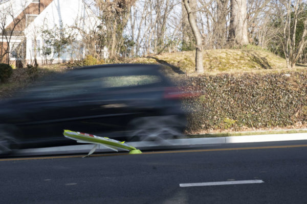
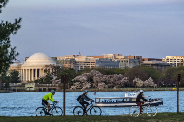
The good news for users of the Mount Vernon Trail is that a proposed widening project was selected for state funding. The bad news? It will be 2026 before work even starts on the project.

As anyone who has bicycled or walked along the popular trail could likely attest, there are parts that can feel dangerously narrow. Last year, the National Park Service released a report recommending widening. The report noted that there were 225 reported bike and pedestrian crashes on the trail between 2006 and 2010, many of them at crash hotspots near National Airport and the 14th Street Bridge.

Some spots along the trail are in notoriously poor condition, like the infamous Trollheim Bridge section south of Roosevelt Island, where the trail’s wooden planks often become slick in icy or rainy conditions.

The goal of the approved project is to improve and reconstruct approximately 6.5 miles of the trail, from the access point to Roosevelt Island down to Jones Point Park in Alexandria. One of the most narrow stretches of the trail, a single-lane tunnel under Memorial Bridge, is on Columbia Island, which is technically part of D.C.

According to the application, the project would “widen the trail’s paved surface from between seven and eight feet to 11 where feasible.”

The total project cost is estimated at $33 million, with $29 million funded by the Virginia SMART SCALE grant — which doesn’t fund the needed improvements on Columbia Island. The grant was on the list of projects approved by the Commonwealth Transportation Board at a meeting on June 23.

The widening is likely a few years down the road. The National Park Service previously said work could begin on the trail starting in 2026, Greater Greater Washington reported.

https://twitter.com/TrailsCoalition/status/1417887666671128578


After initially failing to garner enough votes from the regional Transportation Planning Board, a controversial project to widen I-270 in Maryland and replace the American Legion Bridge is back on.

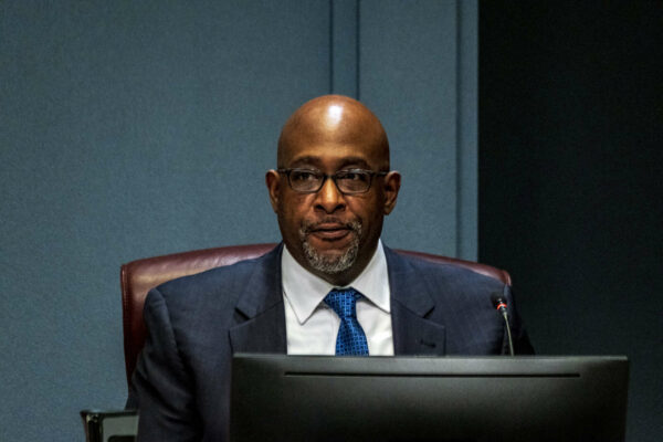
And Arlington County Board Member Christian Dorsey, who sits on the regional board, was one of the leaders who flipped his vote from a ‘no’ to a ‘yes.’

Dorsey appeared on WAMU’s The Politics Hour with Kojo Nnamdi on Friday to talk about why he flipped his vote. Dorsey also explained the powers and limitations of the newly created Community Oversight Board, which provides oversight over the conduct of officers in the Arlington County Police Department.

Maryland Gov. Larry Hogan’s signature project would add two high-occupancy toll lanes in each direction to part of its Beltway and lower I-270. The toll system would connect with Northern Virginia’s toll lanes on I-495 and 395.

Supporters say the project will relieve intense bottleneck, but in June, Dorsey said it was “not ready for prime time,” according to the show. In the interim month, the project was revised and Hogan’s team reportedly spent significant time lobbying those who voted ‘no.’ The board voted 28-10 in favor of the project.

Dorsey said his vote hinged on funding for public transit, as lower congestion could encourage more single-occupancy vehicle traffic. He denied being contacted by Hogan’s office, but said he was contacted by “targeted campaigns.”

“What was missing was a commitment to provide the funding to make sure locally-developed transit solutions could be developed, and could be constructed and operated in the long term,” he said.

The project now includes state funding to design bus lanes for the expanded highway, in addition to $300 million in private funding for transit projects. Dorsey said the revised project also outlines timelines and efforts for transit projects, he said.

“There was significant progress  — at least enough progress for me to move it along in the regional planning process,” Dorsey said.

The Maryland Board of Public Works is set to vote on the project later this summer, according to the show.

Dorsey also clarified the roles of the Community Oversight Board, which has investigative and subpoena power. The board will have an independent policing auditor who can conduct an investigation alongside one being conducted internally by ACPD.

“If for some reason in that concurrent [model], which we think is artfully designed, records are withheld, it has ability to get them via subpoena,” he said. “We hope it’s rarely used, as that means the concurrent model not working.”

(The Arlington branch of the NAACP has criticized the County Board for not granting the oversight board the full powers recently granted by the state legislature.)

Since County Manager Mark Schwartz hires staff, including police officers, a Community Oversight Board with county staff would not be effectively independent, Dorsey said. The solution was to create an independent policing auditor who is accountable to the oversight board and who ensures investigations take place.

The Board voted against a provision setting aside three seats on the oversight board for people of color or people from marginalized groups.

“This is not about saying there shouldn’t be three people of color on the board, but that we shouldn’t send a signal that three is somehow an acceptable minimum,” Dorsey said. “Most [members] should be people of color, from my perspective.”

Dorsey said he does not deny that ACPD has had occasional issues worthy of scrutiny, but “overall, we’ve had a professional and effective and trustworthy police department.”


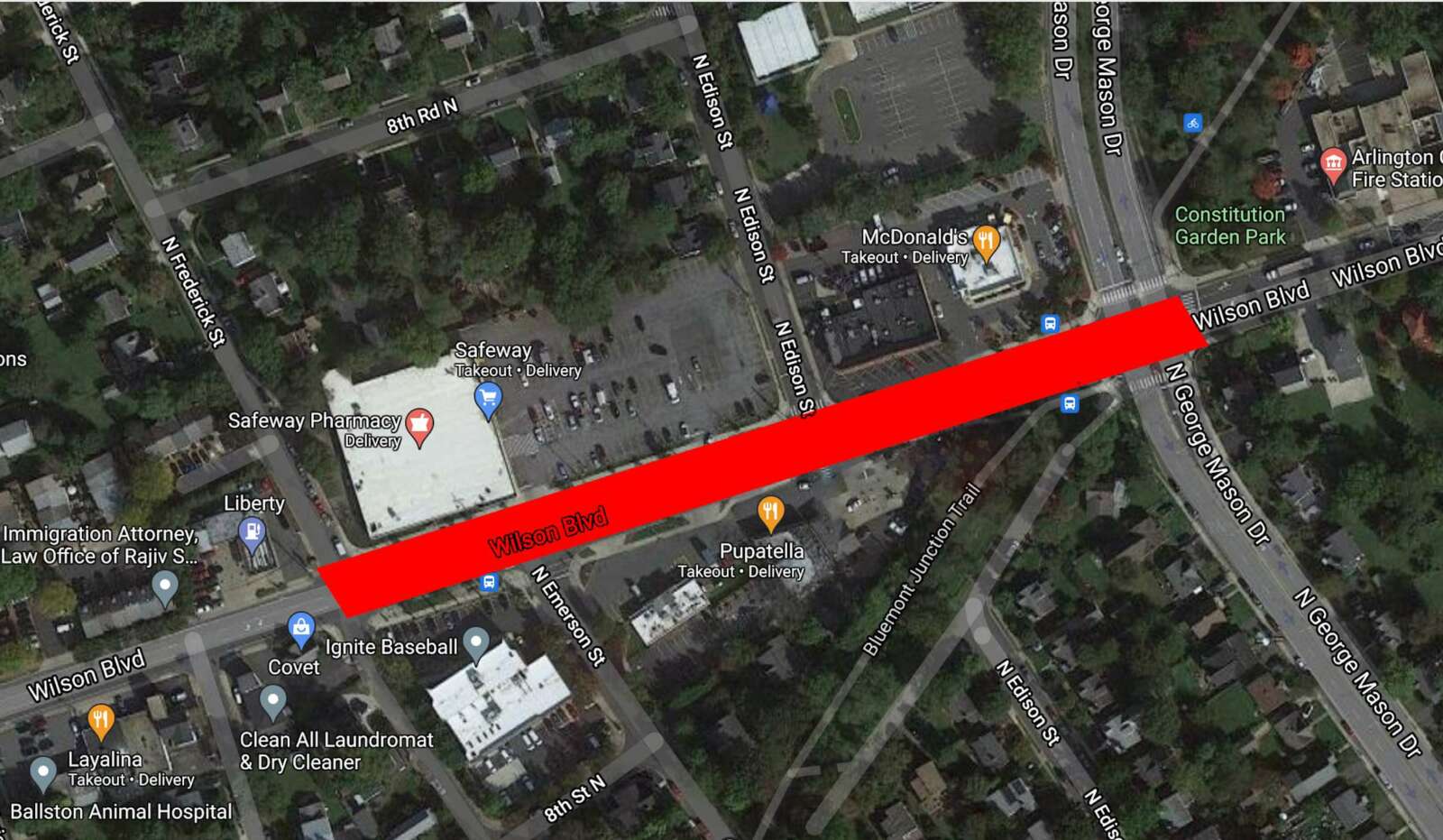
The county plans to resurface a stretch of Wilson Blvd in Bluemont to improve the driving, cycling and walking experience.

The project is part of Arlington County’s annual effort to resurface about 100 lane miles of roadway annually, prioritizing those in the most need of upgrades and those adjacent to development or other capital projects.

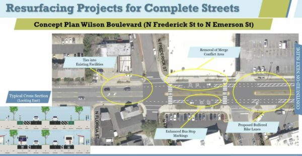
County staff propose reducing — in most places — the number of vehicle travel lanes along Wilson Blvd from four to two between N. Frederick Street and N. George Mason Drive. During a meeting last night (Monday), they said the reduction will accommodate new turn lanes and buffered and standard bike lanes, and prevent merging conflicts where Wilson Blvd transitions from two lanes to one in each direction west of N. Frederick Street.

Transportation Engineer Dan Nabors said the changes will “improve pedestrian crossings, provide separation between people who are driving, walking and biking, reduce and control vehicle speeds, improve sightlines, and make the street easier to understand for all users.”

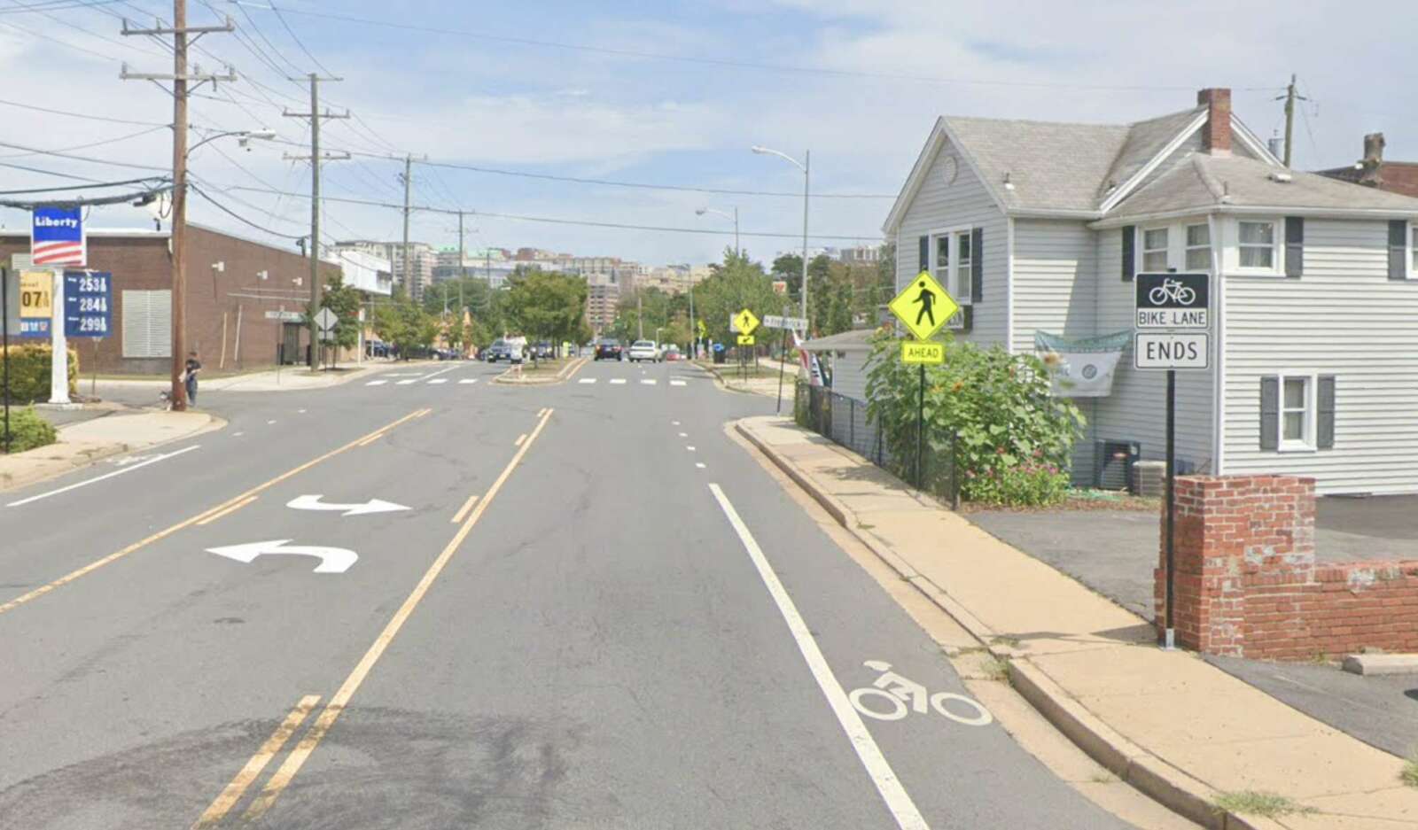
Currently, east of N. Frederick Street — near the Safeway — Wilson Blvd has two vehicle travel lanes in each direction, curbside transit stops and shared-lane bicycle markings, also known as “sharrows.” The posted speed limit is 30 mph and most people go 33.8 mph, said fellow transportation engineer Cathie Seebauer.

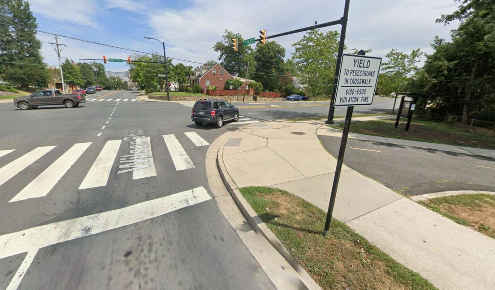
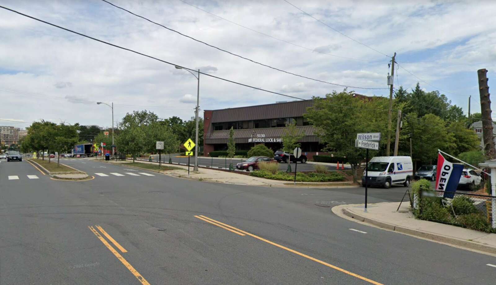
This spring, road users suggested changes to this segment of Wilson Blvd, which staff said they incorporated into the concept plan shared last night. Community members asked for a continuation of existing bike lanes, a safer Bluemont Trail crossing at the intersection with N. George Mason Drive, and changes to the part of Wilson Blvd where it narrows from two lanes to one west of N. Frederick Street, Seebauer said.

Proposed changes to Wilson Blvd from N. Frederick Street to N. Emerson Street (via Arlington County)

From N. Frederick Street to N. Emerson Street, staff propose eliminating the transition from one to two lanes and adding buffered bike lanes that will be shared with enhanced bus stop markings.

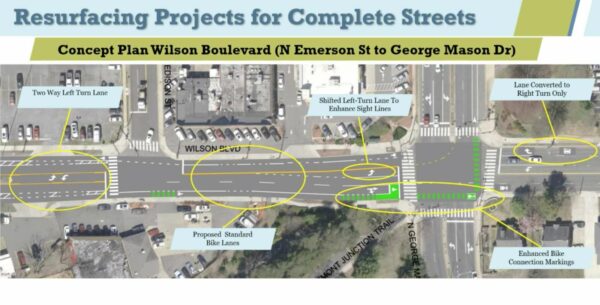
“The road does meet national volume thresholds for a reconfiguration from four lanes to two,” Seebauer said. East of N. Edison Street, however, she said that “two eastbound travel lanes would need to be retained to maintain safety and operations.”

Proposed changes to Wilson Blvd from N. Emerson Street to George Mason Drive (via Arlington County)

From N. Edison Street to N. George Mason Drive, cyclists will have a 6-foot standard bike lane with green paint to warn drivers and cyclists of major conflict points. A two-stage bike box will guide those turning to go north on N. George Mason Drive and help those continuing east on Wilson Blvd to merge with through vehicular traffic when the bike lane disappears.

Wilson Blvd going west will have only one through-lane to make room for dedicated right and left-turn lanes.

An online comment tool will be open until Tuesday, July 7. The resurfacing work will be done this summer and fall.

Photos (1-4) via Google Maps 


A mobility advocacy group is asking the county to build a three-year plan for funding projects that make non-car transit faster, more desirable and safer.

And the group, Sustainable Mobility, is trying to capitalize on signs that people are interested in bicycling and walking more coming out of the pandemic. 

“We have to seize that opportunity before everybody gets into their cars again,” said Chris Slatt, the group’s president, who is also chair of the Transportation Commission and an opinion columnist on ARLnow. “This is an inflection point. Arlington has let too many opportunities pass during COVID-19 — we never achieved open streets, when people demanded more space to walk, sit and eat — we need them to do better now.”

Its recommendations respond to a draft document outlining the large projects that Arlington County intends to embark on over the next three years. This plan, called the Capital Improvement Plan, is winding its way through review processes and is set to be approved by the County Board in July.

Volunteers from Sustainable Mobility, or SusMo, combed through the transportation projects and identified a handful to nix, postpone or kick to developers for funding and implementation, which they say could free up about $17 million that could fund 20 projects or programs.

The alternative projects fall into five of SusMo’s priority areas:  

  1. Funding Vision Zero
  2. Speeding up transit 
  3. Building safe routes to every school 
  4. Building out the bike network for all ages and abilities   
  5. Expanding and connecting the trail network 

“None of what’s in our plan is really our idea,” Slatt said. “It is all things that are in sector plans, projects that… the county already has [identified], projects that were identified in the bicycle element of the Master Transportation Plan, or just ways to fund priorities that Arlington says they already have.” 

Highlights include:

  • Changing the signals to reduce the time buses spend at intersections
  • Completing the Arlington Blvd Trail
  • Conducting a feasibility study of dedicated transit and high-occupancy vehicle lanes on Columbia Pike
  • All-door bus boarding and off-vehicle fare collection, to speed up buses
  • A trail on the west side of Carlin Springs road, with a connection to the W&OD Trail, to provide a safer route to Kenmore Middle School
  • Protected bike lanes on S. George Mason Drive between Route 7 and Route 50, providing a safe connection to Wakefield High School
  • Additional capital funding for other Safe Routes to School projects
  • Protected bike lanes on a portion of N. Highland Street in Clarendon
  • A two-way protected bike lane on Fairfax Drive between Ballston and Clarendon
  • Other “neighborhood bikeways”

Some projects are already in the County Manager’s draft Capital Improvement Program proposal, including a feasibility study for a trail underpass under Shirlington Road near the Weenie Beenie, and a new trail along the Arlington National Cemetery wall between Columbia Pike and Memorial Avenue.

(more…)


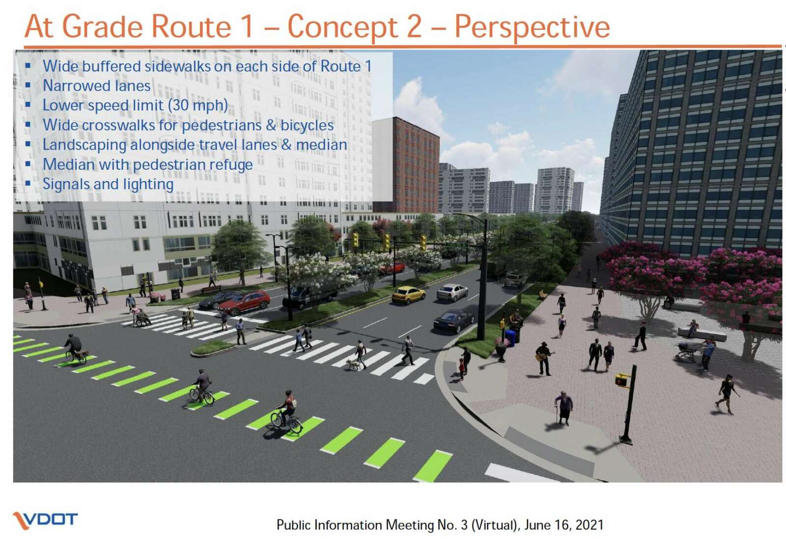
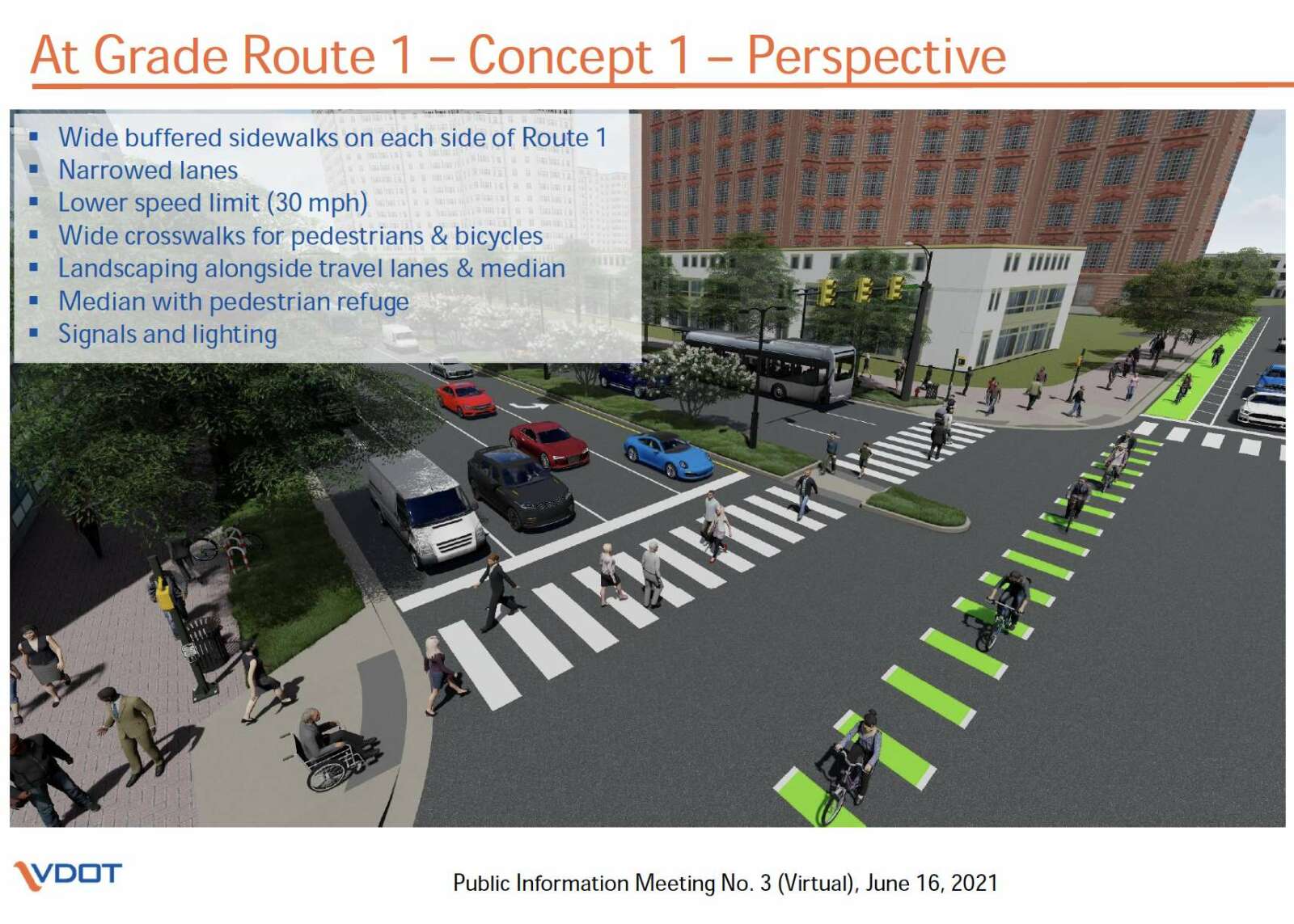
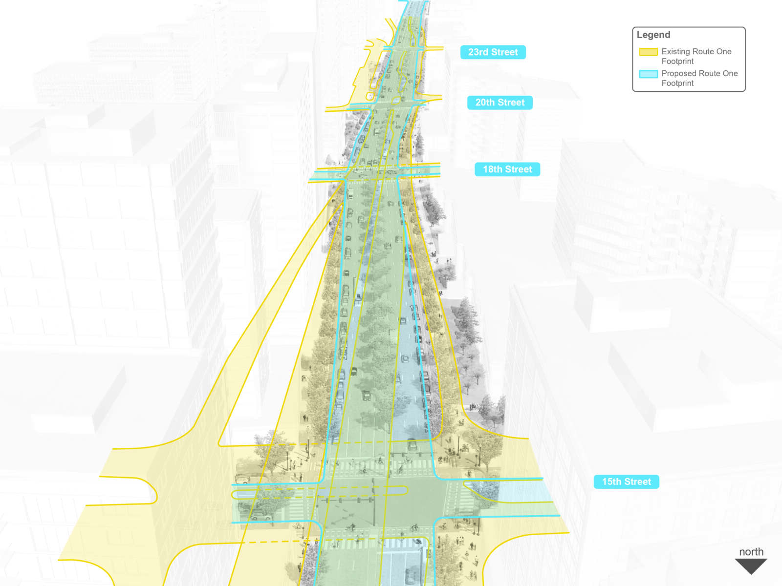
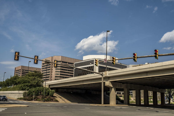
It’s official: The Virginia Department of Transportation recommends turning Route 1, which is elevated over 12th, 15th and 18th streets, into an at-grade urban boulevard.

“An at-grade configuration for Route 1 provides most desirable characteristics that meet the multimodal and community vision for National Landing,” according to presentation materials from a virtual VDOT meeting Wednesday.

The news caps off one year of study, but is not much of a surprise, as the at-grade solution seemed to emerge as the likely recommendation over the last few months despite some concerns about it being more dangerous for pedestrians. But the newest version appears to take into account concerns among some over the number of lanes, pedestrian safety, and the possibility of traffic overflow onto local streets.

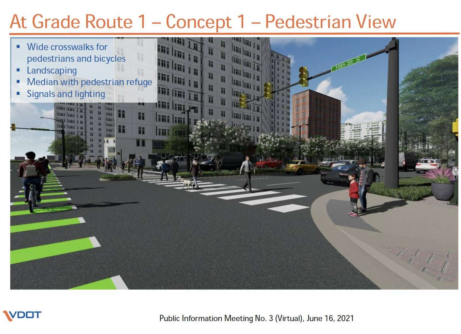
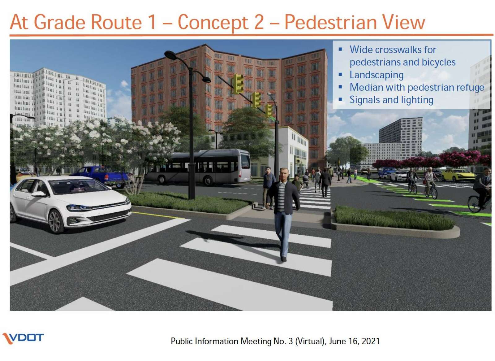
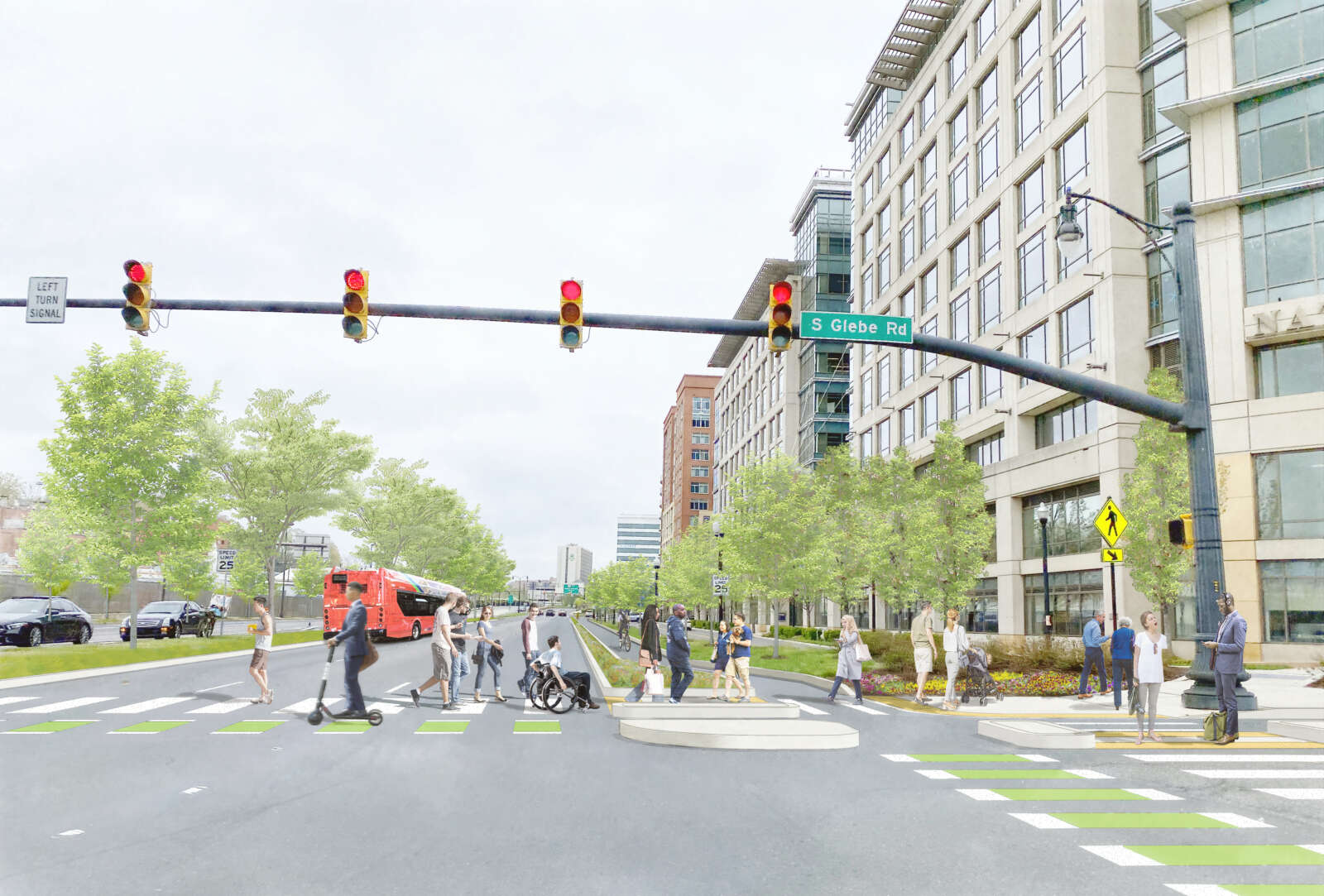
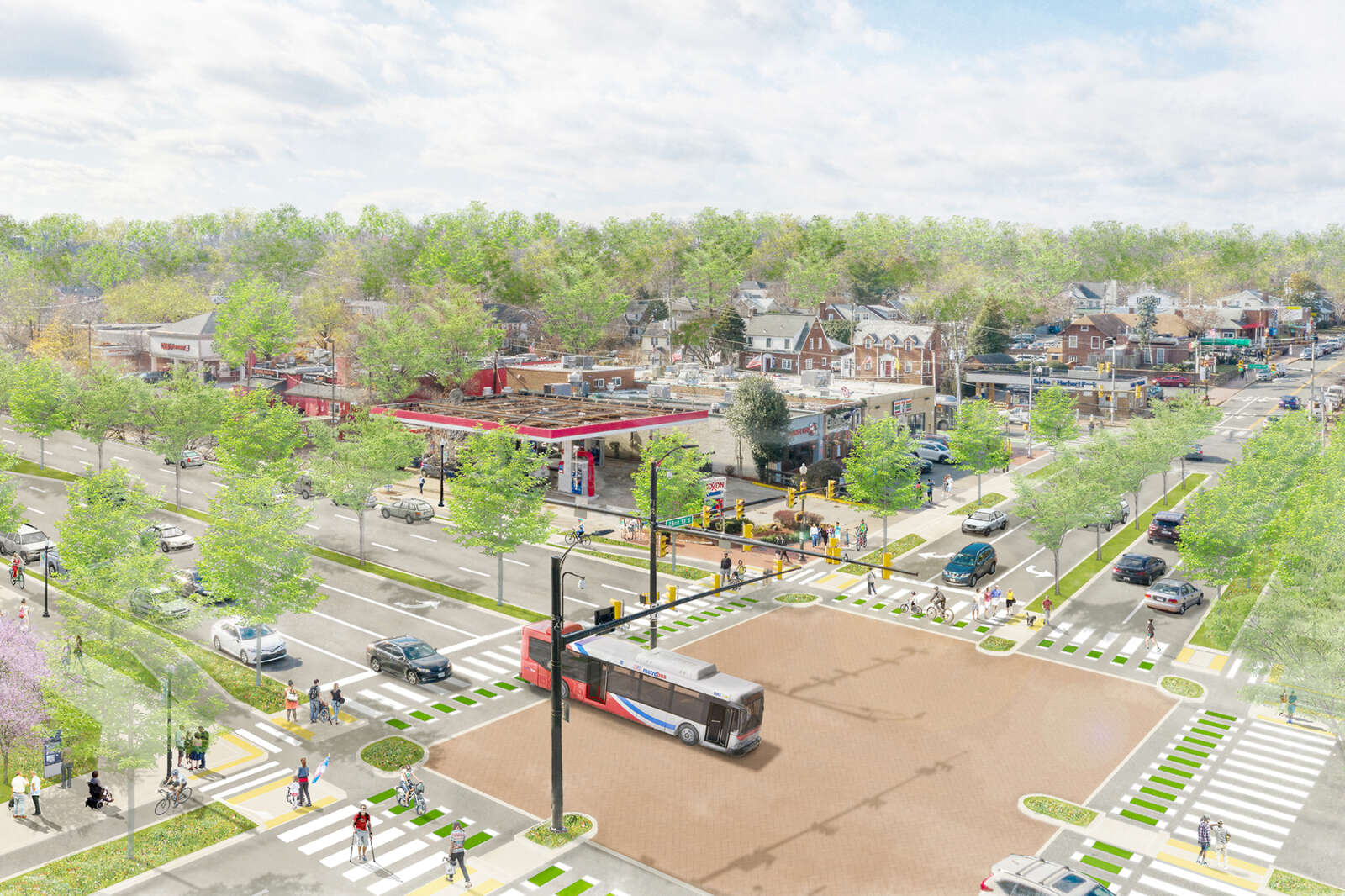
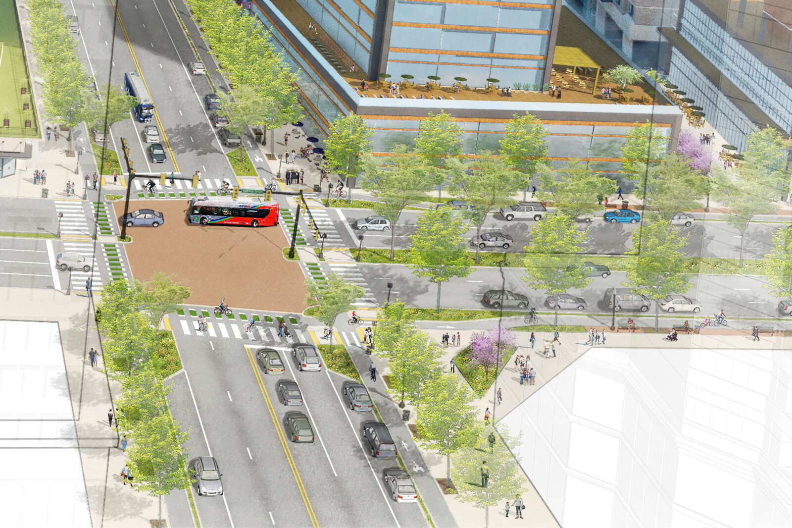
The surface-level Route 1 that VDOT envisions would have wide buffered sidewalks on both sides, six to seven narrowed travel lanes, a 30-mph speed limit, wide crosswalks for pedestrians and bicycles, landscaping and medians with pedestrian refuges.

That is a few lanes fewer than the nine-lane option for the intersection with 15th Street S. that VDOT floated earlier this year. Last night’s presentation said eight- and nine-lane options are “not conducive for pedestrians or the vision for Crystal City.”

According to the presentation, however, even these improvements will not significant reduce crashes and increase pedestrian safety, increase transit effectiveness, or reduce vehicle traffic along an at-grade Route 1.

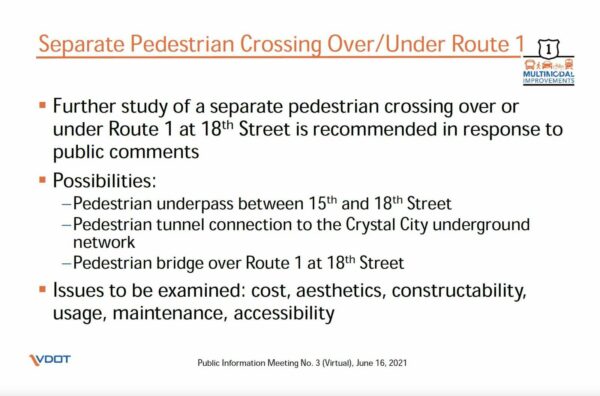
VDOT indicated two things will be needed to make an at-grade Route 1 safer. First is a travel demand management (TDM) strategy to bring down traffic levels. Second, and in response to public comments, the department said it will consider a separated pedestrian crossing over or under Route 1 at 18th Street S.

A “comprehensive and effective TDM strategy that reduces traffic volumes 20% to 30% below existing volumes” will “reduce future congestion and future diversion of traffic to local and regional roads,” according to the presentation materials.

The pedestrian crossing study would look at cost, aesthetics, use, construction feasibility, maintenance and accessibility, the presentation said. Possibilities for grade-separated crossings include a pedestrian underpass, a tunnel connection to the Crystal City underground, or a pedestrian bridge over Route 1.

Both the TDM and pedestrian crossing proposals will be explored in a second phase of the study. The next phase will likely further examine the department’s third recommendation — based on a concept requested by Arlington County staff — to allow all turns at 15th Street S. but no left turns at 18th Street S., near the Crystal City Metro station.

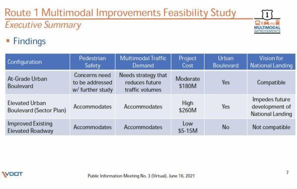
Realizing the urban boulevard vision could cost $180 million, which is less than the $260 million VDOT projects would be needed to create a split-level highway for through-traffic and local traffic, as envisioned in the ten-year-old Crystal City Sector Plan.

The National Landing Business Improvement District has been a champion of turning Route 1 into an urban boulevard. It recently released renderings of a road transformed by protected bike lanes, pedestrian refuges and prominent sidewalks, as part of a new campaign, “People Before Cars,” which has featured outdoor signs and public advocacy.

The state transportation department is accepting public comments on these recommendations through July 12. A draft report will come out in August and a final report in September.


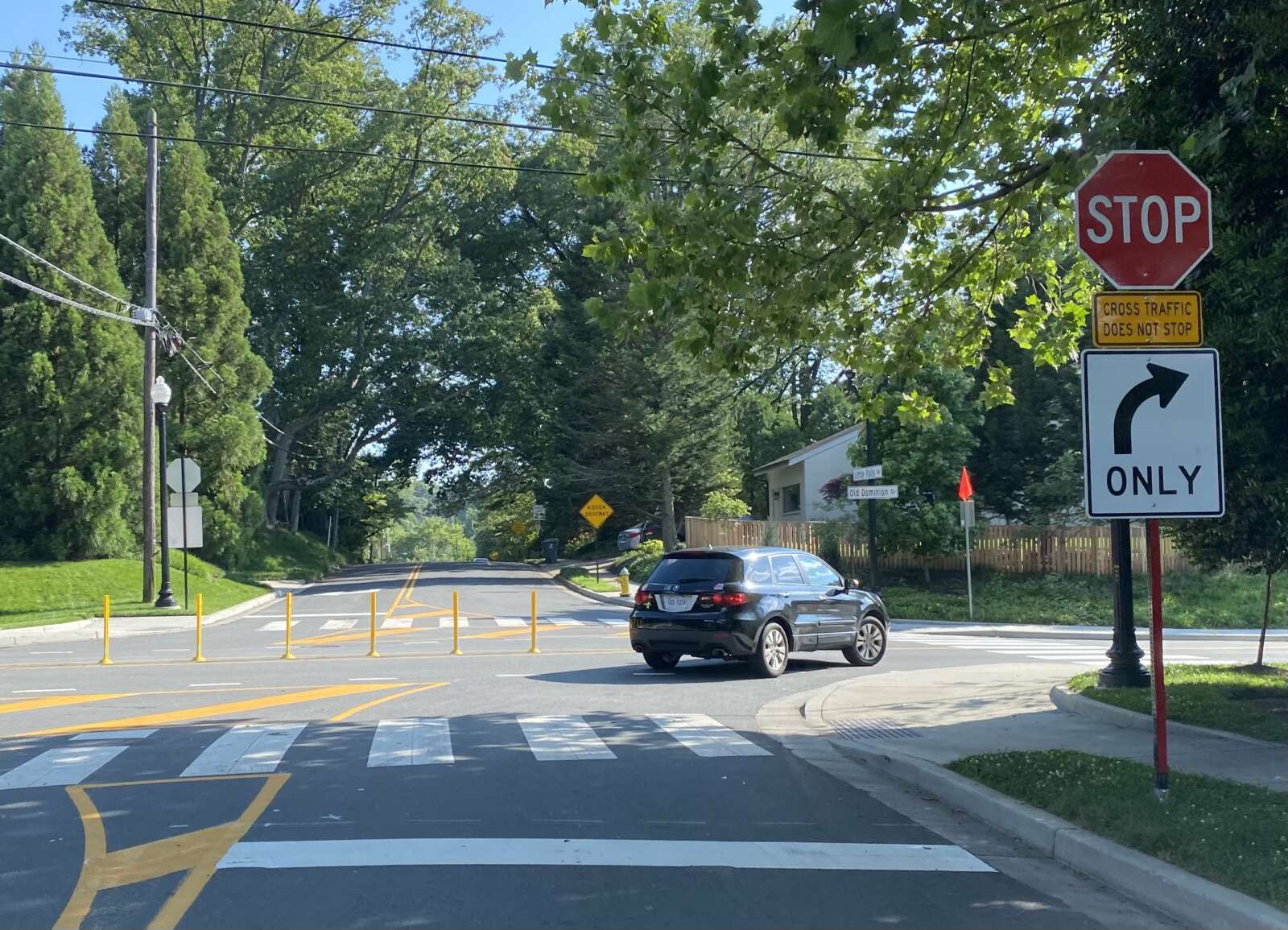
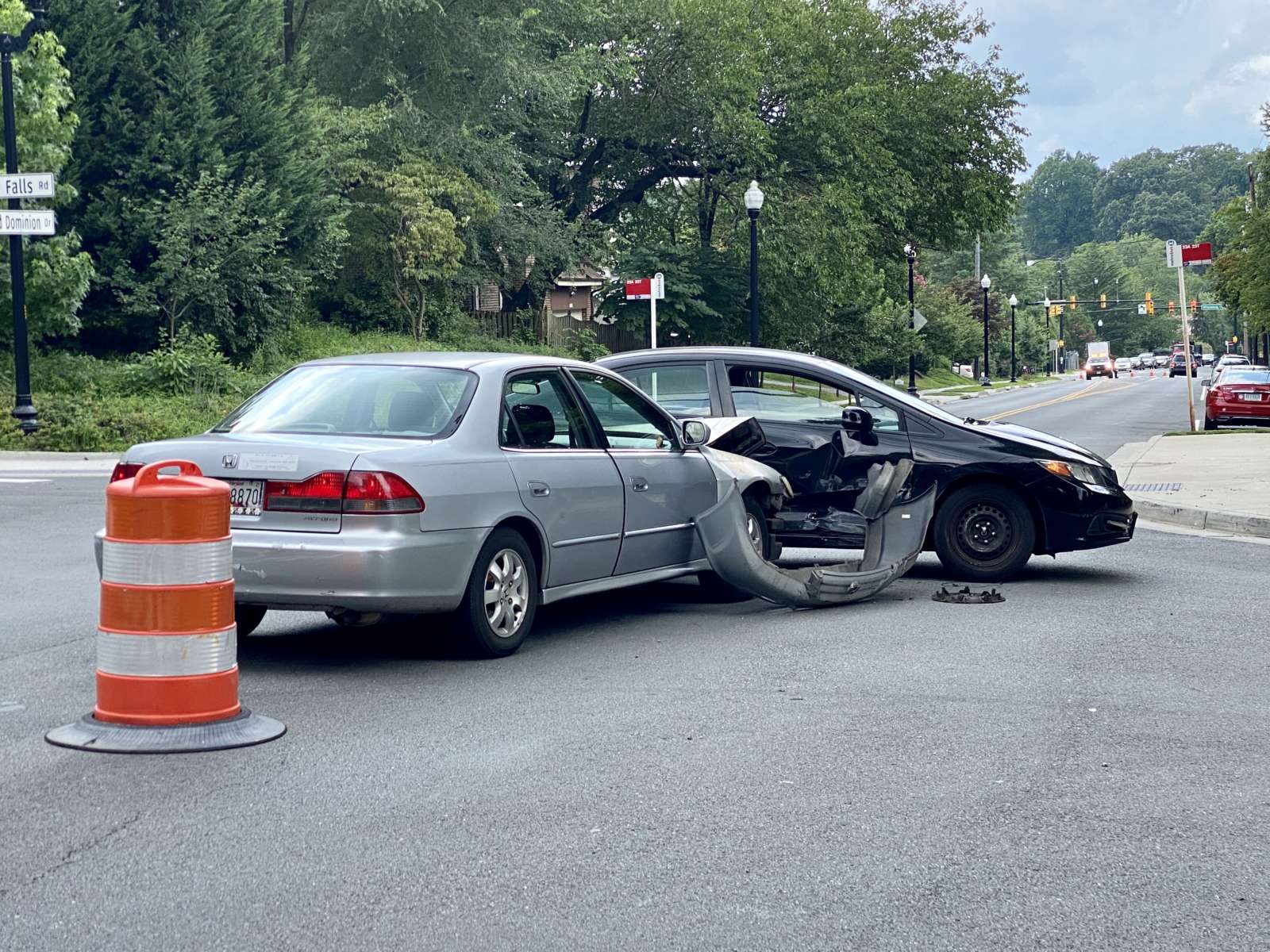
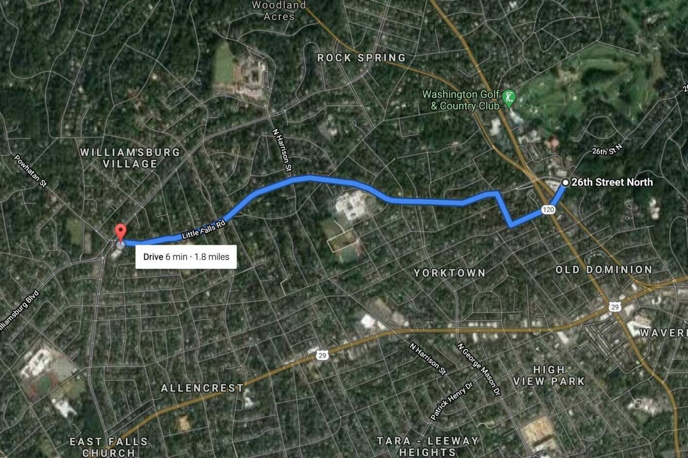
For years the intersection of Old Dominion Drive and Little Falls Road has been the scene of numerous crashes.

Now, after a push for traffic signals and minor efforts to make it safer, the intersection in the Rock Spring neighborhood has undergone its biggest change yet.

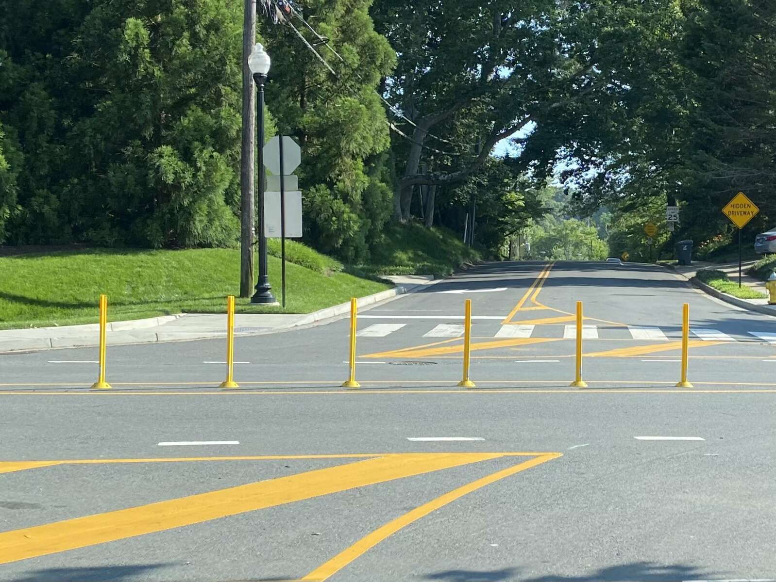
Instead of the rush hour restrictions that were put in place last year — making it right-turn-only for Little Falls Road traffic during certain hours — a recently-constructed row of bollards now ensures that those driving on Little Falls can only turn right at all times.

The bollards also prevent left turns from Old Dominion Drive.

“On June 10, the Virginia Department of Transportation installed a small center island of along the centerline of Old Dominion Drive to make Little Falls Road right-in/right-out at Old Dominion Drive,” Arlington County Dept. of Environmental Services spokeswoman Katie O’Brien tells ARLnow. “Additional markings and signage have been installed to help guide right-turning drivers. We anticipate making small changes, such as to the center median material, in the coming months.”

“These short-term changes were made because a crash trend has been identified at this location, including a high number of angle collisions involving drivers either turning left or continuing through the intersection from Little Falls Road,” O’Brien continued.

There were 13 crashes at the intersection in 2018, 14 crashes in 2019, 12 crashes in 2020 and 4 crashes so far in 2021, according to Arlington County Police Department spokeswoman Ashley Savage.

O’Brien also wrote in an email that the county and VDOT will be studying the possibility of lowering the speed limit on Old Dominion Drive or installing a traffic signal at the problematic intersection.

To help Arlington County and the Virginia Department of Transportation determine a long term solution, The County will also collect additional speed and volume data in this area. This data will help VDOT and County staff evaluate:

  • If a traffic signal is warranted. For the traffic signal, the County will work with VDOT to determine if the intersection meets the State Signal Justification requirement.
  • If a speed limit reduction is warranted. For the speed evaluation, the County will work with VDOT to determine whether a posted speed limit reduction is warranted.

Old Dominion Drive was formerly a streetcar line. It was converted into a road in the 1930s.


Arlington County is considering lowering the speed limit along a number of corridors with lots of pedestrian activity.

On Saturday, the County Board will decide whether to authorize a public hearing next month to discuss and potentially approve the reductions, which would impact seven corridors throughout Arlington.

The proposals were generated from traffic studies conducted at the request of some citizens, staff and Arlington County Public Schools, according to a report. These studies looked at speeding and crash statistics as well as anticipated pedestrian and bicyclist activity and future projects, among other considerations.

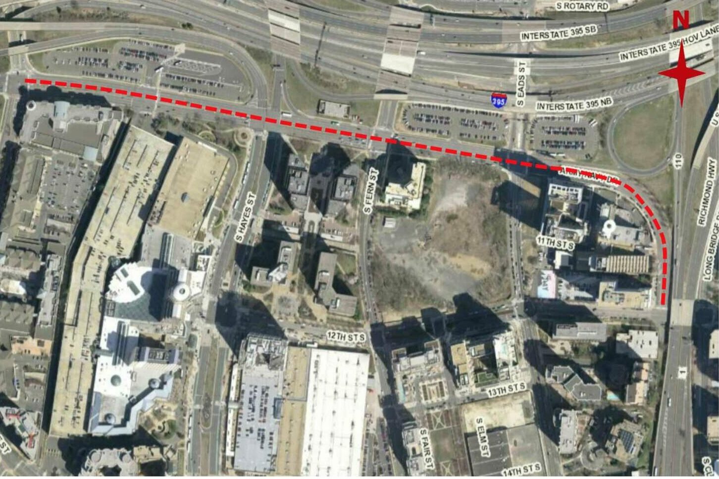
Overall, the studies concluded that lower speed limits would help the county reach its new goal of zero transportation-related deaths and serious injuries by 2030, also known as Vision Zero. Two reductions along Army Navy Drive would also prepare drivers for an upcoming construction project that would rebuild the road to be more pedestrian- and bicycle-friendly, the report said.

“As part of the Streets Element of the Master Transportation Plan, a policy was established to design streets to generally favor lower vehicle speeds without impeding or diverting existing vehicle volumes,” the document said. “One of the implementation actions for that policy is the adoption of lower speed limits for arterial streets on which there are high volumes of pedestrian crossings and higher density land development.”
The studies recommend lowering the speed limit along Army Navy Drive from S. Joyce Street to 12th Street S. from 35 to 25 miles per hour.

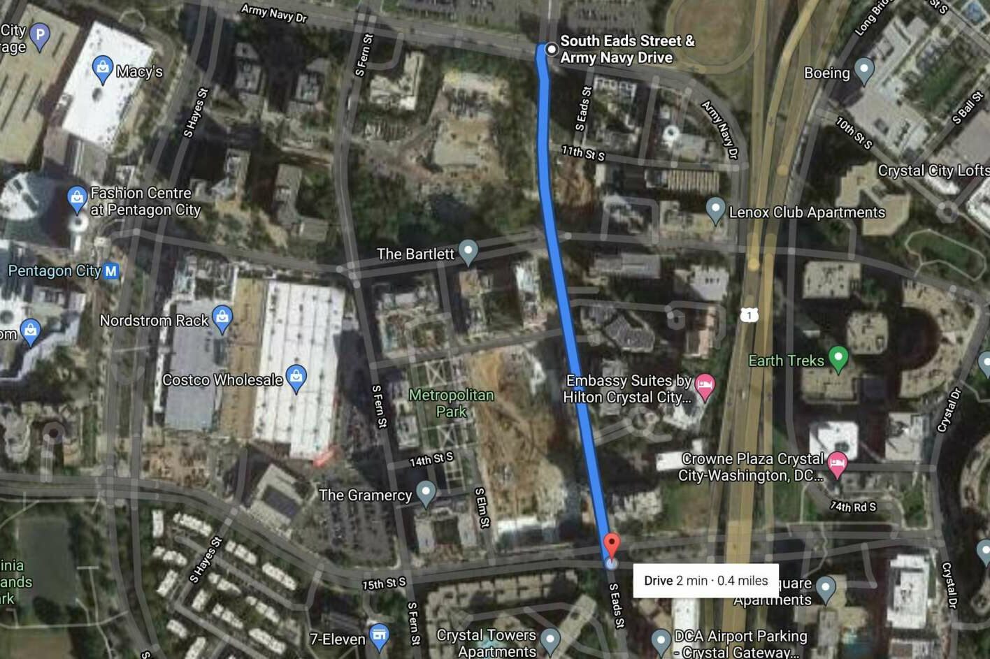
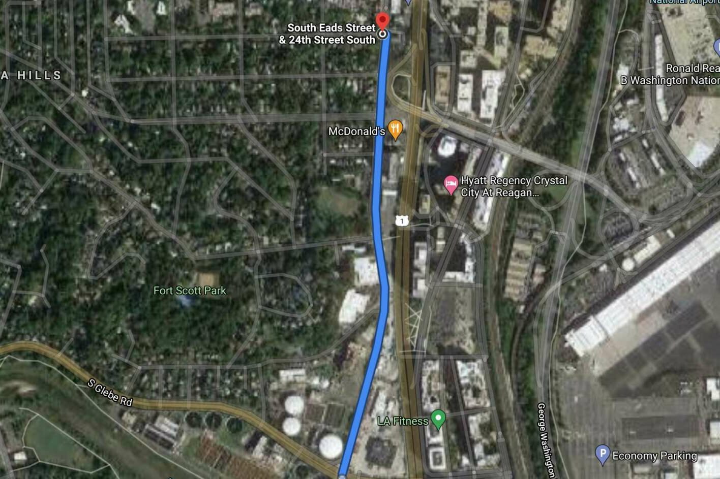
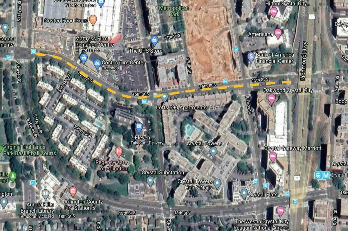
Speed limits on six other road segments would be lowered from 30 to 25 miles per hour:

The project to rebuild Army Navy Drive as a “Complete Street” is in its final design and review phases, according to the county. During construction, the county is recommending a reduced speed along Army Navy Drive of 25 miles per hour. Making the change now would get drivers accustomed to the change, the document said.

“Significant roadway enhancements are included in this project, so to decrease the speed at the onset of construction would provide for a safer work zone for workers and roadway users and support the expectation of lower speeds once the project is completed,” the report said.

The Army Navy Drive project is intended to improve local connections between the Pentagon and the surrounding commercial, residential and retail services by reducing the number of lanes and their width, enhancing pedestrian and cycling activity, and improving transit facilities.

The studies also found that along all seven corridors, “the majority of motorists are comfortable driving within 5 mph of the existing posted speed limit and the proposed decreased speed limit of 25 mph.” Lower speed limits can help accommodate new development and more robust transit infrastructure in the future, the studies suggest.

These changes would cost about $1,500 per corridor to purchase and install new speed limit signs, for a total of $10,500.


(Updated at 12:20 p.m.) New renderings from the National Landing Business Improvement District explore what Route 1 would look like if it were surface-level.

These images of protected bike lanes, pedestrian refuges and prominent crosswalks are part of a campaign the BID launched this week touting the benefits of transforming the highway — which is elevated over 12th, 15th and 18th streets — into an at-grade urban boulevard.

People Before Cars” aims to advocate “for the implementation of best practices in urban street design and highway-to-boulevard conversions,” according to the BID.

The new campaign builds on “Reimagining Route 1,” a report it released last year envisioning the highway as a leafy, vibrant urban boulevard. Meanwhile, the Virginia Department of Transportation is wrapping up a study of how to improve the thoroughfare, which will likely involve making it surface-level.

“The improvement of Route 1 has been a huge priority for the collective community and was even featured in the historic negotiations that brought Amazon’s HQ2 to the area — further cementing its importance in the overall repositioning of National Landing,” said Jay Corbalis, Vice President of Public Affairs for JBG Smith, the largest property owner in the area.

More than half of Arlington residents surveyed by VDOT said Route 1 is not safe, easy or effective to use. About 45% of respondents said cyclists face dangers in the area and 64% want more protected bike lanes.

By 2040, conditions could be worse for drivers, who could experience heavy traffic at snail-like speeds during the morning rush hour, as the National Landing area and the region continues to grow, VDOT projects. Area employment by then is expected to double while the population is expected to grow nearly 50%.

The competing priorities of keeping traffic moving while making the corridor more attractive and safe is a tough balancing act for VDOT, and the BID is pushing a less car-centric approach.

The BID recommends shortening pedestrian crossings, narrowing vehicle travel lanes, dedicating spaces for all modes of transportation and automating traffic enforcement. It also suggests adding lush landscaping, public art and wider sidewalks. Growth does not necessarily equate to more traffic, the BID argues.

“As our area experiences an influx of new residents and workers in the coming years — a population that is anticipated to favor walking and biking as means of transit over cars — we must do all we can to ensure that Route 1 can safely and effectively serve the needs of our growing community,” said Tracy Sayegh Gabriel, President and Executive Director of the National Landing BID.

According to the campaign, traffic fell by 18% between 2000 and 2018, despite 67% population growth during that time. One-quarter of households in National Landing do not have cars, and the number of cars passing through National Landing dropped from 61,000 in 2005 to 47,000 in 2019, the BID says.

Still, JBG Smith and the BID have raised concerns that VDOT still views Route 1 as a highway where drivers are prioritized, the Washington Business Journal reported, after the department previewed a vision of Route 1 that included nine at-grade vehicle lanes at the intersection with 15th Street S.

That worry is shared by some others, who also question whether crossing the road at-grade is safer than the current underpasses.

A group of civic associations, known as Livability 22202, has recommended taking Route 1 below ground instead.

VDOT is slated to issue a new report on possible improvements this summer. A virtual public meeting will be held Wednesday, June 16 at 6:30 p.m.


By 2030, Arlington County aims to have zero transportation-related deaths and serious injuries on its streets and trails.

The County Board took its first step toward this ambitious goal in July 2019, the same year that Arlington registered six fatal crashes, according to county data. The board adopted a “Vision Zero” resolution that, at the time, offered few details. Its second step was to draft a five-year action plan.

After more than a year of work by county staff and review by advisory commissions, the final draft of the first five-year Vision Zero Action Plan, with those long-awaited details, is set to be reviewed by the County Board next Saturday (May 15).

This plan — informed by local crash data, public engagement and talks with other Vision Zero communities — lays out one-time and ongoing projects aimed at improving public safety. These range from installing automated traffic enforcement cameras and lowering speed limits to maintaining a crash data dashboard and educating children about safety with help from Arlington Public Schools.

If adopted, the plan will result in a number of changes locals will see and experience, Principal Planner Christine Baker told the Arlington Transportation Commission in February.

She said these will include enhanced intersections (shown below) and improved warning signs, as well as more education programs and messaging from the Arlington County Police Department.

“It’ll take time to see these improvements on every single street in the county, but in the meantime, we’re going to be reporting our progress on the program,” Baker said. “We’re really excited to be diving into this program.”

The county will update its website and send emailed updates telling people “when they’ll be able to recognize Vision Zero is on the streets,” she said.

Folks may be seeing some recent changes made in the spirit of Vision Zero: Over the last year, the county has sought lower speed limits while raising fines along 11 mostly residential streets in Arlington.

The County Board also made installing speed cameras a legislative priority in the 2021 General Assembly assembly session, a move toward more equitable law enforcement that also would reduce public interactions with police officers.

According to the action plan, there are a dozen target areas to tackle, from pedestrian safety and intersections to drunk or distracted driving and speeding.

Pedestrian safety is the most at risk, according to county data. One-quarter of serious crashes and more than half of fatal crashes involved a pedestrian, though pedestrian-involved crashes account for 5% of total crashes. Bicyclists and motorcycles comprise 2% and 1%, respectively.

The plan also cites data indicating that speeding and turning-related crashes are more common than alcohol-related ones, but almost half of all fatal crashes involved alcohol and more than half occurred at night.

(more…)


New Irish Pub Now Open in Pentagon City — “If your notion of an Irish pub is a static menu of fish n’ chips in a shamrock-decked bar, chef Cathal Armstrong wants to change that perception with Mattie and Eddie’s. The James Beard-anointed chef, who championed seasonal Irish cooking over 14 years at Alexandria’s Restaurant Eve, just opened the gastropub with a large outdoor patio in Pentagon City.” [Washingtonian]

Extended Power Outage in Barcroft — A driver crashed into a utility pole at S. Buchanan Street and 6th Street S. in the Barcroft neighborhood Sunday, initially knocking out power to thousands. Hundreds of homes were still in the dark until early this morning. [Twitter]

Candidate Comes Out Swinging At Dem Meeting — “[Chanda] Choun, who is attempting to unseat sitting Democrat Takis Karantonis in a June primary, did not pull many punches in an April 7 kickoff speech before the Arlington County Democratic Committee rank-and-file. ‘Takis was not the best candidate to represent Arlington’ during a politically and racially charged era, Choun said… If elected, Choun said he would be an elected official who ‘goes beyond the platitudes and buzzwords’ to promote an aggressively left-leaning agenda. One example: Choun said he wanted the county to establish a ‘truth and reconciliation commission’ to focus on equity issues.” [Sun Gazette]

School Board Advances Budget Proposal — “The School Board adopted its FY 2022 Proposed Budget at its April 8 meeting. The proposed budget expenditures total $699,919,805. The School Board amended the Superintendent’s FY22 Revised Proposed Budget by reducing the budgeted expenditures by $6,796,056 and 35.00 FTE and replacing the 2% cost of living adjustment with Compensation Option 1. Compensation Option 1 provides different compensation models by employee scale to ensure that every employee in the school division receives a compensation increase.” [Arlington Public Schools]

Pentagon Police Officer Faces Murder Charges — “Takoma Park police have charged the off-duty Pentagon Force Protection Agency officer they say shot and killed two men Wednesday morning in Montgomery County, Maryland. The officer has also been charged for an alleged assault that happened last year. David Hall Dixon, of Takoma Park, has been charged with two counts of second-degree murder, two counts of use of a handgun in commission of a felony and reckless endangerment.” [WTOP]
Don’t Hang Up on 911 — From Arlington County: “Oops, did you call 911 by mistake? It’s OK, just stay on the line and tell the friendly dispatcher it was an accident. That way, they can confirm there’s no emergency… Otherwise, we’ll have to call you back, taking away a dispatcher who could help someone who needs it.” [Twitter]

County Getting Paid for Glass Recycling — “Arlington’s glass recycling drop-off program continues to shatter expectations–surpassing 5 million pounds (2,500 tons) collected since its debut in 2019. And the effort is officially paying off. The County now receives $15 per ton for glass collected as the result of a new hauling and commodity contract with a Pennsylvania recycler.” [Arlington County]
VDOT’s Route 1 Proposal Bombs — “As a new vision for Crystal City’s portion of U.S. Route 1 comes into focus, local businesses, neighbors and the area’s dominant landlord are all becoming increasingly concerned… Renderings unveiled in a Virginia Department of Transportation meeting Wednesday night have united the National Landing Business Improvement District, JBG Smith Properties and some neighborhood activists in opposition over fears that the designs are still too car-centric.” [Washington Business Journal, Twitter]

Police Warn of Ongoing Scams — “The Arlington County Police Department is sharing information on common scams circulating in Arlington County and ways you can spot, avoid, and report them. The public should be particularly cautious of anyone calling, emailing, or interacting with them and requesting payment in the form of gift cards as this is often a red flag for fraud.” [ACPD]

Driver of Stolen Car Escapes — “At approximately 2:15 a.m. on March 3, a patrol officer observed a stolen vehicle traveling on S. Carlin Springs Road. Before a traffic stop could be initiated, the driver accelerated the vehicle and made evasive turns before pulling over and fleeing the scene on foot. A perimeter was established and officers, with aerial support from the Fairfax County Police Helicopter Division, conducted a search for the driver with negative results.” [ACPD]

New Race Planned Next Weekend — “Join Arlington For Justice and Black Parents of Arlington for the 1st Run For Her Life (Women’s Only) 5k WALK and YOGA Event… March 13, 2021 at 2 p.m.” [Facebook]


View More Stories