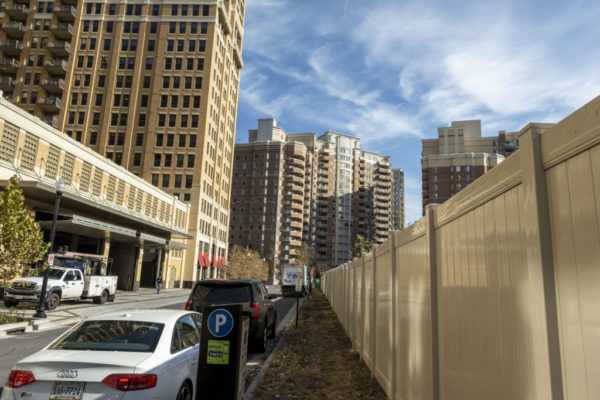
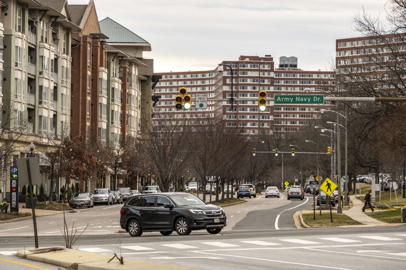
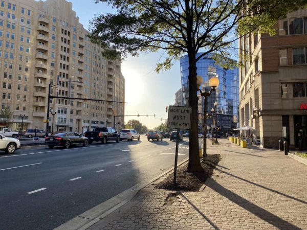
County staff has released its recommendations on how to improve Crystal City’s bike lane network.

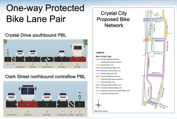
The proposal includes adding one-way protected bike lanes on Crystal Drive and S. Clark Street, improved cross-street east-west connections, and additional protected or buffered bike lanes on 15th, 18th, 23rd, and 26th streets.

In March 2020, the Arlington County Board directed staff to develop a plan to improve the bicycle network “east of Richmond Highway, from the Alexandria border extending north to Long Bridge Park.” The requirement for the proposal is that it needed to be completed within four years — by Dec. 31, 2024 — and require minimal changes to the curb line.

The broad goals, according to the county, were to improve safety, provide greater access to trails, improve connections, and reduce blocking of bike lanes.

“By providing additional protected and buffered bike lanes, the County can increase safety for people riding bikes while also addressing challenges like bike lane blocking,” Eric Balliet, spokesperson for Arlington’s Dept. of Environmental Services, wrote in an email. “The bike network will also support Crystal City as a multimodal hub by balancing the multiple needs of the streetscape, such as parking, pick-up/drop-off, and transit.”

Balliet noted that residents want safer connections to the nearby Mount Vernon and Potomac Yard trails.

Staff considered several other options, but those rejected either didn’t fully address safety issues, could not be completed in the four-year timeline, or substantial capital improvements would be needed.

Not everyone thinks the recommendations go far enough. Darren Buck, who serves on Arlington’s Transportation Commission and lives in the Aurora Highlands neighborhood, said the recommendations reflect a “short-term view” that will not age well given that Crystal City in the midst of so much development.

“Let’s create a road map with a long-term vision, especially on Crystal Drive,” Buck says. “Let’s plan ahead with a 10 or 20 year goal for how that street should look.”

Right now, he says, gaps remain in the plan that doesn’t fully protect and provide safety to cyclists on all Crystal City streets, particularly from 18th Street to Clark and 27th streets.

For the county’s part, Balliet says that Crystal Drive has proven to be a challenge.

“There’s a fixed amount of space in which cyclists, pedestrians, transit, vehicles, emergency vehicles, and the needs of businesses all must be accommodated,” he writes.

Buck does say he’s “thrilled” to see the recommendations include a number of protected bike lanes.

I have wanted to see a protected bike lane on that one single block of 18th Street that leads to the Mount Vernon Trail for years,” he says. “It is a big missing piece in our network and it’s just super exciting.” 

He also cites the inclusion of east-west connections to 23rd Street and lanes on the block of 15th Street leading to Crystal Drive as another great step.

Members of the public will be able to share their thoughts on the recommendations on Wednesday, Feb. 24 at a virtual community meeting. A second public engagement meeting will be held in the spring.

Public feedback will be incorporated into the development of a “preferred alternative” plan, says Balliet.

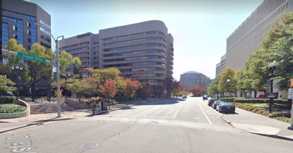
Photo (top) via Google Maps


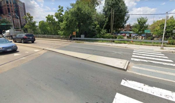
Shirlington Road bridge crosswalk (Photo via Google Maps)

As Arlington County prepares to build a new pedestrian and bike bridge in Shirlington — two decades in the making — some continue to express concerns about safety.

Late last week, the county brought advanced concept designs to the community for a new pedestrian and bike span between the Shirlington and Green Valley neighborhoods, and for maintenance to the existing bridge, which has only a narrow pedestrian sidewalk.

While incorporating previous public feedback into the design, questions still cropped up about safety and convenience, particularly regarding the crosswalks across busy S. Arlington Mill Drive and Shirlington Road, which provide access to the W&OD and Four Mile Run trails. Both are heavily-traveled by cyclists.

The first part of the project will be to improve and update the existing bridge. The bridge is in need of routine maintenance and resurfacing, and this project provides a chance for other needed renovations, the county says.

Based on public feedback, staff said they will widen the sidewalk to about 7 feet from a previous 3-5 feet. They will also coordinate the design aesthetic with the renovations to Jennie Dean Park, while adding new guardrails.

However, despite some urging it, the county won’t be removing the slip lane from the I-395 ramp. While admitting that it’s not bike or pedestrian-friendly, county officials say there isn’t much that can be done at present.

The lane is owned and maintained by the Virginia Department of Transportation. Adding a crosswalk there would also increase risk for an incident due to traffic taking the right turn with speed, while the lane it could lead to traffic backing-up on the I-395 ramp.

“We, at the county, are very much interested in [removing the lane],” said Jason Widstrom, Arlington County Transportation Capital Program Manager. “Unfortunately… it is not within our authority to remove it.”

Construction for these renovations should begin in the late summer or early fall of this year and be completed prior to the end of the year.

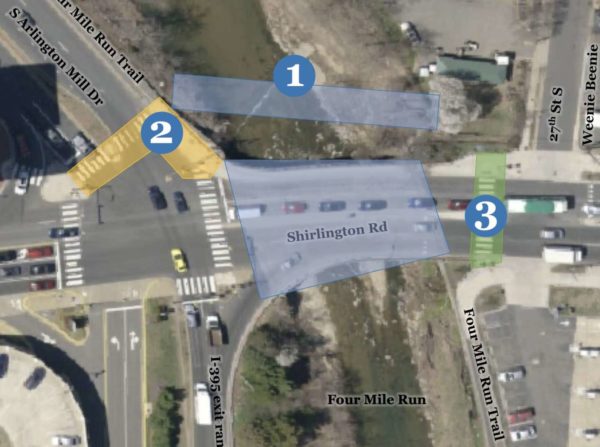
Then, at the end of 2021 or beginning of 2022, construction will begin on a prefabricated, 15-foot pedestrian and bike bridge located 20 feet to the west of the existing bridge. It will parallel the existing bridge, will be multi-use, and have “enhanced pedestrian treatments.”

Additionally, improvements are being made to those crosswalks at Arlington Mill Drive and near the Four Mile Run Trail.

Based on feedback, the county is widening pedestrian ramps and the refuge median, redesigning curbs and the crossing to allow for better sightlines, and adding new rapid flashing beacons to improve visibility of the crosswalk. There’s also thought of trimming trees to further help sightlines.
Crosswalk safety, particularly near the Four Mile Trail, has long been a concern for residents.

“County staff is well aware of the history of the crosswalk and the troubles of trying to cross at this location,” says Widstrom.

Funding for these projects are coming from a state grant and will cost just over $1 million.

County officials said they would like to do a longer term study about adding a bridge that goes over Shirlington Road and thus separates vehicle and pedestrian traffic.

That study remains “down the road,” however, and costs to add that bridge could exceed $8 million.

In the meantime, said Widstrom, “we are trying to make the situation a bit better.”

Photo (1) via Google Maps, (2) via Arlington County


While VDOT considers lowering a section of Route 1 to a surface boulevard, a group of civic associations, known as Livability 22202, recommends going below ground instead.

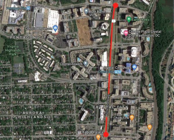
As development activity in Crystal City and Pentagon City continues, VDOT and Arlington County are looking for ways to improve the pedestrian and transit experience along Route 1, also known as Richmond Highway. The study directly responds to the increased demand for transportation resulting from the construction of Amazon’s HQ2.

VDOT’s study will examine the feasibility of an at-grade boulevard, with the current overpasses removed, comparing it to the current elevated route and the changes prescribed in the Crystal City Sector Plan, according to a presentation from December.

Following online public engagement in the fall and a virtual public meeting, Livability 22202, which represents the Arlington Ridge, Aurora Highlands and Crystal City civic associations, published a series of alternatives to an at-grade boulevard — including taking part of Route 1 below-grade.

The group suggests going underground for at least the 18th Street S. and 23rd Street S. intersections, creating patterns similar to those in Washington, D.C., where through-traffic is below-grade and local traffic uses at-grade streets — like Connecticut Avenue NW through Dupont Circle.

For a more extensive below-grade roadway, the group suggests trenched express routes from 23rd Street S. to 15th Street S., flanked by at-grade roads. The underground portion would eventually transition into the 12th Street overpass.

“This concept would solve side-street traffic issues, create far-safer pedestrian crossings, create a brand-new open space in what is now wasteland, and open up myriad redevelopment opportunities,” the group said in its response. An even more extensive “big dig” is also proposed, though the group acknowledges is may be “infeasible.”

Dropping Route 1 to grade and creating more signalized intersections would make pedestrians and cyclists less safe unless significant measures are put in, Liveability 22202 predicted. They suggested lower speeds, bike tunnels, signalized right turns and pedestrian-led crossings.

The group also envisions an at-grade boulevard as a “linear park” with retail, wide sidewalks and an abundance of trees.

If VDOT keeps Route 1 elevated, Livability urged VDOT to consider something like a viaduct. Such a bridge would allow the space below to be activated with open spaces or retail.

In a letter, the presidents of the three civic association said “a study of Route 1 in this area is long overdue,” but until VDOT conducts a broad stakeholder review of multiple alternatives, “we endorse the Crystal City Sector Plan as the best alternative.”

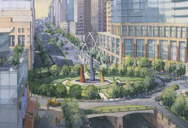
The 2010 sector plan keeps the grade separations at 12th, 15th and 18th streets, reconfigures the 15th Street intersection and takes traffic below-grade at 26th Street S., under a newly-created National Circle, as pictured below.


A virtual public meeting is being held this week on the topic of potential improvements to Route 1 through Crystal City.

VDOT and Arlington County are studying ways to improve the safety, accessibility and experience along Route 1 between 12th and 23rd Street. The study responds to greater demand for various transportation methods as construction of Amazon’s HQ2 progresses.

“As this area’s commercial and residential densities continue to increase, transportation plans will need to address the wide-ranging needs of pedestrians, bicyclists, transit riders, motorists, and other users while maximizing the safety, convenience, and sustainability of the system for decades to come,” said the VDOT study page.

Participants in the online meeting, scheduled for Wednesday at 6:30 p.m., will hear a review of existing conditions on Route 1 — also known as Richmond Highway — and learn about responses to a public survey that was open during October and November. They can also ask questions and give input.

The public is invited to provide comments during the meeting or through Monday, Dec. 28.

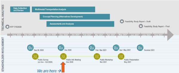
After the meeting, the public will hear and have the chance to provide feedback on draft recommendations in spring 2021. Officials expect the final study to be done next summer.

“At this time, no construction funding has been allocated, so the study will not set design or construction dates,” the VDOT website said.

The department is not the only group thinking of ways to improve the highway. In October, the National Landing BID released “Reimagining Route 1,” a report that transformed the car-centric highway into a safer boulevard lined with trees, retail and restaurants.

“Route 1 was originally designed to accommodate the auto-centric development trends of the mid-20th century, when the primary objective was to move cars through the area as quickly as possible,” the BID said in a press release. “The resulting elevated highway, super blocks, and oversized intersections divided the community for decades, inhibiting not only connectivity and access, but also the area’s ability to come together as a singular downtown district.”

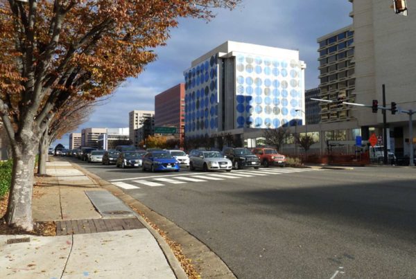
VDOT is studying the Route 1 overpasses over 12th, 15th and 18th streets, which some have called to be eliminated in favor of more urban intersections at grade.

Those interested in joining the virtual meeting can register online or participate in listen-only mode by calling 877-309-2071 (access code 205-472-841).

The study team will make a short presentation beginning at 6:30 p.m. and answer questions for about an hour afterward, the website said. A recording and meeting materials will be available online following the meeting.

In addition to doing so during the meeting, feedback can be provided via a comment form or email.


Arlington County is expected to pilot a program that prices parking by demand along Metro corridors.

The proposed $5.4 million program, funded by VDOT, is slated to be considered by the County Board this weekend.

Staff recommend that the Board accepts the state funding and approve the pilot that would alter parking prices based on the day, time and number of people competing for a spot. It would also give drivers real-time information on spot availability and price.

The grant has been approved by the Commonwealth Transportation Board and staff included the project in the 2021 fiscal year capital improvements plan, a county staff report says. The County will not have to match state funds.

“The Commonwealth’s recognition of the innovative nature of the project… serves not only as a recognition of the relative level of risk, when compared with a traditional highway or transit project, but also of the project’s promise and potential transferability to other locations in the Commonwealth,” said the county staff report.

In other words, the state is willing to take a chance on the system in Arlington, and should it succeed other communties follow Arlington’s lead.

Demand-based parking, which county staff call “performance parking,” is being piloted in a few cities across the country, including D.C.

The District Department of Transportation said this program, which was tested over the course of four years in Penn Quarter/Chinatown, “was largely successful.” It provided real-time information on spot availability and was able to lower or raise prices, which encouraged turnover and, as a result, increased the number of available spots.

Proponents say surge price parking reduces the number of cars on the road and lightens congestion caused by people circling blocks looking for spaces. At the time, critics said that D.C.’s surge-price parking would hurt low-income people looking to visit popular destinations.

The County Board last reviewed the idea for this system two years ago, when the board gave staff the green light to apply for “SMART SCALE” funding — to the tune of $6.1 million — to pilot the project.

If Arlington was chosen, those funds would not have been available until July 1, 2024. But the reason staff included the project in this year’s capital improvement plan is because the state gave the county a new offer.

“In the fall of 2018, during the application evaluation process for SMART SCALE, the Commonwealth, through one of the Deputy Secretaries of Transportation, approached Arlington County and asked if it would accept funding from [VDOT’s Innovation and Technology Transportation Fund] instead of SMART SCALE,” the county staff report says. “ITTF was designed specifically for cutting-edge projects like Performance Parking that advance the state of the practice in transportation.”

Work on the new system along the Rosslyn-Ballston corridor and Crystal City-Pentagon City corridor is expected to start kick off during the current fiscal year, which ends on June 30.

“A total of $700,000 is anticipated to be used for FY 2021,” the staff report says. “The balance of funding will be used in FY 2022 and FY 2023… These funds will be used for design, installation, testing, and deployment of a pilot hardware and software system.”


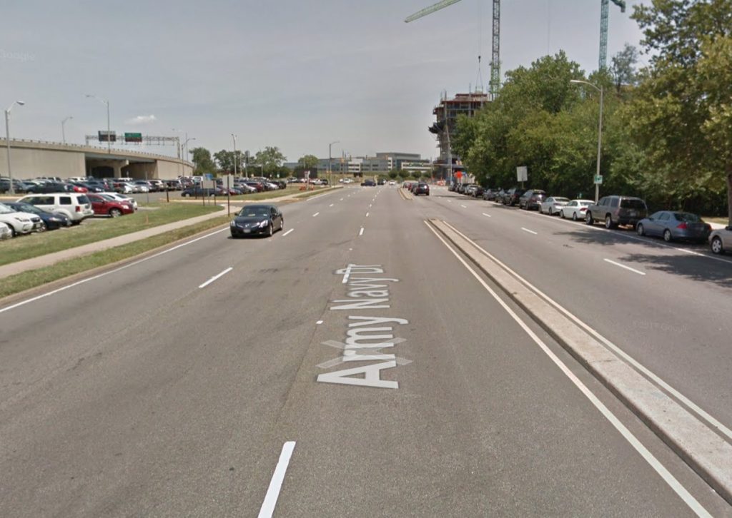
After five years, Arlington County is putting finishing touches on its Complete Street plan to improve walking, biking and driving conditions along a stretch of Army Navy Drive in the Pentagon City area.

The updated plans — which are 90% complete — were presented in a virtual public hearing on Wednesday. County staff are taking public comments via email on this version until Dec. 4, and the final plans will be submitted next summer. Construction on the section of road from S. Joyce Street to S. Eads Street is slated to begin in 2022.

The $16.87-million project aims to reduce conflicts among cars, buses, bikes and pedestrians with narrower lanes, stretches of bus-only lanes, protected left turns and signalized right turns, clearer sidewalks and shorter crosswalks. The south side of Army Navy Drive will have two-way bike lane protected by a line of trees.

“A lot of the signalizations will improve safety, prevent fatalities, reduce collisions, things like that,” Jon Lawler, the project manager, said during the meeting.

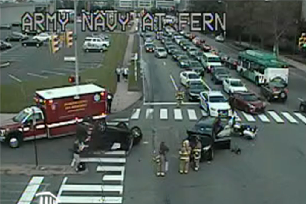
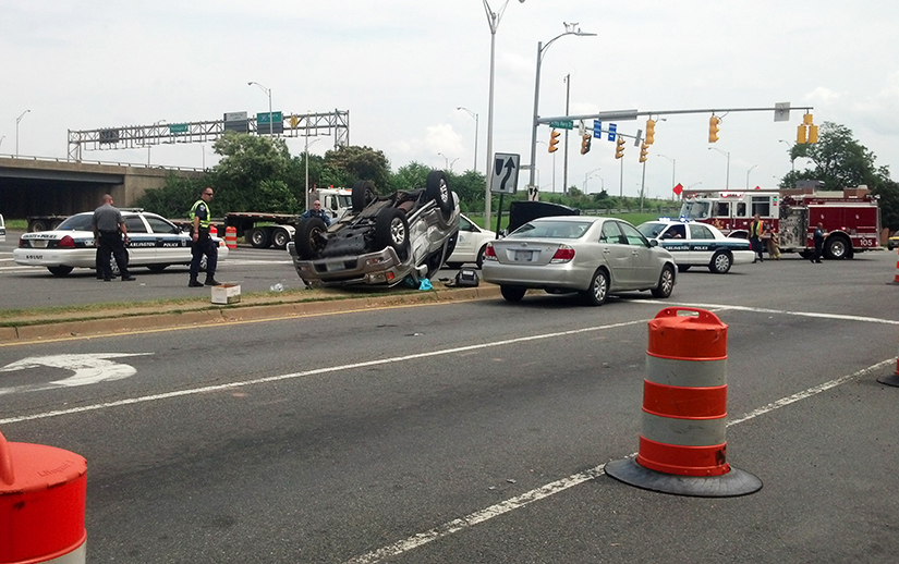
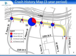
Crashes happen frequently in its intersections: Staff said the S. Hayes St/I-395 off-ramp intersection had the second-most collisions of any Arlington intersection in 2016.

The measures mean the new Army Navy Drive will be reduced to two through lanes in each direction, narrowing to one lane east of S. Eads Street.

“This segment has much lower traffic volumes than the other four blocks of the project corridor,” Lawler said in an email.

Reducing a lane of traffic to accommodate a bus lane between S. Joyce Street and S. Hayes Street will actually improve flow because buses will not block traffic while loading passengers, he said.

Traffic lanes will be narrowed to slow down cars, but staff are not planning to propose a lower speed limit, which is 35 miles per hour, Lawler said during the meeting.

Construction is still a ways off. Staff expect construction to begin in the spring of 2022. With work scheduled block by block to minimize disruptions, it could last until the fall of 2024. Original plans had construction starting in 2020 and ending in 2022.

Lawler attributed the delays to the additional tasks needed for a project receiving federal aid.

“For this project, it took much longer to receive our National Environmental Policy Act document approval than we had envisioned,” he said in an email.

Staff skipped the 60% design phase to make up for lost time, he said.

After the medians are removed, work will start on the south side of Army Navy Drive, beginning with the area where Amazon HQ2 will be, along S. Eads Street, and moving west. Once the medians are replaced, the road will be repainted and striped, concluding the project.

Lawler said in the meeting that “we won’t have any conflict” with Amazon construction.

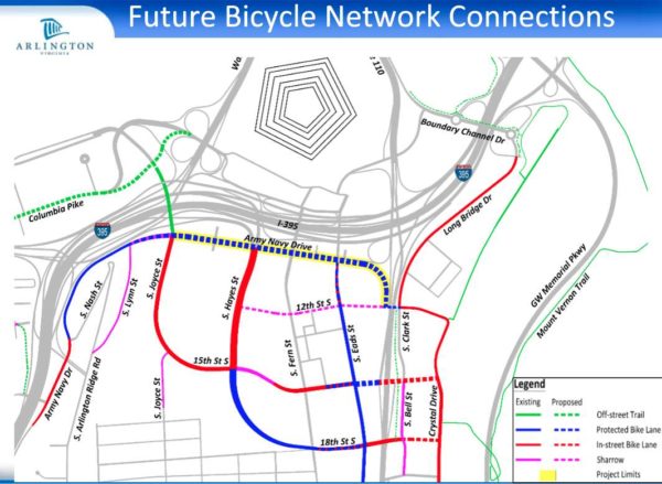
Community feedback led to two major changes, he said. First, another block of protected bike lane was added to connect the bike lane west of S. Lynn Street with the planned protected bike lane starting at S. Joyce Street.

“This way we don’t have a missing link in the system,” Lawler said in the meeting.

Staff could not insert this change into this project, as it is receiving federal funding, so they created a separate capital improvement project to address it, he said.

From S. Lynn Street — near Prospect Hill Park — to S. Eads Street, Army Navy Drive is “pretty uncomfortable to use scooters and bikes on,” Lawler told ARLnow after the meeting. “The changes will provide them a safer route for them to use.”

With the changes, bicyclists on Army Navy Drive will be able to use the major east-west link more easily to connect with the Mount Vernon Trail and get to Washington, D.C., he said.

Another change was to align the bumpy pedestrian ramps with the crosswalk. Initially, the ramps were perpendicular to the crosswalk, which advocates said directs vision-impaired pedestrians into harm’s way.


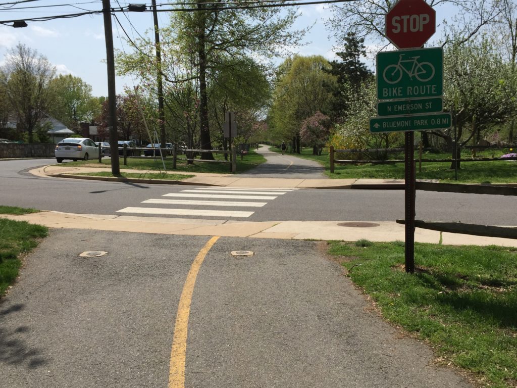
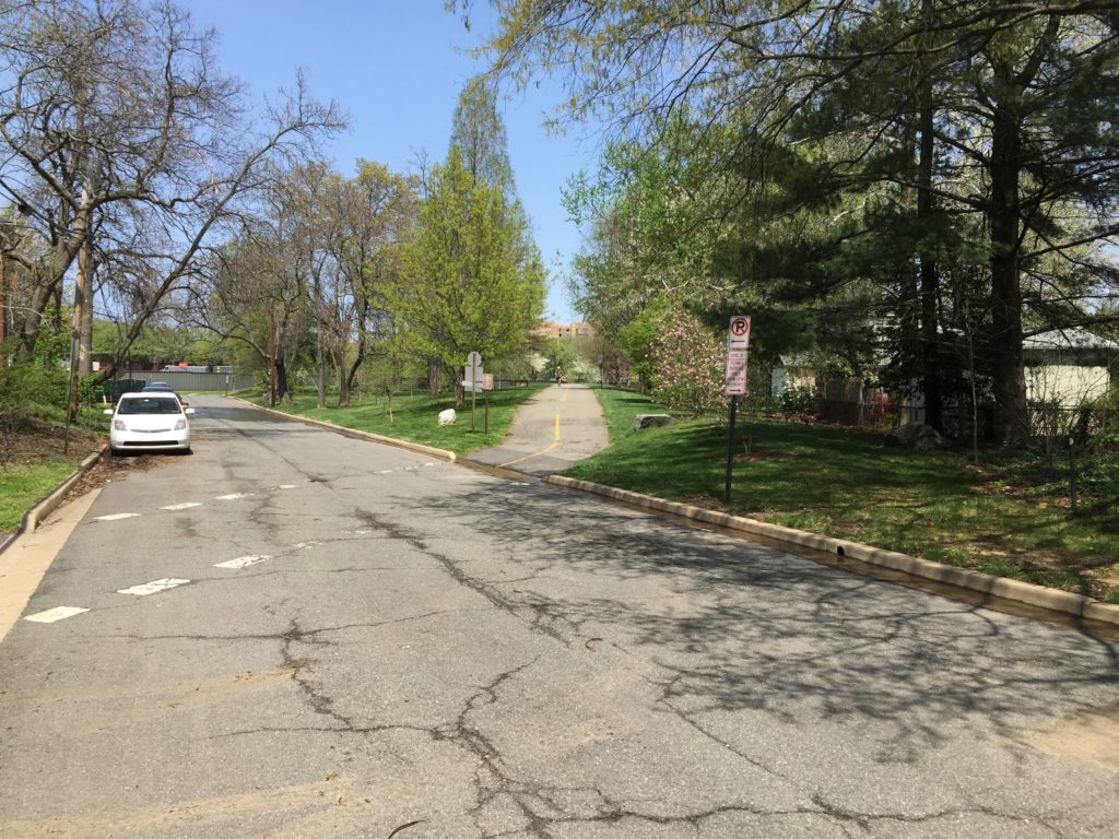
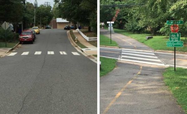
County staff are accepting public comments on some long-awaited safety improvements at three intersections along the Bluemont Junction trail.

Residents will be asked if the proposed changes would make them feel safe using the trail or driving across it. The engagement period is open through Friday, Nov. 20.

For years, users have said conditions are unsafe along the trail, which connects Ballston with the Washington and Old Dominion trail at Bluemont Park. It’s difficult for trail users and drivers to see one another at the intersections, until the former are already in the crosswalk.

Discussions and presentations on upgrades began last winter, but staff had to pause their progress this spring due to the pandemic. Work resumed this fall.

“Trail safety and access issues for the Bluemont Junction trail were first raised by the community in 2013,” the county project page said. “The project has evolved to focus on the three intersections included based on site visits, data analysis, and community input.”

The intersections are at N. Kensington Street, N. Emerson Street and N. Buchanan Street.

The Bluemont Civic Association, the Bicycle Advisory Committee and Pedestrian Advisory Committee provided input on the preliminary designs. The public comment period through Nov. 20 will inform the design plans that county staff will present to stakeholders for more comments once they are 30% complete.

“This project was identified as necessary to improve safety and accessibility at intersections where the trail and the street network meet,” the county staff project page said. “It will benefit people walking, biking, accessing transit, and driving.”

Where the trail intersects with N. Buchanan Street and N. Emerson Street, the trail and road are at different elevations and visibility is low, the survey said.

Although the trail is typically more heavily used than the roads, signs are limited and the street markings are worn out.

At N. Buchanan Street, staff propose using striping at the trail crossing to slow speeds and give motorists more time to see trail users, adding warning signs and possibly creating a raised crossing.

At N. Emerson Street, county staff propose raising the crossing, changing the angle of the approach to the trial and adding signs. 

Sightlines at the N. Kensington Street intersection are limited and nearby transit stops are not ADA accessible, the survey said.

They propose narrowing the trail crossing, adding ADA-compliant transit stops with boarding platforms, bringing the raised crossing up to trail grade, adding ADA-compliant tactile warning strips and improving the high-visibility crosswalk markings.


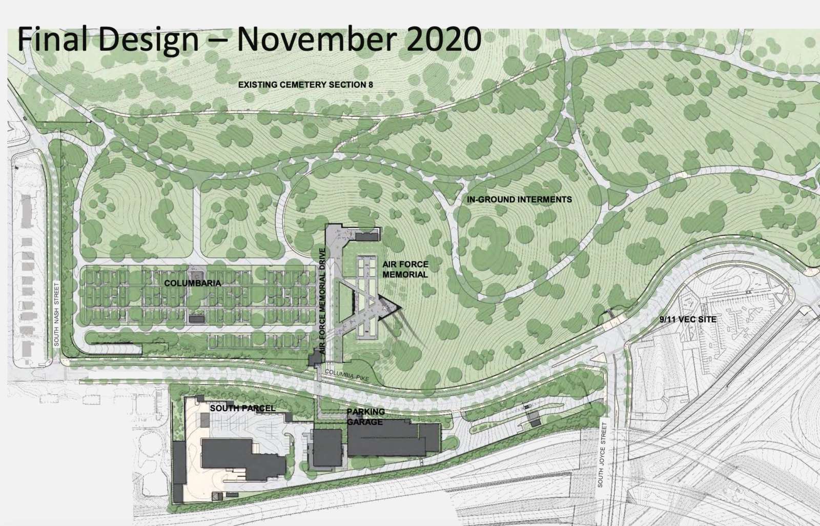
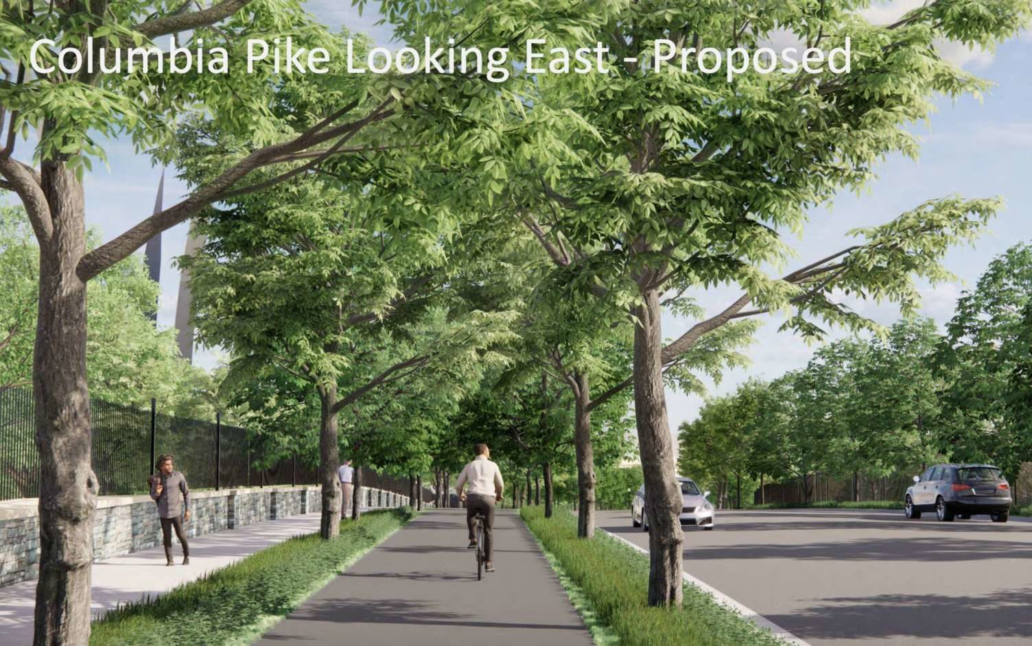
A major project to add 70 acres to Arlington National Cemetery while reconfiguring the eastern end of Columbia Pike is inching forward.

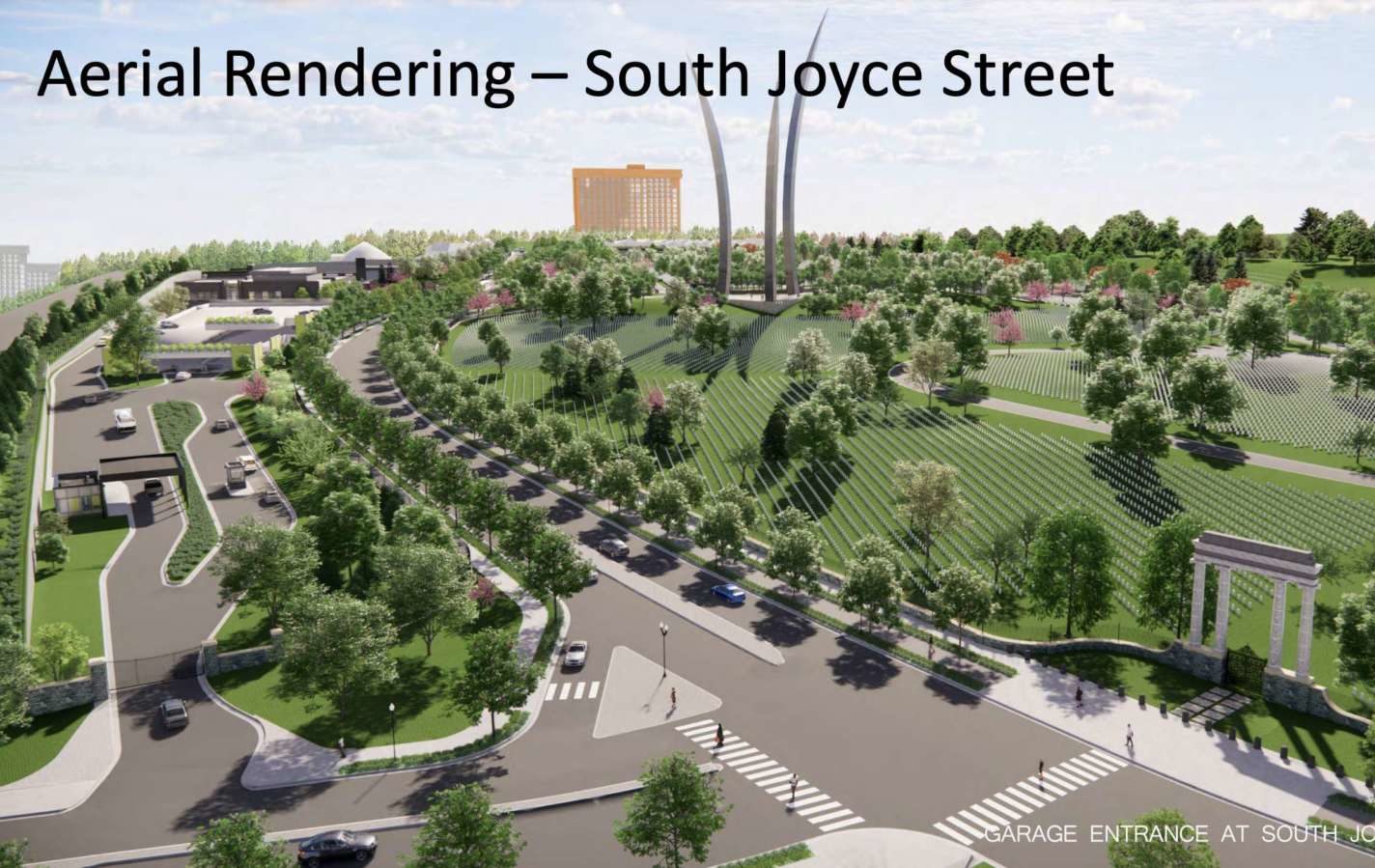
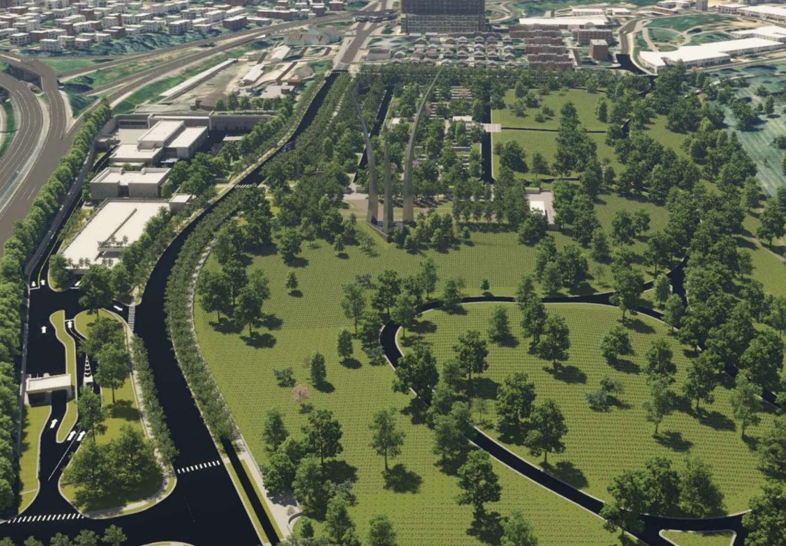
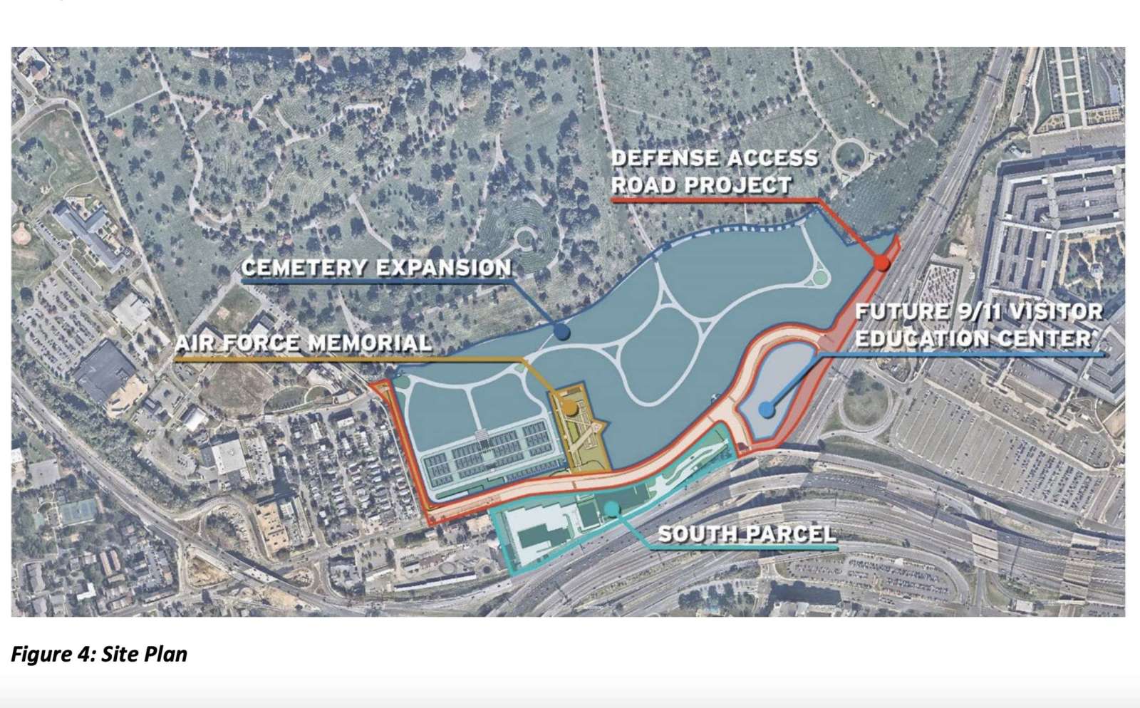
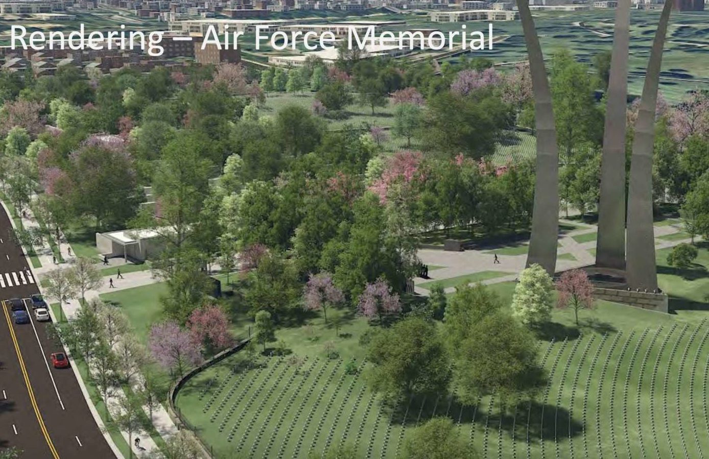
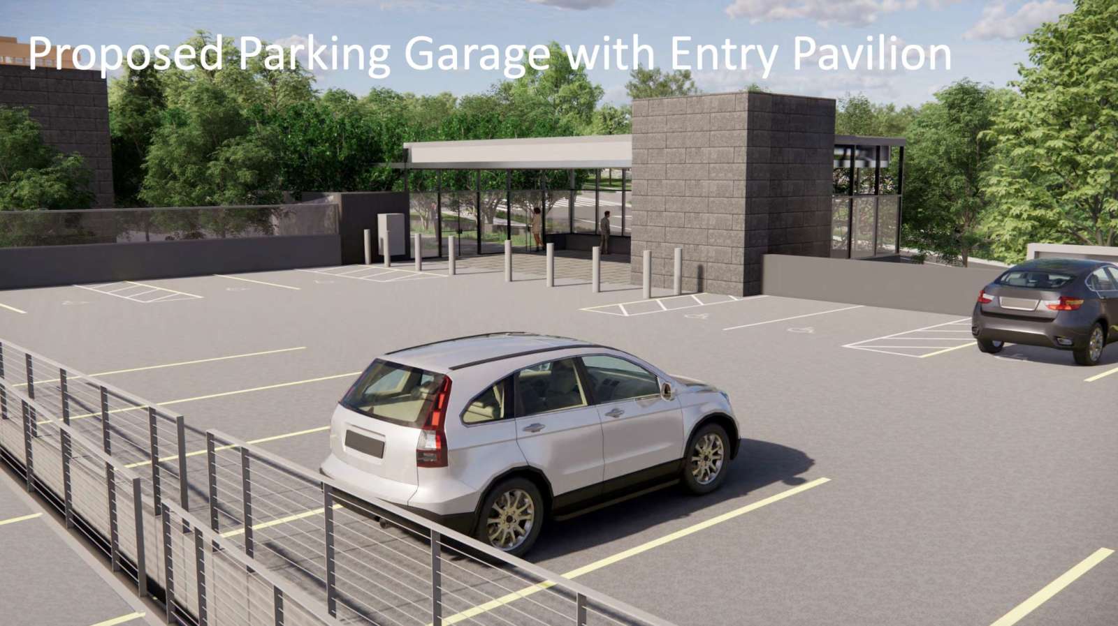
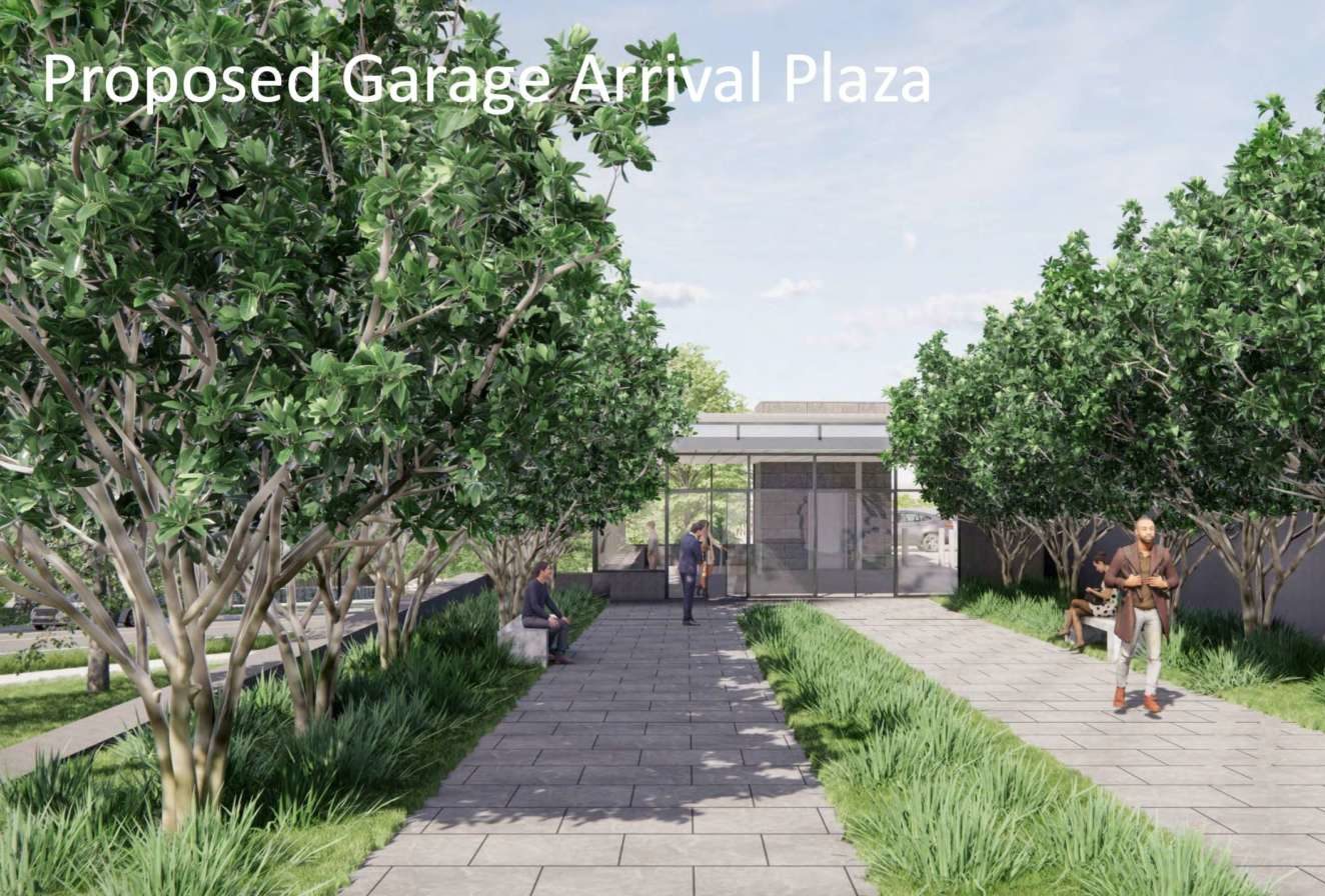
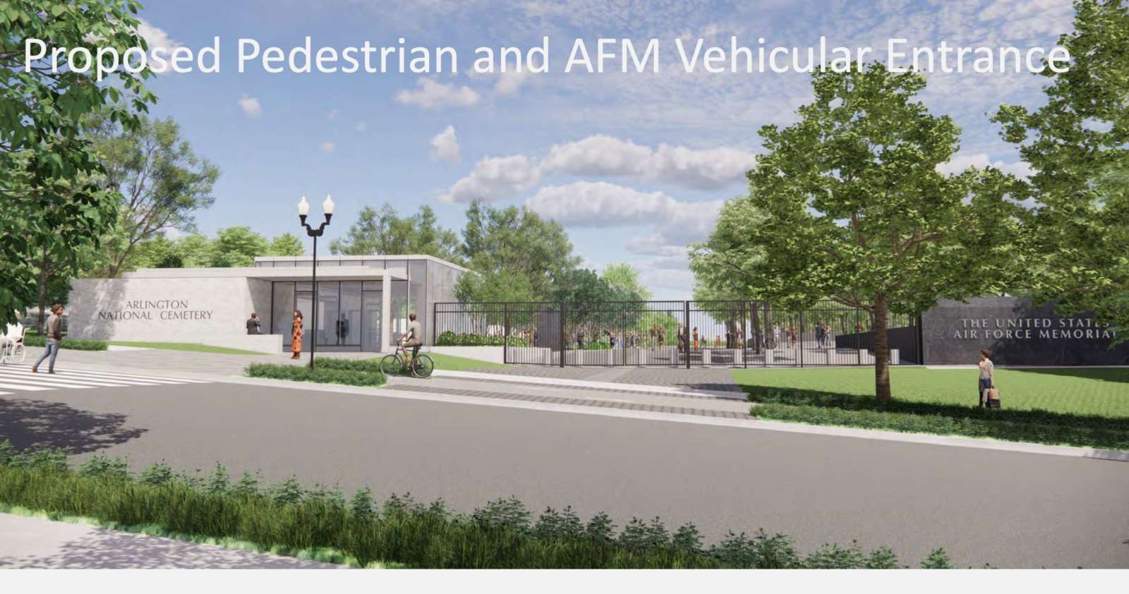
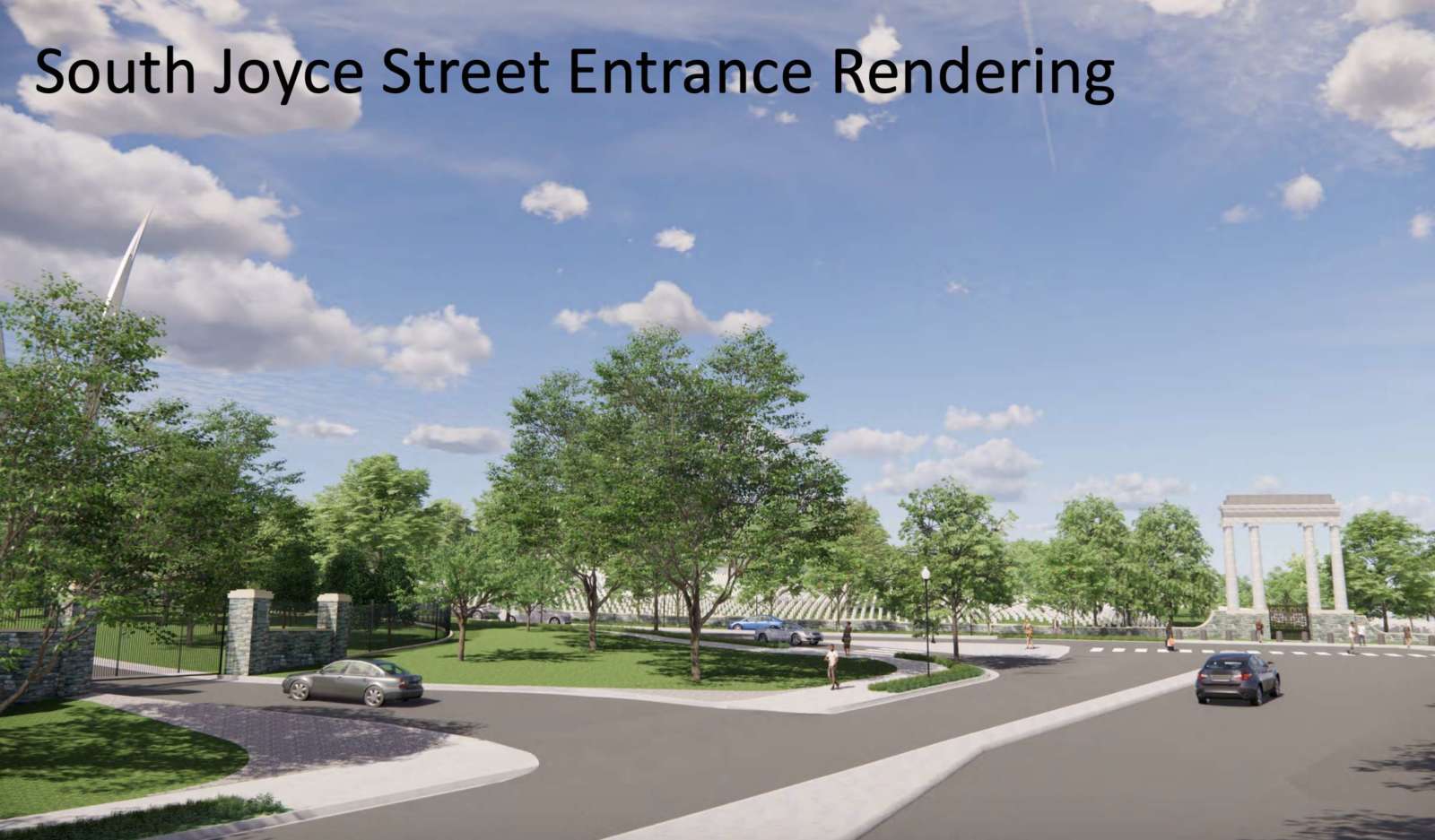
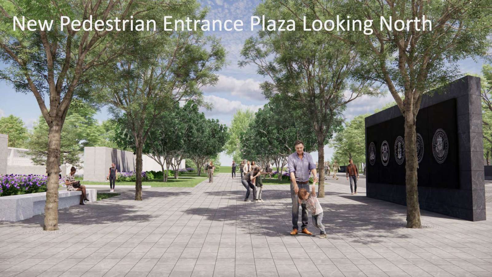
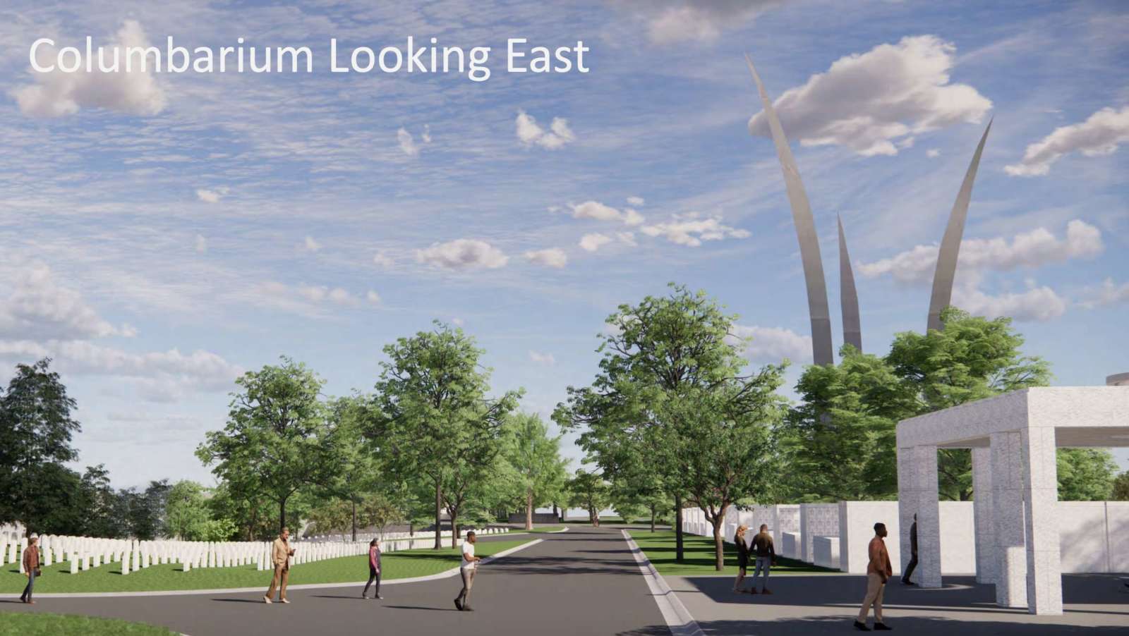
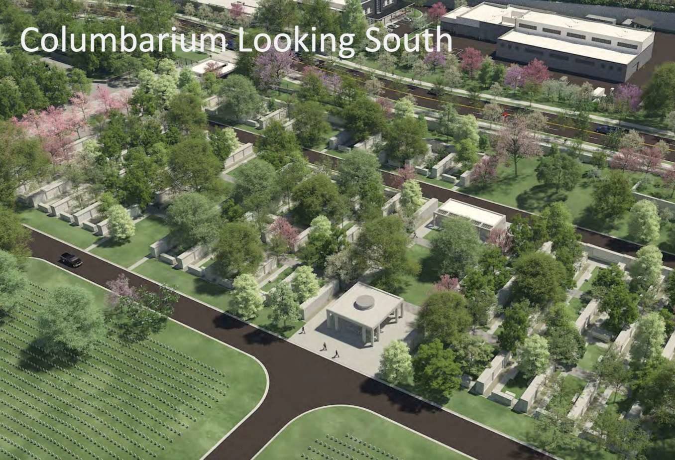
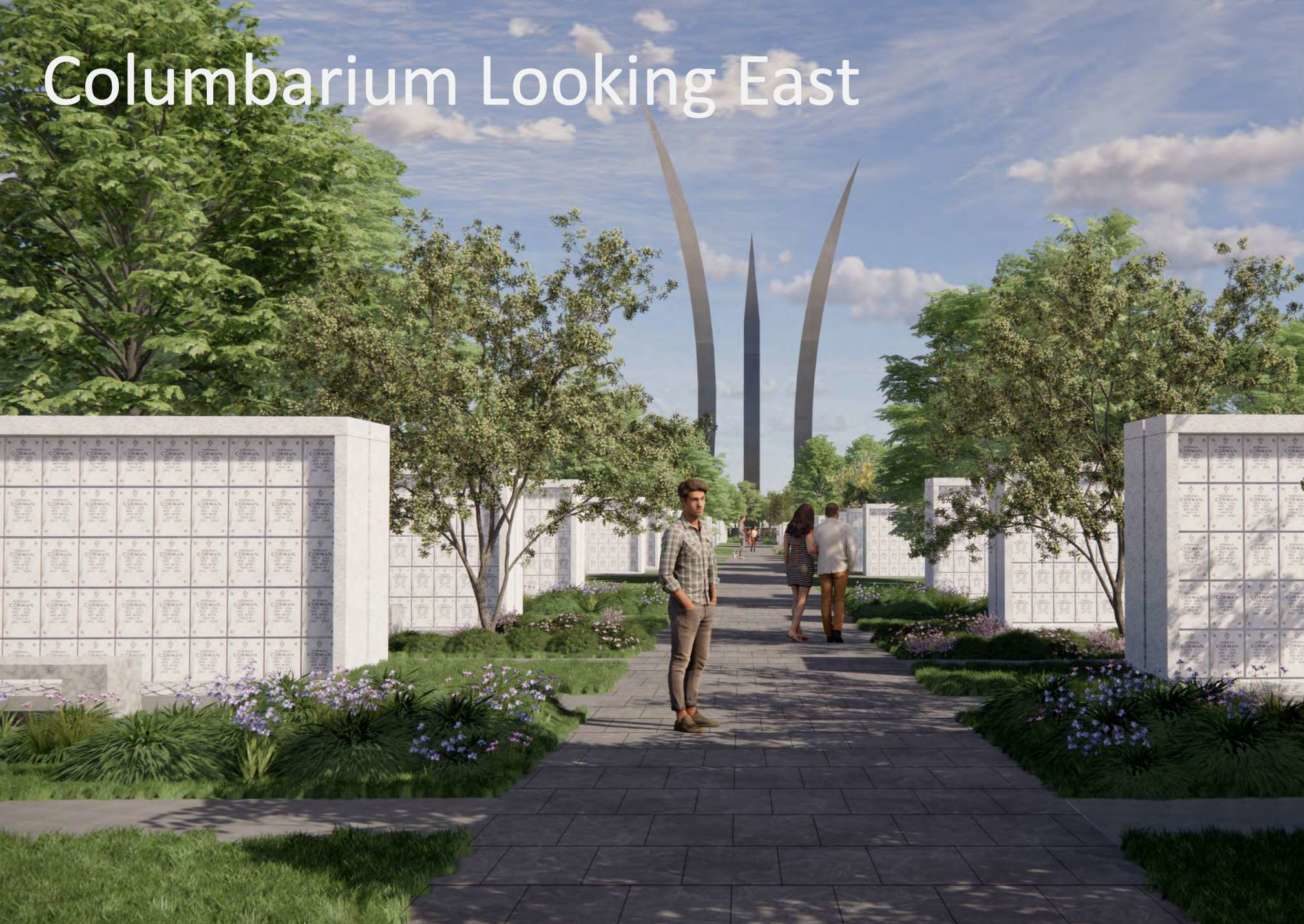
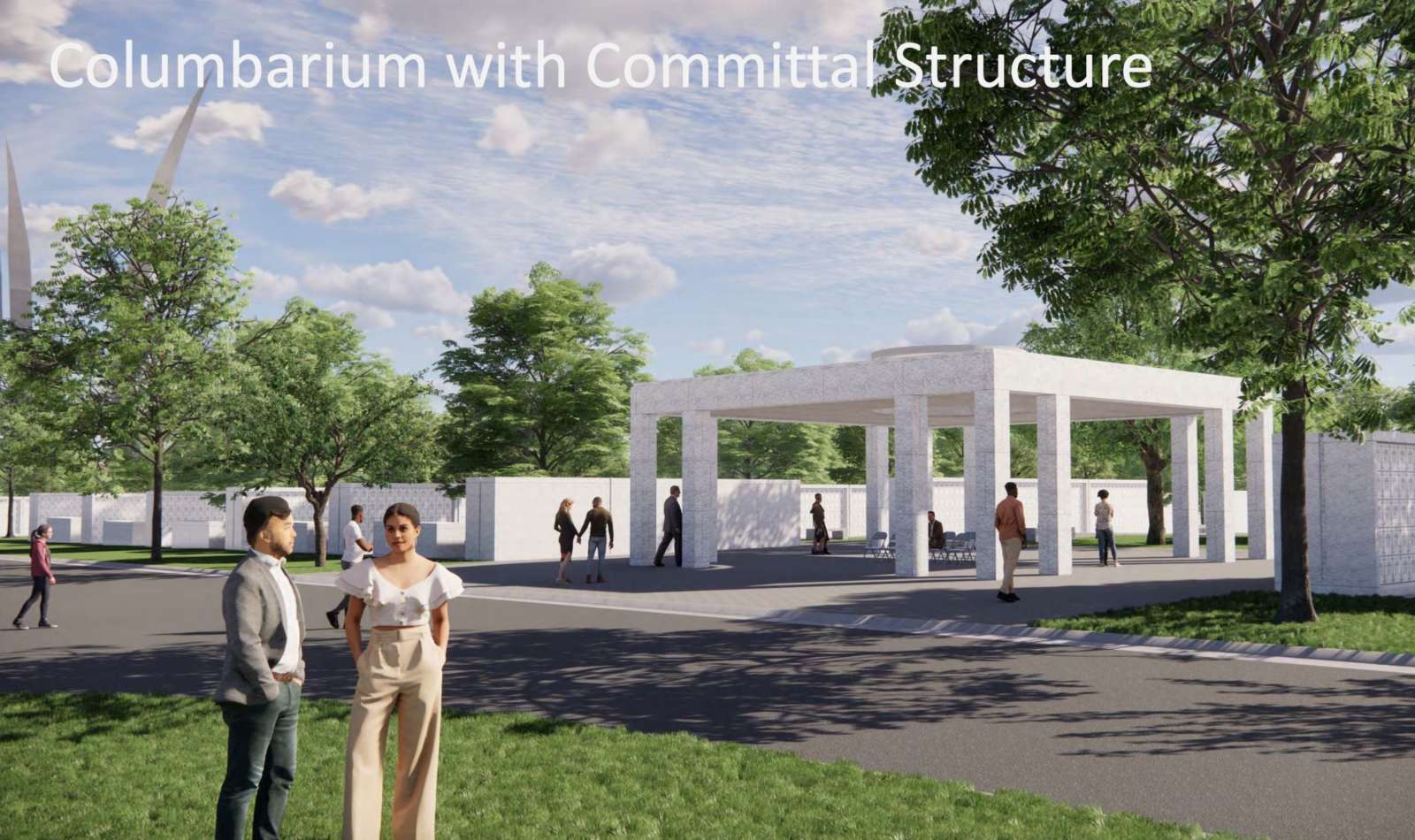
The cemetery’s southern expansion project will add about 60,000 burial sites, across 37 acres of new burial plots and an above-ground columbarium, allowing the cemetery to continue military burials through the 2050s. It will also bring the Air Force Memorial within the cemetery grounds, and add a parking garage across Columbia Pike.

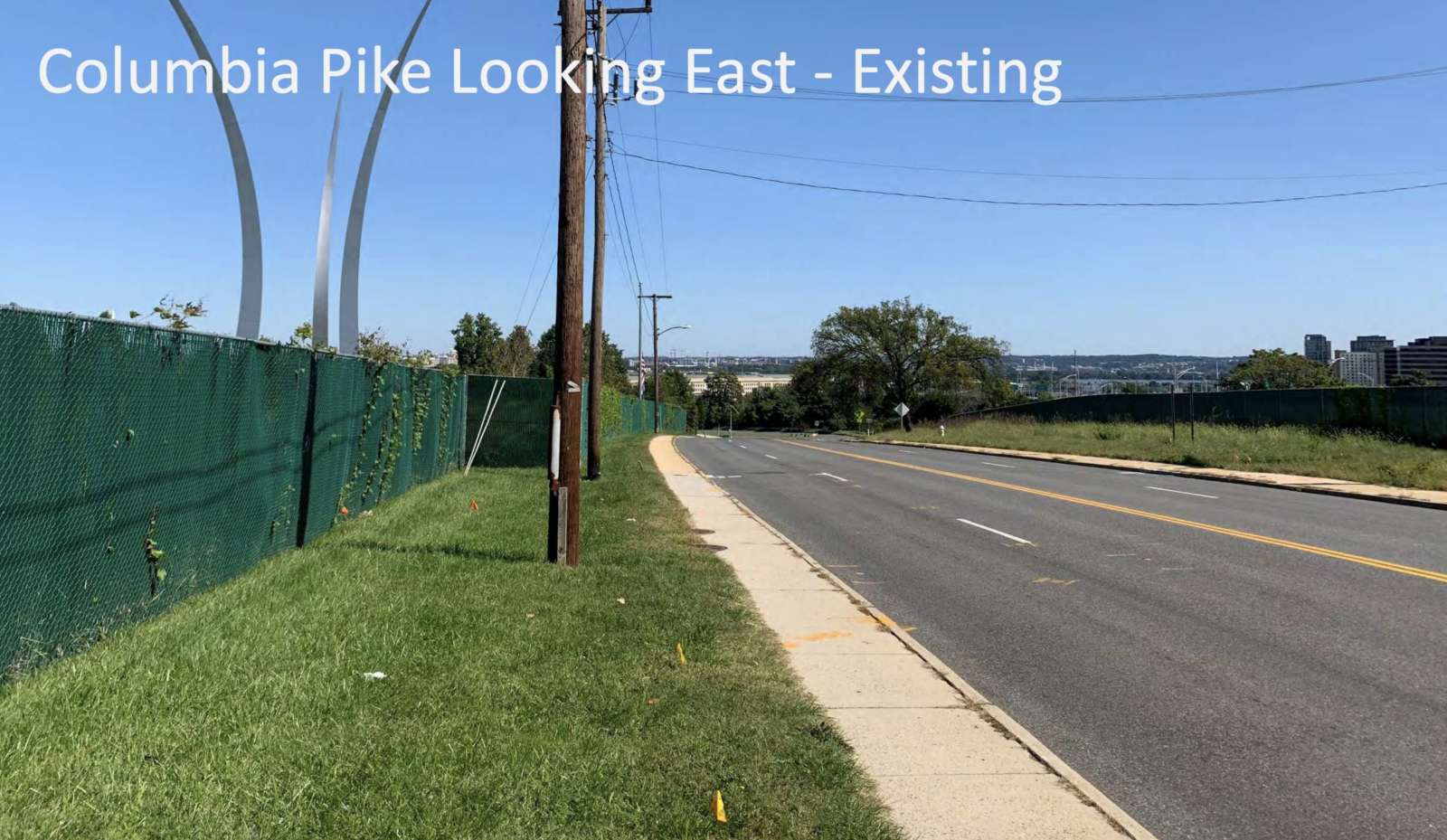
The federal government acquired county-owned land for the expansion via an eminent domain suit this summer. In exchange, the feds are paying for the reconfiguration of Columbia Pike and the creation of a new S. Nash Street in the tiny Foxcroft Heights neighborhood adjacent to the Air Force Memorial — a $60 million project.

“The expansion project will benefit Arlington County and its residents by, among other things, burying overhead power lines and incorporating the Air Force Memorial and surrounding vacant land into Arlington National Cemetery,” the federal government said in June. “The project will transform Columbia Pike from South Oak Street to Washington Boulevard by re-aligning and widening it. The project includes streetscape zones with trees on both sides of Columbia Pike, adding a new dedicated bike path, and widening pedestrian walkways.”

In all, the cemetery expansion and the road project are expected to cost $420 million, most of which has already been appropriated by Congress.

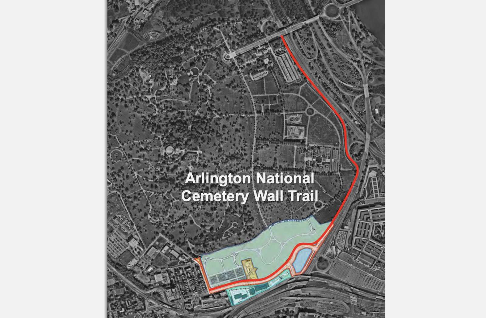
Separately, the federal government is also planning a visitor center for the 9/11 Memorial at the Pentagon, across from the expanded portion of the cemetery closer to the Pentagon, as well as a new trail along the cemetery border from Foxcroft Heights to Memorial Drive.

The National Capital Planning Commission discussed the cemetery expansion plan at a review meeting last week. A presentation that preceded the discussion included a number of renderings of the project, as seen above.

The commission largely approved of the plan, but asked the Army to “submit a revised design for the Air Force Memorial vehicular entrance gate to address the unwelcoming experience created by the 60-foot line of bollards and fencing.”


Changes are coming to the Boundary Channel Drive and I-395 interchange, and with a public hearing on the plans set for Thursday.

VDOT is set to hold the virtual design public hearing at 7 p.m. tomorrow (Nov. 5) via Cisco Webex. It will discuss the agency’s plans “to upgrade the Boundary Channel Drive interchange at I-395 to improve safety, traffic flow and enhance accessibility and connectivity for bicyclists and pedestrians.”

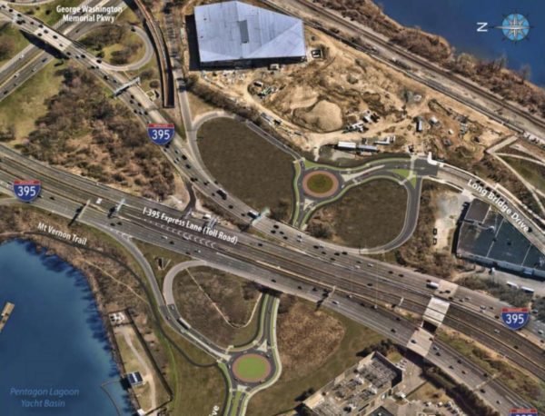
Boundary Channel Drive runs along the northeast side of the Pentagon and under I-395, before connecting with Long Bridge Drive, near Long Bridge Park and the new (but yet to open) aquatics center.

Among the planned changes are:

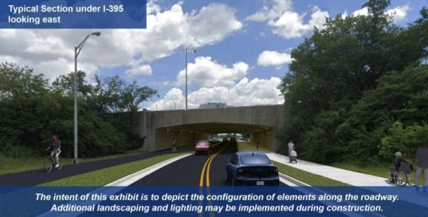
  • Reducing Boundary Channel Drive from four lanes to two
  • Adding a ten-foot-wide path/sidewalk on either side of the road
  • Installing roundabouts on either side of I-395
  • Reconfiguring the highway ramps
  • Adding crosswalks
  • Creating a new shared-use path that links the Mount Vernon Trail to Long Bridge Park

“In lieu of an in-person hearing, VDOT invites residents and travelers to learn more, participate in the virtual hearing and give feedback,” the agency said in a press release. “Once the hearing is complete, the recorded presentation will be available online. Project materials and details are also available at virginiadot.org/BoundaryChannel.”

Comments on the plans are being accepted through Monday, Nov. 16.

The $20.4 million project is being paid for “with state (including Revenue Sharing), Arlington County and Northern Virginia Transportation Authority funding,” VDOT notes. The agency expects to start the process for selecting a design-build contractor this winter.

Photos via VDOT


Greens Want Tax Hike for New Initiative — “The Arlington Green Party is seeking a five-fold increase in one local tax in order to fund an environmental initiative. The party in late October promoted the idea of the county government giving owners of single-family properties in Arlington $1,000 credits to have energy audits conducted and then take cost-effective steps to improve efficiency…. The party wants to increase the existing utility tax from $3 per household per month to eventually hit $15 per household per month.” [InsideNova]

Looking On the Bright Side — “And the winner is: free paper yard waste bags. Available at five County sites during leaf season.” [@ArlingtonDES/Twitter, Arlington County]

Improvements Proposed in Seven Corners — “The Virginia Department of Transportation has provided another in a series of updates on potential improvements being studied along Route 50 (Arlington Boulevard) between Jaguar Trail and Wilson Boulevard in the Falls Church/Seven Corners area.” [InsideNova, VDOT]


The Virginia Department of Transportation is asking residents to take a short survey that will shape a study of potential improvements to Route 1 between 12th and 23rd Streets S. in Crystal City.

As development activity in Crystal City and Pentagon City continues, VDOT and Arlington County are looking for ways to improve the safety, accessibility and effectiveness of a variety of transportation modes on Route 1 in the area. In particular, the study responds to the increased demand for transportation resulting from the construction of Amazon’s HQ2.

“As this area’s commercial and residential densities continue to increase, transportation plans will need to address the wide-ranging needs of pedestrians, bicyclists, transit riders, motorists, and other users while maximizing the safety, convenience, and sustainability of the system for decades to come,” according to a news release from the VDOT.

The survey asks respondents to explain how they use Route 1 (also known as Richmond Highway), rank improvements by priority, and identify areas with congestion or safety problems. It is available through Nov. 15.

Officials say the study will help identify safety improvements for pedestrians, bicyclists, those using micro-mobility modes such as electric bicycles and scooters, and those taking transit or driving. The study will also examine ways to make transit more accessible, reliable and convenient, as well as options for protecting the environment.

The team leading the study plans to form a task force from representatives of civic associations, Arlington County advisory groups and the National Landing Business Improvement District, the news release said. The task force is anticipated to have five meetings.

More from the press release:

After collecting and analyzing the initial survey data, VDOT is planning a virtual public meeting this winter to share preliminary survey results and latest study information. Draft recommendations for the study will be presented to the public for feedback in spring 2021, and the final study is expected to be complete in summer 2021.

Please note that this study does not include construction funding, but will develop proposed future improvements that VDOT and other agencies will consider and may pursue for funding.

The study was announced a week after the National Landing BID released a report, “Reimagining Route 1,” which envisioned the car-centric highway as a slower, greener, pedestrian-friendly boulevard lined with retail and restaurants.

VDOT is studying the Route 1 overpasses over 12th, 15th and 18th streets, which some have called to be eliminated in favor of more urban intersections at grade.

“Route 1 was originally designed to accommodate the auto-centric development trends of the mid-20th century, when the primary objective was to move cars through the area as quickly as possible,” the BID said in a press release. “The resulting elevated highway, super blocks, and oversized intersections divided the community for decades, inhibiting not only connectivity and access, but also the area’s ability to come together as a singular downtown district.”


View More Stories