As the summer approached with lockdowns in place, many cities, including D.C. and Alexandria, closed some streets to drivers and expanded walking and biking options.

Arlington did not, although many residents supported the idea, according to an ARLnow poll from April that found support for closing streets among 80% of respondents.

The county did not close roads primarily because it lacked materials and manpower, Director of Transportation Dennis Leach told the Arlington Bicycle Advisory Committee during its meeting on Monday. The explanations angered members.

Gillian Burgess, the former chair of the committee, told ARLnow that the meeting was “frustrating.” Members were told to advocate for increased funding to close streets and to attend other meetings, which she said deflected the responsibility away from the department.

“No one is willing to say ‘Yes, how do we do it?'” she said.

Burgess started championing the cause in March, when she rallied together people from various organizations to ask the County Manager for more space for non-drivers. Their efforts were unsuccessful.

Transportation and Operations Bureau Chief Hui Wang told ARLnow that the department looked at the roads people suggested for closures, considering safety, feasibility, resources and the opinions of neighboring businesses and residents.

“We had a hard time to find a good piece of road that was suitable for the treatment that was suggested,” she said.

Obstacles included frequent bus stops and curb cuts, pick-up and drop-off zones next to businesses and access for emergency responders, Wang said. Closing streets, she said, is not as easy as just putting up a few signs.

Signs must meet national standards, for instance, while getting placed in safe spots, checked for damage and replaced when necessary, she said. Safety requirements like these make the task difficult.

Wang said the pandemic revealed what her bureau lacked in order to respond. Her team did manage to procure temporary outdoor seating areas within sidewalks, and closed some parking lanes to allow people to walk around the new outdoor dining areas, but does not have the resources for large-scale temporary pedestrian-only zones, she said.

Another factor in the action: questions of equity and whether closing streets in certain areas would benefit those hardest-hit by the pandemic.

Burgess said she understood these reasons at the beginning of the pandemic. Eight months later, it is “super disappointing that Arlington can’t be creative, nimble or quick and can’t try something that would serve residents,” she said.

Arlington transportation officials have now turned their attention to Arlington Public Schools an an anticipated return to school for students. They are working to identify the best routes for walking and changing the timing of lights to make crossing the street safer.

Buses will operate at a lower capacity, meaning more parents may drive their kids when they could walk or bike instead, Burgess said. She said a silver lining of decreased busing may be a growing realization that Arlington should prioritize making streets more biking- and walking-friendly.


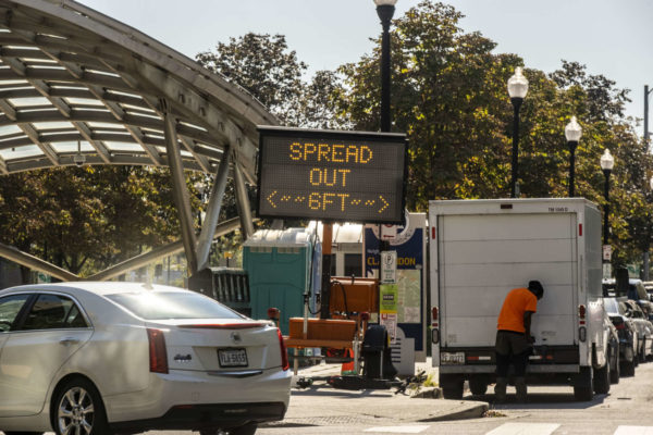
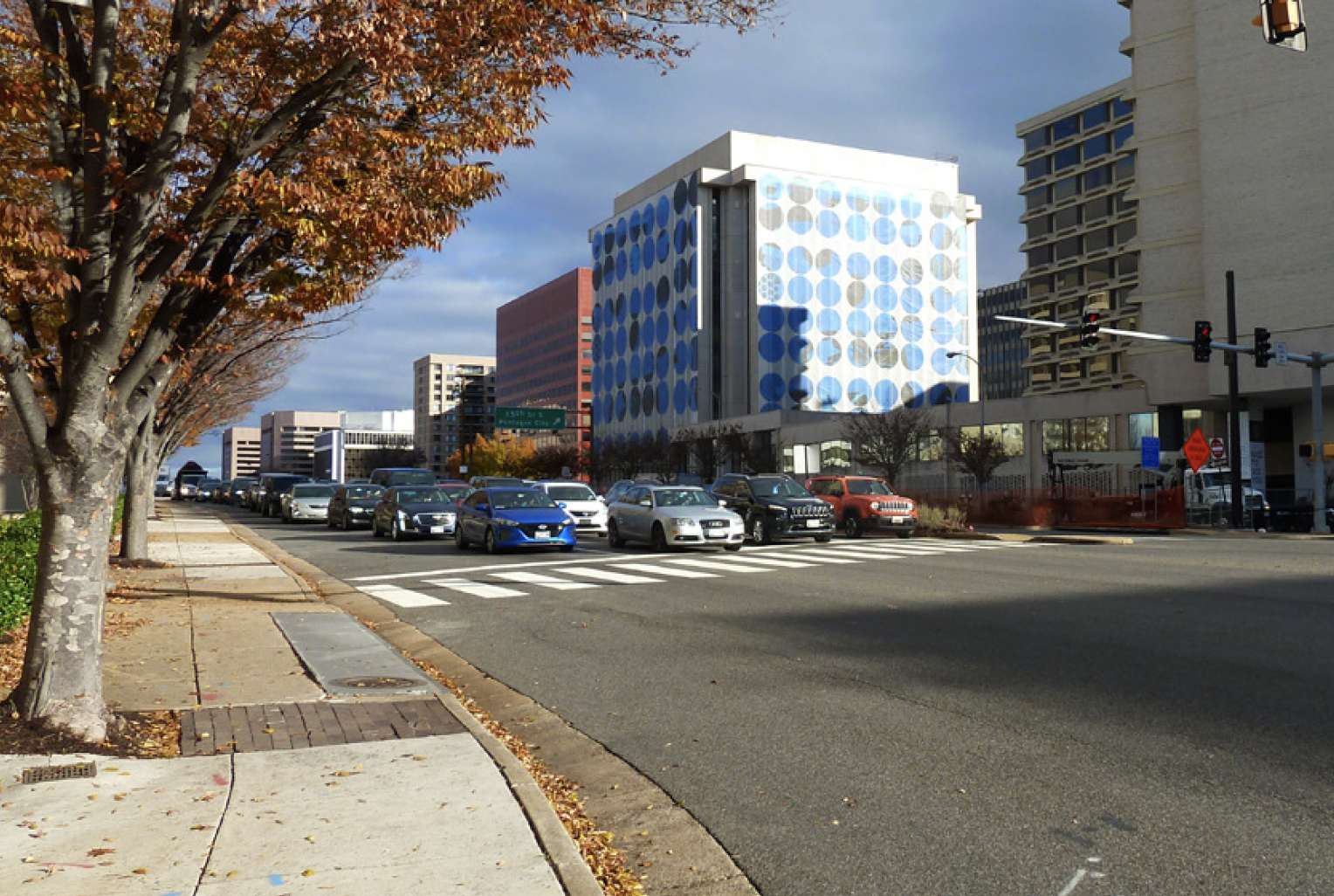
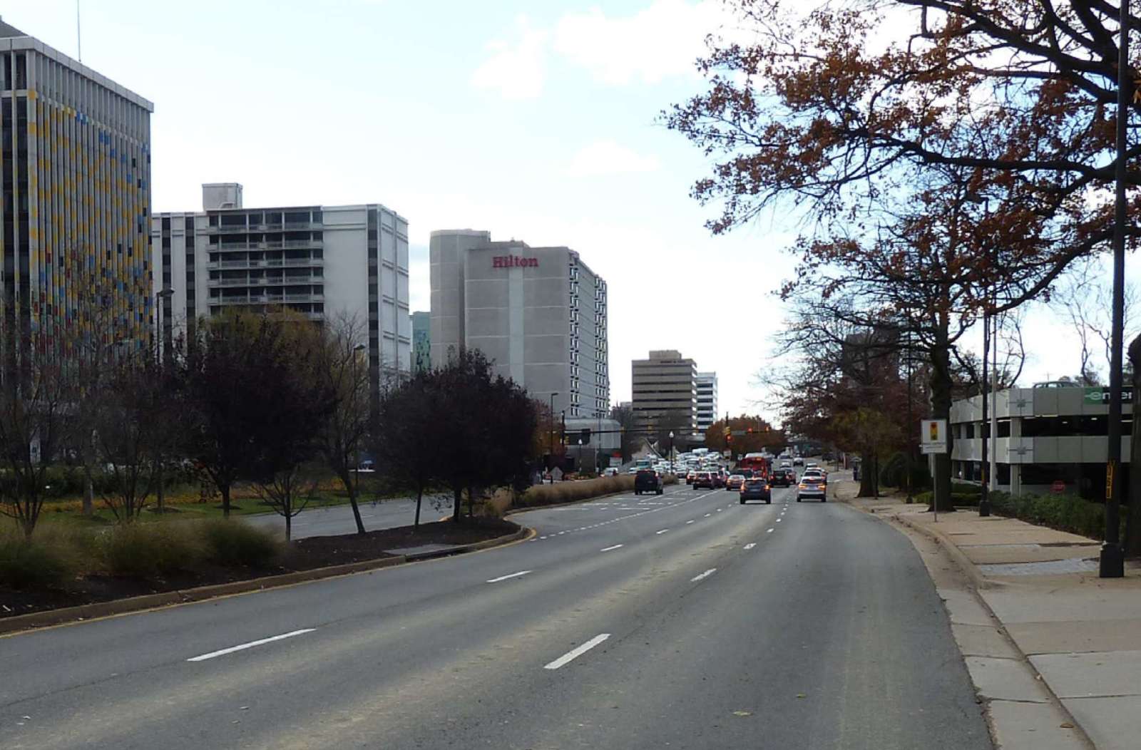
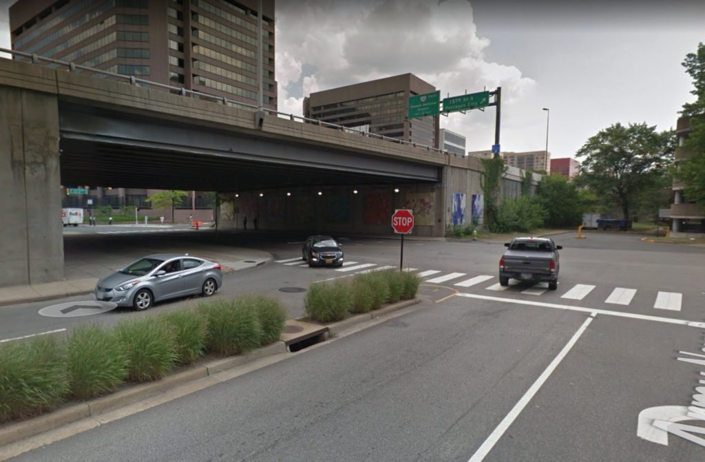
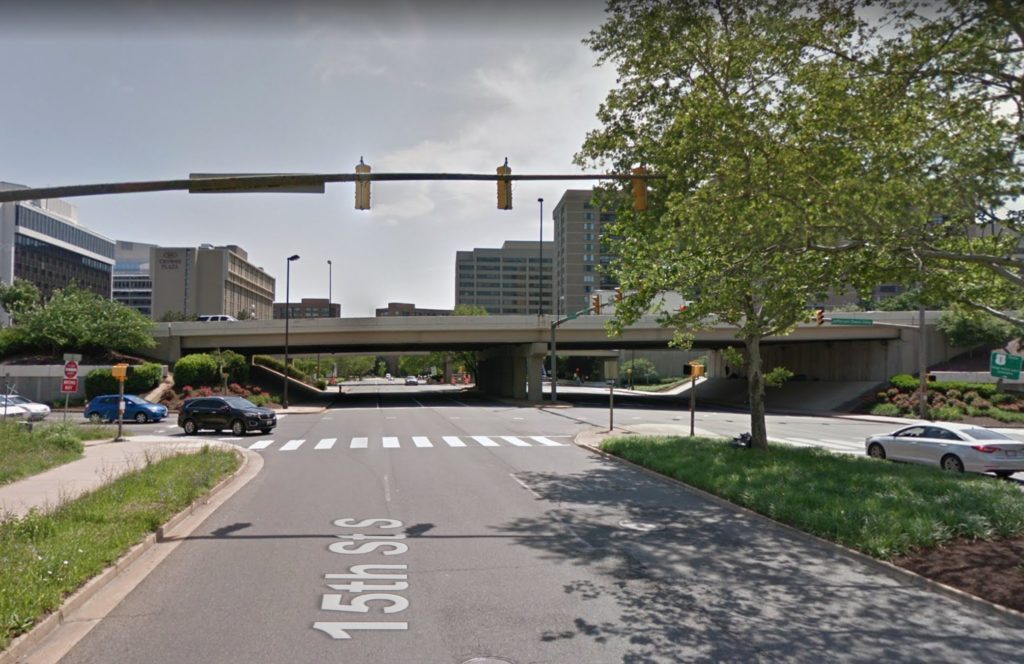
Route 1 through Crystal City is currently a car-oriented, exhaust-clogged asphalt canyon that’s unpleasant for pedestrians to cross or even walk along. But there’s a push for that to change.

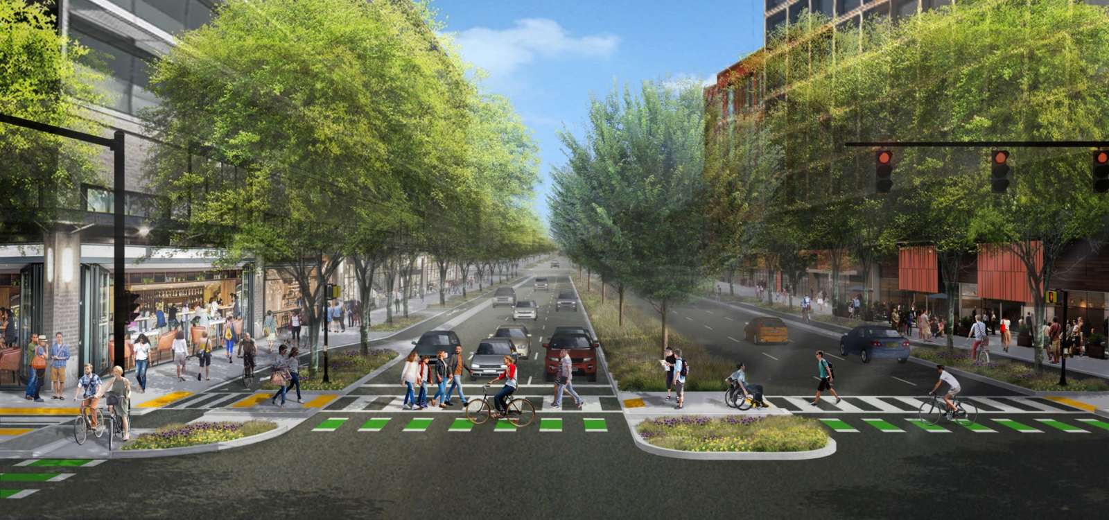
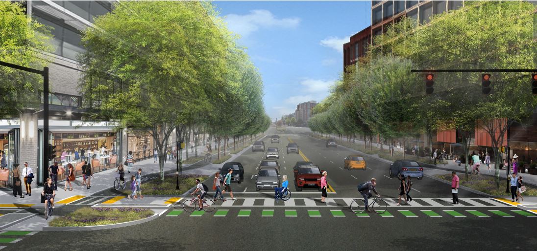
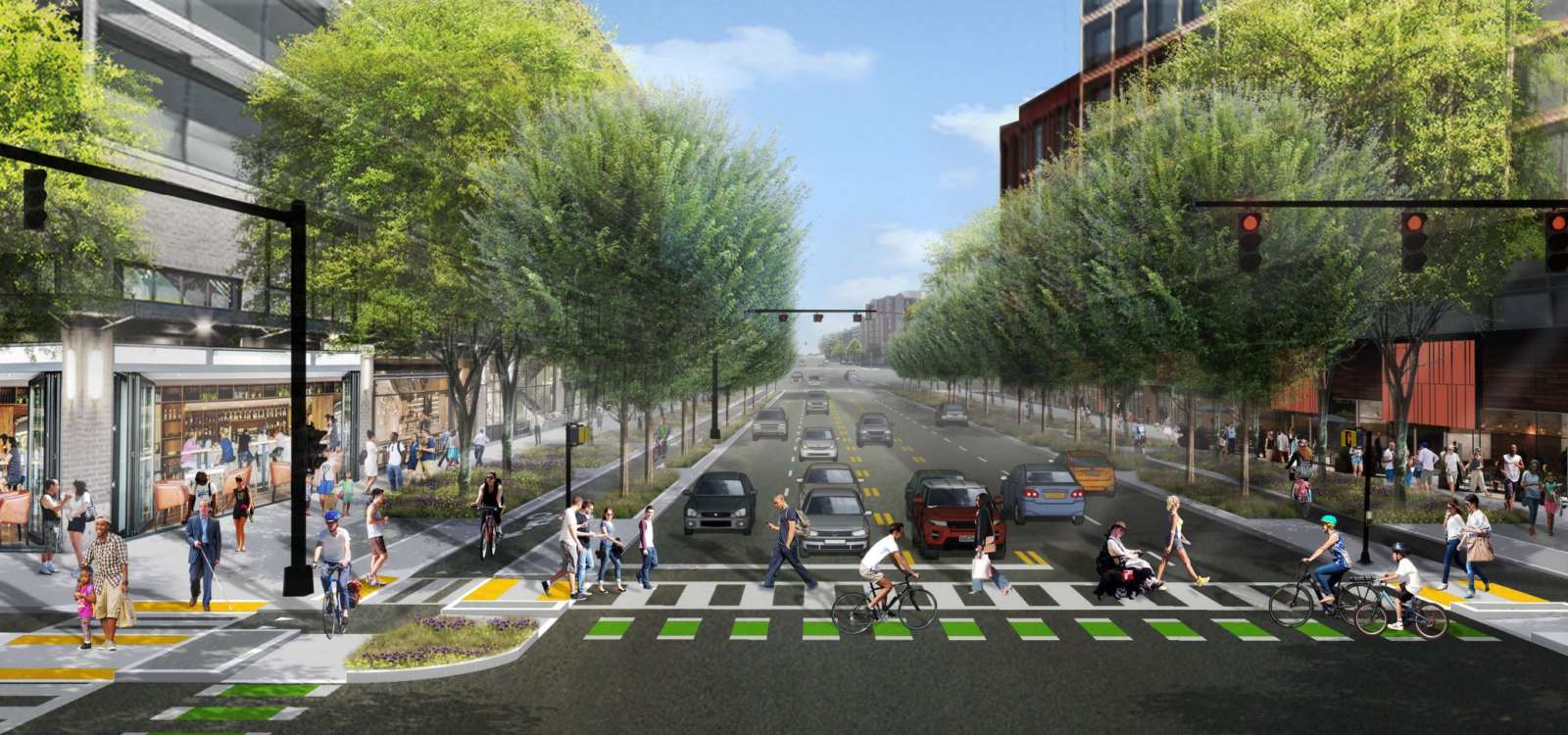
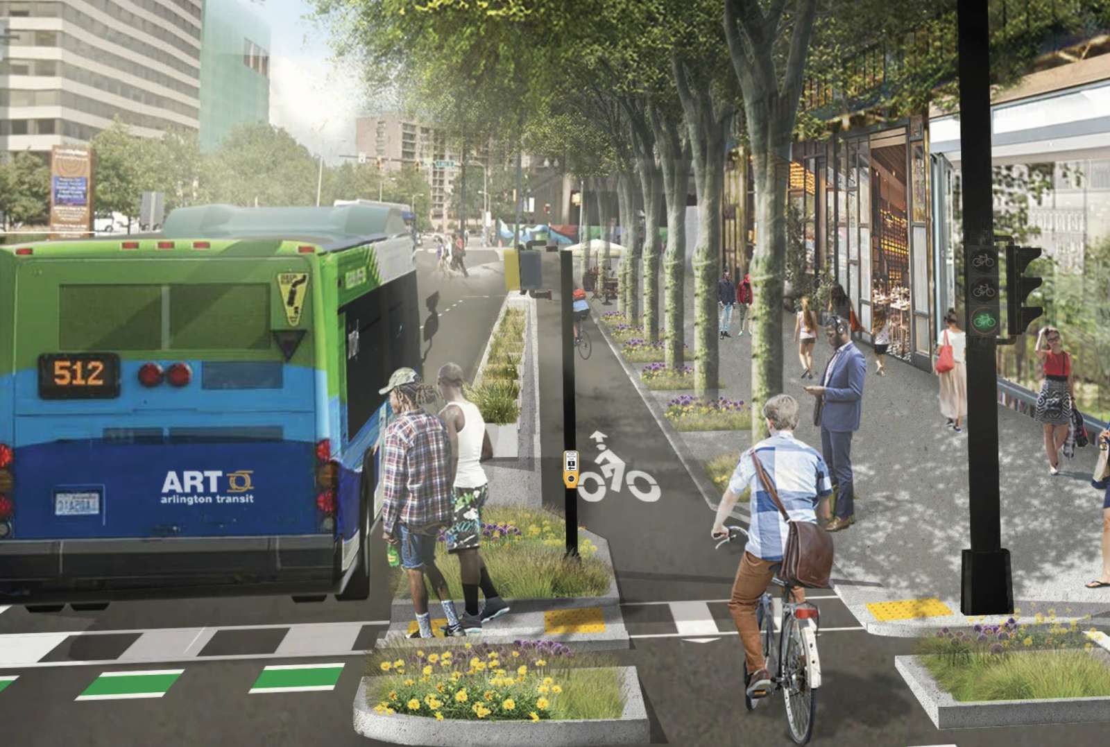
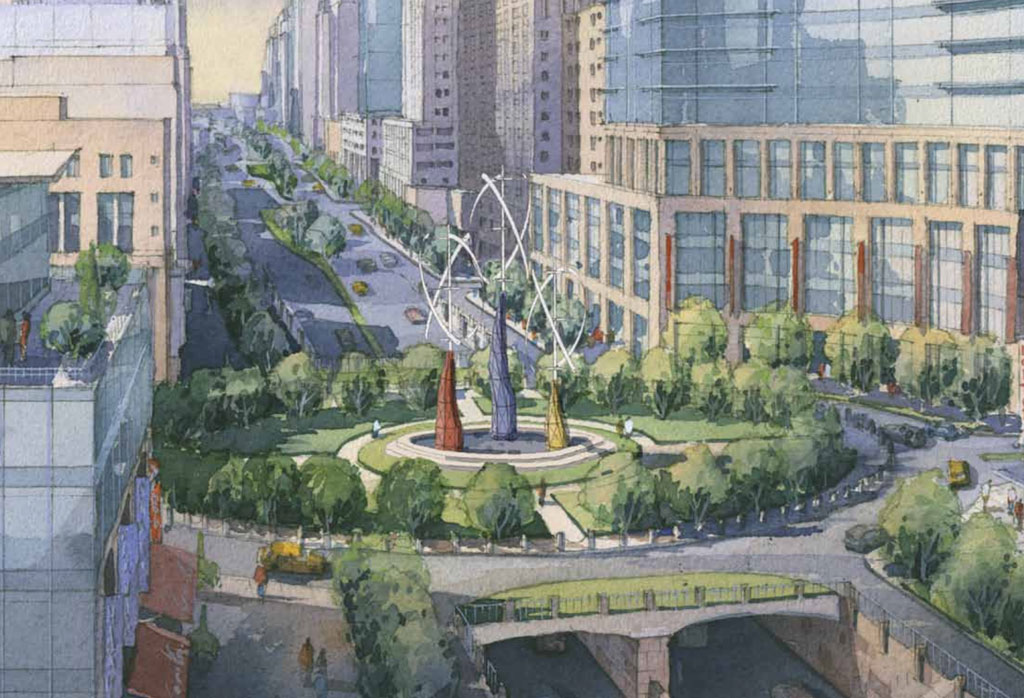
The National Landing BID, formerly known as the Crystal City BID before Amazon came to town, has just revealed its lusher, more pedestrian-friendly vision for Route 1, complete with wide sidewalks lined with ground-floor retail and restaurants.

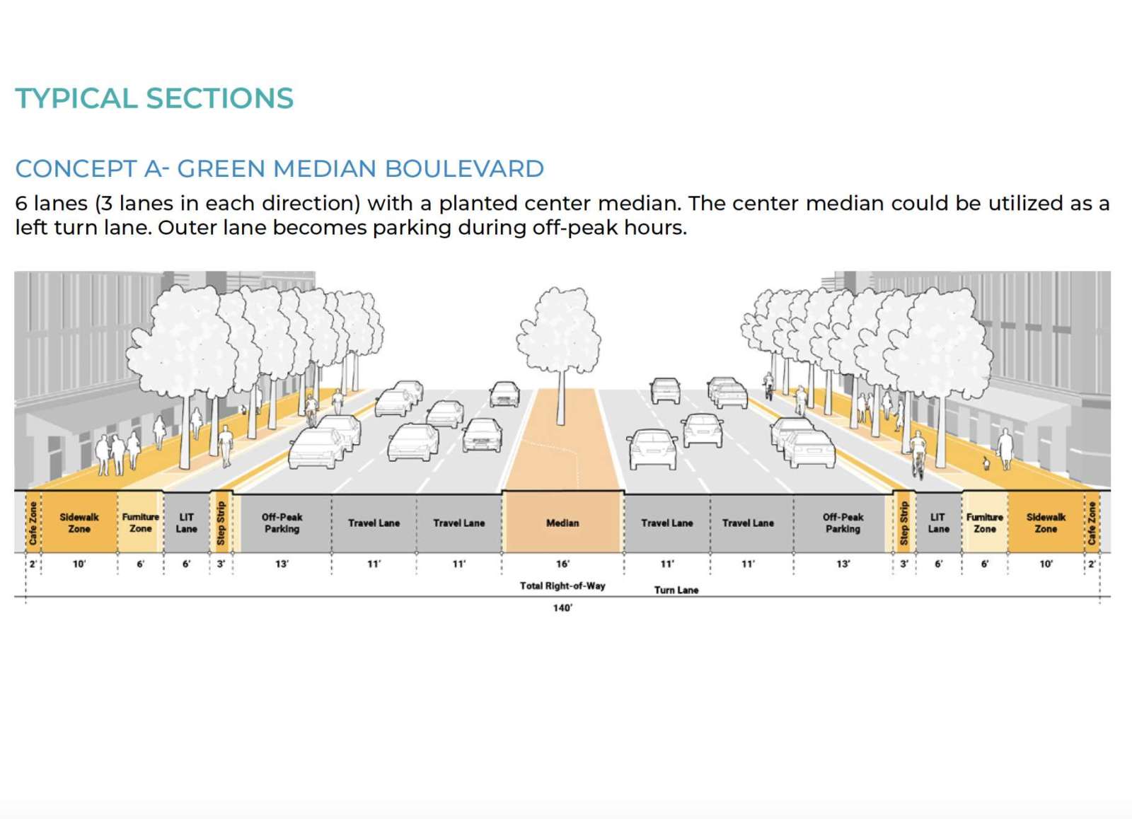
VDOT is currently studying the corridor and considering whether overpasses in the Crystal City area should be removed in favor of a more conventional, urban street grid. The BID’s new Reimagine Route 1 report takes that and other ideas for modernizing the corridor and turns it into a series of concept designs, complete with 3D renderings.

“The concepts presented in Reimagine Route 1 draw upon best practices in urban street design by placing people at the center of National Landing’s future,” Matt Gerber, General Manager of the Westin Crystal City and Co-Chair of the BID’s Transportation Committee, said in a statement today. “Narrow lane widths, lower design speeds, and urban intersection geometries ensure that the autocentric mistakes of the past will not be replicated in the development of the corridor’s new and distinctly community-focused identity.”

The BID’s vision for turning Route 1 — also known as Richmond Highway — from a commuter route into an “iconic corridor serving a thriving urban neighborhood” draws comparisons to main routes in other major cities.

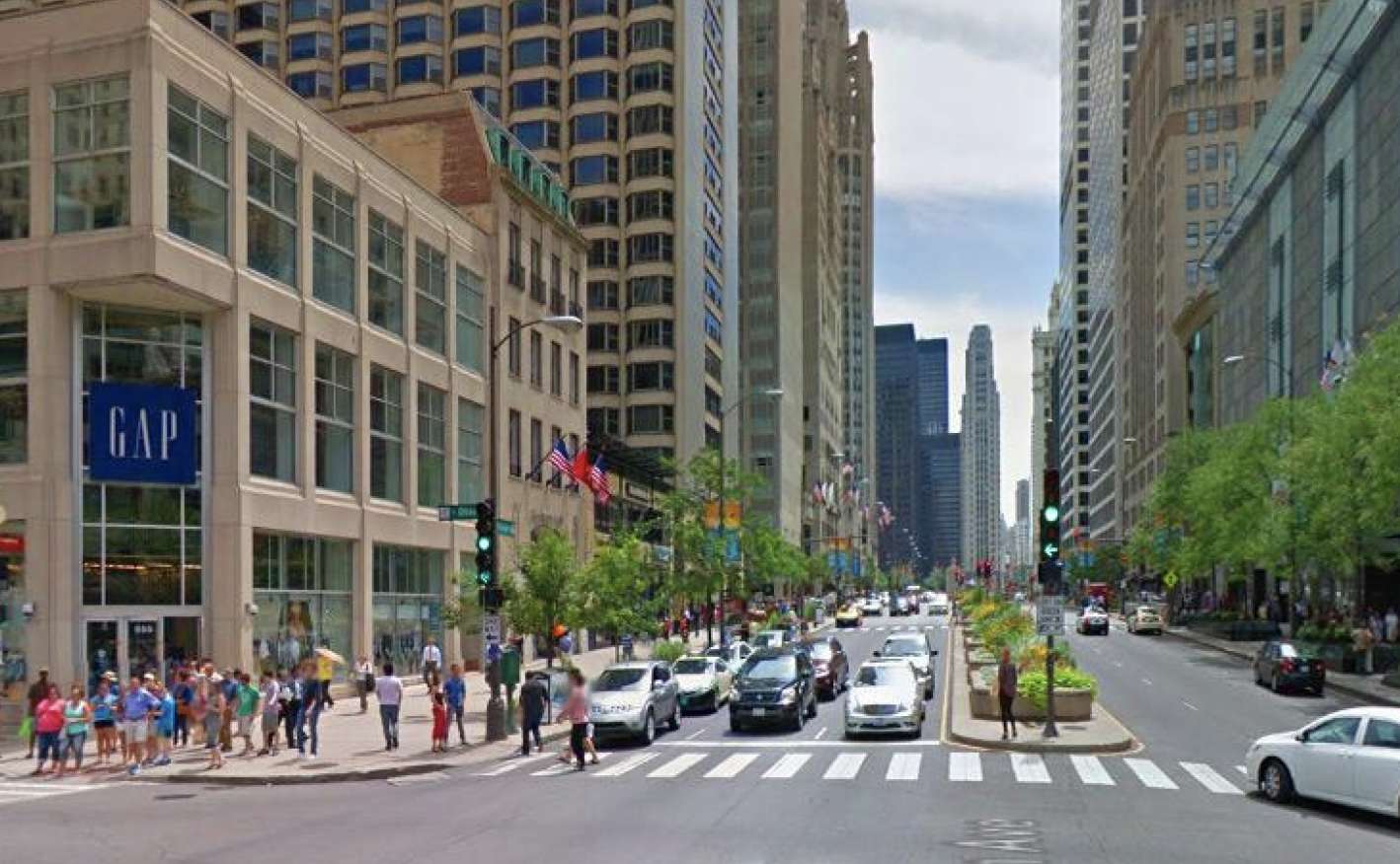
The report includes photos of Octavia Boulevard — formerly Central Freeway — in San Francisco, as well as Michigan Avenue in Chicago, which like Route 1 has three vehicle lanes in each direction.

“Also known as the Magnificent Mile, the 13-block stretch of North Michigan Avenue from the Chicago River to Oak Street has a similar vehicle carrying capacity as the existing Route 1 yet boasts a walkable and vibrant public realm with safe connections to transit and a well-connected street grid,” the report says.

The report is intended to start a conversation about the corridor’s long-term future, which officials may then opt to turn into action via transportation and land use changes. The overall goal is to turn the Crystal City, Pentagon City and Potomac Yard neighborhoods — collectively now known as National Landing — into a cohesive urban area over time.

“Route 1 was originally designed to accommodate the auto-centric development trends of the mid-20th century, when the primary objective was to move cars through the area as quickly as possible,” the BID said in a press release. “The resulting elevated highway, super blocks, and oversized intersections divided the community for decades, inhibiting not only connectivity and access, but also the area’s ability to come together as a singular downtown district.”

Others have also been working on envisioning changes to Route 1. The Crystal City Sector Plan, approved in 2010, set a more urban vision for the community through 2040. Local civic associations, meanwhile, have recently formed a collective called Livability 22202 to discuss ideas. From an August article:

Proposed changes ranged from building storefronts or markets in the area underneath the overpasses, creating more open space where thick sandstone-colored walls now hold up the highway, and putting Route 1 underground to allow for development on top of it.

More on the Reimagine Route 1 report, from a press release, is below.

(more…)


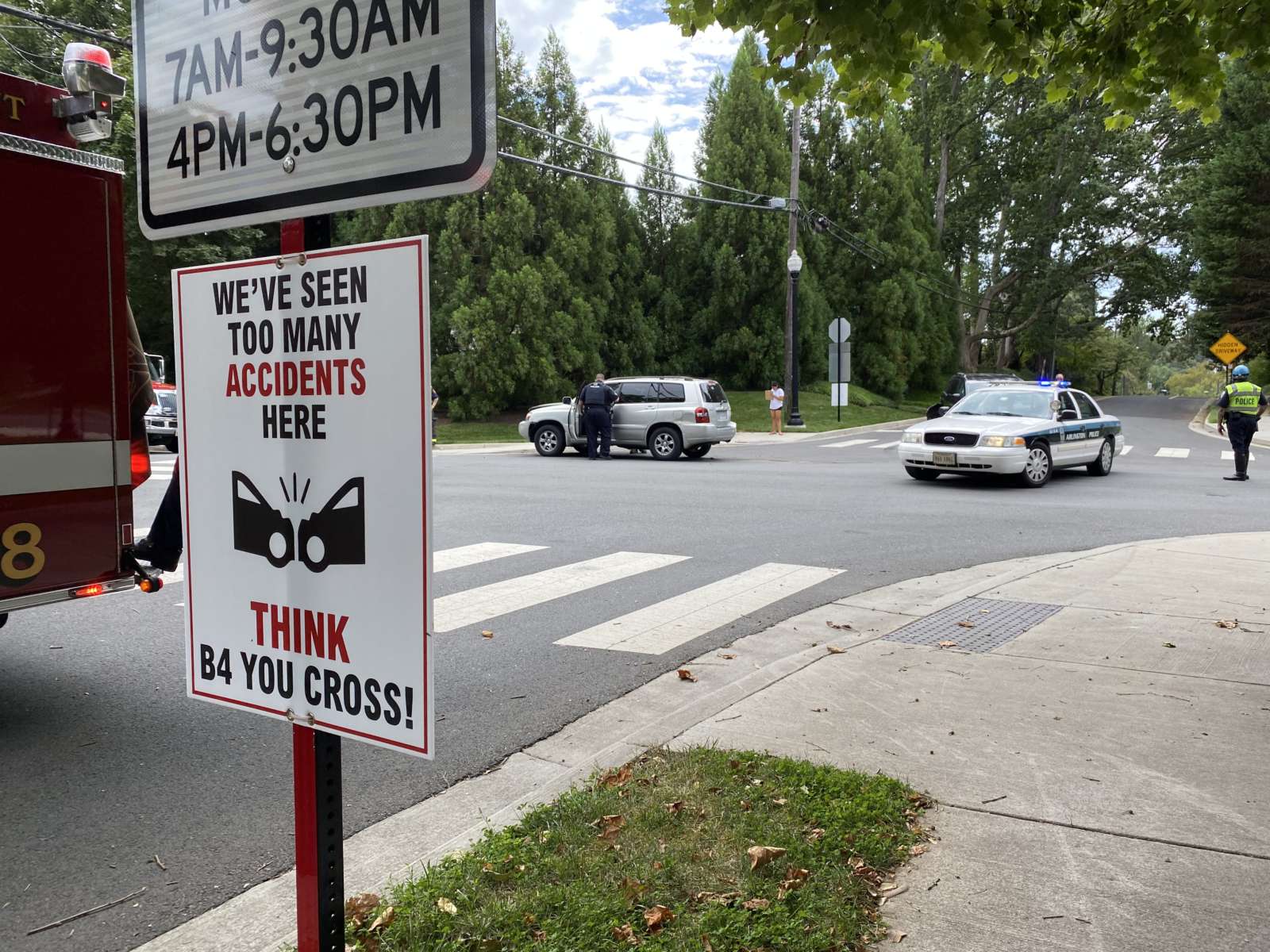
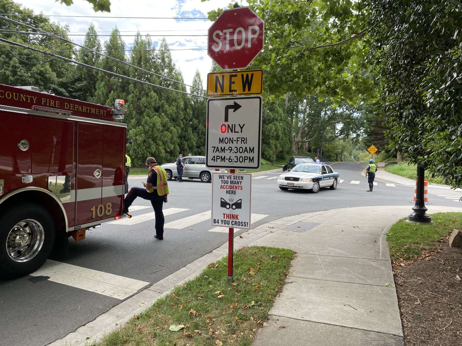
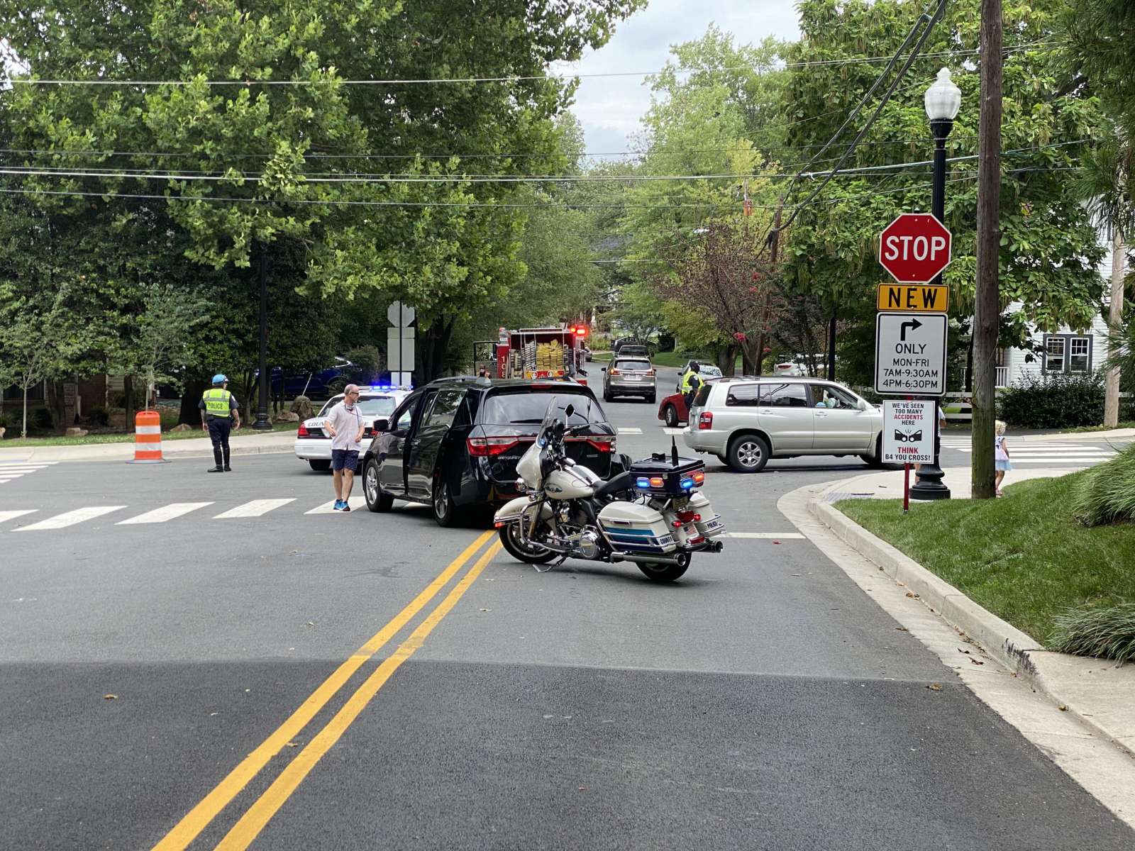
“We’ve seen too many accidents here. Think [before] you cross!”

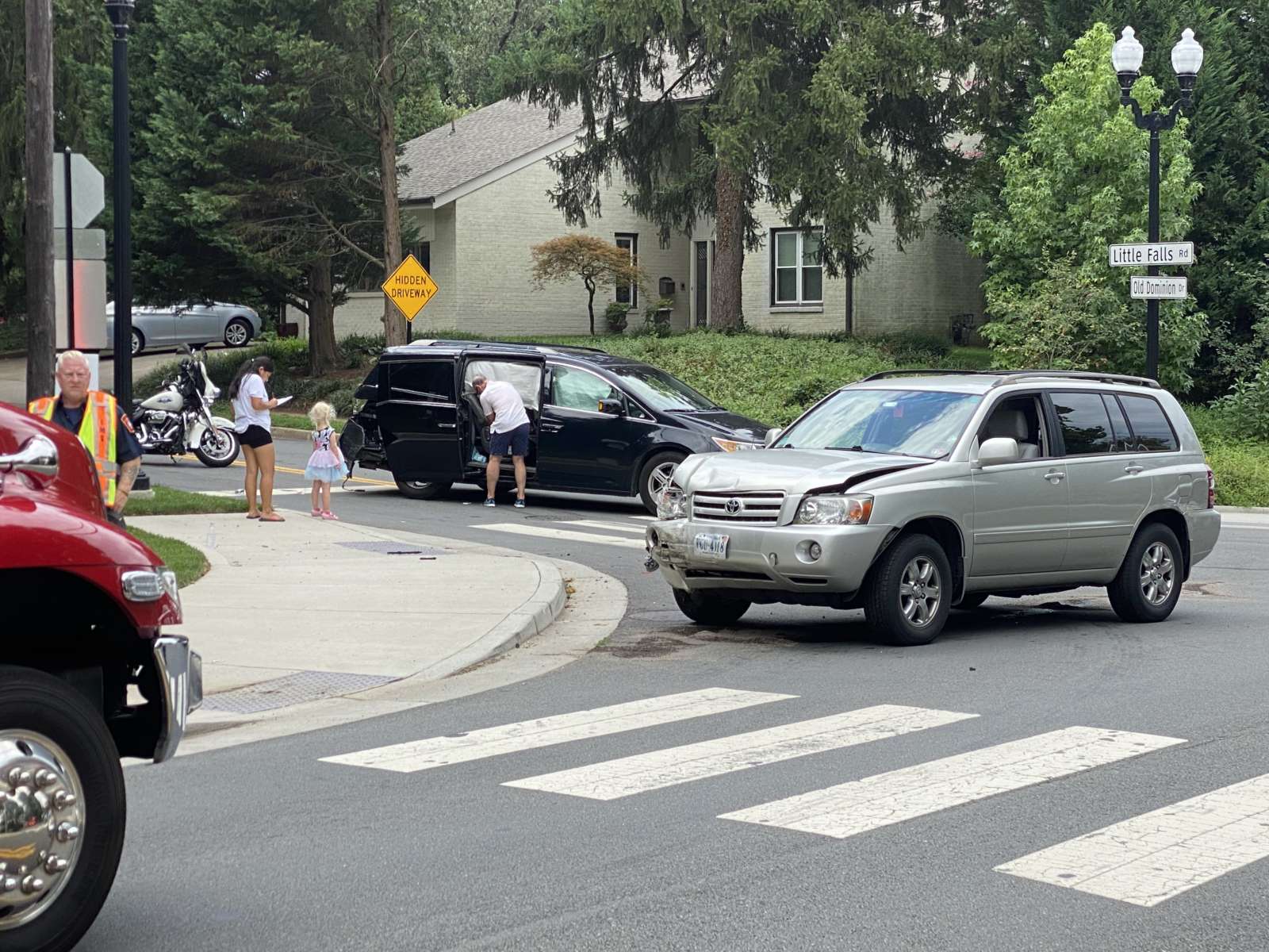
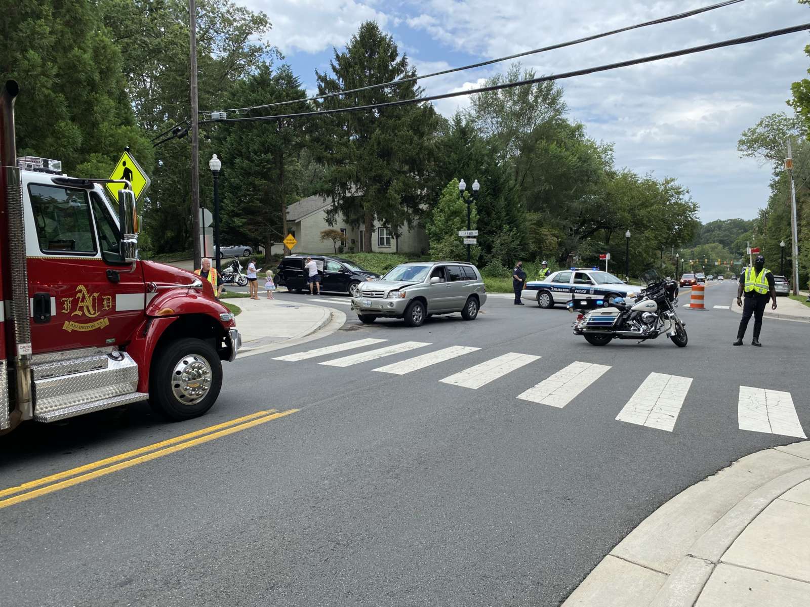
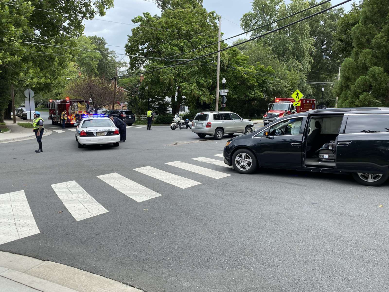
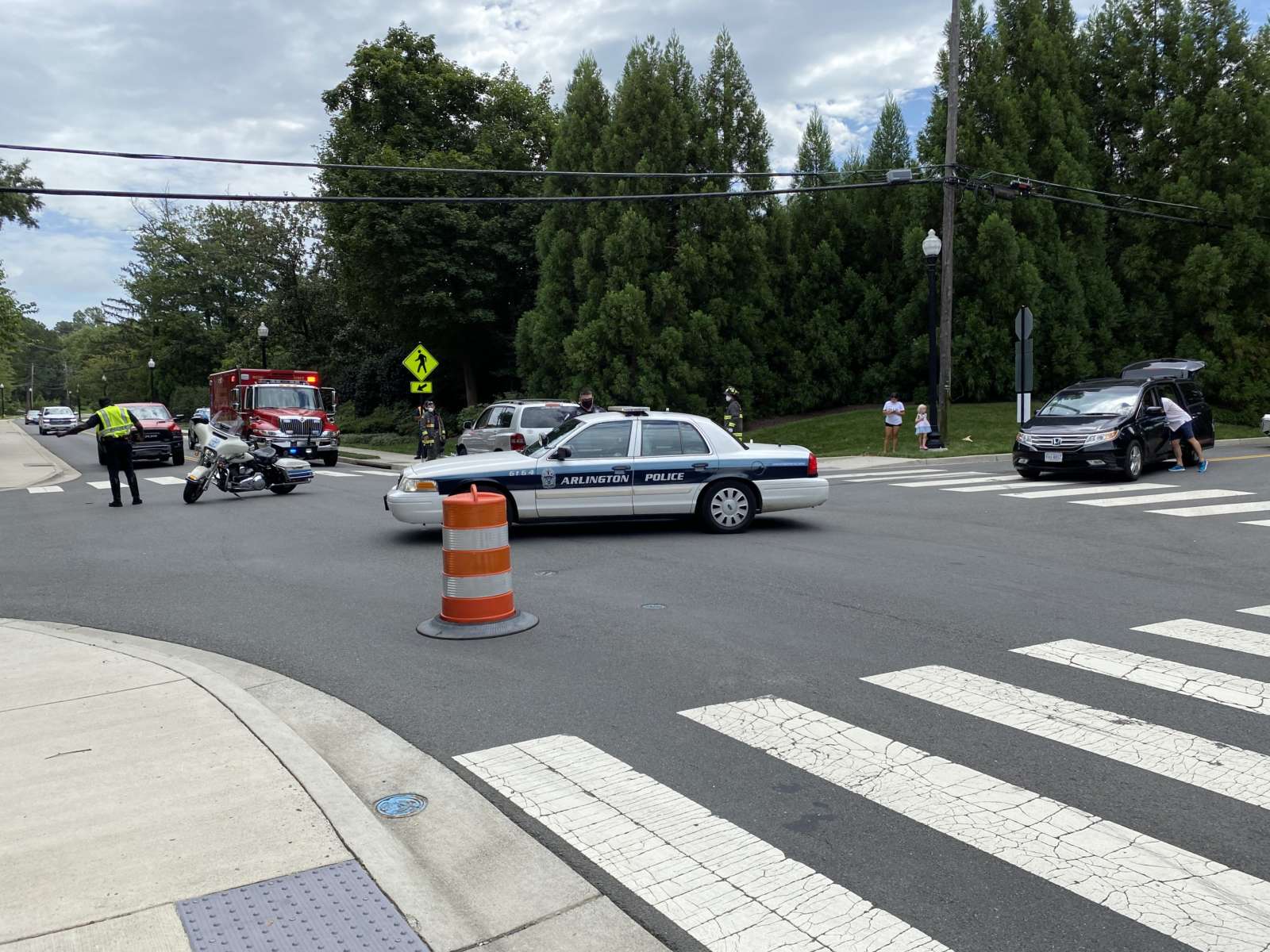
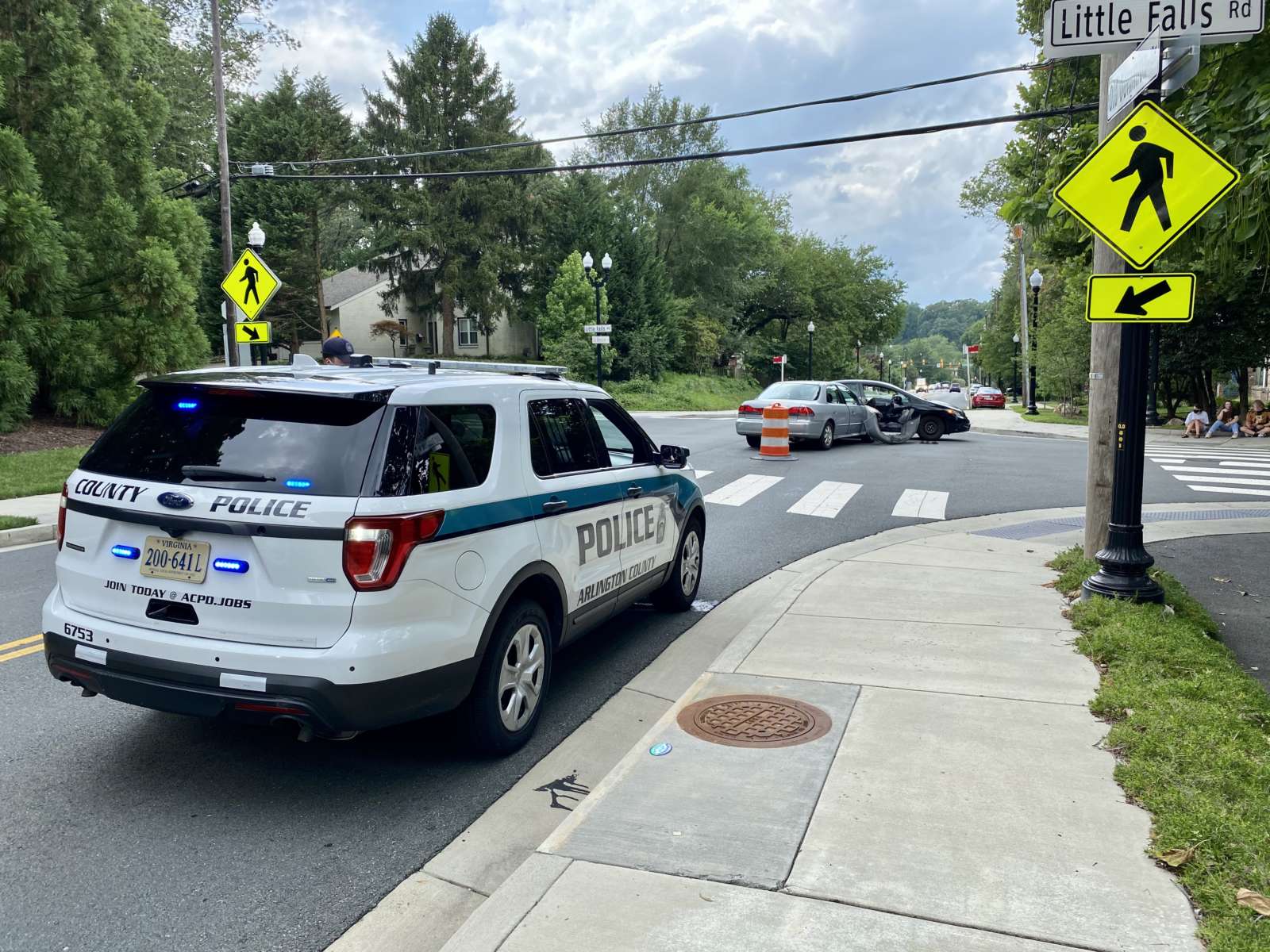
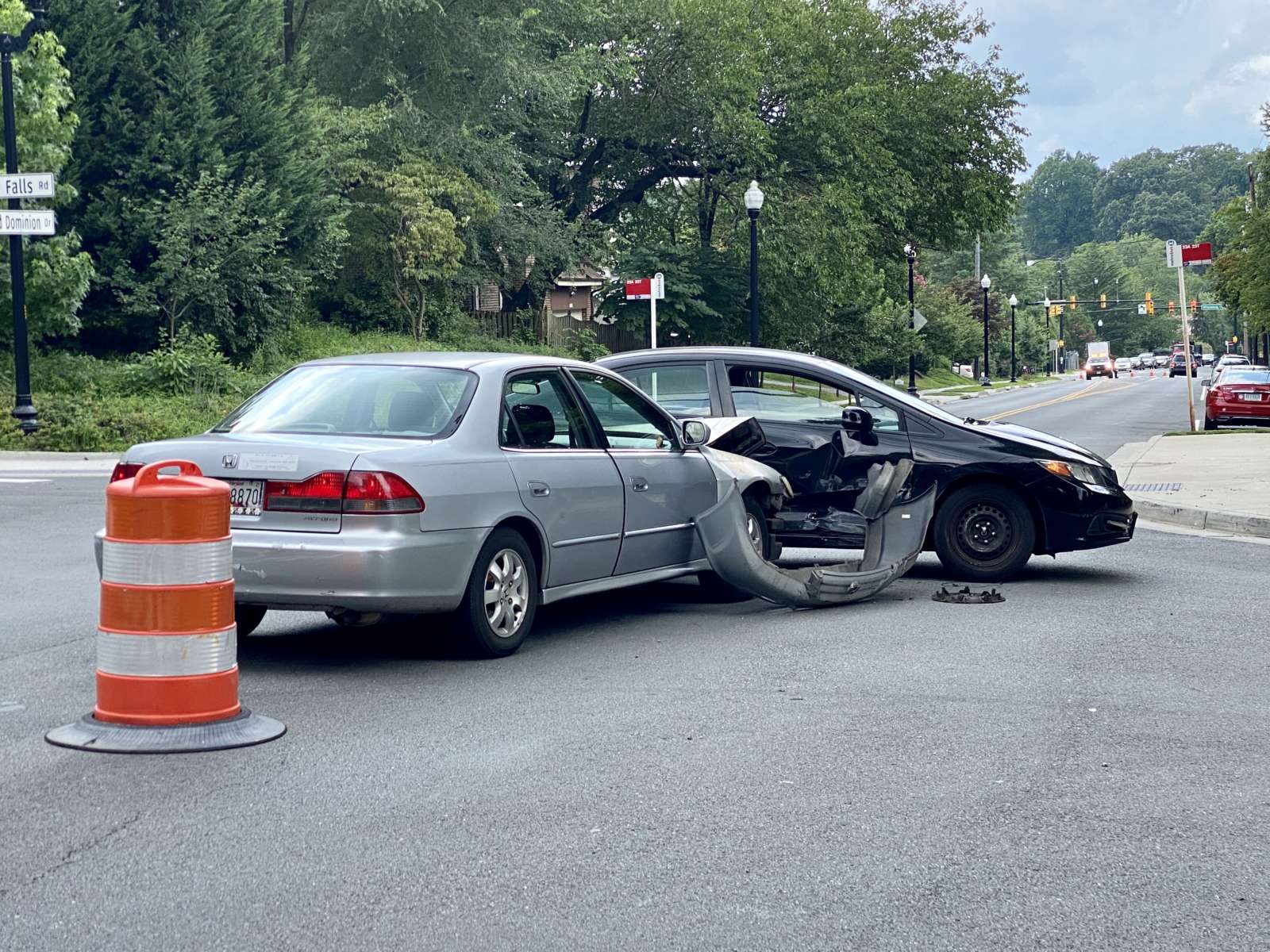
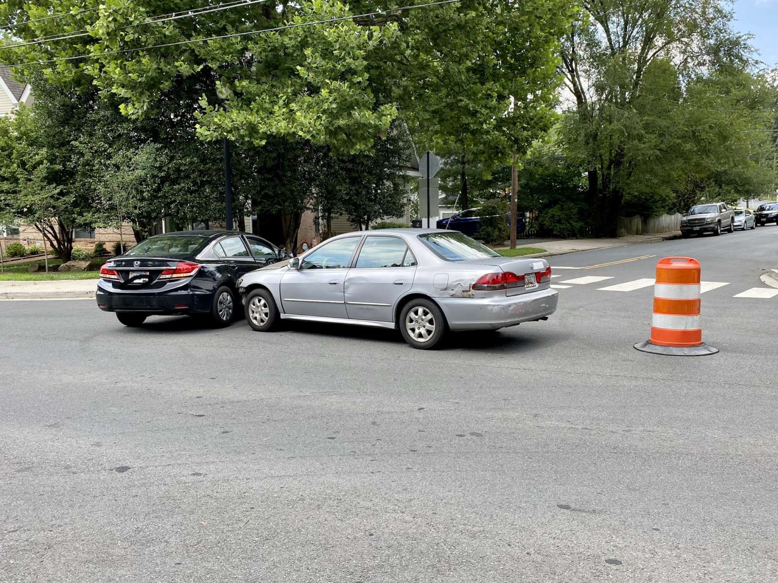
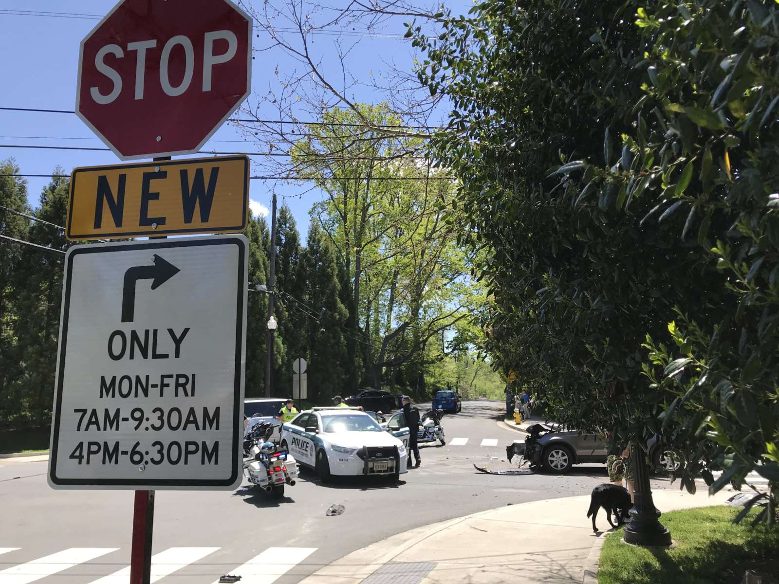
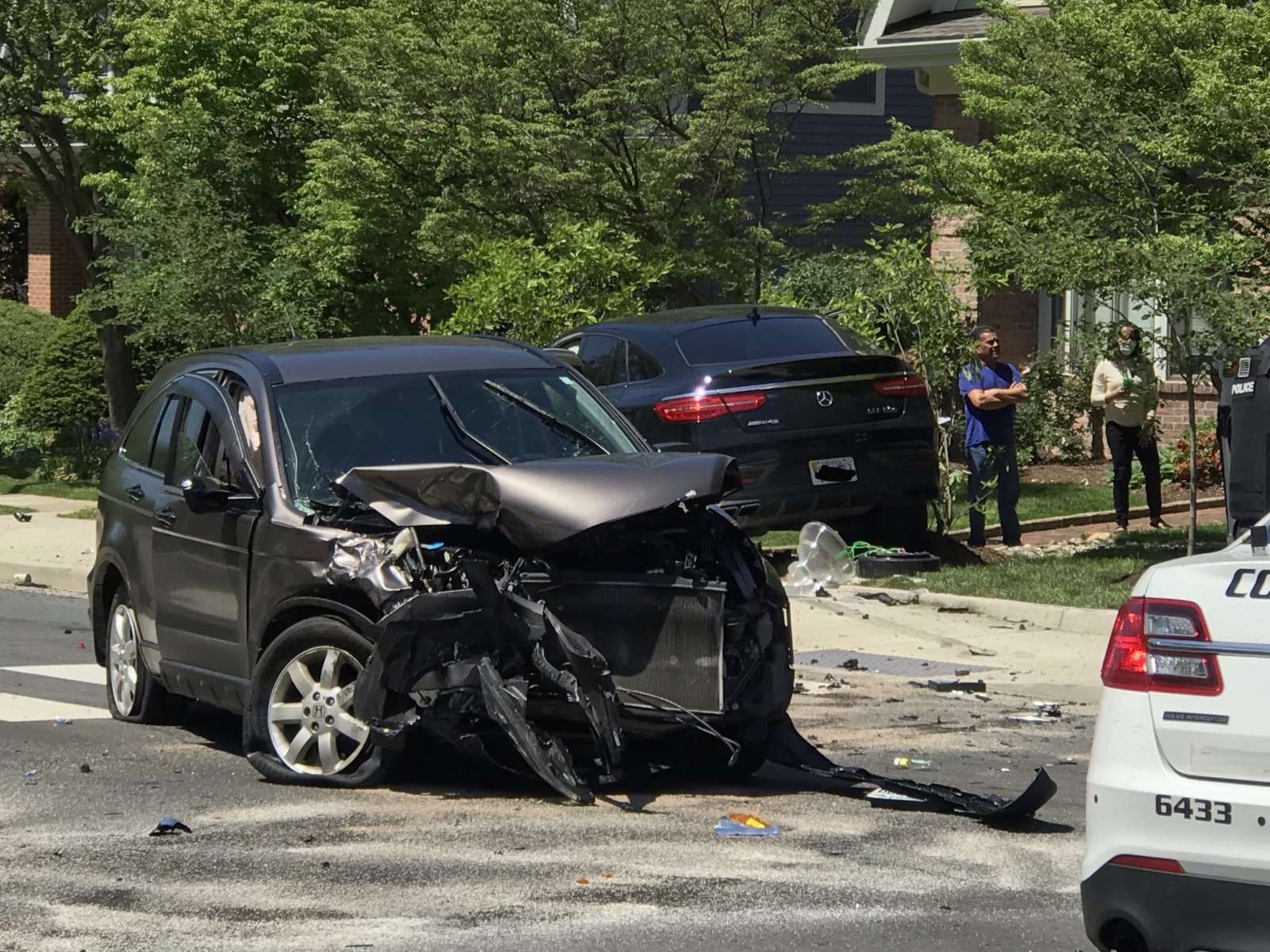
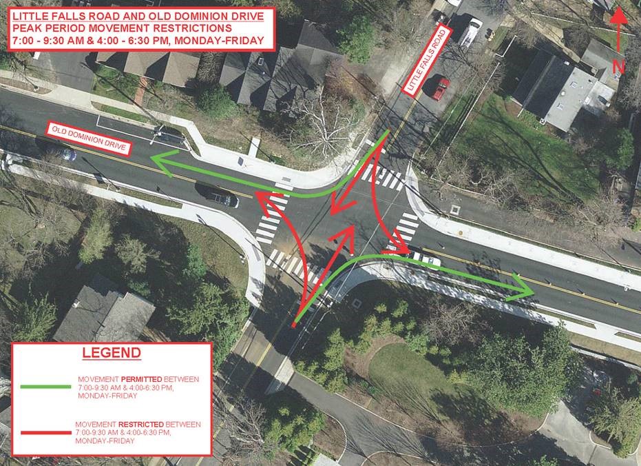
So reads signs recently placed on Little Falls Road, at the crash-prone intersection with Old Dominion Drive, below signs restricting traffic to right turns only during rush hour. A few yards from the signs, around lunchtime Friday, was yet another crash.

The two-vehicle, T-bone crash involving an SUV and a minivan resulted in at least one vehicle occupant, a young woman who was visibly shaken, being evaluated by medics. A young girl appeared to have been riding in a car seat in the minivan at the time but was uninjured.

“It’s always this intersection here,” a police officer directing traffic could be heard saying to a passerby.

Friday’s crash was the eleventh so far this year at Old Dominion and Little Falls, according to Arlington County Police Department data. By comparison, there were 14 crashes there during all of 2019 and 13 throughout 2018.

Locals have long known the intersection — with no stop for Old Dominion traffic and limited sightlines for Little Falls traffic — to be dangerous, so much so that three years ago a 13-year-old took it upon himself to start a petition for safety changes, ultimately leading to the rush hour restrictions. Though the restrictions have been in place for a year, the crashes have not slowed down.

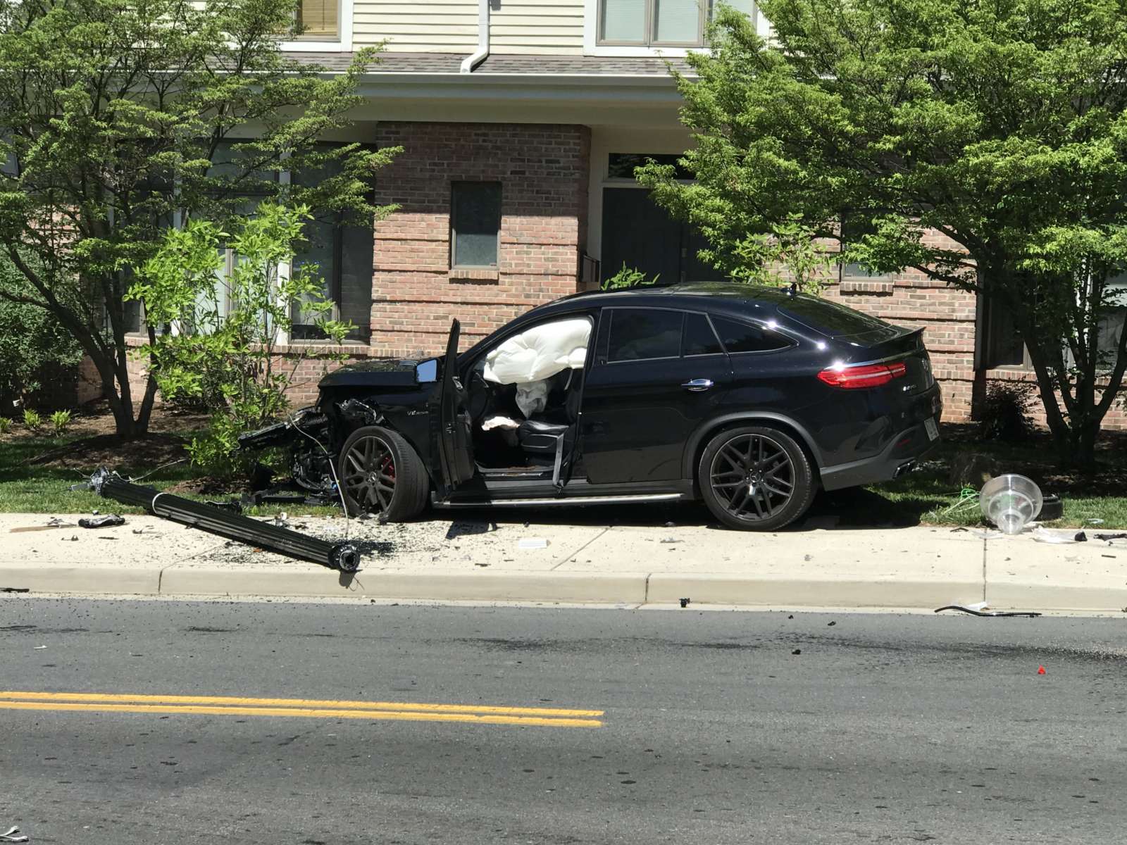
A wreck in May sent an SUV careening over the sidewalk and into the front yard of a home in the corner. No injuries were reported. A subsequent ARLnow morning poll found that more than 70% of respondents think a four-way stop or a traffic signal should be installed at the intersection.

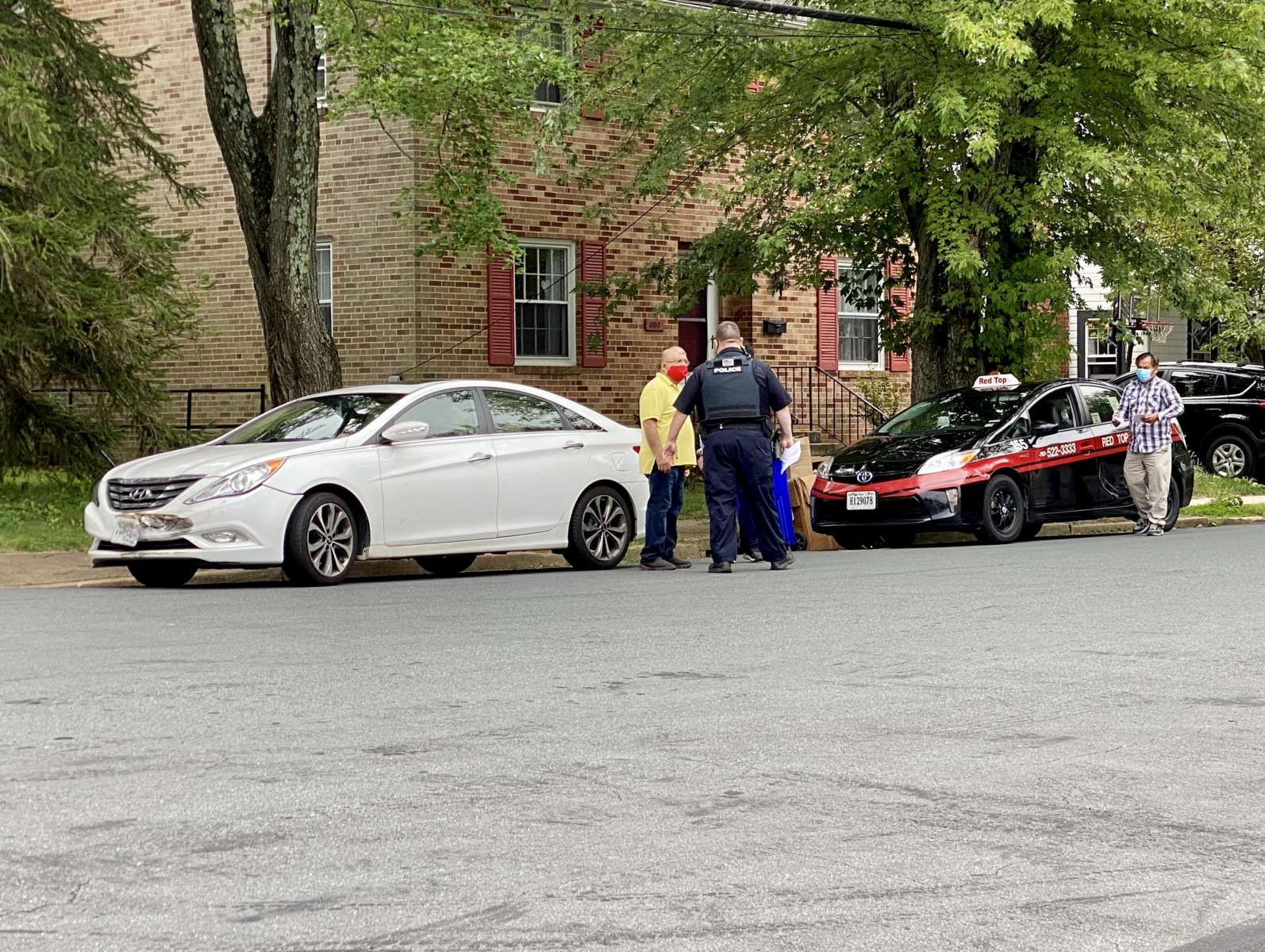
There was another two-vehicle crash at the intersection on Monday, though it’s not clear whether it actually occurred in the intersection.

No additional changes are currently planned for the intersection, though some may be forthcoming — eventually.
Arlington County officials tell ARLnow that VDOT has applied for grant funding for the intersection on the county’s behalf, a process that might take some time.

“This intersection continues to pose safety challenges, and has been investigated by our Transportation Engineering and Operations (TE&O) staff,” said Arlington County Board Chair Libby Garvey. “As the intersection is under VDOT control, we’ve applied to the VDOT STARS (Strategically Targeted Affordable Roadway Solutions) program for grant funding.”
Hui Wang, Arlington’s Transportation Engineering and Operations Bureau Chief, said the state grant would help fund a study that will then provide recommendations for safety changes.
“If approved, VDOT has a group conducting comprehensive review of all aspects with community engagement included,” Wang said.

Garvey said she has also asked about “interim solutions.”

“I’ve asked our staff for a briefing to better understand the situation and, if there are any further interim solutions to pursue, I’m hopeful we can advanced them,” she said.


Members of civic associations for Crystal City, Aurora Highlands and Arlington Ridge are developing a proposal for changes to Route 1

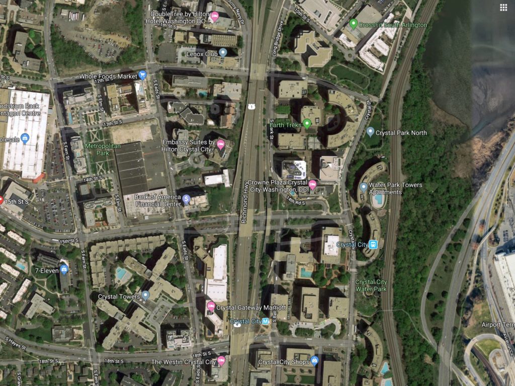
The associations, convening as “Livability 22202” in a Zoom meeting last night, focused on how to improve Route 1 in Crystal City, specifically where it goes over 12th Street S. and 18th Street S.

Proposed changes ranged from building storefronts or markets in the area underneath the overpasses, creating more open space where thick sandstone-colored walls now hold up the highway, and putting Route 1 underground to allow for development on top of it.

The discussion comes after the Virginia Department of Transportation (VDOT) hired a contractor to conduct a feasibility study of removing the overpasses and lowering the highway to ground level.

Darren Buck — an Aurora Highlands resident, professional transportation planner, and member of the Arlington Transportation Commission — presented the possible changes, saying they were ideas meant to set a line of thinking. Factors like cost, construction time and general practicality are yet to be fully considered.

“These really are kind of unconstrained by a lot of reality,” Buck said. “They’re really trying to get to what could we do that would address some of… the identified things that we are concerned about with the at-grade proposal and start to toss around alternatives.”

Ultimately, Livability 22202 will make “community-based recommendations for an innovative new vision for Route 1 and its cross streets between 12th Street S. and 23rd Street S.,” a slide in the meeting said.

If the highway was at-grade, it could be turned into an “urban boulevard” running through Crystal City, according to VDOT.

This would fall in line with the transportation portion of Virginia’s HQ2 deal with Amazon, which lists “improvements to Route 1 through Crystal City and Pentagon City” as a project the government would fund.

According to a 2018 Virginia Economic Development Partnership presentation, this project could cost around $250 million.

Livability 22202 said dropping Route 1, also known as Richmond Highway, to ground level would force pedestrians walking between east and west Crystal City to cross the busy commuter artery.

“We want a pedestrian-friendly, walking-friendly neighborhood,” Michael Dowell of Livability 20222 said. “Having Route 1 be an impediment to achieving that is a really big worry.”

Pedestrians can currently cross under the overpasses, which many do to access the Crystal City Metro station on the east side.

Another Livability 22202 meeting on the topic will be held on September 30.

Images via Google Maps


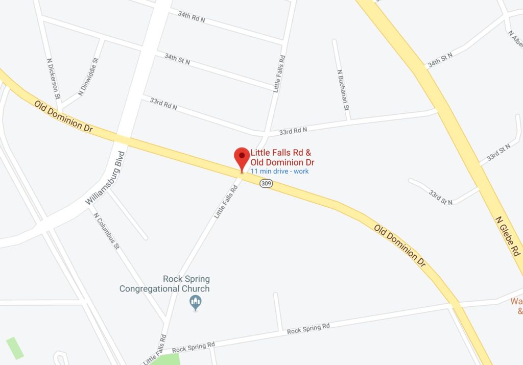
There was another crash at the intersection of Old Dominion Drive and Little Falls Road yesterday afternoon.

No one was seriously injured in the wreck, which temporarily closed the eastbound lanes of Old Dominion Drive in the Rock Spring neighborhood. But it’s just the latest in a long string of crashes.

The crash-prone intersection has been the subject of local discussion for years. It was the scene of 27 crashes over a two-year period between mid-2017 and mid-2019, according to Arlington County police.

Minor safety changes rolled out last year — restricting traffic on Little Falls Road to right turns only during the morning and evening rush hours — have not eliminated the danger. In May, a two-vehicle crash at the intersection sent one car careening into the front yard of a house on the corner.

In 2017, a Williamsburg Middle School student led an effort to convince the county to implement safety changes at the Old Dominion and Little Falls intersection. Ultimately, only the rush hour restrictions were deemed appropriate — county staff said that stop signs for traffic on Old Dominion, an arterial street, would result in too much queuing, while a traffic light was not justified because there was not enough traffic on Little Falls Road. (There are existing stop signs for traffic on Little Falls.)

Given the continued collisions, what, if anything, do you think should be done?


Four major transportation projects in Arlington will receive tens of millions in regional funding, the Northern Virginia Transportation Authority announced today.

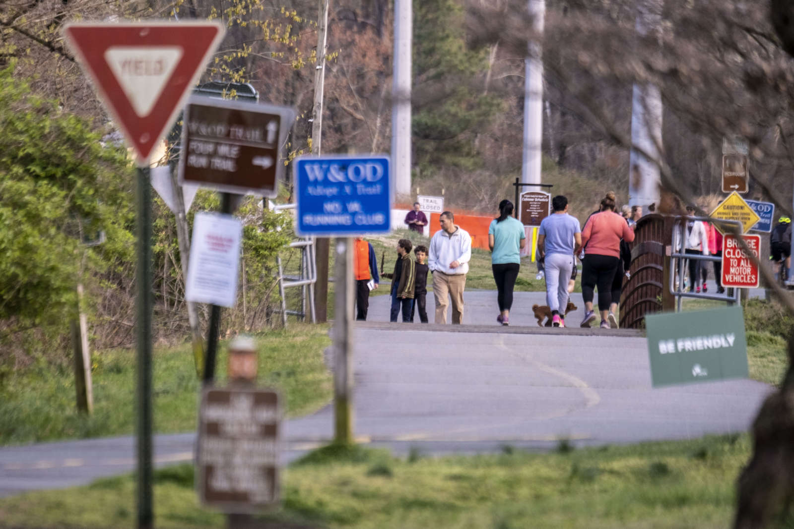
The projects, all of which are in the planning stages, will bring multimodal upgrades to Crystal City and Rosslyn, as well as to the W&OD Trail. In all, the NTVA is providing more than a half billion dollars in funding to 21 projects around the region.

“On the evening of July 9th, the Northern Virginia Transportation Authority adopted the FY 2020-2025 Six Year Program, the Authority’s fifth funding program and the most competitive to date,” the regional governmental body said in a press release. “$1.44 billion in multimodal transportation funding was requested by 13 Northern Virginia localities and agencies – including Arlington County – with $539 million in Authority regional revenues available.”

“The Authority unanimously voted to fund 21 of the 41 transportation projects submitted for funding consideration,” the press release continues. “Arlington County was awarded $29.874 million in regional revenues on the following projects aimed at reducing congestion and getting people to their destinations faster.”

The projects being funded in Arlington include:

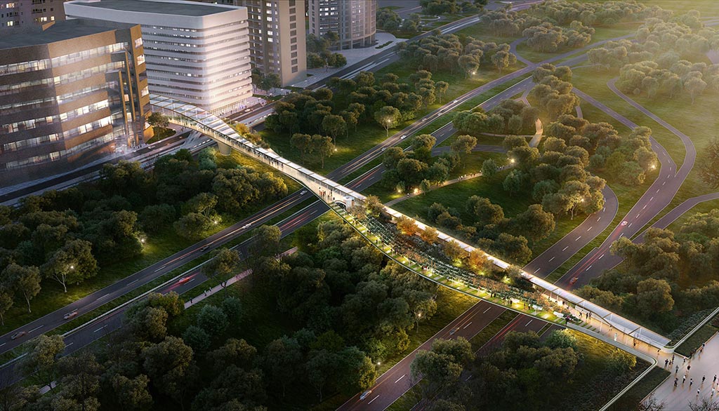
The “CC2DCA” pedestrian bridge from Crystal City to Reagan National Airport, which is envisioned as providing a “High Line“-like experience as it spans the GW Parkway and makes walking to the airport more feasible for those in the National Landing area.

The project is set to receive $18 million from NVTA, of the total estimated project cost of $36.2 million.

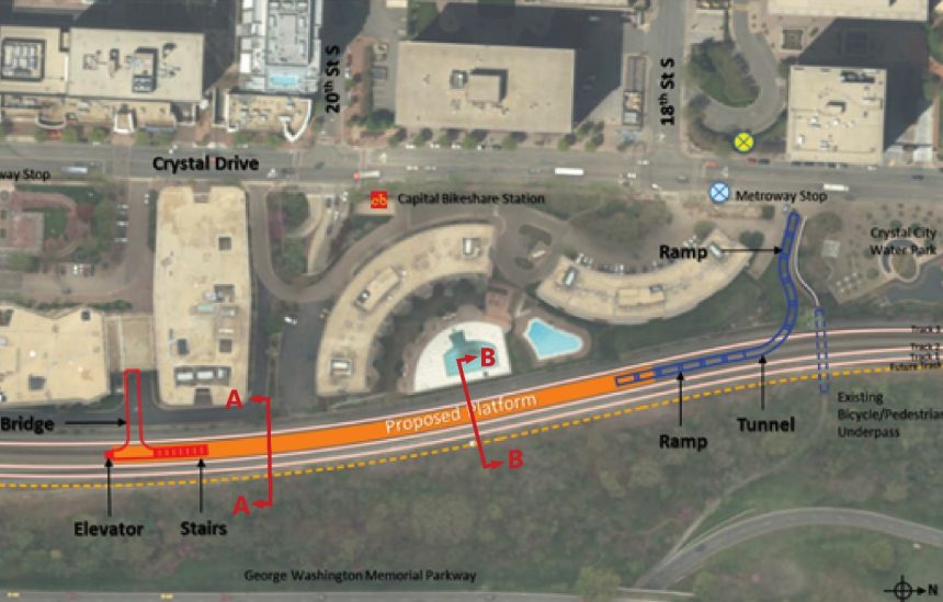
The project will create a pedestrian connection between Crystal City and Ronald Reagan Washington National Airport (DCA). It would provide an additional transportation access point to the airport, which is less than one-half mile away from Crystal Drive, but is practically inaccessible by foot today. In addition to the potential reduction in vehicular traffic between the two destinations, the project is located roughly two blocks from the under-design Crystal City Metrorail Station East Entrance and provides a direct connection to bus service on the Crystal City-Potomac Yard Transitway. The CC2DCA Intermodal Connector is intended to connect to the future relocated VRE commuter rail station. The CC2DCA Intermodal Connector project builds upon a recently completed feasibility study prepared by the Crystal City Business Improvement District (CCBID). This project will further evaluate alternatives, complete environmental documentation and approvals, engineering design, and ultimately construct a pedestrian connection between Crystal Drive and the terminals of DCA. The NVTA funding would be leveraged with both State and local funds to completely fund design and construction of the project; the Commonwealth has committed $9,500,000 to the CC2DCA Intermodal Connector.

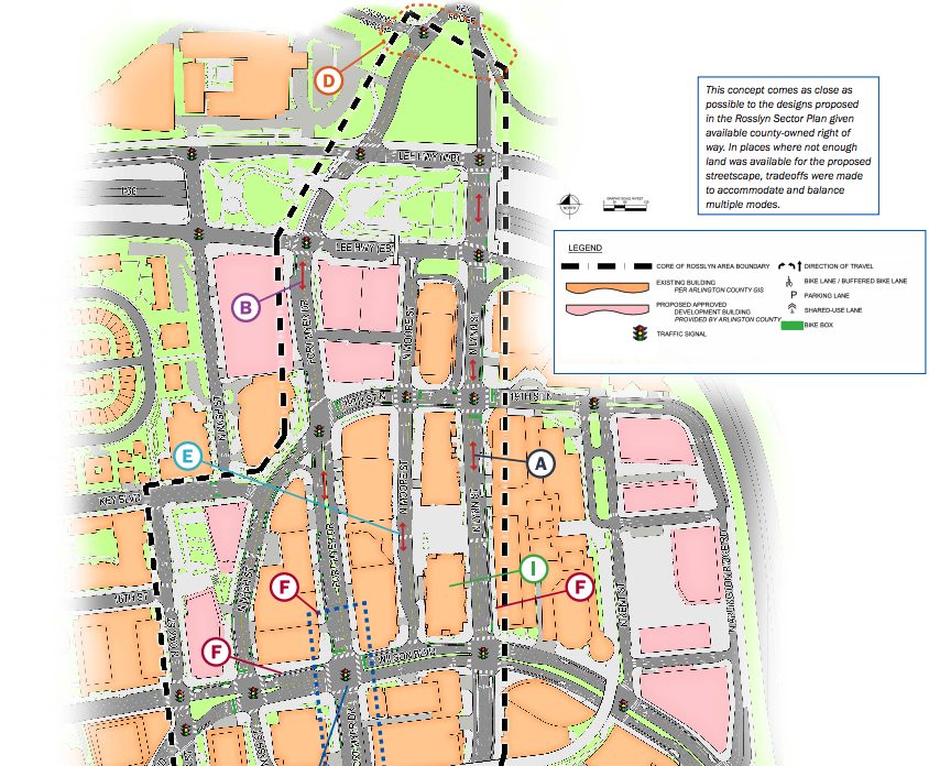
Rosslyn Multimodal Network Improvements, which is an extension of the Core of Rosslyn study. The study, which was completed last year, calls for major changes to Rosslyn’s road and pedestrian network, including removal of the Fort Myer Drive tunnel under Wilson Blvd and upgrades to crosswalks, sidewalks and bike lanes.

The project is set to receive $11.9 million from NVTA, its full estimated cost, though the project description does not mention the tunnel removal.

Design and construct a suite of complementary bicycle and pedestrian improvements largely taken from the recommended implementation projects in the draft Core of Rosslyn study. Collectively as a package, the projects significantly improve access to employment, housing, and transit within the Rosslyn regional activity center, and improve regional connections between Rosslyn and Georgetown, DC.

The long-planned VRE Crystal City Station Improvements project, which would building a new, upgraded Virginia Railway Express station in Crystal City, the last VRE stop before D.C.

The project is set to receive $15.8 million of its estimated total $49.9 million cost.

(more…)


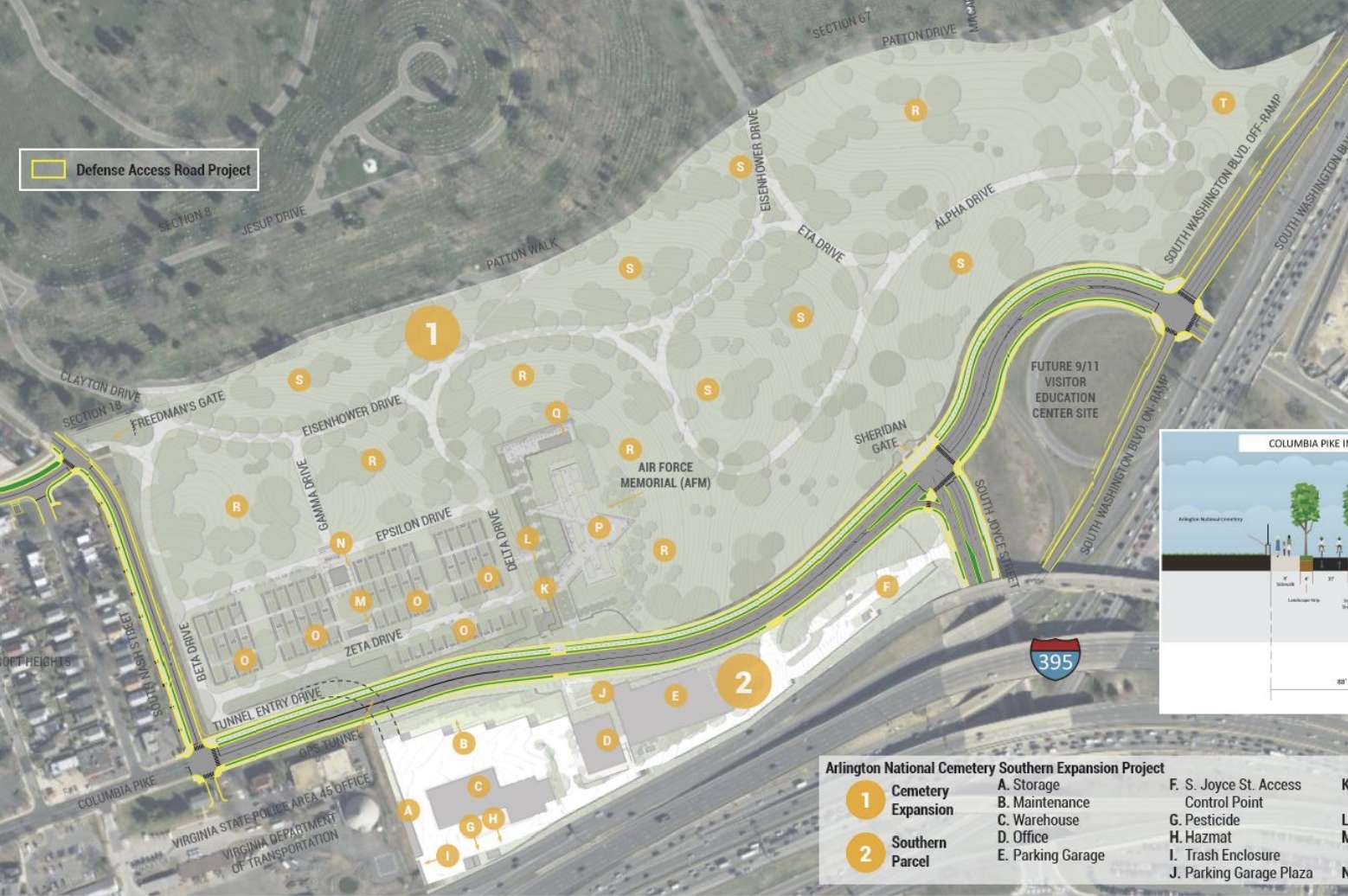
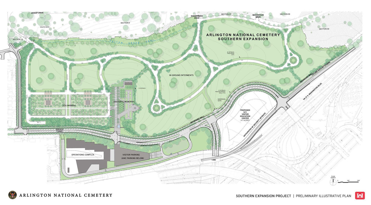
The Dept. of Justice has filed a civil action that would seize nine acres of county land on the eastern end of Columbia Pike by eminent domain, in order to expand Arlington National Cemetery.

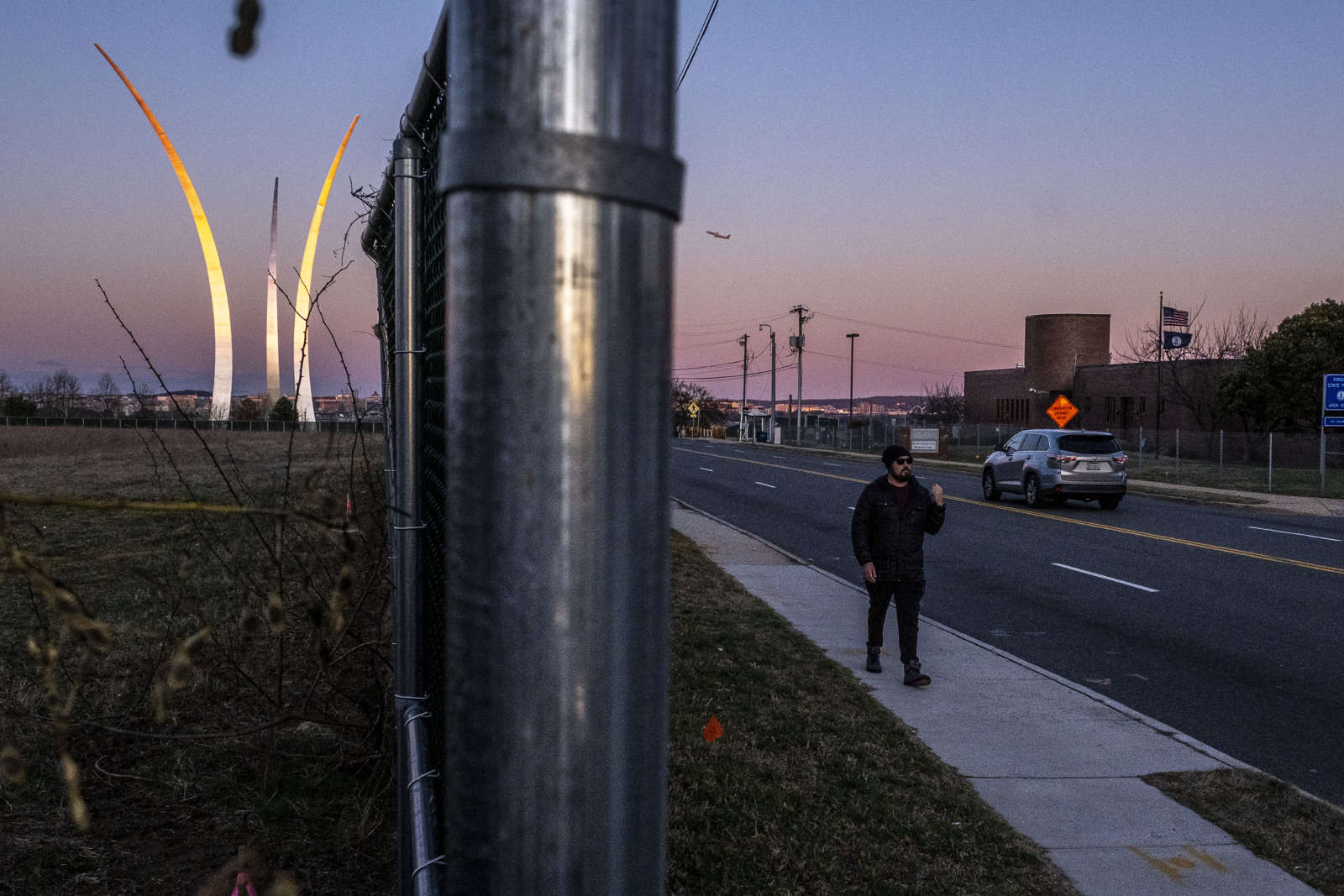
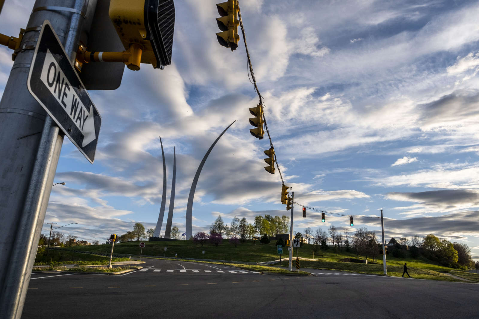
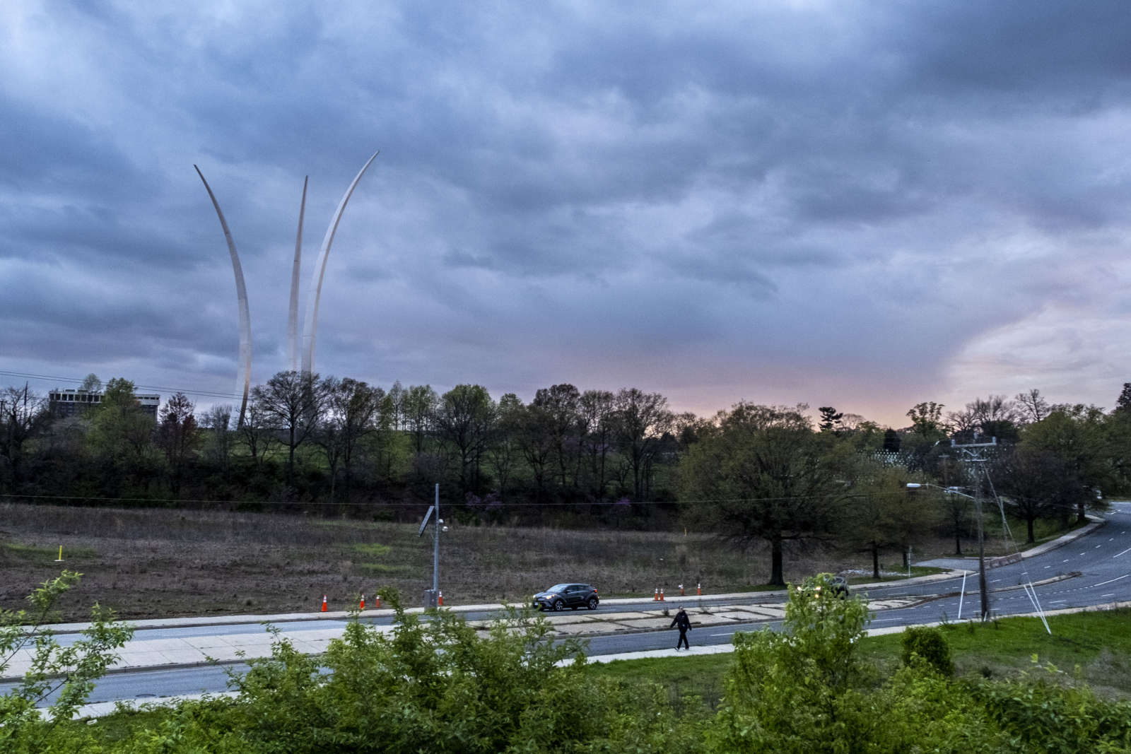
The suit appears to be part of the long-standing plan to expand the cemetery around the Air Force Memorial, and includes no indication of resistance from the county. Arlington endorsed the federal proposal in April, which realigns and upgrades a portion of Columbia Pike in exchange for the county-owned land next to the cemetery.

As of Tuesday morning neither the Justice Department nor the county responded to requests for comment by ARLnow.

The action was announced Monday, with the DOJ touting it as a win for both military veterans and local residents.

“When completed, the Arlington National Cemetery Southern Expansion Project will provide for approximately 60,000 additional burial sites, including an above ground columbarium,” said a press release. “The expansion will extend the timeline for Arlington National Cemetery to continue as an active military cemetery.”

“The expansion project will benefit Arlington County and its residents by, among other things, burying overhead power lines and incorporating the Air Force Memorial and surrounding vacant land into Arlington National Cemetery,” the press release continues. “The project will transform Columbia Pike from South Oak Street to Washington Boulevard by re-aligning and widening it. The project includes streetscape zones with trees on both sides of Columbia Pike, adding a new dedicated bike path, and widening pedestrian walkways. The project also provides for the construction of a new South Nash Street.”

The full press release is below.

(more…)


Petition for Intersection Improvements — “Last Friday, our life turned upside down when a car traveling upward of 40-50 mph mowed down our 10-year old daughter and puppy… We would like to see three simple measures put in place at each of these intersections – (1) stop signs, (2) crosswalk stripes on the asphalt and (3) curb extensions or mini-circles if deemed appropriate/necessary by County traffic experts.” [Change.org]

County: Support Civil Rights By Taking Census — “Census data on both race and origin are used to ensure civil rights protections including voting rights and fair housing. The data are also used to address employment discrimination, provide language services and fund schools, as well as many other programs and services.” [Arlington County]

Nearby: Foot Chase in Falls Church — “Police received two separate calls about two women who felt threatened by a man while they were walking near the 400 block of W. Broad Street. Police located the man and pursued him as he fled on foot. Officers attempted to communicate with the man, but he became aggressive. Officers gave warning, then used capsaicin or “pepper” spray… After officers consulted with one of the victims, no arrest was made and no charges were pressed at this time.” [City of Falls Church]


Amazon Orders Thousands of Meals from Freddie’s — “Amazon has hired Freddie’s Beach Bar and Restaurant, which is widely known as an LGBT establishment, to prepare and deliver 10,000 meals in the month of May for front line healthcare workers and first responders in Arlington and nearby Alexandria who are dealing with the coronavirus pandemic. In a statement released to the Washington Blade, Amazon said it was investing $200,000 to pay for the 10,000 meals.” [Washington Blade]

VRE Ridership Down 97% — “First, the good news, such as it is: Ridership on Virginia Railway Express stabilized in April as the public-health pandemic rolled on. The bad news: The ridership decline is now averaging 97% compared to normal times.” [InsideNova]

Meat Section Bare at Local Costco — A photo posted Wednesday evening shows the Pentagon City Costco store’s meat section picked clean, amid a worsening meat shortage in the U.S. [@dccelebrity/Twitter]

Arlington Getting Big Check via WMATA — “The Arlington County government can expect a check for $7.2 million at some point in the future from the Washington Metropolitan Area Transit Authority, as federal COVID-19 relief funding makes its way among government agencies. The funding will be part of $110 million that WMATA plans to reimburse to its member localities, so they can support non-Metro local transit systems, such as Arlington’s ART buses.” [InsideNova]

Army Navy Drive Project Pushed Back — “Anticipated completion of the Army Navy Drive Complete Streets project quietly slips an entire year with no explanation.” [@alongthepike/Twitter]


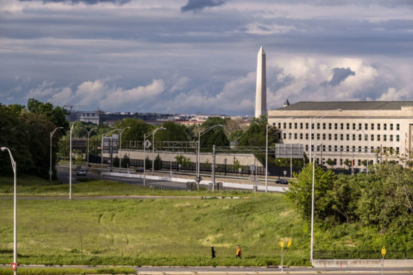
Arlington and the Virginia Department of Transportation are looking at how to improve the situation along the notably crash prone stretch of Route 50 (Arlington Blvd) between Glebe Road and Fillmore Street.

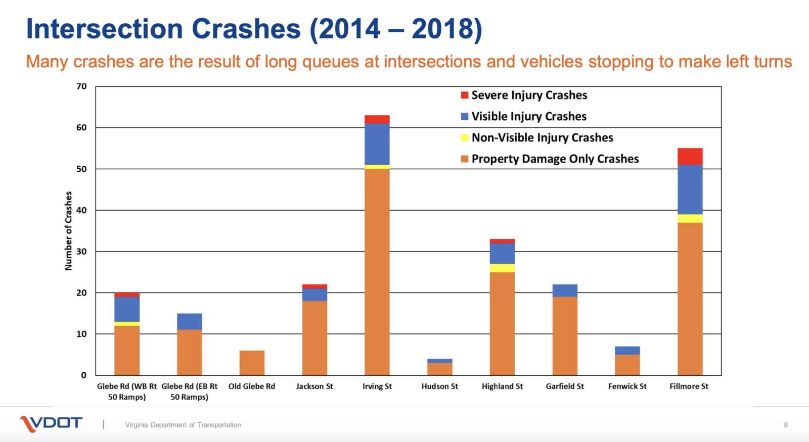
Between 2014 and 2018, VDOT said there were 247 total crashes with 61 crashes resulting in injuries, a few severe but none resulting in fatalities. Most of these crashes were concentrated around intersections.

“This segment of Route 50 experiences congestion in the morning and evening peak periods and a high number of crashes,” VDOT noted. “Route 50 averages 62,000 vehicles a day within the study limits.”

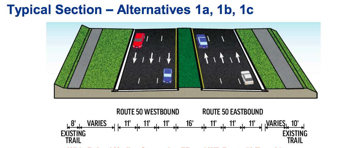
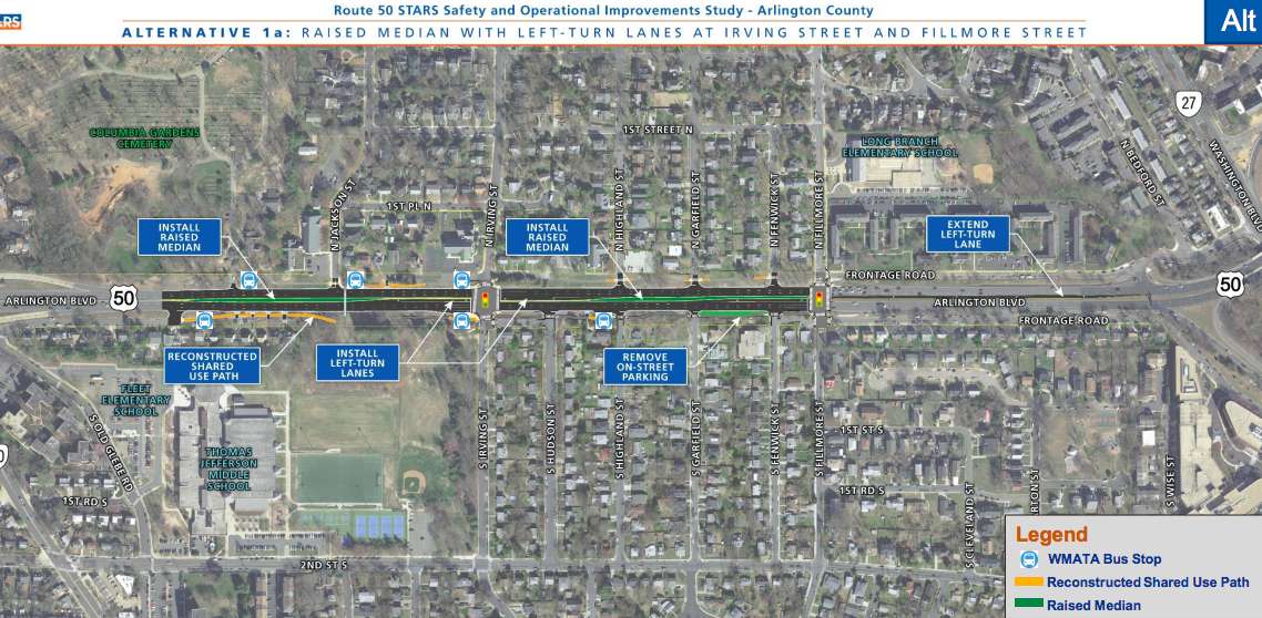
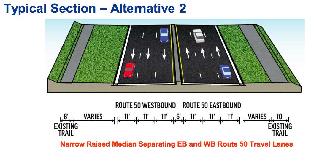
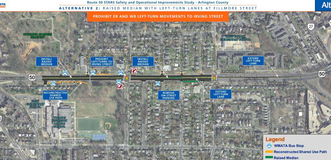
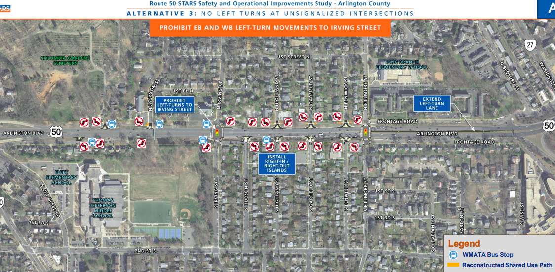
In an online presentation, VDOT proposed three alternatives with a variety of sub-options to cut down on conflict points — places where vehicles intersect. Two of the options would add new raised medians to Route 50, and each of them had sub-options that would limit left turns or turn Irving Street or Fillmore Street into one-way streets.

The three primary alternatives are:

  • Wide Raised Median Separating EB and WB Route 50: the widened, raised medium would reduce conflict points at intersections without signals and at trail crossings. The only four-way intersections would be at Irving Street and Fillmore Street, where there are traffic lights. This alternative also includes left-turn lanes along Route 50 at Irving Street. The increased separation between eastbound and westbound travel lanes, and the additional turn lanes, would require the widening of Route 50.
  • Narrow Raised Median Separating EB and WB Route 50: the narrower median accomplishes the same reduction in conflict points as the first alternative, but would also not include left-turn lanes at Irving Street, meaning there would be reduced widening requirements. Left-turns at Irving would be prohibited and the third lane would likely see more use. But while this plan would improve the situation at Irving Street, VDOT warned that it would not reduce conflicts at Fillmore Street and could create higher traffic volumes and delays there.
  • No Left Turn at Unsignalized Intersections: the final alternative would add no median, but extensive signage prohibiting left turns along the street at all intersections without a signal. The widening impact would be low or non-existent, but VDOT warned that enforcing the new restrictions would be more difficult.

The sub-options to the first alternative include prohibiting any turning onto Irving Street and no left-turns at Fillmore Street, or flipping those so there are no left-turns onto Irving Street and no turning at all onto Fillmore Street.

Traffic signal improvements are also proposed.

VDOT data presented at the meeting said that two of the sub-options within the first alternative — which includes a wider raised median —  would have the highest chance of improving safety conditions, resulting in a total 69% reduction in conflict points, while the other two options reduce conflict points by 63%.

The first alternative is also the most costly, however, at an estimated $14-18 million budget. The second alternative, the narrow median, is cheaper at $12-14 million, while the third alternative is cheapest at $5-7 million.

“Cost estimates will be prepared for alternatives under consideration,” a VDOT official said in the video. “Improvements identified as part of the story have not yet been funded and there’s no timeline for construction”

Other potential additions to Route 50 would be new service roads along either side of the highway. One would be on the south side of Route 50 would extend past S. Old Glebe Road, which would eliminate five residential driveways onto the main lanes. The other would be on the north side of Route 50, extending an existing road west of Irving Street.

Comments on the project can be submitted online until Friday, May 29. Recommendations are scheduled to be finalized and posted online this summer, with Arlington County submitting a SMART SCALE funding application in August.


The Arlington County Board is set to vote this weekend on the federal government’s plan to realign Columbia Pike to facilitate the southern expansion of Arlington National Cemetery.

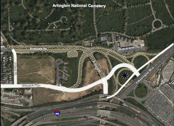
Under the plan, Southgate Road, which runs from the entrance to Henderson Hall to the intersection of the Pike and S. Joyce Street, would be removed to make way for new cemetery grounds and interment spaces. Columbia Pike would be realigned near the Air Force Memorial to run directly down to Joyce Street rather than curving around the memorial.

The County Board is expected to endorse the plan — part of the federally-funded Defense Access Roads program — this weekend, allowing it to move forward.

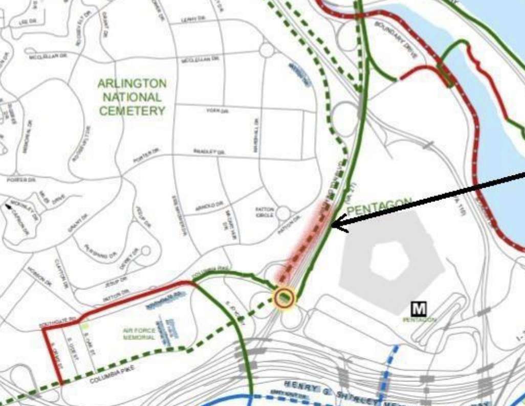
Also on the Board agenda is a Memorandum of Agreement with a federal transportation agency for the creation of a new segment of multi-use trail between Washington Blvd and Arlington National Cemetery.

The long-proposed trail would run along the western side of Washington Blvd, from the realigned portion of the Pike to Memorial Drive. It would provide a safer alternative to an existing trail on the other side of the highway, which is well-utilized but has a number of harrowing crossings at ramps to and from the GW Parkway.

“Upgrading this portion of the trail provides an important connectivity from the Columbia Pike/Pentagon City area to Memorial Drive,” a county staff report said. “With the expansion of Arlington National Cemetery and the interchange modifications, the timing is perfect for this segment of trail improvements. ”

The County Board is expected to approve the MOA, along with a half-million dollars in funding for the trail from the existing Columbia Pike multimodal improvements project.

“Representatives from [Arlington National Cemetery] have agreed to provide Arlington County the necessary easements for the trail improvements,” the staff report noted. “Under this MOA, Arlington County will provide advanced funding to Eastern Federal Lands Highway Division (EFLHD), in an amount of $500,000, for engineering design, construction advertisement, and procurement for construction services, and oversight of the construction required for the multi-use trail portion of the project.”

More on both items, from a County Board meeting preview:

The Board will consider two agreements with the federal government that, if approved, would endorse major design elements for the planned realignment of Columbia Pike and build a trail segment that will connect Columbia Pike Pentagon City to Memorial Drive. The realignment grows out of the federal government’s southern expansion project to create more burial space for Arlington National Cemetery by closing, realigning and relocating several Arlington roadways. The federal government has agreed to realign Columbia Pike modify the South Joyce Street intersection and the Columbia Pike/ Washington Boulevard interchange and replace Southgate Road with a new segment of South Nash Street. A second, related agreement that the Board will consider would, if approved, provide $500,000 for the federal government to design a multi-use trail along Washington Boulevard adjacent to the cemetery. This segment of the trail, adjacent to the cemetery, is an important connection from Columbia Pike Pentagon City to Memorial Drive. If approved, the agreement would give the Eastern Federal Lands Highway Division the authority to move forward with designing the trail.


View More Stories