Sponsored by Monday Properties and written by ARLnow, Startup Monday is a weekly column that profiles Arlington-based startups, founders, and other local technology news. Monday Properties is proudly featuring 1812 N. Moore Street in Rosslyn.

(Updated on 11/16/21 at 6 p.m.) Shift5, a Rosslyn-based cybersecurity company, has raised $20 million in Series A funding to help protect the world’s transportation infrastructure and weapons systems from cyberattacks.

The money will allow Shift5 to expand its Arlington office, adding secured facilities and labs, and add to its 50-person team, according to its announcement.

Shift5 also plans to educate fleet operators, regulators and legislators on the risks that unsecured computerized infrastructure present and show them how the data collected by these digitized planes and trains can be used to improve their efficiency, the announcement said.

The round was led by 645 Ventures, with participation from Squadra Ventures, General Advance and First In.

The company, founded by two veterans of the U.S. Army’s Cyber Branch, closed its seed funding round in 2019. Since then, Shift5 has grown through a series of contracts with several large, national passenger rail systems and more recently, with the U.S. Army and Air Force to beef up security on their combat vehicles and planes, respectively.

With the news of the second funding round and new contracts, ARLnow asked Shift5’s CEO and co-founder Josh Lospinoso to reflect on the entrepreneurial process and on what it takes to raise money as a startup. The following Q&A has been slightly condensed and edited for clarity.

ARLnow: How long have you been actively working on raising Series A funding? Did the numbers meet or exceed expectations?

Lospinoso: Shift5 closed seed funding in 2019, and in the aftermath, won a series of contracts, including work with the US Air Force, which allowed us to grow organically through this year. Our Series A was very competitive, and ultimately our new partners at 645 represented a huge addition to the team that we couldn’t pass up.

ARLnow: When you started the company, were you someone who got energized by the idea of talking to investors, or was that intimidating? Do you think your product is an easy sell, given the immediate and debilitating threats cyberattacks pose?

Lospinoso: The Shift5 founding team is very passionate about the risk to national security posed by insecure transportation infrastructure. The idea of spreading awareness about the problem was more exciting and energizing than intimidating. We live in an era in which the cyber physical effects of cyberattacks are rapidly becoming a national menace. We’re seeing the US government act here — for example, the TSA is mandating rail and air operators tighten cybersecurity. Our customers are just glad there are folks out there solving the problem for them.
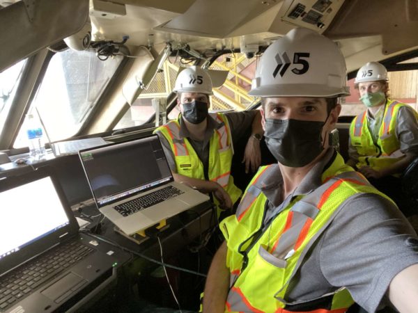
Shift5 founders deploy their product on a train (courtesy of Shift5)

ARLnow: Was there a steep learning curve to starting a company after leaving the military? Or do you think that it imparted some entrepreneurial skills?

Lospinoso: There was a pretty steep learning curve. The military prepared Mike and me for this. You’re used to jumping into high-tempo environments, having to learn the ropes quickly under a lot of pressure.

ARLnow: Which was harder, raising Seed or Series A funding?

Lospinoso: Both have difficulties in their own way. Seed Series funding is really team- and mission-focused. The Series A is much more about product/market fit. It’s about showing how your thesis at the Seed Series is playing out. By numbers, relatively few companies raise a Series A successfully. We were fortunate that we faced a problem in uniform that gave us a unique perspective on a very large opportunity. And we see that playing out.

ARLnow: What does it take to raise $20 million?

  1. Knowing something about the world that few people know to be true. Go after a big problem facing lots of people. The best kinds of problems are those that people don’t know they have.
  2. Having a risk appetite to eschew a steady paycheck and work/life balance to throw every ounce you have at a single problem.
  3. Being stubborn enough not to be deterred by short-term setbacks but nimble enough to accept feedback from customers, investors, and employees.
  4. Telling the story effectively and rallying others to your cause.
  5. Having a maniacal focus on solving customer problems.
  6. Having the maturity to give up responsibilities and control to empower those around you. Remember about rallying others to your cause.

Reckless drivers are regularly backing up on I-395 to get to the Express Lanes, despite bollards placed to prevent it.

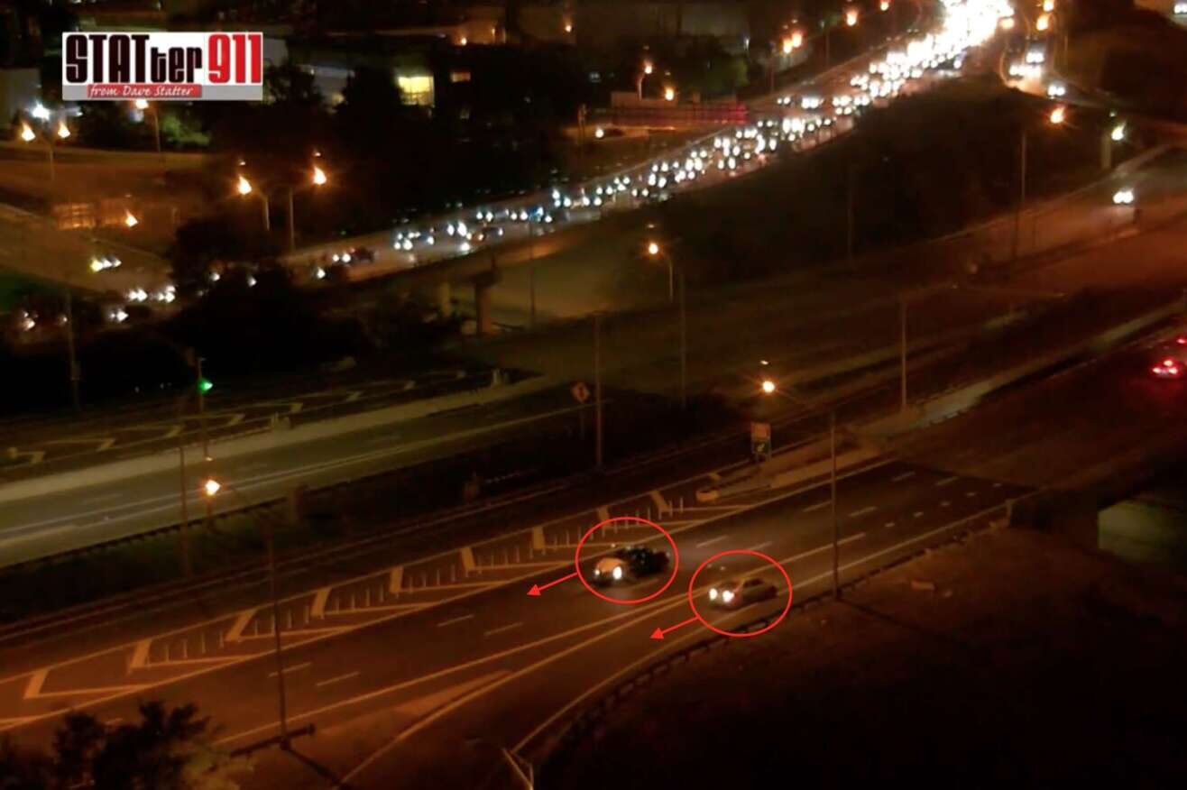
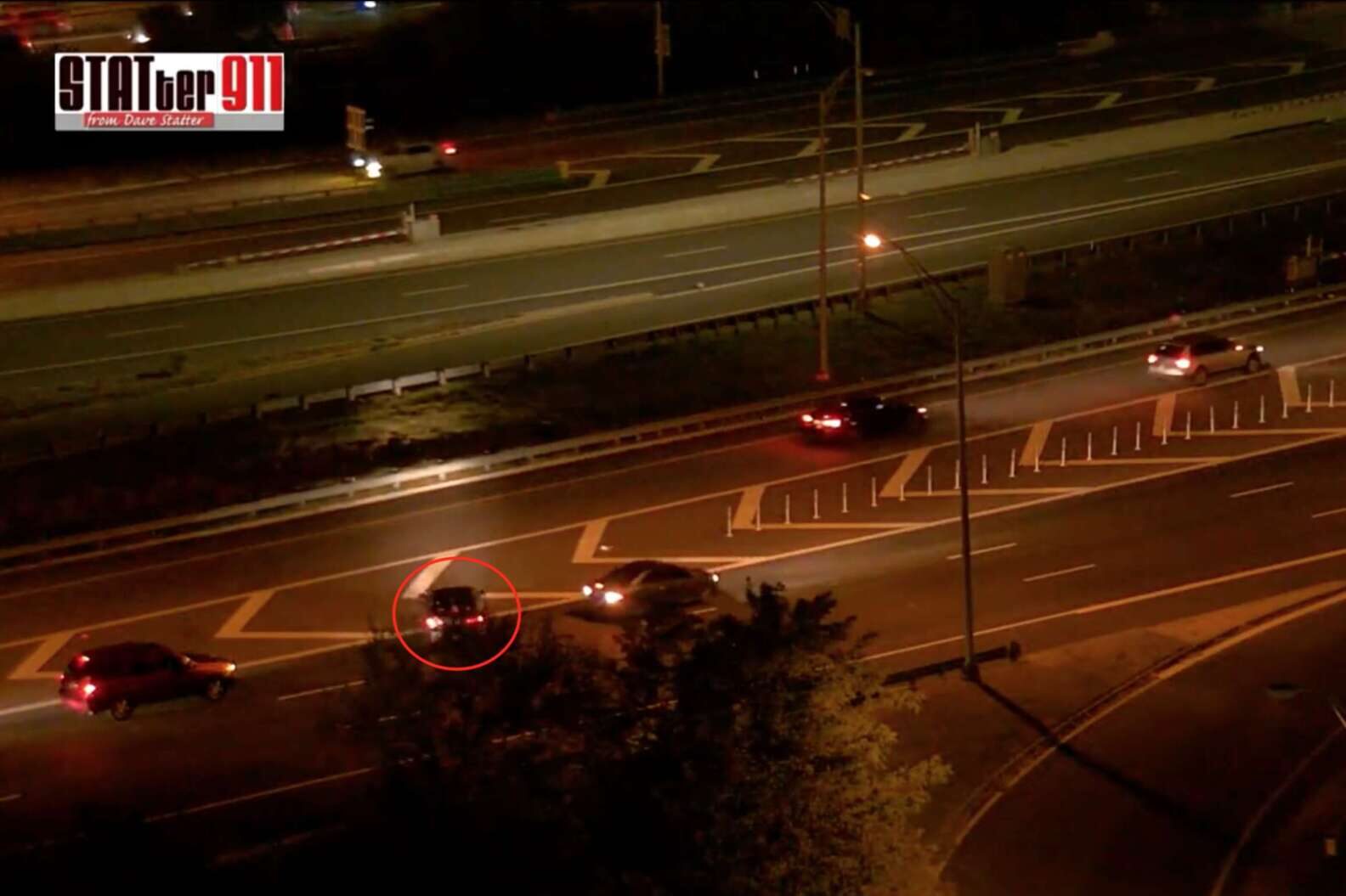
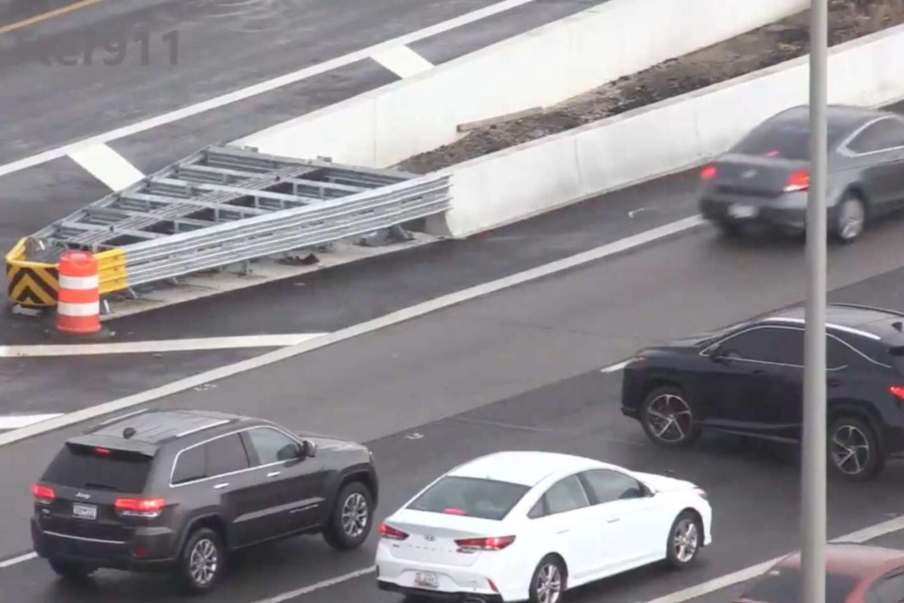
Video has captured a number of drivers getting onto northbound I-395 from the Route 110 ramp, near the Pentagon, then driving in reverse to get around bollards that block access to the high-occupancy toll lanes. In return for driving the wrong way on a major highway, the drivers get to save a couple of minutes by avoiding minor traffic backups in the main lanes of the 14th Street Bridge.
Footage of the wrong-way drivers has been published by public safety watchdog Dave Statter over the past two years. The most recent jaw-dropping video — showing multiple drivers drive in reverse in traffic lanes — was posted last week.
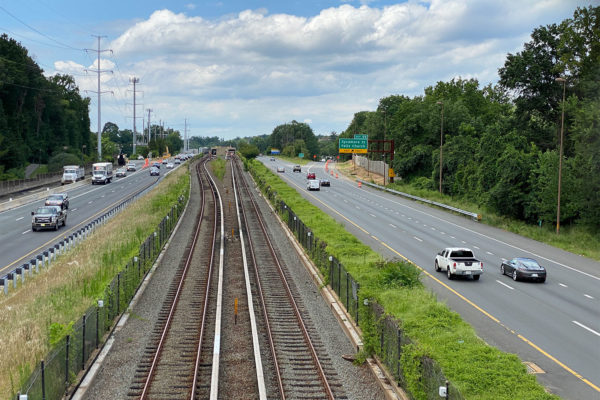
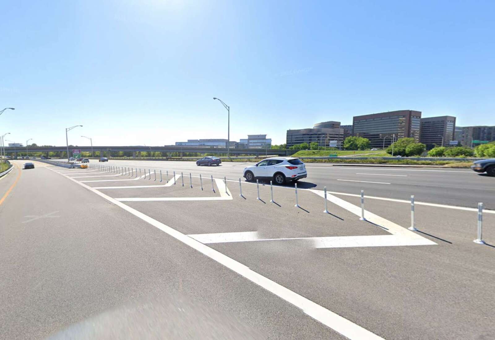
It appears the scofflaws have upped their antics in response to the addition of the bollards near where the main lanes and the Express Lanes split, before the bridges.

“Last year, in close coordination with [the Virginia Department of Transportation] and external engineering firms, we worked together to determine that adding bollards at that location was and continues to be the best solution,” said Pam Davila of the Australian company Transurban, which operates the 495/95/395 HOT lanes. “We’re confident that the bollards continue to serve their purpose and cannot stress enough that drivers should be mindful to practice safe driving at all times, on and off the Express Lanes.”

She said Transurban and VDOT discussed “other mitigation options” and talked extensively about issues such as the optimum length for the bollards.

After they went up, Statter observed an improvement, but 15 months later, people are out-maneuvering them.

Virginia State Police is “very aware of” this problem, spokeswoman Corinne Geller says, and is working with VDOT and Transurban to tackle it from both enforcement and engineering perspectives.

“As a preventative measure, state police has stepped up its enforcement and presence in that particular area,” she said. “But our troopers simply cannot be everywhere all the time, nor would permanently stationing a trooper at that one location be efficient or fair use of our limited resources across the Northern Virginia region. Our troopers are committed to doing everything we can to prevent such reckless behavior from occurring.”

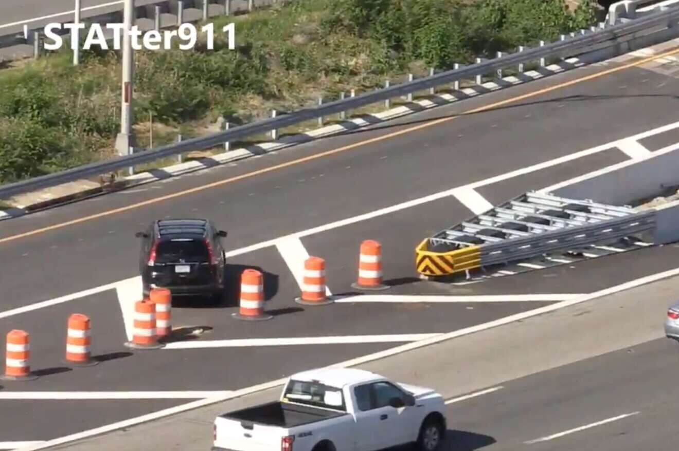
Statter’s videos show what people did pre-bollards. Originally, defiant drivers crossed the highway at a nearly perpendicular angle to make the lane.

Orange barrels and cones didn’t deter some drivers. With surprising courtesy, one driver used the turn signal to cross three traffic lanes — blocking oncoming cars — and squeeze through an opening.

More barrels went up in shorter intervals, which did not stop this intrepid driver from creating an opening.

https://twitter.com/VaDOTNOVA/status/1283172582213197825

Instead of making these dangerous moves, the Transurban spokeswoman says drivers can access the Express Lanes at a different juncture.

“There is an option for drivers coming from the Pentagon City to safely get on the Express Lanes by taking the Pentagon/Eads Street ramp, and we encourage drivers to use that route, especially during rush hour when there is heavy traffic on the general-purpose lanes,” she said.

While enforcement plays a role in stopping the antics, Geller reminded drivers it is their job to follow the basic rules of the road.

“There is still a responsibility on the driver to make safe, legal and logical decisions when behind the wheel,” she said. “Backing up and/or driving the wrong way on an interstate ramp and/or in a travel lane put that driver and countless other motorists at risk of a crash and serious injury. The safety of our highways is a collaborative responsibility and one we hope the motoring public will help us improve, especially at this particular location.”


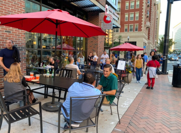
Customers enjoy outdoor dining at Good Company Doughnuts & Café (courtesy photo)

Locally-owned Good Company Doughnuts & Café in Ballston is trying to save its bustling outdoor patio from being downsized by a county transportation project.

Arlington County is installing a bus shelter in front of the business at 672 N. Glebe Road before the winter. Good Company co-owner Charles Kachadoorian says the shelter will obscure much of the storefront from the street and halve the available outdoor seating, both of which will hurt business.

“Our indoor space is small, so we continue to limit seating to our beautiful outdoor patio in order to keep our staff and neighbors as safe as possible. Unfortunately, we are at risk of losing more than half those patio seats,” he said. “We requested the county delay the installation and relocate the shelter to an area on the sidewalk that will serve the intended purpose while allowing for Good Company, a locally-owned and operated business that truly cares about its neighbors, to continue to thrive.”

Located on the ground floor of the 672 Flats apartments, Good Company not only stayed afloat during the pandemic but provided free lunches to Arlington public school kids. Meanwhile, the patio became a popular open-air gathering spot for locals and tourists seeking coffee, breakfast, lunch and of course, decadent donuts. Kachadoorian says there’s been a “huge response” from patrons and neighbors who want to see the patio stay.

The plan to build the shelter at the corner of N. Glebe Road and 7th Street N. was approved as part of the site plan for 672 Flats in October 2015, said Ben Aiken, the director of constituent services for the county. Arlington received $12,500 for the bus shelter from 672’s developer and a $6,000 bus shelter grant from the Virginia Department of Rail and Public Transportation as part of the bus stop improvement program.

That’s four years before Good Company opened in April 2019.

“There was no way they would’ve known in 2015 that there’d be this restaurant with neighborhood appeal,” Kachadoorian said. “The important thing for us is to get the site plan adjusted and move the bus stop.”

Arlington County says the project will not impact the seating Good Company is permitted to operate.

“Arlington is committed to supporting our small businesses and we have been in close contact with Good Company Doughnuts & Cafe on this issue,” Aiken said. “The business will still be allowed to keep their approved outdoor dining, as it does not impede access to the bus stop…. While the restaurant has indicated the bus stop’s location will take away half of their dining, it appears this is because of an unpermitted expansion beyond their approved seating area.”

The row of seating closer to the road is not permitted because of the dimensions of the proposed bus shelter, confirmed Kachadoorian. He says he’s been talking with the county about his extra seating and his desire to see that row made permanent.

He says the patio can’t expand around the corner, as the sidewalk is not wide enough, but the shelter could move further south on N. Glebe Road where it wouldn’t block a business.

“For us, it’s more important to have the patio, so we’d be willing to help defray the cost or do whatever needs to be done to move the shelter,” he said.

Aiken maintained that Good Company’s storefront should still be visible after the shelter is in place.

“The bus stop uses our lowest profile shelter design, is transparent, and should not significantly impact the visibility for Good Company,” he said.

(more…)


Amazon has made changes to its plan for the second phase of the company’s HQ2 in Pentagon City.

For the last eight months, Amazon has been hammering out the details of the planned second phase, on the PenPlace site at the corner of S. Eads Street and 12th Street S. Today (Thursday) it unveiled some significant tweaks it has made in response to local feedback.

Members from the community have weighed in on everything from transportation to sustainability to architecture, suggesting changes that would make the office campus more walking- and biking-friendly, more verdant and more architecturally interesting.

“We appreciate the ideas and have made changes to enhance the overall connectivity of the site. We also incorporated additional sustainable elements and more greenery into the design, and diversified the architecture within PenPlace,” wrote Joe Chapman, Amazon’s director of global real estate and facilities, in a blog post published this morning.

“These updates make the entire project even better, benefitting our neighbors and all those that will visit HQ2,” he continued.

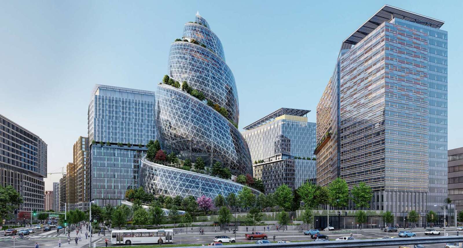
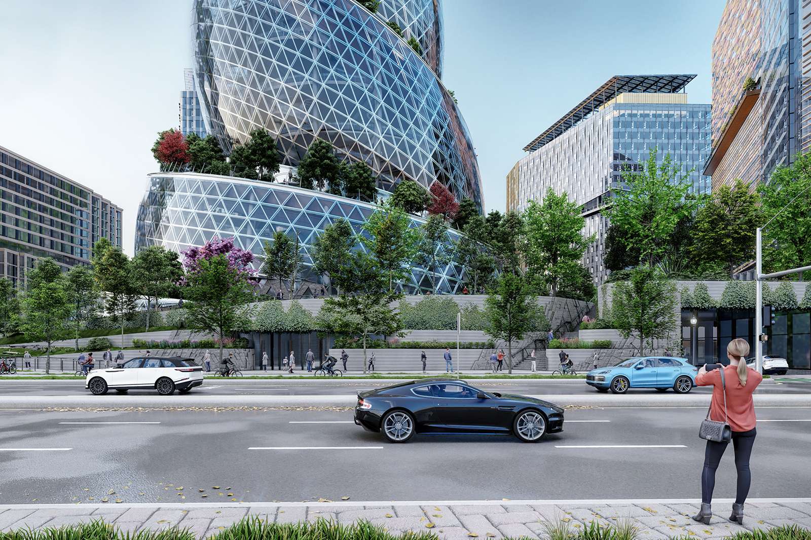
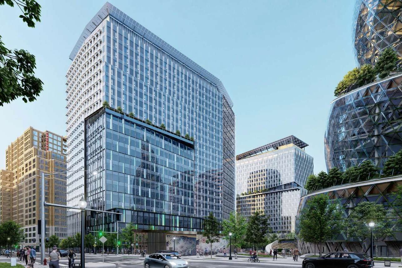
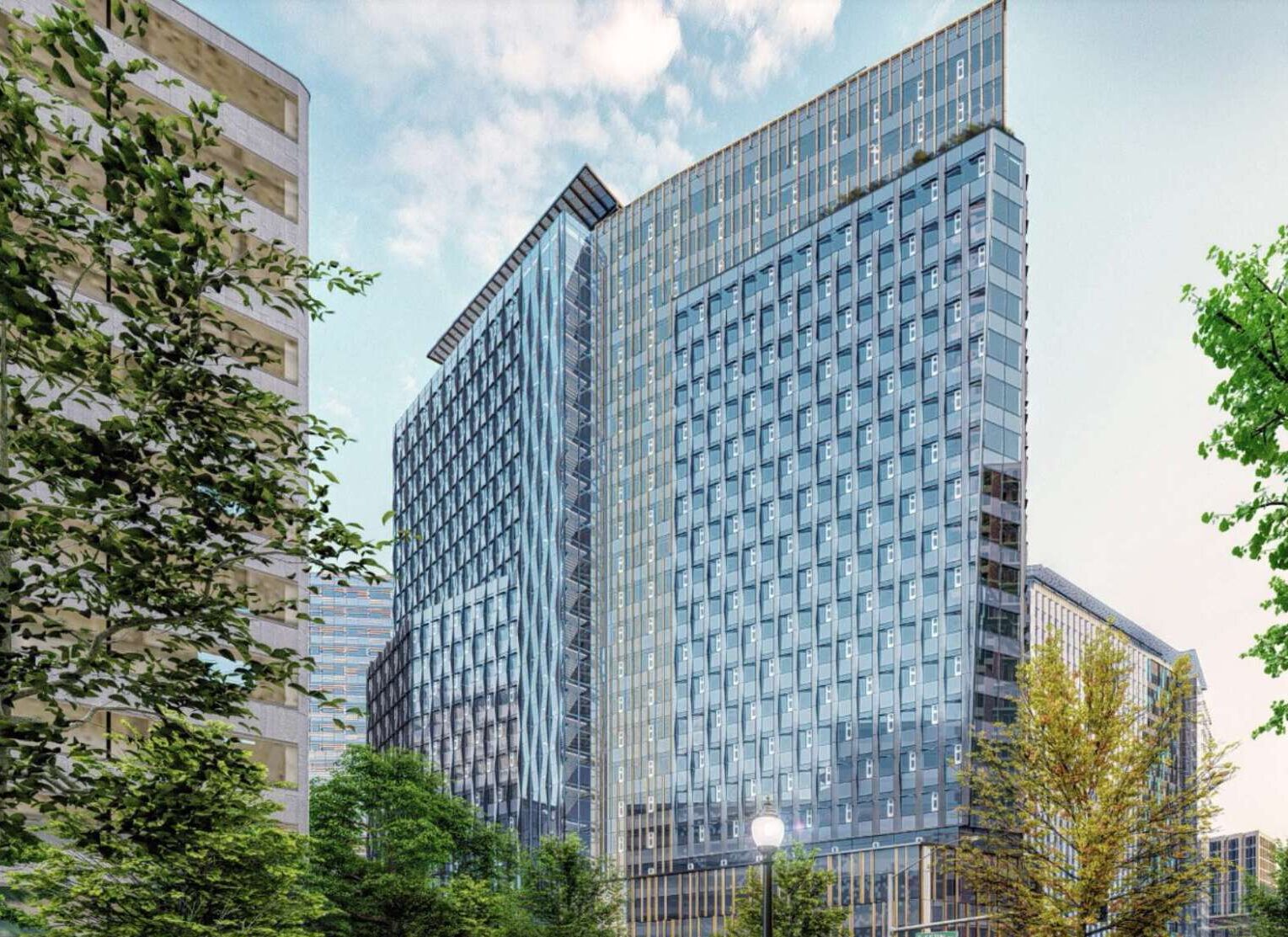
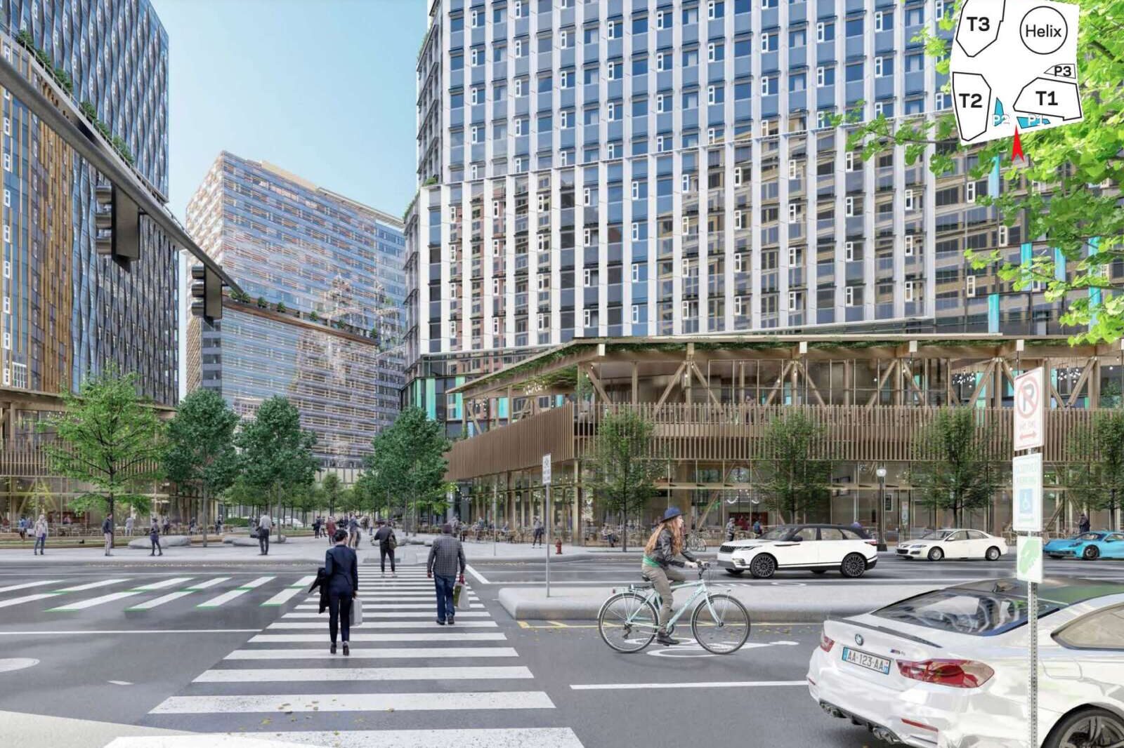
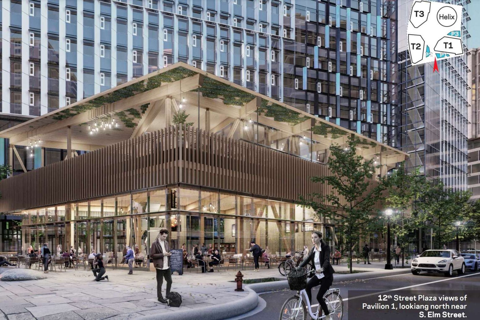
PenPlace is situated on an 11-acre site near the Pentagon City Metro station, bordered by Army Navy Drive, S. Eads Street, 12rd Street S. and S. Fern Street. It will be anchored by a lush, futuristic building, dubbed “The Helix,” and feature three, 22-story office buildings, retail pavilions, a childcare center and a permanent home for Arlington Community High School. A park drawing inspiration from local waterways will run north-south through the site.

But residents were critical of the multimodal transportation planning Amazon offered at first.

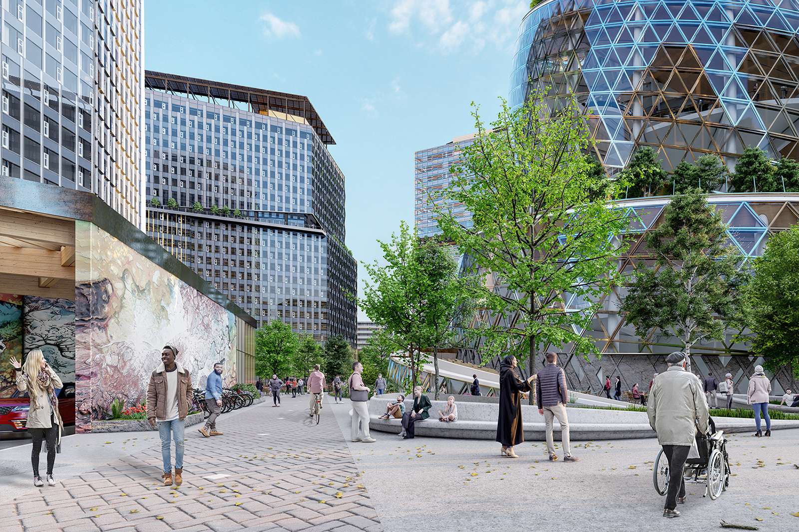
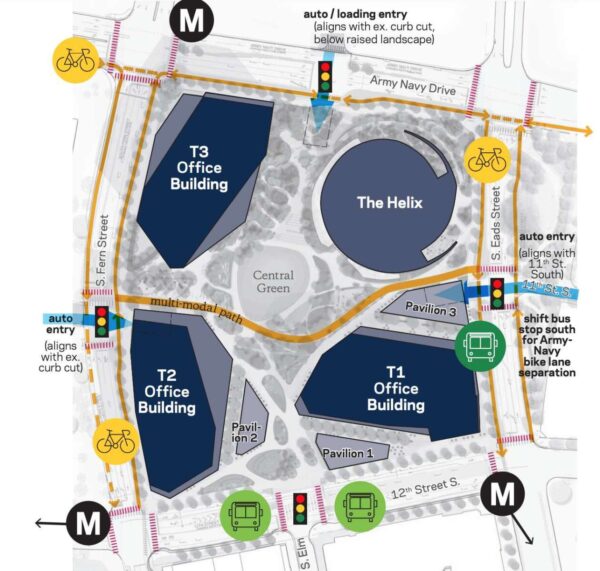
In response, Amazon changed some circulation patterns surrounding and running through the site, widened the paths running east to west to accommodate more pedestrians and cyclists and widened certain sidewalks where the heaviest pedestrian traffic is anticipated.

Transit options around PenPlace (via Arlington County)

It also added protected bike lanes along S. Eads Street and S. Fern Street to connect PenPlace to the county’s surrounding local bike transit plan.

“All of these adjustments will create more direct, wider pathways through the site and make traversing PenPlace even safer,” Chapman said. “It will also make the public Central Green and urban forest at the center of PenPlace even more accessible for everyone to enjoy.”

At least one transit advocate welcomed the change, but said a protected bike lane along 12th Street S. would further improve circulation.

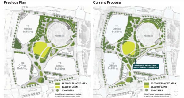
Per an Amazon blog post, residents who weighed in on the planning process told Amazon to add even more green space and native plant species to its campus. In turn, the tech and ecommerce giant expanded the planted area by 5,500 square feet and reduced the amount of impermeable surfaces, such as paving.

“We are excited to be able to deliver 2.5 acres of public open space for everyone to enjoy at PenPlace,” Chapman said.

Amazon increased the plantings within PenPlace in response to community feedback (via Arlington County)

(more…)


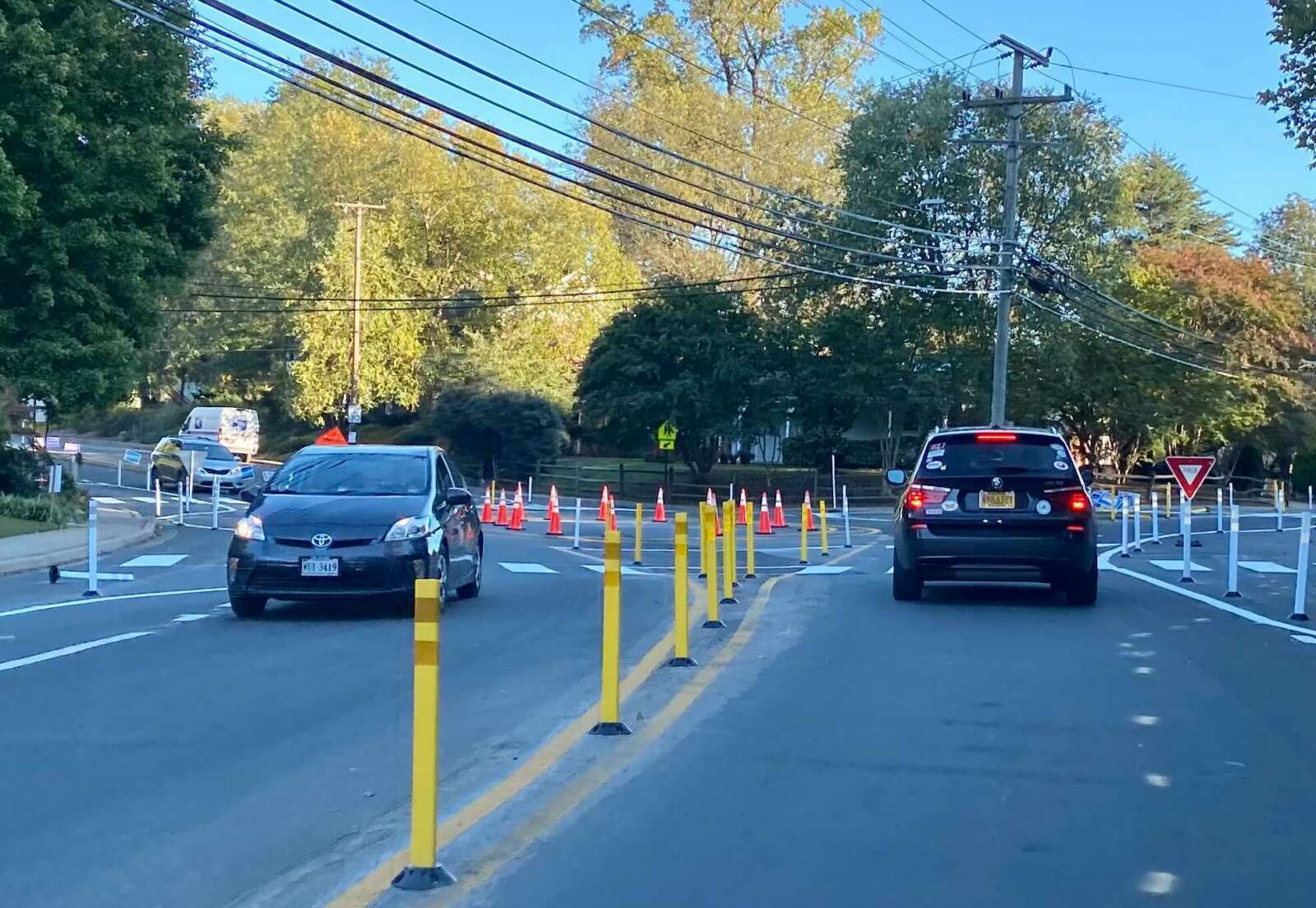
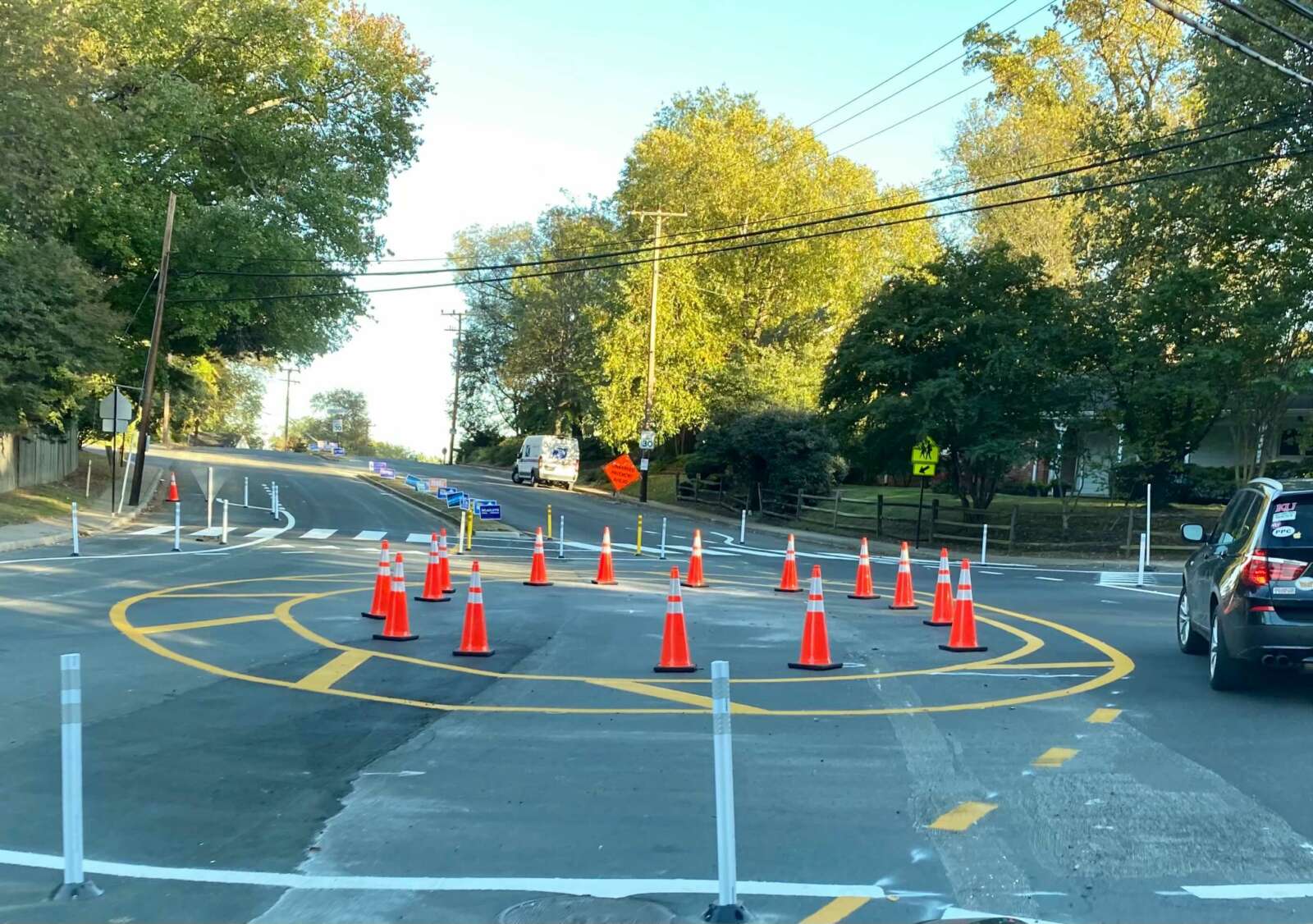
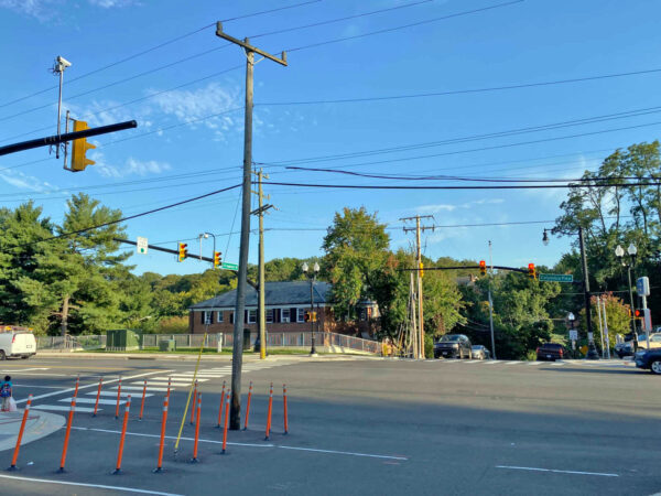
(Updated at 1:30 p.m.) There’s a new temporary traffic circle along Military Road aimed at improving safety where it intersects with Nelly Custis Drive.

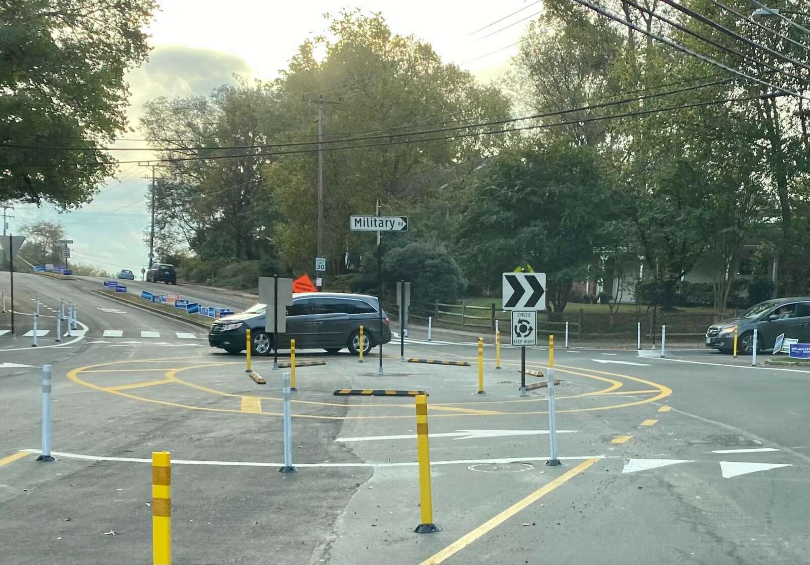
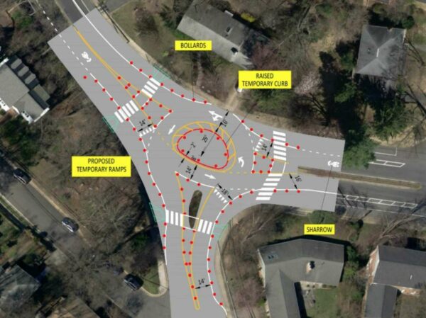
Where there used to be a stop sign for traffic on northbound Military Road, the county has added paint lines, bollards and raised temporary curbs, and partially demolished a median. The work was completed Saturday, according to a spokesman with the Arlington Department of Environmental Services.

The one-lane roundabout at the intersection in the Donaldson Run neighborhood was completed after the county resurfaced Nelly Custis Drive as part of its annual street maintenance program.

“This pilot project, in conjunction with the Vision Zero transportation safety program, will test the effectiveness of a roundabout for improving pedestrian safety and reducing vehicle speeding at the intersection,” according to the county. “It will be in place for one year to allow data collection of real-world conditions, and since it’s temporary, it can be adjusted as needed or removed easily if it doesn’t work.”

The county will study traffic patterns to determine whether to keep the roundabout or install a lighted intersection, per a county webpage on the project.

“Military Road and Nelly Custis Drive intersection safety improvements will focus on driver yield rates, shortening crossing distances for people walking through the intersection, providing predictable turning movements [and] reducing vehicle speeding,” the website says.

Some neighbors are displeased with the new traffic configuration. An October newsletter from the Old Glebe Civic Association called the changes “unwanted.”

The civic association said it has repeatedly expressed its opposition to the potential project for four years, and it would like to see the old traffic pattern restored after the study.

“OGCA pledges continued opposition to the roundabout,” it said. “Other civic associations have concurred with OGCA that the project is overly expensive, will not improve traffic safety, and will unnecessarily slow movement along Military Road.”

Per DES data, about 11,000 vehicles pass through the intersection daily. In a presentation this summer, county staff said conversions to roundabouts reduce pedestrian crashes by 27%, and conversions from stop-controlled intersection reduce injury crashes by 82%.

But OGCA argues that crash data for the intersection doesn’t merit the change.

“In August, OGCA argued that the… construction cost was unjustified given little evidence of any safety concerns,” the newsletter continues. “Only three accidents have occurred over the past eight years (two involving bicycles) out of the approximately 32 million vehicles that passed through the intersection during that period. Our letter also said removal of the stop sign and bike lane increases danger for pedestrians — particularly school children during morning rush hour — and also for bicyclists.”

Bike lanes were converted to “sharrows,” or arrows reminding drivers to share the road with cyclists, per a planning document.

The Military Road and Nelly Custis Road intersection roundabout (via Arlington County)

This is the last of three intersections — including those at Marcey Road and 36th Road N. — to be changed as part of a project aimed at improving safety along Military Road.

“These intersections were identified in a 2004 Arterial Transportation Management Study that suggested several recommendations to improve safety for all modes of transportation in the Military Road corridor,” according to DES.

Some local residents said in public comments that they supported the roundabout.

“As 25-year residents who live one block from this intersection and who walk, ride bikes, commute, and use the ART bus, we believe that a safer solution is needed due to excessive speed; drivers who fail to yield to pedestrians; and increased traffic volume,” said one couple.

The county website says the key takeaways for traveling through a roundabout are:

  • Always yield to pedestrians and cyclists at the crosswalks
  • When entering the roundabout, yield to vehicles and cyclists inside the roundabout
  • Signal when exiting the roundabout

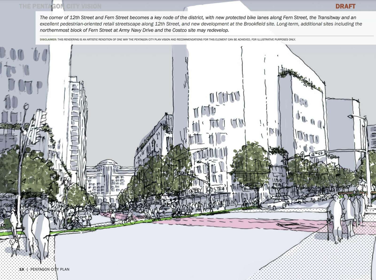
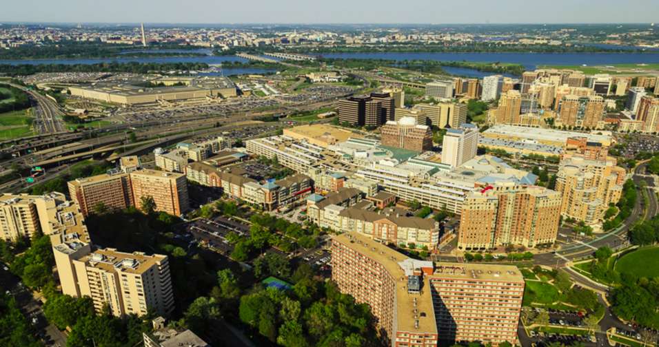
With the construction of Amazon’s HQ2, a 45-year-old planning document guiding development in Pentagon City has reached the end of its useful life.

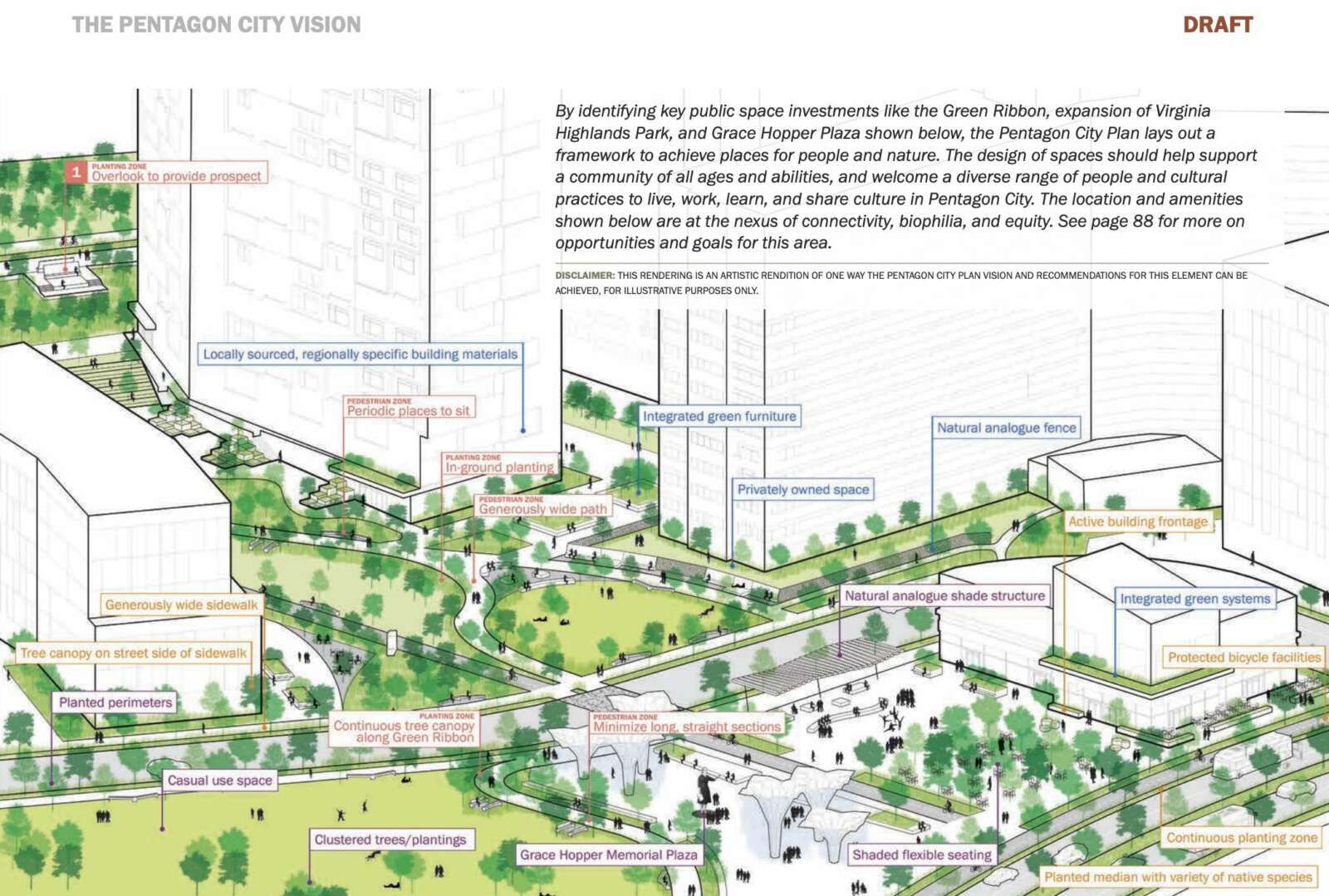
Now, Arlington County has to lay out a vision for the next 20 years of development. According to the most recent draft of the Pentagon City Planning Study, that will include a significant amount of redevelopment and infill development, with an emphasis on residential buildings. Two other priorities are increased green spaces and multimodal transportation upgrades.

The year-plus planning effort is set to wrap up later this fall, and currently, county planners are engaging with the community about their second draft plan.

Per the draft, Pentagon City could — if developers follow through — see about nine significant redevelopment projects over the next two decades.

“We have tried to continue to engage to get an understanding of what they’re thinking,” said Kathleen Onufer, of architecture firm Goody Clancy, which worked with the county on the plan. “The years are based on conversation with the property owners and their sense of interest.”

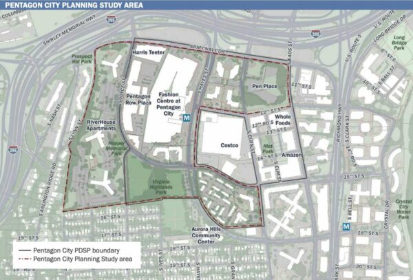
Pentagon City Planning Study Area (via Arlington County)

RiverHouse, one of the largest housing complexes in the D.C. area, is listed as having significant development potential. That’s why county planners included the apartments in the study, despite them being outside the document’s core planning area.

Adding more density to RiverHouse and its expanse of surface parking lots and green space — already a hot topic — prompted a strong reaction from attendees of an open house last night (Tuesday). A number of attendees expressed disapproval for the impact they believed it would have on property values, while a few were more supportive.

“There is plenty of room to build out mid- and high-rises west [on] Columbia Pike [and] south on Richmond Highway, Potomac Yard, and Arlandria,” former RiverHouse resident and attendee Tina Ghiladi said. “To think RiverHouse should absorb the majority of all this density is being expedient. We’re not being NIMBYs. We understand the need for additional housing, we just want height limits.”

After the meeting, Aurora Highlands Civic Association member Ben D’Avanzo told ARLnow he supports turning the tracts of parking spaces into additional housing.

“RiverHouse is a sensitive area, being both a transition to lower density neighbors and one of the somewhat affordable rental housing [options] available” in the area, he said. “Yet, as housing values and rents skyrocket, there are wide swaths of surface parking just blocks from the Metro that do not represent a livable version of our neighborhood. I think the Pentagon City final plan should, accounting for more detail needed on streetscape, open space, schools and other community needs, have a balance of new housing types at RiverHouse, with townhouses at the southern end and more density at the northern [end].”

Overall, the draft plan divides potential redevelopment opportunities into five phases, ranging between two and five years.

“Reality is not that convenient and neat, but it gives you a sense [of] what we can expect if these sites actually redevelop,” said the lead county planner on the project, Matt Mattauszek. “That’s not in our control, but at least organizing it this way gives people a sense of what’s more likely to redevelop sooner rather than later, and what that means for the addition of units and the impact on schools.”

The current and proposed mix of land-use in Pentagon City (via Arlington County)

The phases are as follows below.

(more…)


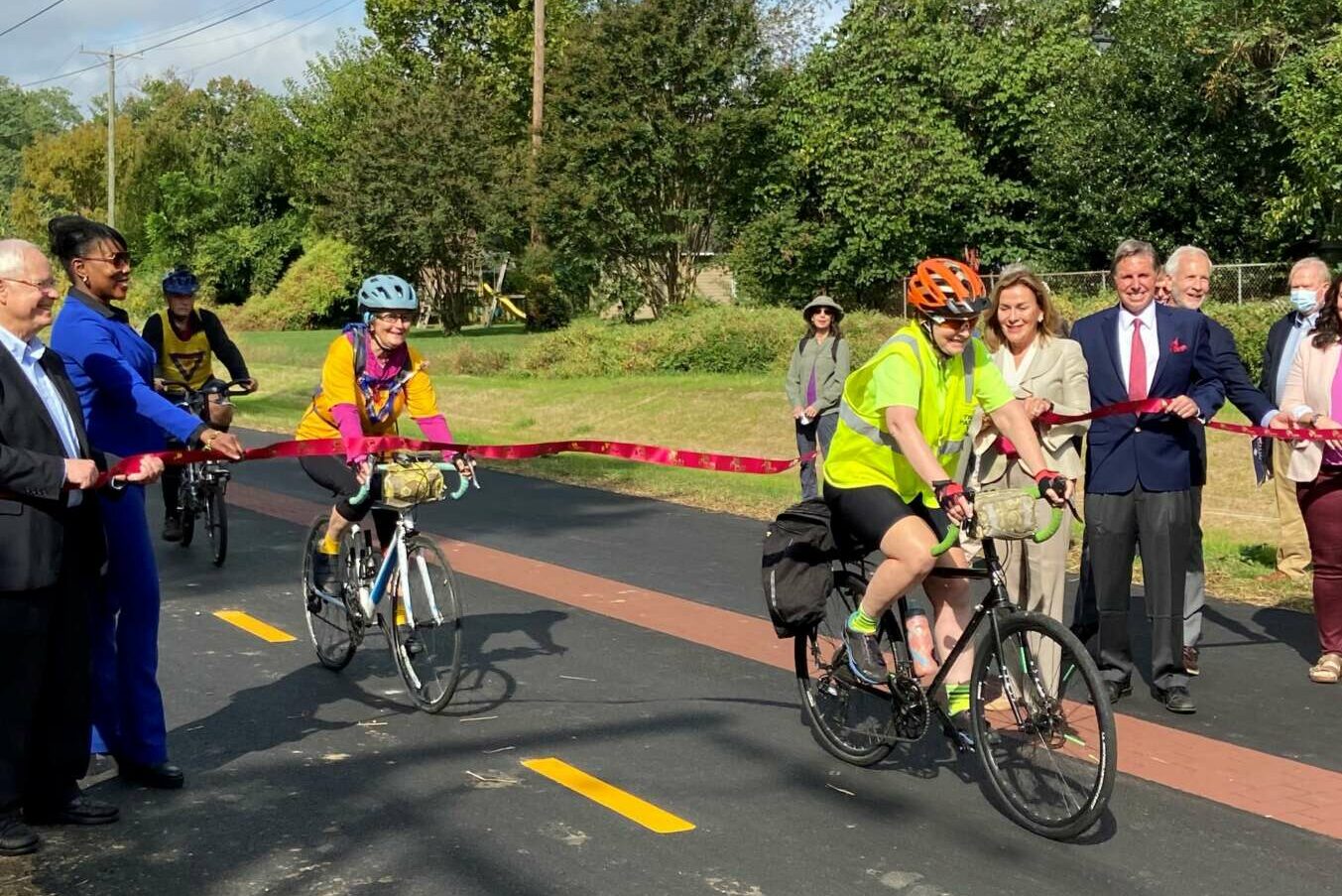
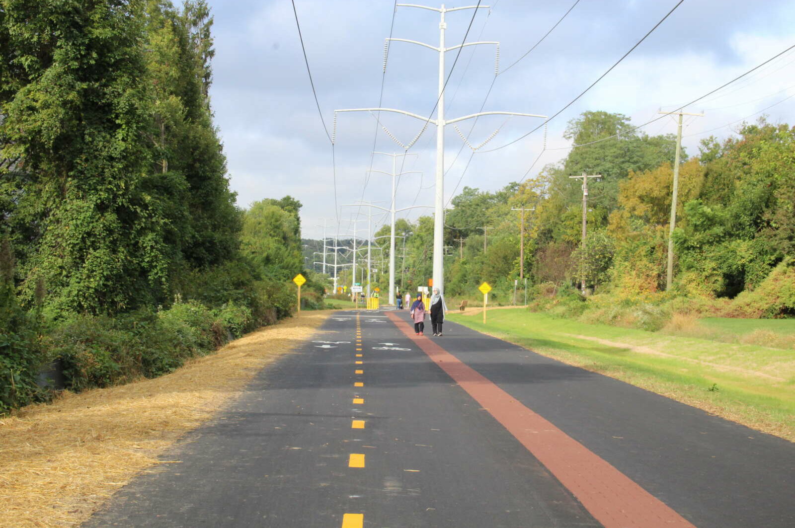
A newly-reopened segment of the Washington & Old Dominion (W&OD) Trail in Falls Church boasts a feature that could be replicated in Arlington: separate paths for cyclists and those on foot.

Regional parks authority NOVA Parks widened just over one mile of the trail through the Little City in order to accommodate separate tracks. The organization celebrated the completion of the five-year, $3.7 million project this morning.

The parks authority says something similar should be done along the Arlington segment, which has seen an increased number of pedestrians, leisure riders and commuters competing for the same narrow asphalt strip.

“Our focus was getting Falls Church completed, since we had all the funds and city approval lined up for that,” NOVA Parks Director Paul Gilbert said. “The next step will be to see when we can get the Arlington section done — when we have design work done and we can talk to civic groups.”

Two years ago, the organization signaled its intent to widen the two-mile stretch between N. Roosevelt Street and N. Carlin Springs Road and incorporate separated trails. Work is contingent, however, on when a $5.6 million grant from the Northern Virginia Transit Authority becomes available.

That likely won’t happen until 2024, but having the Falls Church segment done helps the process in Arlington, he says.

“It’s not a theoretical,” he said. “Everyone can experience it, see it, understand how it works.”

Among those trying it out was local cycling advocate Gillian Burgess, who hit the trails this past weekend, ahead of the official opening today.

She says she wants to see similar mode-separated trails for the entire length of the W&OD in Arlington, as well as the Mt. Vernon Trail, the Bluemont Trail and parts of the Custis and Four Mile Run trails.

Gilbert says widening large sections of the Arlington W&OD Trail is “feasible, desirable and necessary.”

(more…)


A discussion about improving Georgetown-Rosslyn connectivity last night was not supposed to be about the controversial yet ironically beloved gondola.

But the gondola — which 47% of respondents to a recent, unscientific ARLnow poll said they support — was nonetheless on Arlington transportation commissioners’ minds during their Thursday meeting.

The same coalition of D.C. nonprofits and organizations that studied the feasibility of the gondola five years ago is now embarking on a study of other ways to improve transit in and out of Georgetown. Last night, Federal City Council (FC2), a nonprofit dedicated to advancing life in the District, presented the scope of the study to the Transportation Commission.

“I think it’s important to start by saying that tonight, I’m not here to talk to you about the gondola,” said FC2 representative Laura Miller Brooks.

A few commission members had to ask just to be sure. The gondola resurfaced this summer when the D.C. Council approved $10 million in 2022 budget to purchase the old Exxon gas station in Georgetown, a location the could work well as a gondola terminus.

“Is this truly a broad look at transit connectivity between Georgetown and Rosslyn, or [are we] all just doing that wink-wink thing where we pretend it could be anything but everyone knows what’s going to come out at the end?” asked commission Chair and ARLnow opinion columnist Chris Slatt.

Commissioner Richard Price warned against re-exploring the gondola. He endorsed an extension of the Blue Line recently proposed by Washington Metropolitan Area Transit Authority, which would include a second Rosslyn Metro station tunnel and a new Georgetown Metro station.

“Don’t run down a rabbit hole with the gondola — that’s going to make us a laughing stock,” he said. “We need a second Rosslyn tunnel. We need a station in Georgetown. That is the future.”

The $250,000 study is a partnership among FC2, the District Department of Transportation, the Georgetown Business Improvement District and Georgetown University. While the gondola seems off the table, it is why these organizations originally came together in 2016 and partnered with Arlington County. The need for better connectivity remains, study organizers said.

“The core question from the gondola feasibility study — can transit access to Georgetown be improved, especially access to jobs? — still has not been met,” Brooks said.

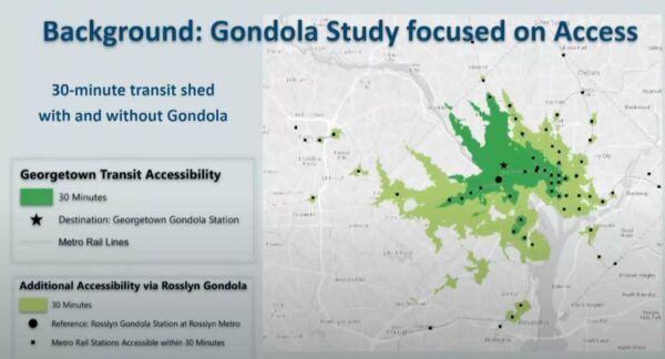
With 23,000 jobs, Georgetown is one of region’s largest employment centers without convenient Metro access, she said. Better transit would enhance access to jobs, healthcare, hospitality, retail and education for D.C. area residents, putting more people within 30 minutes of a Metro station.

How transit access would improve with a Rosslyn-Georgetown gondola (via Arlington County)

Commissioner Jim Lantelme countered that the proposed gondola would only get folks to the old gas station, leaving them to walk uphill to get to Georgetown University, its hospital, M Street retail or to the West End.

“I always look at that map as being a little disingenuous,” he said.

In addition to encouraging the group to study destinations within Georgetown, commissioners said the group should look into “low-hanging fruit” such as exclusive bus lanes on the Key Bridge and enhanced DC Circulator bus service.

“There are so many more improvements that could be made in terms of frequency, reliability, and customer service,” said commissioner Donald Ludlow.

As for Arlington’s involvement in the new study, Brooks said some transportation staff members are providing input, and FC2 will occasionally present to the Transportation Commission and the County Board.

The public can weigh in now through next Friday to inform the drafting of the study. People will have another opportunity, later on, to provide input on proposed solutions.

Brooks told the commissioners that FC2 sees the study and its possible outcomes as beneficial for Arlington. It will help the county understand how current congestion levels affect bussing, cycling, walking and ride-sharing, she said.

“It will also… hopefully provide a new platform for imagining how Arlington County can connect with Georgetown and create a bigger corridor that benefits economic development, place-making initiatives and creates more cohesive Rosslyn-Ballston, Rosslyn-National Landing, Arlington-Georgetown connections,” she said.


Arlington County’s transportation division is kicking off its ambitious plan to eliminate traffic deaths with a series of relatively quick safety projects.

For now, most of those projects appear to be in North Arlington. 

Four months ago, the Arlington County Board adopted a five-year action plan that aims to eliminate traffic fatalities and severe injuries, known as “Vision Zero.” The plan lays out a systematic approach to safety improvements, addressing the most urgent needs through data analysis, equity and community engagement.   

These improvements vary in scope: “quick-build projects” address immediate needs quickly using low-cost materials, while larger-scale projects require funding from the county’s Capital Improvement Program or grants. Others include pilot projects and regular maintenance work. 

“We’re focusing initially on small-scale operational improvements… a small but important part of program,” said Dennis Leach, the director of transportation for the Department of Environmental Services.  

Residents will see upgrades such as curb and median extensions, improved bus stops, curb-and-gutter repairs, new ramps and new high visibility crosswalks. DES has already completed eight “quick-build” projects and 11 are underway, according to its website.

Staff identify projects by analyzing crash data and considering reports by police, Arlington Public Schools and community members. They are constructed on a rolling basis.

For example, this month, staff completed a new mid-block crosswalk across N. Ohio Street that will improve access to Cardinal Elementary School and Swanson Middle School School. Staff are now installing a crosswalk with accessible curb ramps over Sycamore Street for better access to Tuckahoe Park and Tuckahoe Elementary School. 

Of the 19 completed and under-construction projects, only three appear to be in South Arlington. One Twitter user mapped out the geographic spread of these projects, raising questions about how these projects are chosen and when DES will make its way south, given that equity is a core tenant of Vision Zero. 

Leach said that could be because there are a number of older community and school requests being worked through. 

“I think there’s an issue of a pipeline of small projects that may have gotten their start in early years,” Leach said. “What you see in the pipeline of quick-build projects has been built up over years… These projects may have gotten their start before Vision Zero was adopted.” 

Transportation and Operations Bureau Chief Hui Wang said these projects are “a very small, skewed piece of the transportation program” because they don’t show large-scale investments, such as those on Columbia Pike.

“When we’re talking about balance, equity, we have to make sure that we’re not looking at it through a shaded lens,” she said.  

Leach agrees. 

“[Columbia Pike] is our single largest focus areas, as it has some of our oldest infrastructure,” he said. “In other parts of the county, like the Rosslyn-Ballston corridor, private development builds a lot of the infrastructure. In Columbia Pike, until recently, there’s been little private development — there’s more now — but it’s been left to county to actually make those investments in advance of redevelopment.”

When asked if certain communities generate more traffic reports than others, Wang said DES doesn’t map out community reports because it’s hard to categorize them and her team doesn’t have the resources for that. 

“My team is focused on the engineering part — our goal is trying to get things done,” she said. 

The data-based approach helps weed out what is a perceived safety risk versus actual safety risks, Wang noted.

“We use crash data to identify real problems,” she said. “We’re using data as a guiding force, focusing on high-injury networks.” 

Chris Slatt, who is president of transportation advocacy group Sustainable Mobility for Arlington County, said it’s not surprising that initial projects will skew toward North Arlington. 

“Complaint-driven processes are well-known to reflect the biases of whom within the community is best equipped to spend precious time and energy complaining, so we would fully expect that method of identifying projects to skew toward the more affluent areas of Arlington unless staff works intentionally to correct that bias,” he said.

(more…)


The lonely utility pole at Columbia Pike and S. Frederick Street (staff photo by Matt Blitz)

A lonely utility pole protruding into the intersection of Columbia Pike and S. Frederick Street is expected to come down by the end of the year, a county official tells ARLnow.

Last fall, a permanent traffic signal was installed at the intersection of S. Frederick Street and Columbia Pike near Arlington Mill. The work was part of the Columbia Pike Multimodal Street Improvements project to make the thoroughfare more friendly to all users.

It was also in response to a long-time request from residents and advocates to improve the safety of the intersection, which had become notorious for crashes and accidents, some involving pedestrians.

Along with the new traffic signals, the driveway to Arbor Heights — an affordable housing complex with an entrance right off Columbia Pike — was rebuilt to align with S. Frederick Street, Department of Environmental Services spokesman Eric Balliet said. The previous horseshoe driveway had a cement island with a strip of sidewalk and the utility pole. The island was removed, leaving the errant utility pole, which now sits several feet from the sidewalk in the road.

The pole is surrounded by bollards and Balliet said the county has not received any complaints about it being dangerous or blocking traffic. ARLnow did receive a tip about it from a concerned motorist, however.

That pole is coming down soon as utilities move underground, he says. A new underground duct bank was built as part of the street improvement project and the utility companies will use it to bury their lines.

Most of the lines could be taken underground by the end of the month, according to the project’s most recent update on the website.

Comcast, Dominion Energy and Verizon all have overhead wires on the utility pole at S. Frederick Street and Columbia Pike, a county official confirms.

Comcast has started this process and began removing wires last week, while Dominion also began the switchover last week and is removing its overhead wires this week. Verizon is currently applying for permits, according to the county, and work will begin once those permits are issued.

Once all the companies take down their wires, the pole will be removed.

The entire switchover from overhead to underground wiring and the removal of all utility poles along the Pike from S. Jefferson Street to the Four Mile Run Bridge is expected to be completed by the end of this year.


Arlingtonians planning on taking Metro this weekend might want to allot more time than usual for their trips.

All four Metro lines running through Arlington will have delays this weekend, according to the Washington Metropolitan Area Transit Authority. The transit authority said riders should expect “service adjustments” on Saturday and Sunday for lines running through Northern Virginia.

On the Blue and Yellow lines, Metro will be single-tracking between the stations at Reagan National Airport and Braddock Road. WMATA said riders should expect a train every 30 minutes.

The cause of the single-tracking is ongoing work at the Potomac Yard Metro station in Alexandria, according to WMATA. Originally scheduled to open this coming April, the station’s opening was pushed back to next September.

The Orange Line, meanwhile, will be shut down between the East Falls Church and Ballston Metro stations for radio cable installation.

“Trains will operate in two segments: Vienna to East Falls Church and Ballston to New Carrollton,” WMATA said on its website. “Free shuttle buses available.”

The Silver Line will only be running from East Falls Church out to the Wiehle-Reston East station. Silver Line riders will have to take a shuttle bus to continue on the Orange Line.


View More Stories