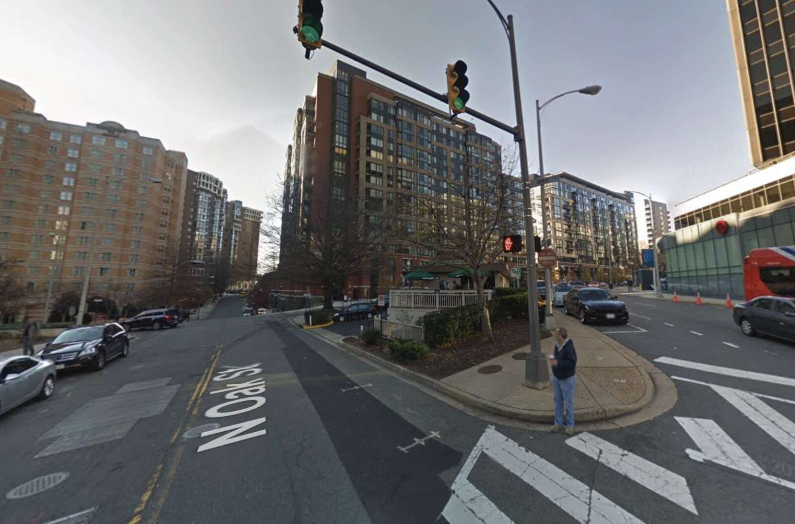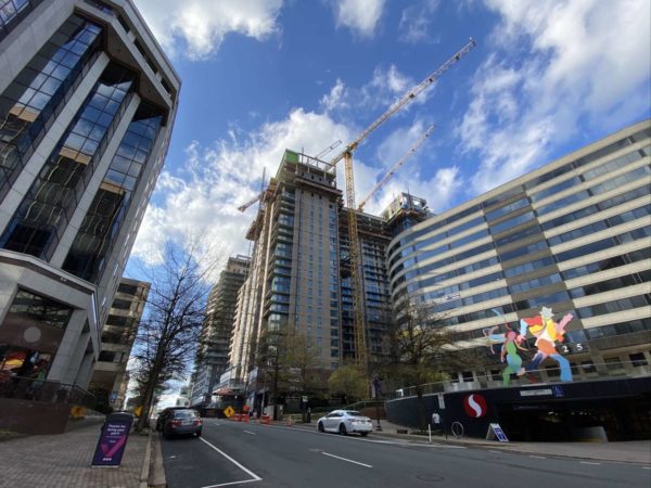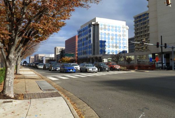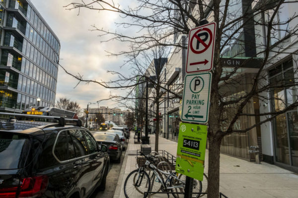
A lot happens on N. Oak Street between Clarendon Blvd and 17th Street N. in Rosslyn.

To the east is an office building where the internet was invented. It now serves as an annex for the State Department. To the west is a very busy, standalone Starbucks.

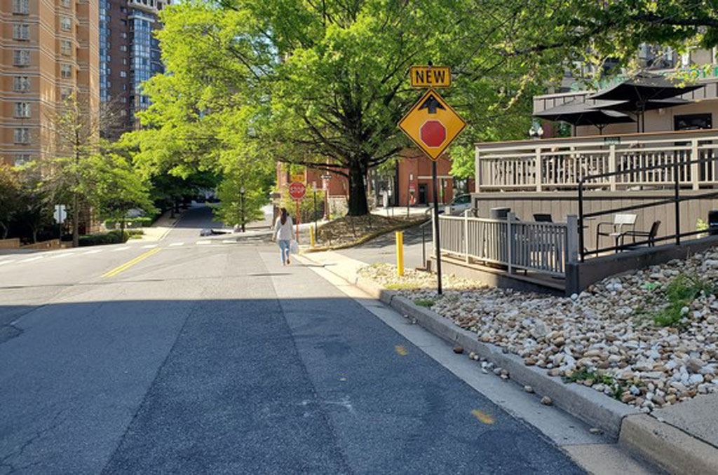
What the block lacks, at least on the west side, is a sidewalk.

A new project set to kick off next week aims to rectify the lack of a pedestrian walkway, with a makeshift path along the road. More from an Arlington County transportation update:

During the week of May 10, weather permitting, the County will create a pedestrian pathway along the west side of North Oak Street between Clarendon Boulevard and 17th Street North.

Currently, there is no sidewalk on the west side of Oak Street. After receiving a request from the community, County staff conducted a traffic investigation for this location and determined that adding a pedestrian treatment would help improve safety and access.

The pedestrian pathway will be installed by adding a barrier between the travel lane and the curb. This will slightly narrow the southbound lane, but access for vehicles, including the driveway to the coffee shop, will be retained.

What to expect during this work:

  • Once installation begins on the pathway, we anticipate completion within 1 week.
  • The installation will be done during work hours, generally 8 am to 2 pm, Monday through Friday.
  • During installation, there may be some impacts to the southbound travel lane on North Oak Street.

Photos (1) via Arlington County, (2) via Google Maps


With COVID-19 cases declining and 31% of the local population fully vaccinated, more people appear to be out and about in Arlington, according to recent county parking data.

Arlington County logged more than 266,500 and 263,000 parking meter transactions in March and April, respectively — the highest these numbers have been since October when cases started mounting for the second time in 2020.

The figures are one indication that Arlington has returned to a level of activity last seen in Arlington late last summer when case numbers were low and the state lifted many of the restrictions on daily life.

While parking numbers have recovered from the second and larger wave of coronavirus, the road to pre-pandemic parking levels may still be a long one. The transactions this spring are roughly 40% lower than they were in the spring of 2019.
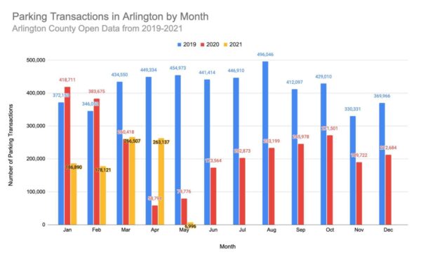
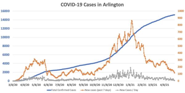
The parking transaction trends appear to be the inverse of COVID-19 cases in Arlington.

Parking transactions dropped dramatically between October to November, during which time coronavirus cases started rising. Parking transactions bounced back in March and remained at similar levels in April; meanwhile, COVID-19 cases have reached their lowest point since October.

Today, the Virginia Dept. of Health reported only five new cases in Arlington, after nine new cases were reported yesterday — the first two-day stretch of single-digit new cases in the county since Sept. 1-2.
Arlington’s recently-adopted budget projects parking revenue getting close to pre-pandemic levels by the end of the 2022 fiscal year, “but there is a lot of uncertainty about that assumption,” parking manager Stephen Crim said.

The county has a long way to go to recover lost parking revenue, which plummeted from a 2019 peak of nearly 500,000 transactions in August to fewer than 60,000 transactions in April 2020.

If the revenue trends from April continue into May and June, however, parking revenue for the second quarter of 2021 could surpass the $1.4 million that the county logged through March, county officials say.

“A return to pre-pandemic levels will depend not only on how quickly jurisdictions lift restrictions on places like restaurants but also on how comfortable people feel going back to their usual activities,” Crim said. “Also, there may be medium- or long-term changes to the way people shop, socialize and conduct business meetings, which could affect parking in Arlington, just like everywhere else.”

In February, Gov. Ralph Northam rolled back a 10 p.m. alcohol curfew for restaurants to midnight, and by mid-May, he is expected to raise the caps on venue capacity and social gatherings, while lifting the curfew on liquor sales. Last month, the Centers for Disease Control and Prevention cleared Americans to be outside without a mask in most situations. Soon after, Virginia followed suit.

Although transactions levels are lower, the overall patterns of where people park are generally similar to pre-pandemic patterns, Crim said.

“A quick look at some of our meter data indicates that areas that were popular pre-pandemic remain popular today and areas that were less popular are still less popular,” he said.

He did not indicate whether the county expects a new pilot program that prices parking by demand along Metro corridors — approved by the County Board in December — will impact parking transaction rates.

Arlington’s Department of Environmental Services will be conducting the performance parking pilot to improve parking management, “regardless of the overall number of people who want to park in Arlington,” Crim said.

“We started planning for this pilot well before the pandemic struck and we don’t see the pilot as an opportunity to shore up revenue,” he said.

Charts compiled by ARLnow using data from Arlington County and Virginia Department of Health  


(Updated 4:30 p.m.) For National Walking Day on Wednesday, April 7, locals are being encouraged to explore Arlington on foot.

Among the new options for doing so: a virtual scavenger hunt.

“Join us on a virtual hunt for hidden gems in your own neighborhood that you may not have known existed,” the county-run WalkArlington program said on its website.

The initiative from WalkArlington and Arlington Transportation Partners is virtual this year due to the coronavirus. Instead, the organizers have assembled resources for local residents, workers and visitors to take self-guided walking tours through any of the county’s 10 urban villages on National Walking Day — or any day, for that matter

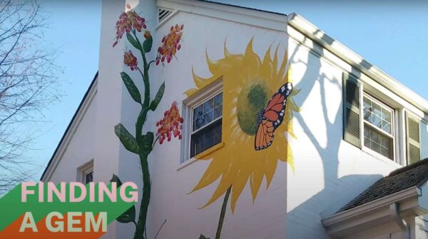
“Walking in Arlington is inspiring, full of surprises, peaceful — like finding a gem,” WalkArlington said in a video, below.

Walkers can use an interactive map to find these gems, which include nature escapes, historical sites, local businesses and public art.

Participants will need to register to access the map. Those who register by Friday (March 26) will receive a free item in the mail, according to the registration page.

Photos via WalkArlington/YouTube


A major redevelopment proposal in Rosslyn is facing pushback from those who think it doesn’t do enough for cyclists and pedestrians.

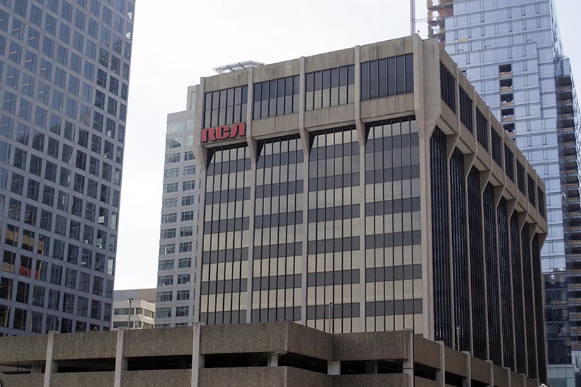
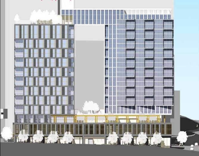
McLean-based Jefferson Apartment Group is proposing a 27-story mixed-use residential complex with 424 units at 1901 N. Moore Street, replacing the 1960s-era RCA building. Two towers will be connected at the top by a penthouse and at the base with ground floor retail.

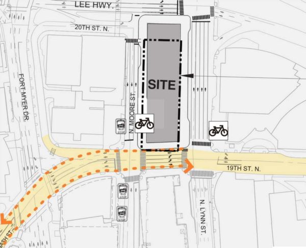
But as the project moves through the public review process, some have expressed concerns a number of transportation-related issues: the proposed unprotected bike lanes along 19th Street N., the project’s parking ratio, and the pedestrian experience along the block.

These three topics are likely to resurface during a follow-up Site Plan Review Committee meeting on Monday, March 15 — and perhaps later this spring, when the project will go before the Planning Commission and the County Board.

“We’ve been identifying issues, responding to citizen comments, and having very good discussions with surrounding community groups,” said Andrew Painter, an attorney with land use firm Walsh Colucci, during the first SPRC meeting last month.

Staff members are considering some protections for the proposed 19th Street bike lanes in response to public input.

“It may be possible to provide an additional level of protection in one direction” on the block from N. Lynn to N. Moore streets, said Principal Planner Dennis Sellin, adding that staffers “don’t see the capacity to do it in both directions.”

Arlington Transportation Commission Chair Chris Slatt said 19th Street N. has enough traffic to qualify it for protected or buffered bike lanes.

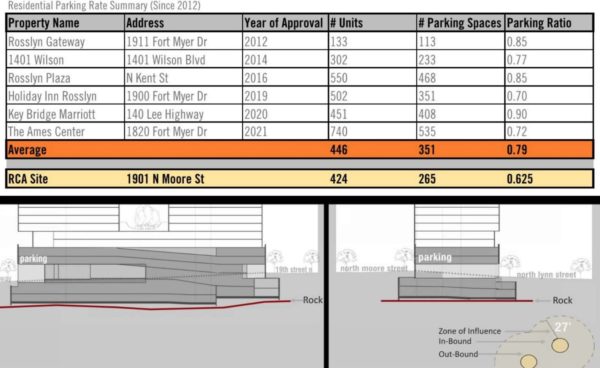
Another hot issue was the parking ratio of .625 spaces per residential unit. Jefferson is proposing 290 total spaces, split among 265 residential spaces, 15 retail and 10 visitor spaces, according to a staff report.

“The goal is to right-size the garage to meet the market demand but not provide extra that incentivizes people to drive,” Painter said.

Although the proposal is within county guidelines, Sellin said “we would certainly accept a lower ratio.” The minimum is .2 spaces per unit but the lowest Sellin said he has seen proposed is .38 spaces per unit.

North Rosslyn Civic Association representative Terri Prell said people, particularly the elderly, still need cars for tasks such as grocery shopping.

“You have to understand this is a residential community, not a business community,” she said.

Lowering the ratio would attract people who want to lead a car-free lifestyle, Slatt said, asking for data on space utilization rates.

The parking needs to be built partially above ground due to “particularly dense rock” and Metro tunnels. To conceal the parking above the retail and below the residential units — and add public art — the architect is exploring adding graphics by local artists, said architect Shalom Baranes.

The Metro tunnels add another complication: a longer expected demolition process.

As for the pedestrian experience, some members were concerned that the block will be too long and there will be no opportunities for cutting through it. Sellin said the block is comparable to others at 400 feet long.

SPRC Chair Sara Steinberger said knowing the length “may not change the community’s feelings on what feels like a longer stretch of block when you have large buildings covering a greater area.”

In 2017, Weissberg Investment Corp., which developed the RCA building in the 1960s, filed plans to redevelop the RCA site — but those plans were put on hold indefinitely in 2018. Jefferson started filing application materials in May 2020.


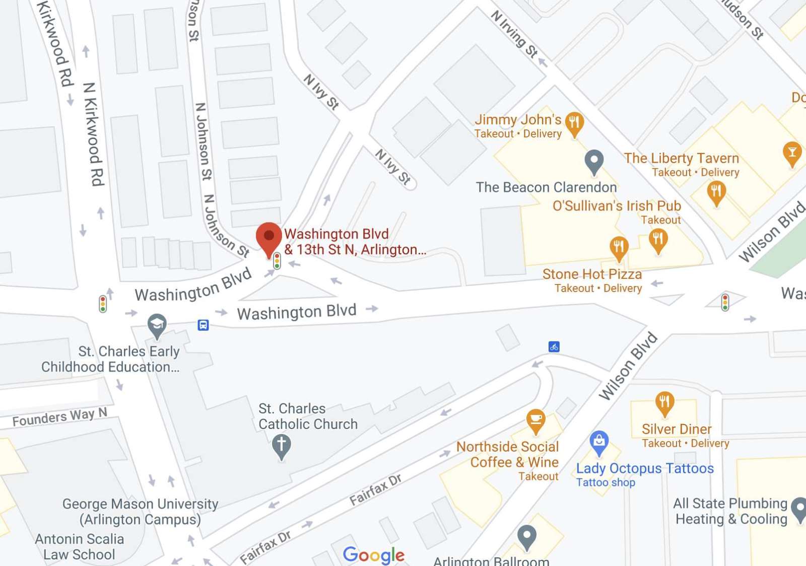
Arlington County is looking to overhaul the reversible lanes and the triangle-shaped intersection at Washington Blvd and 13th Street N., near Clarendon.

Washington Blvd would be widened to create a four-lane road between Clarendon Circle and N. Kirkwood Road, while 13th Street N. would be realigned to form a “T” intersection with Washington Blvd, according to a county staff report.

“The project will improve pedestrian safety and accessibility along Washington Boulevard and 13th Street North to provide a safe, and practical pedestrian route,” staff said.

The County Board is slated to hear proposed changes to the traffic patterns and pedestrian infrastructure at this intersection — which staff call a “porkchop” — during its regular meeting on Saturday.

As a part of the project, utilities would be moved underground, and revamped sidewalks, Americans with Disabilities Act-compliant ramps, and other streetscape elements will be constructed to match improvements at Clarendon Circle.

The county’s Washington Blvd plans, made in conjunction with the Clarendon Circle work and the redevelopment of the nearby Red Top Cab properties, were delayed by more than a year.

“[The project] required coordination with Dominion Power on the utility undergrounding part of the project and staff work to improve the plans for walking pathways during construction, to make it safer for people walking around the construction area,” Arlington Dept. of Environmental Services spokesman Eric Balliet tells ARLnow. “Both of these items have been worked on for over a year, and needed to be completed before we issued the construction contract for bid in December.”

Arlington County has selected Sagres Construction — which bid just over $2.5 million, to which the county is adding $500,000 for contingency — as the contractor.

Taking the utilities underground means the project will take about 18 months, a timeline that, according to the county, concerned some stakeholders.

Still, “there is a general understanding of the technical difficulties associated with the undergrounding of utilities along Washington Boulevard” and “members of the community have expressed full support for the project,” staff said in the report.

This project is a part of the 2006 Clarendon Sector Plan. In the intervening years, Arlington County said it has acquired three lots at Washington Boulevard and N. Johnson Street needed to make the intersection a “T.”

These changes are moving forward amid a county-led review of the Clarendon Sector Plan to accommodate a handful of major redevelopment projects. One such project is to update the St. Charles Church campus, which also includes changes to the walking and biking experience along Fairfax Drive between Clarendon Circle and Kirkwood Road.

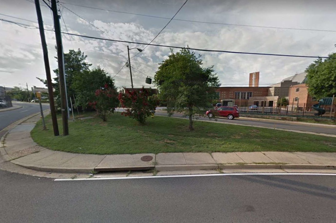
Images via Google Maps


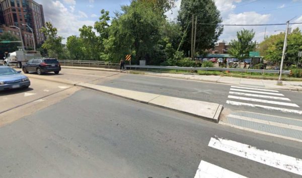
Shirlington Road bridge crosswalk (Photo via Google Maps)

As Arlington County prepares to build a new pedestrian and bike bridge in Shirlington — two decades in the making — some continue to express concerns about safety.

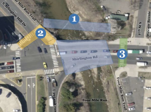
Late last week, the county brought advanced concept designs to the community for a new pedestrian and bike span between the Shirlington and Green Valley neighborhoods, and for maintenance to the existing bridge, which has only a narrow pedestrian sidewalk.

While incorporating previous public feedback into the design, questions still cropped up about safety and convenience, particularly regarding the crosswalks across busy S. Arlington Mill Drive and Shirlington Road, which provide access to the W&OD and Four Mile Run trails. Both are heavily-traveled by cyclists.

The first part of the project will be to improve and update the existing bridge. The bridge is in need of routine maintenance and resurfacing, and this project provides a chance for other needed renovations, the county says.

Based on public feedback, staff said they will widen the sidewalk to about 7 feet from a previous 3-5 feet. They will also coordinate the design aesthetic with the renovations to Jennie Dean Park, while adding new guardrails.

However, despite some urging it, the county won’t be removing the slip lane from the I-395 ramp. While admitting that it’s not bike or pedestrian-friendly, county officials say there isn’t much that can be done at present.

The lane is owned and maintained by the Virginia Department of Transportation. Adding a crosswalk there would also increase risk for an incident due to traffic taking the right turn with speed, while the lane it could lead to traffic backing-up on the I-395 ramp.

“We, at the county, are very much interested in [removing the lane],” said Jason Widstrom, Arlington County Transportation Capital Program Manager. “Unfortunately… it is not within our authority to remove it.”

Construction for these renovations should begin in the late summer or early fall of this year and be completed prior to the end of the year.

Then, at the end of 2021 or beginning of 2022, construction will begin on a prefabricated, 15-foot pedestrian and bike bridge located 20 feet to the west of the existing bridge. It will parallel the existing bridge, will be multi-use, and have “enhanced pedestrian treatments.”

Additionally, improvements are being made to those crosswalks at Arlington Mill Drive and near the Four Mile Run Trail.

Based on feedback, the county is widening pedestrian ramps and the refuge median, redesigning curbs and the crossing to allow for better sightlines, and adding new rapid flashing beacons to improve visibility of the crosswalk. There’s also thought of trimming trees to further help sightlines.

Crosswalk safety, particularly near the Four Mile Trail, has long been a concern for residents.

“County staff is well aware of the history of the crosswalk and the troubles of trying to cross at this location,” says Widstrom.

Funding for these projects are coming from a state grant and will cost just over $1 million.

County officials said they would like to do a longer term study about adding a bridge that goes over Shirlington Road and thus separates vehicle and pedestrian traffic.

That study remains “down the road,” however, and costs to add that bridge could exceed $8 million.

In the meantime, said Widstrom, “we are trying to make the situation a bit better.”

Photo (1) via Google Maps, (2) via Arlington County


A number of major changes are coming to Boundary Channel Drive and the I-395 interchange near Crystal City.

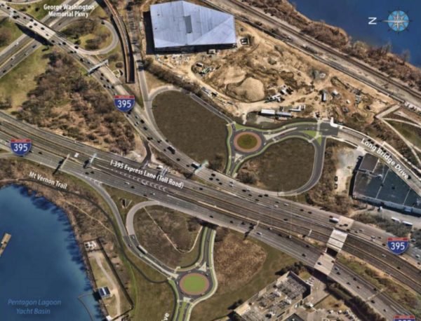
The modifications include a shared-use walkway, pedestrian and bicycle access to the yet-to-open Long Bridge aquatics center, and reduction of four lanes to two.

On Saturday, the Arlington County Board voted to endorse the $20.4 million Virginia Department of Transportation project. It was part of the consent agenda, meaning they are non-controversial and can be acted upon by a single vote.

“We’ve long sought these improvements,” said County Board Chair Matt de Ferranti at the meeting. “They will reconfigure the interchange that you see to make it work a lot better and safer for everyone.”

Major components include adding roundabouts on each side, as well as building a 12 foot shared path that connects to the Mount Vernon Trail, the Long Bridge Park esplanade, and a new loop that goes around the aquatics center. Also along Boundary Channel Drive, there’ll be 8 foot wide sidewalks, landscaping, crosswalks, and street lighting.

A public hearing was held in November where, according to the county report, the public “expressed strong support for the project.”

Much of the feedback revolved around the shared-use path, making sure it was wide enough to accommodate both pedestrians and bicyclists safely. There were also a number of comments about the crosswalks and proposed safety measures.

The project is funded by a combination of state, federal, regional, and county money. Construction is expected to start in spring 2022 and be completed in fall 2023.

Construction of the Long Bridge Park Fitness and Aquatic Center, meanwhile, is still expected wrap up later this year, according to the county website. The upcoming FY 2022 county budget will decide when it ultimately opens to the public.

Image via VDOT


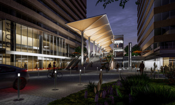
A proposed rendering of the new VRE station in Crystal City (Rendering courtesy of National Landing BID)

A new Virginia Railway Express station could bring Amtrak service to Crystal City, says a new report.

The expanded and relocated station is set to open in 2024 and Amtrak is currently “exploring” adding regional service to this station.

This according to a National Landing Business Improvement District report released earlier this month, detailing a number of significant transportation projects scheduled for completion over the decade (many of which long have been in the works).

Responding to inquiries from ARLnow, an Amtrak spokesperson wrote in an email that the planning remains underway “so it’s premature to discuss in depth expansion plans.”

The VRE station station will be built on land owned by real estate developer JBG Smith and will be designed to host Amtrak trains as well as Maryland Rail Commuter (MARC) trains. (Neighboring Alexandria has an existing Amtrak station.)

The $50 million two-track station will be built on Crystal Drive between 12th Street S. and Airport Access Road, about a quarter mile from the current one-track station. That existing station was built about 40 years ago and has been called a “operational bottleneck.”

Tracy Sayegh Gabriel, executive director and president of the National Landing BID, says bringing an Amtrak station to Crystal City would “shrink the region” and would enable a “direct one-seat ride between our region by commuter rail.” Some day those heading to New York City might be able to just head to Crystal City to get on a train, rather than trek into D.C. and battle crowds at Union Station.

Gabriel does note that Amtrak has yet to decide about adding a station there.

Along with a new VRE station, a new two-track railway bridge across the Potomac is also being planned. It will replace the 116-year-old Long Bridge and is estimated to be completed by 2030. Gabriel says the existing bridge is also a “bottleneck.”

Other projects highlighted in the report include the $650 million Project Journey at Reagan National Airport set to be completed this year, the continued construction of the new Potomac Yard Metro station, adding a new entrance to the Crystal City Metro station, replacing Route 1 with a “unifying, urban boulevard,” and a pedestrian walkway over the George Washington Memorial Parkway connecting Crystal City to the airport.

According to Gabriel, the airport bridge would create a five-minute walk from the train station to the airport, as opposed to a walk that’s currently long and somewhat dangerous.

All of these projects together, including the possible presence of Amtrak, could transform the neighborhoods collectively known as National Landing, said Gabriel.

“Investments of this scale are really positioning us to be the most connected downtown in the country,” she said.

Full press release about the report is below.

(more…)


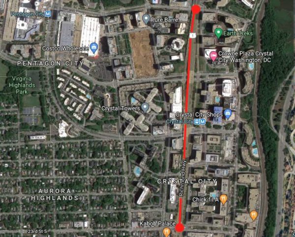
While VDOT considers lowering a section of Route 1 to a surface boulevard, a group of civic associations, known as Livability 22202, recommends going below ground instead.

As development activity in Crystal City and Pentagon City continues, VDOT and Arlington County are looking for ways to improve the pedestrian and transit experience along Route 1, also known as Richmond Highway. The study directly responds to the increased demand for transportation resulting from the construction of Amazon’s HQ2.

VDOT’s study will examine the feasibility of an at-grade boulevard, with the current overpasses removed, comparing it to the current elevated route and the changes prescribed in the Crystal City Sector Plan, according to a presentation from December.

Following online public engagement in the fall and a virtual public meeting, Livability 22202, which represents the Arlington Ridge, Aurora Highlands and Crystal City civic associations, published a series of alternatives to an at-grade boulevard — including taking part of Route 1 below-grade.

The group suggests going underground for at least the 18th Street S. and 23rd Street S. intersections, creating patterns similar to those in Washington, D.C., where through-traffic is below-grade and local traffic uses at-grade streets — like Connecticut Avenue NW through Dupont Circle.

For a more extensive below-grade roadway, the group suggests trenched express routes from 23rd Street S. to 15th Street S., flanked by at-grade roads. The underground portion would eventually transition into the 12th Street overpass.

“This concept would solve side-street traffic issues, create far-safer pedestrian crossings, create a brand-new open space in what is now wasteland, and open up myriad redevelopment opportunities,” the group said in its response. An even more extensive “big dig” is also proposed, though the group acknowledges is may be “infeasible.”

Dropping Route 1 to grade and creating more signalized intersections would make pedestrians and cyclists less safe unless significant measures are put in, Liveability 22202 predicted. They suggested lower speeds, bike tunnels, signalized right turns and pedestrian-led crossings.

The group also envisions an at-grade boulevard as a “linear park” with retail, wide sidewalks and an abundance of trees.

If VDOT keeps Route 1 elevated, Livability urged VDOT to consider something like a viaduct. Such a bridge would allow the space below to be activated with open spaces or retail.

In a letter, the presidents of the three civic association said “a study of Route 1 in this area is long overdue,” but until VDOT conducts a broad stakeholder review of multiple alternatives, “we endorse the Crystal City Sector Plan as the best alternative.”

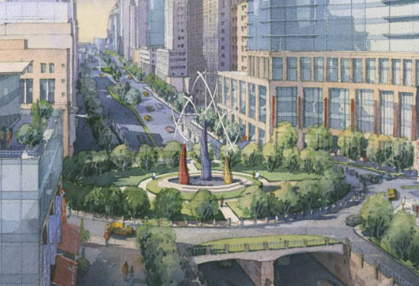
The 2010 sector plan keeps the grade separations at 12th, 15th and 18th streets, reconfigures the 15th Street intersection and takes traffic below-grade at 26th Street S., under a newly-created National Circle, as pictured below.


NY Man Arrested for NYE Gunfire — “The Arlington County Police Department’s Homicide/Robbery Unit is investigating the discharge of a firearm which occurred in the Rosslyn area on the morning of January 1, 2021. At approximately 1:48 a.m., police were dispatched to the report of a person with a gun in the 1500 block of Clarendon Boulevard… officers observed the suspect on the sidewalk holding a firearm as they arrived on scene. The suspect was compliant and taken into custody without incident.” [ACPD]

First Arlington Baby of 2021 — “What a way to ring in the #newyear! Welcome to the world, Mohamed! Our first [Virginia Hospital Center] #newborn of #2021 was born at 1:18 am this morning. Congratulations to the family, and thank you for letting us celebrate the new year with your bundle of joy!” [Twitter]

Parent Files Suit Against APS — “An Arlington Public Schools parent wants his daughter back in class so badly, he plans to file a lawsuit against the district. ‘We started the fundraising today, and we’ve already gotten a lot of great contributions from fellow parents,’ Russell Laird told Fox 5 Wednesday, referring to a GoFundMe campaign launched in an effort to raise $10,000 that would be used to sue Arlington Public Schools.” [Fox 5]

Nat’l Landing Touts Transpo Projects — “National Landing, the renamed neighborhood of Crystal City-Pentagon City-Potomac Yards in Arlington and Alexandria, will become the country’s most connected urban center sometime in the next decade, its business boosters say. Eight major transportation projects are underway in the area, with the aim of turning what is often seen as a busy pass-through into a truly urban neighborhood where residents, office workers and visitors have easy access to local and regional amenities as well as long-distance travel.” [Washington Post]

Local Nonprofit Sees Surge in Aid — “The financial assistance nonprofit Arlington Thrive is helping four times as many people as families are devastated by COVID-19. ‘I was never thinking this would happen in America. I was working hard. I was working three jobs. I lost all three jobs,’ one client, a cook, waiter and ride-share driver, told News4’s Pat Collins.” [NBC 4]

Bikeshare Station Work — “Pardon our dust! In Jan & Feb, some @bikeshare stations in Crystal City, Pentagon City, & Potomac Yard will be replaced, expanded, moved, or removed and may be OFFLINE for a few hours or days.” [Twitter]

Reminder: Bus Changes in Effect — “Riders on the Arlington, Virginia, bus system will once again have to pay fares and enter the bus through the front door starting on Sunday. Arlington County said that both practices were suspended by Arlington Transit (ART) last March, but fares can now be paid by either using the SmarTrip card, SmarTrip app or by exact change at the fare box, while plastic glass barriers have been installed to protect the drivers at the front of the bus.” [WTOP]


A virtual public meeting is being held this week on the topic of potential improvements to Route 1 through Crystal City.

VDOT and Arlington County are studying ways to improve the safety, accessibility and experience along Route 1 between 12th and 23rd Street. The study responds to greater demand for various transportation methods as construction of Amazon’s HQ2 progresses.

“As this area’s commercial and residential densities continue to increase, transportation plans will need to address the wide-ranging needs of pedestrians, bicyclists, transit riders, motorists, and other users while maximizing the safety, convenience, and sustainability of the system for decades to come,” said the VDOT study page.

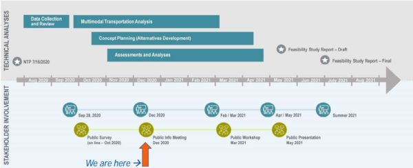
Participants in the online meeting, scheduled for Wednesday at 6:30 p.m., will hear a review of existing conditions on Route 1 — also known as Richmond Highway — and learn about responses to a public survey that was open during October and November. They can also ask questions and give input.

The public is invited to provide comments during the meeting or through Monday, Dec. 28.

After the meeting, the public will hear and have the chance to provide feedback on draft recommendations in spring 2021. Officials expect the final study to be done next summer.

“At this time, no construction funding has been allocated, so the study will not set design or construction dates,” the VDOT website said.

The department is not the only group thinking of ways to improve the highway. In October, the National Landing BID released “Reimagining Route 1,” a report that transformed the car-centric highway into a safer boulevard lined with trees, retail and restaurants.

“Route 1 was originally designed to accommodate the auto-centric development trends of the mid-20th century, when the primary objective was to move cars through the area as quickly as possible,” the BID said in a press release. “The resulting elevated highway, super blocks, and oversized intersections divided the community for decades, inhibiting not only connectivity and access, but also the area’s ability to come together as a singular downtown district.”

VDOT is studying the Route 1 overpasses over 12th, 15th and 18th streets, which some have called to be eliminated in favor of more urban intersections at grade.

Those interested in joining the virtual meeting can register online or participate in listen-only mode by calling 877-309-2071 (access code 205-472-841).

The study team will make a short presentation beginning at 6:30 p.m. and answer questions for about an hour afterward, the website said. A recording and meeting materials will be available online following the meeting.

In addition to doing so during the meeting, feedback can be provided via a comment form or email.


View More Stories