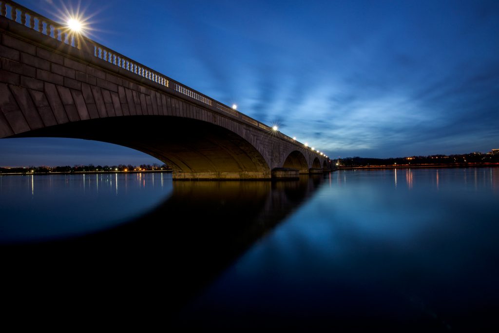
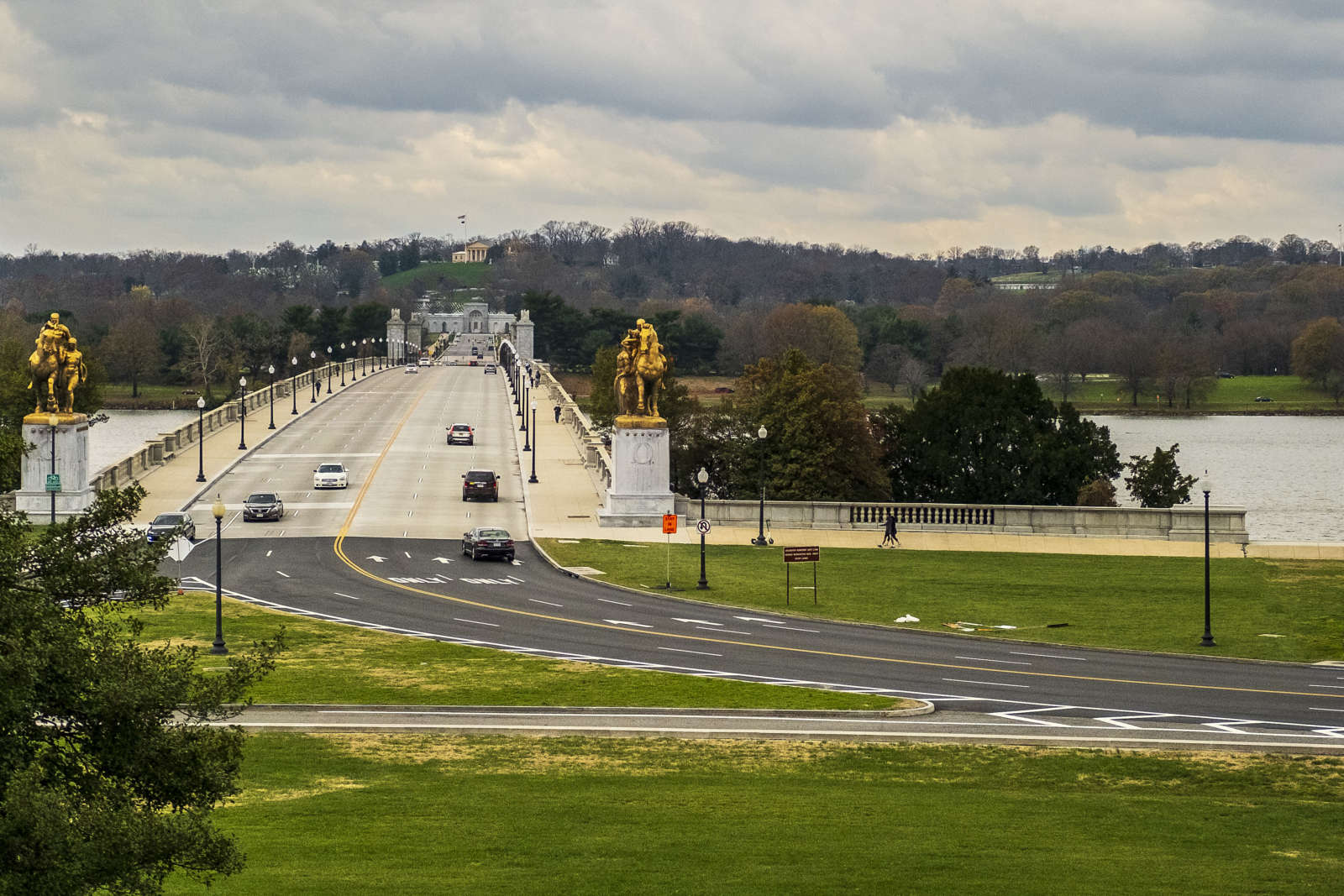
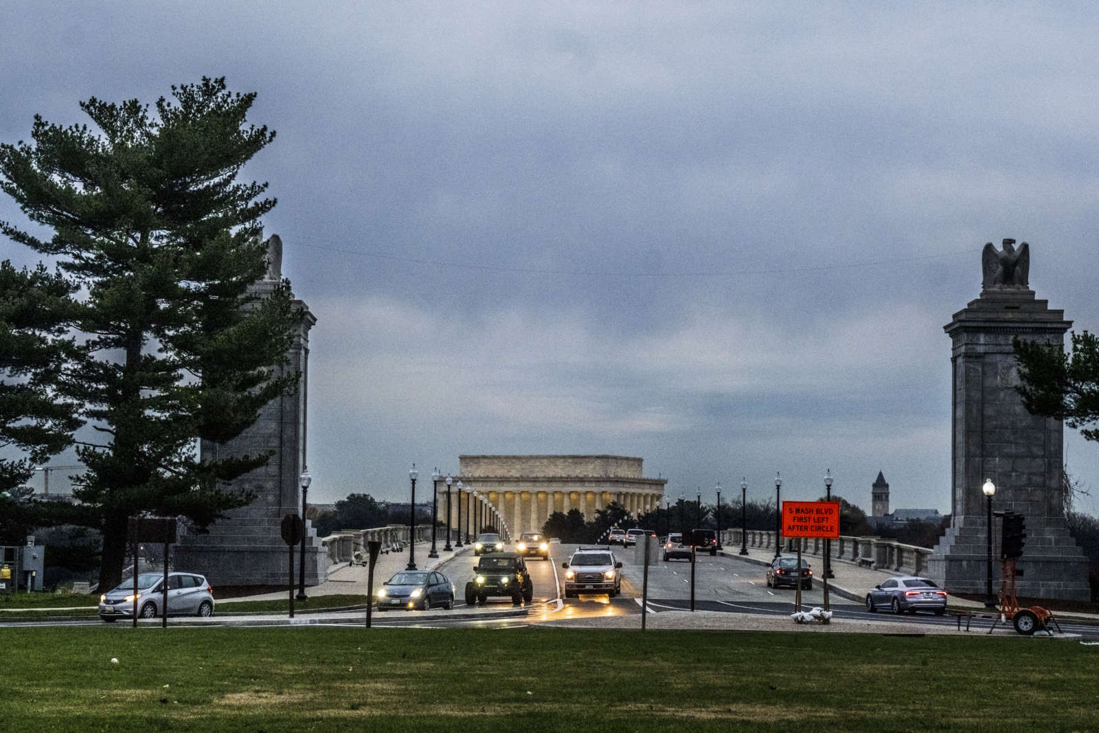
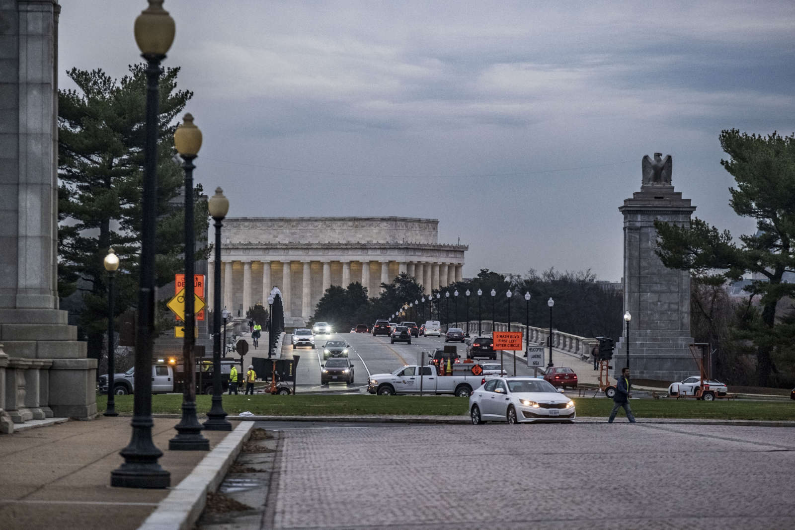
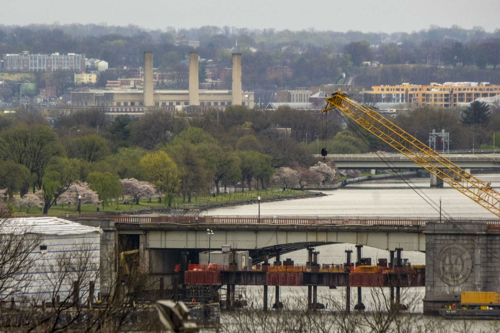
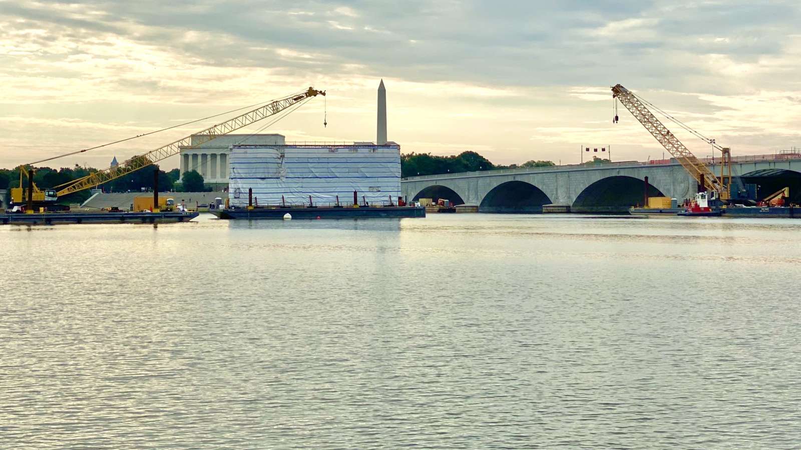
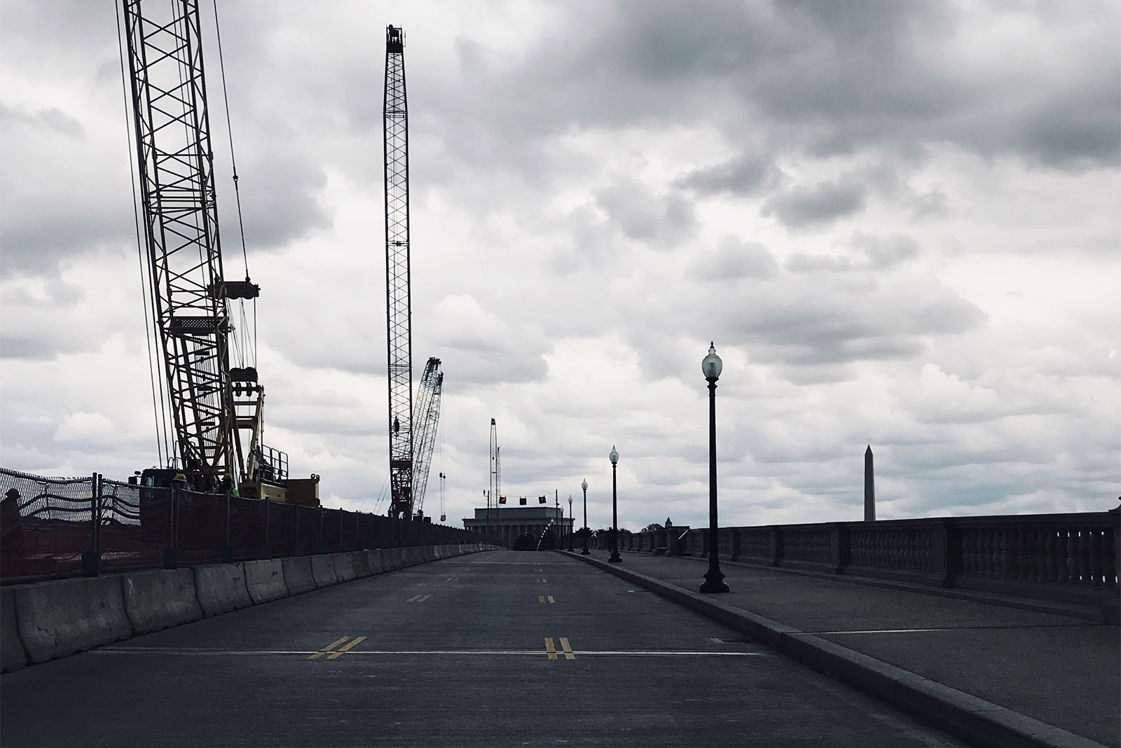
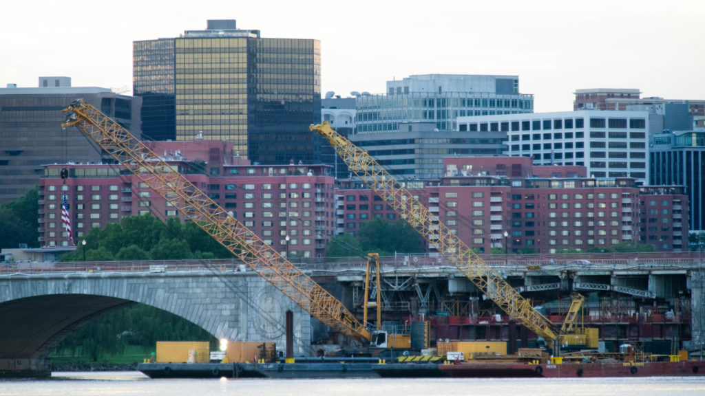
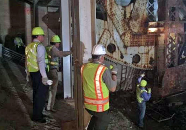
(Updated at 1:45 p.m.) After two years of construction, the Arlington Memorial Bridge is completely open for drivers, pedestrians and bicyclists.

The 90-year-old bridge, which connects Arlington National Cemetery and the Lincoln Memorial, was renovated to save it from potentially closing for good in 2021. The $227 million rehabilitation project, one of the largest infrastructure projects in National Park Service history, will give the bridge another 75 years of service, officials said on Friday.

According to NPS, although the bridge is officially open, workers will continue putting final touches on the bridge and the Memorial Circle, replanting staging areas, completing small projects on the deck and installing bird netting.

In addition to the heavy infrastructure work on the bridge, a key Potomac River crossing, NPS repaved, improved crossings, added new signs and made the area easier and safer for drivers, pedestrians and bicyclists to navigate, officials said.

The overhaul closed lanes and created traffic headaches for the 68,000 daily commuters that use it — by pre-pandemic counts, at least.

Local members of Congress — including Sens. Mark Warner and Tim Kaine, Reps. Don Beyer and Gerry Connolly and D.C. Delegate Eleanor Holmes Norton — pushed for funding the project, after the discovery of corrosion led officials to close outer lanes and impose a weight limit.

In a joint statement issued Friday, the lawmakers said they worked to save the bridge because a closure would hurt their constituents.

“Memorial Bridge is now fully operational, and stands not only as a historic and functional monument, but also as a symbol of the kind of progress that is possible on rebuilding key transportation infrastructure through smart government investment,” they said in a statement.

Warner added that the project’s funding only came together as a result of a long-running, concerted effort among lawmakers and local officials.

“In 2015, we were warned that Memorial Bridge — a critical artery between Virginia and the nation’s capital — was literally falling apart,” said Sen. Warner. “Today’s reopening is a testament to years of work by the region’s congressional delegation, our local partners, and the National Park Service. Commuters can now rest easy knowing that this nearly 90-year-old landmark will carry them safely over the Potomac for years to come.”

The completed project preserves a national memorial to the sacrifices of veterans, U.S. Secretary of the Interior David L. Bernhardt said.

“The completion of this project marks one of the largest infrastructure projects in National Park Service history, which was done on time and on budget,” Bernhardt said. “I hope that all Americans are brought together to remember and honor our veterans every time they cross this bridge into the capital of our nation.”

Flickr pool photo (top) by Kevin Wolf, photo (bottom) courtesy of Office of Sen. Mark Warner


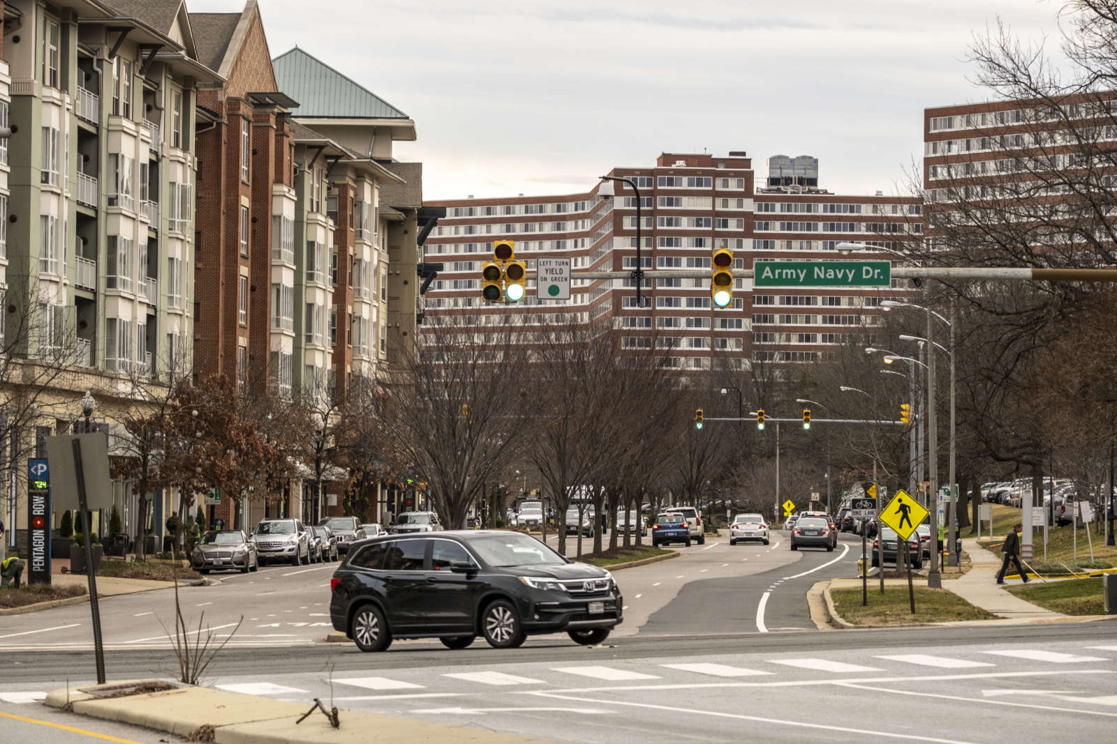
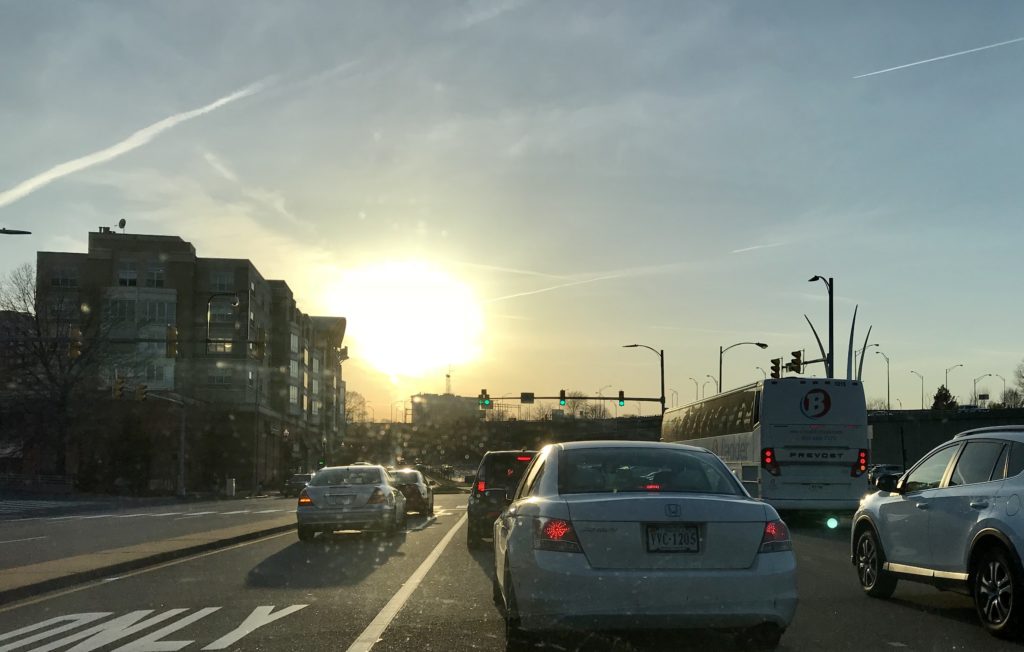
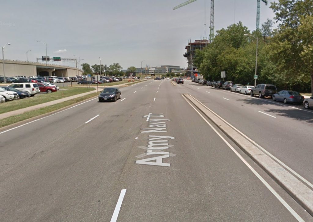
After five years, Arlington County is putting finishing touches on its Complete Street plan to improve walking, biking and driving conditions along a stretch of Army Navy Drive in the Pentagon City area.

The updated plans — which are 90% complete — were presented in a virtual public hearing on Wednesday. County staff are taking public comments via email on this version until Dec. 4, and the final plans will be submitted next summer. Construction on the section of road from S. Joyce Street to S. Eads Street is slated to begin in 2022.

The $16.87-million project aims to reduce conflicts among cars, buses, bikes and pedestrians with narrower lanes, stretches of bus-only lanes, protected left turns and signalized right turns, clearer sidewalks and shorter crosswalks. The south side of Army Navy Drive will have two-way bike lane protected by a line of trees.

“A lot of the signalizations will improve safety, prevent fatalities, reduce collisions, things like that,” Jon Lawler, the project manager, said during the meeting.

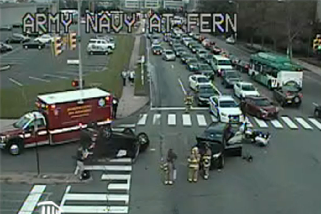
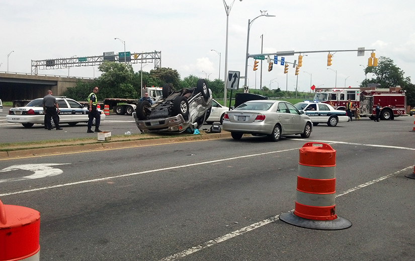
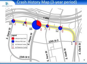
Crashes happen frequently in its intersections: Staff said the S. Hayes St/I-395 off-ramp intersection had the second-most collisions of any Arlington intersection in 2016.

The measures mean the new Army Navy Drive will be reduced to two through lanes in each direction, narrowing to one lane east of S. Eads Street.

“This segment has much lower traffic volumes than the other four blocks of the project corridor,” Lawler said in an email.

Reducing a lane of traffic to accommodate a bus lane between S. Joyce Street and S. Hayes Street will actually improve flow because buses will not block traffic while loading passengers, he said.

Traffic lanes will be narrowed to slow down cars, but staff are not planning to propose a lower speed limit, which is 35 miles per hour, Lawler said during the meeting.

Construction is still a ways off. Staff expect construction to begin in the spring of 2022. With work scheduled block by block to minimize disruptions, it could last until the fall of 2024. Original plans had construction starting in 2020 and ending in 2022.

Lawler attributed the delays to the additional tasks needed for a project receiving federal aid.

“For this project, it took much longer to receive our National Environmental Policy Act document approval than we had envisioned,” he said in an email.

Staff skipped the 60% design phase to make up for lost time, he said.

After the medians are removed, work will start on the south side of Army Navy Drive, beginning with the area where Amazon HQ2 will be, along S. Eads Street, and moving west. Once the medians are replaced, the road will be repainted and striped, concluding the project.

Lawler said in the meeting that “we won’t have any conflict” with Amazon construction.

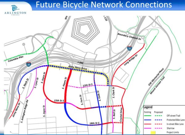
Community feedback led to two major changes, he said. First, another block of protected bike lane was added to connect the bike lane west of S. Lynn Street with the planned protected bike lane starting at S. Joyce Street.

“This way we don’t have a missing link in the system,” Lawler said in the meeting.

Staff could not insert this change into this project, as it is receiving federal funding, so they created a separate capital improvement project to address it, he said.

From S. Lynn Street — near Prospect Hill Park — to S. Eads Street, Army Navy Drive is “pretty uncomfortable to use scooters and bikes on,” Lawler told ARLnow after the meeting. “The changes will provide them a safer route for them to use.”

With the changes, bicyclists on Army Navy Drive will be able to use the major east-west link more easily to connect with the Mount Vernon Trail and get to Washington, D.C., he said.

Another change was to align the bumpy pedestrian ramps with the crosswalk. Initially, the ramps were perpendicular to the crosswalk, which advocates said directs vision-impaired pedestrians into harm’s way.


Without in-person school, play dates and activities, many kids have lost their primary sources of social interaction and exercise due to COVID-19.

But volunteers in Arlington say a new traffic garden, a space where kids can play and learn how to travel roads safely, could restore some of the lost opportunities for play.

“It was clear we needed new stuff for kids to do,” said Fionnuala Quinn, who makes and consults on traffic gardens. “This is a friendly, happy place for them at a time when a lot has been taken away from them.”

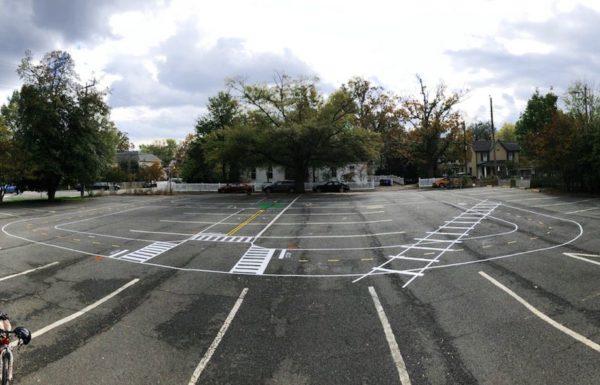
After getting approval from the Women’s Club of Arlington (700 S. Buchanan Street) in Barcroft to use their parking lot, a group of 10 bicycling enthusiasts, community members and engineers grabbed some chalk paint and duct tape and got to work. Three-and-a-half hours later, the parking lot was transformed into space with railroad crossings, crosswalks, streets and roundabouts that kids can walk, bike or skateboard along.

“It’s a bright spot in a tough time,” said Gillian Burgess, a cycling and walking advocate and former chair of the Arlington Bicycle Advisory Committee, who helped with the effort.

Families seem to enjoy it and kids find it intuitive, she said.

“It’s funny, parents will ask us how to use it, but kids just do it naturally,” she said.

The crew in Arlington is one of about 30 nationwide that have repurposed parking lots and constructed these temporary traffic gardens since the start of the pandemic, Quinn said.

“Once you start looking and thinking about this, you realize there is asphalt lying neglected everywhere,” she said. “As soon as you do it, small children appear.”

The original traffic gardens were built in the 1950s in Denmark and the Netherlands. They resembled miniature cities, with tiny buildings and kid-sized roads and traffic signs.

The trend made its way to the U.S., with a large concentration of them in Ohio, where they are called safety towns, Quinn said. She has catalogued about 300 installations in the U.S.

Quinn, who lives in Reston, left her engineering job to engineer and consult on traffic gardens full-time. She said the 50s-era gardens ertr amazing, but expensive to maintain and most kids only ended up going once during their childhood.

Her job is to make these gardens easier and cheaper to build and maintain so that they can be replicated on a smaller scale, more locally, and be more accessible to all kids.

She has helped with permanent installations at two Washington, D.C. schools, and spearheaded two in Alexandria and one in Fauquier County. They required months or years of planning and work.

But temporary pop-ups, including the one in Arlington, use little resources and take less time. Once people see how much kids love them, the pop-ups also advance the community conversation toward permanent versions, she said.

The Barcroft traffic garden will be in place for a few months. Burgess is working on getting the message out through schools and neighborhood email lists and has started looking for other locations in the county. She aims to add more gardens by this spring.

The group is working with the Arlington Safe Routes to School coordinator to apply for grants to fund permanent traffic gardens at Arlington schools.

With kids learning remotely, Safe Routes to School grants are going toward different educational initiatives, including traffic gardens, Burgess said. In the meantime, she and Safe Routes are also working with the school system to make walking and biking routes to school safer.

Photos courtesy Gillian Burgess 


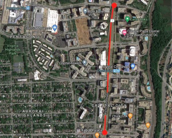
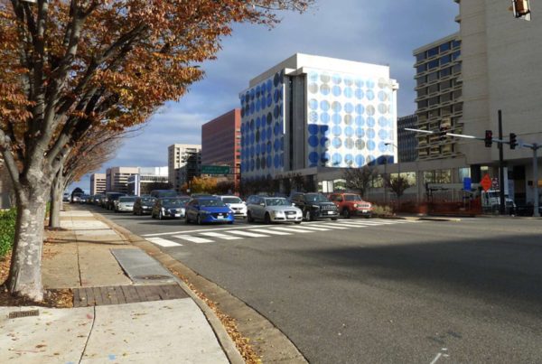
The Virginia Department of Transportation is asking residents to take a short survey that will shape a study of potential improvements to Route 1 between 12th and 23rd Streets S. in Crystal City.

As development activity in Crystal City and Pentagon City continues, VDOT and Arlington County are looking for ways to improve the safety, accessibility and effectiveness of a variety of transportation modes on Route 1 in the area. In particular, the study responds to the increased demand for transportation resulting from the construction of Amazon’s HQ2.

“As this area’s commercial and residential densities continue to increase, transportation plans will need to address the wide-ranging needs of pedestrians, bicyclists, transit riders, motorists, and other users while maximizing the safety, convenience, and sustainability of the system for decades to come,” according to a news release from the VDOT.

The survey asks respondents to explain how they use Route 1 (also known as Richmond Highway), rank improvements by priority, and identify areas with congestion or safety problems. It is available through Nov. 15.

Officials say the study will help identify safety improvements for pedestrians, bicyclists, those using micro-mobility modes such as electric bicycles and scooters, and those taking transit or driving. The study will also examine ways to make transit more accessible, reliable and convenient, as well as options for protecting the environment.

The team leading the study plans to form a task force from representatives of civic associations, Arlington County advisory groups and the National Landing Business Improvement District, the news release said. The task force is anticipated to have five meetings.

More from the press release:

After collecting and analyzing the initial survey data, VDOT is planning a virtual public meeting this winter to share preliminary survey results and latest study information. Draft recommendations for the study will be presented to the public for feedback in spring 2021, and the final study is expected to be complete in summer 2021.

Please note that this study does not include construction funding, but will develop proposed future improvements that VDOT and other agencies will consider and may pursue for funding.

The study was announced a week after the National Landing BID released a report, “Reimagining Route 1,” which envisioned the car-centric highway as a slower, greener, pedestrian-friendly boulevard lined with retail and restaurants.

VDOT is studying the Route 1 overpasses over 12th, 15th and 18th streets, which some have called to be eliminated in favor of more urban intersections at grade.

“Route 1 was originally designed to accommodate the auto-centric development trends of the mid-20th century, when the primary objective was to move cars through the area as quickly as possible,” the BID said in a press release. “The resulting elevated highway, super blocks, and oversized intersections divided the community for decades, inhibiting not only connectivity and access, but also the area’s ability to come together as a singular downtown district.”


As the summer approached with lockdowns in place, many cities, including D.C. and Alexandria, closed some streets to drivers and expanded walking and biking options.

Arlington did not, although many residents supported the idea, according to an ARLnow poll from April that found support for closing streets among 80% of respondents.

The county did not close roads primarily because it lacked materials and manpower, Director of Transportation Dennis Leach told the Arlington Bicycle Advisory Committee during its meeting on Monday. The explanations angered members.

Gillian Burgess, the former chair of the committee, told ARLnow that the meeting was “frustrating.” Members were told to advocate for increased funding to close streets and to attend other meetings, which she said deflected the responsibility away from the department.

“No one is willing to say ‘Yes, how do we do it?'” she said.

Burgess started championing the cause in March, when she rallied together people from various organizations to ask the County Manager for more space for non-drivers. Their efforts were unsuccessful.

Transportation and Operations Bureau Chief Hui Wang told ARLnow that the department looked at the roads people suggested for closures, considering safety, feasibility, resources and the opinions of neighboring businesses and residents.

“We had a hard time to find a good piece of road that was suitable for the treatment that was suggested,” she said.

Obstacles included frequent bus stops and curb cuts, pick-up and drop-off zones next to businesses and access for emergency responders, Wang said. Closing streets, she said, is not as easy as just putting up a few signs.

Signs must meet national standards, for instance, while getting placed in safe spots, checked for damage and replaced when necessary, she said. Safety requirements like these make the task difficult.

Wang said the pandemic revealed what her bureau lacked in order to respond. Her team did manage to procure temporary outdoor seating areas within sidewalks, and closed some parking lanes to allow people to walk around the new outdoor dining areas, but does not have the resources for large-scale temporary pedestrian-only zones, she said.

Another factor in the action: questions of equity and whether closing streets in certain areas would benefit those hardest-hit by the pandemic.

Burgess said she understood these reasons at the beginning of the pandemic. Eight months later, it is “super disappointing that Arlington can’t be creative, nimble or quick and can’t try something that would serve residents,” she said.

Arlington transportation officials have now turned their attention to Arlington Public Schools an an anticipated return to school for students. They are working to identify the best routes for walking and changing the timing of lights to make crossing the street safer.

Buses will operate at a lower capacity, meaning more parents may drive their kids when they could walk or bike instead, Burgess said. She said a silver lining of decreased busing may be a growing realization that Arlington should prioritize making streets more biking- and walking-friendly.


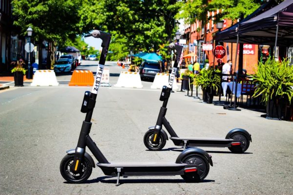
(Updated at 4:50 p.m.) After a launch delayed by the pandemic, mobility company Helbiz has started putting e-scooters onto Arlington and Alexandria streets.

The company announced yesterday that it would immediately move forward with bringing 100 new scooters to locations in Arlington and 200 to Alexandria. Like other scooter companies, like Lime or Bird, Helbiz scooters are unlocked by scanning a code in a smartphone app, with the cost of each ride determined by distance and parking.

“The vehicles will also be able to operate between these cities’ for riders’ convenience,” the company said in a press release. “These fleets follow the company’s successful launch of e-bikes in neighboring Washington, D.C., highlighting Helbiz’s continued growth in the area and its commitment to offering eco-friendly micro-mobility solutions to the community.”

While Helbiz — an Italian-American transportation company founded in 2015 — was approved for e-bike use in Alexandria, the company said those plans have hit a snag.

“We plan to launch a fleet of 200 e-bikes in Alexandria in Q4 of this year,” said Gian Luca Spriano, Director of International Business Development. “Unfortunately, our bike manufacturer experienced delays due to COVID, and we’re working closely with them to get our bikes in Alexandria as soon as possible.”

Helbiz was not listed as one of the scooter operators granted a permit to operate in Arlington earlier this year, though there have been several changes in the local e-scooter world amid the pandemic.

“Helbiz is in the process of obtaining a permit to offer e-scooters in Arlington,” said Eric Balliet, spokesperson for the Arlington County Department of Environmental Services. “Final steps include providing the County a device for testing, which is expected later this week.”

The distribution of and access to scooters have faced some concerns at the Alexandria City Council that the programs disproportionately favored wealthy, predominately white Old Town at the exclusion of lower-income communities. In response, Helbiz said in a press release that it has launched the Helbiz Access Program to provide discounts on rides for low-income residents.

Photo via Helbiz/Facebook


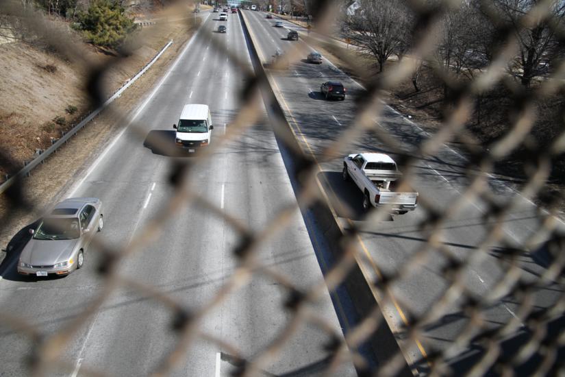
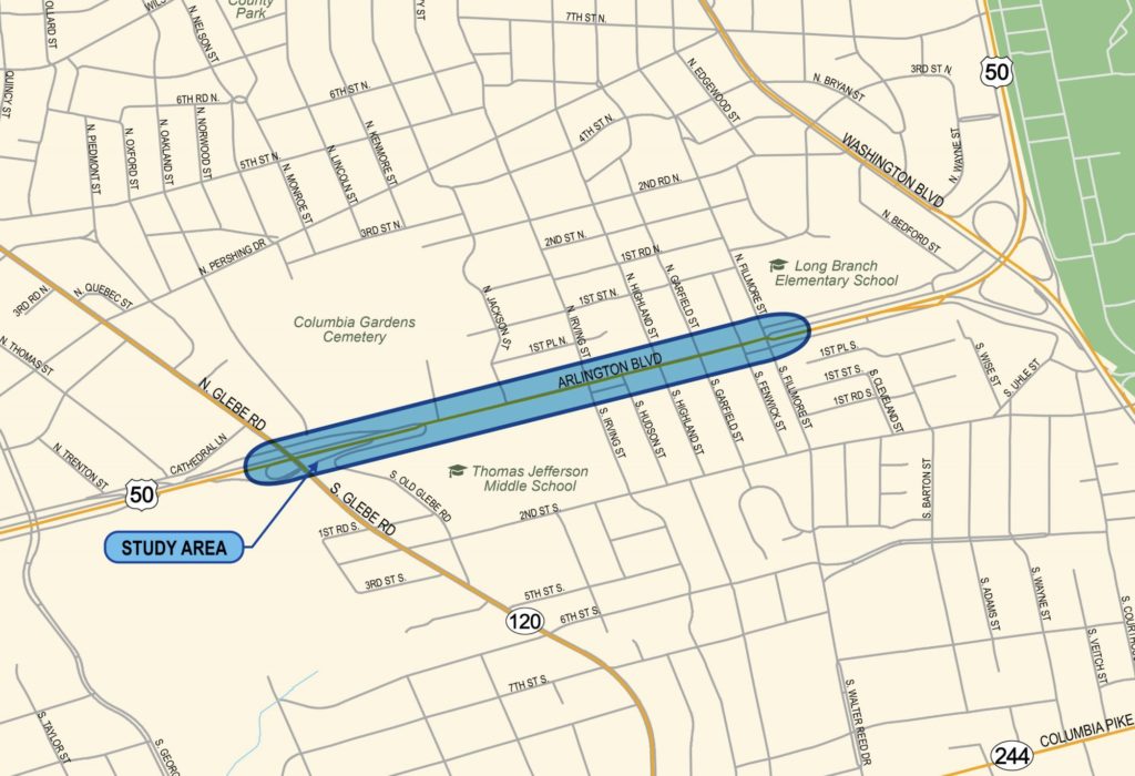
Arlington and the Virginia Department of Transportation are looking at how to improve the situation along the notably crash prone stretch of Route 50 (Arlington Blvd) between Glebe Road and Fillmore Street.

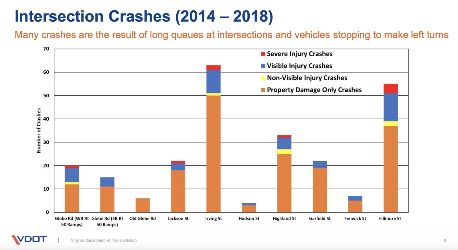
Between 2014 and 2018, VDOT said there were 247 total crashes with 61 crashes resulting in injuries, a few severe but none resulting in fatalities. Most of these crashes were concentrated around intersections.

“This segment of Route 50 experiences congestion in the morning and evening peak periods and a high number of crashes,” VDOT noted. “Route 50 averages 62,000 vehicles a day within the study limits.”

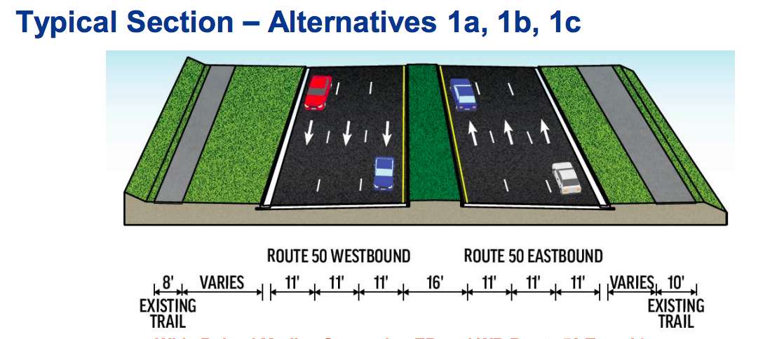
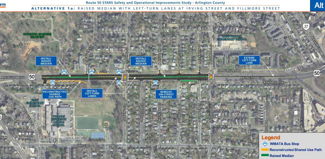
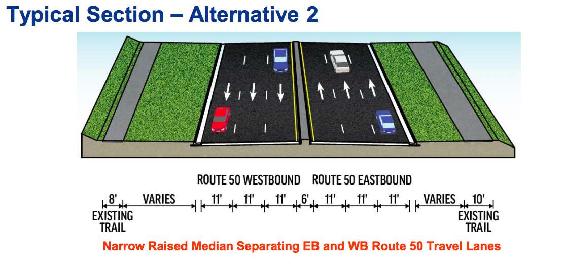
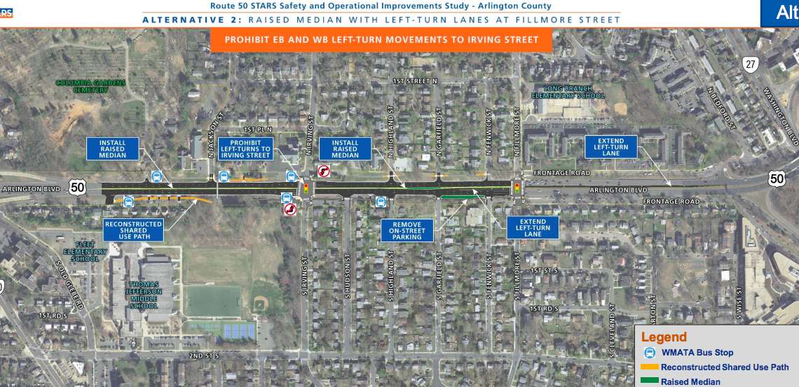
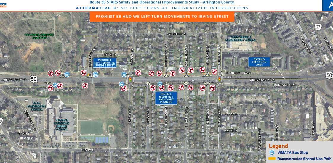
In an online presentation, VDOT proposed three alternatives with a variety of sub-options to cut down on conflict points — places where vehicles intersect. Two of the options would add new raised medians to Route 50, and each of them had sub-options that would limit left turns or turn Irving Street or Fillmore Street into one-way streets.

The three primary alternatives are:

  • Wide Raised Median Separating EB and WB Route 50: the widened, raised medium would reduce conflict points at intersections without signals and at trail crossings. The only four-way intersections would be at Irving Street and Fillmore Street, where there are traffic lights. This alternative also includes left-turn lanes along Route 50 at Irving Street. The increased separation between eastbound and westbound travel lanes, and the additional turn lanes, would require the widening of Route 50.
  • Narrow Raised Median Separating EB and WB Route 50: the narrower median accomplishes the same reduction in conflict points as the first alternative, but would also not include left-turn lanes at Irving Street, meaning there would be reduced widening requirements. Left-turns at Irving would be prohibited and the third lane would likely see more use. But while this plan would improve the situation at Irving Street, VDOT warned that it would not reduce conflicts at Fillmore Street and could create higher traffic volumes and delays there.
  • No Left Turn at Unsignalized Intersections: the final alternative would add no median, but extensive signage prohibiting left turns along the street at all intersections without a signal. The widening impact would be low or non-existent, but VDOT warned that enforcing the new restrictions would be more difficult.

The sub-options to the first alternative include prohibiting any turning onto Irving Street and no left-turns at Fillmore Street, or flipping those so there are no left-turns onto Irving Street and no turning at all onto Fillmore Street.

Traffic signal improvements are also proposed.

VDOT data presented at the meeting said that two of the sub-options within the first alternative — which includes a wider raised median —  would have the highest chance of improving safety conditions, resulting in a total 69% reduction in conflict points, while the other two options reduce conflict points by 63%.

The first alternative is also the most costly, however, at an estimated $14-18 million budget. The second alternative, the narrow median, is cheaper at $12-14 million, while the third alternative is cheapest at $5-7 million.

“Cost estimates will be prepared for alternatives under consideration,” a VDOT official said in the video. “Improvements identified as part of the story have not yet been funded and there’s no timeline for construction”

Other potential additions to Route 50 would be new service roads along either side of the highway. One would be on the south side of Route 50 would extend past S. Old Glebe Road, which would eliminate five residential driveways onto the main lanes. The other would be on the north side of Route 50, extending an existing road west of Irving Street.

Comments on the project can be submitted online until Friday, May 29. Recommendations are scheduled to be finalized and posted online this summer, with Arlington County submitting a SMART SCALE funding application in August.


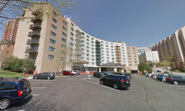
A plan is currently in process to transform the Arlington Court Suites hotel into an apartment complex, but at a Transportation Commission meeting last week the project hit a small snag as commissioners unanimously agreed the project might have too much parking.

The plan would convert the 187 hotel rooms in the Arlington Court Suites into a 180-unit residential property called Park Arlington at Courthouse. The current plans do not call for any major demolition work and staff said the proposed residential units would likely be less expensive than new construction at the same site.

The applicant could maintain as hotel use, staff said, but this project would help meet the demand for mid-rise housing at a middle-income level.

While the project is only two blocks south of the Court House Metro station, the parking ratio would increase in the new plans. Currently, there are 153 parking spaces and the proposal would elevate that to 171 spaces. Many of those would be located on a surface parking lot, with the rest in a garage under the building. The plan also calls for 76 bicycle parking spaces.

Transportation Commission member Audrey Clement, who earlier in the meeting had expressed opposition both the Veitch Street redevelopment and the Missing Middle housing study, shared her general support for the Park Arlington project, with one main objection.

“I really do support this project,” Clement said. “This is right up my alley. It does not involve the demolition of an existing property… I’m very impressed with this project, but in one respect it is not consistent with County policy, and that is the parking ratio.”

In 2017, the county adopted a new policy that said the parking ratio should be reduced from one space per unit to as low as 0.2 spaces per unit in certain areas near Metro stations.

“I do believe this project would be more consistent with county policy if it reduced the number of parking spaces and what I’m particularly interested in is the surface parking. Has the developer considered replacing some or all of the surface parking with green space? This would be a benefit to the residents of this facility.”

“It is a huge parking lot and the only way to get into the building is through the parking lot,” said Transportation Commission member Jim Lantelme. “It’s still way too auto-oriented… This parking lot is just enormous and it really doesn’t work for me. There’s nothing like this site anymore. If we’re going to have adaptive reuse, we have to adapt it to the current requirements.”

The agreement on the Transportation Commission took some of the members by surprise.

“I never thought I would hear myself say this, but I 100% agree with everything you just said,” said Transportation Commission member Richard Price. “I never thought I would hear myself say this, but Commissioner Clement hit it right on the head… All I see is ugly surface parking and I’m glad you’re going to address it. There are lots of sites that all you have to get the front entrance is walk through a parking lot. That is disturbing and that needs to change, and it needs to start changing now.”

Others said that along with the parking lot reduction, the sidewalk needs to be widened.

The developer said that an alternative plan could eliminate the surface parking, but more market research needs to be done. If the building winds up as condos, the developer said there would be a higher demand for parking. The developer noted that the widening the sidewalk on N. Courthouse Road, however, is complicated by things like utilities and a retaining wall.

Photo via Google Maps


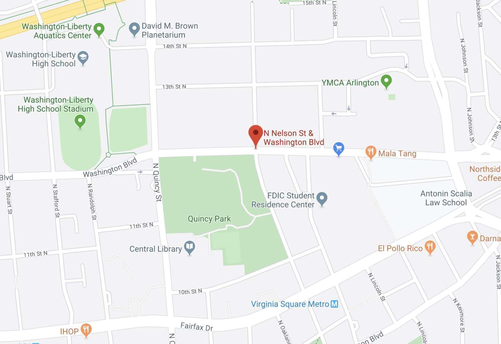
A bus station on Washington Blvd is temporarily closing for improvements to an intersection a couple blocks north of the Virginia Square Metro station.

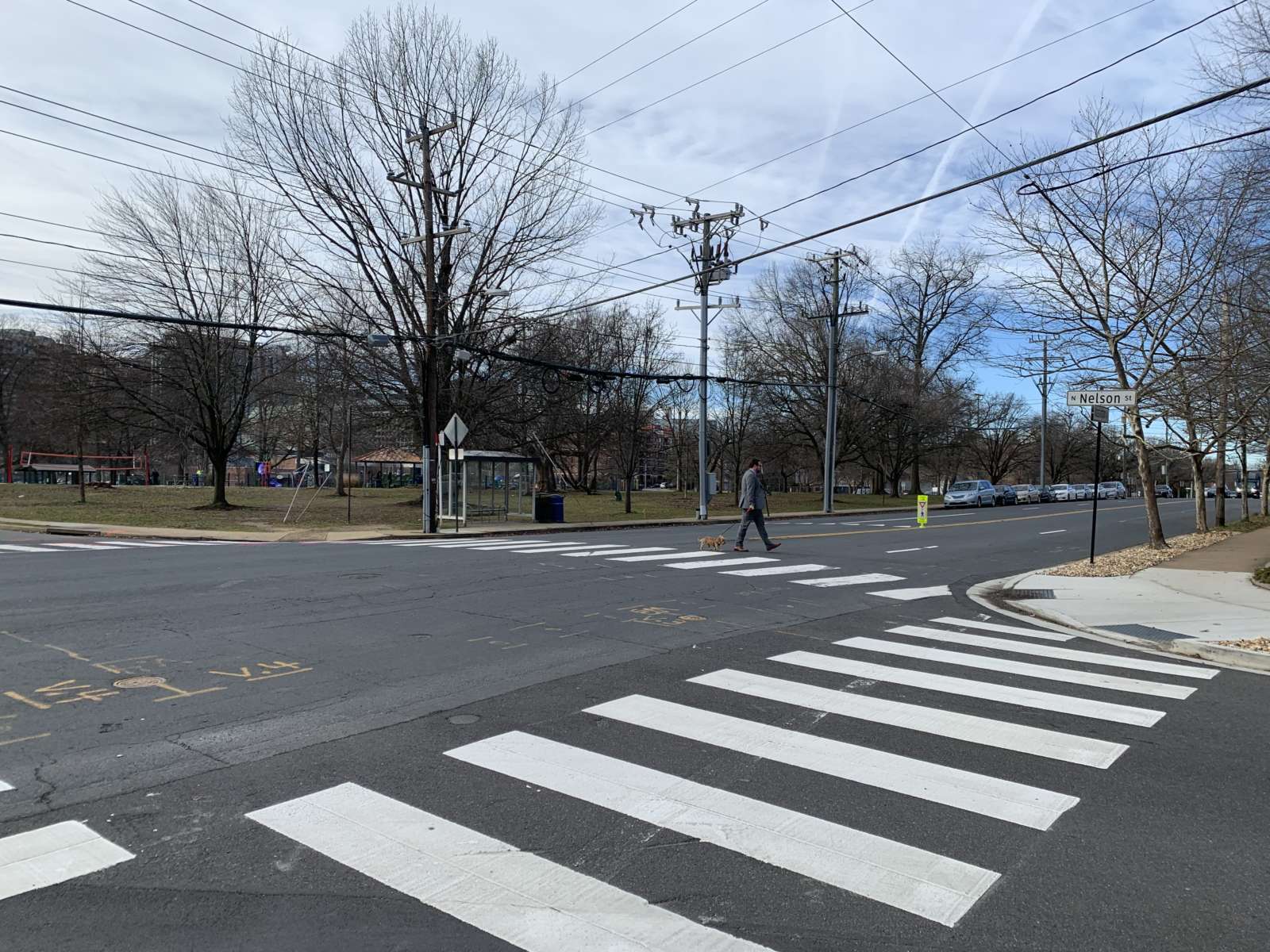
The intersection of Washington Blvd and N. Nelson Street is considered a “hot spot” of crashes, according to an Arlington County project webpage. It’s located on the northeast corner of Quincy Park, one block from Washington-Liberty High School, and several blocks from intersections that have seen a number of notable crashes involving pedestrians.
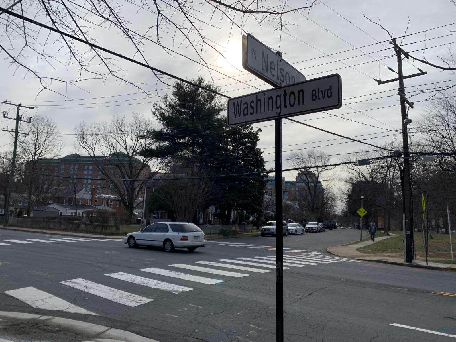
“Three pedestrian crashes occurred at this location in the three-year analysis timeframe,” staff said in a webpage for the project. “Traffic speeds are generally higher than the posted speed limit. Auto and pedestrian volumes at this location are also relatively high for the facility type.”
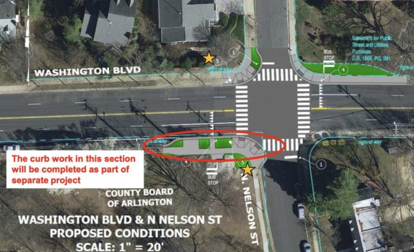
The County plans to install rectangular rapid flashing beacons for pedestrians and to make additional crossing and curb improvements to make the intersection more accessible. The changes will also make the sidewalk wider on the northern side of Washington Blvd.

A county staff presentation from December suggests construction will take place over the course of this spring and summer. WMATA says the bus stop at the intersection will be discontinued starting today (Monday) and passengers should board or exit at N. Quincy Street and N. Lincoln Street a block west and east respectively.

Other parts of Washington Blvd have also gone through changes to make the street safer, including the nearby intersection of N. Utah Street.

Map via Google Maps


The Virginia Dept. of Transportation is studying possible upgrades to Route 50 between Glebe Road and Fillmore Street.

The 0.7 mile stretch, which is notably crash prone and difficult for drivers making left turns and pedestrians trying to cross the street, is a candidate for what VDOT has dubbed “Strategically Targeted Affordable Roadway Solutions.” Possible upgrades range from new turn lanes to pedestrian enhancements to — perhaps — even roundabouts.

VDOT is holding a public information session about the possible changes on Thursday (Nov. 14) from 6:30-8:30 p.m. at Thomas Jefferson Middle School (125 S. Old Glebe Road).

More from VDOT:

The concepts being studied will be based on public input and may include improving turn lanes, traffic signal timing and operations, and access management for properties and streets along the corridor. Other concepts being studied may also include pedestrian, bicycle and transit enhancements, turn restrictions and “Innovative Intersections” such as roundabouts and interchanges. Stop by between 6:30 p.m. and 8:30 p.m. to view displays and learn more about the project. A presentation will begin at 7 p.m. Project staff will be available to answer your questions.

“This stretch of Route 50 has long backups and delays during weekday peak commute times and several high crash locations due to the high number of access and conflict points,” VDOT said on a webpage for the study. “Route 50 averages 62,000 vehicles per day within the study limits.”

An online survey for the project asks, among other things, which multimodal facilities are needed along the Route 50 corridor. The multiple-choice options include sidewalks, crosswalks, pedestrian signals, shared-use bicycle lanes, bus shelters and a park and ride lot.


A new, eco-friendly form of transportation is in the works for some residents along Columbia Pike.

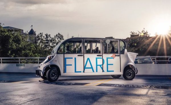
Electric shuttle company FLARE Technology and Services is in the process of securing contracts with several apartment buildings in south Arlington. Once finalized, residents those buildings will be able to use the free service — offered as an amenity — to shuttle anywhere they might not have immediate access to, such as a Metro station or grocery store.

The service will be exclusive to the apartment residents, meaning those who stumble upon the cars along Columbia Pike will not be able to hop in, clarified FLARE CEO Andres Delgado.

Delgado said he hopes to have FLARE ready by the start of next year. In the meantime, the business will host a ribbon cutting ceremony at the Arlington Economic Development office in Ballston today (Tuesday).

“There are many desirable places to live within Arlington County, but everyone is not able to live in locations with easy access to transit,” said Delgado in a statement. “We created FLARE as a solution to solve the connectivity problem within Arlington and in the greater D.C. metro area.”

The company’s white vehicles, which look a bit like stretched-out golf carts with doors, have spent the last several weeks testing rides in the Shirlington area.

“We were able to drive people in Shirlington from a farmers market, to their apartments, to the grocery store,” said Delgado, “and it was awesome.”

Delgado emphasized that he is working with his co-founder, Chris Yeazel, to eventually have an app-based subscription service available for public use.

“Then anyone in the neighborhood will be able to jump on,” he said.

Another free ride service, Sprynt, hit the streets in Arlington in 2017. A “100% electric on-demand” ride, the service was paid for by advertisers, but the company stopped operating a year later.

Photo courtesy FLARE


View More Stories