A resident sells air conditioning units at 11th and Randolph, near Ballston

Hot Car Mom Released from Jail — Zoraida Magali Conde Hernandez, who’s accused of fatally locking her 8-month-old son in a hot car earlier this month, was released from jail yesterday afternoon after being granted a $25,000 bond. Police say Conde Hernandez accidentally left the baby in her car for 6 hours while she went to work. NBC4 reports that she works at the Catholic Diocese of Arlington. [NBC Washington]

More Money for Paving in Virginia — More money is available for VDOT’s summer paving effort this year thanks to new transportation taxes. The planned repaving includes 90 lane miles of interstate highways and 79 miles of primary roads. Arlington is one of two Virginia counties that doesn’t rely on VDOT for maintenance of secondary roads. [Sun Gazette]

Library Group to Hold ‘Great Gatsby’ Ball — The group Friends of the Arlington Public Library will be holding a 1920s-themed “Great Gatsby” ball at Artisphere on Sept. 28. The event will raise money for the library’s early literacy initiatives. [Arlington Public Library]

Photo by Katie Pyzyk. Hat tip to Peter Golkin.


Stretch of Wilson Blvd and Clarendon Blvd in Courthouse (photo via Google Maps)The County Board may decide to decrease speed limits on a number of roads throughout Arlington, including the main thoroughfares from Rosslyn to Clarendon. Board members are scheduled to take up the issue at their meeting on Saturday (July 13).

The Department of Environmental Services conducted studies to examine the viability of changing speed limits on several streets. Information was gathered regarding factors such as vehicle speeds, collisions, traffic volumes, pedestrian and bicyclist activity and development patterns. Studies were performed in the following areas: N. Meade Street from Arlington Blvd to Marshall Drive (formerly Jackson Avenue), Clarendon Blvd from Washington Blvd to N. Oak Street, Wilson Blvd from Route 110 to Washington Blvd, and N. Sycamore Street from Washington Blvd to 17th Street N. and N. Roosevelt Street from 17th Street N. to the county line.

The studies indicated that speed limits along N. Meade Street, Clarendon Blvd and Wilson Blvd could be decreased from 30 miles per hour to 25 miles per hour. The N. Sycamore Street/N. Roosevelt Street studies indicated the speed limit could be lowered from 35 miles per hour to 30 miles per hour.

Arlington’s Master Transportation Plan includes a policy to design streets with lower vehicle speeds without impeding or diverting traffic. Part of that involves adopting a 25 mile per hour speed limit in the county’s “downtown” areas where pedestrian traffic is high, such as along Wilson Blvd and Clarendon Blvd.

The Board also has been asked to authorize the correction of speed limit discrepancies along parts of I-395 and I-66. According to VDOT records, the speed in the regular lanes of I-395 from Alexandria to D.C. is 55 miles per hour. The county code, however, was recently discovered to list a portion of the segment as 35 miles per hour, and that the entire segment is 55 miles per hour. There is a similar discrepancy between county code and VDOT records regarding the HOV lanes. Additionally, the county code does not include speed limits for I-66, but VDOT lists the limits at 45 miles per hour and 55 miles per hour, depending on the section in question.

County staff members recommend Board approval for the speed limit discrepancy corrections and for decreasing the speeds along the four stretches of county roads.

The cost of installing new speed limit signs to reflect the changes is estimated to be $5,000. Funds are available in the Fiscal Year 2014 Department of Environmental Services Transportation Engineering and Operations operating budget.


I-66 air rights development proposal in Rosslyn (photo via VDOT)The air space above I-66 is being targeted for the construction of high-density, mixed-use development.

Gov. Bob McDonnell (R) and County Board Chair Walter Tejada announced Wednesday that the state, county and the Washington Metropolitan Area Transit Authority are looking into leasing the air rights above I-66 near the East Falls Church and Rosslyn Metro stations in order to generate additional revenues for transportation improvements.

“By leasing airspace above certain transportation facilities owned by the Commonwealth, we can better utilize our existing infrastructure to generate additional revenues to fund future transportation improvements, while at the same time attracting new jobs and economic development,” McDonnell said in a statement. “Additionally, by co-locating these potential developments around existing Metro stations and other major transportation facilities, we can reduce congestion and create more livable communities.”

From the press release:

Air rights development projects have proven a successful revenue generator in other parts of the United States. The Massachusetts Department of Transportation, for example, generated $40 million in FY 2011 through leases, with long-term lease income projected at $868 million. Further, earlier this year MassDOT awarded a contract for an additional air rights project through a 99-year lease that will generate $18.5 million (net present value) in rental payments.

“Virginia has long been a leader in partnering with the private sector to advance innovative solutions to our transportation infrastructure needs,” said Secretary of Transportation Sean T. Connaughton. “The potential development of these air rights presents a unique opportunity to attract additional private sector investment to the Commonwealth and better utilize our existing assets to fund future transportation projects.”

Arlington County is currently undertaking a review of the Rosslyn Sector Plan. As part of that process, development over I-66 in the northern and eastern edges of the Rosslyn Metro Station area can be evaluated. While there are no existing mixed-use development rights over the I-66 right-of-way at either Rosslyn or the East Falls Church Metro Station location, the East Falls Church Area Plan currently supports mixed use development on VDOT and WMATA’s property next to I-66.

Arlington County Board Chairman J. Walter Tejada emphasized, “It is important to involve our residents, businesses and developers in this conversation about air rights. We will ensure that any potential transit-orientated development using these air rights in Arlington County is consistent with our community’s vision and is consistent with the County’s land use and transportation plans.”

The state has issued a Request for Information to gauge private sector interest and feasibility. Following the RFI, the county, various state agencies and WMATA will weigh in on assessing how the air rights would match up with the planned development for the communities. The state will then issue a Request for Proposals in the fall, according to the governor’s office.
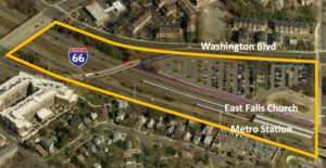
I-66 air rights development proposal in East Falls Church (photo via VDOT)The Rosslyn project has a suggested location adjacent to the Lynn Street overpass, but staff of the state Office of Public-Private Partnerships said it would consider other areas of I-66 in Rosslyn if those were deemed feasible.

At East Falls Church, the area of I-66 between Sycamore Street and Route 29, including the Metro parking lot to the north, is the targeted area.


One man’s palatial homeless camp near Rosslyn took VDOT crews five hours to tear down using heavy machinery and numerous dump trucks, WJLA reported.

The camp, located in the woods along the path that leads from the Mt. Vernon Trail to N. Lynn Street, near the Key Bridge, was about half the size of a football field. The camp was reportedly the work of one El Salvadoran immigrant, who spent years building it, eventually adding a makeshift kitchen, bedroom, and living room.

VDOT crews with bulldozers and heavy machinery spent hours tearing the camp down on Monday, after complaints from some passersby, according to WJLA.


The filming of a big Hollywood movie will temporarily close the Roosevelt Bridge on Sunday.

The closures are scheduled from 8:20 to 9:10 a.m., and again from 1:00 to 1:30 p.m. From the D.C. film office:

On Sunday, May 5 there will be intermittent closing of the Theodore Roosevelt Bridge to allow for the filming of a major motion picture set in the District. MPTD has negotiated an agreement with the DC Department of Transportation, the Metropolitan Police Department, the Virginia Department of Transportation, Arlington Police and the National Park Service to close the Theodore Roosevelt Bridge.

The Theodore Roosevelt Bridge plays an integral role in the storyline. Aerial photography will be used to capture various angels (sic) of the bridge. While in the nation’s capital the production company will film other iconic sites.

VDOT is advising drivers to take alternate routes.

Drivers accessing the bridge from Virginia via I-66, Route 50 or the George Washington Parkway will be detoured. Virginia motorists heading into D.C. from I-66 have three options:

  • Take I-66 East to Route 110 to the 14th Street Bridge (this is the official detour motorists can follow).
  • Take I-66 East to Exit 73/Lee Highway to the Key Bridge.
  • Take I-66 East to Exit 72 to Spout Run Parkway to George Washington Parkway to the Memorial Bridge.

Motorists heading from D.C. to I-66 can use the same options in reverse.

During the closures, message signs on I-66 as far west as Centreville will advise motorists to use alternate routes.

Virginia State Police, Arlington County Police, and U.S. Park Service Police will be stationed at various traffic control points on Route 50, I-66 and the GW Parkway.

VDOT traffic engineers anticipate that the 8:20 a.m. shut down will create 15-minute delays and the 1 p.m. closure will create 30-minute delays.

While neither agency specified which movie is being filmed, ComicBookMovie.com speculates that the closures are for the filming of Captain America: The Winter Soldier, a new superhero movie that’s set in D.C.

Hat tip to @shticksstickler


The $39 million Route 50/Courthouse Road/10th Street interchange project is apparently running behind schedule.

The project was originally slated for completion this fall but, in a new county-produced video, Greg Emanuel, Director of Arlington’s Department of Environmental Services, says the project is now slated to be complete by the summer of 2014.

The VDOT website now lists “mid-2014” as the completion date, though a recently-updated Arlington County project page still lists “fall 2013.”

“It’s a multi-phased project,” Emanuel said in the video (above.) “It takes some time, because while it’s going on we need to maintain traffic.”

Arlington is contributing $1 million to the $39 million cost of the VDOT-led project. Construction started in April 2011. Recent work includes a realignment of the ramp from Courthouse Road to westbound Route 50, and the January demolition of the bridge from eastbound Route 50 to Courthouse Road.

The Courthouse Road bridge, and the 10th Street bridge that was torn down last year, were both originally built in 1954. No word yet on when they’ll be rebuilt, given the change in the project timeline.

Emanuel says the project will make the interchange safer and will help traffic flow more smoothly.

“Right now traffic is kind of complicated at these intersections,” he said. “This is going to provide new acceleration and deceleration lanes, and make it much safer for the traveling public that’s coming on and off these intersections.”

So far representatives from VDOT and DES have not responded to a request for comment.


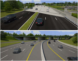
VDOT rendering of new Washington Blvd bridge over Route 110VDOT is planning to “modify and repair” the aging Washington Boulevard (Route 27) bridge over Route 110, near the Pentagon, and will be holding a public hearing to discuss its plan.

The hearing will be held from 6:30 to 7:30 p.m. on Wednesday, Feb. 13 at the VDOT Arlington headquarters at 1426 Columbia Pike. The project manager, Edwin Woo, is also soliciting comments via email for the next three weeks.

The bridge, which was built in 1941 and carries 3 lanes of traffic in each direction, is structurally deficient, according to VDOT. The replacement will be widened by 9 feet, to 105 feet, to accommodate an 14-foot shared use path and an 8-foot sidewalk on either side of the bridge — an improvement over the existing, narrow concrete sidewalks.

The bridge will also be lengthened, to 485 feet, and will also allow a slightly higher clearance: 16 feet 6 inches compared to 15 feet 4 inches. It will still carry three vehicle travel lanes in each direction.

Construction on the $20 million project is tentatively expected to start in 2014 and wrap up in 2015. At least two traffic lanes will be maintained on Washington Boulevard and Route 110 during the duration of the project, with the exception of some temporary nighttime closures, according to VDOT.

The bridge carries more than 100,000 vehicles per day, VDOT figures suggest.


Eastbound Route 50 before the now-closed Courthouse Road bridge

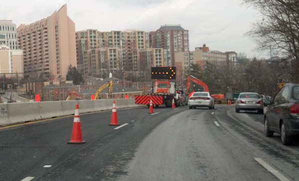
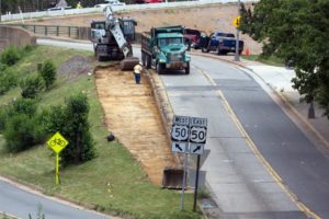
VDOT crews have started tearing down the bridge from Courthouse Road to eastbound Route 50, leading to numerous closures, detours and delays in the area.

Today through Sunday night, traffic on westbound Route 50 is being diverted onto 14th Street N., up to Wilson Boulevard, down Barton Street and back to Route 50 via 10th Street. This afternoon, a long line of traffic was observed before the detour, which is in place to allow for the two-day demolition of the bridge.

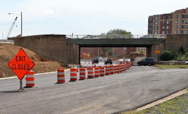
Through August, when construction of a new bridge is expected to be completed, eastbound Route 50 drivers heading to Courthouse will have to drive past Courthouse and take the Rhodes Street bridge to 14th Street.

Drivers in Courthouse seeking to get on to eastbound Route 50, who used to be able to use the Courthouse Road bridge, will now have to take the Rhodes Street bridge to the Arlington Boulevard service road that leads to the difficult blind merge with Route 50 near the U.S. Marine Corps (Iwo Jima) memorial. Temporary traffic lights have reportedly been placed at the Arlington Boulevard/N. Meade Street intersection, before the entrance ramp, to help with traffic flow.

The bridge demolition is part of the $39 million Route 50/Courthouse Road interchange project. The project is scheduled for completion in October.


Courthouse Road bridge over Route 50

(Updated at 2:15 p.m.) The heavily-used Courthouse Road bridge, which connects Courthouse with eastbound Route 50, will be torn down in two weeks.

The bridge is expected to close on Friday, Jan. 25. VDOT is planning to block and reroute westbound I-50 in the Courthouse area from Jan. 26-27 to allow for the bridge demolition work. That weekend, westbound traffic will be directed around the closure via 14th Street, Wilson Boulevard, Washington Boulevard and 10th Street.

From Jan. 25 to late August, when construction of a new Courthouse Road bridge is expected to wrap up, drivers trying to get from eastbound Route 50 to Courthouse will have to drive past the former bridge and instead take the N. Queen/Rhodes Street bridge, turning left on 14th Street to eventually reach Courthouse Road.

The bridge demolition is part of the $39 million Route 50/Courthouse Road interchange project. The project is scheduled for completion in October.

Photo courtesy (bottom left) Keith Hall

Work on the Courthouse Road bridge (photo courtesy Keith Hall) VDOT map depicting Courthouse Road bridge demolition and detour


Construction will close the righthand lane of eastbound Columbia Pike in the area of the Washington Boulevard bridge through 2014.

VDOT will close the lane as soon as tomorrow as part of the ongoing Washington Boulevard bridge and interchange project. Drivers should expect new traffic patterns on eastbound Columbia Pike as a result.

“Motorists in the right lane must take the exit ramp to Washington Boulevard,” VDOT said in a press release. “Motorists on eastbound Columbia Pike can use the left lane to continue east or to access the ramp to Washington Boulevard.”

The closure is expected to be in place through 2014. The overall project is expected to be completed in the summer of 2015.

Photo via Google Maps


State transportation officials say that despite the effects from Superstorm Sandy, a total closure of Columbia Pike at Washington Boulevard is still planned for this coming weekend.

The Pike will be closed between S. Quinn Street and S. Orme Street from 9:00 p.m. on Friday, Nov. 2 to 4:30 a.m. on Monday, Nov. 5. The closure will be in place while crews demolish part of the Washington Boulevard bridge over the Pike as part of VDOT’s ongoing interchange project.

“Motorists on Columbia Pike will follow detour signs as will motorists heading from Washington Boulevard to Columbia Pike,” VDOT said in an email. “The closure is part of the bridge replacement project at Washington Boulevard (Route 27) and Columbia Pike. Visit the VDOT project page for more information.”


View More Stories