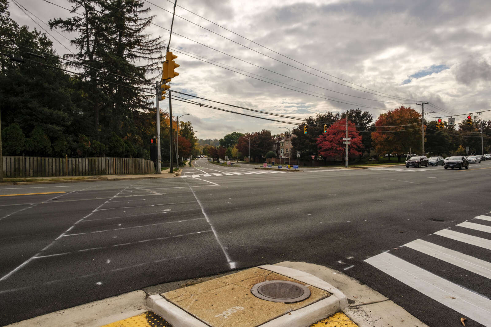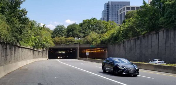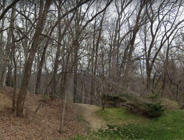
A trail leading to VDOT-owned land near Chain Bridge Forest (via Google Maps)

(Updated at 9:15 a.m. on 7/12/23) A secluded wooded area south of Pimmit Run in North Arlington with a little-known history is up for sale and Arlington County could become the buyer.

The county is considering whether to buy a 6.7-acre parcel near the Chain Bridge Forest neighborhood from the Virginia Dept. of Transportation for $2.88 million. The property, between a curving section of N. Glebe Road and Pimmit Run, includes both developable and protected land.

VDOT originally intended to use it for a connector road from N. Glebe Road to Route 123 (Chain Bridge Road) in Fairfax County, which it never built, the county says. It now is giving Arlington first dibs before turning to private buyers. Should the sale go through, the county would set the land aside for public open space.

The property in question sits within the historic boundaries of a near-forgotten settlement by freed Black people who worked the land from the 1850s to the 1950s, according to the county and Jessica Kaplan, a local expert on and author of a definitive 2018 article about the community.

Kaplan pieced her article together from census data, deeds, wills, maps and claims residents made against the government for property it confiscated during the Civil War.

The settlement grew after John Jackson, a free Black man, bought three acres from white landowner William Walker, who he had known since childhood, shortly before the Civil War broke out, Kaplan writes. She says it is unclear if he sold to Jackson because of their friendship or because white people were not interested because it was a low-lying, flood-prone area.

Despite those issues, Jackson went through with the purchase. Walker’s initial sale sparked a small exodus of Black families — who had either escaped slavery, bought their freedom or were born free — from Fairfax County to what is now Arlington.

In what may be a riff on the problems with the land, residents called it “The Bottom,” Kaplan writes. At its peak, 20 families lived there.

“Whether [leasees] or owners, they found relative safety in numbers and in the secluded, timber-lined hollow of The Bottom,” she said. “The Bottom remained their home through challenging times: war, Reconstruction, Jim Crow, segregation, and suburbanization.”
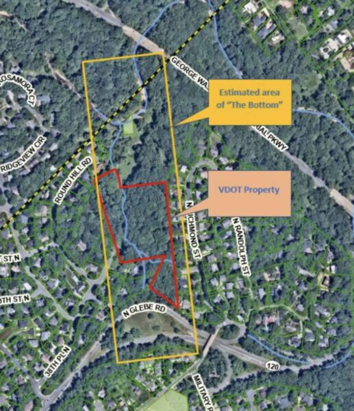
The presumed borders of The Bottom and the VDOT property within it (via Arlington County)

Residents eked out a living farming, tending livestock and quarrying stone, she said. During the Civil War, men helped build nearby Fort Marcy and Fort Ethan Allen while women sold baked goods and did laundry for soldiers. Some of the Union soldiers, however, raided their farms and burned the land for fuel.

With paltry government repayments for confiscated property, the families built back after the war, Kaplan wrote. They farmed, quarried stone and worked for nearby white families. Their children walked three miles to attend the closest school for Black children, then called Sumner School.

The enclave dwindled to non-existence in the 1950s as residents died, moved to other Black neighborhoods in Arlington such as Halls Hill, or left the area. Economic pressures were compounded by access: Arlington County abandoned a road running along The Bottom’s west side and circumvented it with the new N. Glebe Road to Chain Bridge.

Investors ended up owning all the land comprising The Bottom, eventually selling to the U.S. government. Kaplan says the community “became the anchor for an overpass of the George Washington Memorial Parkway.”  (more…)


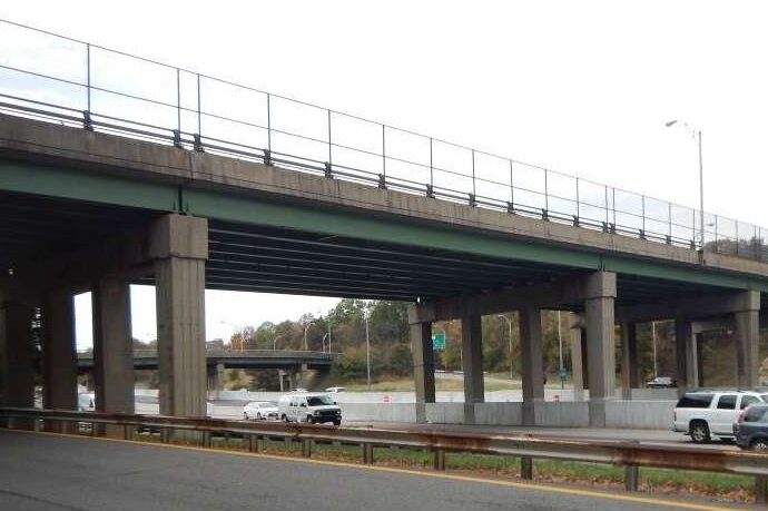
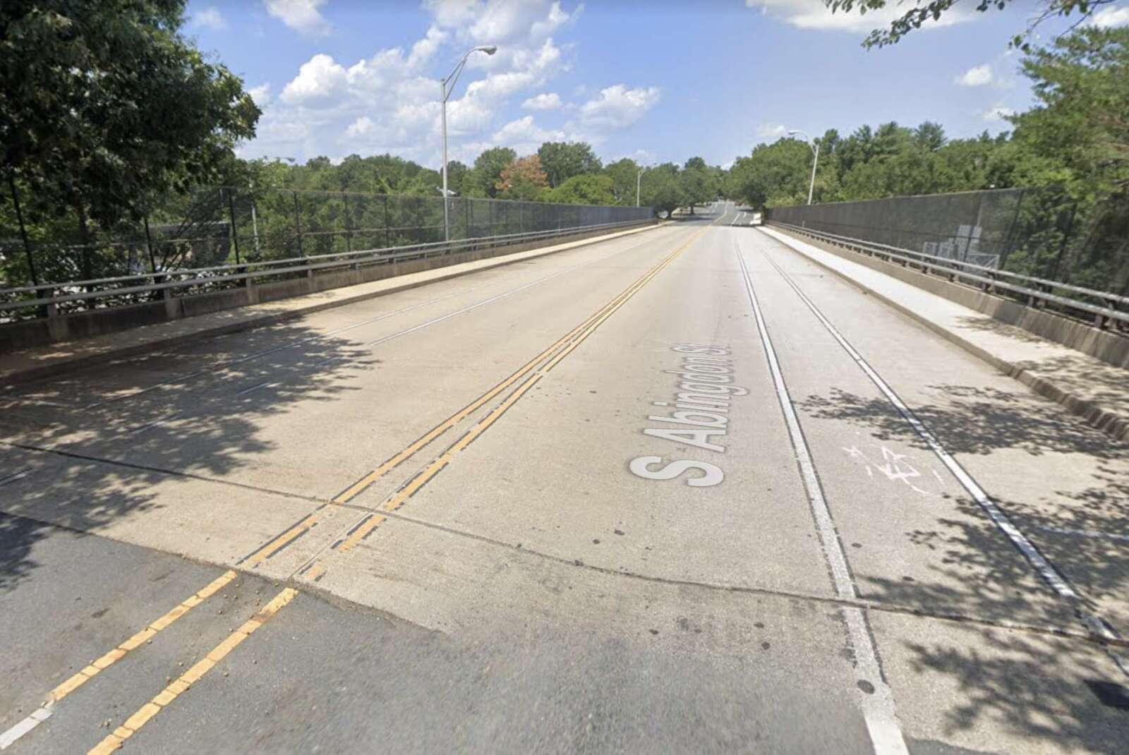
Work is underway to make a 53-year-old bridge S. Abingdon Street bridge over I-395 safer and extend its overall life, per the Virginia Dept. of Transportation.

The 53-year-old bridge is located between the I-395 interchanges for King Street and Shirlington Circle in the Fairlington neighborhood. It was last rehabilitated in 1994 and is in need of attention, according to a press release from the state transportation department.

The planned repairs will use $8.4 million in federal and state funding and will wrap up in late 2024, the press release said.

Work includes rehabilitating the bridge deck, repairing deteriorating concrete, replacing all steel bearings and eliminating bridge joints, per a project overview video.

Arlington County also identified S. Abingdon Street, from 34th Street S. to Fire Station 7, for resurfacing. It is coordinating with the state on those changes, including a buffered bike lane to improve the cycling experience and narrower travel lanes to manage vehicle speeds.

Bridge deck rehabilitation work will last about 12 weeks and occur in three stages, the video says.

In the first phase, all traffic will be shifted to the east side of the bridge, with two shared bicycle and traffic lanes and one five-foot-wide sidewalk. A temporary crosswalk will be added near 36th Street S. In the second phase, all traffic will be shifted to west side of the bridge.

In the third stage, traffic will be split on both sides of the work zones and the crosswalk will be removed.

“When one sidewalk along the bridge is closed, pedestrians will be detoured to the sidewalk on the opposite side,” VDOT said in the press release. “Drivers, bicyclists and pedestrians are reminded to use caution when traveling in active work zones. Be alert to new traffic patterns and limit distractions.”

The I-395 main and express lanes may see periodic daytime and overnight lane closures, VDOT says.

“Most of the work below the bridge will be performed during nighttime operation to avoid impact to normal daytime traffic particularly peak hour traffic,” the project video says.


A sewer repair company put a price on dealing with federal and state agency permitting processes and working on high-traffic roadways.

That price tag is just over $2.6 million.

Arlington County is poised to pay that extra sum, conceding that the location of the project in question presents “unique challenges.”

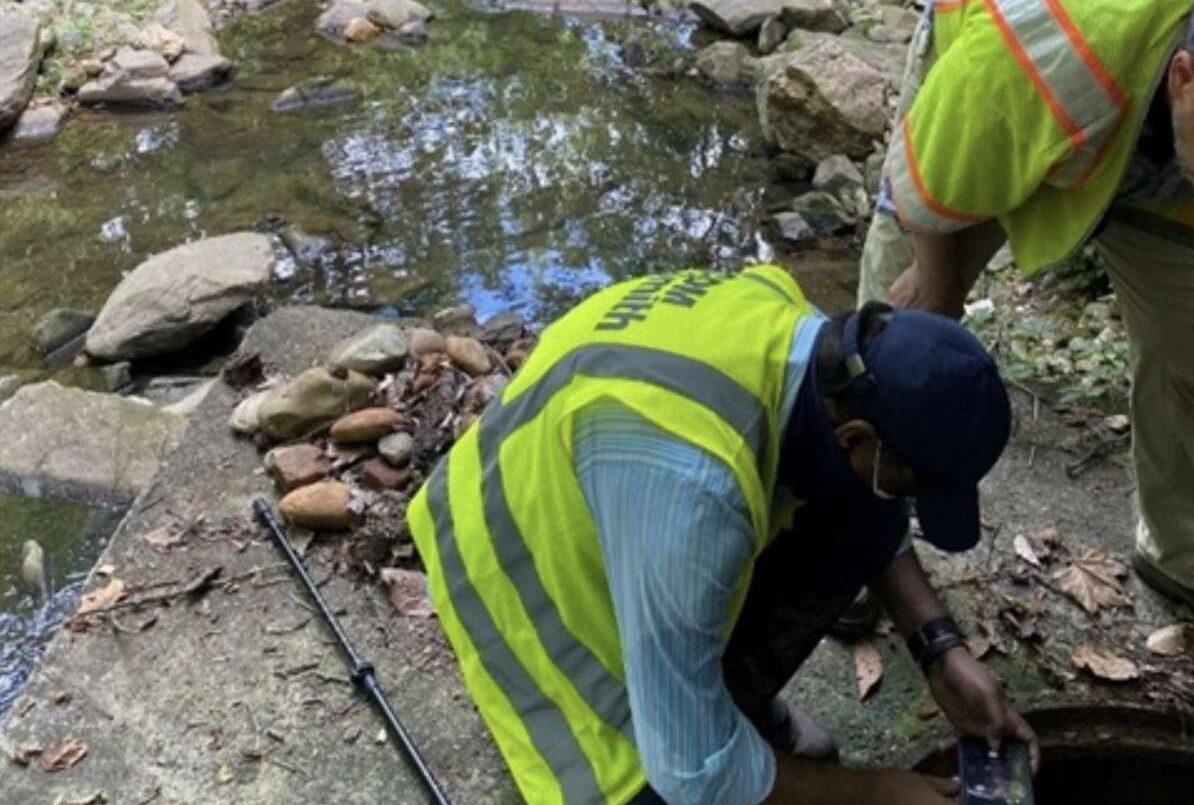
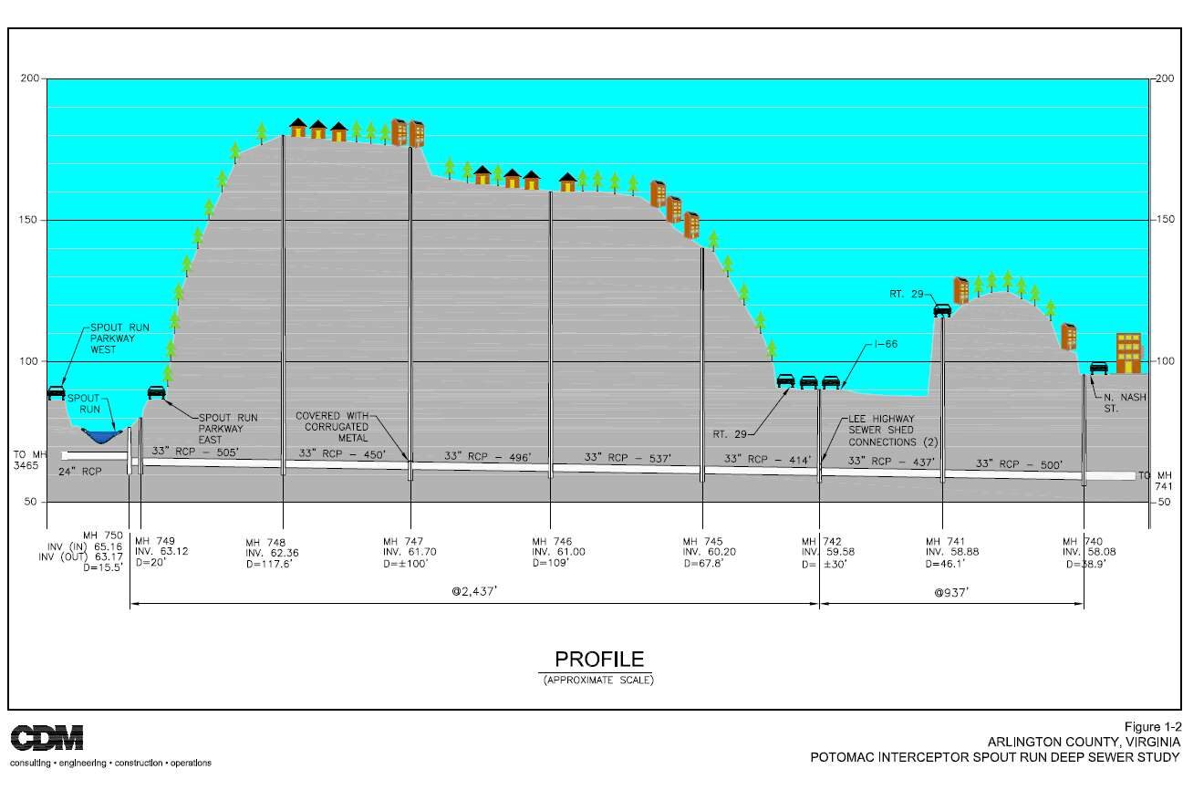
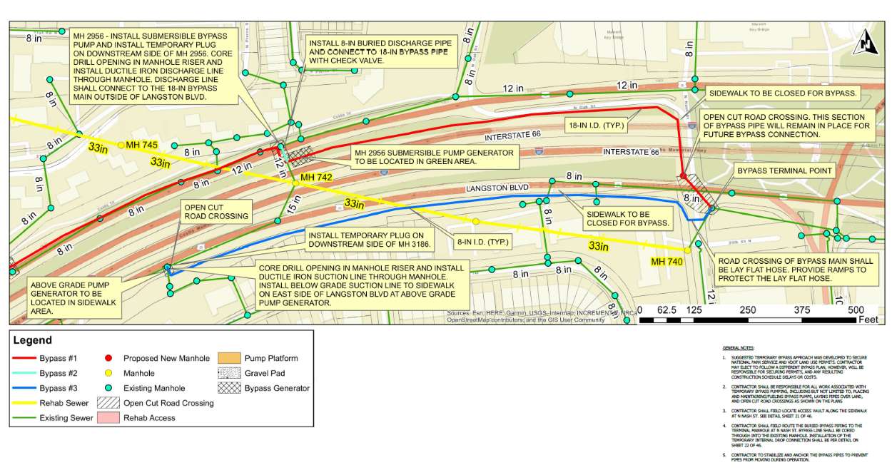
To repair an “essential part” of the county’s sanitary sewer system — dubbed the Spout Run Deep Sewer Line — the selected contractor, AM-Liner East, will have to navigate distinct permitting processes and regulations for the National Park Service and the Virginia Dept. of Transportation.

This pipe carries “a significant amount of flow” from federally protected land, and along Langston Blvd and I-66, with the pipe reaching depths up to 115 feet below ground, according to the county.

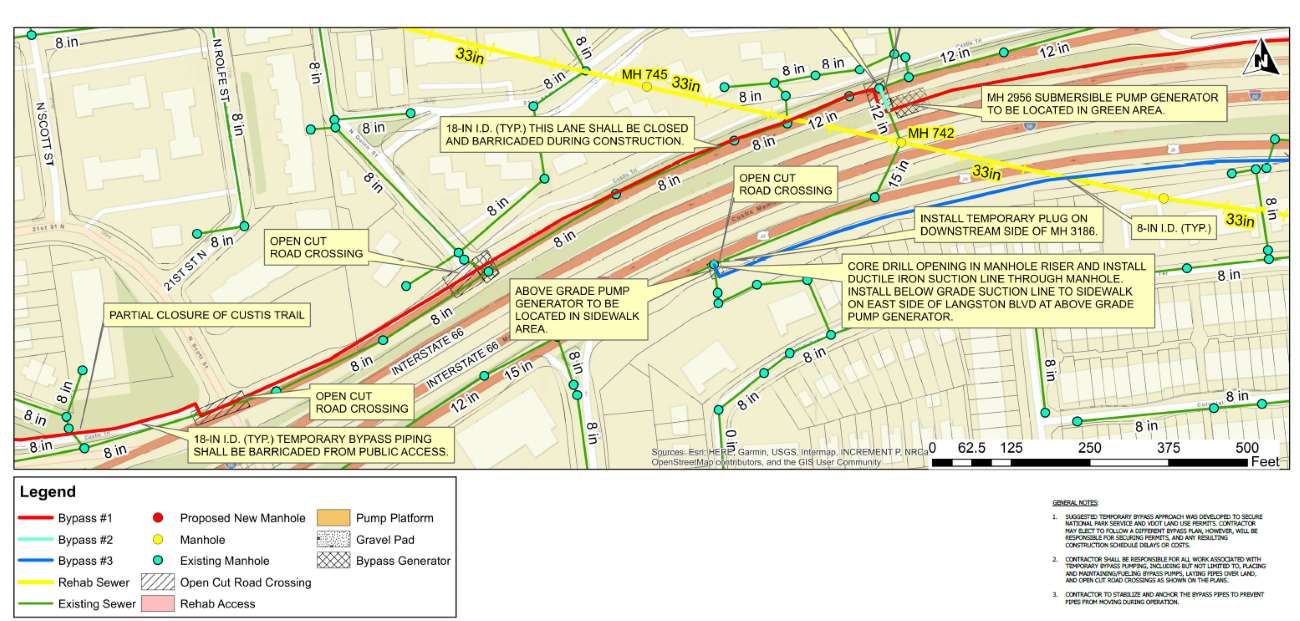
After getting permission from NPS to work on protected parkland, the contractor will seek state permission once it hits I-66. It will be working on a narrow median and shoulder of I-66 and multiple travel lanes in both directions on Langston Blvd.

“It is believed that the bidders perceived significantly more risk in these bid items, which County staff consider fair given the unique challenges of this project area,” per the report.

For these reasons, AM-Liner East — the lowest responsible bidder — still exceeded expected project costs of $5.3 million. The Arlington County Board is scheduled to approve a $7.9 million contract, plus a $1.2 million contingency “for change orders or increased quantities,” at its upcoming Saturday meeting.

The proposed project generated what the county described as significant interest from nine contractors specializing in trenchless sewer rehabilitation. Only two bid on the project, however — a testament to its perceived challenges.

“For the work on federal lands and in VDOT right-of-way, the contractor will have to comply with restrictive NPS and VDOT permit requirements, respectively, and perform all restoration as per each agency’s specifications, which differ greatly from each other and from the County’s specifications,” the report said.

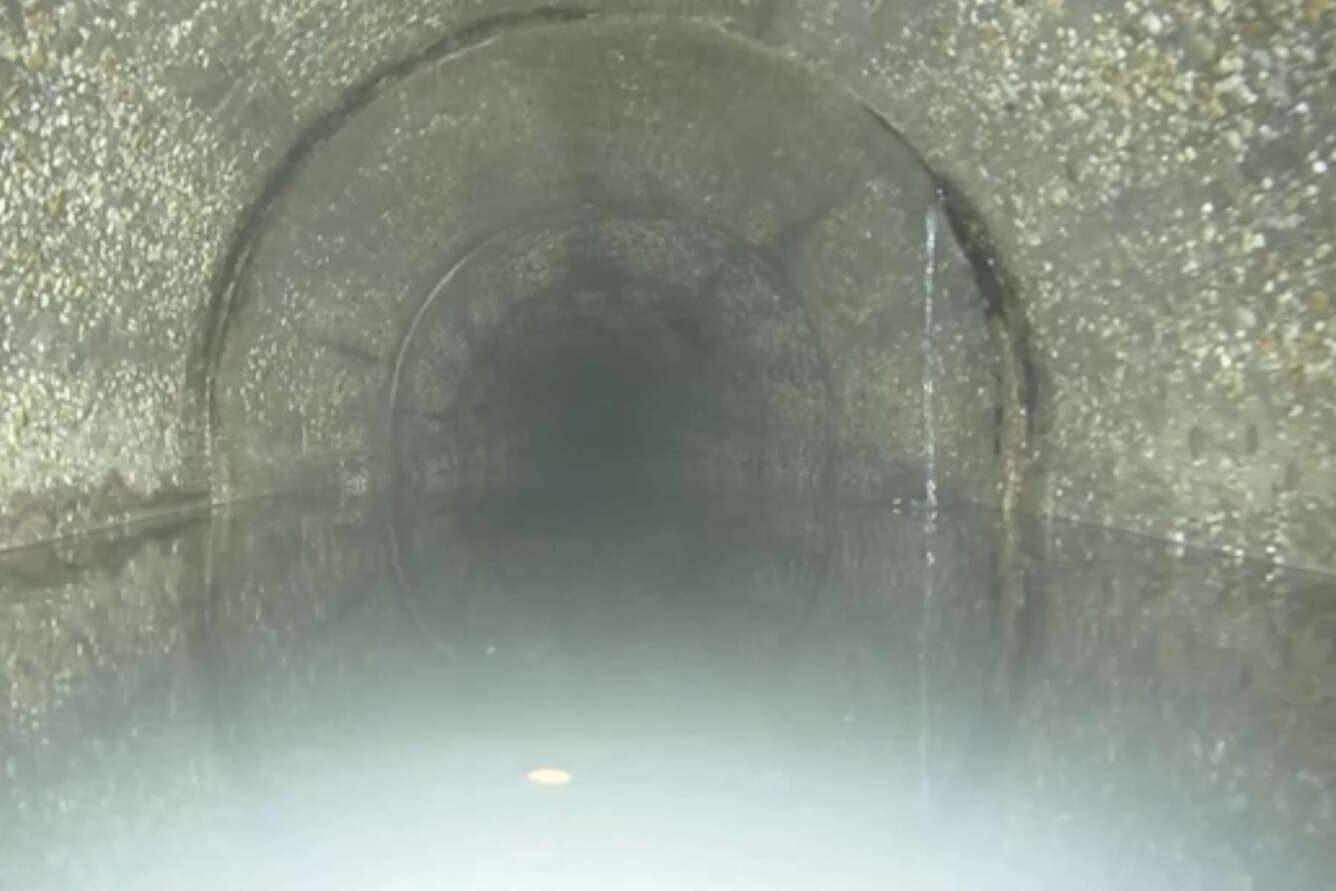
Arlington County says it identified this 86-year-old sewer line for repair in 2019 after a video inspection “revealed corrosion of the concrete pipe, indicated by exposed aggregate, exposed reinforcing steel, infiltration at the pipe joints, and small cracks.”

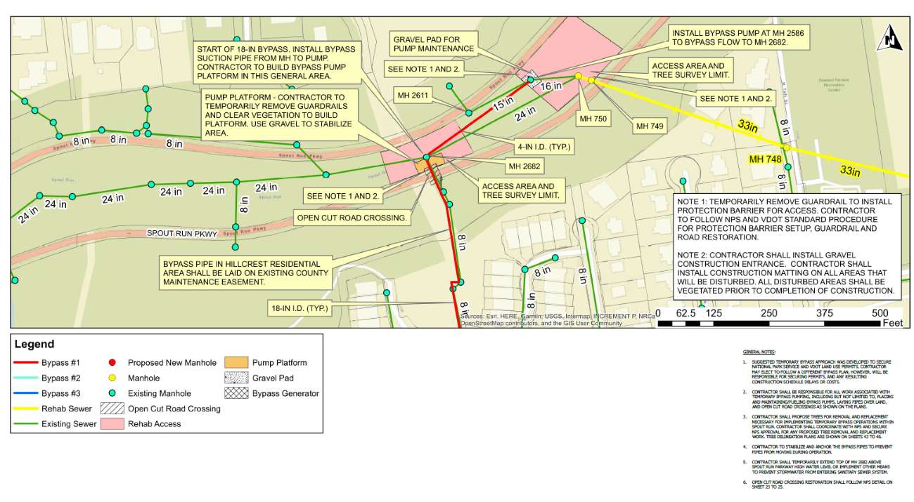
The project is part of the county’s program to rehabilitate critical large sewers, which are part of Arlington’s 465-mile sanitary sewage system. This project will start at Spout Run, north of the N. Courthouse Road cul-de-sac and end at N. Nash Street.

“This intricate network exists to make sure that the wastewater that gets flushed every day from homes and businesses makes its way to the Water Pollution Control Plant where it’s properly cleaned and treated before being recycled back into the environment,” the project webpage says.

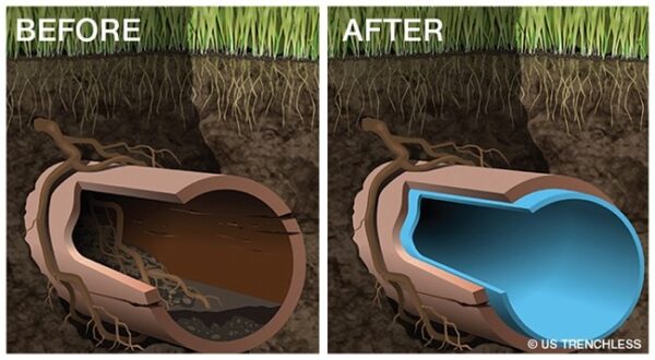
For this project, AM-Liner East will use a trenchless technology known as cured-in-place pipe lining, which is seen as a relatively quick way to fix pipes with little or no digging involved.

A flexible liner is inserted into the pipe, inflated and exposed to heat or ultraviolet light to harden it and create a new, smooth surface inside.

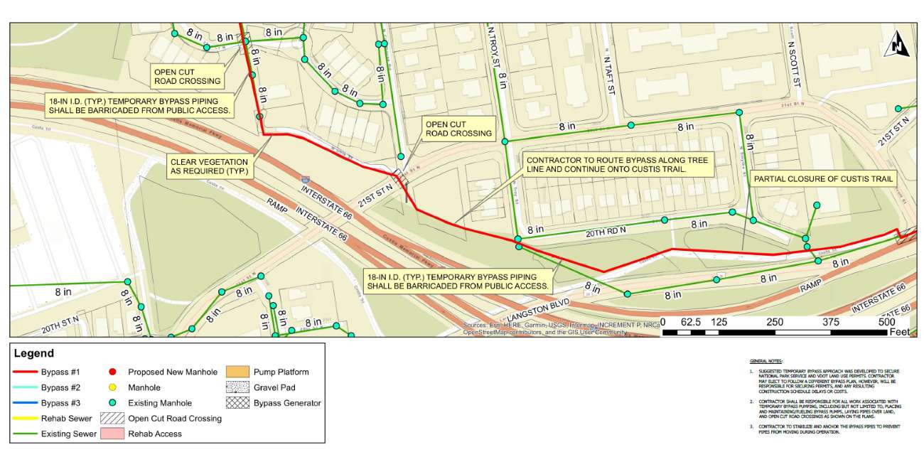
To ensure this is done without disrupting existing flow, the contractor will install a temporary bypass. The bypass will be above-ground through residential grass areas along N. Uhle St, the Custis Trail and one lane of Langston Blvd. It will go underground near street crossings, such as at N. Scott, N. Quinn and N. Nash streets.

How the trenchless pipe repair technology ‘cured-in-place-piping’ works (via Arlington County)

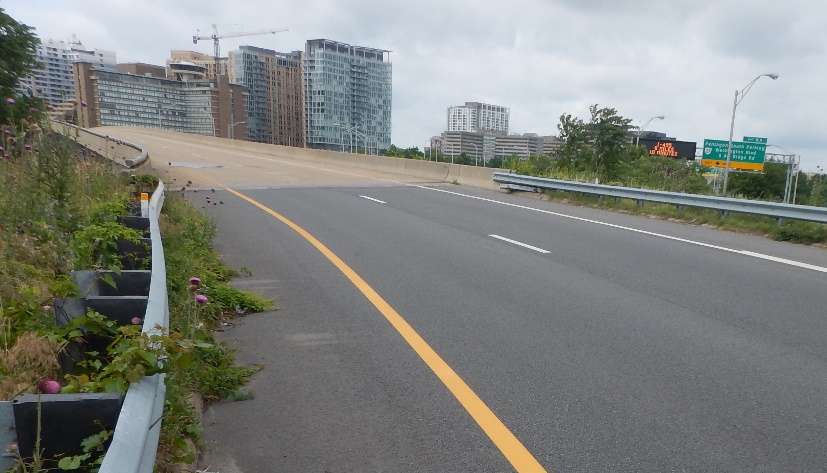
Repairs are in progress on the bridge that takes traffic from southbound I-395 to Route 1 in the Crystal City area.

The $4 million Virginia Dept. of Transportation project will “improve safety and extend the overall life of the bridge,” which was originally built in 1976.

More from a VDOT press release:

Repairs are underway on the weight-restricted (20 tons) southbound I-395/Route 1 Exit 8C bridge, according to the Virginia Department of Transportation. The project will improve safety and extend the overall life of the bridge, which carries southbound Route 1 over the 395 Express Lanes, the northbound I-395 general purpose lanes and northbound Route 110.

The project includes retrofitting and spot painting structural steel, and replacing the catcher beam system and strip seal at the joint.

During the project, some day and overnight single-lane closures may be scheduled, along with occasional overnight full closures of the bridge with detours.

The bridge, which was originally built in 1976 and rehabilitated in 1999, is about a fifth of a mile long and averages 20,000 vehicles a day.

The $4 million project is financed with federal and state funding and is scheduled for completion in late 2023. […]

Drivers are reminded to use caution when traveling in active work zones. Be alert to new traffic patterns and limit distractions.

The entrance to the bridge has been the scene of numerous crashes caused by drivers trying to exit across multiple lanes at the last second, as documented by public safety watcher Dave Statter.


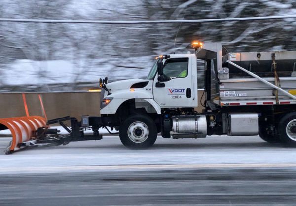
VDOT snow plow spreading salt on N. Glebe Read in 2021 (staff photo)

(Updated at 3:45 p.m.) A major storm affecting most of the eastern U.S. and midwest is set to ramp up tomorrow, making for hazardous holiday travel.

Ahead of the storm, the Virginia Dept. of Transportation sent a clear message this afternoon: start your trip now, if you can.

The storm will mostly bring the D.C. area copious amounts of rain starting Thursday morning, along with gusty winds and bitter cold temperatures on Friday. Frozen precipitation beyond some possible snow flurries is not expected in Arlington, but points west and north will likely see snow, sleet and freezing rain.

Along I-81 and the Blue Ridge, the storm is expected to be a high-impact event, and travel on Thursday is “not advised,” VDOT says.

More from a VDOT press release, below.

The Virginia Department of Transportation (VDOT) is advising motorists traveling in and through Virginia to adjust their holiday travel ahead of winter weather expected in parts of the Commonwealth beginning Wednesday night and continuing through Friday.

Travelers are advised to shift holiday travel to Wednesday if possible. Travel on Thursday is not advised, especially through the western regions of Virginia along the Interstate 81 corridor, to avoid potentially hazardous conditions created by forecasted winter weather.

According to current forecasts, wintry precipitation is expected to arrive as soon as 11 p.m. on Wednesday, Dec. 21 in the southwestern regions of the state, and move northward through the western third of the state, and into portions of northern Virginia through Thursday. Periods of heavy snow are expected along the northern sections of I-81 and the mountain passes including Interstate 64 over Afton Mountain and Rt. 33 between Standardsville and Harrisonburg early Thursday. Temperatures are expected to drop rapidly through the day on Friday leading to the potential for refreeze in areas where the pavement remains wet.

VDOT crews are pretreating roadways and interstates today in anticipation of the weather event.

With extreme low temperatures expected to move in Friday, motorists, if traveling, should pack an emergency kit and blankets, and have mobile devices fully charged in the event of a breakdown or emergency.

“Please continue to monitor forecasts closely as forecasts can improve or worsen quickly,” VDOT said in a separate advisory. “Drivers should expect roads to be impacted Thursday and Friday… Treat anything that looks wet as if it could be icy, especially bridges, ramps, overpasses, and elevated surfaces. If there is snow or ice on roadways, travel is hazardous.”

The transportation agency is currently pretreating roads and “will begin deploying trucks early Thursday morning to treat roads as needed.”

“Adjust travel plans and avoid all nonessential travel during the height of the storm,” VDOT said “This helps to avoid deteriorating conditions and to allow crews room to work.”

A Flood Watch, meanwhile, has been issued for the D.C. area ahead of the rain.

322 PM EST Wed Dec 21 2022

…FLOOD WATCH IN EFFECT FROM THURSDAY MORNING THROUGH LATE THURSDAY NIGHT…

* WHAT…Flooding caused by excessive rainfall is possible.

* WHERE…DC and portions of Maryland and northern Virginia, including the following areas: District of Columbia. In Maryland, Anne Arundel, Cecil, Central and Southeast Howard, Central and Southeast Montgomery, Prince Georges, Southeast Harford and Southern Baltimore. In northern Virginia, Arlington/Falls Church/Alexandria, Fairfax and Prince William/Manassas/Manassas Park.

* WHEN…From Thursday morning through late Thursday night.

* IMPACTS…Excessive runoff may result in flooding of rivers, creeks, streams, and other low-lying and flood-prone locations. Flooding may occur in poor drainage and urban areas.

* ADDITIONAL DETAILS…
– Moderate rainfall is expected Thursday into Thursday evening, with rainfall totals of one to two inches. This may lead to isolated instances of flooding, especially in urban and poor drainage areas.
– http://www.weather.gov/safety/flood

PRECAUTIONARY/PREPAREDNESS ACTIONS…

You should monitor later forecasts and be alert for possible Flood Warnings. Those living in areas prone to flooding should be prepared to take action should flooding develop.

VDOT released the following timeline of expected conditions in Northern Virginia and western zones through Christmas.

(more…)

Ice / freezing rain on windshield (file photo)

Arlington Public Schools will open on a two-hour delay on Thursday due to expected freezing rain, the school system just announced.

APS follows Fairfax County Public Schools in announcing a two hour delay tonight. Other Northern Virginia districts have announced weather plans ranging from two hour delays to closures.

From APS:

CODE 2: All APS schools and offices will open two hours late Thursday, Dec. 15. The Extended Day program will also open two hours late and morning field trips are canceled. Custodial and maintenance staff and food service workers should report to work at their regularly scheduled time. All other employees should report to work two hours past their usual start time. For updates about Pool Operations, go to www.apsva.us/aquatics. For information about Arlington County operations go to www.arlingtonva.us.

More on the storm timing from the National Weather Service:

Metro, meanwhile, said today that it’s tracking the weather and will respond to hazardous conditions as necessary.

Metro is keeping an eye on the sky and advising customers to be prepared for potential service impacts to Metrobus service tomorrow, December 15, if icy conditions materialize.

Metrobus plans to provide regular scheduled service tomorrow. However, if road conditions are observed to be hazardous, Metrobus customers may experience delays or detours as outlined in Metro’s light snow plan, which adjusts service on a route-by-route basis to keep buses off of steep hills, narrow roadways, and other challenging route segments during inclement weather.

Customers can review planned detours in advance to see how their service may be affected by clicking here. If conditions require that a route be detoured, customers will be notified via MetroAlerts email and text messages. Customers are also encouraged sign up for MetroAlerts and to follow @wmata, @metrobusinfo, and @metrorailinfo on Twitter for the latest service information.

Customers should allow additional travel time and use caution on platforms, escalators, parking lots and other areas that may be slippery.

Elsewhere across the system, Metrorail is expected to operate on a normal weekday schedule. MetroAccess will operate normally, with extra travel time possible based on road conditions.

VDOT is encouraging drivers to stay off the roads after the frozen precipitation starts falling overnight.

Motorists should avoid travel as frozen precipitation will create icy roadway conditions in portions of the Commonwealth tonight and tomorrow morning. Pavement temperatures will be at or near freezing levels. Temperatures will drop overnight and could cause treacherous conditions during the morning commute, primarily in the northern, northwestern and parts of central Virginia. As a reminder, bridges, overpasses and shaded areas tend to freeze first.

Freezing rain is forecasted to begin around 9 p.m. tonight in northwest Virginia and will continue through the morning.

Most Virginia Department of Transportation (VDOT) crews did not apply liquid pretreatment to roads in areas where the event is forecasted to start as rain, as the pretreatment application will wash away and be ineffective. VDOT crews are ready to treat roadways with salt, sand and abrasives once icy conditions begin to develop. Wreckers are pre-staged along certain routes and tree crews are available to handle downed trees.

Motorists should be vigilant, pay attention to weather forecasts in areas where they plan to drive, and delay travel in the impacted areas.


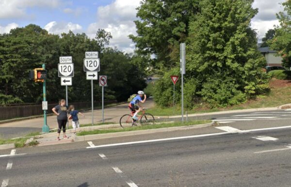
A cyclist and pedestrians near Route 50 (via Google Maps)

A number of options have emerged for upgrading an iffy portion of the Arlington Blvd Trail.

Engineers found it would be possible to accommodate a trail up to 11 feet wide with buffers and guardrails, between the bridge to Thomas Jefferson Middle School and George Mason Drive. That could be accomplished by narrowing a few on- and off-ramps, closing slip lanes and reducing the number of thru-lanes and turn lanes in some places.

This summer, Arlington County asked trail users how they feel navigating the 1.3-mile stretch of the trail, which runs along the busy and congested six-lane Route 50. Many said they feel unsafe due to bicycle, pedestrian and vehicle conflicts and the lack of buffer between the trail and vehicle travel lanes.

“It’s not very welcome to users. It feels narrow, it’s not continuous and there are poor pavement conditions,” Arlington County transportation planner Bridget Obikoya said in a Nov. 17 meeting. “We want to develop design concepts that improve the existing conditions, such as widening key pinch points and removing barriers and obstructions, improving connectivity and making the trail overall a much more pleasant place to be.”

Over the years, several plans have recommended improvements to the Virginia Department of Transportation-owned trail, which runs east-west from D.C. through Arlington to Fairfax County and bisects a 16-mile bike loop ringing the county.

The 2022-24 Capital Improvements Plan allocated $200,000 to study potential intersection improvements and accessibility upgrades to the area, which has a number of destinations: Thomas Jefferson Middle School and community center, Fleet Elementary School, the National Foreign Affairs Training Center, the Columbia Gardens Cemetery and several churches.

Despite these features, there isn’t much of a trail, and sidewalks are not continuous, says Jim Sebastian, an engineer with Toole Design, a firm that studied the corridor and developed the proposed changes.

“It is challenging, but it’s also exciting thinking about some of the improvements we can make to allow biking and walking to be a little more safe and comfortable,” Sebastian said.

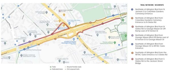
The 1.3-mile stretch was broken into seven segments, four on the north side of Route 50 and three on the south side.

Segments of the Arlington Blvd Trail that could get upgrades (via Arlington County)

All but one segment has two proposed alternatives, and details of these proposed alternatives can be found in a presentation and explained in a recorded online meeting.

Residents can share their feedback on the proposed alternatives through Monday, Dec. 5. There will be pop-up events along the trail corridor, hosted by the county and local churches and other community destinations.

“This is extremely preliminary,” Nate Graham, a DES public engagement specialist, said in the Nov. 17 meeting. “This is an opportunity… to hear what parts you prefer and develop some combination of first and second alternatives between these seven segments to meet the goals of this project and serve the needs of the community.”

The study found that accommodating the trail, along some segments, could require changes to vehicle traffic.

For instance, between Glebe Road and George Mason Drive, one alternative calls for the closure of the off-ramp slip lane west of N. Thomas Street. The connection between the service road and George Mason Drive would also be closed, with traffic rerouted up to N. Trenton Street.

(more…)


The parking garage over I-66 near Ballston is falling apart and needs repairs, says the Virginia Department of Transportation.

The garage sits above I-66 between N. Stafford and Quincy streets, next to Washington-Liberty High School. It serves as the primary parking area for the school and is the site of a seasonal flea market, called the Arlington Civitan Open Air Market.

VDOT has launched a public engagement period to brief locals on the garage’s deteriorating condition and the $2.7 million in planned improvements. Through next Monday, Nov. 7, people can provide comments online in a survey and by email or postal mail.

The state transportation department says it aims to minimize traffic disruptions and keep most parking spaces available during construction. VDOT expects to send out the project for bid next summer and to start work in the fall of 2023, with construction wrapping up in about six months.

“The purpose of this project is to address various conditions identified through routine inspections that are likely to deteriorate further if not repaired soon,” a VDOT staff member said in a presentation. “Delaying action could allow some of them to become critical requiring much more extensive, expensive and disruptive repairs down the road. The repairs will ensure the structure remains safe for all users for years to come.”

The garage was built in 1982, and since then, there has been no major work performed beyond routine maintenance, VDOT Communications Coordinator Mike Murphy tells ARLnow.

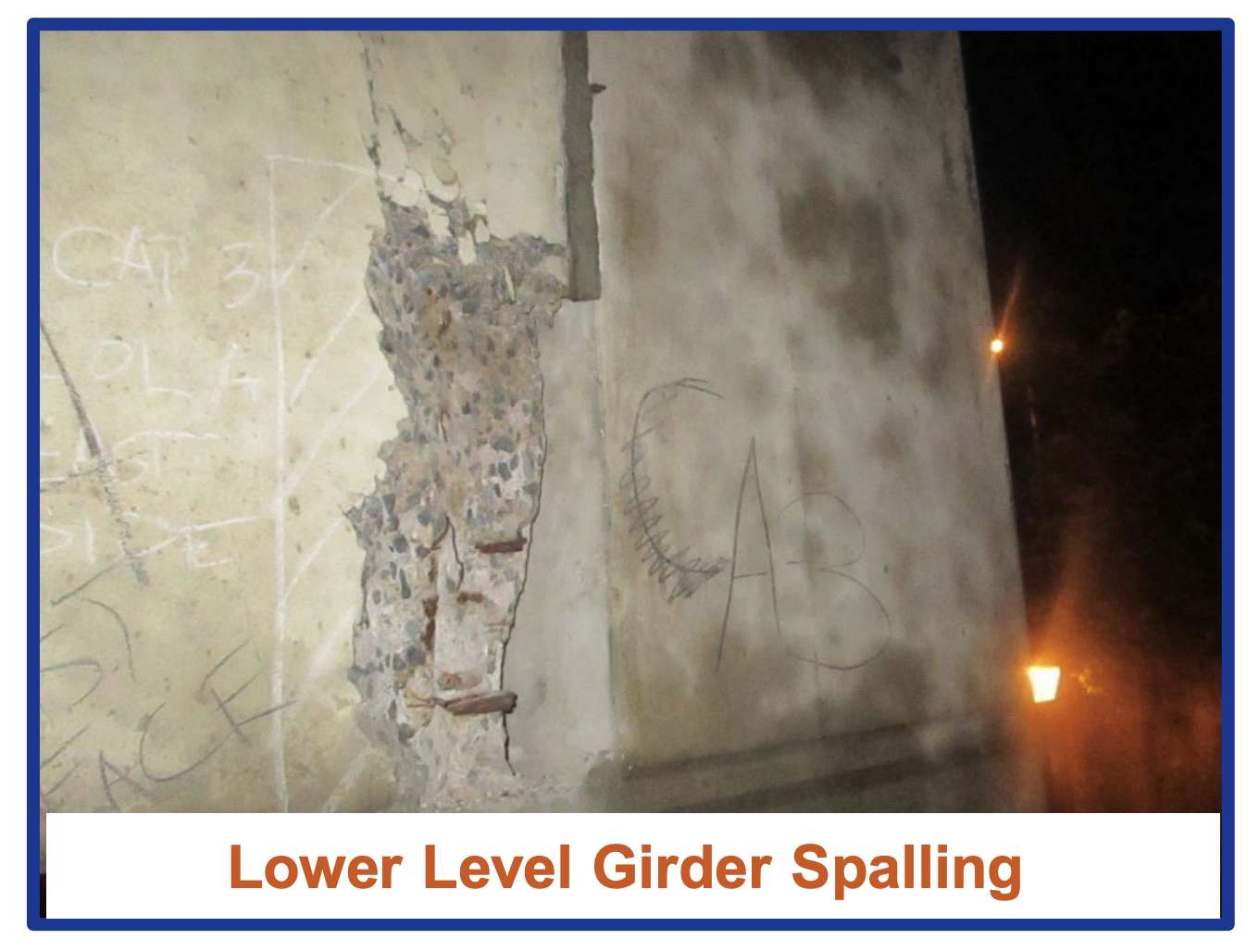
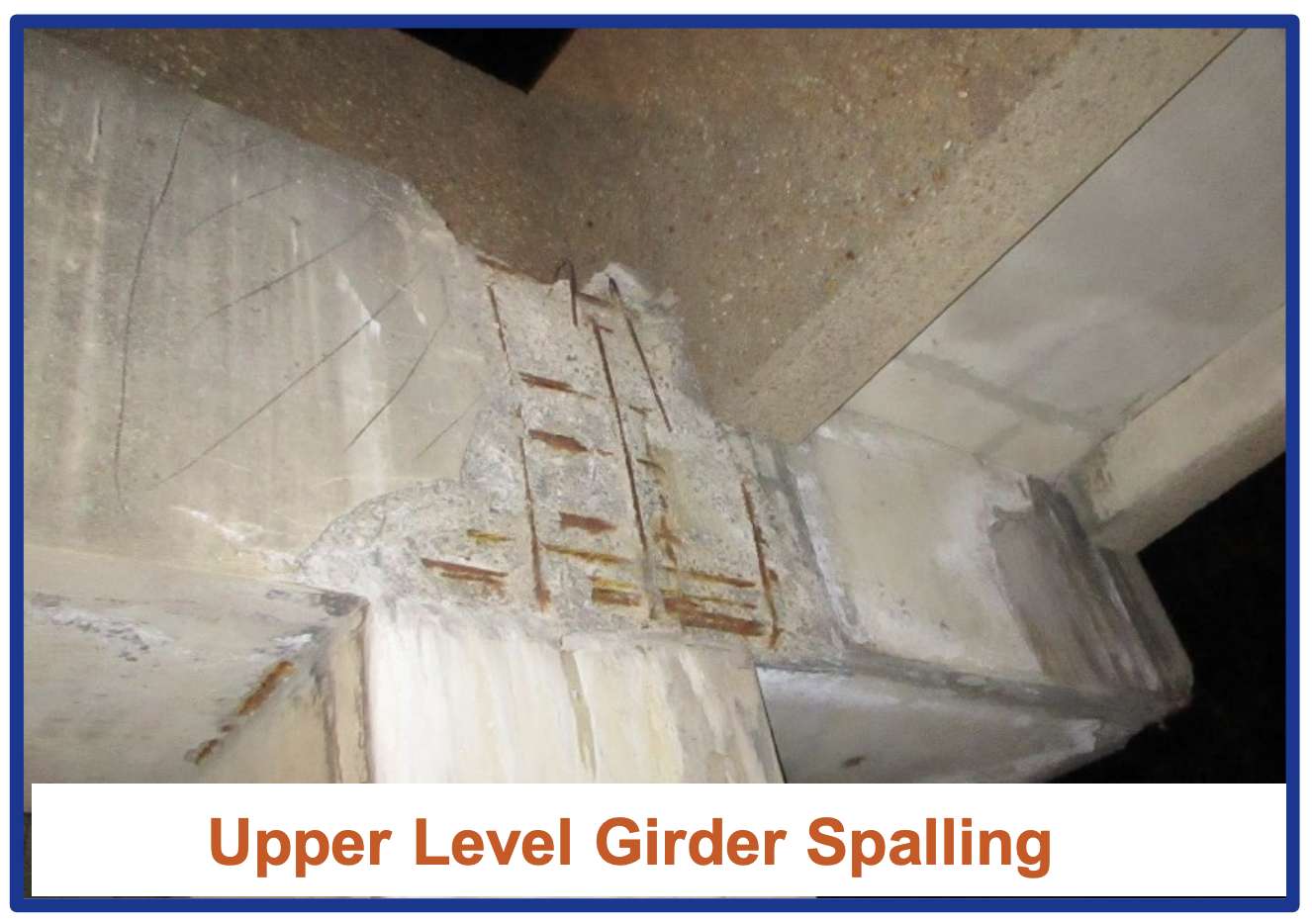
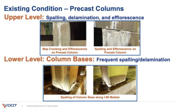
After 40 years of exposure to the elements — including cycles of freezing and thawing, anti-icing salts, and high temperatures — the garage’s columns and surfaces are worse for wear, according to the state transportation department’s presentation. The presenter said these signs of deterioration are typical of structures this age.

Slides showing deterioration of the I-66 overpass and parking lot (via VDOT)

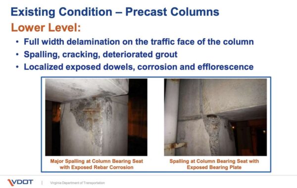
Some columns on the garage’s lower level need significant repairs to ensure its structural integrity, the presenter said. Leaking water has caused the reinforcing steel within the concrete to corrode, causing the concrete to break in flakes.

Slides showing deterioration of the I-66 overpass and parking lot (via VDOT)

In one phase of the project, traffic lanes on I-66 will be shifted to the outside lane and the shoulder to allow work along the median, per the presentation. Lane closures are expected to be limited to single lanes.

“The majority of repair work occurs on the lower level along I-66, which is isolated from parking areas of the garage,” the VDOT staff member said. “There will be no changes to local traffic patterns or pedestrian flow on N. Quincy Street, N. Stafford Street, or 15th Street N.”

No impacts to the Custis Trail — which runs parallel to I-66 under the garage — are anticipated at this time, Murphy said.


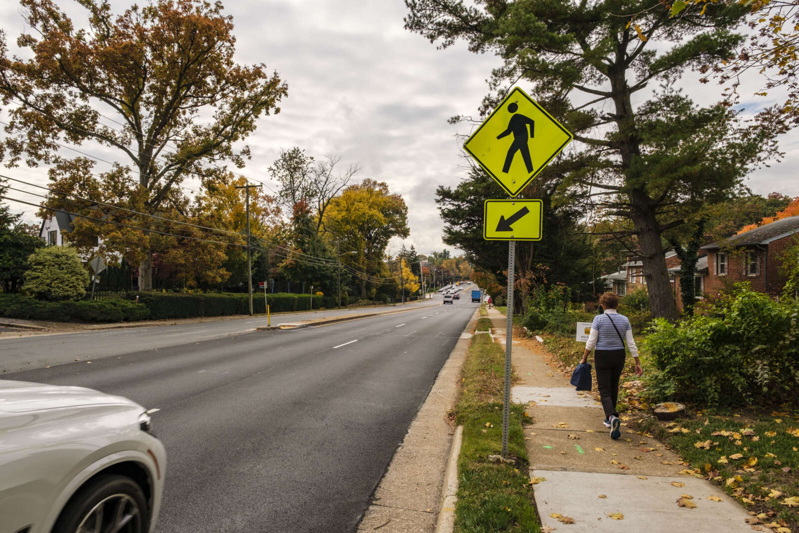
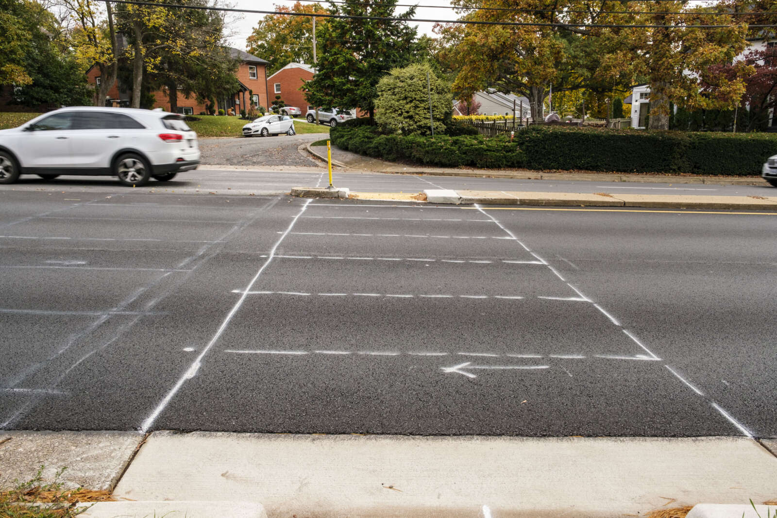
Unmarked or temporarily marked crosswalks along Langston Blvd are slated to be painted today (Friday), weather permitting.

The repainting activity comes nearly two months after the Virginia Department of Transportation paved Langston Blvd from Washington Blvd to N. Glebe Road, in East Falls Church, and from Military Road to N. Kenmore Street, in Cherrydale, according to a paving map.

VDOT, which manages the road, finished the repaving projects at the start of September, as part of its annual road repaving and repainting schedule.

According to the state transportation department, the lag between paving and painting is not uncommon.

“As the line painting contractors are different than the milling/paving contractors, sometimes schedules don’t line up as smoothly,” VDOT spokeswoman Ellen Kamilakis tells ARLnow.

Arlington County and some residents tell ARLnow they have raised concerns about the lag with state transportation department.

“VDOT is aware of our concerns and are working to complete the markings on Langston Blvd,” Arlington Dept. of Environmental Services spokeswoman Katie O’Brien said.

The repainting comes while pedestrian safety occupies the minds of Arlington County Board members, local advocates and residents. In recent months, drivers struck and killed two pedestrians: one woman near Thomas Jefferson Middle School was killed by an alleged drunk driver and a woman near Nottingham Elementary School was killed in a crash, which police are still investigating.

While VDOT repaves state routes, Arlington County does take advantage of the state’s schedule to consider changes to the streets under its purview through its Resurfacing for Complete Streets program, O’Brien said.

“For roadways maintained by VDOT, Arlington does coordinate with VDOT on improvements,” she said. “For example, this year VDOT will be adding crossing enhancements on Langston Blvd at our request.”

These include high visibility crosswalk markings, advance yield signs and markings, she says.

She added that the county coordinated with the state to “upgrade the two uncontrolled crosswalks at the intersections of Langston Blvd and N. Oakland Street and Langston Blvd and N. Nelson Street, as well as marking all side streets with high-visibility crosswalks instead of standard crosswalks.”

On Langston Blvd between Military Road and N. Kenmore Street, VDOT will be installing bike lane skip marks through intersections, high-visibility crosswalks along side streets and additional directional markings, according to the county’s first annual Vision Zero report, released this spring.

Arlington County is a year and a half into its Vision Zero initiative that aims to eliminate traffic fatalities and serious injuries. Between January 2021 and March 2022, the county updated 238 crosswalks to high-visibility crosswalks, according to the report.

It also “added new warning signage, pavement yield and high visibility crosswalk markings, and other minor improvements at 12 multilane crossing locations,” after a review of multi-lane crossings, per an August newsletter.


I-66 Rosslyn tunnel (photo courtesy VDOT)

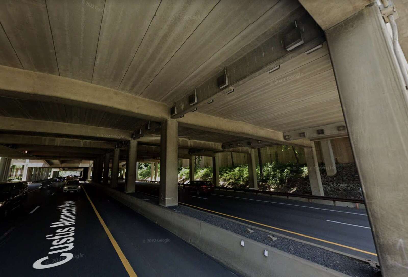
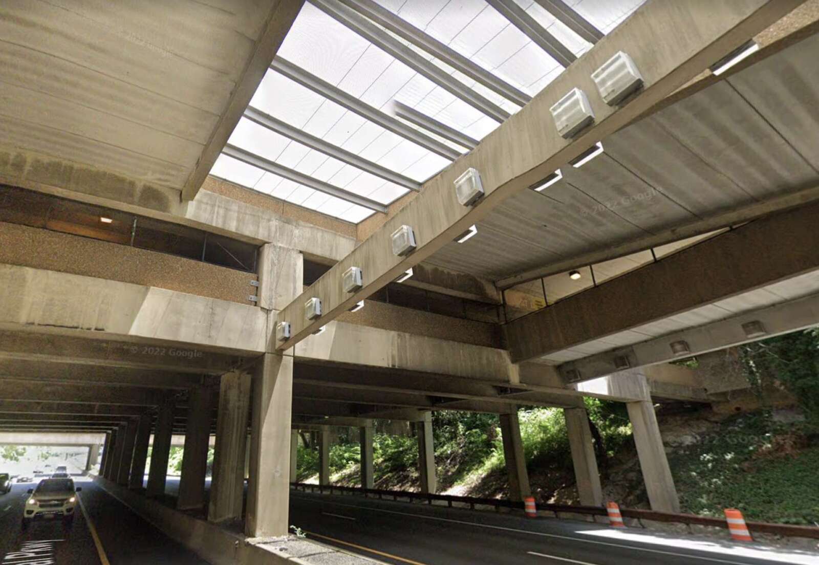
VDOT has kicked off work on its I-66 Rosslyn Tunnel Rehabilitation project.

The nearly $38 million project is expected to stretch well into 2025, retrofitting the tunnel under Rosslyn’s Gateway Park that was built some 40 years ago.

The construction will prompt some lane closures on I-66, but mostly during overnight hours.

More from a VDOT press release:

Construction is underway on the rehabilitation and improvements to the Rosslyn Tunnel that carries I-66 under North Nash Street, Fort Myer Drive, North Lynn Street and Gateway Park, according to the Virginia Department of Transportation. The project’s purpose is to improve safety and extend the overall life of the tunnel.

The project includes removing the existing tunnel ceiling to improve long-term maintenance; upgrading electrical systems; installing a new fireproofing system; repairing steel beams, abutment and pier concrete, and joints; cleaning and repairing bearings; and replacing the tunnel lighting system.

Lane closures on I-66 associated with the project will mainly occur overnights, with at least one lane of I-66 in each direction open at all times.

The tunnel, which opened to traffic in 1983, is nearly a fifth of a mile long and averages 64,000 vehicles a day.

The $37.7 million project is financed with state funding and is scheduled for completion in summer 2025.

For the most recent updates and to learn more, visit the VDOT project webpage.

Drivers, cyclists and pedestrians are reminded to use caution when traveling in active work zones. Be alert to new traffic patterns and limit distractions.

You can get real-time traffic, work zone and incident information online at 511virginia.org, via the free mobile 511Virginia app, or by calling 511 in Virginia anywhere anytime.


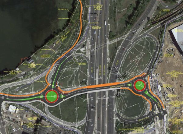
Changes coming to Boundary Channel Drive and I-395 interchange (image via VDOT)

Construction is starting next week to make Boundary Channel Drive and the I-395 interchange near Crystal City and the Pentagon safer.

The impact on locals should be “minimal,” Virginia Department of Transportation spokesperson Mike Murphy told ARLnow. While there could be lane closures, access to surrounding facilities will be kept open.

“Some day and overnight lane closures may be scheduled along I-395, Boundary Channel Drive, and Long Bridge Drive in the project area,” Murphy said. “Access to I-395 via Boundary Channel Drive, as well as access to Pentagon facilities and the Long Bridge Aquatics & Fitness Center will be maintained during construction.”

The long-planned $20 million project is set to reduce traffic lanes on Boundary Channel Drive to make room for paths and sidewalks, install roundabouts, reconfigure ramps, and add crosswalks.

The purpose of the renovations is to simplify traffic patterns and to make it safer for pedestrians, cyclists and drivers.

“We’ve long sought these improvements,” then-County Board Chair Matt de Ferranti said at a Board meeting last year when voting to approve the project. “They will reconfigure the interchange that you see to make it work a lot better and safer for everyone.”

The VDOT-led project is expected to be completed about a year from now, in fall 2023.

Crews will begin with work on Boundary Channel Drive, where both directions will be reduced to one lane to allow for the construction of the new roundabouts, utility work, and pedestrian improvements.

Those improvements include a path along the south side of Boundary Channel Drive, complete with crosswalks, landscaping, and street lighting.

The new shared-use path, varying in width between ten and twelve feet, will start at the Long Bridge Aquatic Center parking lot entrance. It will then follow Long Bridge Drive northbound before connecting with westbound Boundary Channel Drive, per Murphy. The half-mile-long path will pass under I-395 and turn north at the soon-to-be-built western Boundary Channel Drive interchange roundabout.

The new path will ultimately connect with the existing one that parallels the southbound George Washington Memorial Parkway ramp to I-395 southbound.

This project has been in the works since at least 2014 and is estimated to cost $19.6 million. It’s being paid for by a combination of state, federal, regional, and county money.


View More Stories