Arlington County is expected to pilot a program that prices parking by demand along Metro corridors.

The proposed $5.4 million program, funded by VDOT, is slated to be considered by the County Board this weekend.

Staff recommend that the Board accepts the state funding and approve the pilot that would alter parking prices based on the day, time and number of people competing for a spot. It would also give drivers real-time information on spot availability and price.

The grant has been approved by the Commonwealth Transportation Board and staff included the project in the 2021 fiscal year capital improvements plan, a county staff report says. The County will not have to match state funds.

“The Commonwealth’s recognition of the innovative nature of the project… serves not only as a recognition of the relative level of risk, when compared with a traditional highway or transit project, but also of the project’s promise and potential transferability to other locations in the Commonwealth,” said the county staff report.

In other words, the state is willing to take a chance on the system in Arlington, and should it succeed other communties follow Arlington’s lead.

Demand-based parking, which county staff call “performance parking,” is being piloted in a few cities across the country, including D.C.

The District Department of Transportation said this program, which was tested over the course of four years in Penn Quarter/Chinatown, “was largely successful.” It provided real-time information on spot availability and was able to lower or raise prices, which encouraged turnover and, as a result, increased the number of available spots.

Proponents say surge price parking reduces the number of cars on the road and lightens congestion caused by people circling blocks looking for spaces. At the time, critics said that D.C.’s surge-price parking would hurt low-income people looking to visit popular destinations.

The County Board last reviewed the idea for this system two years ago, when the board gave staff the green light to apply for “SMART SCALE” funding — to the tune of $6.1 million — to pilot the project.

If Arlington was chosen, those funds would not have been available until July 1, 2024. But the reason staff included the project in this year’s capital improvement plan is because the state gave the county a new offer.

“In the fall of 2018, during the application evaluation process for SMART SCALE, the Commonwealth, through one of the Deputy Secretaries of Transportation, approached Arlington County and asked if it would accept funding from [VDOT’s Innovation and Technology Transportation Fund] instead of SMART SCALE,” the county staff report says. “ITTF was designed specifically for cutting-edge projects like Performance Parking that advance the state of the practice in transportation.”

Work on the new system along the Rosslyn-Ballston corridor and Crystal City-Pentagon City corridor is expected to start kick off during the current fiscal year, which ends on June 30.

“A total of $700,000 is anticipated to be used for FY 2021,” the staff report says. “The balance of funding will be used in FY 2022 and FY 2023… These funds will be used for design, installation, testing, and deployment of a pilot hardware and software system.”


Local Unemployment Rate Improves — “Arlington’s jobless rate continued to improve in October… the county’s unemployment rate of 4.1 percent in October represented a decline from 4.5 percent in September, according to data reported Dec. 3 by the Virginia Employment Commission. Despite the improvement, the county’s jobless picture has significant more room for recovery. A year ago, the jobless rate stood at a rock-bottom 1.7 percent.” [InsideNova]

Custis Trail Roundabout ‘Fully Open’ — “The Custis Trail has reopened under I-66 near Arlington’s Bon Air Park as overhead work on I-66 progresses for VDOT’s Transform 66 Inside the Beltway Eastbound Widening Project. With the underpass re-opened, the new trail roundabout is fully open and the detour is no longer needed… Lighting is planned to be installed in early 2021.” [VDOT]

New Pedestrian Beacons in Bluemont — “Happy to see this safety improvement in the Bluemont neighborhood… rectangular rapid flash beacons have been added on Wilson near Safeway. So, a light now flashes when you’re trying to cross. Makes a big difference!” [Twitter]

Tiny Glass Houses at Ambar — At Ambar (2901 Wilson Blvd) in Clarendon, “guests can now reserve one of the 10 fully enclosed new glass tiny houses, that can seat up to six people for dining in warmth, safety, and privacy. They are totally self-contained, with heat, lighting elements and music selections for each host’s personal preference while dining at Ambar.” [Press Release]


A recent Morning Notes post on ARLnow has resulted in a fake road sign being removed in Arlington.

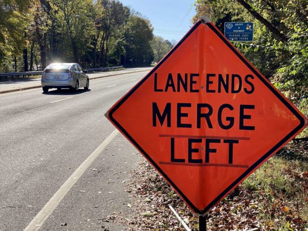
ARLnow published the photo above, taken along N. Glebe Road near Chain Bridge, on Nov. 5. Though the construction sign in the foreground gets top billing, eagle-eyed readers might have noticed the “Adopt-a-Highway” sign behind it, which says — in the space reserved for the adopting organization — “PLEASE JUST RAISE TAXES.”

Was that strictly a prank, or did a group by that name really sign up, using the name to send a snarky message about the concept of volunteer roadway trash collection.

A regular ARLnow commenter, known as Smiley456, emailed VDOT to ask about it.

“Can you verify if the group mentioned on the Adopt a Highway sign either exists or someone defaced the sign?” Smiley456 asked in an email sent to the agency’s Adopt-a-Highway inbox earlier this month.

The answer that came back, from a VDOT employee, was that it was indeed a prank.

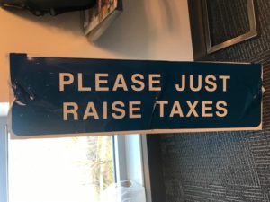
“Upon investigation we found that this current road section is available for adoption via the Adopt-a-Highway program,” the employee said. “The previous permit holder’s sign was vandalized with a look-alike VDOT sticker reading ‘PLEASE JUST RAISE TAXES.’ Currently we have removed this portion of the signage and have an order to remove the former Adopt-a-Highway group’s signage in process.”

“I appreciate you bringing this to my attention and allowing me to investigate and resolve this situation,” the employee added, attaching a photo of the removed portion of the sign.

Those interested in adopting that stretch of Glebe Road can find out more about the Adopt-a-Highway program on VDOT’s website.

Photo (below) via VDOT


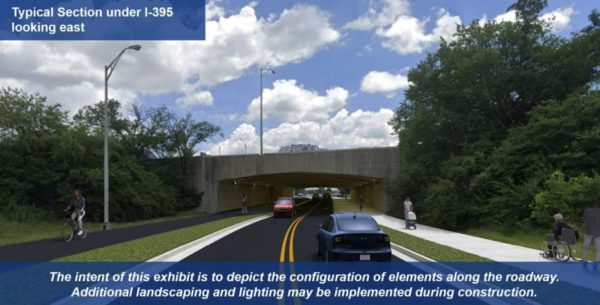
Changes are coming to the Boundary Channel Drive and I-395 interchange, and with a public hearing on the plans set for Thursday.

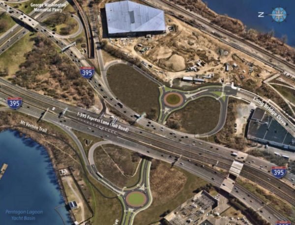
VDOT is set to hold the virtual design public hearing at 7 p.m. tomorrow (Nov. 5) via Cisco Webex. It will discuss the agency’s plans “to upgrade the Boundary Channel Drive interchange at I-395 to improve safety, traffic flow and enhance accessibility and connectivity for bicyclists and pedestrians.”

Boundary Channel Drive runs along the northeast side of the Pentagon and under I-395, before connecting with Long Bridge Drive, near Long Bridge Park and the new (but yet to open) aquatics center.

Among the planned changes are:

  • Reducing Boundary Channel Drive from four lanes to two
  • Adding a ten-foot-wide path/sidewalk on either side of the road
  • Installing roundabouts on either side of I-395
  • Reconfiguring the highway ramps
  • Adding crosswalks
  • Creating a new shared-use path that links the Mount Vernon Trail to Long Bridge Park

“In lieu of an in-person hearing, VDOT invites residents and travelers to learn more, participate in the virtual hearing and give feedback,” the agency said in a press release. “Once the hearing is complete, the recorded presentation will be available online. Project materials and details are also available at virginiadot.org/BoundaryChannel.”

Comments on the plans are being accepted through Monday, Nov. 16.

The $20.4 million project is being paid for “with state (including Revenue Sharing), Arlington County and Northern Virginia Transportation Authority funding,” VDOT notes. The agency expects to start the process for selecting a design-build contractor this winter.

Photos via VDOT


Greens Want Tax Hike for New Initiative — “The Arlington Green Party is seeking a five-fold increase in one local tax in order to fund an environmental initiative. The party in late October promoted the idea of the county government giving owners of single-family properties in Arlington $1,000 credits to have energy audits conducted and then take cost-effective steps to improve efficiency…. The party wants to increase the existing utility tax from $3 per household per month to eventually hit $15 per household per month.” [InsideNova]

Looking On the Bright Side — “And the winner is: free paper yard waste bags. Available at five County sites during leaf season.” [@ArlingtonDES/Twitter, Arlington County]

Improvements Proposed in Seven Corners — “The Virginia Department of Transportation has provided another in a series of updates on potential improvements being studied along Route 50 (Arlington Boulevard) between Jaguar Trail and Wilson Boulevard in the Falls Church/Seven Corners area.” [InsideNova, VDOT]


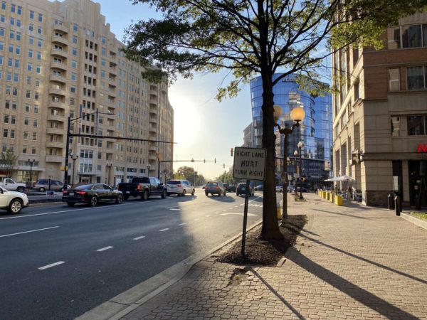
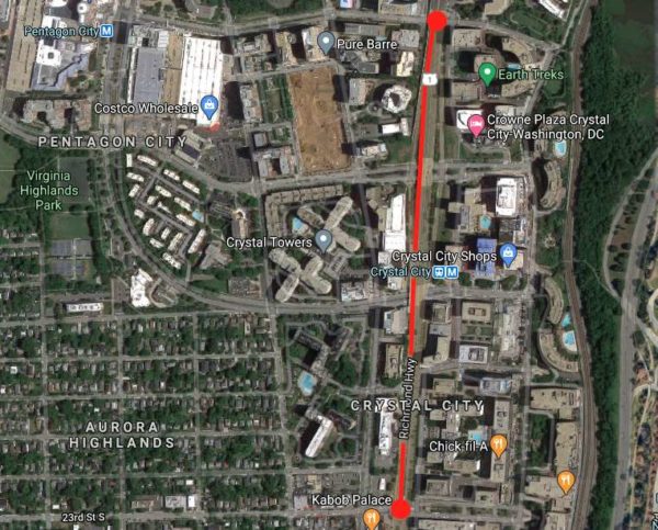
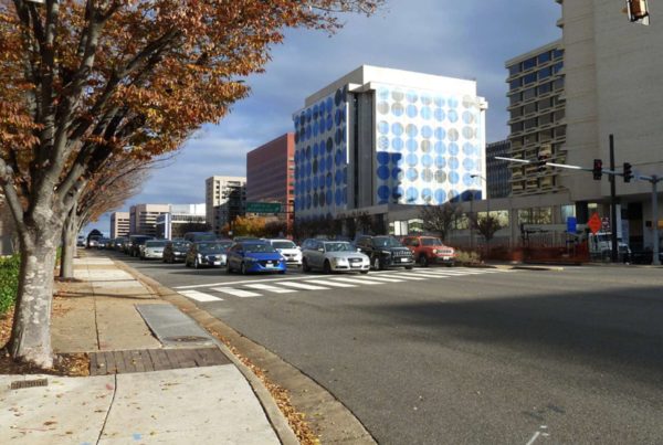
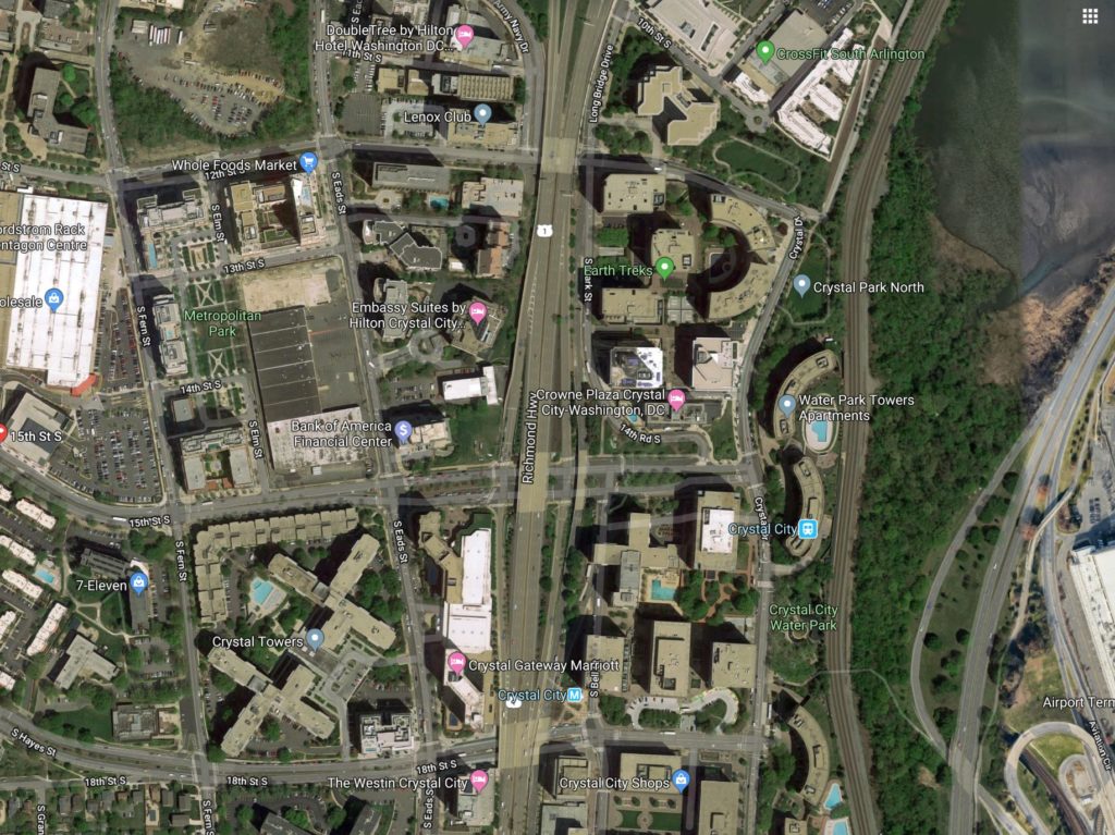
The Virginia Department of Transportation is asking residents to take a short survey that will shape a study of potential improvements to Route 1 between 12th and 23rd Streets S. in Crystal City.

As development activity in Crystal City and Pentagon City continues, VDOT and Arlington County are looking for ways to improve the safety, accessibility and effectiveness of a variety of transportation modes on Route 1 in the area. In particular, the study responds to the increased demand for transportation resulting from the construction of Amazon’s HQ2.

“As this area’s commercial and residential densities continue to increase, transportation plans will need to address the wide-ranging needs of pedestrians, bicyclists, transit riders, motorists, and other users while maximizing the safety, convenience, and sustainability of the system for decades to come,” according to a news release from the VDOT.

The survey asks respondents to explain how they use Route 1 (also known as Richmond Highway), rank improvements by priority, and identify areas with congestion or safety problems. It is available through Nov. 15.

Officials say the study will help identify safety improvements for pedestrians, bicyclists, those using micro-mobility modes such as electric bicycles and scooters, and those taking transit or driving. The study will also examine ways to make transit more accessible, reliable and convenient, as well as options for protecting the environment.

The team leading the study plans to form a task force from representatives of civic associations, Arlington County advisory groups and the National Landing Business Improvement District, the news release said. The task force is anticipated to have five meetings.

More from the press release:

After collecting and analyzing the initial survey data, VDOT is planning a virtual public meeting this winter to share preliminary survey results and latest study information. Draft recommendations for the study will be presented to the public for feedback in spring 2021, and the final study is expected to be complete in summer 2021.

Please note that this study does not include construction funding, but will develop proposed future improvements that VDOT and other agencies will consider and may pursue for funding.

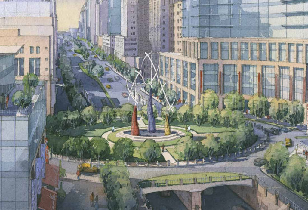
The study was announced a week after the National Landing BID released a report, “Reimagining Route 1,” which envisioned the car-centric highway as a slower, greener, pedestrian-friendly boulevard lined with retail and restaurants.

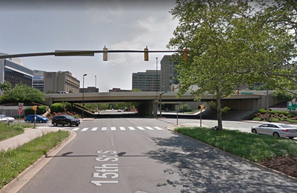
VDOT is studying the Route 1 overpasses over 12th, 15th and 18th streets, which some have called to be eliminated in favor of more urban intersections at grade.

“Route 1 was originally designed to accommodate the auto-centric development trends of the mid-20th century, when the primary objective was to move cars through the area as quickly as possible,” the BID said in a press release. “The resulting elevated highway, super blocks, and oversized intersections divided the community for decades, inhibiting not only connectivity and access, but also the area’s ability to come together as a singular downtown district.”


The Arlington Transportation Commission voted 8-2 at its meeting last week to not recommend that the County Board submit a funding application for proposed changes to Route 50.

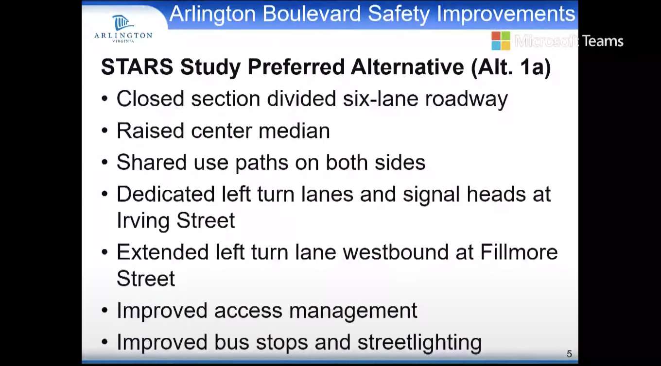
The project would, among other changes, widen the roadway to add dedicated turn lanes.

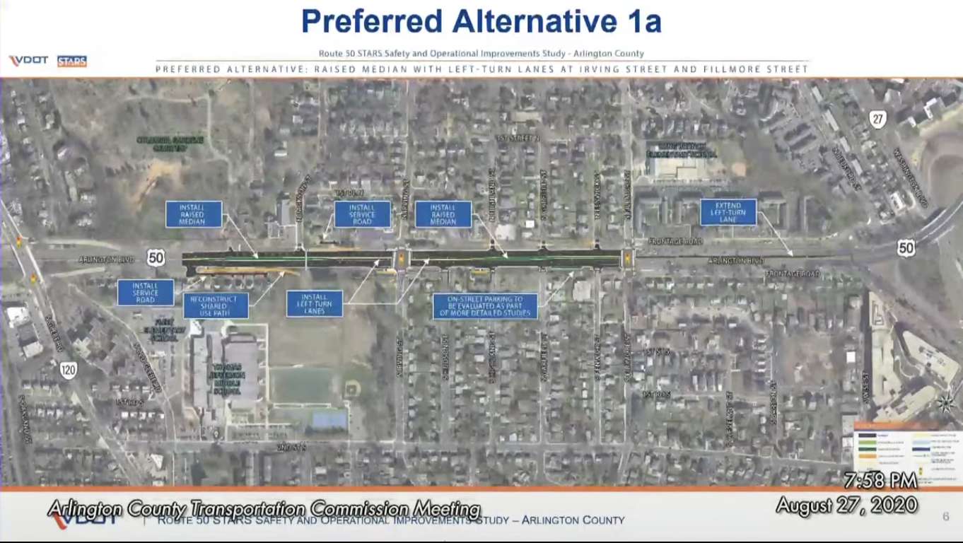
The application requests $25.1 million from the Virginia Department of Transportation‘s (VDOT) SMART SCALE funding program to make improvements to Route 50, also known as Arlington Blvd, where it runs between Glebe Road and Fillmore Street.

This stretch of road, according to VDOT, had 247 crashes on it with 61 total injuries between 2014 and 2018.

“This segment of Route 50 experiences congestion in the morning and evening peak periods and a high number of crashes,” VDOT said in an April presentation. “Route 50 averages 62,000 vehicles a day within the study limits.”

Potential changes would come from recommendations made in a yearlong VDOT study of this area. These include adding new left-turn lanes and expanding current ones, as well as installing raised medians in certain high crash areas.

Constructing a new service road where Route 50 runs eastbound between Glebe and N. Jackson Street, and reconstructing a shared-use path in the section, were also recommended by VDOT.

The commission did pass a motion to recommend the County Board direct the County Manager to lay plans for a Route 50 corridor study between Roosevelt Bridge and Fairfax County.

Members voting against VDOT’s recommendation cited issues with the department’s study — including what they said was a limited scope, a failure to consider how changes would impact speed in this section of road, and a failure to account for more cars driving this road — as reasons for their vote.

Commissioner Darren Buck, the most outspoken critic of VDOT’s recommendations during the meeting, said the fact that VDOT’s study only looked at the area between Glebe and Fillmore and not Route 50 as a whole was among his greatest concerns about supporting the plan.

“I do not want to apply to fund this fundamentally flawed project to fill pressing local needs when a more comprehensive study of the corridor is pushed off indefinitely,” Buck said. “I do not think [the state should be] sinking $25 million into a spot improvement that basically determines how the rest of the corridor is going to look when we still haven’t addressed that long-standing open community question of how the rest of the corridor should look and operate.”

Commissioner Margarita Brose, as one of two commissioners voting for recommending the funding application, said the already high number of crashes in the section outweighed concerns over the project’s cost and a widening of the roadway.

“The safety concerns really weigh heavily on me,” Brose said. “I understand it’s a lot of money for a short period but we’ve seen the statistics on the number of cars that go through there and the crashes.”

VDOT said the study’s recommendations were primarily focused on improving the road’s safety.

“The safety aspect is one of the key things that led us to try and find a solution or a way to reduce those crashed,” VDOT said. “That’s one of the key motivating things that got us to start the study and to come up with the alternatives that we reviewed.”

Still, commission members questioned the actual safety added by VDOT’s recommendations.

“We are adding lanes for cars and making the highway more divided so that cars will go faster,” Commissioner Taylor Reich said. “As a result of this, I am unconvinced this project will improve safety, especially for pedestrians.”

VDOT said its plan leaves three through lanes in each direction on Route 50, which is similar to its current state. The road widening, she said, is to allow room for new left turn lanes.

If the County Board approves a SMART SCALE funding application, there is no guarantee the project would receive the money. VDOT describes SMART SCALE funding as highly competitive.

Images via Arlington County


Members of civic associations for Crystal City, Aurora Highlands and Arlington Ridge are developing a proposal for changes to Route 1

The associations, convening as “Livability 22202” in a Zoom meeting last night, focused on how to improve Route 1 in Crystal City, specifically where it goes over 12th Street S. and 18th Street S.

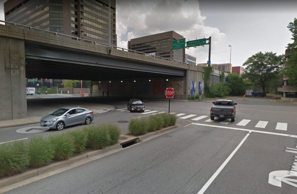
Proposed changes ranged from building storefronts or markets in the area underneath the overpasses, creating more open space where thick sandstone-colored walls now hold up the highway, and putting Route 1 underground to allow for development on top of it.

The discussion comes after the Virginia Department of Transportation (VDOT) hired a contractor to conduct a feasibility study of removing the overpasses and lowering the highway to ground level.

Darren Buck — an Aurora Highlands resident, professional transportation planner, and member of the Arlington Transportation Commission — presented the possible changes, saying they were ideas meant to set a line of thinking. Factors like cost, construction time and general practicality are yet to be fully considered.

“These really are kind of unconstrained by a lot of reality,” Buck said. “They’re really trying to get to what could we do that would address some of… the identified things that we are concerned about with the at-grade proposal and start to toss around alternatives.”

Ultimately, Livability 22202 will make “community-based recommendations for an innovative new vision for Route 1 and its cross streets between 12th Street S. and 23rd Street S.,” a slide in the meeting said.

If the highway was at-grade, it could be turned into an “urban boulevard” running through Crystal City, according to VDOT.

This would fall in line with the transportation portion of Virginia’s HQ2 deal with Amazon, which lists “improvements to Route 1 through Crystal City and Pentagon City” as a project the government would fund.

According to a 2018 Virginia Economic Development Partnership presentation, this project could cost around $250 million.

Livability 22202 said dropping Route 1, also known as Richmond Highway, to ground level would force pedestrians walking between east and west Crystal City to cross the busy commuter artery.

“We want a pedestrian-friendly, walking-friendly neighborhood,” Michael Dowell of Livability 20222 said. “Having Route 1 be an impediment to achieving that is a really big worry.”

Pedestrians can currently cross under the overpasses, which many do to access the Crystal City Metro station on the east side.

Another Livability 22202 meeting on the topic will be held on September 30.

Images via Google Maps


A portion of the Custis Trail will be detoured next week for construction of a roundabout.

The roundabout is being installed on the south side of the pedestrian underpass beneath I-66, which is currently a somewhat dangerous T-intersection. The project is part of VDOT’s larger I-66 widening project.

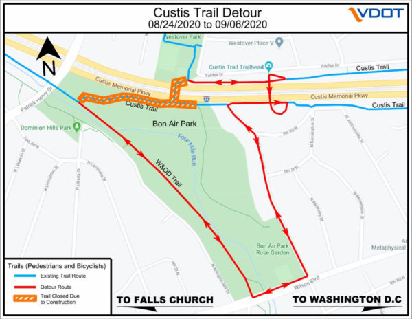
For two weeks, from Monday, Aug. 24 to Sunday, Sept. 6, those heading to and from the W&OD Trail on the Custis Trail will be detoured around Bon Air Park, via Wilson Boulevard and N. Lexington Street.

More from VDOT:

The Custis Trail will close in Arlington’s Bon Air Park between the Washington and Old Dominion (W&OD) Trail and the I-66 underpass for up to two weeks for construction to create a roundabout to enhance safety for trail users. The closure is planned from Monday, August 24, through Sunday, September 6. Detour signs will be posted to direct pedestrians, cyclists, and other trail users around the closure. This work is being done as a component of the Transform 66 Inside the Beltway Eastbound Widening Project.

A posted detour will route users around the closure using the W&OD Trail, Wilson Boulevard, N. Lexington Street, and N. 9th Road to reach the bike/pedestrian bridge over I-66. Delineators will be placed temporarily on a short span of Wilson Boulevard to separate cyclists from vehicle traffic and provide a wider bike lane to allow cyclists to travel in both directions for about 500 feet. The sidewalk on the north side of Wilson Boulevard will also be available for trail users.

A roundabout is being constructed on the south side of the Custis Trail I-66 underpass to improve safety and sightlines for pedestrians, cyclists, and other users of the Custis Trail and Bon Air Park. The Custis Trail remains closed under I-66 for safety reasons while an additional travel lane is added overhead. The trail is expected to fully reopen in late October 2020.

The I-66 Eastbound Widening Project will add a travel lane along four miles of eastbound I-66 and install approximately 12,000 linear feet of new and replacement noise barriers. The project also includes constructing a new direct access ramp from eastbound I-66 to the West Falls Church Metro Station at the Route 7 interchange, and a new W&OD Trail bridge over Lee Highway (Route 29).


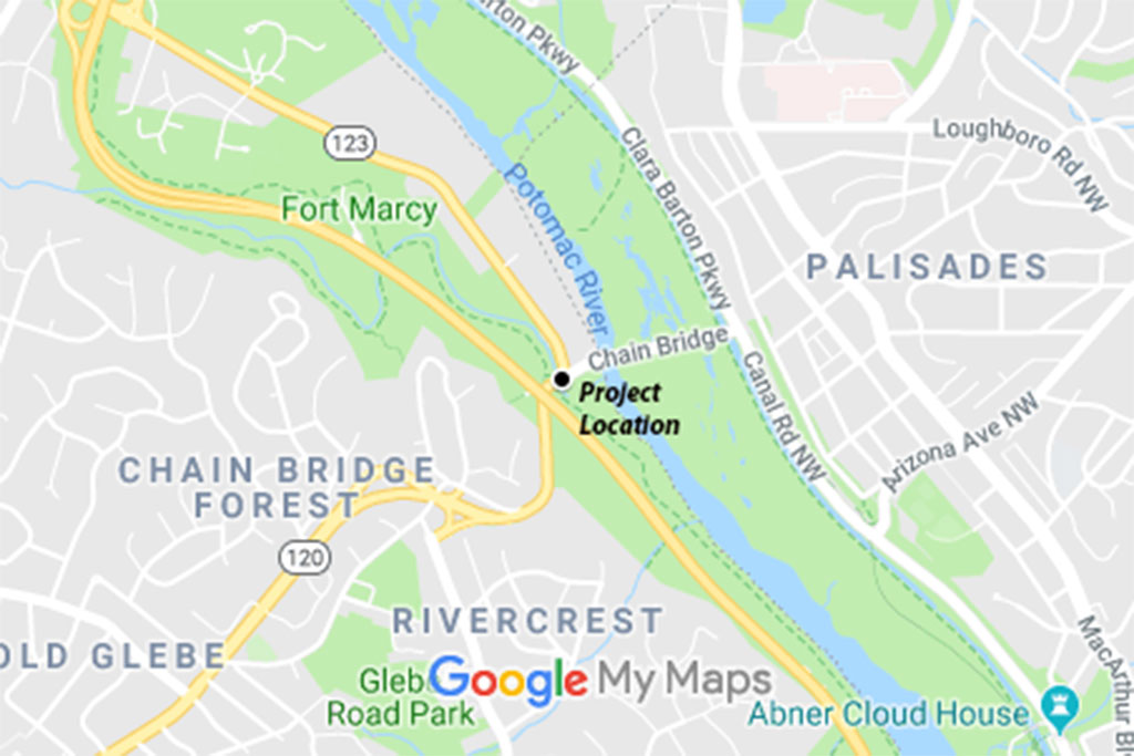
N. Glebe Road is expected to close for nine straight days next year for a bridge rehabilitation project.

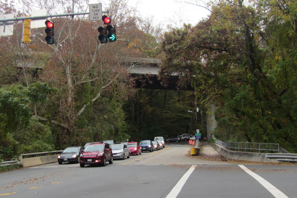
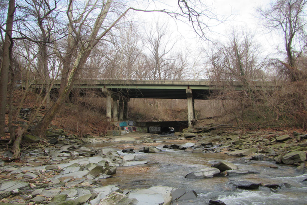
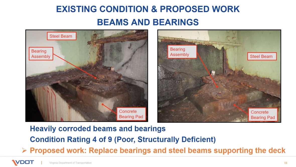
In a recently-posed video presentation, VDOT provided an update on its planned Pimmit Run bridge project. The presentation details the plan to replace the deteriorating bridge deck and steel supporting beams with large, prefabricated components.

Sections of the bridge deck and support beams will be constructed off-site and trucked in, then placed with a crane. That will allow crews to replace the entire top of the bridge much faster than with conventional construction techniques, which would require a sequential series of lane closures.

The downside is that the bridge — and thus N. Glebe Road, just up from Chain Bridge — will need to be closed to traffic entirely for an estimated nine days next year.

The project is set to kick off next spring and wrap up in the fall of 2021. Its projected cost of $9.5 million will come from state and federal funds.

The bridge was built in 1973, serves 13,000 vehicles per day, and is suffering from corroding concrete and steel supports. The project will replace the entire bridge deck and support beams, while also repairing the concrete bridge piers in and around Pimmit Run, near where it flows into the Potomac.

The rehabilitated bridge will have new rails and barriers, as well as a widened pedestrian path.

During the project, traffic heading to and from Chain Bridge will be detoured via McLean and N. Chain Bridge Road. A closure of N. Glebe Road just up from the bridge last week, due to water main work, resulted only in minor traffic impacts — albeit during a pandemic during which many people are working from home.

VDOT is asking for anyone with feedback on the project to email [email protected] by Aug. 7.


McDonald’s Rebuild Decision Delayed — “Action on a proposal to rebuild the existing McDonald’s fast-food restaurant in the 4800 block of Lee Highway has been put off for another two months. Arlington County officials and the applicant had sparred over the plan, which also would include a revamped traffic-circulation design.” [InsideNova]

Bollards Deter Dangerous I-395 Driving — VDOT has installed new bollards to prevent drivers from cutting across northbound I-395 to access the HOV bridge. The barriers appears to be doing the trick, succeeding where orange barrels previously failed. [Twitter]

Crystal City Farmers Market Moving — “Arlington County Board members on July 18 approved the temporary relocation of the once-a-week Crystal City Farmers’ Market, so services could continue to be provided during the COVID-19 pandemic. The traditional spot of the market – the 2000-2100 block of Crystal Drive – does not have enough room to space out vendors.” [InsideNova]


View More Stories