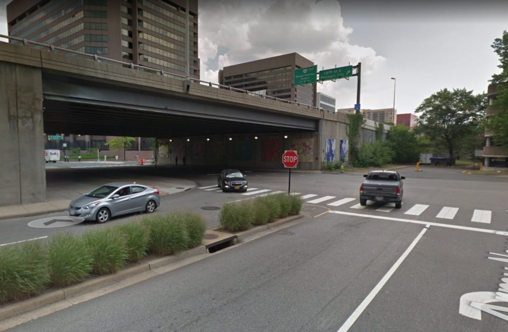
Officials are considering lowering Route 1 in Crystal City to ground level after Amazon moves in.

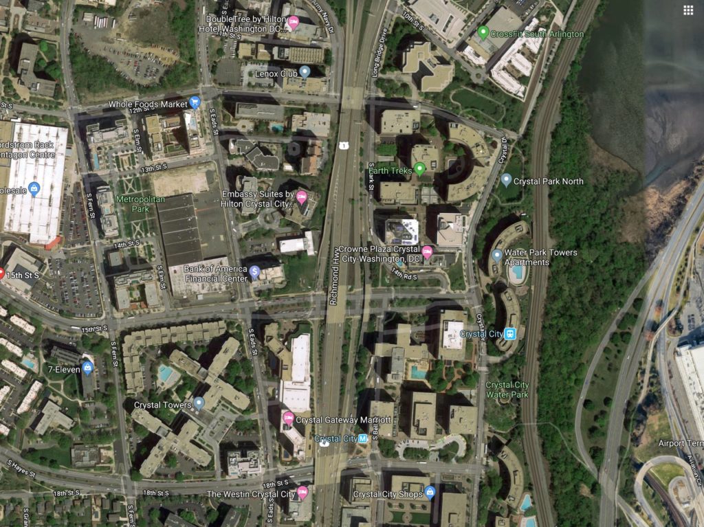
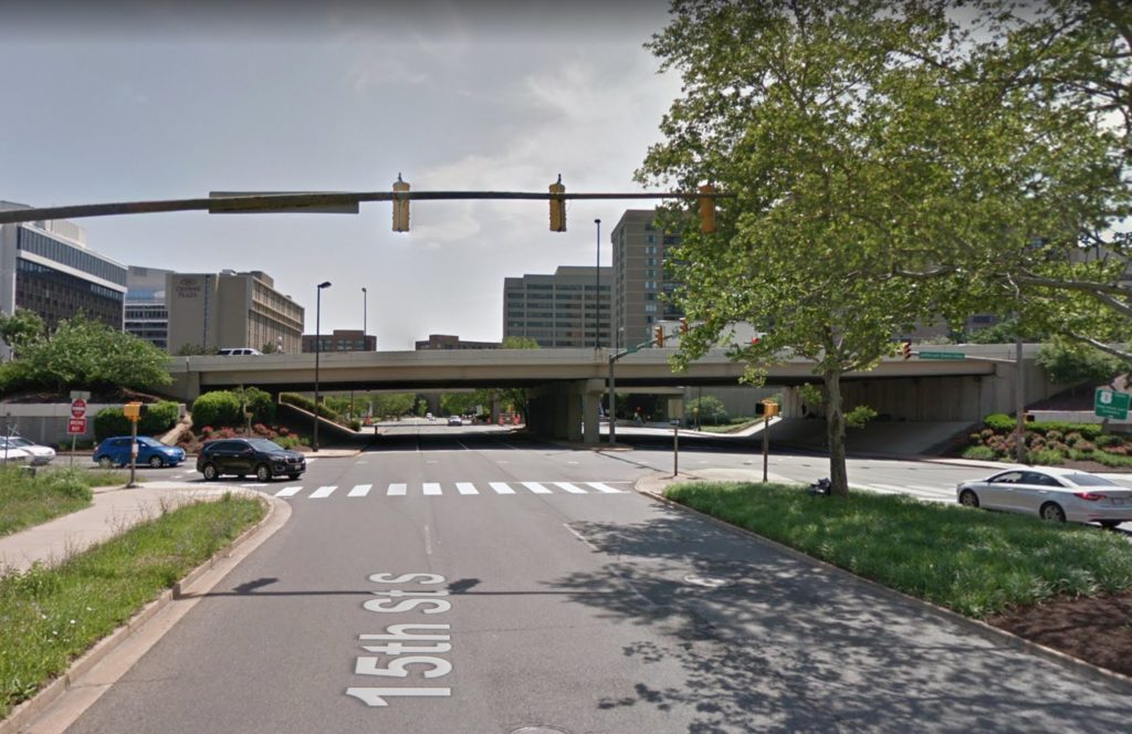
Details remain scant, but officials appear to considering a plan to remove several highway overpasses that span over roads from 12th Street S. to 18th Street S. in favor of at-grade intersections with traffic signals. Currently, the Virginia Department of Transportation (VDOT) is studying the project.

“The study for Route 1 is still in very preliminary stages, where VDOT and Arlington County are looking at feasibility of different concepts, and the best potential balance to accommodate all modes of travel — buses, pedestrians, bicycles, vehicles, etc,” VDOT spokeswoman Jennifer McCord told ARLnow Monday.

When asked, McCord said VDOT did not yet have a cost estimate for the potential project. However, a 2018 Virginia Economic Development Partnership presentation and an entry in the state’s Six-Year Improvement Plan indicate work could cost some $250 million.

McCord noted that the ongoing study for the project is funded with $2 million from the state.

Theoretically the changes wouldn’t affect the commuter route’s vehicle throughput, given that there are already traffic signals up and down Route 1 from Alexandria to Arlington. Pedestrians, however, would have to cross Route 1 at grade along 18th Street to get from the Crystal City Metro station entrance to points west.

Authorities are considering several changes to the streetscape around its HQ2 like a protected bike lane on S. Eads Street and new bus stops. As part of the state and local incentive package used to woo the company to Arlington, officials also pledged to fund a slew of transportation projects which could include this Route 1 revamp.

The 2018 presentation noted that $138.4 million (55%) of the projected cost could be paid for by the state as part of the incentive package for Amazon’s new second headquarters.

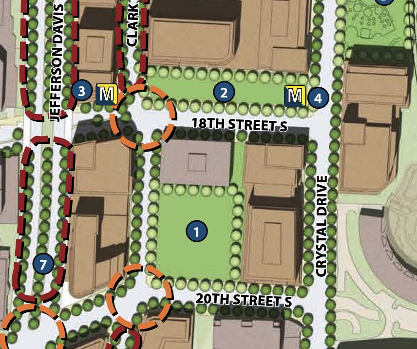
Lowering the (newly renamed) Richmond Highway predates Amazon with a reference in the 2010 Crystal City Sector Plan to turn the highway “into an asset of the overall multimodal transportation network.”

A diagram in the plan depicts Route 1 as more of an urban boulevard, lined with trees.

Tracy Sayegh Gabriel, head of the Crystal City Business Improvement District, said Monday that the way the highway cuts through the area “forms a physical and psychological barrier separating Crystal City and Pentagon City.”

The BID is expanding its boundaries and is currently considering renaming itself “National Landing” to reflect a unified identity of the Crystal City, Pentagon City and Potomac Yard neighborhoods, which are poised for significant growth with the additions of HQ2 and a new Virginia Tech campus just over the Alexandria border in Potomac Yard.

“As various public and private projects are developed throughout the area, there is an even greater need for enhanced connectivity and a safer way to move between the neighborhoods,” said Gabriel, of the possible Route 1 changes.

“Transforming the roadway into a multi-modal, pedestrian-friendly, and urban-oriented boulevard presents the largest and most comprehensive opportunity to create a truly walkable, connected, urban downtown,” she added.

When discussing the plan back in November, Arlington County Board Chair Christian Dorsey said it could “lead to the total reimagining of Route 1.”

Image 1 via Arlington County, Images 2-5 via Google Maps


A $17.2 million overhaul of the Boundary Channel Drive interchange along I-395 is in the works.

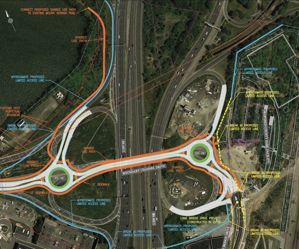
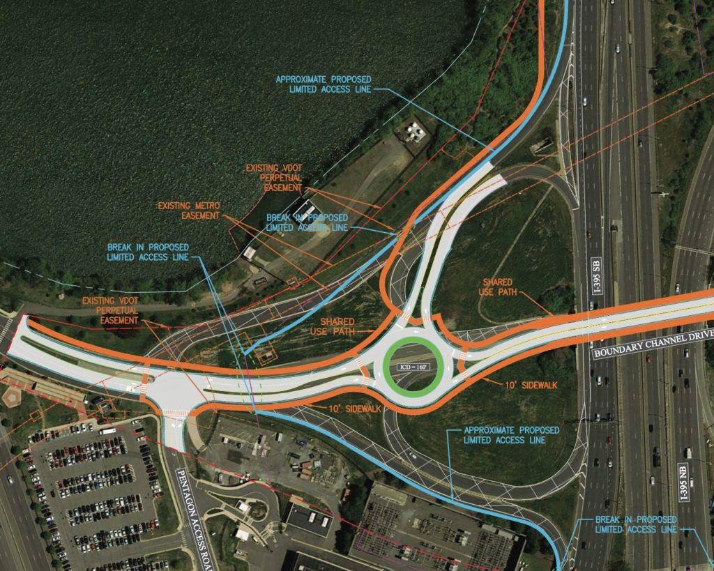
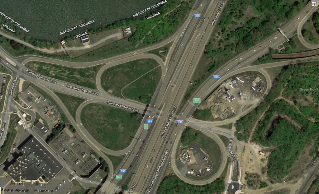
Plans call for overhauling the existing, difficult-to-navigate interchange near the Pentagon and Crystal City with two rotaries, to be installed on either side of I-395.

The 150 and 160-foot wide rotaries aim to merge traffic from Boundary Channel Drive and the Pentagon Access Road on the left, and the Boundary Channel and Long Bridge Drive on the right. The project would remove I-395’s two southbound loop ramp, and add a new multi-use trail, shared by cyclists and pedestrians, connecting the Mt. Vernon Trail to Long Bridge Park.

The project will be managed by the Virginia Department of Transportation (VDOT) and is expected to cost around $17 million.

The Arlington County Board will review an agreement for the project during its upcoming meeting this Saturday. As of Tuesday, the project was featured on the Board’s consent agenda, a place usually reserved for items expected to pass without debate.

Officials hope the redesign will better connect to the long awaited Long Bridge Park Aquatics Center and better serve area commuters, as staff noted in a report to the Board:

The Interchange serves the Pentagon (five million square foot office building with 25,000 employees), Pentagon City (12.7 million square feet of office, 2.3 million square feet of retail and over 13,000 residential units), Crystal City, Long Bridge Park plus its future park expansion and the future Aquatics & Fitness Center, which is expected to draw regional visitors from Maryland and the District of Columbia, as well as from the areas south and west of Arlington in Virginia. The existing interchange design is dated and will need to be redesigned to better serve the transportation needs of the existing and future land uses in the area.

The county held public meetings to showcase the designs in 2015, during which staff noted feedback “varied greatly.” The points staff said residents agreed on included:

  • There needs to be fewer ramps onto I-395
  • Rotary islands need to be designed to not allow cars to speed
  • Pedestrian crossings need to be designed to reduce conflicts with cars and bicycles

County staff also noted that plan for the trail meets goals set by the newly-upgraded bike element of the Arlington County Master Transportation Plan to make it easier for cyclists and pedestrians to use the Mt. Vernon Trail.

“The Mount Vernon Trail connection is an extremely critical part of the project and will create a much-needed link between Long Bridge Park and the trail,” the staff report said.

Image 3 via Google Maps


Tonight and through the end of next week, drivers can expect delays along I-66 in Rosslyn from nighttime lane closures on both eastbound and westbound sides.

Crews will work until Thursday, September 26 — minus this coming Friday and Saturday nights — to set up concrete panels and a debris shield alongside the N. Lynn Street overpass as part of the Lynn Street Esplanade and Custis Trail Improvements project, according to a Virginia Dept. of Transportation press release.

Eastbound closures will occur on I-66 between the Exit 73 ramp to northbound Route 29 (Lee Highway) and Route 110 (Exit 75), while the westbound closures will go from the North Lynn Street ramp (Exit 73) to the western end of the Rosslyn Tunnel.

The timing of the closures are as follows, per VDOT:

  • Eastbound I-66 right lane: Sunday night, Sept. 15, Monday night, Sept. 16 and Tuesday night, Sept. 17 from 9:30 p.m. each night until 5 a.m. the following morning
  •  Eastbound I-66 left lane: Wednesday night, Sept. 18 and Thursday night, Sept. 19 from 9:30 p.m. each night until 5 a.m. the following morning
  • Westbound I-66 left lane: Sunday night, Sept. 22, Monday night, Sept. 23 and Tuesday night, Sept. 24 from 10 p.m. each night until 5 a.m. the following morning.
  • Westbound I-66 right lane: Wednesday night, Sept. 25 and Thursday night, Sept. 26 from 10 p.m. each night until 5 a.m. the following morning.

During construction drivers should expect delays and are advised to take alternate routes. Real-time traffic information and lane closure locations are available online.

The $9.3 million project will ultimately improve bicycle and pedestrian conditions along North Lynn Street with wider sidewalks, upgraded curb ramps, traffic signals, and more. Final completion is expected in spring 2020.

Flickr pool photo by Michael Coffman


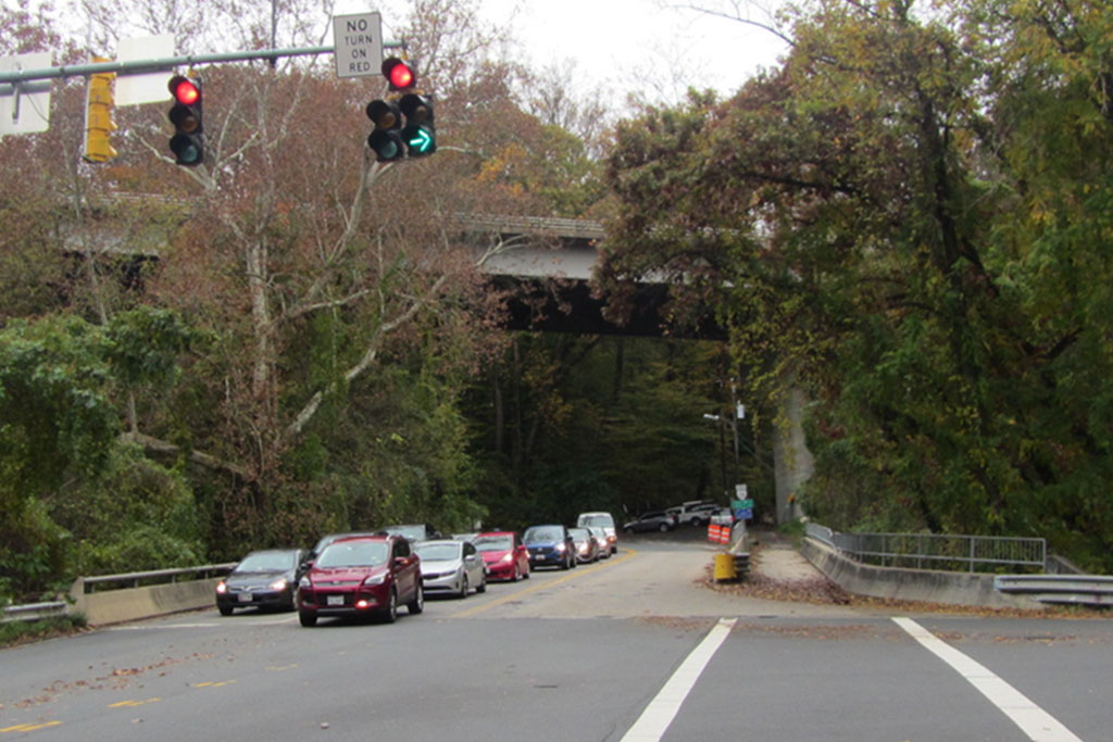
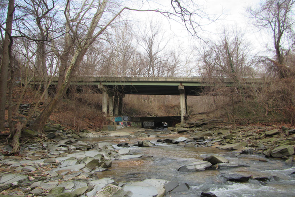
(Updated at 10:15 a.m.) The N. Glebe Road bridge over Pimmit Run has been serving drivers, cyclists and pedestrians since 1973 but is due for some major maintenance.

At a public meeting tonight (Tuesday) at Williamsburg Middle School (3600 N. Harrison Street), the Virginia Department of Transportation (VDOT) is scheduled to unveil new plans for the bridge. The improvements are aimed at improving safety and extending the overall life of the bridge.

According to a press release, improvements will include:

  • Repairing and resurfacing the bridge deck
  • Repairing, waterproofing and providing corrosion protection to abutments and piers
  •  Repairing, cleaning and painting beams
  •  Replacing railings along bicycle and pedestrian connection to trails
  • Upgrading guardrails and drainage

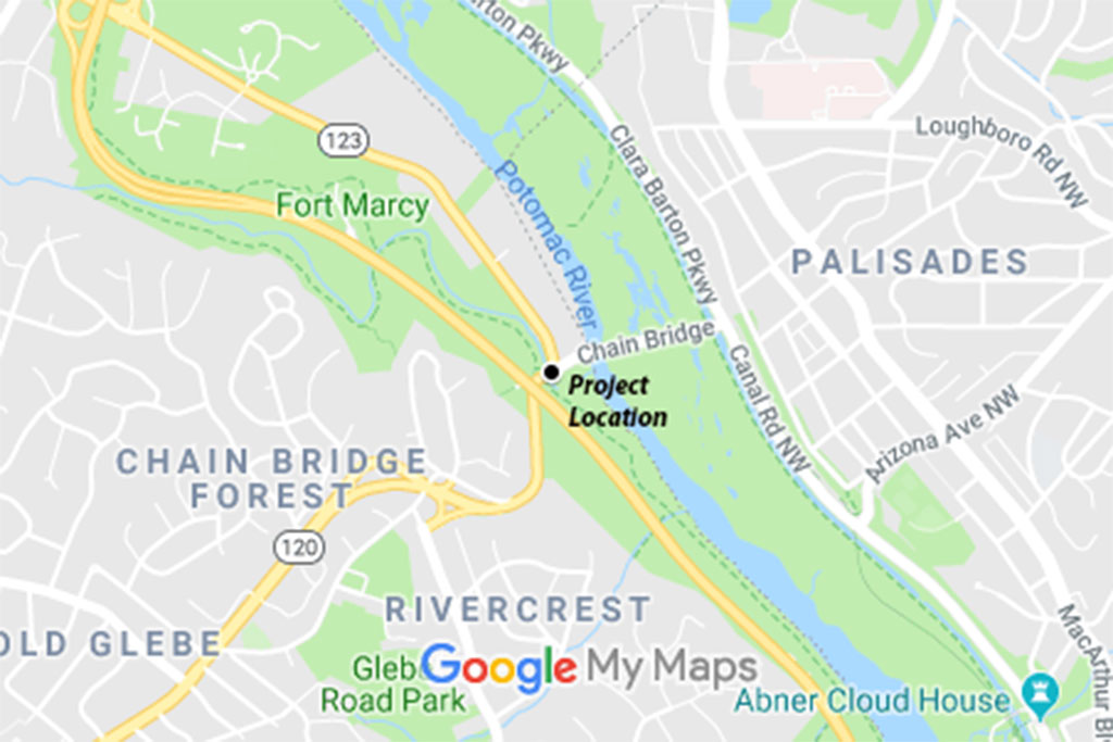
The bridge feeds into nearby Chain Bridge and sees an average of 12,000 vehicles each day.

The press release says the event will be an open house running from 6:30-8:30 p.m., with displays and information about the project’s design. A presentation will be made at 7 p.m.

The project is estimated to cost $7.5 million and will be financed by the State of Good Repair fund, a state and federal program used to address repairs on bridges considered structurally deficient on the National Bridge Inventory, according to the press release.

Construction is expected to start in fall 2020.


Those traveling to, from and through Arlington may need to pack their patience this weekend, depending on the route and time of day.

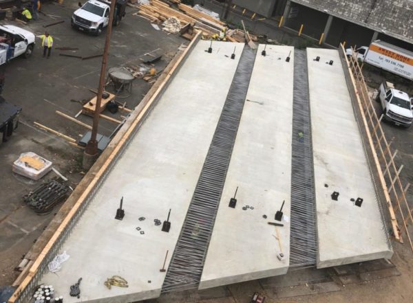
Both directions of Route 50 will be closed in the area of Wilson Blvd in Seven Corners, from Friday night to Monday morning, to allow VDOT to lift a new, 87-foot Wilson Blvd bridge span into place. Drivers are being encouraged to avoid the area if possible.

More from a VDOT press release:

Eastbound and westbound Route 50 (Arlington Boulevard) at the Route 7 (Leesburg Pike) interchange and eastbound Wilson Boulevard (Route 613) between the eastbound Route 50 service road and the westbound Route 50 service road will be closed from 10 p.m. Friday, August 2 to 5 a.m. Monday, August 5 to safely demolish the Wilson Boulevard bridge deck over Route 50 and install the new bridge deck, according to the Virginia Department of Transportation.

Eastbound Route 50 traffic will be detoured via the eastbound Route 50 service road back to Route 50, and westbound Route 50 traffic will be detoured via the westbound service road back to Route 50.

Eastbound Wilson Boulevard traffic will be detoured via Route 7, Patrick Henry Drive, Route 50 and the westbound Route 50 service road back to Wilson Boulevard.

Drivers can expect delays and are advised to use alternate routes.

The work is part of the Wilson Boulevard over Route 50 bridge rehabilitation project. After the weekend closure, drivers can expect single-lane closures on Route 50 and the eastbound Wilson Boulevard bridge until late fall. The project is scheduled for completion this winter.

Also this weekend, “significant lane closures” are planned along I-395.

The work, part of the 395 Express Lanes project, will close multiple northbound lanes at night, starting Friday. Drivers are being encouraged to use the HOV lanes of I-395, which will be switched to the northbound direction starting at 8 p.m. tonight.

More on the I-395 work, from VDOT:

Northbound I-395 from Duke Street (Exit 3) to past the Pentagon City/Crystal City exit (Exit 8C) will have nighttime lane closures Friday night, August 2 through Sunday night, August 4 for bridge work. The I-395 HOV lanes will be switched to northbound at 8 p.m. Friday and will remain northbound all weekend.  The 95 Express Lanes from Edsall Road to Garrisonville Road will operate on a standard schedule; on Saturday from midnight to 2 p.m., the 95 Express Lanes will operate in the southbound direction while the I-395 HOV lanes are open northbound.

Photo via VDOT/Twitter


VDOT Repaving Planned This Month — “Upcoming @VaDOTNOVA night paving into August: Glebe Road, Spout Run Parkway, Washington Boulevard, Route 1 aka Richmond Highway aka the roadway formerly known as Jefferson Davis. Dates tentative, subject to change.” [Twitter]

ACPD Still Not Meeting Staffing Goal — The Arlington County Police Department has, on net, added a few new officers over the past year. But staffing challenges remain, echoing challenges for police departments across the region: ACPD currently has 352 officers despite a staffing goal of 374 officers. [NBC 4]

Arlington Hiring Public Safety Positions — Arlington County is currently hiring school crossing guards and 911 dispatchers.

Lee Highway Apartment Complex Sold — “A 50-year-old apartment complex along Route 29 in Arlington County has traded hands for the first time in 20 years. Connecticut-based Westport Capital Partners, through the entity WM MF Horizons Property LLC, acquired the Horizons Apartments from an entity connected to Dweck Properties to in a deal that closed June 26 for $71M, Arlington County property records show.” [Bisnow]

Rosslyn-Based Firm Buys Clyde’s — “It’s official: Clyde’s Restaurant Group, a 56-year-old institution in Greater Washington’s restaurant scene, is now a subsidiary of Graham Holdings Co. Graham, which is led by members of the Graham family that formerly owned The Washington Post, did not disclose a sale price.” [Washington Business Journal]

Nearby: More People Biking in Alexandria — “More than halfway through this summer’s Blue and Yellow Line shutdown… bicycle volume [has] almost doubled on the Metro Linear Trail, a smaller, along-rail trail which connects the King Street and Braddock Road stations.” [DCist]

Flickr pool photo by Lisa Novak


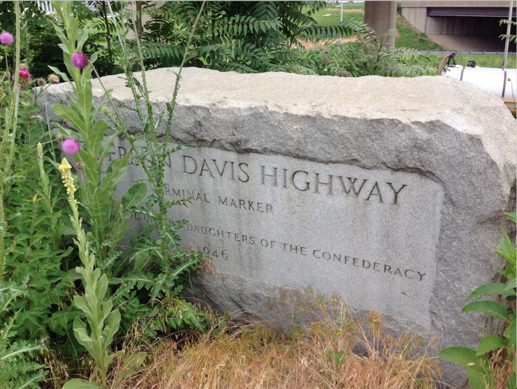
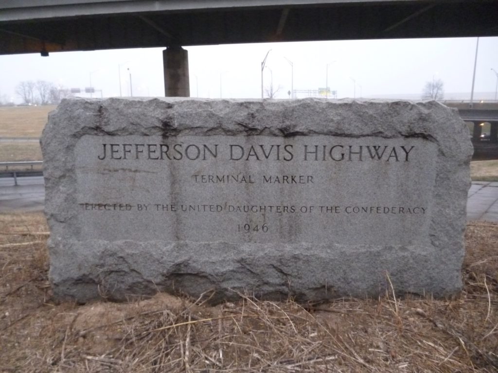
The future of a highway marker on Jefferson Davis Highway is uncertain after state and local officials voted to rename the roadway.

The monument was erected in 1946 on the shoulder of the highway, which soon will be named Richmond Highway in place of the name of Confederate President Jefferson Davis.

The stone marker is located along Route 1 near the Pentagon. An Arlington County spokeswoman told ARLnow that it is on VDOT land and that “unless VDOT has information otherwise, the County Manager’s Office has no information at this time on how the marker will be handled.”

When reached for comment, a spokeswoman for VDOT said the department didn’t have specific details about the marker’s future, “but we are working with the County to determine the next steps for this particular piece.”

The renaming is part of a broader movement to strip Confederate references from neighborhoods, public schools, and a special education program in Arlington.

The county agreed to pay $17,000 to cover the cost of new street signs for Route 1 — the updated signs are expected to be placed in October — after the Arlington County Board approved the renaming in April. It’s unclear if any of those funds will be used for the marker.

An inscription on the Route 1 marker indicates the United Daughters of the Confederacy was the organization that placed it along the highway.

Arlington County also removed a Confederate memorial after requests from residents in the wake of the deadly Charlottesville white nationalist rally. The plaque commemorated a Civil War lookout post and was also placed by the United Daughters of the Confederacy.

Photos courtesy of Twitter user 202FSUNole


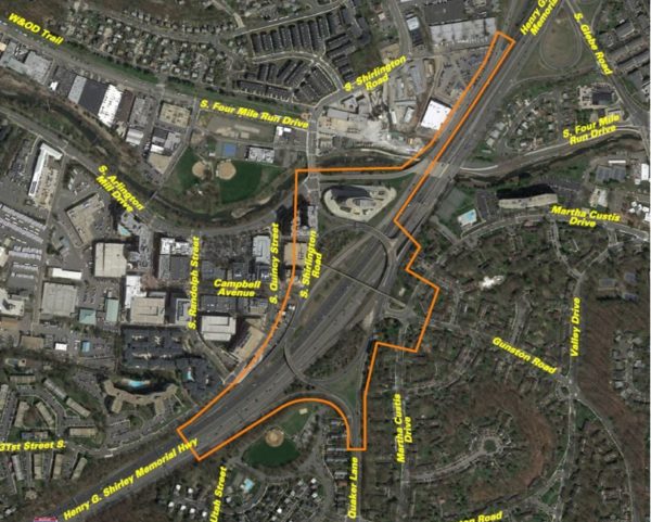
VDOT is planning a community meeting to discuss changes that might be coming to the “Shirlington Circle” interchange of I-395.

The somewhat labyrinthine interchange has been the scene of several notable crashes over the past few years. VDOT has been studying ways to improve it over the past few years.

The meeting is planned from 7-9 p.m. next Wednesday, June 12, at Drew Model School (3500 23rd Street S.). The transportation agency says it will reveal options for reducing congestion and crashes while soliciting public comments.

More from VDOT:

Join the Virginia Department of Transportation on Wednesday, June 12 to learn about and give input on alternatives identified by a study assessing safety and operational improvements at the I-395 Shirlington interchange (Exit 6), as well as at the following:

  • The ramp from South Glebe Road (Route 120) to southbound I-395
  • The intersection of South Shirlington Road and South Arlington Mill Drive
  • The intersection of Gunston Road and Martha Custis Drive

The study has collected data on traffic volumes and vehicle movements, and identified safety and operational issues. Learn more about the study’s identified alternatives, which aim to reduce congestion and crashes as well as boost the interchange’s overall performance. The study is being financed with federal funds and is expected to be finalized in fall 2019.

Residents are invited to stop by Drew Model Elementary School, 3500 23rd Street South, Arlington, VA 22206 between 7 p.m. and 9 p.m. to view displays and learn more about the study. A presentation will begin at 7:30 p.m. VDOT staff will be on hand to answer questions.

Give comments at the meeting, or e-mail or mail them by June 24, 2019 to Ms. Olivia Daniszewski, EIT, Virginia Department of Transportation, 4975 Alliance Drive, Fairfax, VA 22030.

Image via VDOT


Progressive Voice is a weekly opinion column. The views and opinions expressed in the column are those of the individual authors and do not necessarily reflect the views of their organizations or ARLnow.com.

By Cheryl W. Moore

(Updated at 9 a.m.) Several years ago, my then 13-year-old son announced that he had been hit by a car on Washington Blvd. in Westover. He quickly added that he wasn’t hurt; a car had lightly tapped him when he was riding his bike. That memory came back to me when I heard that Arlington County is collaborating with the Virginia Department of Transportation (VDOT) on repaving a portion of Washington Blvd in the Westover neighborhood near where I live.

A lot has happened in the years since my son’s incident. New retail establishments have made Westover a magnet for more visitors, and there are more walkers, drivers and cyclists on Washington Blvd. Reed Elementary School will undoubtedly add to the congestion when it opens in 2021.

All of these factors raise the likelihood of accidents involving pedestrians, cars and bicycles. Last fall, a woman was struck by a car while she was in a crosswalk, resulting in serious injuries. That accident spurred many calls for improvements on this busy street.

While Arlington County takes safety concerns seriously, staff also know that Arlington residents want to be involved in decisions affecting their neighborhoods before they are set in stone (or in this case, asphalt). The challenge is how much and what kind of public engagement, for which kinds of projects, will be most effective. County staff say they are trying to be clearer about expectations for community involvement.

The Westover repaving project is one example of how county staff are trying to engage the community more effectively. When staff learned that Washington Blvd was going to be repaved between N. McKinley Road and N. Frederick Street, they saw an opportunity to improve lane striping, replace crosswalks and add bike lanes. A routine repaving project might generally involve communicating with the community. However, the Department of Environmental Services (DES) staff determined that this project required a higher level of involvement, due to multiple uses of Westover Shopping Center and the project’s potential to change the character of the road.

Community members had feedback opportunities at two open houses at the Westover Library, a “pop-up” at the Westover farmers market, and via an online survey (which garnered 900 responses). Not surprisingly, the main concern was for greater safety, including better visibility of pedestrian crossings.

Three different proposals included such elements as high-visibility crosswalks, bike lanes on one or both sides of the street, back-in parking and reducing the number of parking spaces. From the final plan submitted to VDOT, it’s clear that community feedback had an impact. For example, the back-in parking concept was not favored by a majority of the community, so it was eliminated. It was also decided to include a bike lane only on the eastbound side of the street.

(more…)


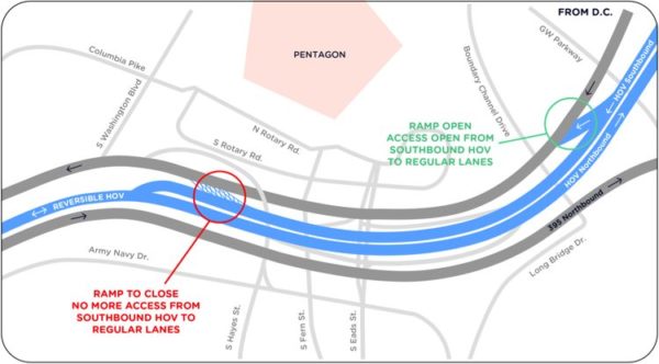
VDOT is permanently closing a ramp that allowed drivers heading southbound in the HOV lanes of I-395 to merge into the main southbound lanes near the Pentagon.

The closure, which is expected to happen later this week, will mean that drivers who take the southbound HOV lanes of the 14th Street Bridge from D.C., but who want to get into to the main lanes in Arlington, will need to take the earlier exit, closer to the bridge.

The closure is part of the 395 Express Lanes project.

More details from a VDOT press release:

The slip-ramp connecting the HOV lanes to the regular (or general purpose) lanes on I-395 South near the Pentagon will close permanently starting on or about June 1, according to the Virginia Department of Transportation.

Drivers wanting to access the southbound general purpose lanes from the southbound HOV lanes on this stretch of I-395 will need to use the slip-ramp located north of the Pentagon, near Boundary Channel Drive after crossing the 14th Street Bridge from D.C. into Virginia. Motorists traveling to the Pentagon or Crystal City — or non-HOV drivers who missed the exit near Boundary Channel — must take the exit at Eads Street. Drivers heading to the I-395 general purpose lanes should then follow signs to Army/Navy Drive and Hayes Street.

Tips for Motorists:

In the mornings:

  • Southbound motorists traveling on the I-395 HOV lanes from Washington, D.C. should move into the general purpose lanes immediately after crossing the 14th Street Bridge at the ramp near Boundary Channel Drive. Don’t wait to switch lanes until after you pass the Pentagon, as this slip-ramp will be closed.

In the afternoons:

  • For HOV motorists traveling southbound from D.C., nothing changes.
  • For non-HOV drivers, exit the HOV lanes after crossing the 14th Street Bridge at the ramp near Boundary Channel Drive.
  • Anyone heading to the Pentagon or Crystal City – or non-HOV drivers who missed the exit near Boundary Channel – should take the exit at Eads Street. Follow signs to Army/Navy Drive and Hayes Street to return to the I-395 South general purpose lanes.

Getting to I-395 South from the Pentagon:

  • Non-HOV drivers should take North Rotary Road to South Washington Boulevard to the I-395 southbound general purpose lanes.
  • HOV drivers should take the Eads Street ramp near the Pentagon to get directly onto the I-395 HOV lanes.

To help plan, drivers can find maps, videos and other educational information at www.expresslanes.com/projects/395.

This planned ramp closure is part of the new I-395 Express Lanes configuration, which will provide eight miles of faster, safer and seamless travel from the I-95 Express Lanes north to the D.C. line, as well as direct connections to the Pentagon and Crystal City. The new express lanes are scheduled to open in late October 2019. Information on how Express Lanes work and how to get an E-ZPass can be found at www.ExpressLanes.com.

The 395 Express Lanes are a public-private partnership between VDOT and Transurban. See more details on the project and related lane closures.


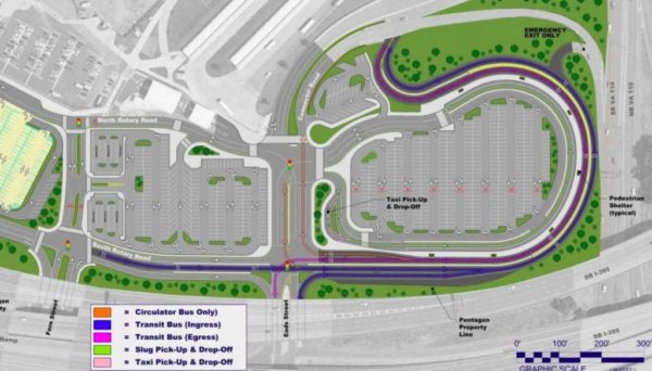
After over a year of work, the new bus and slug lanes are finally open at the Pentagon’s south parking lot.

Yesterday (Tuesday), the new configuration opened with bus-only travel lanes, reconfigured commuter lanes and slug lanes — lanes designed for High-Occupancy Vehicle (HOV) carpooling.

The new, dedicated bus loop is designed to distance passenger vehicles and buses to make the lot safer and increase mobility.

“The changes to the South Parking Lot are going to have a positive impact on the thousands of commuters traveling to and from the Pentagon Reservation each day,” said Susan Shaw, megaprojects director for the Virginia Department of Transportation, in a press release. “This important feature of the 395 Express Lanes project reinforces VDOT‘s commitment to support travel choices and alternative travel modes throughout our roadway network in Northern Virginia.”

An average of 25,000 employees use the Pentagon lots, with more than 1,800 buses and 3,400 “sluggers” passing through the lot each day, according to the press release.

Other improvements include new pedestrian sidewalks, new signage, and new lighting.

Image via National Capital Planning Commission


View More Stories