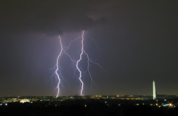
Update at 8:40 p.m. — Closures along Lee Highway and N. Glebe Road, among others, are expected to remain in place into the morning rush hour, according to Arlington Alert.

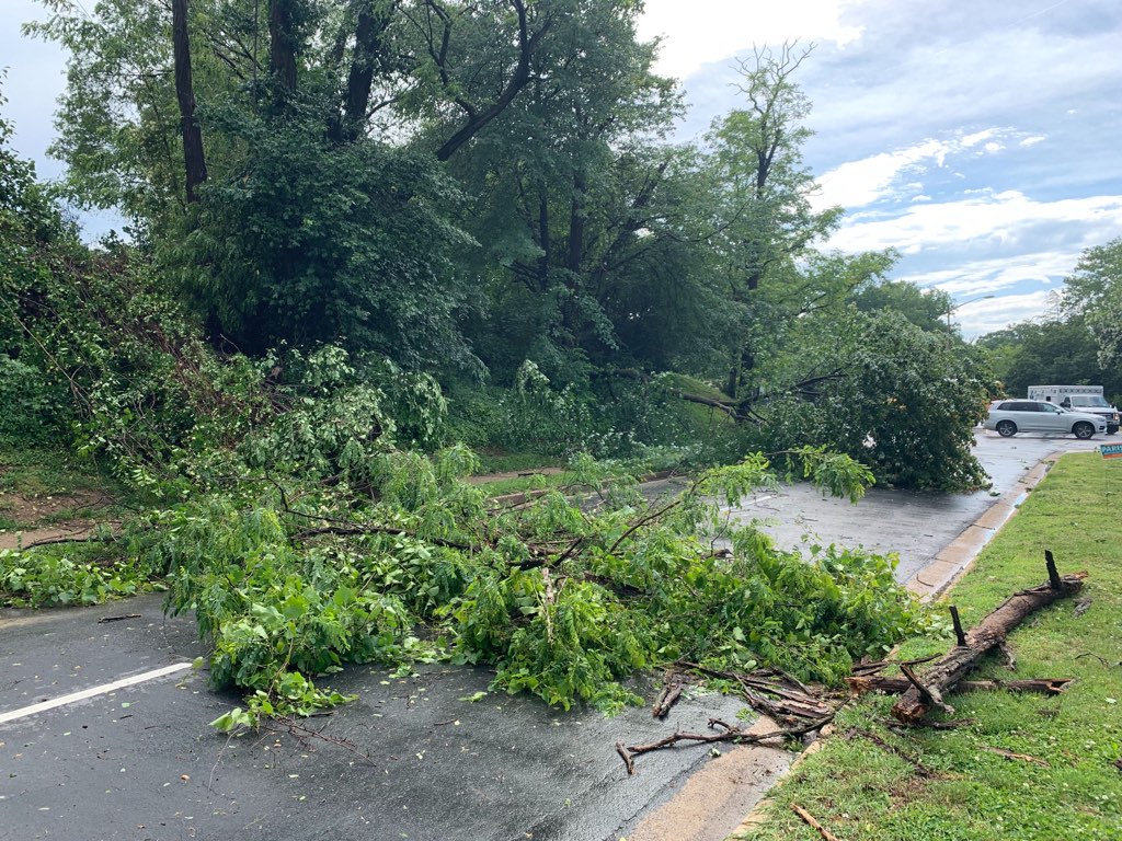
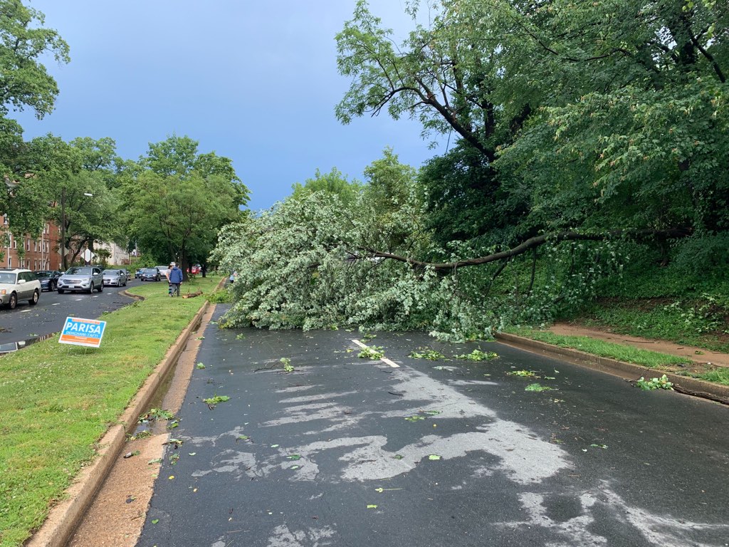
Update at 7 p.m. — Lee Highway is blocked at N. Nottingham Street, just west of the District Taco, due to a downed tree, according to scanner traffic. Reported power outages are down to about 28,500 in Arlington.

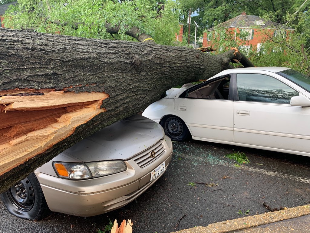
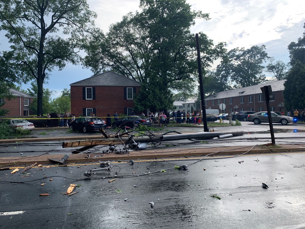
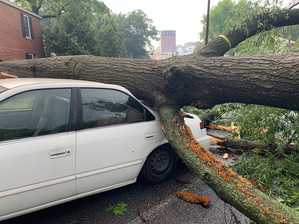
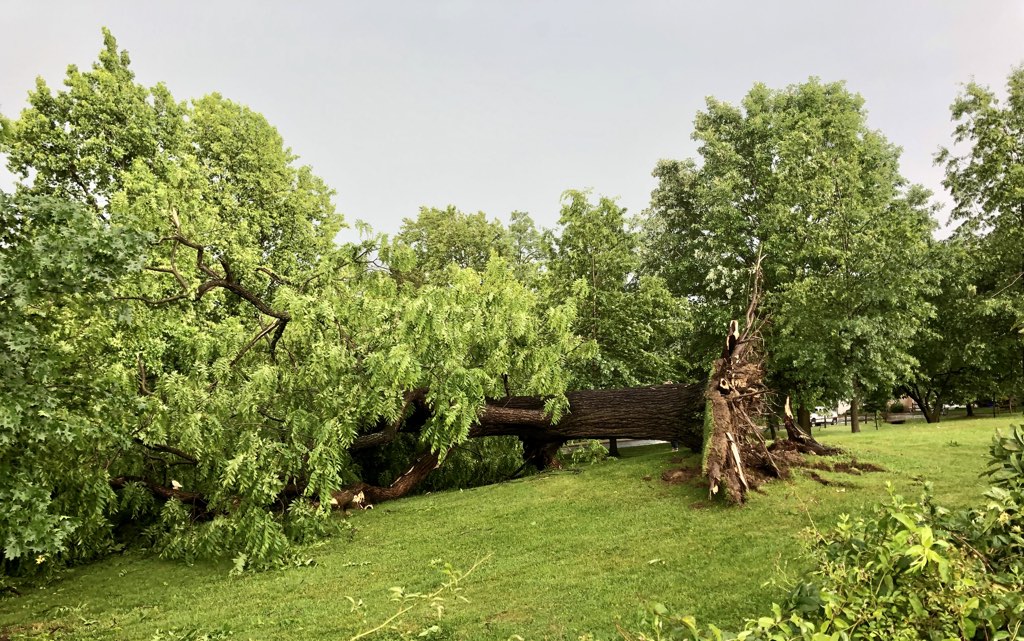
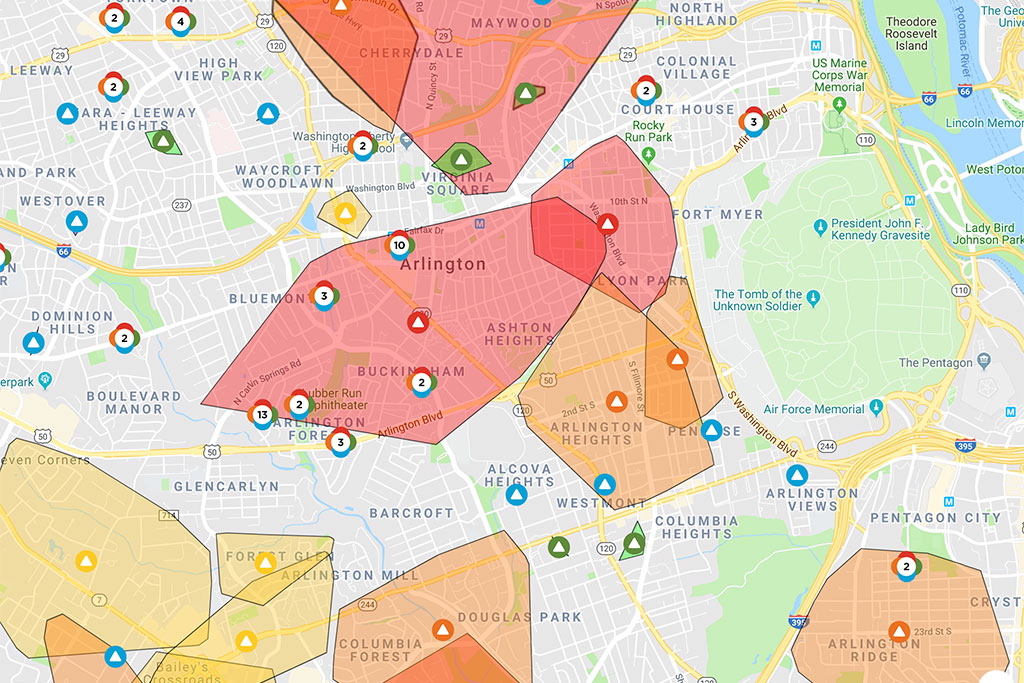
Update at 6 p.m. — Power outages in Arlington have reached a new peak of 35,719 customers, per Dominion’s website. Firefighters, meanwhile, are continue to respond to numerous reports of trees and wires down on houses — and across sidewalks and roadways — as well as a number of vehicle crashes. A tree is reported down on a car at the intersection of N. Kennebec Street and 11th Road N. in the Westover neighborhood, according to the National Weather Service.

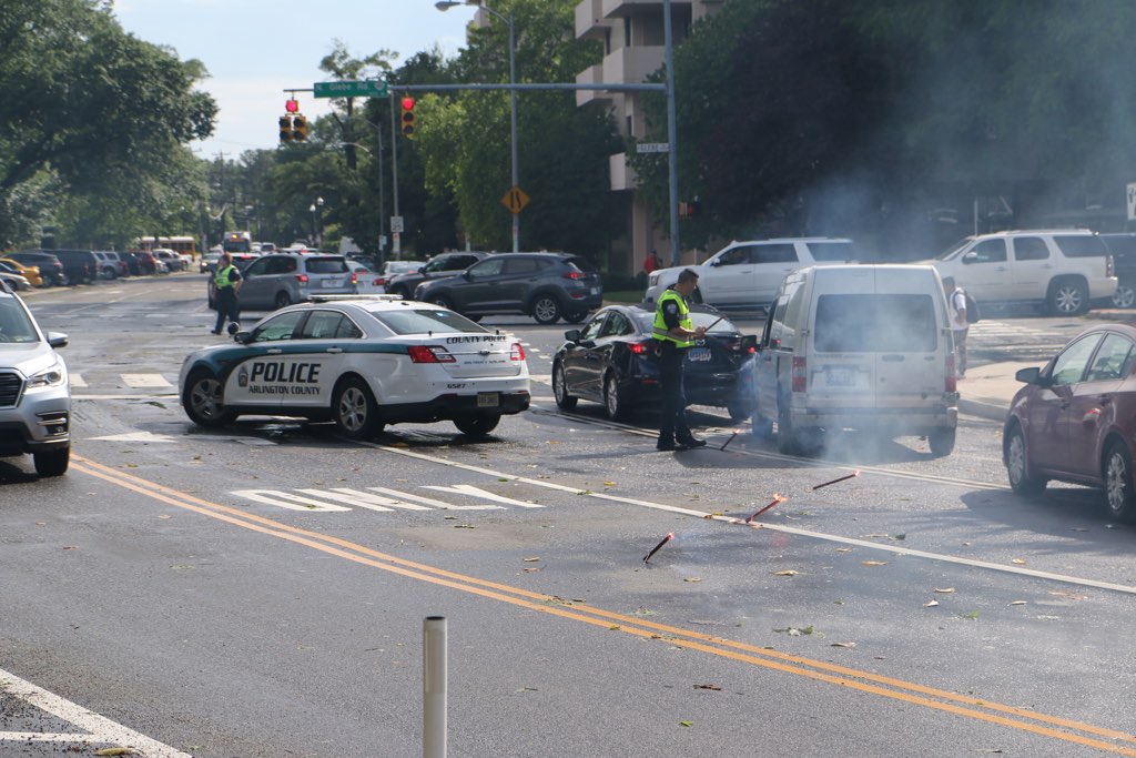
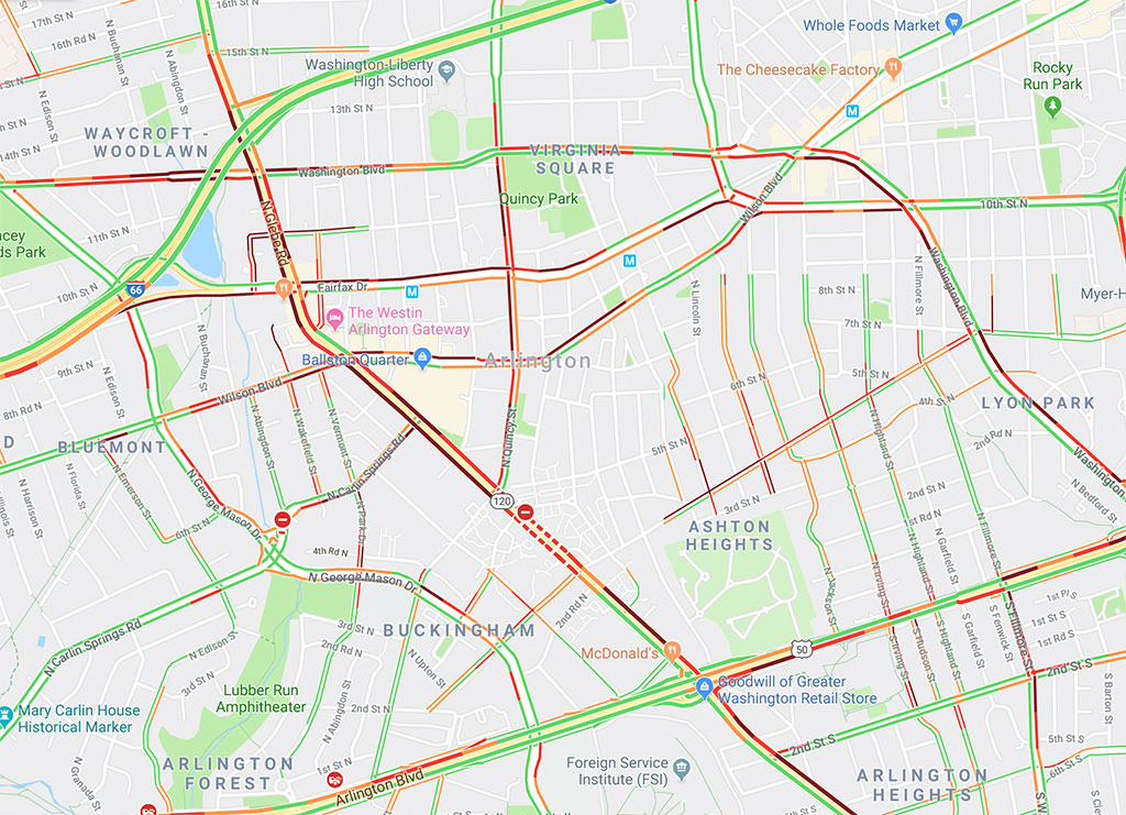
Update at 5:20 p.m. — Dark traffic signals is causing gridlock on local roads. A Google traffic map shows significant delays, particularly around the Ballston area. Arlington Public Schools and Arlington Transit buses are reported to be delayed due to heavy traffic.

Video recently posted of the storm arriving in Ballston shows a transformer explosion.

Update at 4:55 p.m. — Dominion has posted the following message on its website about the storm recovery.

Dominion Energy’s northern region has been impacted by severe thunderstorms, which included 70 mph wind gusts and lightning. These locations are the most impacted:

  • Alexandria
  • Fairfax
  • Woodbridge
  • Springfield
  • Leesburg
  • Fredericksburg

Customers have reported several spans of wire, trees and tree limbs down on the ground and over roadways.

We are still getting impacted by this line of storms. Our crews are working as quickly and as safely as possible to restore power. As soon as we are able to do a thorough assessment of the damages, we will be able to establish an estimated time of restoration.

Please stay back from all downed wires or damaged equipment, and call us immediately to report these damages at 1-866-DOM-HELP or 1-866-366-4357. You may also report power outages online by clicking here. If using a generator, please follow your manufacturer’s guidelines to operate it safely.

We appreciate your patience.

Dominion Energy

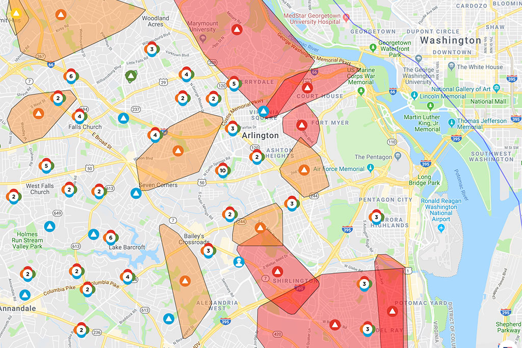
Update at 4:50 p.m — Due to the extensive storm damage, some parts of Arlington are not expected to have their power restored for hours. Dominion’s map shows the estimated restoration time for some large outages as 5-10 p.m., while others do not have an estimated time of restoration. N. Glebe Road is expected to remain closed south of Ballston, near 4th Street N., for about 12 hours per an Arlington Alert.

Volunteer firefighters have started responding to some calls to help work down the fire department’s backlog, per scanner traffic. Among the calls handled by ACFD are numerous stuck elevators, caused by power outages; several people were just freed from a stuck elevator at Don Tito’s in Clarendon, per scanner traffic.

Update at 4:35 p.m. — Dominion is now reporting just under 35,000 customers without power in Arlington. Among the neighborhoods without power is a large portion of residential north Arlington; several neighborhoods along Columbia Pike; most of Clarendon, Virginia Square and Ballston; Shirlington and Fairlington; and Aurora Highlands and Arlington Ridge.  

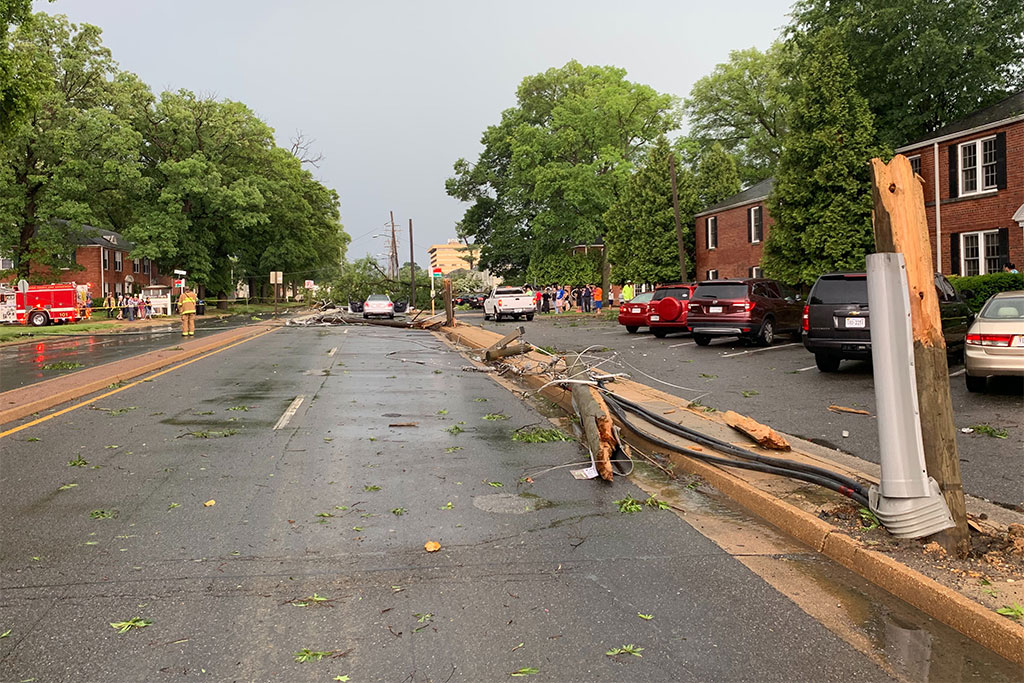
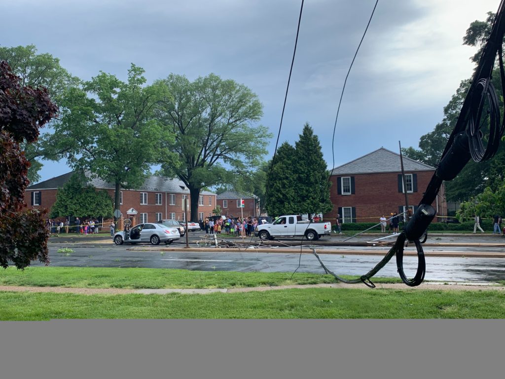
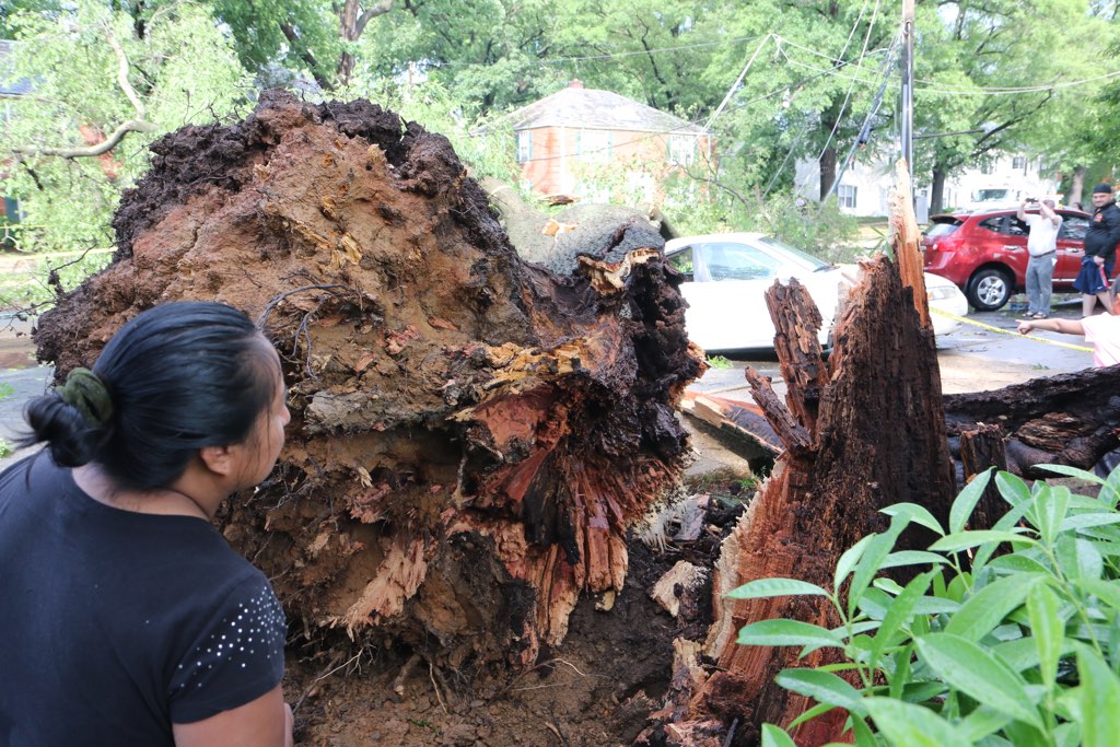
Updated at 4:20 p.m. — Photos from the scene show extensive storm damage to trees and power lines on N. Glebe Road south of Ballston. Police have requested additional units to the area for crowd control. Arlington’s 911 call center is “slammed” with calls and police have a 20-call backlog, per scanner traffic.

(more…)


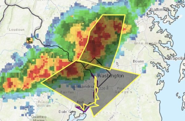
Arlington County and surrounding areas are under a Severe Thunderstorm Warning until 4:30 p.m.

More from the National Weather Service:

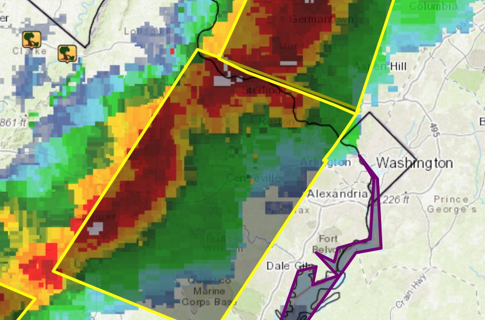
THE NATIONAL WEATHER SERVICE IN STERLING VIRGINIA HAS ISSUED A * SEVERE THUNDERSTORM WARNING FOR… THE DISTRICT OF COLUMBIA… SOUTHERN MONTGOMERY COUNTY IN CENTRAL MARYLAND… CENTRAL PRINCE GEORGES COUNTY IN CENTRAL MARYLAND… THE CITY OF FAIRFAX IN NORTHERN VIRGINIA… ARLINGTON COUNTY IN NORTHERN VIRGINIA… THE CITY OF FALLS CHURCH IN NORTHERN VIRGINIA… CENTRAL FAIRFAX COUNTY IN NORTHERN VIRGINIA… THE CITY OF ALEXANDRIA IN NORTHERN VIRGINIA… * UNTIL 430 PM EDT. * AT 337 PM EDT, SEVERE THUNDERSTORMS WERE LOCATED ALONG A LINE EXTENDING FROM MCLEAN TO FAIRFAX, MOVING EAST AT 20 MPH. HAZARD…60 MPH WIND GUSTS. SOURCE…RADAR INDICATED. IMPACT…DAMAGING WINDS WILL CAUSE SOME TREES AND LARGE BRANCHES TO FALL. THIS COULD INJURE THOSE OUTDOORS, AS WELL AS DAMAGE HOMES AND VEHICLES. ROADWAYS MAY BECOME BLOCKED BY DOWNED TREES. LOCALIZED POWER OUTAGES ARE POSSIBLE. UNSECURED LIGHT OBJECTS MAY BECOME PROJECTILES. * LOCATIONS IMPACTED INCLUDE… ARLINGTON, ALEXANDRIA, CENTREVILLE, BETHESDA, BOWIE, ANNANDALE, CLINTON, SPRINGFIELD, FORT WASHINGTON, FAIRFAX, FORT HUNT, VIENNA, GROVETON, FORESTVILLE, FALLS CHURCH, HUNTINGTON, LARGO, CORAL HILLS, MANTUA AND FORT BELVOIR. PRECAUTIONARY/PREPAREDNESS ACTIONS… FOR YOUR PROTECTION MOVE TO AN INTERIOR ROOM ON THE LOWEST FLOOR OF A BUILDING. && HAIL…<.75IN WIND…60MPH


Update at 2:50 p.m. — The Severe Thunderstorm Warning has been cancelled by the National Weather Service.

Update at 2:30 p.m. — A Severe Thunderstorm Warning has been issued for Arlington.

THE NATIONAL WEATHER SERVICE IN STERLING VIRGINIA HAS ISSUED A * SEVERE THUNDERSTORM WARNING FOR… THE DISTRICT OF COLUMBIA… SOUTHEASTERN MONTGOMERY COUNTY IN CENTRAL MARYLAND… NORTHERN PRINCE GEORGES COUNTY IN CENTRAL MARYLAND… THE NORTHEASTERN CITY OF FAIRFAX IN NORTHERN VIRGINIA… ARLINGTON COUNTY IN NORTHERN VIRGINIA… THE CITY OF FALLS CHURCH IN NORTHERN VIRGINIA… NORTHEASTERN FAIRFAX COUNTY IN NORTHERN VIRGINIA… THE CITY OF ALEXANDRIA IN NORTHERN VIRGINIA… * UNTIL 315 PM EDT. * AT 225 PM EDT, A SEVERE THUNDERSTORM WAS LOCATED OVER HUNTINGTON, MOVING NORTHEAST AT 45 MPH. HAZARD…60 MPH WIND GUSTS AND QUARTER SIZE HAIL. SOURCE…RADAR INDICATED. IMPACT…DAMAGING WINDS WILL CAUSE SOME TREES AND LARGE BRANCHES TO FALL. THIS COULD INJURE THOSE OUTDOORS, AS WELL AS DAMAGE HOMES AND VEHICLES. ROADWAYS MAY BECOME BLOCKED BY DOWNED TREES. LOCALIZED POWER OUTAGES ARE POSSIBLE. UNSECURED LIGHT OBJECTS MAY BECOME PROJECTILES… REMAIN ALERT FOR A POSSIBLE TORNADO! TORNADOES CAN DEVELOP QUICKLY FROM SEVERE THUNDERSTORMS. IF YOU SPOT A TORNADO GO AT ONCE INTO THE BASEMENT OR SMALL CENTRAL ROOM IN A STURDY STRUCTURE. FOR YOUR PROTECTION MOVE TO AN INTERIOR ROOM ON THE LOWEST FLOOR OF A BUILDING. TO REPORT SEVERE WEATHER, CONTACT YOUR NEAREST LAW ENFORCEMENT AGENCY. THEY WILL SEND YOUR REPORT TO THE NATIONAL WEATHER SERVICE OFFICE IN STERLING VIRGINIA. && TORNADO…POSSIBLE HAIL…1.00IN WIND…60MPH

Earlier: A Tornado Watch has been issued for Arlington and much of the D.C. region.

The watch, which is in effect until 9 p.m. tonight, was issued ahead of the arrival of a line of storms packing heavy rain and strong winds.

More from the National Weather Service on Twitter:

Flickr pool photo by Kevin Wolf


Update at 4:20 p.m. — The storm passed quickly, but not before dropping enough snow-like graupel and hail to whiten the ground.

Earlier: A Severe Thunderstorm Warning has been issued for Arlington, ahead of a line of storm approaching from the northwest.

The storms may produce hail and strong wind gusts, forecasters say.

More from the National Weather Service:

THE NATIONAL WEATHER SERVICE IN STERLING VIRGINIA HAS ISSUED A * SEVERE THUNDERSTORM WARNING FOR… THE DISTRICT OF COLUMBIA… SOUTHEASTERN MONTGOMERY COUNTY IN CENTRAL MARYLAND… PRINCE GEORGES COUNTY IN CENTRAL MARYLAND… NORTHWESTERN CHARLES COUNTY IN SOUTHERN MARYLAND… ARLINGTON COUNTY IN NORTHERN VIRGINIA… THE CITY OF FALLS CHURCH IN NORTHERN VIRGINIA… SOUTHEASTERN FAIRFAX COUNTY IN NORTHERN VIRGINIA… EAST CENTRAL PRINCE WILLIAM COUNTY IN NORTHERN VIRGINIA… THE CITY OF ALEXANDRIA IN NORTHERN VIRGINIA… * UNTIL 430 PM EDT. * AT 351 PM EDT, A SEVERE THUNDERSTORM WAS LOCATED NEAR OAKTON, OR NEAR RESTON, MOVING SOUTHEAST AT 50 MPH. HAZARD…60 MPH WIND GUSTS. WIND GUSTS OVER 50 MPH WERE REPORTED IN WINCHESTER, LEESBURG AND AT DULLES AIRPORT. SOURCE…RADAR INDICATED. IMPACT…DAMAGING WINDS WILL CAUSE SOME TREES AND LARGE BRANCHES TO FALL. THIS COULD INJURE THOSE OUTDOORS, AS WELL AS DAMAGE HOMES AND VEHICLES. ROADWAYS MAY BECOME BLOCKED BY DOWNED TREES. LOCALIZED POWER OUTAGES ARE POSSIBLE. UNSECURED LIGHT OBJECTS MAY BECOME PROJECTILES. * LOCATIONS IMPACTED INCLUDE… ARLINGTON, ALEXANDRIA, WALDORF, DALE CITY, BETHESDA, BOWIE, ANNANDALE, CLINTON, SPRINGFIELD, COLLEGE PARK, FORT WASHINGTON, GREENBELT, LANGLEY PARK, BELTSVILLE, FORT HUNT, GROVETON, FORESTVILLE, FALLS CHURCH, HUNTINGTON AND LARGO. PRECAUTIONARY/PREPAREDNESS ACTIONS… GET INDOORS TO PROTECT YOURSELF FROM WIND AND LIGHTNING. TREES AROUND YOU MAY BE DOWNED FROM DAMAGING WINDS, SO IF YOU ARE NEAR LARGE TREES, MOVE TO AN INTERIOR ROOM ON THE LOWEST FLOOR. DON’T DRIVE UNDERNEATH TREES OR IN WOODED AREAS UNTIL THE THREAT HAS PASSED. && HAIL…<.75IN WIND…60MPH


High Wind Warning Today — Arlington is now under a High Wind Warning until 6 p.m. today. Gusty winds knocked out power in a number of areas overnight. As of 8 a.m., more than 250 Dominion customers in Arlington were still without power. [Twitter, Weather.gov]

American Legion Project Approved — “The Arlington County Board today approved a redevelopment plan to replace the aging American Legion Post 39 at 3445 Washington Blvd. with a seven-story building that will include 160 affordable units atop a new Post 139. In a related action, the Board allocated a $5.79 million loan from the County’s Affordable Housing Investment Fund to help build the project.” [Arlington County]

Amazon Development Boom Likely — “Arlington County could see the number of major development plans triple with the arrival of Amazon.com Inc.’s second headquarters. At least, that’s what County Manager Mark Schwartz wants to be ready for.” [Washington Business Journal]

Next Step for Child Care Initiative — “The Arlington County Board today ratified advertisements of public hearings on proposed changes to the Zoning Ordinance and local child care Codes aimed at improving the availability, accessibility, affordability and quality of child care in Arlington.” [Arlington County]

Overturned Vehicle on Residential Street — The driver of a Subaru somehow flipped the vehicle on the 2100 block of N. Quantico Street, in the Highland Park-Overlee Knolls neighborhood, Sunday morning. Another vehicle was damaged in the crash, according to photos sent by a passerby. The driver was extricated by firefighters but uninjured. [Twitter]

County Budget Includes Theater Cuts — “The spending plan calls for the closure of the Scenic Studio program and Costume Lab at Gunston…  Remarks range from ‘unbelievable’ and ‘terrible,’ to ‘this is very disturbing that Arlington County may actually be killing local arts programs.'” [WTOP]

Flickr pool photo by Dennis Dimick


Arlington County is under a Severe Thunderstorm Warning as strong storms approach.

The National Weather Service issued the warning just before 8:35 p.m. It is in effect, at least initially, through 9:15 p.m.

More from NWS:

THE NATIONAL WEATHER SERVICE IN STERLING VIRGINIA HAS ISSUED A * SEVERE THUNDERSTORM WARNING… * UNTIL 915 PM EDT. * AT 834 PM EDT, A SEVERE THUNDERSTORM WAS LOCATED OVER LAKE BARCROFT, OR OVER FALLS CHURCH, MOVING EAST AT 30 MPH. HAZARD…60 MPH WIND GUSTS AND QUARTER SIZE HAIL. SOURCE…RADAR INDICATED. IMPACT…DAMAGING WINDS WILL CAUSE SOME TREES AND LARGE BRANCHES TO FALL. THIS COULD INJURE THOSE OUTDOORS, AS WELL AS DAMAGE HOMES AND VEHICLES. ROADWAYS MAY BECOME BLOCKED BY DOWNED TREES. LOCALIZED POWER OUTAGES ARE POSSIBLE. UNSECURED LIGHT OBJECTS MAY BECOME PROJECTILES. * LOCATIONS IMPACTED INCLUDE… ARLINGTON, ALEXANDRIA, BETHESDA, ANNANDALE, CLINTON, SPRINGFIELD, COLLEGE PARK, FORT WASHINGTON, GREENBELT, FAIRFAX, LANGLEY PARK, BELTSVILLE, VIENNA, GROVETON, FORESTVILLE, FALLS CHURCH, HUNTINGTON, LARGO, CORAL HILLS AND BLADENSBURG.

PRECAUTIONARY/PREPAREDNESS ACTIONS… GET INDOORS TO PROTECT YOURSELF FROM WIND AND LIGHTNING. TREES AROUND YOU MAY BE DOWNED FROM DAMAGING WINDS, SO IF YOU ARE NEAR LARGE TREES, MOVE TO AN INTERIOR ROOM ON THE LOWEST FLOOR. DON’T DRIVE UNDERNEATH TREES OR IN WOODED AREAS UNTIL THE THREAT HAS PASSED. && HAIL…1.00IN WIND…60MPH


Update at 7:45 p.m. — There have been reports of downed trees, branches and power lines in Arlington, but no major power outages have been reported by Dominion. Flights are Reagan National Airport are resuming.

No major flooding issues have been reported, though ARLnow.com’s office sprung a leak during the storm.

Update at 7:01 p.m. — The Severe Thunderstorm Warning has been extended until 7:30 p.m.

Update at 6:58 p.m. — A Flash Flood Warning has also been issued for Arlington.

The National Weather Service in Sterling Virginia has issued a

* Flash Flood Warning for…
The District of Columbia…
South central Montgomery County in central Maryland…
Arlington County in northern Virginia…
The City of Falls Church in northern Virginia…
Northeastern Fairfax County in northern Virginia…
The City of Alexandria in northern Virginia…

* Until 1000 PM EDT.

* At 654 PM EDT, Doppler radar indicated thunderstorms producing
heavy rain across the area. Around an inch of rain has fallen, and
an additional 1 to 2 inches of rain is possible over the next 1
to 2 hours leading to flash flooding in the metro area.

PRECAUTIONARY/PREPAREDNESS ACTIONS…

Turn around, don’t drown when encountering flooded roads. Most flood
deaths occur in vehicles.

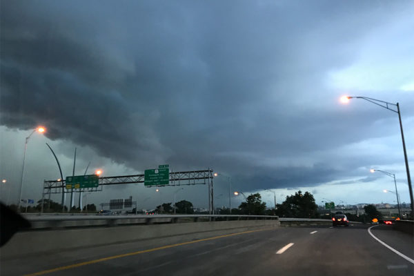
(Updated at 6:55 p.m.) The National Weather Service has issued a Severe Thunderstorm Warning for Arlington as a powerful line of storms rolls through the county.

More from the National Weather Service:

…A SEVERE THUNDERSTORM WARNING REMAINS IN EFFECT UNTIL 700 PM EDT FOR THE DISTRICT OF COLUMBIA…SOUTHERN MONTGOMERY…NORTHWESTERN PRINCE GEORGES…SOUTHEASTERN LOUDOUN…FAIRFAX…EAST CENTRAL FAUQUIER…PRINCE WILLIAM…AND ARLINGTON COUNTIES…THE CITY OF FALLS CHURCH…THE CITY OF MANASSAS PARK…THE CITY OF MANASSAS…THE CITY OF FAIRFAX AND THE CITY OF ALEXANDRIA…

At 646 PM EDT, severe thunderstorms were located along a line extending from Bethesda to Newington to 11 miles east of Bealeton, moving southeast at 35 mph.

HAZARD…70 mph wind gusts and quarter size hail.

SOURCE…Radar indicated.

IMPACT…Damaging winds will cause some trees and large branches to fall. This could injure those outdoors, as well as damage homes and vehicles. Roadways may become blocked by downed trees. Localized power outages are possible. Unsecured light objects may become projectiles.

Locations impacted include…
Arlington, Alexandria, Germantown, Centreville, Dale City, Rockville, Bethesda, Gaithersburg, Reston, Annandale, Springfield, College Park, South Riding, Fort Washington, Herndon, Greenbelt, Fairfax, Langley Park, Fort Hunt and Vienna.

PRECAUTIONARY/PREPAREDNESS ACTIONS…

Prepare immediately for large hail and damaging winds. People outside should move to a shelter, inside a strong building and away from windows.

Reagan National Airport, meanwhile, has imposed a ground stop on flights due to the severe weather.

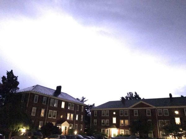
Photo (top) courtesy Milan


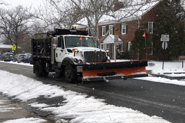
(Updated at 3:45 p.m.) A Winter Storm Warning is set to take effect overnight tonight, as a snowstorm bears down on the D.C. area.

Forecasters say 4-8 inches of heavy snow accumulation is likely for Arlington and the immediate metro area, though even snow is possible.

From the National Weather Service:

…WINTER STORM WARNING IN EFFECT FROM 2 AM TO 8 PM EDT WEDNESDAY… * WHAT…HEAVY SNOW EXPECTED. TOTAL SNOW ACCUMULATIONS OF 4 TO 8 INCHES ARE EXPECTED. * WHERE…THE DISTRICT OF COLUMBIA, PORTIONS OF CENTRAL AND NORTHERN MARYLAND AND NORTHERN AND NORTHWEST VIRGINIA. * WHEN…FROM 2 AM TO 8 PM EDT WEDNESDAY. * ADDITIONAL DETAILS…PLAN ON DIFFICULT TRAVEL CONDITIONS. BE PREPARED FOR SIGNIFICANT REDUCTIONS IN VISIBILITY AT TIMES. PRECAUTIONARY/PREPAREDNESS ACTIONS… A WINTER STORM WARNING FOR SNOW MEANS SEVERE WINTER WEATHER CONDITIONS WILL MAKE TRAVEL VERY HAZARDOUS OR IMPOSSIBLE. IF YOU MUST TRAVEL, KEEP AN EXTRA FLASHLIGHT, FOOD AND WATER IN YOUR VEHICLE IN CASE OF AN EMERGENCY. THE LATEST ROAD CONDITIONS FOR THE STATE YOU ARE CALLING FROM CAN BE OBTAINED BY CALLING 5 1 1. &&


Arlington County is under a Severe Thunderstorm Warning until 8:15 p.m. tonight.

A strong storm is heading towards Arlington from the northwest, forecasters say. Very heavy rain and damaging wind is possible with the storm.

THE NATIONAL WEATHER SERVICE IN STERLING VIRGINIA HAS ISSUED A * SEVERE THUNDERSTORM WARNING FOR… THE DISTRICT OF COLUMBIA… SOUTHEASTERN MONTGOMERY COUNTY IN CENTRAL MARYLAND… CENTRAL PRINCE GEORGES COUNTY IN CENTRAL MARYLAND… ARLINGTON COUNTY IN NORTHERN VIRGINIA… THE CITY OF FALLS CHURCH IN NORTHERN VIRGINIA… NORTHEASTERN FAIRFAX COUNTY IN NORTHERN VIRGINIA… THE CITY OF ALEXANDRIA IN NORTHERN VIRGINIA… * UNTIL 815 PM EDT * AT 731 PM EDT, SEVERE THUNDERSTORMS WERE LOCATED ALONG A LINE EXTENDING FROM WHEATON-GLENMONT TO VIENNA, MOVING SOUTHEAST AT 15 MPH. HAZARD… 60 MPH WIND GUSTS. SOURCE… RADAR INDICATED. IMPACT… DAMAGING WINDS WILL CAUSE SOME TREES AND LARGE BRANCHES TO FALL. THIS COULD INJURE THOSE OUTDOORS, AS WELL AS DAMAGE HOMES AND VEHICLES. ROADWAYS MAY BECOME BLOCKED BY DOWNED TREES. LOCALIZED POWER OUTAGES ARE POSSIBLE. UNSECURED LIGHT OBJECTS MAY BECOME PROJECTILES. * LOCATIONS IMPACTED INCLUDE… ARLINGTON, ALEXANDRIA, BETHESDA, BOWIE, ANNANDALE, CLINTON, OLNEY, SPRINGFIELD, COLLEGE PARK, FORT WASHINGTON, GREENBELT, LANGLEY PARK, BELTSVILLE, FORT HUNT, VIENNA, GROVETON, FORESTVILLE, FALLS CHURCH, HUNTINGTON AND LARGO. PRECAUTIONARY/PREPAREDNESS ACTIONS… GET INDOORS TO PROTECT YOURSELF FROM WIND AND LIGHTNING. TREES AROUND YOU MAY BE DOWNED FROM DAMAGING WINDS, SO IF YOU ARE NEAR LARGE TREES, MOVE TO AN INTERIOR ROOM ON THE LOWEST FLOOR. DON’T DRIVE UNDERNEATH TREES OR IN WOODED AREAS UNTIL THE THREAT HAS PASSED. && HAIL… <.75IN WIND… 60MPH


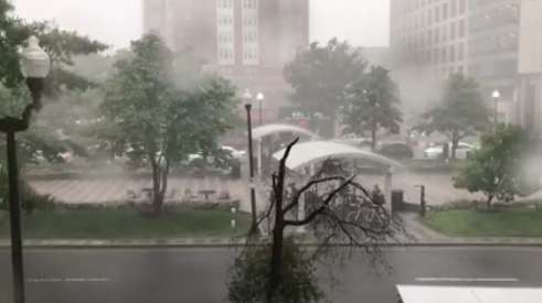
(Update at 8:10 p.m.) A storm packing torrential rain, hail, thunder, lightning and strong wind gusts rolled through Arlington Thursday evening.

As of 8 p.m., nearly 2,600 Dominion customers in Arlington were still without power, according to the utility’s website. The primary outage is located along Lee Highway, between East Falls Church and N. Harrison Street, where downed trees and power lines were reported.

The outage prompted the Lee Highway location of District Taco to temporarily close, according to the restaurant’s Twitter account.

Here's a view of Wednesday's crazy thunderstorm from our office in Clarendon

Posted by ARLnow.com on Thursday, August 3, 2017

(more…)


Arlington is under a Severe Thunderstorm Warning through 5:45 p.m. today (Monday).

The National Weather Service says a strong storm is heading toward Arlington, packing heavy rain and wind.

More from NWS:

THE NATIONAL WEATHER SERVICE IN STERLING VIRGINIA HAS ISSUED A * SEVERE THUNDERSTORM WARNING FOR… THE CENTRAL DISTRICT OF COLUMBIA… SOUTHERN MONTGOMERY COUNTY IN CENTRAL MARYLAND… THE CITY OF FAIRFAX IN NORTHERN VIRGINIA… ARLINGTON COUNTY IN NORTHERN VIRGINIA… THE CITY OF FALLS CHURCH IN NORTHERN VIRGINIA… CENTRAL FAIRFAX COUNTY IN NORTHERN VIRGINIA… THE NORTHWESTERN CITY OF ALEXANDRIA IN NORTHERN VIRGINIA… * UNTIL 545 PM EDT * AT 501 PM EDT, SEVERE THUNDERSTORMS WERE LOCATED ALONG A LINE EXTENDING FROM NEAR FAIRFAX TO MANTUA, MOVING EAST AT 20 MPH. HAZARD… 60 MPH WIND GUSTS. SOURCE… RADAR INDICATED. IMPACT… DAMAGING WINDS WILL CAUSE SOME TREES AND LARGE BRANCHES TO FALL. THIS COULD INJURE THOSE OUTDOORS, AS WELL AS DAMAGE HOMES AND VEHICLES. ROADWAYS MAY BECOME BLOCKED BY DOWNED TREES. LOCALIZED POWER OUTAGES ARE POSSIBLE. UNSECURED LIGHT OBJECTS MAY BECOME PROJECTILES. * LOCATIONS IMPACTED INCLUDE… ARLINGTON, ALEXANDRIA, CENTREVILLE, RESTON, ANNANDALE, SPRINGFIELD, FAIRFAX, VIENNA, FALLS CHURCH, MANTUA, PIMMIT HILLS, MCLEAN, NATIONALS PARK, GALLAUDET UNIVERSITY, AMERICAN LEGION BRIDGE, REAGAN NATIONAL AIRPORT, ROSSLYN, CRYSTAL CITY, RFK STADIUM AND BURKE. PRECAUTIONARY/PREPAREDNESS ACTIONS… GET INDOORS TO PROTECT YOURSELF FROM WIND AND LIGHTNING. TREES AROUND YOU MAY BE DOWNED FROM DAMAGING WINDS, SO IF YOU ARE NEAR LARGE TREES, MOVE TO AN INTERIOR ROOM ON THE LOWEST FLOOR. DON’T DRIVE UNDERNEATH TREES OR IN WOODED AREAS UNTIL THE THREAT HAS PASSED. && HAIL… <.75IN WIND… 60MPH


View More Stories