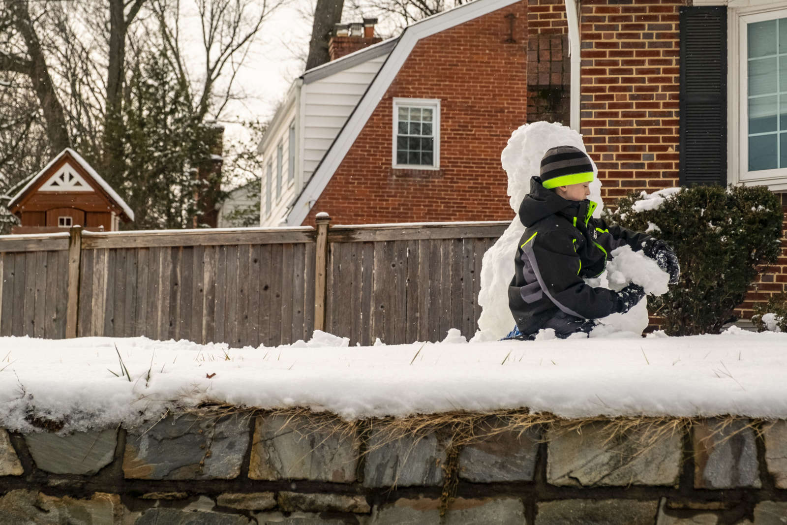
Building a snowman in Tara-Leeway Heights (Staff Photo by Jay Westcott)

(Updated at 11:55 a.m.) Light freezing drizzle and snow is falling now, but a change this afternoon may bring new hazards.

The wintry precipitation is expected to taper off around noon, just as temperatures start dropping and the wind picks up.

In a new Special Weather Statement, the National Weather Service says those on the roads should expect slick spots.

…Areas of freezing drizzle through midday. Becoming blustery and turning sharply colder in the afternoon…

Areas of freezing drizzle can be expected from the Blue Ridge and Catoctin Mountains to the Chesapeake Bay until about noon today. Precipitation may change briefly back to snow before it ends with little or no additional snow accumulation expected. As the precipitation ends, expect blustery northwest winds to strengthen and gust to about 30 mph with temperatures decreasing during the afternoon. Expect slick spots on roadways especially over bridges and any untreated surfaces.

Arlington County, meanwhile, says its snow crews are now tackling residential streets, having already treated arterial routes.

“Residential streets may only be passable with one lane and you may not see bare pavement yet,” the county noted on social media.

Arlington property owners also have a snow removal responsibility, thanks to a circa-2010 county ordinance.

“A recent weather event has concluded and deposited snow/ice accumulations of less than 6 inches,” the county noted. “Arlington’s sidewalk snow removal ordinance requires residents and businesses to clear adjacent public sidewalks of snow and ice by 6:00 A.M. on Wednesday, January 17, 2024.”

Due to poor road conditions, trash and recycling collection in Arlington has been delayed another day, according to Arlington’s Dept. of Environmental Services.

In all, Arlington — as measured at National Airport — received just over 4 inches of snow from the MLK Day storm. More snow is in the forecast for Friday.


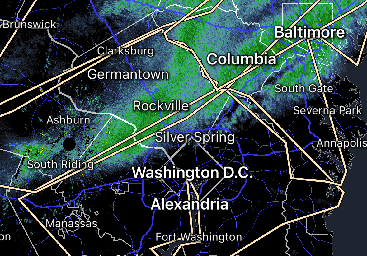
Weather radar image of arriving snow as of 11:30 a.m.

Update at 9:30 p.m. — More snow, including some accumulation, is now possible early Monday morning. Forecasters say it could cause major problems on the roads. From NWS:

841 PM EST Sun Jan 14 2024

…POTENTIAL WINTER COMMUTING HAZARD FOR THE WASHINGTON METROPOLITAN AREA AND SOUTHERN MARYLAND MONDAY MORNING…

There is a potential for hazardous commuting conditions for the Monday morning commute. A period of snow is POSSIBLE (a 40 to 60 percent chance) late tonight into Monday morning across the Washington metro area into southern Maryland with up to an inch of accumulation along with the potential for snow covered roads.

If this threat does materialize during the late tonight through the Monday morning commute, many roads could quickly turn snow covered. This could lead to dangerous traveling conditions, multiple accidents, and extensive delays.

If commuting late tonight through Monday morning, be aware of the POSSIBILITY of significant travel disruptions. Plan ahead by allowing for extra travel time, and consider using public transportation and telework options.

Stay tuned for updates on this potential winter weather episode.

Earlier: If the blowing wind and sudden arrival of dark clouds did not make it clear, we’re about to get a change in the weather.

The National Weather Service has issued a Special Weather Statement, warning that an incoming snow shower may bring reduced visibility and light accumulation to the area.

More from NWS:

…LIGHT SNOW WILL AFFECT THE DC METRO INTO CENTRAL MARYLAND…
Snow may coat elevated and grassy surfaces through midday, and with temperatures falling into the lower to middle 30s, some untreated surfaces may become slick. Wind gusts around 30 to 40 mph combined with the snow may reduce visibility to near one mile at times.

Locations impacted include…

Arlington, Alexandria, Centreville, Waldorf, Dale City, Bethesda, Reston, Bowie, Annandale, Clinton, Springfield, College Park, Crofton, South Riding, Fort Washington, Greenbelt, Fairfax, Langley Park, Beltsville, and Fort Hunt.

This includes the following highways…
Interstate 95 in Maryland between mile markers 2 and 34.
Interstate 270 in Maryland between mile markers 1 and 3.
Slow down and allow extra time when traveling.


The flag atop an office building in Courthouse blowing in the wind (staff photo by Jay Westcott)

After an expected deluge tonight, Saturday may feature hazardous wind gusts.

The National Weather Service just issued the following Wind Advisory, warning of falling tree limbs and possible power outages to start the weekend.

…WIND ADVISORY REMAINS IN EFFECT FROM 7 AM TO 4 PM EST SATURDAY…

* WHAT…West to southwest winds 20 to 30 mph with gusts up to 50 mph expected.

* WHERE…Portions of central, north central, northeast, northern and western Maryland, The District of Columbia, northern and northwest Virginia and eastern and panhandle West Virginia.

* WHEN…From 7 AM to 4 PM EST Saturday.

* IMPACTS…Gusty winds could blow around unsecured objects. Tree limbs could be blown down and a few power outages may result.

In addition to the earlier Flood Watch, which takes effect at 6 p.m. tonight, Arlington is also under a Coastal Flood Advisory.

…COASTAL FLOOD ADVISORY REMAINS IN EFFECT FROM 5 AM TO NOON EST SATURDAY…

* WHAT…Up to one foot of inundation above ground level expected in low lying areas due to tidal flooding.

* WHERE…Shoreline in the City of Alexandria and Arlington County.

* WHEN…From 5 AM to noon EST Saturday, especially around the time of high tide.

* IMPACTS…Water is expected to approach the curb near the intersection of King Street and Strand Street in Alexandria.

* ADDITIONAL DETAILS…Tides two to two and a half feet above normal. The next high tides at Alexandria are at 8:59 PM this evening and 9:30 AM Saturday morning.

The active weather pattern is slated to continue into next week. Starting Sunday, arctic air will bring an extended bout of freezing temperatures to the area, ahead of a potential snowstorm on Tuesday.

Some forecasters are highlighting the potential of major snow accumulation, while others are more reserved in their predictions.


Wind-blown raindrops on a window (staff photo)

Update at 3:55 p.m. — A Flood Warning has been issued for Arlington.

Update at 12:30 p.m. — The earlier Wind Advisory has been upgraded to a High Wind Warning.

…HIGH WIND WARNING IN EFFECT UNTIL 1 AM EST WEDNESDAY…

* WHAT…Southeast winds 25 to 40 mph with gusts up to 60 mph expected.

* WHERE…In District of Columbia, District of Columbia. In Maryland, Prince Georges, Charles, Central and Southeast Montgomery and Central and Southeast Howard Counties. In Virginia, Fairfax, Stafford, King George and Central and Southeast Prince William/Manassas/Manassas Park Counties, and Arlington/Falls Church/Alexandria.

* WHEN…Until 1 AM EST Wednesday.

* IMPACTS…Damaging winds will blow down trees and power lines. Widespread power outages are expected. Travel will be difficult, especially for high profile vehicles.

Update at 12:25 p.m. — The National Weather Service has issued the following forecast update, predicting deteriorating conditions and a period of “intense” rainfall between 6-10 p.m.

…HAZARDOUS WEATHER CONDITIONS FOR BALTIMORE/WASHINGTON
REGION TODAY BETWEEN 500 PM AND 1000 PM EST…

Weather conditions will deteriorate as a strong frontal system approaches this afternoon, then passes through the greater Baltimore/Washington region this evening. This will result high winds capable of downing trees and powerlines, tidal flooding, and the potential for flooding of small streams and creeks. This will create hazardous travel conditions late this afternoon through late evening across the region.

Light-to-moderate rain will continue early this afternoon, then increase in intensity late this afternoon, with a several hour period of heavy, intense rainfall expected between 6 PM and 10 PM. This heavy rainfall, coupled with already saturated soils from recent rainfall, will cause flooding of small streams and creeks. Do not attempt to drive across flooded roadways; additionally, flooding at night increases the risk for motorists not being able to quickly identify the water hazards due to decreased visibilities by the heavy rain and darkness.

Easterly winds will increase in intensity as well this afternoon across the region, with gusts to 50 MPH expected late this afternoon through mid-evening. Locations closer to the Chesapeake Bay will see higher wind gusts of 60-70 MPH. Strong winds will increase the risk of falling trees and downed powerlines. Again, the risk of poor outcomes resulting from high winds is increased during nighttime. Winds will decrease after midnight tonight.

Finally, areas along the tidal Potomac River and western shore of the Chesapeake Bay north of Smith Point VA should prepare for moderate-to-major tidal flooding. The cities of Baltimore, Annapolis MD, and Alexandria VA are most prone to tidal flooding, and the coupling of heavy rainfall and strong onshore winds of 50-60 MPH in these locations will work together to create moderate-to-major tidal impacts.

Earlier: Arlington County will be under a Wind Advisory and a Flood Watch from early this afternoon until Wednesday morning.

A storm packing heavy rain and gusty winds will sweep through the area, forecasters say, potentially causing widespread power outages.

Some local school districts like Montgomery County are dismissing students early, but Arlington and neighboring Alexandria and Fairfax County have so far not announced any early dismissals.

As of noon Arlington Public Schools said that after-school and evening activities have been canceled.

All APS after-school and evening activities are canceled for today, Tue, Jan. 9, 2024, including extracurricular activities, games, team practices, field trips, adult education classes, and programs in schools and on school grounds. The School Board Work Session scheduled for this evening is also canceled. Extended Day will remain open until 6 p.m. For updates about Pool Operations, go to www.apsva.us/aquatics.  For information about Arlington County programs and operations, go to www.arlingtonva.us.

VDOT, meanwhile, is warning of a potentially hazardous evening on local roads. From a press release:

…heavy rain is forecast across the commonwealth from Tuesday afternoon through Tuesday night, with precipitation pushing off to the east after midnight into early Wednesday morning. Areas of flooding will be possible due to the saturated soils already in place. Wind gusts of up to 65 mph may also occur.

VDOT crews will be monitoring roadways and treating conditions as they develop.

This severe weather system may cause downed trees and power lines and other debris, as well as flooding that will make roadways extremely hazardous or impassable. Stay away from downed wires and do not approach or touch trees or limbs that are entangled with wires as they could be extremely dangerous. If those are in state maintained roadways, VDOT crews must await the power company to remove any electrical hazard before addressing downed trees or other roadway debris.

(more…)


Flags flying at the Arlington County Government Center (staff photo by Jay Westcott)

The rain is over but the winds are now blowing.

The drenching Nor’easter storm that passed overnight is bringing gusty winds up to 50 mph in its wake.

Those winds combined with the soggy ground are expected to cause significant power outages, as trees topple and branches fall. As of 9:30 a.m., about 250 Dominion customers are reported to be without power in parts of Arlington — a number that will almost certainly go up over the course of the day.

The National Weather Service has issued a Wind Advisory, below, in effect through 2 p.m.

…WIND ADVISORY REMAINS IN EFFECT FROM 8 AM THIS MORNING TO 2 PM EST THIS AFTERNOON…

* WHAT…Northwest winds 25 to 30 mph with gusts up to 45 to 50 mph expected.

* WHERE…Portions of central, north central, northeast, northern, southern and western Maryland, The District of Columbia, northern, northwest and western Virginia and eastern and panhandle West Virginia.

* WHEN…From 8 AM this morning to 2 PM EST this afternoon.

* IMPACTS…Gusty winds could blow around unsecured objects. Tree limbs could be blown down and a few power outages may result.

Another impact from the winds: trash bins getting blown over on garbage collection day. Arlington’s Dept. of Environmental Services is reminding residents to secure their carts.


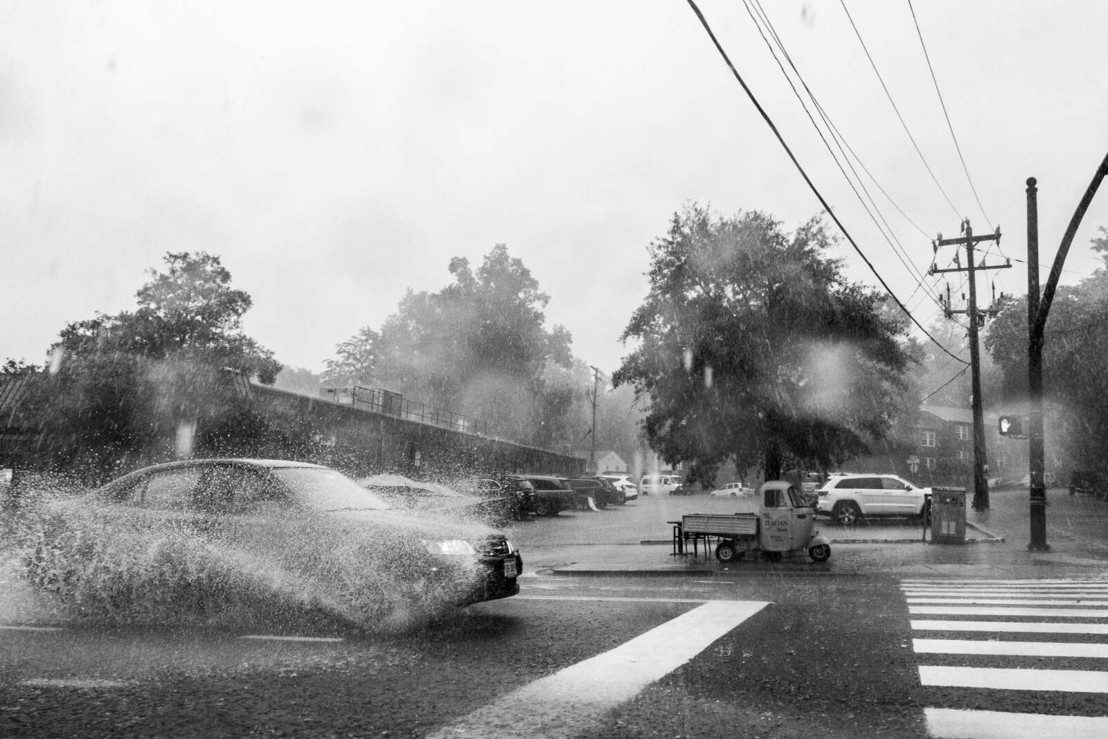
Thunderstorms and heavy rain in Westover in 2021 (staff photo by Jay Westcott)

Get ready for some wild weather over the next day and a half.

First up are some storms tonight (Sunday) that are likely to be packing torrential rainfall. The heavy rain could cause flash flooding, prompting a Flood Watch to be issued this afternoon, taking effect at 8 p.m.

More from the National Weather Service:

239 PM EDT Sun Aug 6 2023

…FLOOD WATCH IN EFFECT FROM 8 PM THIS EVENING TO 2 AM EDT MONDAY…

* WHAT…Flash flooding caused by excessive rainfall is possible.

* WHERE…Portions of DC, Maryland and northern Virginia, including the following areas: in DC, District of Columbia. In Maryland, Anne Arundel, Central and Southeast Howard, Central and Southeast Montgomery, Prince Georges, Southeast Harford and Southern Baltimore. In northern Virginia, Arlington/Falls Church/Alexandria, Central and Southeast Prince William/Manassas/Manassas Park, Fairfax and Stafford.

* WHEN…From 8 PM this evening to 2 AM EDT Monday.

* IMPACTS…Excessive runoff may result in flooding of rivers, creeks, streams, and other low-lying and flood-prone locations.

* ADDITIONAL DETAILS…
– Heavy rainfall moving through with the potential for 1 to 2 inches of rainfall, locally higher, in a short period of time.
– Please visit www.weather.gov/safety/flood for flood safety and preparedness information

Monday has the potential for even more active weather.

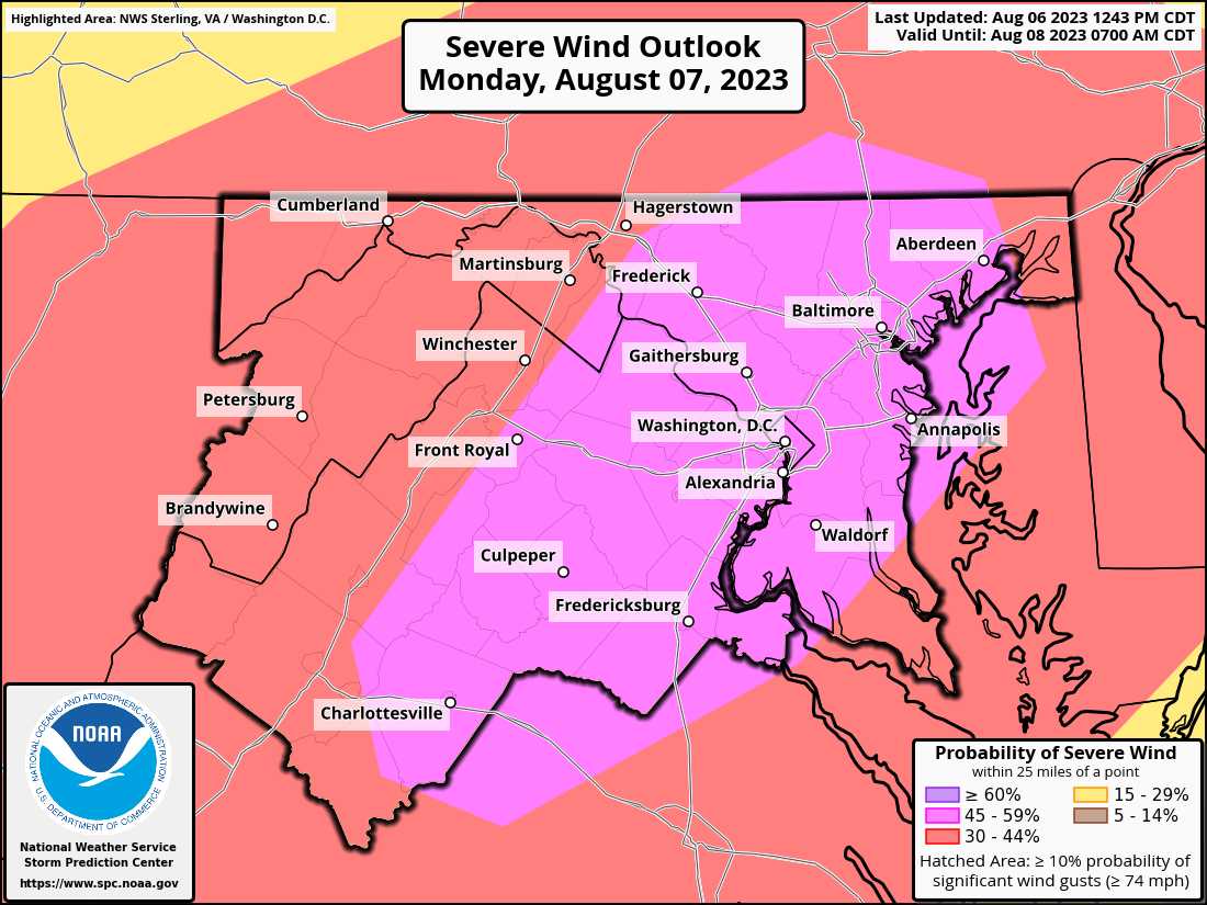
Arlington, D.C. and other parts of the region are under an “enhanced” risk of severe weather, according to a National Weather Service outlook. Severe winds are likely, according to NWS forecasters, noting the “seriousness” of the threat.

Meanwhile, large hail and even a tornado are also possible in the D.C. area.

Severe wind outlook for Aug. 7, 2023 (via National Weather Service)

According to NWS, this is the first time that D.C. has ever had a 45% or greater risk of severe winds on its next-day outlook.

The last instance of such a high probability of severe winds was the same-day outlook on Halloween day 2019.


Strong wind gusts have brought down trees and knocked out power in parts of Arlington tonight.

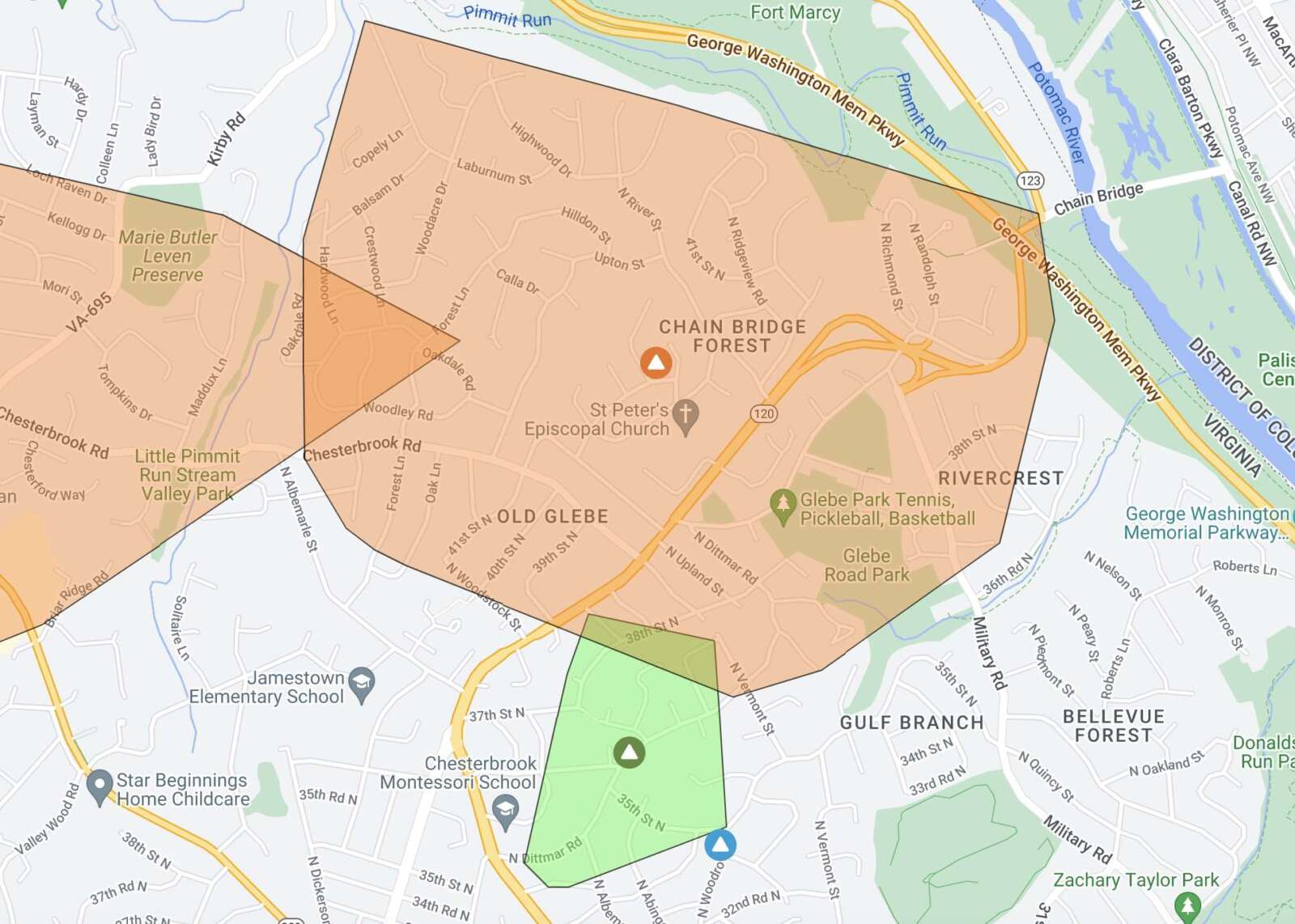
More than 3,500 Dominion customers were without power in Arlington as of 10:45 p.m. The power company’s outage map shows sizable outages in the following local areas:

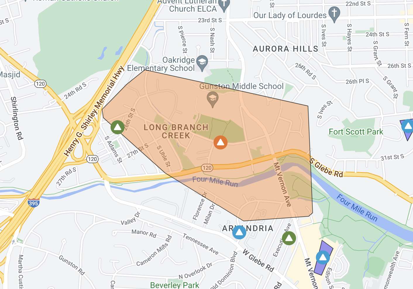
  • Long Branch Creek, including the intersection of S. Glebe Road and S. Arlington Ridge Road
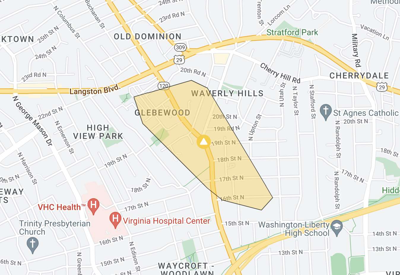
  • Glebewood and Waverly Hills, along N. Glebe Road just south of Langston Blvd, where ARLnow observed power crews and a tree down
  • Old Glebe, Chain Bridge Forest and Rivercrest in far northern Arlington, along the N. Glebe Road corridor

There were also smaller outages in the Dominion Hills and Bluemont neighborhoods. Estimates of when the power would be back on were not available on Dominion’s website.

The outages come amid wind gusts of up to 60 mph in the D.C. metro area, which is under a High Wind Warning. National Airport recorded a 60 mph gust around 10 p.m., according to the National Weather Service.

Damaging winds are expected to continue through about midnight, forecasters said.

Throughout Northern Virginia, Dominion reported more than 43,000 customers without power.

https://twitter.com/PeggyDomEnergy/status/1642354836413767680


Flags blowing in the wind at Arlington County government headquarters (staff photo by Jay Westcott)

(Updated at 9:15 a.m.) Batten down the hatches, it’s going to get pretty windy Saturday.

The National Weather Service has upgraded the earlier High Wind Watch for Arlington to a High Wind Warning, in effect Saturday from noon to midnight.

Forecasters say gusts of up to 60 mph could fell trees, knock out power to parts of the area, and make travel treacherous.

More from NWS:

…HIGH WIND WARNING REMAINS IN EFFECT FROM NOON SATURDAY TO MIDNIGHT EDT SATURDAY NIGHT…

* WHAT…Southwest winds 20 to 30 mph with gusts up to 50 mph Saturday afternoon, becoming northwest 25 to 35 mph with gusts up to 60 mph Saturday evening.

* WHERE…Portions of central and northern Maryland, The District of Columbia, and northern Virginia.

* WHEN…From noon Saturday to midnight EDT Saturday night. The strongest winds are expected Saturday evening.

* IMPACTS…Damaging winds will blow down trees and power lines. Widespread power outages are expected. Travel will be difficult, especially for high profile vehicles.

The expected weather is already postponing outdoor events, like National Landing’s Pink in the Park event.

More via social media:

https://twitter.com/NationalLanding/status/1642125435403218949


Flags on cars for sale flap in the strong winds at a dealer on Columbia Pike (staff photo by Jay Westcott)

Arlington County and surrounding areas, including D.C., are currently under a Wind Advisory.

Gusty winds are expected to persist throughout the day an into the overnight hours Wednesday. With gusts of up to 50 mph, downed trees and power outages are possible.

More from the National Weather Service.

523 AM EDT Tue Mar 14 2023

…WIND ADVISORY NOW IN EFFECT FROM 9 AM THIS MORNING TO 2 AM EDT WEDNESDAY…

* WHAT…Northwest winds 25 to 35 mph with gusts up to 50 mph expected.

* WHERE…Portions of central, north central, northeast, northern and southern Maryland, The District of Columbia and northern and northwest Virginia.

* WHEN…From 9 AM this morning to 2 AM EDT Wednesday.

* IMPACTS…Gusty winds could blow around unsecured objects. Tree limbs could be blown down and a few power outages may result.

PRECAUTIONARY/PREPAREDNESS ACTIONS…

Use extra caution when driving, especially if operating a high profile vehicle. Secure outdoor objects.


Flags blowing in the wind at Arlington County government headquarters (staff photo by Jay Westcott)

Arlington County is under a Wind Advisory for much of the day on Saturday.

Rain showers will give way to fog tonight (Friday) before the clouds clear Saturday and the wind starts blowing. Gusts of up to 50 mph are expected.

The gusty wind combined with waterlogged ground could topple trees and cause power outage.

More, below, from the National Weather Service.

256 PM EST Fri Mar 3 2023

…WIND ADVISORY REMAINS IN EFFECT FROM 10 AM TO 3 PM EST SATURDAY…

* WHAT…West to northwest winds 20 to 30 mph with gusts up to 50 mph expected.

* WHERE…Portions of central, north central, northern and southern Maryland, The District of Columbia and northern Virginia.

* WHEN…From 10 AM to 3 PM EST Saturday.

* IMPACTS…Gusty winds could blow around unsecured objects. Tree limbs could be blown down and a few power outages may result.

PRECAUTIONARY/PREPAREDNESS ACTIONS…

Use extra caution when driving, especially if operating a high profile vehicle. Secure outdoor objects.


Flags blowing in the wind at Arlington County government headquarters (staff photo by Jay Westcott)

Get ready for a particularly breezy afternoon and evening.

Arlington and much of the D.C. region will be under a Wind Advisory, starting at 1 p.m. today (Tuesday).

…WIND ADVISORY IN EFFECT FROM 1 PM THIS AFTERNOON TO 7 PM EST THIS EVENING…

* WHAT…West winds 20 to 30 mph with gusts around 50 mph expected.

* WHERE…The Washington and Baltimore Metropolitan areas, northern and central Virginia, and eastern West Virginia.

* WHEN…From 1 PM this afternoon to 7 PM EST this evening.

* IMPACTS…Gusty winds could blow around unsecured objects. Tree limbs could be blown down and a few power outages may result.

PRECAUTIONARY/PREPAREDNESS ACTIONS…

Use extra caution when driving, especially if operating a high profile vehicle. Secure outdoor objects.

Although some overnight rain dampened the ground, low humidity this afternoon may enhance the risk of wildfires.

Arlington is not immune from such risks and typically sees a few small brush fires each year.

…ENHANCED THREAT FOR THE SPREAD OF WILDFIRES THIS AFTERNOON…

West winds of 20 to 30 mph will gust to 40 to 50 mph will develop this afternoon into early this evening across central Virginia, northern Virginia, and the Shenandoah Valley. These westerly winds will be accompanied by minimum relative humidity values of 20 to 30 percent. Although fuels are relatively damp owing to recent rainfall, they will quickly dry out, leading to an enhanced threat for the spread of wildfires.

Outdoor burning is strongly discouraged during this time. Please refer to your local burn permitting authority on whether you can burn. If you do burn, use extreme caution and ensure fire suppression is readily available.

Also today, there’s a chance of thunderstorms with the passing of a cold front in the early afternoon.

Some of the isolated storms may cross the immediate D.C. region.


View More Stories