
")
(Updated at 7:35 a.m.) Arlington will be under both a Wind Advisory and, later, a Wind Chill Advisory on Friday.
The wind is expected to whip up starting Friday morning, then temperatures will plummet throughout the day. The combination will lead to dangerous conditions for anyone outside.
To make matters worse, the strong winds — gusts of up to 50 mph are expected — may knock out power and leave some locals in the cold.
From the National Weather Service:
737 PM EST Thu Dec 22 2022
…WIND ADVISORY REMAINS IN EFFECT FROM 8 AM TO 2 PM EST FRIDAY…
* WHAT…West winds 20 to 30 mph with gusts up to 50 mph expected.
* WHERE…Portions of central, north central, northeast, northern and southern Maryland, The District of Columbia and central and northern Virginia.
* WHEN…From 8 AM to 2 PM EST Friday.
* IMPACTS…Gusty winds could blow around unsecured objects. Tree limbs could be blown down and a few power outages may result.
* ADDITIONAL DETAILS…Bitterly cold wind chills will be ongoing during the time of this high wind event. It is essential to make preparations now for extreme cold conditions with the potential for loss of power.
PRECAUTIONARY/PREPAREDNESS ACTIONS…
Use extra caution when driving, especially if operating a high profile vehicle. Secure outdoor objects.
Also from NWS:
725 PM EST Thu Dec 22 2022
…WIND CHILL ADVISORY REMAINS IN EFFECT FROM 7 PM FRIDAY TO 10 AM EST SATURDAY…
* WHAT…Very cold wind chills expected. Wind chills as low as 10 below zero.
* WHERE…Portions of central, northeast, northern and southern Maryland, The District of Columbia and central and northern Virginia.
* WHEN…From 7 PM Friday to 10 AM EST Saturday.
* IMPACTS…The cold wind chills could result in hypothermia if precautions are not taken.
* ADDITIONAL DETAILS…The highest wind speeds will be Friday into Friday evening. Affects from the extreme cold could be made worse due to power outages.
PRECAUTIONARY/PREPAREDNESS ACTIONS…
Use caution while traveling outside. Wear appropriate clothing, a hat, and gloves.
Meanwhile, icy roads are possible due to a rapid freeze of wet surfaces following the passing of an arctic front, forecasters say.
ICY ROADS POSSIBLE TODAY for District of Columbia [DC] and Anne Arundel, Calvert, Carroll, Cecil, Central and Eastern Allegany, Central and Southeast Howard, Central and Southeast Montgomery, Frederick, Northern Baltimore, Northwest… till 11:45 AM EST https://t.co/u15MZXIe2h pic.twitter.com/SHJ29bilcc
— WashingtonianWXAlerts (@WashWXGeekAlert) December 23, 2022
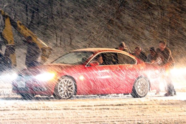
Flickr pool photo by Erinn Shirley
")

")