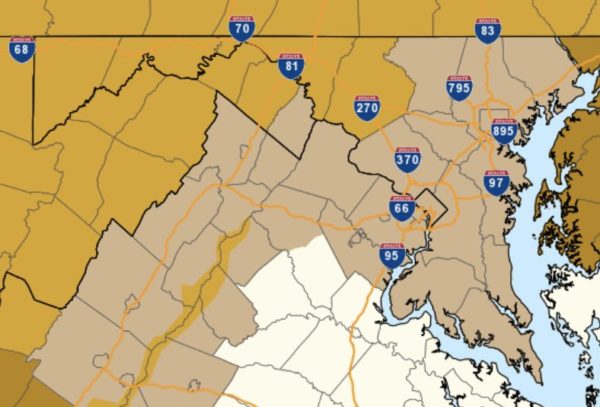
Arlington County and surrounding areas are under a Wind Advisory Sunday afternoon and evening.

The advisory was issued Saturday, ahead of what is expected to be a very breezy and potentially hazardous end to the weekend.

More from the National Weather Service:

…WIND ADVISORY IN EFFECT FROM 3 PM TO 10 PM EST SUNDAY… THE NATIONAL WEATHER SERVICE IN BALTIMORE MD/WASHINGTON HAS ISSUED A WIND ADVISORY, WHICH IS IN EFFECT FROM 3 PM TO 10 PM EST SUNDAY. * TIMING…SUNDAY AFTERNOON INTO SUNDAY EVENING. * WINDS…SOUTHWEST SUNDAY AFTERNOON, BECOMING WEST TO NORTHWEST SUNDAY EVENING 20 TO 35 MPH WITH GUSTS AROUND 50 TO 55 MPH. * IMPACTS…SCATTERED TREE AND POWER LINE DAMAGE. DIFFICULTY DRIVING HIGH PROFILE VEHICLES. PRECAUTIONARY/PREPAREDNESS ACTIONS… A WIND ADVISORY MEANS THAT WINDS OF 45 TO 55 MPH ARE EXPECTED. WINDS THIS STRONG CAN MAKE DRIVING DIFFICULT, ESPECIALLY FOR HIGH PROFILE VEHICLES. &&


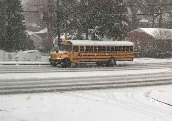
(Updated at 8:15 a.m.) Arlington public schools are opening on a two-hour delay Wednesday, due to expected icy conditions.

APS announced the delay Tuesday night “based on the current weather forecast and conditions,” leaving open the possibility that worse-than-expected road conditions Wednesday could prompt a cancellation. Fairfax County Public Schools announced earlier that its schools would be closed tomorrow.

Wednesday morning, APS affirmed the two-hour delay decision.

The federal government, meanwhile, will open on a three-hour delay.

Authorities are asking anyone driving overnight and in the morning to take extra precautions due to the likelihood of dropping temperatures turning wet roads into icy hazards. Around Arlington Wednesday, there were some reports of black ice, particularly on local roads.

“VDOT asks that drivers be aware of weather and road conditions prior to making decisions to travel tonight and Wednesday morning,” said VDOT’s Northern Virginia office, in a press release. “Plan for the potential need to delay commutes Wednesday morning, as low temperatures overnight will freeze precipitation and create potential hazardous conditions.”

At least one significant crash was reported Tuesday night — a multi-vehicle wreck on I-395 near the Pentagon — but it’s unclear if weather was a factor.

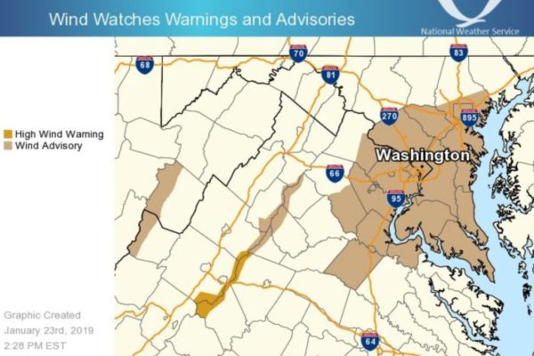
As if the deep freeze wasn’t bad enough, the National Weather Service issued a Wind Advisory Tuesday night.

…WIND ADVISORY IN EFFECT FROM 9 AM TO 6 PM EST WEDNESDAY…

The National Weather Service in Baltimore MD/Washington has issued a Wind Advisory, which is in effect from 9 AM to 6 PM EST Wednesday.

* TIMING…Mid-morning through late afternoon Wednesday.

* WINDS…West 20 to 30 mph with gusts up to 50 mph.

* IMPACTS…Strong winds may blow down limbs, trees, and power lines. Scattered power outages are expected.

PRECAUTIONARY/PREPAREDNESS ACTIONS…

A Wind Advisory means that winds of 45 to 55 mph are expected. Winds this strong can make driving difficult, especially for high profile vehicles.


Arlington County and surrounding areas are under both a Flood Watch and a Wind Advisory Thursday, as a front brings heavy rain and strong winds to the region.

About 1-2 inches of rain is expected to fall, potentially causing flooding in low-lying areas and along streams and creeks.

More from the National Weather Service:

…FLOOD WATCH REMAINS IN EFFECT… * FROM LATE TONIGHT THROUGH THURSDAY AFTERNOON * RAIN WILL OVERSPREAD THE AREA THIS EVENING AND OVERNIGHT. THE HEAVIEST RAIN IS EXPECTED OVERNIGHT AND THURSDAY MORNING. TOTAL RAINFALL AMOUNTS AROUND 1 INCH ARE EXPECTED, WITH ISOLATED HIGHER AMOUNTS OF 1.5 TO 2 INCHES POSSIBLE. * EXCESS RUNOFF FROM A NEARLY FROZEN GROUND AND SATURATED SOILS WILL CAUSE THE POTENTIAL FOR STREAMS AND CREEKS TO RISE OUT OF THEIR BANKS AS WELL AS POTENTIAL FLOODING IN LOW LYING URBAN AREAS. PRECAUTIONARY/PREPAREDNESS ACTIONS… A FLOOD WATCH MEANS THERE IS A POTENTIAL FOR FLOODING BASED ON CURRENT FORECASTS. YOU SHOULD MONITOR LATER FORECASTS AND BE ALERT FOR POSSIBLE FLOOD WARNINGS. THOSE LIVING IN AREAS PRONE TO FLOODING SHOULD BE PREPARED TO TAKE ACTION SHOULD FLOODING DEVELOP. &&

In addition to the rain, damaging winds are possible.

…WIND ADVISORY IN EFFECT FROM 6 AM TO NOON EST THURSDAY… THE NATIONAL WEATHER SERVICE IN BALTIMORE MD/WASHINGTON HAS ISSUED A WIND ADVISORY, WHICH IS IN EFFECT FROM 6 AM TO NOON EST THURSDAY. * TIMING…THURSDAY MORNING. * WINDS…SOUTHWEST 20 TO 30 MPH WITH GUSTS UP TO 50 MPH. * IMPACTS…GUSTY WINDS WILL BLOW AROUND UNSECURED OBJECTS. TREE LIMBS COULD BE BLOWN DOWN AND A FEW POWER OUTAGES MAY RESULT. PRECAUTIONARY/PREPAREDNESS ACTIONS… A WIND ADVISORY MEANS THAT WINDS OF 45 TO 55 MPH ARE EXPECTED. WINDS THIS STRONG CAN MAKE DRIVING DIFFICULT, ESPECIALLY FOR HIGH PROFILE VEHICLES. &&

More via social media:

Photo (top) via National Weather Service


Wind Chill Advisory in Effect — A Wind Chill Advisory is in effect this morning due to a combination of gusty winds and bitterly cold temperatures. [Weather.gov]

MLK Day of Service — As of Friday, more than 850 people were signed up to volunteer for Arlington County’s MLK Day of Service today.

Rosslyn Building Sold — “Rosslyn’s Oakwood Arlington extended-stay apartments has changed hands for $70 million. Mapletree Investments, a Singapore real estate investment firm, has acquired the 184-unit property at 1550 Clarendon Blvd. from AvalonBay Communities Inc.” [Washington Business Journal]

Local Nonprofit Gets TV Donation — “Patricia Funegra founded La Cocina VA in Arlington as a way to create change through feeding, educating and empowering the community… FOX 5 and Easterns Automotive Group teamed up to help Funegra… with a $1,000 donation and all her students received new cast-ironed pots, recipe books and $50 gift cards.” [Fox 5]

Local Nonprofit Helping Puerto Rico — Wheels to Africa, which was founded by a 10-year-old Arlington boy in 2005 to send used bikes to Africa, is now sending used bikes to Puerto Rico to help residents still recovering from Hurricane Maria. The nonprofit’s founder has since gone to graduate from college and is now working in Arlington. [Washington Post]

County: Get a Flu Shot — “Flu season is officially underway. The Centers for Disease Control and Prevention (CDC) reports that flu activity is ‘elevated’ as flu viruses circulate nationwide. Arlington healthcare officials are urging residents to take precautions and get vaccinated to help prevent the spread of flu.” [Arlington County]

Nearby: Kitten Lounge Coming to Georgetown — “What’s being called the first-in-America kitten-only place to rest, relax and interact with kittens between the ages of three-to-six months will open in early March, at 3109 M(eow) Street NW.” [WTOP]

Reduced Publishing Schedule Today — Due to the Martin Luther King Jr. Day federal holiday, ARLnow will be publishing on a limited schedule today. We’ll return with a full slate of local coverage tomorrow.

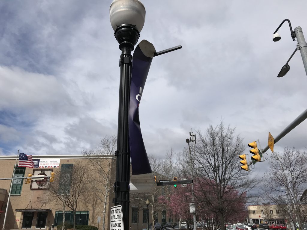
Photo courtesy Tom Mockler


Arlington County will be under a Flood Watch and nearby bodies of water under a Gale Warning starting Thursday evening.

Heavy rain is expected to fall between Thursday night and Friday afternoon, while strong, gusty winds may fell trees and pose a danger to boaters Thursday night into Friday morning.

More from the National Weather Service:

FLOOD WATCH REMAINS IN EFFECT FROM THURSDAY EVENING THROUGH FRIDAY AFTERNOON… FROM THURSDAY EVENING THROUGH FRIDAY AFTERNOON * WIDESPREAD RAIN IS EXPECTED THURSDAY NIGHT AND SHOWERS ARE LIKELY FRIDAY. RAINFALL AMOUNTS AROUND 1-2 INCHES ARE MOST LIKELY, BUT LOCALLY HIGHER AMOUNTS AROUND 3-4 INCHES ARE POSSIBLE. SOILS REMAIN SATURATED DUE TO RECENT RAINFALL, SO EXCESS RUNOFF FROM THE RAIN WILL CAUSE THE POTENTIAL FOR FLOODING OF SMALL STREAMS, CREEKS, AND URBAN AREAS. PRECAUTIONARY/PREPAREDNESS ACTIONS… A FLOOD WATCH MEANS THERE IS A POTENTIAL FOR FLOODING BASED ON CURRENT FORECASTS. YOU SHOULD MONITOR LATER FORECASTS AND BE ALERT FOR POSSIBLE FLOOD WARNINGS. THOSE LIVING IN AREAS PRONE TO FLOODING SHOULD BE PREPARED TO TAKE ACTION SHOULD FLOODING DEVELOP. &&

…SMALL CRAFT ADVISORY IN EFFECT FROM 6 PM TO 8 PM EST THURSDAY… …GALE WARNING IN EFFECT FROM 8 PM THURSDAY TO 6 AM EST FRIDAY… THE NATIONAL WEATHER SERVICE IN BALTIMORE MD/WASHINGTON HAS ISSUED A GALE WARNING, WHICH IS IN EFFECT FROM 8 PM THURSDAY TO 6 AM EST FRIDAY. A SMALL CRAFT ADVISORY HAS ALSO BEEN ISSUED. THIS SMALL CRAFT ADVISORY IS IN EFFECT FROM 6 PM TO 8 PM EST THURSDAY. * WINDS…34 TO 47 KNOTS WITHIN THE GALE WARNING. * WINDS…18 TO 33 KNOTS WITHIN THE SMALL CRAFT ADVISORY. PRECAUTIONARY/PREPAREDNESS ACTIONS… A GALE WARNING MEANS WINDS OF 34 TO 47 KNOTS ARE IMMINENT OR OCCURRING. OPERATING A VESSEL IN GALE CONDITIONS REQUIRES EXPERIENCE AND A PROPERLY EQUIPPED VESSEL. RECREATIONAL BOATERS SHOULD SEEK SAFE HARBOR PRIOR TO THE ONSET OF GALE CONDITIONS. A SMALL CRAFT ADVISORY MEANS WINDS OF 18 TO 33 KNOTS ARE IMMINENT OR OCCURRING. BOATERS OPERATING SMALLER VESSELS SHOULD AVOID NAVIGATING IN THESE CONDITIONS. &&


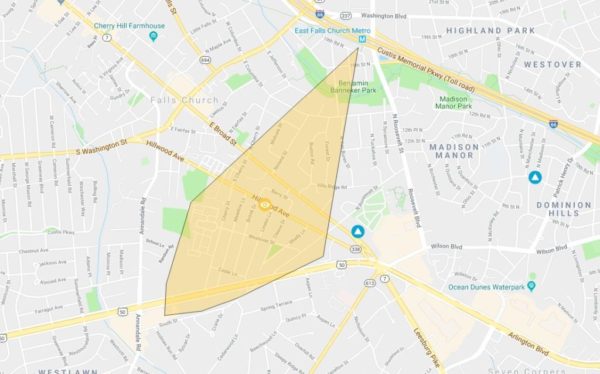
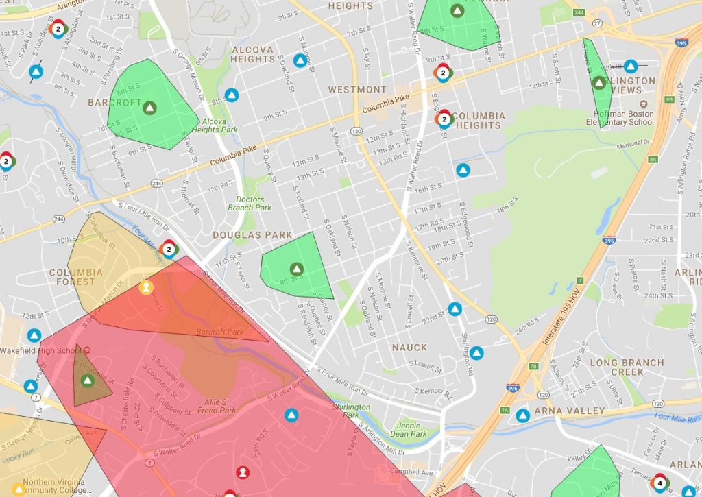
More than 700 Dominion customers are without power in Arlington and the City of Falls Church this morning due to a possibly wind-related outage.

The outage extends from an area near the East Falls Church Metro station to the E. Broad Street commercial corridor of Falls Church and other parts of the city.

Restoration is estimated between noon and 3 p.m.

A number of downed tree branches and utility lines have been reported this morning (Wednesday) as the area remains under a Wind Advisory through 4 p.m.

Image via Dominion


Arlington and surrounding areas will be under a Wind Advisory for much of Wednesday.

Gusty winds could result in downed tree limbs and power outages, forecasters say.

More from the National Weather Service:

…WIND ADVISORY IN EFFECT FROM 6 AM TO 4 PM EST WEDNESDAY…

The National Weather Service in Baltimore MD/Washington has issued a Wind Advisory, which is in effect from 6 AM to 4 PM EST Wednesday.

* TIMING…6 AM to 4 PM Wednesday.

* WINDS…West 20 to 25 mph with gusts up to 45 mph.

* IMPACTS…Gusty winds will blow around unsecured objects. Tree limbs could be blown down and a few power outages may result.

PRECAUTIONARY/PREPAREDNESS ACTIONS…

A Wind Advisory means that winds of 45 to 55 mph are expected. Winds this strong can make driving difficult, especially for high profile vehicles.


Arlington ranks as one of the most sustainably powered localities in the country, according to a new study, thanks to its large share of energy-efficient buildings and bevy of electric vehicle options.

Commercial Cafe, a blog tracking commercial real estate trends, ranked Arlington 15th in the country in a new study of America’s greenest cities.

The group awarded localities points based on how much they rely on sustainable forms of energy, like wind, solar and hydropower, and docked points for how much carbon dioxide they generate, or how much they rely on traditional energy sources like coal and natural gas.

Arlington scored poorly when it came the total amount of greenhouses gases the county generates, but made up for those poor marks with its high numbers of commuters who bike or walk to work, and large number of electric vehicle charging stations.

Additionally, Arlington ranked seventh in the country with one of the highest shares of office buildings that are LEED-certified for energy efficiency by the U.S. Green Building Council. Of the county’s 452 buildings, Commercial Cafe found that 106 have LEED certifications, with another eight on the way that are set to meet that specification.

Overall, San Francisco, Seattle and Oakland took the top three spots in the company’s rankings, while D.C. placed ninth.


Arlington and much of the D.C. region will be under a Wind Advisory starting at 10 a.m. Wednesday.

Forecasters say that a line of showers and thunderstorms in the morning will give way to gusty winds through Wednesday evening. The wind gusts may damage trees and cause power outages.

More from the National Weather Service:

…WIND ADVISORY IN EFFECT FROM 10 AM TO 7 PM EDT WEDNESDAY… THE NATIONAL WEATHER SERVICE IN BALTIMORE MD/WASHINGTON HAS ISSUED A WIND ADVISORY, WHICH IS IN EFFECT FROM 10 AM TO 7 PM EDT WEDNESDAY. * TIMING…STRONG WINDS WILL INCREASE WEDNESDAY MORNING AHEAD OF A STRONG COLD FRONT AND CONTINUE INTO EARLY WEDNESDAY EVENING. A LINE OF SHOWERS WILL BE ASSOCIATED WITH THE FRONTAL PASSAGE WHICH COULD BRING LOCALIZED WIND GUSTS TO 50 MPH OR GREATER. FOLLOWING THE PASSAGE OF THE FRONT, WIDESPREAD WEST WINDS GUSTING 40 TO 50 MPH WILL OCCUR THROUGH WEDNESDAY AFTERNOON BEFORE DIMINISHING IN THE EARLY EVENING. * WINDS…WEST 20 TO 30 MPH WITH GUSTS UP TO 50 MPH. * IMPACTS…GUSTY WINDS WILL BLOW AROUND UNSECURED OBJECTS. TREE LIMBS COULD BE BLOWN DOWN AND A FEW POWER OUTAGES MAY RESULT. PRECAUTIONARY/PREPAREDNESS ACTIONS… A WIND ADVISORY MEANS THAT WINDS OF 45 TO 55 MPH ARE EXPECTED. WINDS THIS STRONG CAN MAKE DRIVING DIFFICULT, ESPECIALLY FOR HIGH PROFILE VEHICLES. &&


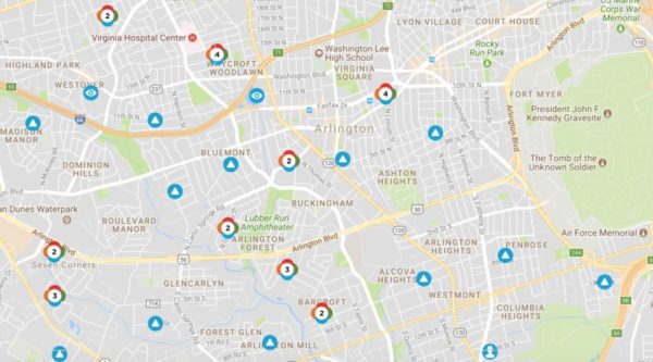
Some 330 Dominion customers in Arlington were still without power Monday morning, following Friday’s intense, prolonged wind storm.

Dominion crews worked throughout the weekend to restore electricity in Northern Virginia. The few hundred without power in Arlington was down from more than 14,000 as of Friday evening.

The power outages in Arlington are mostly smaller, with a few homes or a single home affected in a given area. Sometimes the outage is the result of the service line being ripped from the house by a falling tree.

Dominion is estimating full restoration to be complete by 11 p.m. Tuesday, according to its website.

The company says the “#windmageddon” storm is among the top 5 most damaging storms in Dominion history, with about 700,000 customers losing power. Dominion had nearly 4,000 personnel working to restore power over the weekend, including hundreds called in from out of state.

More via social media:

Map via Dominion


(Updated at 7:35 p.m.) Friday’s wind storm has taken a toll on Arlington, sending trees toppling onto cars, houses and across roads, and knocking out power to tens of thousands.

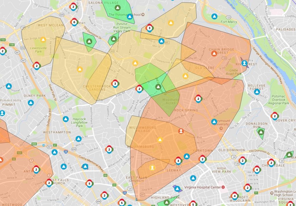
As of 7:30 p.m., Dominion reported 14,663 customers without power in Arlington. An hour earlier, it appeared that the numbers were finally dropping, but thanks to continued strong winds it has, in fact, gone up.

A Dominion outage map showed that a large swath of residential North Arlington and a significant portion of the Fairlington neighborhood was without power as the sun started to set.

Across the D.C. region, nearly 600,000 were in the dark as of early evening.

Arlington County Police say they’ve responded to more than 250 calls for service since this morning, including 66 calls for trees down.

To help with the cleanup, which is expected to take at least a few days, Virginia Gov. Ralph Northam has declared a state of emergency.

“The order is designed to help Virginia mitigate any damage caused by high winds and to streamline the process that the Commonwealth uses to provide assistance to communities impacted,” the governor’s office said in a statement.

A High Wind Warning remains in effect until 6 a.m. Gusty winds are expected to continue overnight as the nor’easter makes its way north and pummels New England.

The National Weather Service says it clocked a wind gust of 71 miles per hour at Dulles International Airport earlier today. NWS is urging those in the D.C. area to remain vigilant as the winds continue to gust.

Widespread power outages are occurring. Travel is dangerous, especially for high profile vehicles, and motorists need to be aware of rapidly changing road conditions due to the potential of downed trees and power lines. Pedestrians will face very hazardous conditions, and need to be aware of wind-borne projectiles. People should avoid being outside in forested areas and around trees and branches. If possible, remain in the lower levels of your homes during the windstorm, and avoid windows. If you use a portable generator, follow manufacturer’s instructions and do not use inside homes, garages, or apartments.

More local weather impacts via social media, after the jump.

(more…)


View More Stories