(Updated at 4:25 p.m.) The National Park Service is ready to move ahead with plans to make Memorial Circle safer and easier to navigate.
NPS finalized a study last week, stating its plans did not negatively impact the surrounding environment or historical character of the area. The agency can now move forward on making the nexus of roadways safer for drivers, pedestrians, and bicyclists.
“The National Park Service is very pleased this project has advanced to a stage where we’ll be able to implement these improvements as soon as funds are available,” a spokesman for the federal agency told ARLnow.
NPS chose the most aggressive of three proposed plans to modify Memorial Circle and the roads around it, S. Arlington Blvd and Washington Blvd.
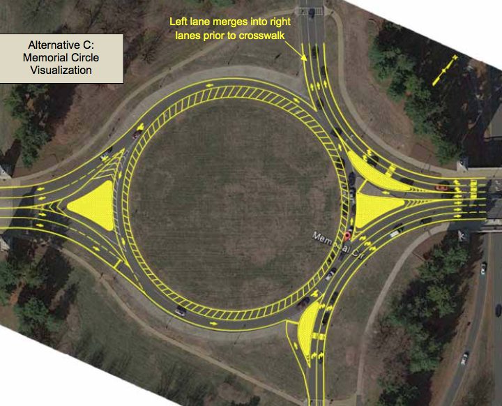
The plan chosen, Alternative C, calls for changes like re-striping Memorial Circle down to one lane of traffic instead of two, thus reducing conflicts between drivers in the circle and approaching the circle.
The plan also includes a proposal to enlarge and shorten the text on signs in the circle, making them easier to read. Additionally, new yield signs would give vehicles inside the circle the right of way.
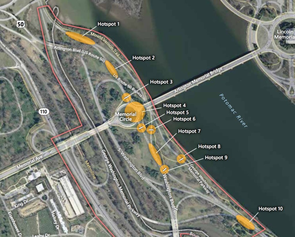
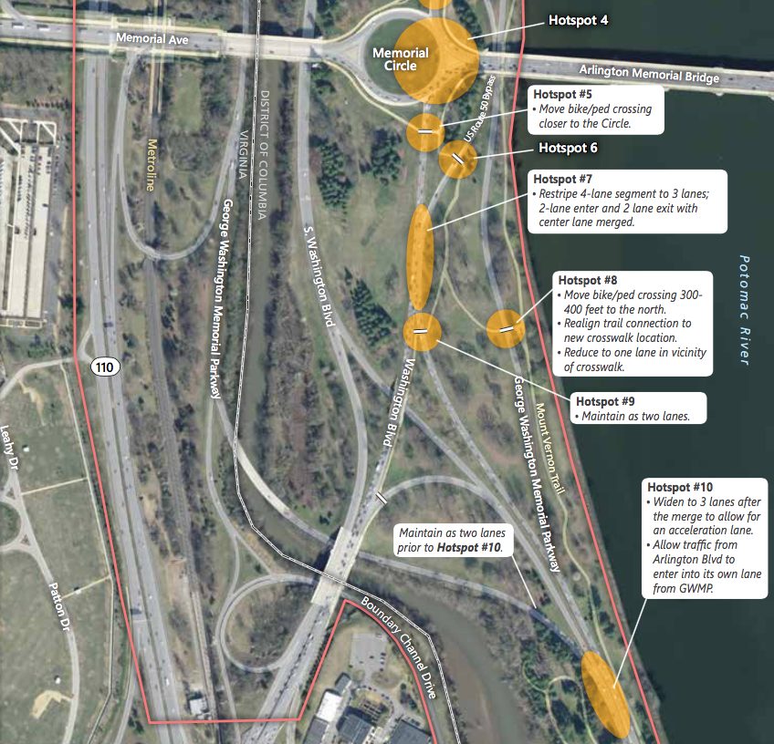
NPS also proposed adding walk signals for pedestrians and flashing beacons for drivers at six intersections where the study notes near-misses are common. Officials estimated 600 crashes occurred near Memorial Circle between 2005 and 2012.
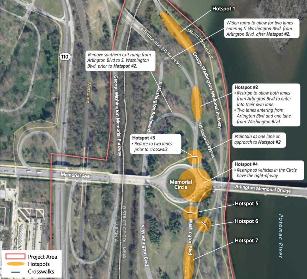
The agency would also re-stripe S. Arlington Blvd down to two lanes before it approaches the crosswalk just north of the circle to make crossing safer for pedestrians.
To help reduce weaving between lanes and merging traffic north of the circle, NPS would:
- Re-stripe Washington Blvd, reducing it to one lane
- Re-stripe S. Arlington Blvd to two lanes and Washington Blvd to one lane where the roadways merge, allowing traffic to continue without changing lanes
- Remove the S. Arlington Blvd exit ramp and far left exit lane to S. Washington Blvd
- Widen the northern ramp off of S. Arlington Blvd up to 12 feet to allow two lanes of traffic to exit, making the left lane exit-only and the right lane a shared exit/through lane
- Possibly remove one or two trees along the exit of the S. Arlington Blvd ramp
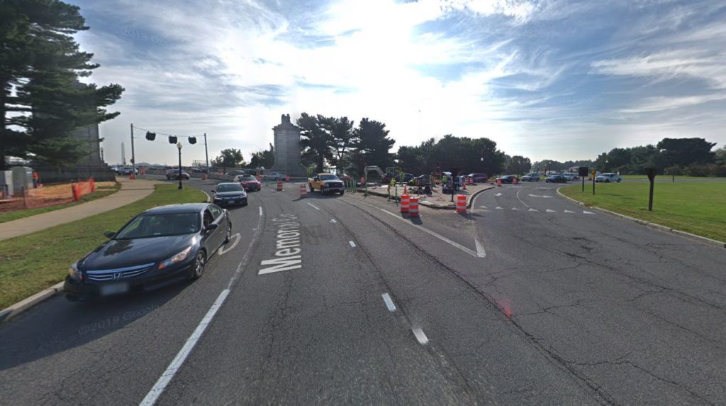
The plan also calls for widening northbound Washington Blvd to fit a third lane as it merges into the circle.
The widened road would make room for a concrete island, directing two of Washington Blvd’s three northbound lanes onto Memorial Bridge and one lefthand lane into the circle. NPS said Washington Blvd could be widened up to 20 feet, pending design specifications.
The existing concrete island where the Memorial Bridge meets the circle’s east side would be split into two. These two new concrete islands would direct the left westbound lane coming off Arlington Memorial Bridge into the circle and syphon the other westbound lanes onto S. Arlington Blvd.
Other changes include:
- Adding rumble strips and raised pavement markings to avoid “last-minute weaving” and provide more guidance to drivers
- Installing more speed limit signs and increased police presence to crack down on speeding
NPS has implemented traffic improvements to the area before. In 2012, the agency moved a sidewalk and installed rumble strips, among other changes, on the GW Parkway in a bid to make the roadway safer.
“Whether you are a frequent commuter, visitor to Washington, D.C. or someone recreating, we want the Memorial Circle area to be a safe and accessible experience for everyone,” said Charles Cuvelier, the Parkway’s superintendent, in a statement about the latest round of improvements.
Work continues nearby on structural repairs to Memorial Bridge, a project NPS started last year.
Image 2 via Google Maps, images 1 and 3-5 via National Park Service


