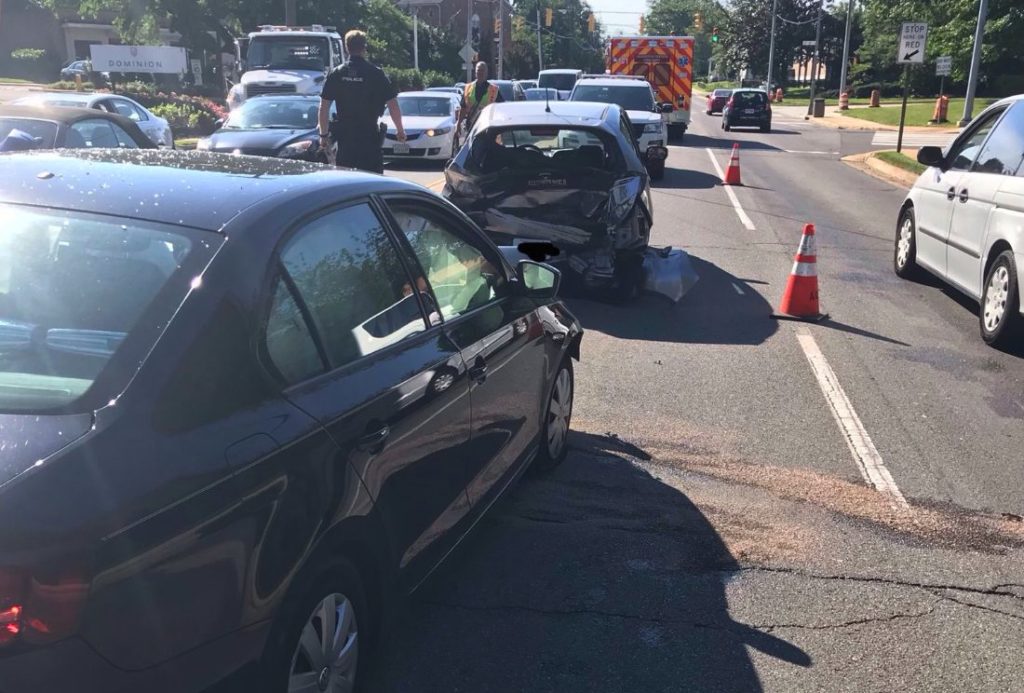
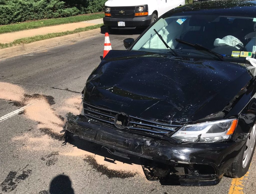
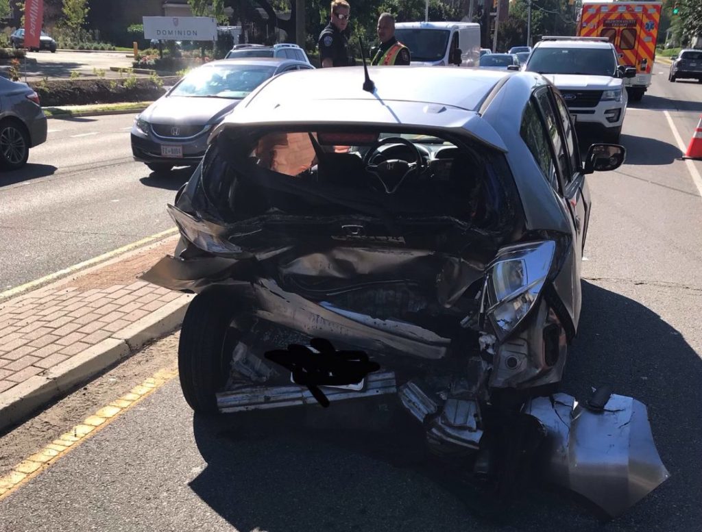
Crash on S. Glebe Road (photo courtesy Arlington County Fire Department/Twitter)
Crash on S. Glebe Road (photo courtesy Arlington County Fire Department/Twitter)
Crash on S. Glebe Road (photo courtesy Arlington County Fire Department/Twitter)
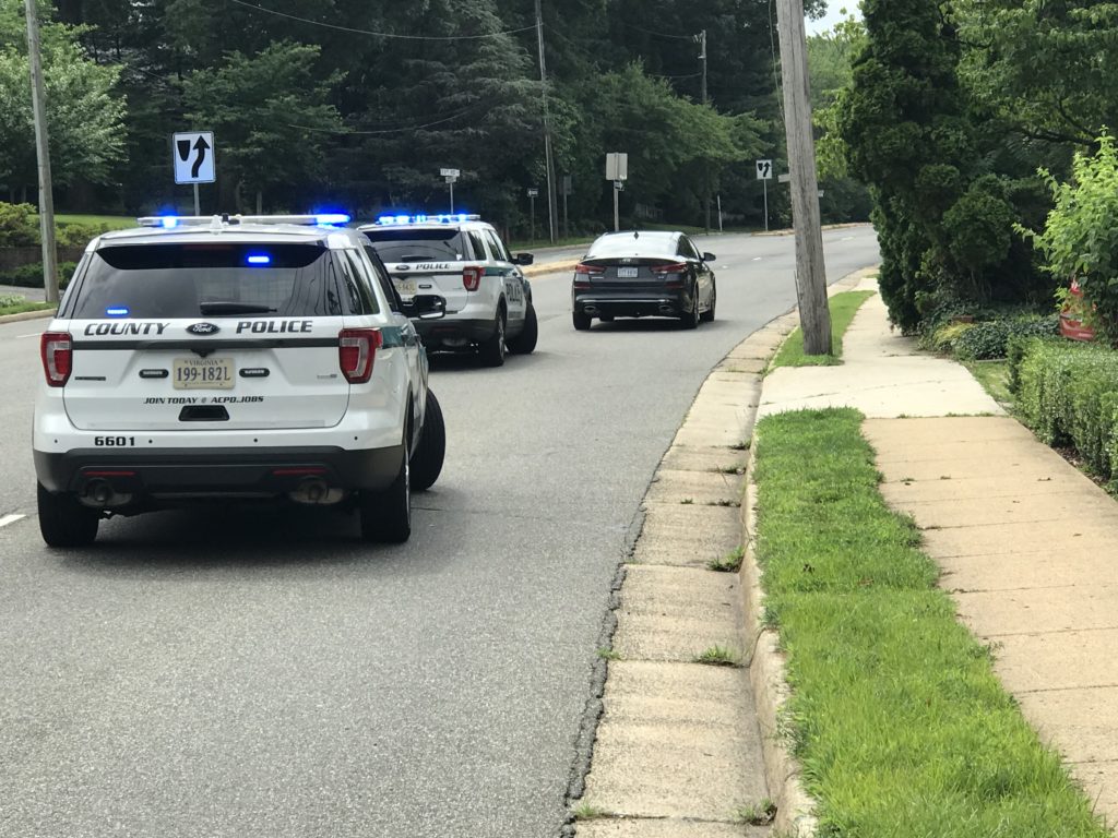
A crash has closed lanes of busy S. Glebe Road during the morning rush hour.
At least two vehicles were involved in the crash. One lane in each direction was blocked at 2nd Street S. as of around 9 a.m., according to the Arlington County Fire Department.
Drivers should expect minor delays in the area while crews work to clean up the crash scene and tow away the vehicles.
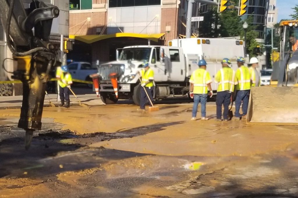
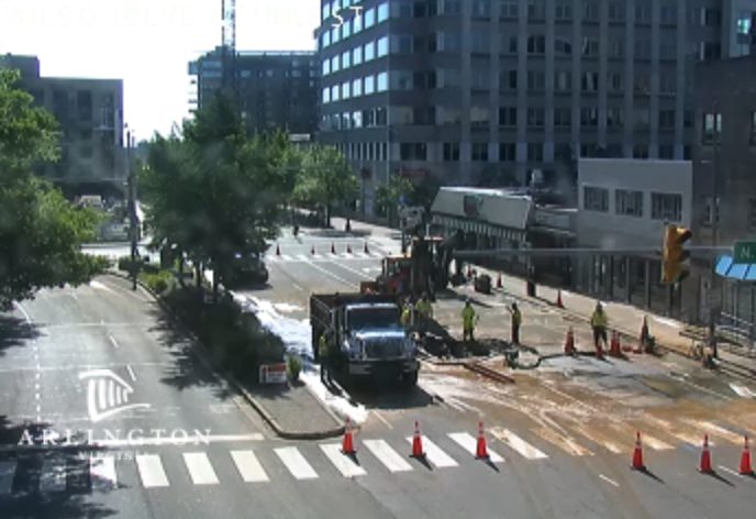
Courthouse water main break (photo via @ArlingtonDES/Twitter)
Courthouse water main break
Road closures in place for Courthouse water main break
Updated at 2:35 p.m. — “The roadway remains closed through the evening commute due to water main repairs,” per an Arlington Alert. “Expect delays and seek alternate routes.”
Earlier: An early morning water main break has prompted a major road closure in Courthouse.
Officials say a 12-inch water main burst under Clarendon Blvd, near the Courthouse Metro station, and repairs are expected to last into the afternoon.
Clarendon Blvd is currently detoured between N. Veitch Street and Courthouse Road.
Emergency Water Main Repairs: Crews investigating break along Clarendon Boulevard between Veitch and Courthouse. Roadway detoured. Area businesses could be affected. No estimation yet on completion time. Questions: 703-228-6555. pic.twitter.com/dvPRxA7eJy
— Arlington Department of Environmental Services (@ArlingtonDES) June 26, 2019
Update 8:20am: Crews on scene working to repair the water main break on Clarendon Blvd. Seek alternative routes. #vatrafficpic.twitter.com/myXabtCBL8
— Arlington Department of Environmental Services (@ArlingtonDES) June 26, 2019
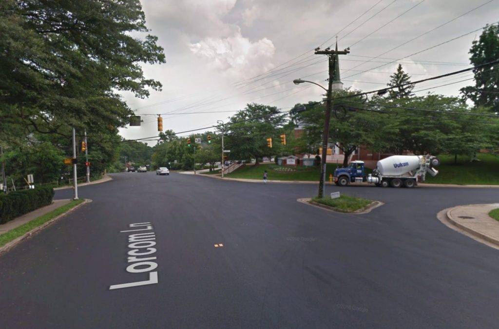
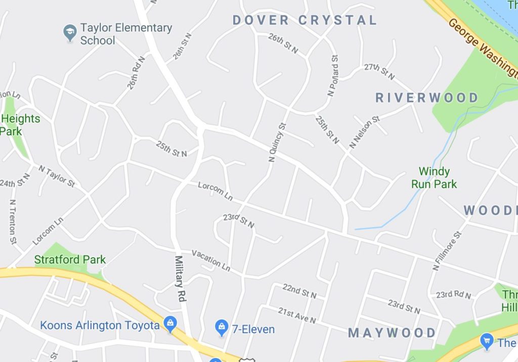
The project is set to re-stripe portions of residential Lorcom Lane and Military Road as “complete streets” with the goal of “reducing conflicts between people driving and people biking through enhanced pavement marking and signage designs.”
Per the county:
Help us improve safety on N Lorcom Lane and N Military Road!
This repaving and remarking project is located on N Lorcom Lane (from Lee Highway to Military Road) and on N Military Road (from Vacation Lane to Lorcom Lane).
Join us anytime between 6:00-7:30 pm to learn about the project and share feedback on design concepts.
The open house is being held at Cherrydale Branch Library (2190 N. Military Road).
Help us improve safety on N Lorcom Lane and N Military Road! Join an open house June 27 to learn about the project and share feedback on design concepts. https://t.co/cxWs81ONXVpic.twitter.com/EBtr1HkBbX
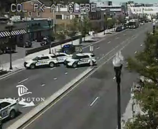
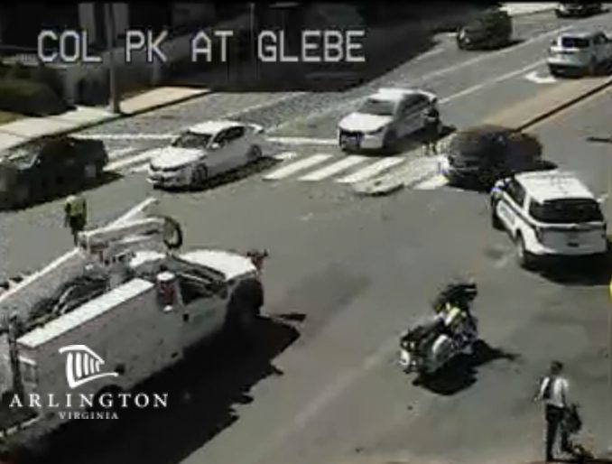
(Updated at 1:20 p.m.) Arlington County Police will close the busy intersection of S. Glebe Road and Columbia Pike for two hours over the weekend as part of a crash investigation.
The closure is scheduled from about 6-8 a.m. Saturday, ACPD said in a statement today. Detectives will be conducting “follow-up investigation pertaining to a critical multiple vehicle crash,” which happened last Friday afternoon.
One person was seriously injured and trapped in their vehicle as a result of the crash, according to scanner traffic at the time.
“One victim was transported to an area hospital with critical, but non-life threatening injuries,” said ACPD spokeswoman Kirby Clark. “No other significant injuries were reported.”
More from ACPD:
The Arlington County Police Department’s Critical Accident Team will close the intersection of South Glebe Road and Columbia Pike on Saturday, June 22 in order to conduct a follow-up investigation pertaining to a critical multiple vehicle crash that occurred at approximately 3:14 p.m. on June 14.
The following road closures will be conducted in order to restrict access to the intersection from 6:00 a.m. until approximately 8:00 a.m.:
South Glebe Road, northbound at South Monroe Street and southbound at 9th Street South
Columbia Pike, eastbound at South Monroe Street and westbound at South Highland Street
Access to businesses within the area will not be impacted, but vehicular traffic and pedestrian traffic in some areas will be restricted.
Motorists are advised to avoid the area during the specified time and seek alternate routes. To access points north and south, motorists may use South George Mason Drive and South Walter Reed Drive. To access points east and west, motorists may use Route 50 and South Four Mile Run Drive.
The investigation into the circumstances of this crash remain ongoing and anyone with additional information related to this incident is asked to contact Detective B. Ames at [email protected] or 703-228-7073. To report information anonymously, contact the Arlington County Crime Solvers at 866.411.TIPS (8477).
⚠️ TRAFFIC ALERT ⚠️ ACPD will close the intersection of S. Glebe Road and Columbia Pike from approx. 6-8 a.m. on Sat., June 22 to conduct a follow-up investigation regarding a critical crash that occurred on June 14 Details: https://t.co/9CnzomYNwapic.twitter.com/7P8zEMstbH
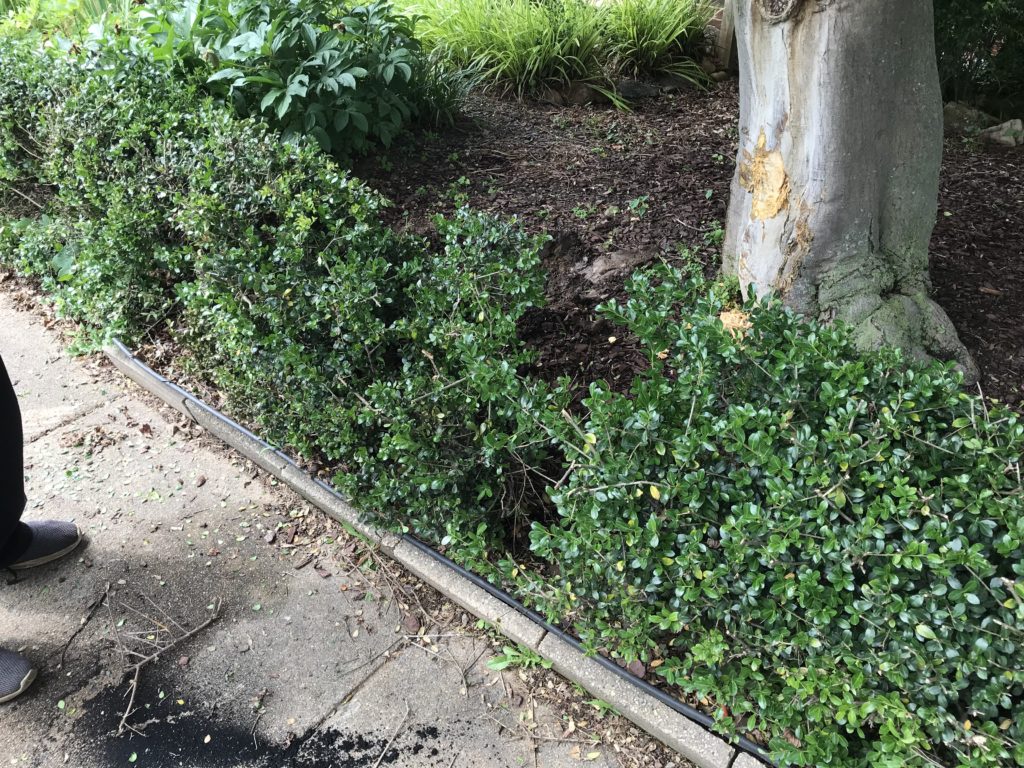
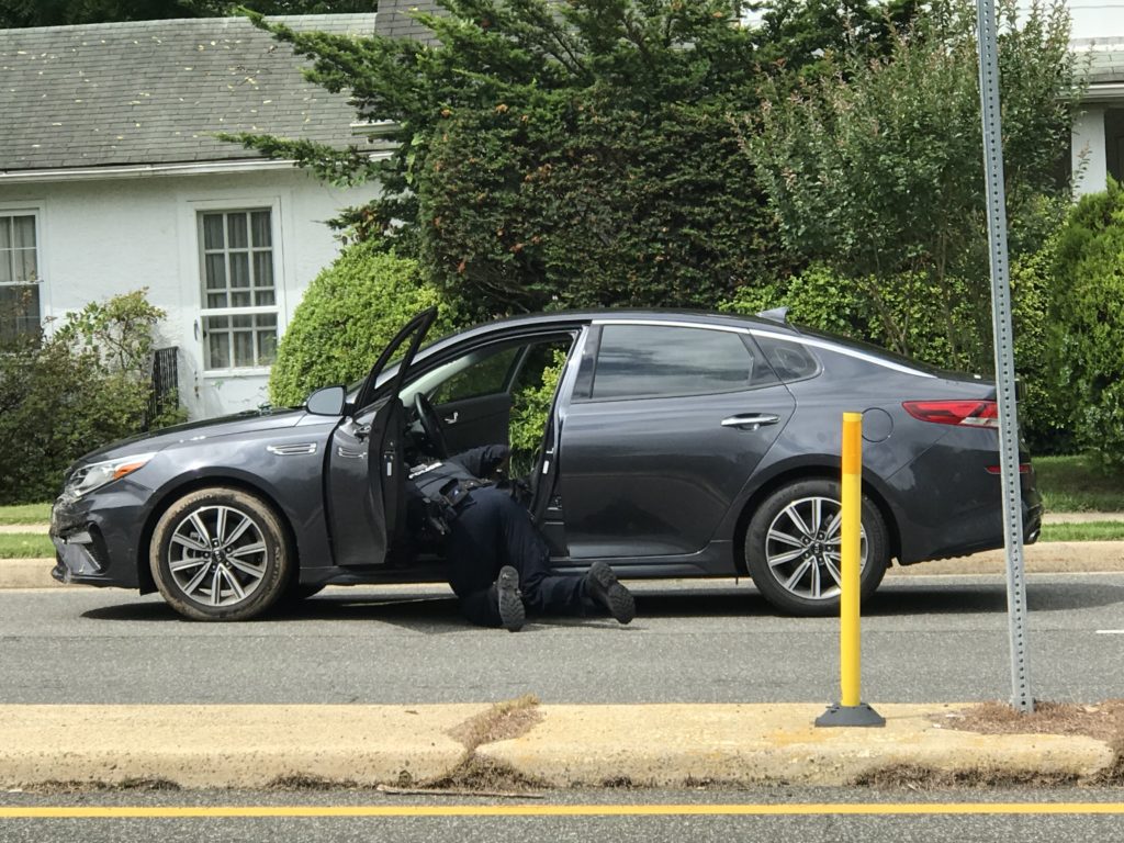
The driver of a car ran off the side of N. Glebe Road, struck a tree, and then allegedly tried to drive off when police arrived.
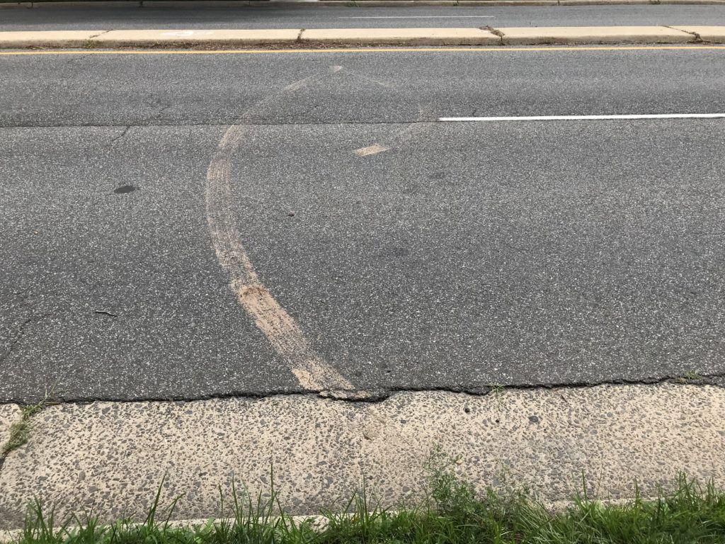
The incident happened around 10:30 a.m. on the 3400 block of N. Glebe Road, near the Country Club Hills neighborhood. It’s unclear how the single-vehicle crash happened, nor is it clear whether the driver was heading northbound or southbound at the time of the crash, but it damaged a tree and bushes in the front yard of a home along Glebe Road.
The vehicle suffered front-end damage on the driver’s side, but the driver allegedly started to drive off when police arrived, according to scanner traffic. Muddy tire tracks could be seen in the roadway.
The driver stopped a short distance away and was transported to Virginia Hospital Center for unspecified injuries.
Police could be seen examining an open plastic bottle near the vehicle shortly after the ambulance departed the scene.
Diagram of proposed changes to Memorial Circle (Image via National Park Service)
Traffic from Arlington Memorial Bridge at Memorial Circle (Image via Google Maps)
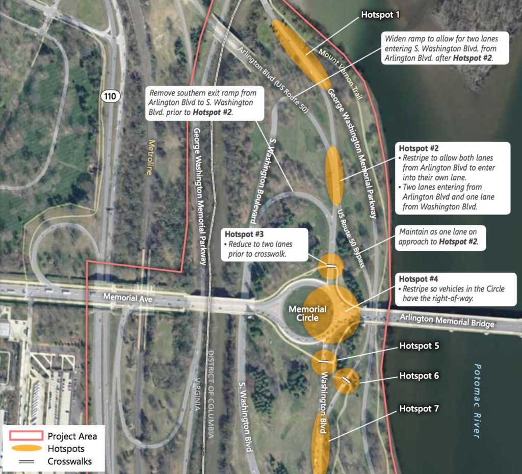
Areas near Memorial Circle designated for safety improvements (Image via the National Park Service)
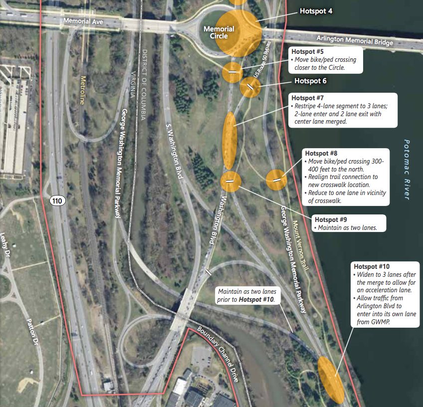
Sites slated for improvements under the new safety changes (Image via the National Park Service)
Sites slated for improvements under the new safety changes (Image via the National Park Service)
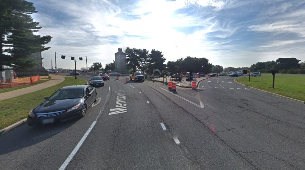
(Updated at 4:25 p.m.) The National Park Service is ready to move ahead with plans to make Memorial Circle safer and easier to navigate.
NPS finalized a study last week, stating its plans did not negatively impact the surrounding environment or historical character of the area. The agency can now move forward on making the nexus of roadways safer for drivers, pedestrians, and bicyclists.
“The National Park Service is very pleased this project has advanced to a stage where we’ll be able to implement these improvements as soon as funds are available,” a spokesman for the federal agency told ARLnow.
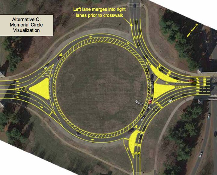
NPS chose the most aggressive of three proposed plans to modify Memorial Circle and the roads around it, S. Arlington Blvd and Washington Blvd.
The plan chosen, Alternative C, calls for changes like re-striping Memorial Circle down to one lane of traffic instead of two, thus reducing conflicts between drivers in the circle and approaching the circle.
The plan also includes a proposal to enlarge and shorten the text on signs in the circle, making them easier to read. Additionally, new yield signs would give vehicles inside the circle the right of way.
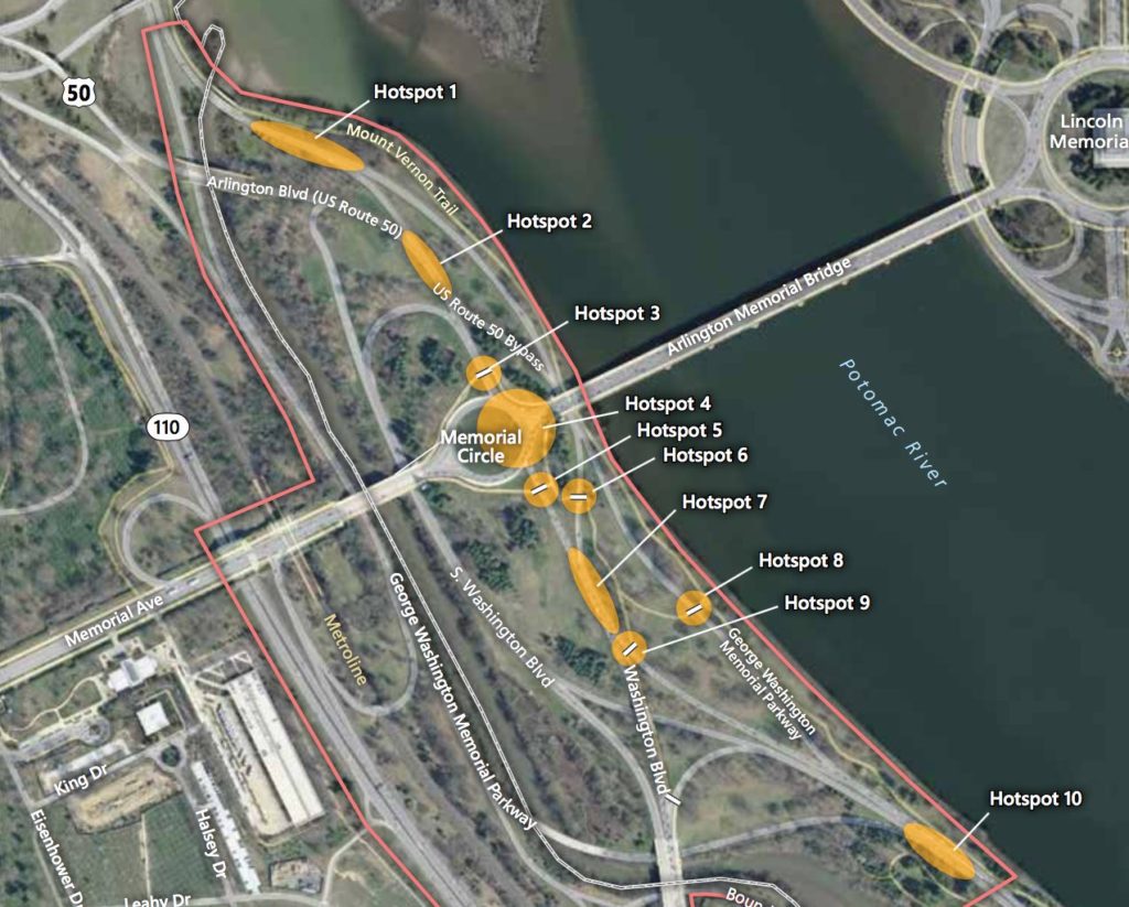
NPS also proposed adding walk signals for pedestrians and flashing beacons for drivers at six intersections where the study notes near-misses are common. Officials estimated 600 crashes occurred near Memorial Circle between 2005 and 2012.
The agency would also re-stripe S. Arlington Blvd down to two lanes before it approaches the crosswalk just north of the circle to make crossing safer for pedestrians.
To help reduce weaving between lanes and merging traffic north of the circle, NPS would:
Re-stripe Washington Blvd, reducing it to one lane
Re-stripe S. Arlington Blvd to two lanes and Washington Blvd to one lane where the roadways merge, allowing traffic to continue without changing lanes
Remove the S. Arlington Blvd exit ramp and far left exit lane to S. Washington Blvd
Widen the northern ramp off of S. Arlington Blvd up to 12 feet to allow two lanes of traffic to exit, making the left lane exit-only and the right lane a shared exit/through lane
Possibly remove one or two trees along the exit of the S. Arlington Blvd ramp
The plan also calls for widening northbound Washington Blvd to fit a third lane as it merges into the circle.
The widened road would make room for a concrete island, directing two of Washington Blvd’s three northbound lanes onto Memorial Bridge and one lefthand lane into the circle. NPS said Washington Blvd could be widened up to 20 feet, pending design specifications.
The existing concrete island where the Memorial Bridge meets the circle’s east side would be split into two. These two new concrete islands would direct the left westbound lane coming off Arlington Memorial Bridge into the circle and syphon the other westbound lanes onto S. Arlington Blvd.
Other changes include:
Adding rumble strips and raised pavement markings to avoid “last-minute weaving” and provide more guidance to drivers
Installing more speed limit signs and increased police presence to crack down on speeding
NPS has implemented traffic improvements to the area before. In 2012, the agency moved a sidewalk and installed rumble strips, among other changes, on the GW Parkway in a bid to make the roadway safer.
“Whether you are a frequent commuter, visitor to Washington, D.C. or someone recreating, we want the Memorial Circle area to be a safe and accessible experience for everyone,” said Charles Cuvelier, the Parkway’s superintendent, in a statement about the latest round of improvements.
Work continues nearby on structural repairs to Memorial Bridge, a project NPS started last year.
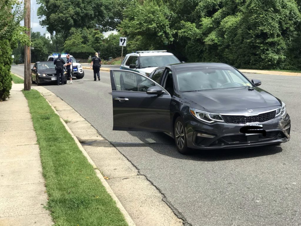
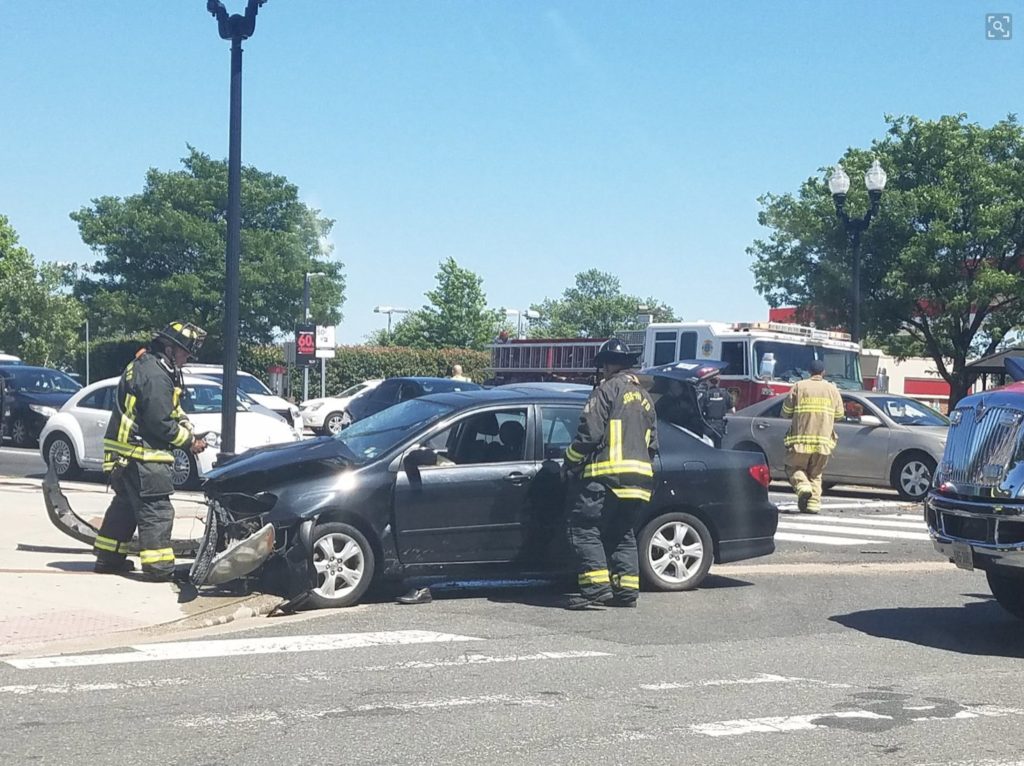
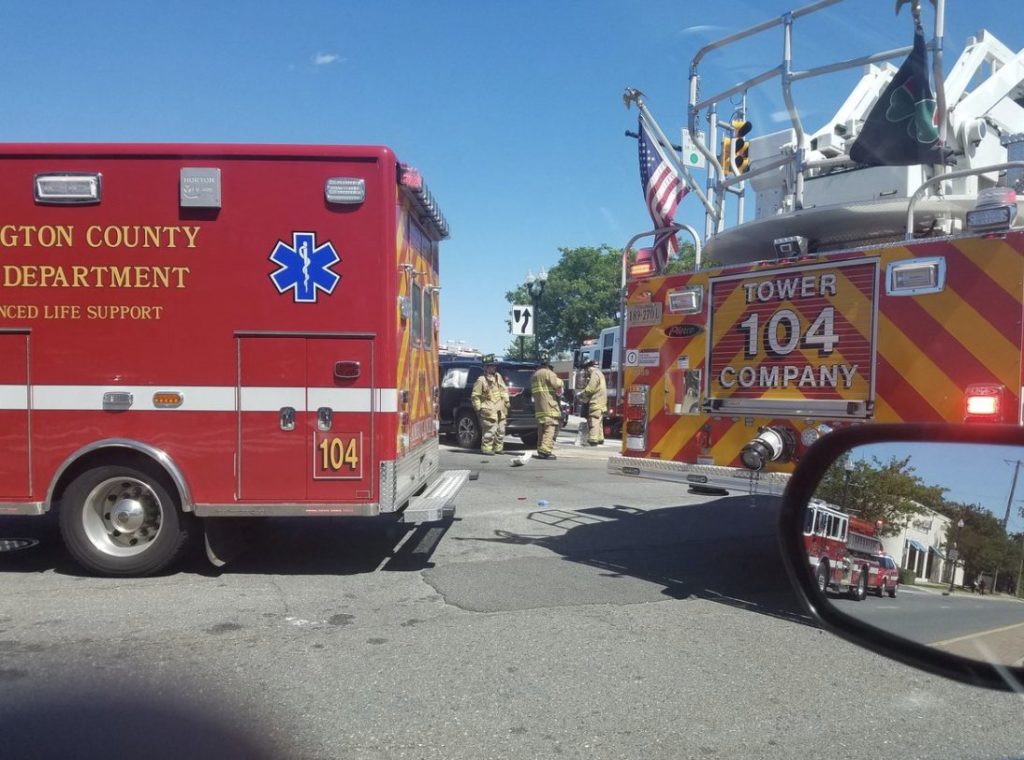
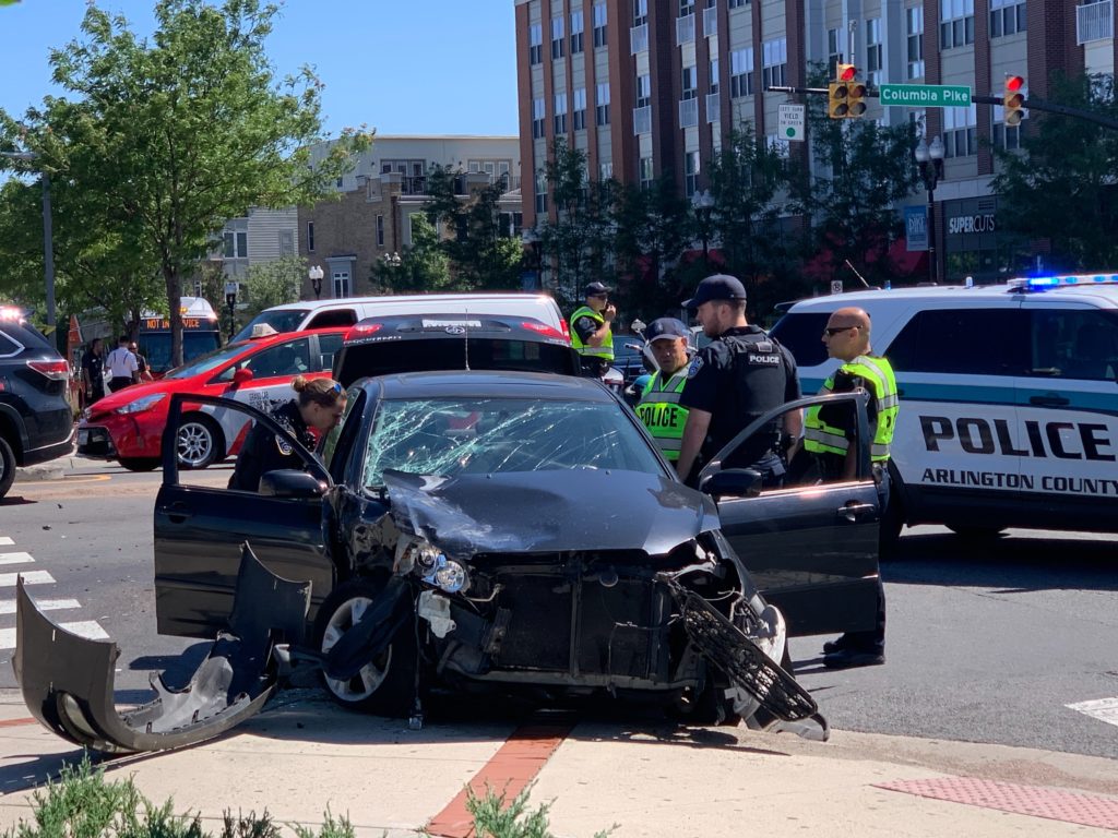
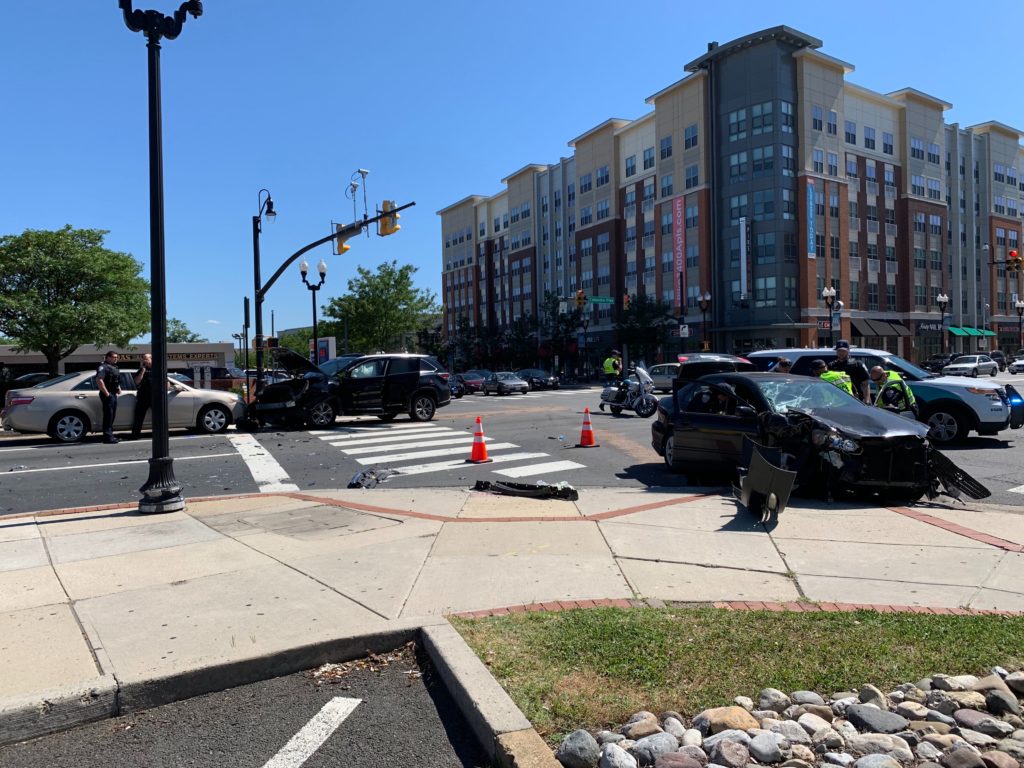
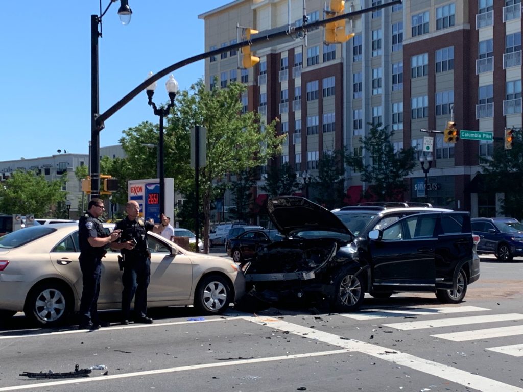
Crash at Columbia Pike and S. Glebe Road (Photo courtesy @LAGATAF1NA/Twitter)
Crash at Columbia Pike and S. Glebe Road (Photo courtesy @LAGATAF1NA/Twitter)
Crash at Columbia Pike and S. Glebe Road
Crash at Columbia Pike and S. Glebe Road
Crash at Columbia Pike and S. Glebe Road
Crash at Columbia Pike and S. Glebe Road
(Updated at 4:05 p.m.) Police and firefighters are on scene of a major crash at the intersection of Columbia Pike and S. Glebe Road.
The westbound lanes of Columbia Pike and at least one northbound lane of Glebe are blocked by the crash and the emergency activity. Drivers should expect significant evening rush hour traffic impacts in the area.
Initial reports suggest three vehicles were involved and at least two people were injured, one of whom suffered serious injuries and was rushed to a local trauma center.
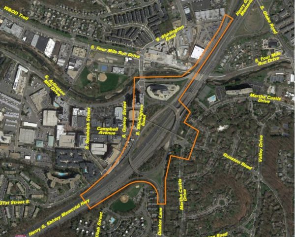
VDOT is planning a community meeting to discuss changes that might be coming to the “Shirlington Circle” interchange of I-395.
The somewhat labyrinthine interchange has been the scene of several notablecrashes over the past few years. VDOT has been studying ways to improve it over the past few years.
The meeting is planned from 7-9 p.m. next Wednesday, June 12, at Drew Model School (3500 23rd Street S.). The transportation agency says it will reveal options for reducing congestion and crashes while soliciting public comments.
More from VDOT:
Join the Virginia Department of Transportation on Wednesday, June 12 to learn about and give input on alternatives identified by a study assessing safety and operational improvements at the I-395 Shirlington interchange (Exit 6), as well as at the following:
The ramp from South Glebe Road (Route 120) to southbound I-395
The intersection of South Shirlington Road and South Arlington Mill Drive
The intersection of Gunston Road and Martha Custis Drive
The study has collected data on traffic volumes and vehicle movements, and identified safety and operational issues. Learn more about the study’s identified alternatives, which aim to reduce congestion and crashes as well as boost the interchange’s overall performance. The study is being financed with federal funds and is expected to be finalized in fall 2019.
Residents are invited to stop by Drew Model Elementary School, 3500 23rd Street South, Arlington, VA 22206 between 7 p.m. and 9 p.m. to view displays and learn more about the study. A presentation will begin at 7:30 p.m. VDOT staff will be on hand to answer questions.
Give comments at the meeting, or e-mail or mail them by June 24, 2019 to Ms. Olivia Daniszewski, EIT, Virginia Department of Transportation, 4975 Alliance Drive, Fairfax, VA 22030.
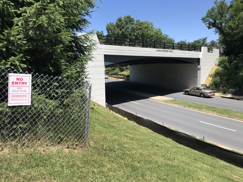
New Carlin Springs Road bridge over George Mason Drive
New Carlin Springs Road bridge over George Mason Drive
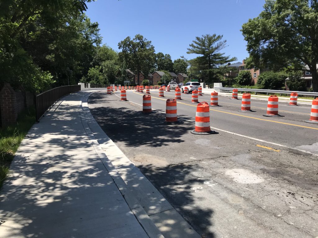
A new Carlin Springs Road bridge over George Mason Drive has been built and county crews are now preparing for some finishing touches.
Construction started in 2017 and most of the work was completed earlier this year. To the consternation of nearby residents, the paving and restriping work has yet to start — the county told residents it was waiting for the right weather conditions — but that’s about to change.
“Remaining work items include installing new street lights for the bridge and the George Mason Drive interchange and landscaping,” Arlington Dept. of Environmental Services spokesman Eric Balliet tells ARLnow. “Crews are scheduled to be on site next week to install the street light conduits.”
“Final paving and marking of the roadway is anticipated to take place by early July, barring any complications and weather permitting,” Balliet continued. “At that time, the permanent traffic pattern will be established and all cones and barrels will be removed.”
Numerous residents have emailed ARLnow with complaints about the project not yet being completed, even though it appears to be on-time based on an Oct. 2017 presentation. One explained that the current traffic pattern has resulted in delays for drivers.
“It’s the left turn on Carlin heading towards Ballston onto George Mason,” a local resident said via email. “It’s causing illegal u-turns so drivers can access George Mason northbound.”
Balliet said the lane striping, when it’s complete, will provide a turn lane for drivers heading from Carlin Springs to George Mason.
(Updated at 2:50 p.m.) The ramp from eastbound Route 50 to the Roosevelt Bridge is closed due to a serious crash involving a motorcycle.
The exact circumstances around the crash are unclear, but initial reports suggest a motorcyclist lost control and crashed into a guardrail around 12:40 p.m., potentially suffering broken bones and other injuries.
The rider was transported via ambulance to a local trauma center in critical condition, according to Arlington County Fire Department spokesman Capt. Ben O’Bryant. Arlington County Police later clarified that the rider’s condition was critical, but with non-life-threatening injuries.
ACPD's Critical Accident Team is investigating a single vehicle accident involving a motorcycle. The driver was transported to an area hospital with critical but non-life threatening injuries. The roadway remains closed as detectives process the scene. Seek alternate routes. https://t.co/80KtVv9UBf
Starting as early as Monday (June 3), N. Irving Street, near Silver Diner, will be blocked off at the busy intersection where Clarendon, Washington and Wilson boulevards all meet. Irving Street has “low traffic volumes,” according to Arlington County, and the permanent closure will — along with the new no-left-turn from Washington Blvd to Wilson Blvd — help simplify the intersection.
— Arlington Department of Environmental Services (@ArlingtonDES) May 29, 2019
Phase 3 of the project will move the focus of construction to the south side of the intersection, starting next week. More details via a construction update from Arlington County:
Next phase of construction starting June 3
As sidewalk work wraps up near Bar Bao, the contractor is preparing to start the next phase of construction on the south side of the intersection on June 3.
The next phase will take about six weeks, weather permitting. Crews are expected to start working near the Silver Diner and then progress toward the Wells Fargo Bank.
North Irving Street’s connection to Clarendon Circle will be permanently closed starting June 3
North Irving Street (next to Silver Diner) will be permanently closed at the intersection. Closing this portion of Irving Street, which has low traffic volumes, will help make traffic operations simpler by reducing the number of streets at the intersection.
Per the project design, green streets elements will be added at the end of this street.


")
")
")