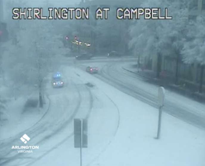
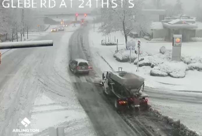
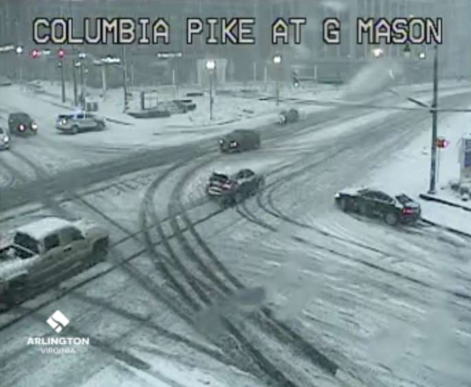
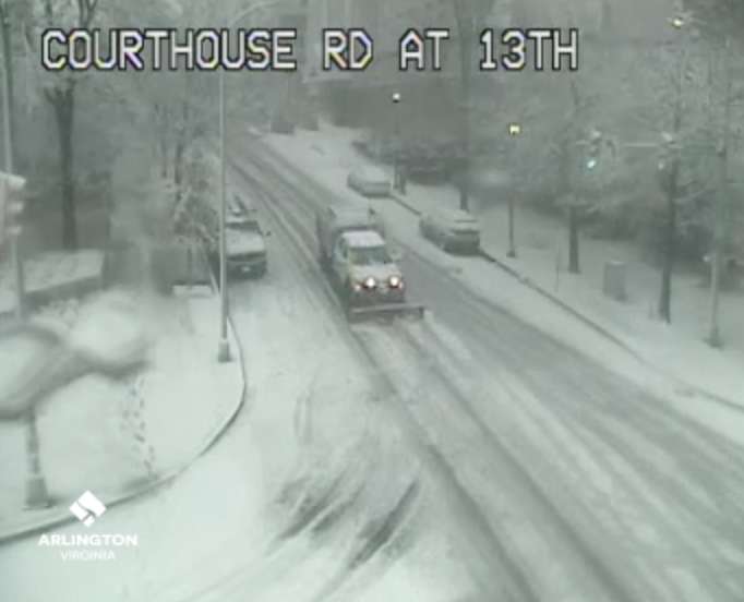
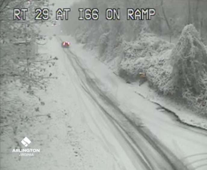
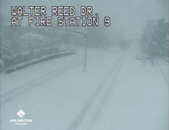
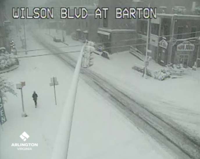
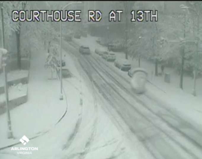
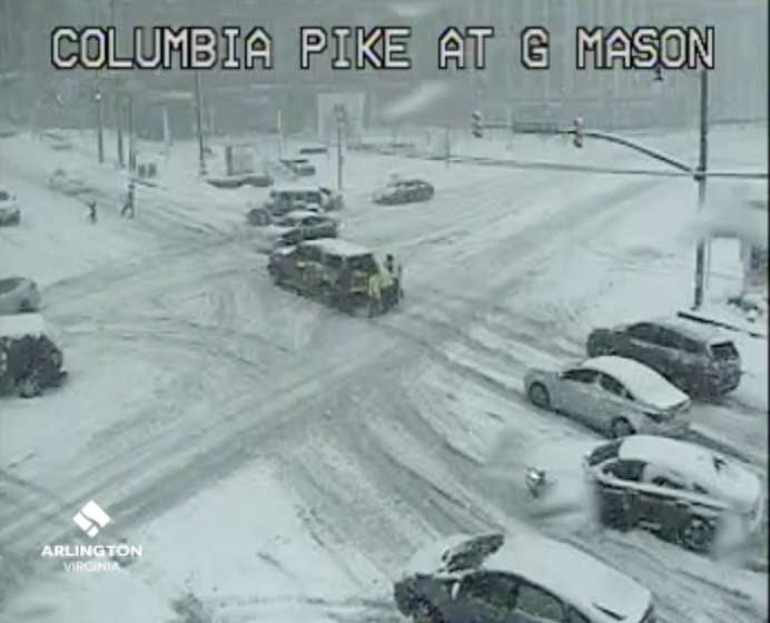
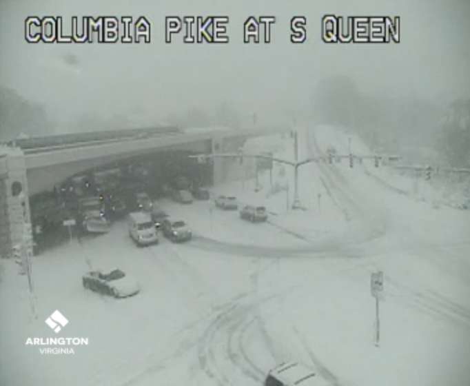
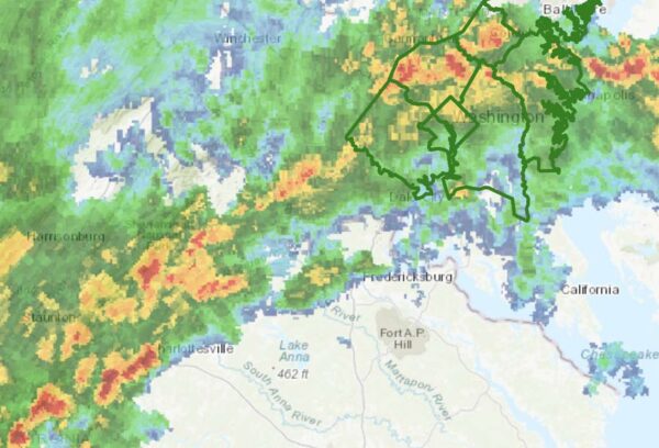
(Updated at 12:25 p.m.) In the battle between the snow plows and the snow in Arlington, the snow is currently winning.

Heavy, accumulating snow covers roads around Arlington, outpacing the rate by which it can be cleared. Snow crews were reportedly unable to pretreat roads, due to the storm starting as rain.

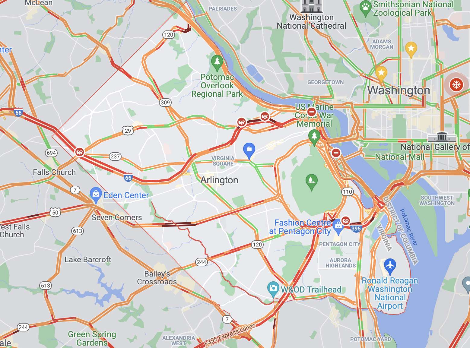
The traffic map around Arlington is a sea of red, with numerous crashes, cars stalled out on hills and other drivers moving slowly even on main thoroughfares.

“Today’s snowfall is likely to be heaviest in late morning, with low visibility and rapid accumulation,” the county said in an Arlington Alert message just after 9 a.m. “Please stay home if you can and stay off the roads.”

Even Route 50, I-66 and I-395, a focus of VDOT plow crews, remain largely snow-covered with several reported crashes and slow traffic. Shortly after 10:15 a.m., Arlington County police were told by dispatchers to avoid I-395 entirely, due to “gridlock.”

Among the places where problems are being reported:

  • Police are blocking westbound Columbia Pike at N. George Mason Drive, prior to the hill
  • Westbound Route 50 is reportedly impassable at the hill past Courthouse and again at N. Park Drive, where cars are stuck “all over the road”
  • The steep hill on N. Courthouse Road itself is said to be “fubar”
  • “A bunch of cars sideways” on N. Glebe Road between Military Road and Chain Bridge, which is now closed. There’s also a report of a downed tree.
  • Cars having trouble getting up the hill on S. Glebe Road near Shirlington Road
  • Police have also been requested to Shirlington Road and Arlington Mill Drive in the Shirlington area. Shirlington Circle may be shut down, according to scanner traffic.
  • The intersection of N. Rhodes Street and 14th Street N. is reportedly “littered with cars” that have been abandoned by drivers who got stuck on the hill
  • S. Arlington Ridge Ridge Road is blocked between 23rd and 28th streets due to two large trees down across the roadway
  • Numerous issues have been reported along Langston Blvd (Route 29) including a stuck tractor trailer at N. Scott Street

The Arlington County Fire Department has declared a snow emergency, according to scanner traffic, affecting how it responds to calls.

Trash and recycling collection was “suspended due to deteriorating conditions” as of 7 a.m. ART service, meanwhile, was suspended just after 9 a.m. Metrobus service was temporarily suspended around 9:30 a.m.

A brief power outage was reported in at least one portion of the county. More outages are possible with heavy wet snow potentially toppling branches and trees.

More via social media:

(more…)


Update at 3:15 p.m. — Both Arlington County and VDOT say snow crews are preparing for the storm.

“Throughout overnight hours, crews and about 2,200 trucks will be staged and ready to treat roads and plow snow where needed,” VDOT said Sunday afternoon. “Crews will begin to plow once two inches of snow have accumulated.”

Update at 2:50 p.m. — The earlier Winter Storm Watch has been updated to a Winter Storm Warning. The forecast still calls for 3 or more inches of snow falling Monday morning.

233 PM EST Sun Jan 2 2022

…WINTER STORM WARNING IN EFFECT FROM 1 AM TO 4 PM EST MONDAY…

* WHAT…Heavy snow. Total snow accumulations of 3 to 7 inches. Winds gusting as high as 35 mph.

* WHERE…The District of Columbia, portions of central Maryland and northern Virginia.

* WHEN…From 1 AM to 4 PM EST Monday.

* IMPACTS…Travel could be very difficult. The hazardous conditions could impact the morning or evening commute.

PRECAUTIONARY/PREPAREDNESS ACTIONS…

If you must travel, keep an extra flashlight, food, and water in your vehicle in case of an emergency.

When venturing outside, watch your first few steps taken on steps, sidewalks, and driveways, which could be icy and slippery, increasing your risk of a fall and injury.

Earlier: Arlington and the D.C. area could get the first significant snowfall of the season tomorrow.

Heavy snow with up to 3-6 inches of accumulation is possible Monday, starting late tonight, according to the National Weather Service, which issued a Winter Storm Watch for Arlington County and other parts of the region early this morning.

Arlington is just on the northern edge of the Winter Storm Watch, meaning that southern parts of the county may get more snow than northern parts.

More from NWS:

428 AM EST Sun Jan 2 2022

…WINTER STORM WATCH IN EFFECT FROM LATE TONIGHT THROUGH MONDAY AFTERNOON…

* WHAT…Heavy snow possible. Total snow accumulations of 3 to 6 inches possible.

* WHERE…Portions of The District of Columbia, central and southern Maryland and central and northern Virginia.

* WHEN…From late tonight through Monday afternoon.

* IMPACTS…Plan on slippery road conditions. The hazardous conditions could impact the morning commute.

PRECAUTIONARY/PREPAREDNESS ACTIONS…

Monitor the latest forecasts for updates on this situation.


Arlington and much of the region will be under a Wind Advisory starting Saturday afternoon.

Unseasonably warm weather in the afternoon — with temperatures as high as 70 degrees — will give way to cooler temperatures, which will be accompanied by gusty winds. Gusts up to 55 mph could snap tree limbs and knock out power.

More from the National Weather Service:

…WIND ADVISORY IN EFFECT FROM 4 PM SATURDAY TO 1 AM EST SUNDAY…

* WHAT… West winds 15 to 25 mph with gusts up to 55 mph expected.

* WHERE… Portions of The District of Columbia, central, north central, northeast and northern Maryland, central, northern, northwest and western Virginia and eastern and panhandle West Virginia.

* WHEN… From 4 PM Saturday to 1 AM EST Sunday.

* IMPACTS… Gusty winds could blow around unsecured objects. Tree limbs could be blown down and a few power outages may result.

* ADDITIONAL DETAILS… The highest gusts are most likely between 6 pm and Midnight this evening.

Flickr pool photo by Kevin Wolf


A warm afternoon will give way to strong winds and colder temperatures tonight.

The National Weather Service has issued a Wind Advisory for Arlington, D.C. and surrounding areas, cautioning against gusts up to 50 mph. Tree damage and power outages are possible.

More from NWS:

334 PM EST Mon Dec 6 2021

…WIND ADVISORY IN EFFECT UNTIL MIDNIGHT EST TONIGHT…

* WHAT…West winds 20 to 30 mph with gusts up to 50 mph.

* WHERE…The District of Columbia, much of northern and central Maryland including Baltimore, and northern Virginia.

* WHEN…Until midnight EST tonight.

* IMPACTS…Gusty winds could blow around unsecured objects. Tree limbs could be blown down. A few power outages may result.

* ADDITIONAL DETAILS…The highest wind gusts are most likely in a 2 to 4 hour window between 7 and 11pm this evening.

PRECAUTIONARY/PREPAREDNESS ACTIONS…

Use extra caution when driving, especially if operating a high profile vehicle. Secure outdoor objects.


Blowing leaves (Staff photo by Jay Westcott)

The National Weather Service has issued a Special Weather Statement about the strong winds that are currently gusting in Arlington and across the region.

Forecasters are cautioning that the gusts may fell tree branches and cause power outages. The strongest of the gusts are expected through mid-afternoon.

As of publication time, no outages have been reported in Arlington, according to Dominion’s outage map.

More from NWS:

1106 AM EST Fri Nov 26 2021

…GUSTY WINDS LEADING TO MINOR TREE DAMAGE…

Gusty northwesterly winds up to 45 mph will be possible through this afternoon and may result in sporadic tree and power line damage.

Remain alert if traveling through wooded areas, and avoid them if possible.


Arlington has been added to an earlier Frost Advisory for parts of the D.C. region.

It’s going to be a cold night, with temperatures near freezing, and forecasters say those with sensitive plants outdoors should take steps to protect them.

This is the first Frost Advisory of the season for Arlington.

More from the National Weather Service:

348 PM EDT Tue Nov 2 2021

…FROST ADVISORY IN EFFECT FROM 2 AM TO 10 AM EDT WEDNESDAY…

* WHAT…Temperatures as low as 34 will result in frost formation.

* WHERE…In Maryland, Prince Georges, Anne Arundel, Charles, St. Marys and Calvert Counties. In District of Columbia, District of Columbia. In Virginia, Arlington/Falls Church/Alexandria, and King George County.

* WHEN…From 2 AM to 10 AM EDT Wednesday.

* IMPACTS…Frost could kill sensitive outdoor vegetation if left uncovered.

PRECAUTIONARY/PREPAREDNESS ACTIONS…

Take steps now to protect tender plants from the cold.

Flickr pool photo by Michael Coffman


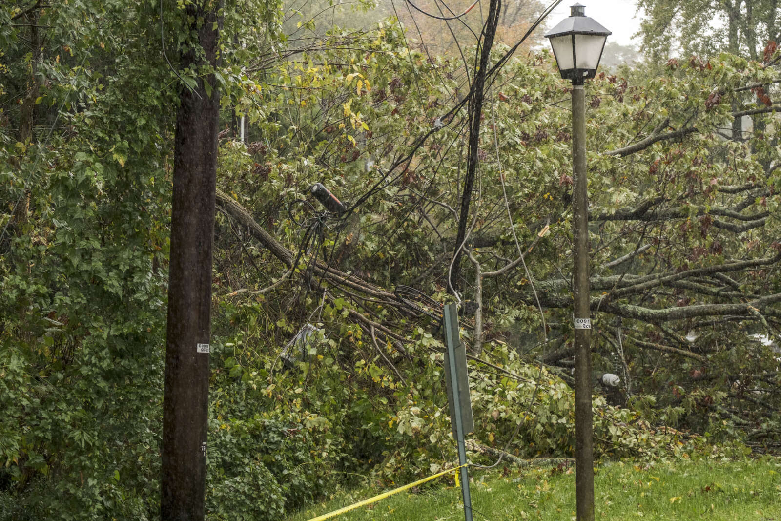
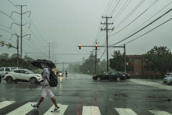
(Updated at 1:25 p.m.) Flooding is not the only imminent threat from today’s wild weather. The saturated ground and gusty winds have brought down several trees and large limbs around Arlington already, causing power outages.

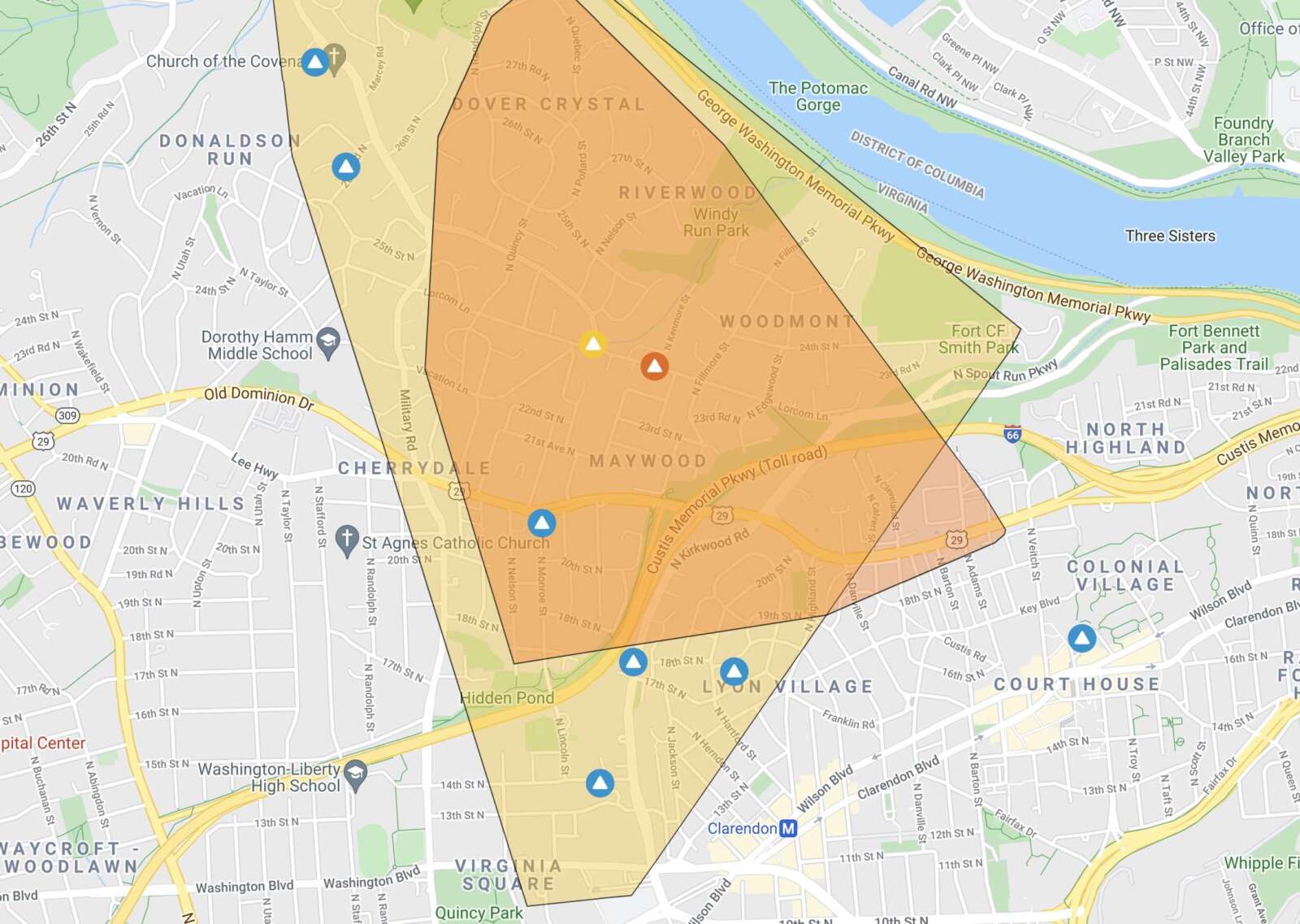
As of 12:30 p.m. more than 2,250 homes and businesses were without power from Virginia Square to Bellevue Forest, with a large chunk of residential North Arlington in between, according to Dominion’s outage map. (The number dipped to 1,925 as of 1:15 p.m.)

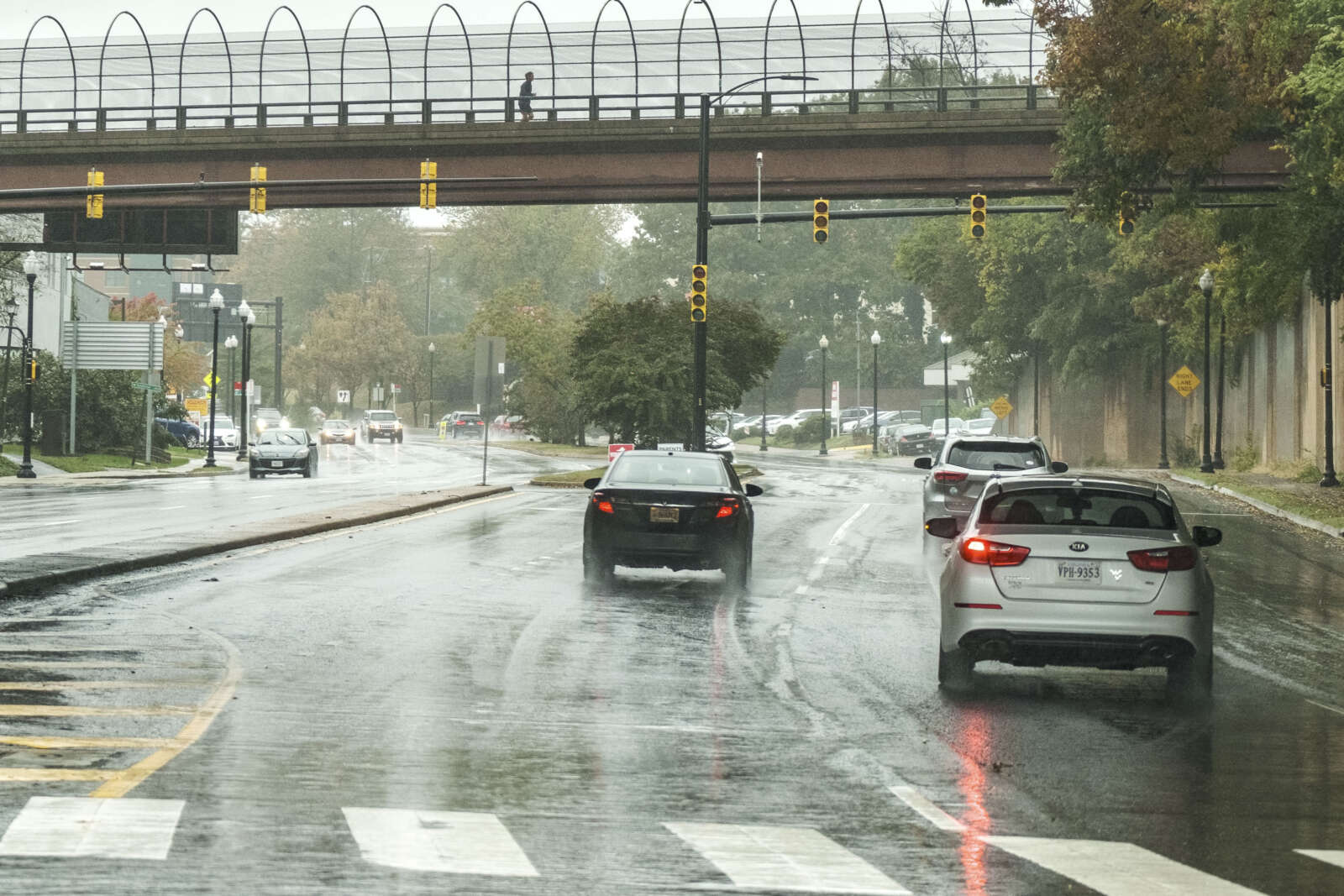
Power flickered briefly in Ballston around noon, before coming back on. The outage knocked out traffic signals on Washington Blvd and Langston Blvd, among others. The Lyon Village Shopping Center, including The Italian Store, is also reportedly affected.

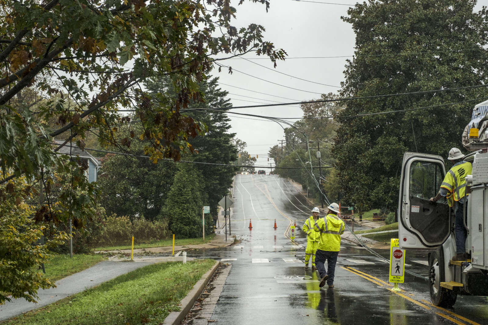
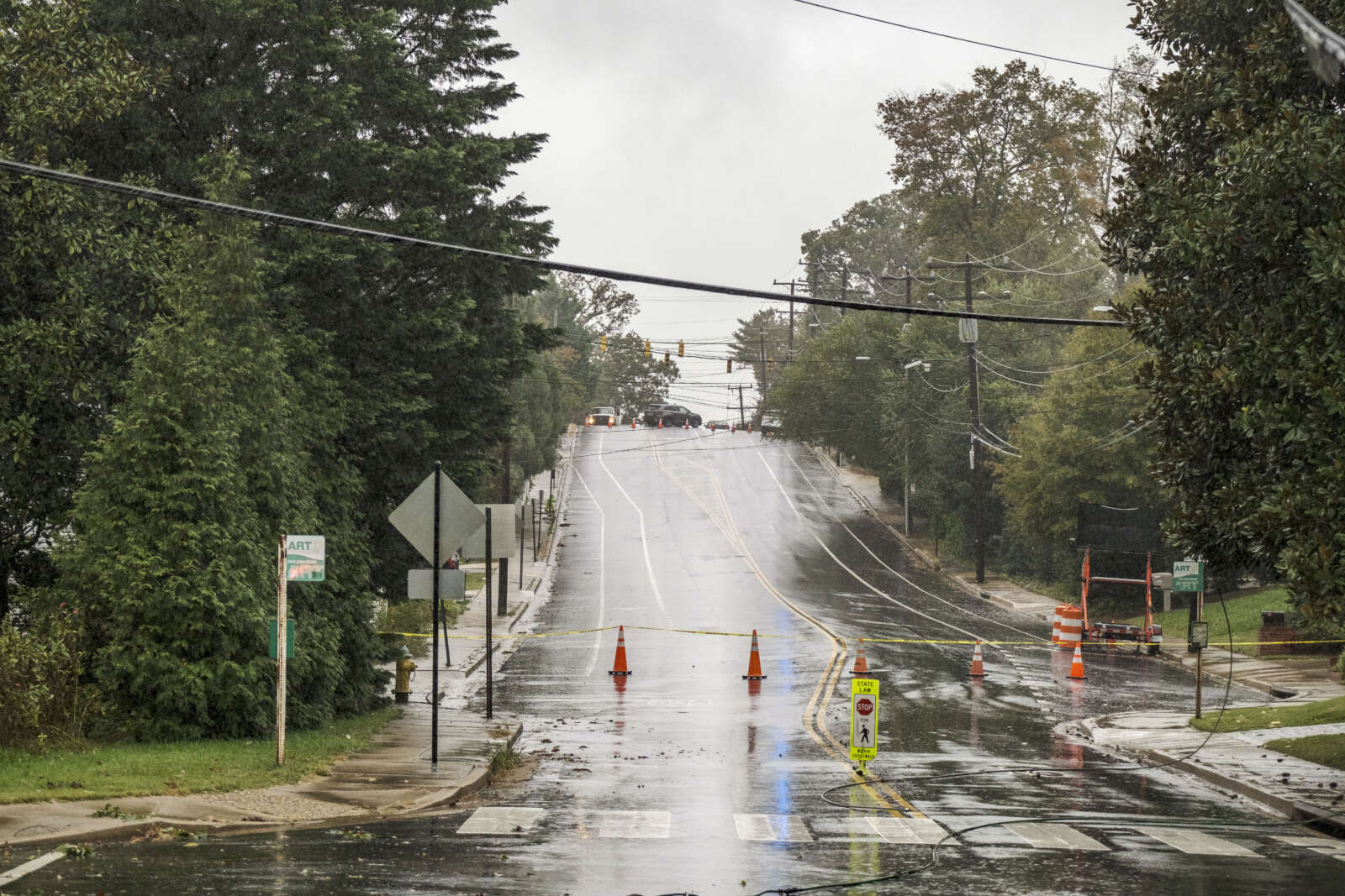
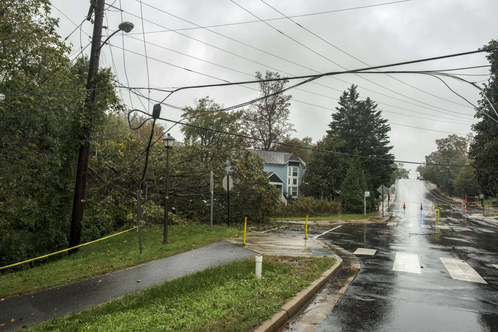
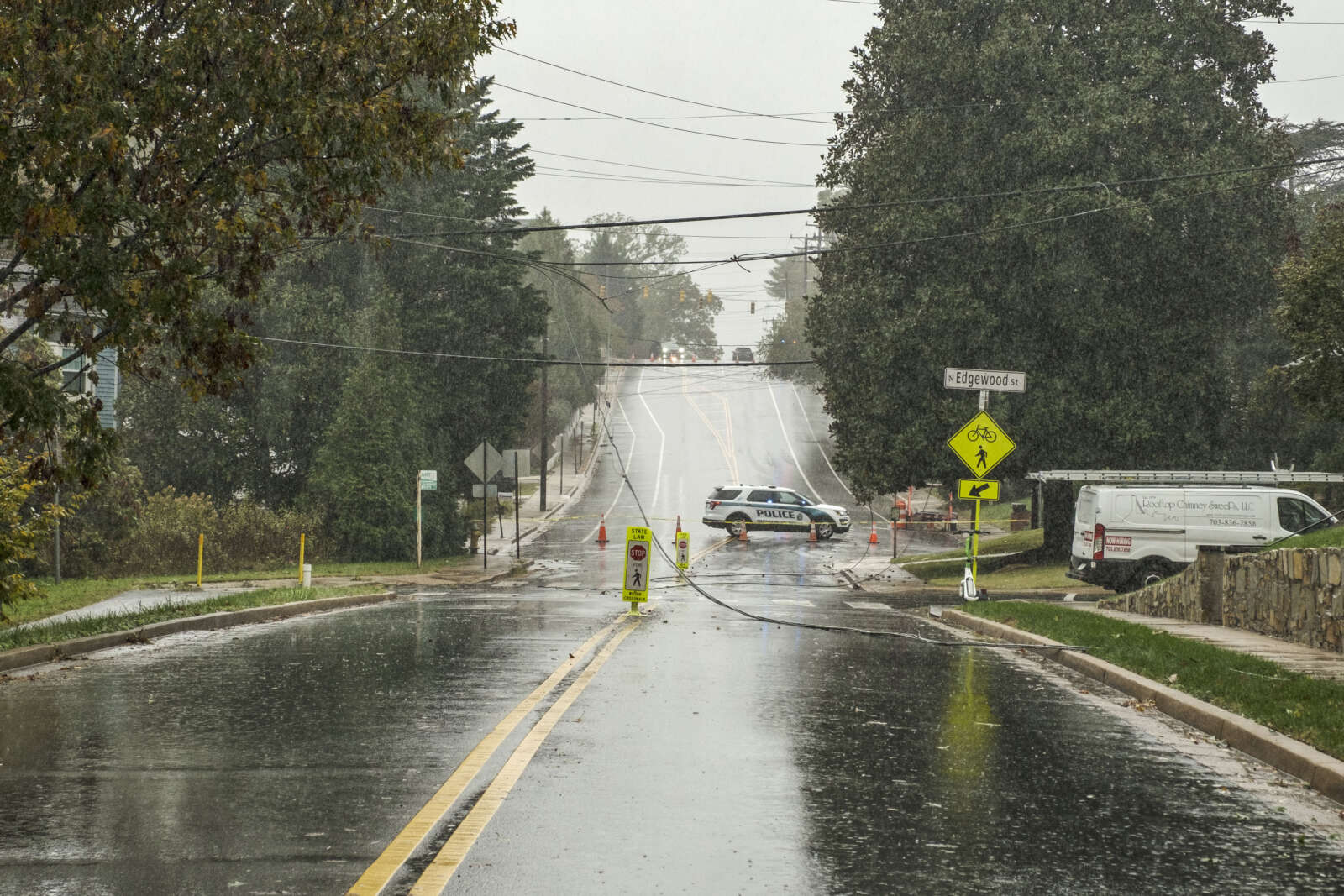
One likely cause is power lines that are down across Lorcom Lane near N. Edgewood Street, in the area of the Maywood and Woodmont neighborhoods. A falling tree took down the lines, which Dominion crews are now working to repair. Lorcom Lane is closed in the area.

The current estimated restoration time for the outage is listed as between 2-8 p.m, according to Dominion.

Meanwhile, more trees are likely to fall.

This morning the National Weather Service issued a statement cautioning about falling trees. NWS has received more than a dozen reports of trees falling around the region, including in Fairfax County where more than 5,000 Dominion customers are currently in the dark.

From NWS:

1122 AM EDT FRI OCT 29 2021

…GUSTY WINDS AND WET GROUND LEADING TO MINOR TREE DAMAGE…

GUSTY EASTERLY WINDS OF UP TO AROUND 40 MPH COMBINED WITH WET GROUND FROM RECENT RAINFALL IS RESULTING IN SPORADIC TREE AND POWER LINE DAMAGE. REMAIN ALERT IF TRAVELING THROUGH WOODED AREAS, AND AVOID THEM IF POSSIBLE.


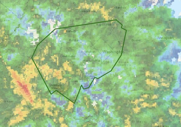
Boundaries of the Flood Warning that includes Arlington (via NWS)

Arlington and much of the region is now under a Flood Warning as rain continues to fall.

The warning was issued by the National Weather Service just after 12:30 p.m. Arlington is also under an earlier Coastal Flood Warning for significant tidal flooding along the Potomac.

More on the latest warning from NWS:

1234 PM EDT FRI OCT 29 2021

THE NATIONAL WEATHER SERVICE IN STERLING VIRGINIA HAS ISSUED A

* FLOOD WARNING…

* UNTIL 630 PM EDT.

* AT 1234 PM EDT, DOPPLER RADAR INDICATED HEAVY RAIN WITH RAINFALL AMOUNTS AROUND 0.5 AND 1.5 INCHES ACROSS MOST OF THE WARNED AREA. A PERIOD OF HEAVY RAIN IS EXPECTED THIS AFTERNOON THROUGH 3 PM WITH RAINFALL RATES AROUND ONE INCH PER HOUR. THIS WILL CAUSE CREEKS AND STREAMS TO RISE THROUGH LATE THIS AFTERNOON. FLOODING IS EXPECTED TO BEGIN SHORTLY IN THE WARNED AREA.

* SOME LOCATIONS THAT WILL EXPERIENCE FLOODING INCLUDE… ARLINGTON… ALEXANDRIA… CENTREVILLE… DALE CITY… ROCKVILLE… BETHESDA… RESTON… ANNANDALE… CLINTON… SPRINGFIELD… COLLEGE PARK… SOUTH RIDING… FORT WASHINGTON… HERNDON… GREENBELT… FAIRFAX… LANGLEY PARK… BELTSVILLE… FORT HUNT… VIENNA…

ADDITIONAL RAINFALL AMOUNTS OF 1 TO 2.5 INCHES ARE POSSIBLE IN THE WARNED AREA.

PRECAUTIONARY/PREPAREDNESS ACTIONS…

TURN AROUND, DON’T DROWN WHEN ENCOUNTERING FLOODED ROADS. MOST FLOOD DEATHS OCCUR IN VEHICLES.

Via Twitter:

https://twitter.com/ReadyArlington/status/1454127524766752777


It’s going to be nasty, rainy Friday.

Arlington will be under both a Flood Watch and a Coastal Flood Warning tomorrow. On top of that, strong winds and the possibility of some severe thunderstorms are in the forecast.

The Flood Watch takes effect Friday morning. From the National Weather Service:

849 PM EDT Thu Oct 28 2021

…FLOOD WATCH REMAINS IN EFFECT FROM FRIDAY MORNING THROUGH FRIDAY AFTERNOON…

The Flood Watch continues for

* Portions of DC, Maryland and northern Virginia, including the following areas: in DC, District of Columbia. In Maryland, Anne Arundel, Central and Southeast Howard, Central and Southeast Montgomery, Prince Georges and Southern Baltimore. In northern Virginia, Arlington/Falls Church/Alexandria, Fairfax and Prince William/Manassas/Manassas Park.

* From Friday morning through Friday afternoon.

* Rainfall amounts around 1 to 2 inches are most likely with isolated amounts of 2 to 4 inches possible.

* Heavy amounts of rain will cause creeks and streams to slowly rise, possibly out of their banks as well as the potential for flooding in urban areas.

PRECAUTIONARY/PREPAREDNESS ACTIONS…

You should monitor later forecasts and be alert for possible Flood Warnings. Those living in areas prone to flooding should be prepared to take action should flooding develop.

While Arlington’s river shoreline is not developed, unlike our neighbors in Alexandria, significant coastal flooding may inundate trails along the Potomac. A rare Coastal Flood Warning is currently in effect.

…COASTAL FLOOD WARNING NOW IN EFFECT UNTIL 2 PM EDT SATURDAY…

* WHAT…Two to three feet of inundation above ground level expected in low lying areas due to tidal flooding.

* WHERE…Shoreline in the District of Columbia, Arlington County, and the City of Alexandria.

* WHEN…Until 2 PM EDT Saturday, especially around the time of high tide.

* IMPACTS…The unprotected area on the Southwest Waterfront at the DC Seafood Market is expected to flood. Water is expected
to approach parts of the Hains Point Loop Road, but it will likely be closed. Water is expected to approach buildings near King Street and Union Street. Shoreline inundation up to one foot above ground is possible elsewhere.

* ADDITIONAL DETAILS…Tides up to 4 feet above normal. The next high tide at Washington Channel is at 2:18 AM and 3:14 PM. The next high tide at Alexandria is at 2:36 AM and 3:32 PM.

PRECAUTIONARY/PREPAREDNESS ACTIONS…

Take the necessary actions to protect flood-prone property. If travel is required, do not drive around barricades or through water of unknown depth.

NWS is calling for wind gusts up to 37 mph tomorrow, raising the possibility of falling trees and branches, as well as power outages.

More via Twitter:

https://twitter.com/ReadyArlington/status/1453742757718200331


Arlington and much of the D.C. region is under a Wind Advisory from noon until midnight today.

Gusty winds will whip up in the afternoon, becoming progressively stronger later in the day and evening, forecasters say. Gusts of up to 50 mph are expected.

Falling trees and tree branches will pose a danger during the wind event, and power outages are likely.

More from the National Weather Service:

…WIND ADVISORY IN EFFECT FROM NOON TODAY TO MIDNIGHT EDT TONIGHT…

* WHAT…NORTHWEST WINDS 25 TO 35 MPH WITH GUSTS UP TO 50 MPH EXPECTED.

* WHERE…PORTIONS OF THE DISTRICT OF COLUMBIA, CENTRAL, NORTH CENTRAL, NORTHERN, SOUTHERN AND WESTERN MARYLAND, CENTRAL, NORTHERN, NORTHWEST AND WESTERN VIRGINIA AND EASTERN AND PANHANDLE WEST VIRGINIA.

* WHEN…FROM NOON TODAY TO MIDNIGHT EDT TONIGHT.

* IMPACTS…GUSTY WINDS COULD BLOW AROUND UNSECURED OBJECTS. TREE LIMBS COULD BE BLOWN DOWN AND A FEW POWER OUTAGES MAY RESULT.

PRECAUTIONARY/PREPAREDNESS ACTIONS…

USE EXTRA CAUTION WHEN DRIVING, ESPECIALLY IF OPERATING A HIGH PROFILE VEHICLE. SECURE OUTDOOR OBJECTS.

File photo


Flash Flood Watch and radar as of 6 p.m. (via NWS)

Update at 10:15 p.m. — Arlington is under a Flood Warning as heavy rain continues to fall. Some flooding is being reported in parts of the area, including along I-66 in Arlington.

Earlier: A rainy night, and possible flooding, is on tap after a line of storms packing gusty winds and downpours blew through Arlington during the evening commute.

More rain is expected to fall on already-saturated ground tonight, prompting the National Weather Service to issue a Flash Flood Watch.

More from NWS:

URGENT – IMMEDIATE BROADCAST REQUESTED
FLOOD WATCH
NATIONAL WEATHER SERVICE BALTIMORE MD/WASHINGTON DC
550 PM EDT MON OCT 25 2021

…FLASH FLOOD WATCH IN EFFECT UNTIL 2 AM EDT TUESDAY…

THE NATIONAL WEATHER SERVICE IN STERLING VIRGINIA HAS ISSUED A

* FLASH FLOOD WATCH FOR PORTIONS OF DC, MARYLAND AND NORTHERN VIRGINIA, INCLUDING THE FOLLOWING AREAS: IN DC, DISTRICT OF COLUMBIA. IN MARYLAND, ANNE ARUNDEL, CENTRAL AND SOUTHEAST HOWARD, CENTRAL AND SOUTHEAST MONTGOMERY, PRINCE GEORGES AND SOUTHERN BALTIMORE. IN NORTHERN VIRGINIA, ARLINGTON/FALLS CHURCH/ALEXANDRIA AND FAIRFAX.

* UNTIL 2 AM EDT TUESDAY.

* SHOWERS AND THUNDERSTORMS ARE EXPECTED TO PRODUCE 1 TO 2 INCHES OF RAIN THROUGH THIS EVENING, WITH LOCALIZED AMOUNTS OF UP TO 4 INCHES POSSIBLE. HEAVY RAIN IN A SHORT AMOUNT OF TIME MAY RESULT IN RAPID RISES OF WATER ON SMALL CREEKS AND STREAMS AND IN URBAN AREAS.

PRECAUTIONARY/PREPAREDNESS ACTIONS…

YOU SHOULD MONITOR LATER FORECASTS AND BE PREPARED TO TAKE ACTION SHOULD FLASH FLOOD WARNINGS BE ISSUED.


View More Stories