Apple Eying Arlington, N. Va. — It’s not just Amazon — Apple is also looking to establish a large new office, potentially in Northern Virginia. Crystal City and the Rosslyn-Ballston corridor are among the sites the world’s most valuable company is considering for a new campus that would bring 20,000 jobs to the area. [Washington Post, Washington Business Journal]

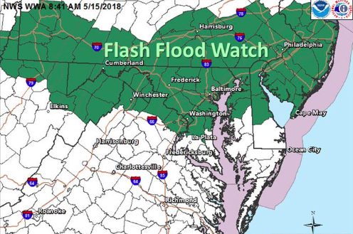
Flood Watch Today — A Flood Watch is in effect today, starting this afternoon and running through Friday night. Heavy rain — 3 to 5 inches — is expected through Friday evening. [Capital Weather Gang, Twitter]

W-L Alums Against Name Change — Hundreds of Washington-Lee High School alumni have signed on to oppose the removal of “Lee” from the school’s name. A decision on the name could come later this year. [Falls Church News-Press]

ACPD Detective Honored — Det. Rosa Ortiz has been named Law Enforcement Officer of the Year by Arlington County Crime Solvers. Ortiz’s dogged work on cold cases “demonstrates our commitment to pursue cases, no matter how much time has passed,” said Arlington County Police. [Facebook]

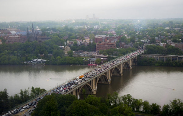
Students Plant Trees Along GW Parkway — “Students from the Children’s International School in Rosslyn recently joined their parents and community volunteers in planting 32 trees in a previously weedy area along the southbound George Washington Memorial Parkway ramp to Key Bridge.” [InsideNova]

Flickr pool photo by TheBeltWalk


Update at 5:55 p.m. — Arlington and much of the D.C. and Baltimore region is now under a Severe Thunderstorm Watch.

Earlier: Arlington County and surrounding areas are currently under a Flash Flood Watch due to expected storms tonight.

Forecasters say heavy rain may lead to flash flooding, as it did last night along Four Mile Run.

More from the National Weather Service:

…FLASH FLOOD WATCH IN EFFECT FROM 3 PM EDT THIS AFTERNOON THROUGH LATE TONIGHT…

A FRONT WILL SAG ACROSS THE REGION THIS AFTERNOON INTO THIS EVENING. A COUPLE ROUNDS OF THUNDERSTORMS ARE EXPECTED TO ACCOMPANY THE FRONT AND SHOULD MOVE ACROSS THE MASON-DIXON REGION LATE AFTERNOON. THESE THUNDERSTORMS SHOULD PUSH FARTHER SOUTH AND EAST INTO EASTERN WEST VIRGINIA, NORTHERN VIRGINIA AND PORTIONS OF NORTHERN MARYLAND DURING THE EVENING. HEAVY RAINFALL AND LIGHTNING WILL BE THE MAIN THREATS WITH THE POTENTIAL OF ENCOUNTERING DAMAGING WINDS AND HAIL IN THE STRONGEST THUNDERSTORMS. RAINFALL AMOUNTS COULD AVERAGE 1 TO 3 INCHES LATER THIS AFTERNOON AND THIS EVENING. FLASH FLOODING IS POSSIBLE, ESPECIALLY IN SLOW-MOVING THUNDERSTORMS.

FLASH FLOODING RISK IS FOR SMALL STREAMS PARTICULARLY IN URBAN AREAS LIKE BALTIMORE AND HAGERSTOWN. PRECAUTIONARY/PREPAREDNESS ACTIONS… A FLASH FLOOD WATCH MEANS THAT CONDITIONS MAY DEVELOP THAT LEAD TO FLASH FLOODING. FLASH FLOODING IS A VERY DANGEROUS SITUATION. YOU SHOULD MONITOR LATER FORECASTS AND BE PREPARED TO TAKE ACTION SHOULD FLASH FLOOD WARNINGS BE ISSUED.


Update at 7:45 p.m. — There have been reports of downed trees, branches and power lines in Arlington, but no major power outages have been reported by Dominion. Flights are Reagan National Airport are resuming.

No major flooding issues have been reported, though ARLnow.com’s office sprung a leak during the storm.

Update at 7:01 p.m. — The Severe Thunderstorm Warning has been extended until 7:30 p.m.

Update at 6:58 p.m. — A Flash Flood Warning has also been issued for Arlington.

The National Weather Service in Sterling Virginia has issued a

* Flash Flood Warning for…
The District of Columbia…
South central Montgomery County in central Maryland…
Arlington County in northern Virginia…
The City of Falls Church in northern Virginia…
Northeastern Fairfax County in northern Virginia…
The City of Alexandria in northern Virginia…

* Until 1000 PM EDT.

* At 654 PM EDT, Doppler radar indicated thunderstorms producing
heavy rain across the area. Around an inch of rain has fallen, and
an additional 1 to 2 inches of rain is possible over the next 1
to 2 hours leading to flash flooding in the metro area.

PRECAUTIONARY/PREPAREDNESS ACTIONS…

Turn around, don’t drown when encountering flooded roads. Most flood
deaths occur in vehicles.

(Updated at 6:55 p.m.) The National Weather Service has issued a Severe Thunderstorm Warning for Arlington as a powerful line of storms rolls through the county.

More from the National Weather Service:

…A SEVERE THUNDERSTORM WARNING REMAINS IN EFFECT UNTIL 700 PM EDT FOR THE DISTRICT OF COLUMBIA…SOUTHERN MONTGOMERY…NORTHWESTERN PRINCE GEORGES…SOUTHEASTERN LOUDOUN…FAIRFAX…EAST CENTRAL FAUQUIER…PRINCE WILLIAM…AND ARLINGTON COUNTIES…THE CITY OF FALLS CHURCH…THE CITY OF MANASSAS PARK…THE CITY OF MANASSAS…THE CITY OF FAIRFAX AND THE CITY OF ALEXANDRIA…

At 646 PM EDT, severe thunderstorms were located along a line extending from Bethesda to Newington to 11 miles east of Bealeton, moving southeast at 35 mph.

HAZARD…70 mph wind gusts and quarter size hail.

SOURCE…Radar indicated.

IMPACT…Damaging winds will cause some trees and large branches to fall. This could injure those outdoors, as well as damage homes and vehicles. Roadways may become blocked by downed trees. Localized power outages are possible. Unsecured light objects may become projectiles.

Locations impacted include…
Arlington, Alexandria, Germantown, Centreville, Dale City, Rockville, Bethesda, Gaithersburg, Reston, Annandale, Springfield, College Park, South Riding, Fort Washington, Herndon, Greenbelt, Fairfax, Langley Park, Fort Hunt and Vienna.

PRECAUTIONARY/PREPAREDNESS ACTIONS…

Prepare immediately for large hail and damaging winds. People outside should move to a shelter, inside a strong building and away from windows.

Reagan National Airport, meanwhile, has imposed a ground stop on flights due to the severe weather.

Photo (top) courtesy Milan


Flooding Closes Roads, Prompts WarningUpdated at 8:45 a.m. — Many Arlington residents may be bleary-eyed this morning after being woken up twice overnight: once by thunder, and another time by a Flash Flood Warning that sounded on many phones. Heavy rain caused flooding that prompted the temporary closure of I-66 in Arlington and the HOV lanes of I-395 just before the 14th Street Bridge. A Flood Warning remains in effect until 11:45 a.m. as additional rain is expected this morning. [Twitter, Twitter, Twitter]

Crystal City ‘Makes Parking Garages Cool Again’ — Some national press for the Crosshairs Garage Races in Crystal City: “Unbeknownst to the few at street level, there’s a crowd gathering in a parking garage below an unremarkable office building. Inside, giant speakers blast rock music. Cow bells ring. There’s whooping and hollering, there’s pie and beer–and there are bikes everywhere.” [Citylab]

County Employee Recognized for Preventing Abuse — “Cheryl Fuentes, who has been working in the Arlington County government for more than a quarter-century changing the lives of parents and children, was honored as Arlington’s 2018 ‘Ally in Prevention’ by Stop Child Abuse Now (SCAN) of Northern Virginia.” [InsideNova]

APS Finalists for WaPo Awards — Hoffman-Boston principal Kimberley Graves and Thomas Jefferson Middle School teacher Timothy Wyatt Cotman, Jr. are among the finalists for the Washington Post Teacher of the Year and Principal of the Year awards. [Washington Post]

ACPD to Hold Award Ceremony — “The Arlington County Police Department will hold its annual Principles of Government Service Awards (PGSA) Ceremony on Monday, May 7, 2018, at Kenmore Middle School, 200 S. Carlin Springs Road, at 7 p.m. The ceremony recognizes the achievements of police personnel in service to the community and highlights the Department’s dedicated pledge of duty, honor and commitment.” [Arlington County]

Photo courtesy Kathleen Branch


Arlington and parts of the D.C. area are under a Flood Watch starting 7 p.m. Saturday.

The National Weather Service says repeated bouts of moderate-to-heavy rain may cause flooding along streams and low-lying areas.

More from NWS:

…FLOOD WATCH REMAINS IN EFFECT FROM 7 PM EST THIS EVENING THROUGH SUNDAY EVENING… THE FLOOD WATCH CONTINUES FOR * PORTIONS OF MARYLAND, THE DISTRICT OF COLUMBIA, VIRGINIA, AND WEST VIRGINIA… A SLOW MOVING FRONT WILL LEAD TO MULTIPLE ROUNDS OF MODERATE TO HEAVY RAINFALL FROM THIS EVENING THROUGH SUNDAY EVENING. WIDESPREAD RAINFALL AMOUNTS OF 1.5 TO 2 INCHES ARE LIKELY, WITH LOCALIZED AMOUNTS UP TO 3 INCHES POSSIBLE. * HEAVY RAIN MAY LEAD TO FLOODING OF STREAMS AND SOME RIVERS. HIGH WATER MAY ALSO DEVELOP IN LOW-LYING AND POOR DRAINAGE AREAS. PRECAUTIONARY/PREPAREDNESS ACTIONS… A FLOOD WATCH MEANS THERE IS A POTENTIAL FOR FLOODING BASED ON CURRENT FORECASTS. YOU SHOULD MONITOR LATER FORECASTS AND BE ALERT FOR POSSIBLE FLOOD WARNINGS. THOSE LIVING IN AREAS PRONE TO FLOODING SHOULD BE PREPARED TO TAKE ACTION SHOULD FLOODING DEVELOP. &&


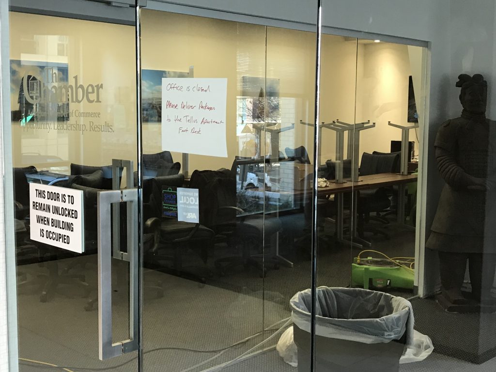
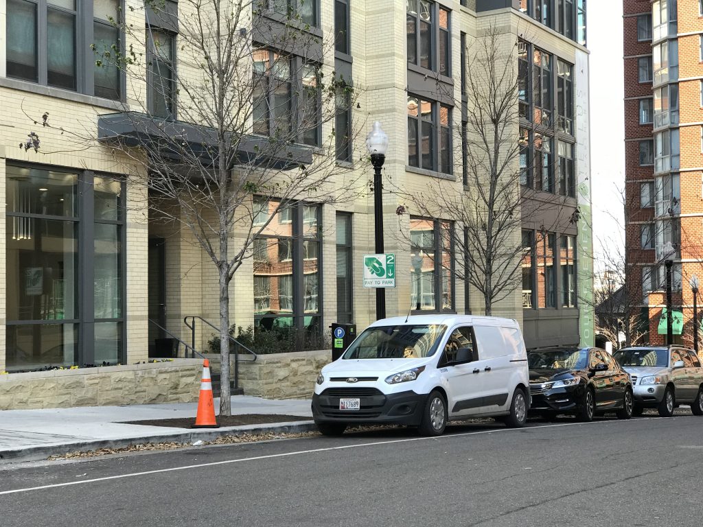
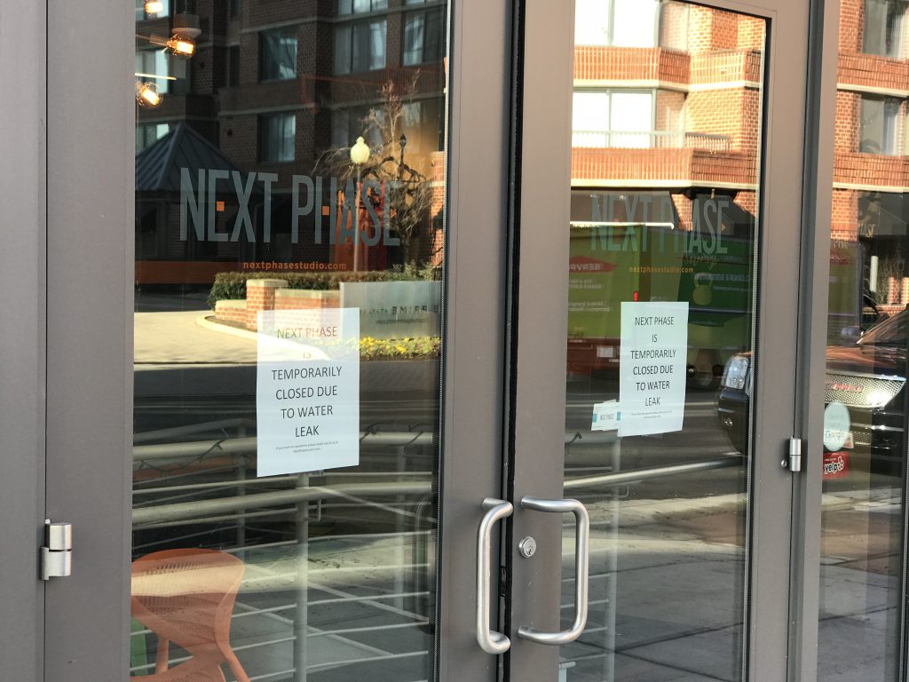
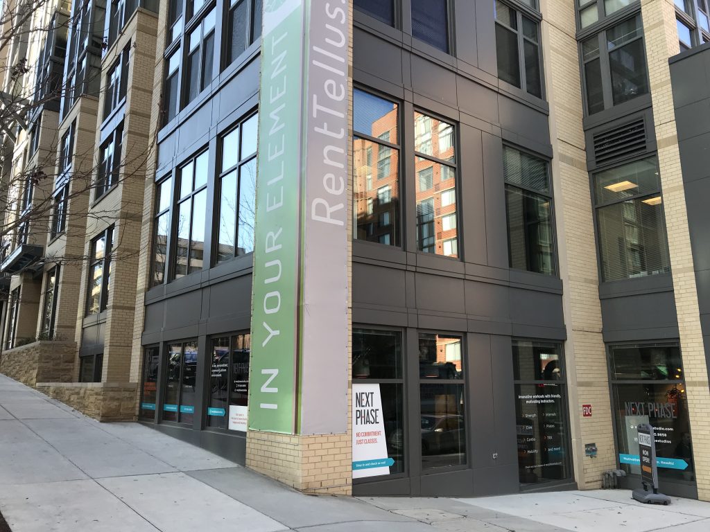
A burst water pipe in an apartment building has closed the offices of the Arlington Chamber of Commerce and the Next Phase fitness studio in Courthouse.

Restoration crews are currently on scene at the Tellus Apartments at 2009 14th St N., cleaning up the mess.

The flooding happened late Monday afternoon, when water started pouring into the offices “monsoon style,” we’re told. Chamber staff scrambled to unplug and save their computers and are currently working remotely as restoration efforts continue.

The Chamber, which has already received several offers of temporary office space, wrote the following to its members today:

The Chamber office is currently closed, due to flooding in our building, and our phone system is down. Our staff is busy handling this unexpected emergency and trying to keep Chamber operations going as best as possible. For assistance, please email full-time members of our staff, and we will do our best to assist you remotely. We apologize for any inconvenience and appreciate your patience and support.

Next Phase is closed and classes today cancelled, though its website still lists classes as available later in the week.


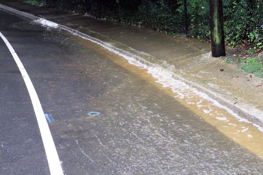
Tuesday’s heavy rains caused some flooding around Arlington, especially in the northern reaches of the county.

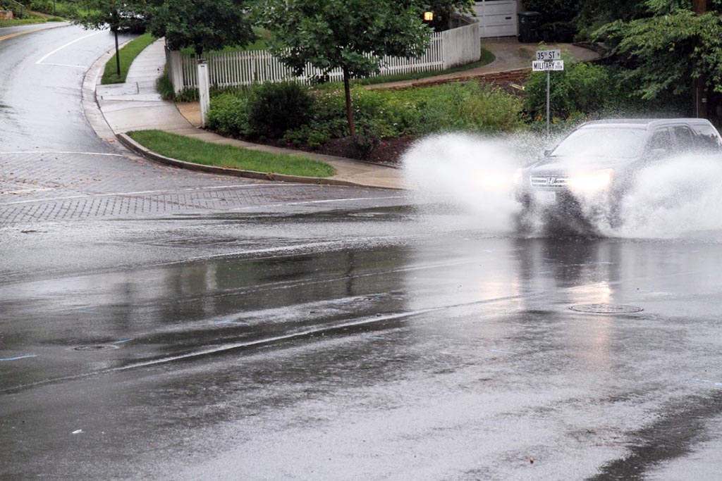
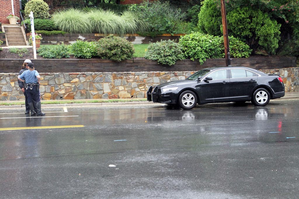
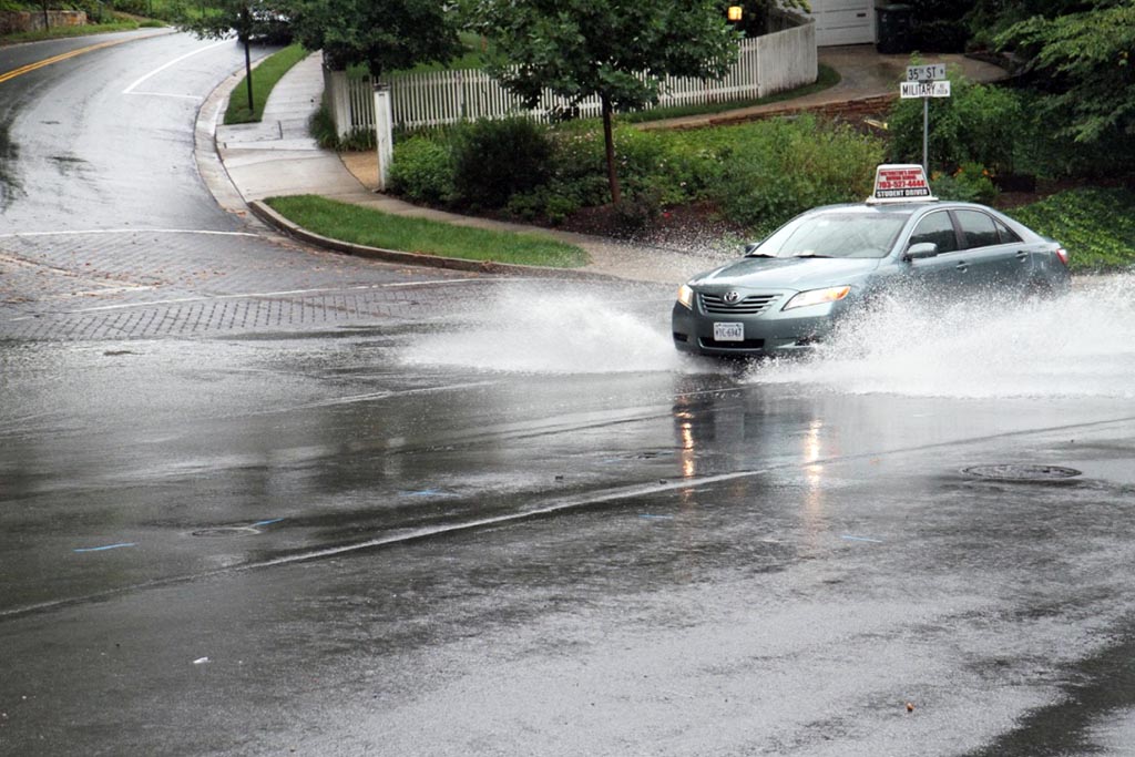
An overflowing storm drain brought elevated water levels to the intersection of Military Road and 35th Street N., where drivers had to contend with significant standing water following a slug of heavy rain this morning. Police were on scene, but there were no road closures.

An earlier report suggested higher, more hazardous water levels along Military Road while the rain was still falling.

Other areas of reported flooding included the area of Glebe Road and Chain Bridge and the intersection of Yorktown Blvd and N. Harrison Street — though no standing water was observed there when an ARLnow.com reporter drove by.

The National Weather Service warned earlier today about flash floods in the region, with the threat running through early afternoon. The heavy rain that brought flooding to Arlington appeared to bring more severe conditions to Northwest D.C., where residents posted photos and videos (below) of roads turned into fast-moving streams.

Arlington’s Dept. of Public Safety Communications & Emergency Management, meanwhile, reminded residents to “turn around and don’t drown” when encountering flooded roadways.


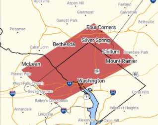
(Updated at 11:35 a.m.) Much of Arlington and portions of Fairfax County, D.C. and suburban Maryland are now under a Flash Flood Warning.

The National Weather Service issued the warning around 11:15 a.m. It is in effect through 2:15 p.m.

Forecasters say heavy rain may produce flooding. Already, some flooding issues are being reported in part of the county, including along Military Road in north Arlington and in the area of Glebe Road and Chain Bridge.

More from the National Weather Service:

THE NATIONAL WEATHER SERVICE IN STERLING VIRGINIA HAS ISSUED A * FLASH FLOOD WARNING FOR… THE NORTHWESTERN DISTRICT OF COLUMBIA… SOUTHEASTERN MONTGOMERY COUNTY IN CENTRAL MARYLAND… NORTHWESTERN PRINCE GEORGES COUNTY IN CENTRAL MARYLAND… ARLINGTON COUNTY IN NORTHERN VIRGINIA… NORTHEASTERN FAIRFAX COUNTY IN NORTHERN VIRGINIA… * UNTIL 215 PM EDT * AT 1114 AM EDT, DOPPLER RADAR INDICATED THUNDERSTORMS PRODUCING HEAVY RAIN ACROSS THE AREA. UP TO ONE INCH OF RAIN HAS ALREADY FALLEN. FLASH FLOODING IS EXPECTED TO BEGIN SHORTLY. * SOME LOCATIONS THAT MAY EXPERIENCE FLOODING INCLUDE… ARLINGTON, BETHESDA, LANGLEY PARK, BLADENSBURG, MCLEAN, HOWARD UNIVERSITY, FORT TOTTEN, ROSSLYN, HYATTSVILLE, TAKOMA PARK, KEMP MILL, CHEVY CHASE, SOUTH KENSINGTON, RIVERDALE PARK, FOREST GLEN, MARTIN’S ADDITIONS, NORTH CHEVY CHASE, FRIENDSHIP VILLAGE, GEORGETOWN AND BALLSTON.


Update at 4:25 p.m. — The Flash Flood Watch has been cancelled.

Arlington and much of the rest of the D.C. area is under a Flash Flood Watch today.

Heavy rain and storms are expected today. Rainfall rates of 1-2 inches per hours could produce flash flooding, forecasters warn.

More from the National Weather Service:

… FLASH FLOOD WATCH NOW IN EFFECT FROM 9 AM EDT THIS MORNING THROUGH THIS EVENING… THE FLASH FLOOD WATCH IS NOW IN EFFECT… * FROM 9 AM EDT THIS MORNING THROUGH THIS EVENING * MULTIPLE ROUNDS OF SHOWERS AND THUNDERSTORMS ARE EXPECTED TODAY WITH LOCALIZED HEAVY RAINFALL RATES OF 1 TO 2 INCHES PER HOUR POSSIBLE. * RUNOFF FROM EXCESSIVE RAINFALL MAY CAUSE RAPID RISES OF WATER IN LOW-LYING AND POOR DRAINAGE AREAS AS WELL AS STREAMS AND CREEKS, RESULTING IN FLASH FLOODING. URBAN AREAS WILL BE MOST SUSCEPTIBLE. PRECAUTIONARY/PREPAREDNESS ACTIONS… A FLASH FLOOD WATCH MEANS THAT CONDITIONS MAY DEVELOP THAT LEAD TO FLASH FLOODING. FLASH FLOODING IS A VERY DANGEROUS SITUATION. YOU SHOULD MONITOR LATER FORECASTS AND BE PREPARED TO TAKE ACTION SHOULD FLASH FLOOD WARNINGS BE ISSUED. &&


Today’s heavy rain has turned Four Mile Run into a raging torrent of murky water.

A Columbia Pike resident posted videos of the overflowing stream on Twitter this afternoon (Friday). The video was taken near S. George Mason Drive.

No major flooding problems were reported during the daytime Friday in Arlington, though forecasters warn that more rain may cause additional problems tonight.

There have, however, been scattered weather-related issues reported. A number of traffic signals have started flashing or gone dark and, as of 6:30 p.m., 165 Dominion customers were without power.

On N. Troy Street near Rosslyn, between Key Blvd and Wilson Blvd, a large tree fell on cars and power lines, according to scanner reports.

More videos of Four Mile Run, after the jump.

(more…)


Updated at 6:25 p.m. — The National Weather Service is warning of a continued threat of very heavy rainfall and flooding tonight.

Update at 3:20 p.m. — A new Flash Flood Warning has been issued for southern portions of Arlington.

Earlier: The National Weather Service has issued a Flash Flood Warning for Arlington, warning that flooding is “imminent” due to very heavy rain.

The Flash Flood Warning covers southern Arlington County, Falls Church, Alexandria, central Fairfax County and Fairfax city.

More from NWS:

THE NATIONAL WEATHER SERVICE IN STERLING VIRGINIA HAS ISSUED A * FLASH FLOOD WARNING FOR… THE CITY OF FAIRFAX IN NORTHERN VIRGINIA… SOUTHERN ARLINGTON COUNTY IN NORTHERN VIRGINIA… THE CITY OF FALLS CHURCH IN NORTHERN VIRGINIA… CENTRAL FAIRFAX COUNTY IN NORTHERN VIRGINIA… THE CITY OF ALEXANDRIA IN NORTHERN VIRGINIA… * UNTIL 230 PM EDT * AT 1024 AM EDT, DOPPLER RADAR INDICATED THUNDERSTORMS PRODUCING HEAVY RAIN ACROSS THE AREA. OVER TWO INCHES OF RAIN HAVE ALREADY FALLEN NEAR MERRIFIELD, WITH OVER ONE INCH IN MUCH OF THE REMAINDER OF THE AREA. ADDITIONAL RAINFALL AMOUNTS OF ONE TO TWO INCHES ARE POSSIBLE. FLASH FLOODING IS EXPECTED TO BEGIN SHORTLY. * SOME LOCATIONS THAT MAY EXPERIENCE FLOODING INCLUDE… ARLINGTON, ALEXANDRIA, RESTON, ANNANDALE, SPRINGFIELD, FAIRFAX, VIENNA, FALLS CHURCH, HUNTINGTON, MANTUA, PIMMIT HILLS, MCLEAN, POTOMAC, BURKE, OAKTON, LINCOLNIA, TYSONS CORNER, FRANCONIA, WOLF TRAP AND GREAT FALLS. THIS INCLUDES FLOOD PRONE LOCATIONS SOUTH TROY STREET NEAR LONG BRANCH… WEST STREET NEAR BRADDOCK ROAD… HOLMES RUN BELOW LAKE BARCROFT… WOODBURN ROAD AT ACCOTINK CREEK… BEULAH ROAD AT BROWNS MILL ROAD AT WOLFTRAP CREEK… FAIRFAX BOULEVARD AT OAK STREET… FAIRFAX BOULEVARD AT UNIVERSITY DRIVE… AND PICKETT RD AT ACCOTINK CREEK NEAR OLD PICKETT RD. PRECAUTIONARY/PREPAREDNESS ACTIONS… TURN AROUND, DON’T DROWN WHEN ENCOUNTERING FLOODED ROADS. MOST FLOOD DEATHS OCCUR IN VEHICLES. A FLASH FLOOD WARNING MEANS THAT FLOODING IS IMMINENT OR OCCURRING. IF YOU ARE IN THE WARNED AREA MOVE TO HIGHER GROUND IMMEDIATELY. RESIDENTS LIVING ALONG STREAMS AND CREEKS SHOULD TAKE IMMEDIATE PRECAUTIONS TO PROTECT LIFE AND PROPERTY. &&

https://twitter.com/ACFDPIO/status/890943656106094593

https://twitter.com/amelia_draper/status/890944643470430211

File photo


View More Stories