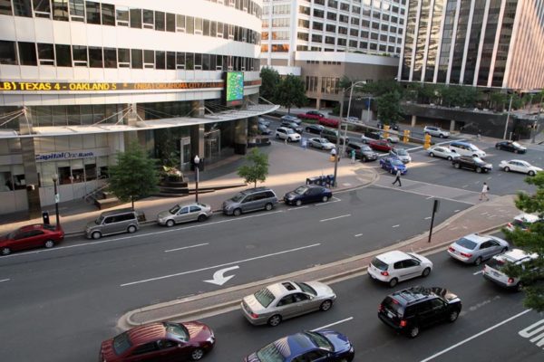
The county is moving forward with long-held plans to narrow lanes and widen sidewalks on Columbia Pike near the Penrose neighborhood, but not everyone is on board.

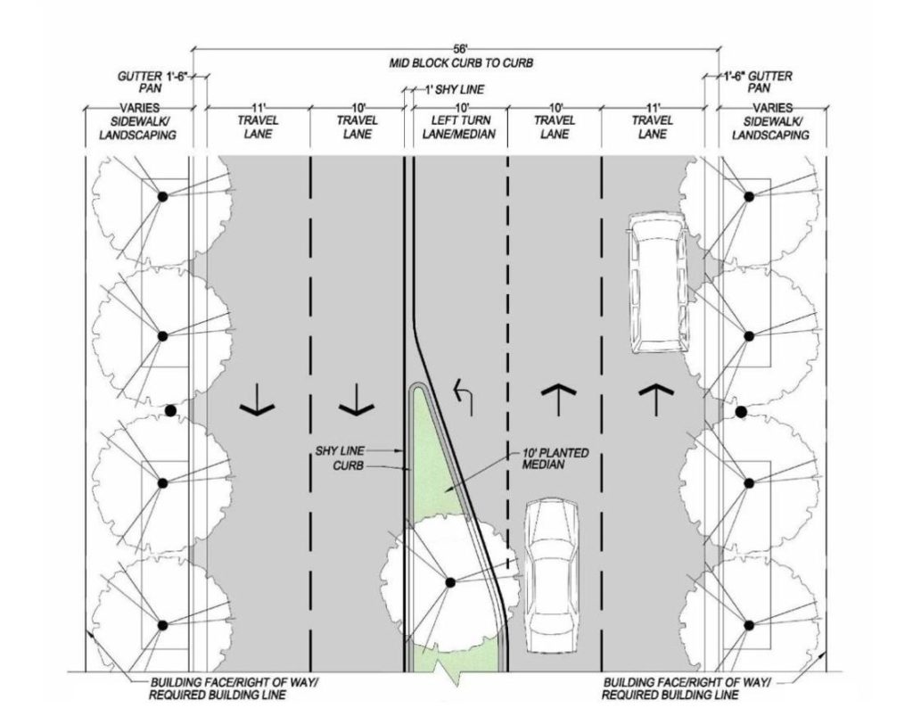
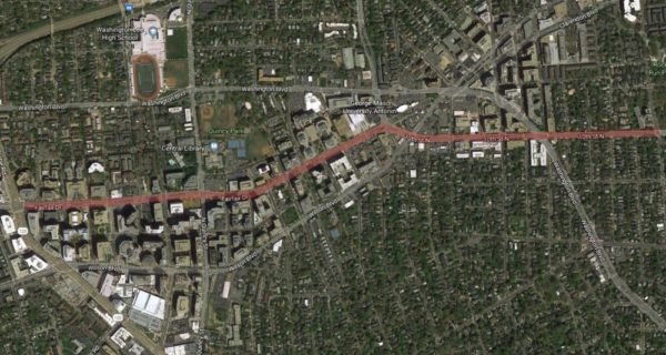
County staff presented an updated version of the plan last week to the Penrose Neighborhood Association. It calls for narrowing the lefthand travel lanes on the Pike east of S. Wayne Street down to 10 feet, and narrowing the righthand lanes, next to the sidewalk, to 11 feet.

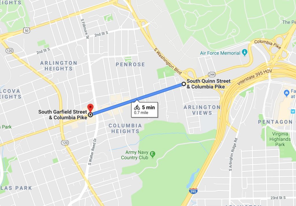
The project is slated for the section of the Pike between S. Garfield Street and S. Quinn Street, staff told ARLnow, and the total Columbia Pike right-of-way width is expected to remain 56 feet width.

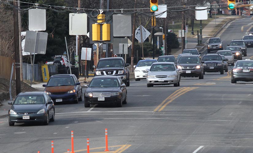
It’s also part of a years-long plan to improve the Pike and add more room for pedestrians and bicyclists. However, attendees at the meeting said they fear tighter lanes could mean trickier turning and more accidents for cars.

“The goal of the project is to make Columbia Pike a safer, more accessible route for all users by creating a balance between pedestrian, bicycle, transit and vehicle spaces,” said county transportation spokesman Eric Balliet in an email Monday.

Even after the presentation by the county, some local residents remained skeptical.

“No satisfactory or convincing reason was offered by the county regarding the plan to reduce the lane size,” said one man. “It is quite concerning that a main hub such as Columbia Pike is expected to suffer significant lane reductions that will likely create traffic backups and accidents.”

“At the meeting we discussed many scenarios, like could a school bus pass a garbage truck, could a Giant delivery truck make the turn into Adams Street, could an 18 wheeler pass a bus on the left,” Penrose Association President Maria “Pete” Durgan said, adding that county staff agreed to look into the questions.

Bailliet said the plan is based on “urban street design guidelines from the National Association of City Transportation Officials,” which “recommend that lanes should not be greater than 11 feet as they may cause unintended speeding and assume valuable right of way at the expense of other modes.”

Bailliet says the new lane widths have also already been rolled out in other parts of the Pike, including on the sections between:

  • Four Mile Run and S. Wakefield Street
  • S. Oakland Street and S. Garfield Street
  • Washington Blvd and Columbia Pike interchange

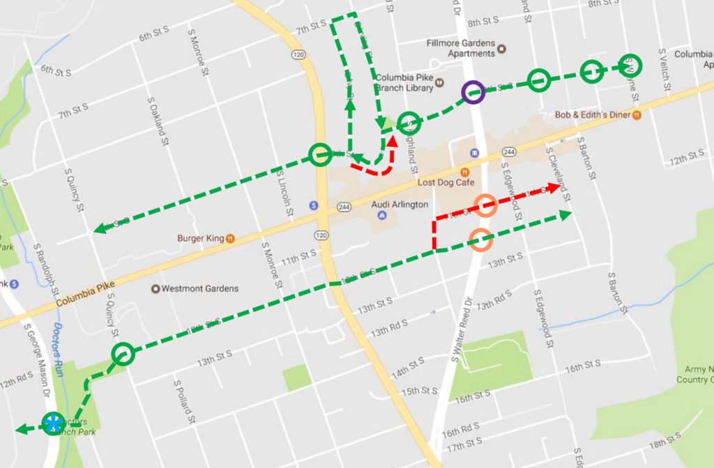
The plan was listed in the the bike component of the county’s Master Transportation Plan, which the County Board updated last week. In it, the county said it intends to build “wide multi-use trails, or wide sidewalks, along at least one side of Columbia Pike in the areas east of S. Wayne Street and west of Four Mile Run” for bikes and pedestrians to share.

“It is tackling a tough question,” the Penrose Neighborhood Association’s website said of the revised lanes. “With only a limited amount of right-of-way, how should that space be allocated? Turn lanes? Street Trees? Wider sidewalks? Bike lanes?”

The reason to widen the sidewalks, Bailliet said, was in part to allow a more vibrant and business-friendly streetscape, but also partially to provide a way for cyclists to connect with the designated bike boulevards that run parallel the Pike.

(more…)


Plans are coming together for a major transformation of Rosslyn’s streets, as county officials advance a series of proposals designed to someday make the neighborhood a bit more friendly to cyclists and pedestrians.

The county is holding a public meeting tomorrow (Wednesday) to unveil a newly revised design for the future of Rosslyn’s street network. Known as the “Core of Rosslyn” study, planners have been working since 2017 to finalize a redesign of the neighborhood that comports with the “Rosslyn Sector Plan” the County Board adopted in 2015.

Some of the proposed changes, revealed in detail last fall, are quite substantial.

Perhaps the largest one is the removal of the Fort Myer Drive tunnel under Wilson Blvd, transforming it into a traditional at-grade, signalized intersection. The county could also follow through on long-contemplated plans of building a car-free, “pedestrian corridor” running from 18th Street N.’s intersection with N. Oak Street to N. Kent Street, replacing the Rosslyn skywalk system to make the Metro station more accessible.

Another major change included in previous proposals was the conversion of N. Fort Myer Drive, N. Lynn Street and N. Moore Street into two-way streets. But officials are now rolling out a revised set of plans that would keep the latter two streets as one-way roads, after hearing feedback from the community on the study.

Planners have indeed seen Lynn Street as a particularly challenging option for opening up to two-way traffic. Though officials expect the change would make things a bit less confusing for drivers, it would also force the county to find new access points to the G.W. Parkway, I-66 and the Key Bridge.

Other proposed changes include 14 new or improved crosswalks for pedestrians, and more than 1.3 miles of new protected bike lanes. Those are largely set to run along Fort Myer Drive, N. Moore Street and N. Nash Street, and are designed to ease bike connections to the Key Bridge and the Mt. Vernon and Custis Trails.

The public meeting on the “Core of Rosslyn” plans is set for the Observation Deck at CEB Tower (1800 N. Lynn Street), located on the 31st floor of the massive office building, tomorrow from 4-7 p.m.

The county hopes to have final results of the study ready for consideration sometime this summer.

File photo


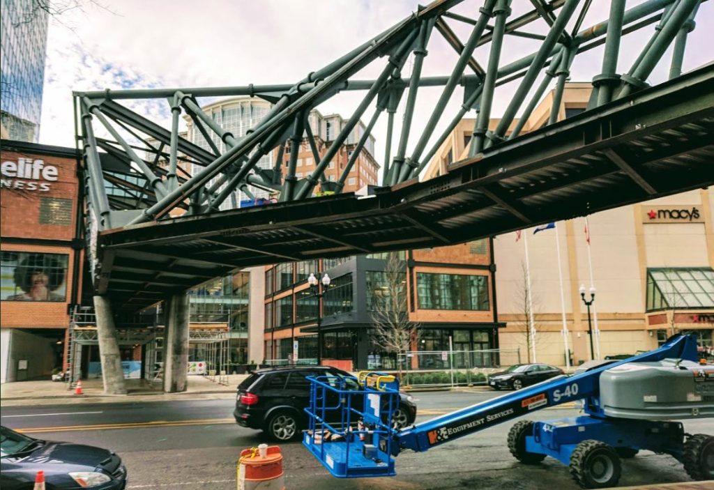
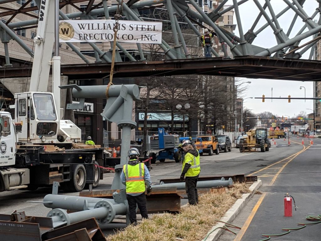
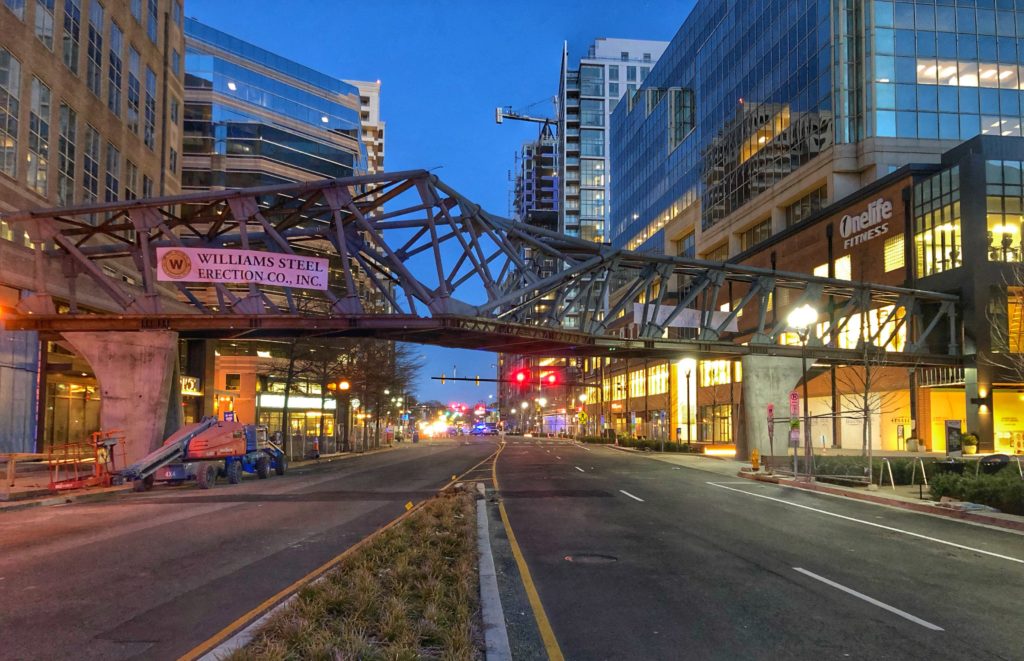
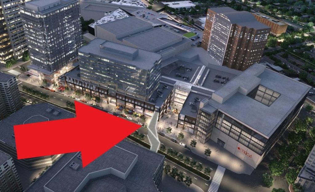
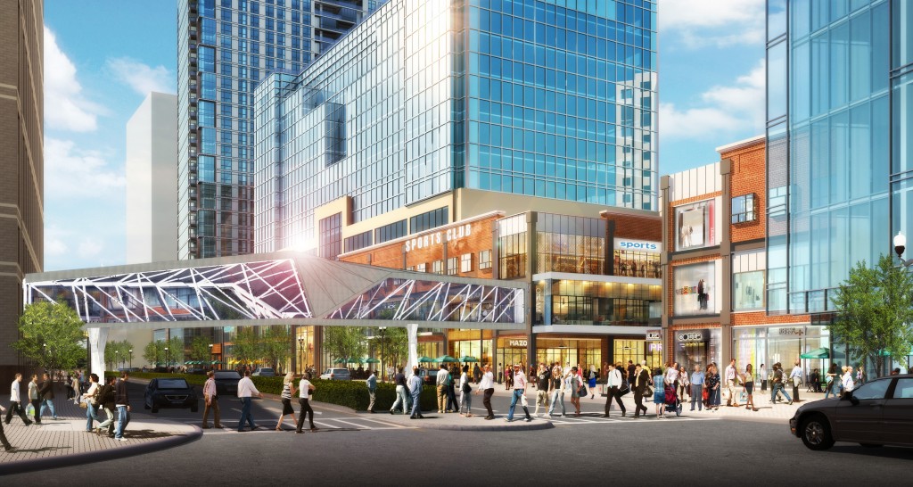
Construction work on the Ballston Quarter pedestrian bridge will prompt yet more road closures tonight (Friday), but the more extensive work set for weeknights is on hold for a bit.

For the second straight week, workers plan to close Wilson Blvd between N. Randolph and N. Stuart streets starting at 8 p.m tonight through Sunday at 6 p.m.

Workers lifted the bridge’s frame into place over Wilson last month, where it will eventually connect the newly revamped Ballston Quarter development with the neighborhood’s Metro station, running through the Ballston Exchange development at 4201 Wilson Blvd.

However, the four months of work set to snarl traffic in Ballston on weeknights is on hold, county officials announced this week. They’d originally planned to start closing the eastbound lanes of Wilson Blvd to allow for more glass installation on the bridge starting Monday night.

“Due to recent inclement weather, installation work on the pedestrian bridge was delayed,” Will Voegele, senior vice president for mixed-use development at Brookfield Properties (the company that bought Ballston Quarter developer Forest City) wrote in a statement.

“Barring any additional weather-related delays, construction will continue to move forward as scheduled,” he added.

The county says that weeknight closures will now begin on March 17. From 8 p.m. to 6 a.m. each night, the eastbound lanes of Wilson Blvd will be off-limits to drivers for the next eight weeks. Then, they’ll close the westbound lanes for another eight weeks.

This is far from the first delay for this project, or Ballston Quarter as a whole. Forest City had originally hoped to have the bridge open in time for stores to begin opening at the development this fall, before pushing back construction for months.

The developer has also missed its own targets for opening some stores to customers, and it’s currently unclear where things stand with its new food court. A few restaurants are now open in the new “Quarter Market,” but it’s unclear when the full, 14-restaurant food hall will be ready.

Photo 1 via @ArlingtonDES


Rosslyn is set to see a few more pedestrian safety improvement over the course of the next year or so.

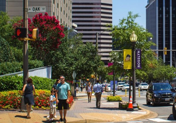
The neighborhood’s Business Improvement District, which advocates for Rosslyn businesses by collecting a small property tax, is planning a variety of short-term fixes to make the bustling streets a bit safer for walkers.

In plans delivered to the County Board Saturday (Feb. 23), the BID says it hopes to use some of its tax revenue to work with county police on the fixes, as part of a broader initiative to make the area more walkable. County officials have even contemplated the more drastic step of make certain roads in Rosslyn “car-free,” though they have yet to settle on a precise strategy for the neighborhood beyond some guiding principles.

In the short term, the BID plans to build new “crash-grade planters to help delineate safer pedestrian crossings” at several intersections. Many of the roads crossing Wilson Blvd are often the site of robust crowds in the morning and evening rush hours.

The BID also hopes to expand some of its “wayfinding” efforts “that will eventually encompass not only pedestrian signs, but also traffic signage” to better brand each section of Rosslyn. The BID has already done some work in that department, setting up area maps, and even rolling out efforts to improve green space in the area, including the county’s first “parklet.”

In the long term, the BID plans to continue to work on efforts to someday convert streets like N. Fort Myer Drive, N. Lynn Street and N. Kent Street into two-way roads, though those changes are still a ways off.

Other, more ambitious efforts could someday remove the Fort Myer Drive tunnel under Wilson Blvd, or replace the existing Rosslyn skywalk system in favor of an all-pedestrian and cycling corridor leading up to the area’s Metro station. Some new developments in the area could help spur progress on the latter effort.

But all of these changes won’t be on the way until the new fiscal year, according to the BID’s proposal. The group is also asking the Board to hold its tax rate on local businesses level at $.078, though ever-rising real estate values will send the BID an extra $166,000 in revenue from a year ago.

Photo via Rosslyn BID


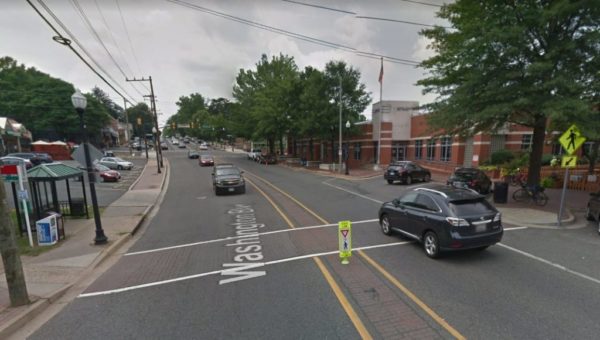
(Updated at 11:30 a.m.) Washington Blvd is about to get a bit of a makeover as it runs between Bluemont and Westover, and county officials are looking for some input on potential changes for the area.

VDOT is planning on repaving the road between its intersection with N. Frederick Street and N. McKinley Road later this summer.

As part of that process, workers expect they’ll remove the brick crosswalks and median in the Westover area, as the road runs between N. McKinley Road and N. Longfellow Street. The county is currently working to replace all of its so-called “brick pavers” across Arlington in favor of crosswalks that are both easier to maintain and a bit more visible at night.

Accordingly, the county is looking to accept feedback on what sort of road features could replace those and make the area a bit safer for pedestrians and cyclists. Officials are holding an open house tomorrow (Wednesday) at the Westover Branch Library (1644 North McKinley Road) from 6-7:30 p.m. to accept suggestions.

The county is hoping to make it a bit easier to access the library, the nearby Post Office and the area’s popular businesses, like the Westover Beer Garden and the Italian Store.

“The county is considering several re-striping options, including high visibility crosswalks, bike treatments, and a limited change option,” staff wrote on the county’s website.

That should come as good news for some neighbors concerned about pedestrian safety in the area, especially after a driver struck an elderly woman with a car in a Westover crosswalk in November.

The county is also examining some potential improvements as the road runs between Westover and East Falls Church, including some new bike lanes, additional pedestrian crossings and clearer markings for existing crossings.

Officials are also planning on holding a “pop-up” engagement session at the Westover Farmer’s Market in the library plaza Sunday (March 3) if you can’t make this week’s meeting. Starting later this week, the county will also accept online comments through the end of March on its website.

Photo via Google Maps


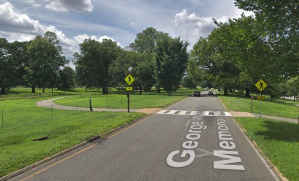
A driver struck a woman with their car while she was crossing the G.W. Parkway just south of the Arlington Memorial Bridge yesterday (Thursday), in what’s long been a troublesome stretch of road for pedestrians.

The woman was in the middle of a crosswalk just south of the bridge at the time of the incident, according to U.S. Park Police spokesman Sgt. Eduardo Delgado.

The crash happened around 11 a.m. yesterday, and the woman suffered “non-life threatening injuries,” Delgado said.

Police believe that the right lane of traffic had stopped for the woman, but a vehicle in the left lane didn’t, Delgado added. Arlington Fire Department spokesman Ben O’Bryant said the woman was conscious when first responders arrived, and she was transported to a local hospital “in good condition.”

The stretch of the parkway leading up to the bridge has often been the scene of dangerous crashes involving pedestrians. Officials estimate that the area saw approximately 600 crashes between 2006 and 2012 alone.

Park officials are even in the process of weighing a variety of changes along the parkway and the nearby Memorial Circle to make them a bit safer for pedestrians.

In fact, some of the potential improvements would target crosswalks on the parkway south of the bridge, like making them a bit more visible for drivers or even narrowing the parkway to one lane as it approaches crosswalks.

Photo via Google Maps


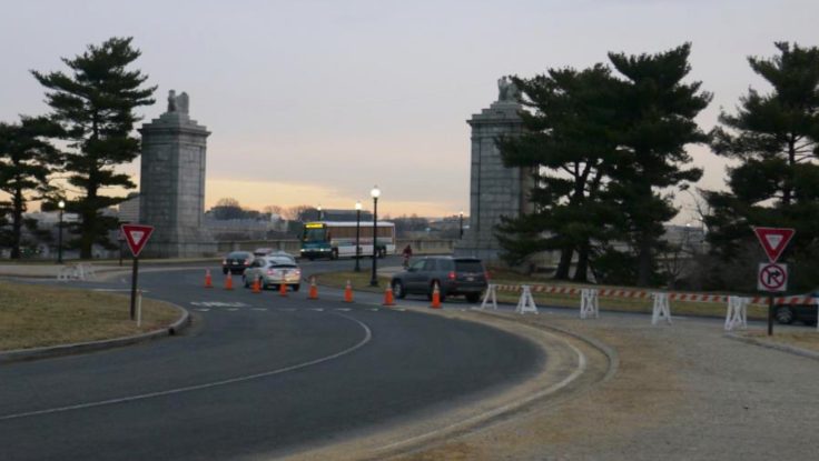
Transportation officials are proposing a host of safety improvements for Memorial Circle, a confusing confluence of roads connecting Arlington National Cemetery to the Arlington Memorial Bridge.

The circle has long been the site of all manner of dangerous crashes, particularly those involving cyclists and pedestrians looking to access the nearby Mt. Vernon Trail or cross into D.C. But the National Park Service has drawn up a series of changes for the roads in the area designed to address the issue, including traffic pattern changes to transform the circle into something more like a traditional roundabout.

“The project area is at a major convergence of regional roadways and modes that interact through a complex series of roadway merges (on-ramps), weaves, diverges (off-ramps), and intersections, resulting in traffic congestion and crashes,” NPS planners wrote in a November environmental assessment. “The proposed action would change the way area users access and circulate through the area by car, bicycle, or foot.”

Officials estimate that the area saw approximately 600 crashes between 2006 and 2012. Lawmakers previously secured some safety improvements for the G.W. Parkway and the circle to try to address the issue. The new NPS proposal would address not only the circle itself, but also the roads approaching the area from both the north and south: S. Arlington Blvd and Washington Blvd.

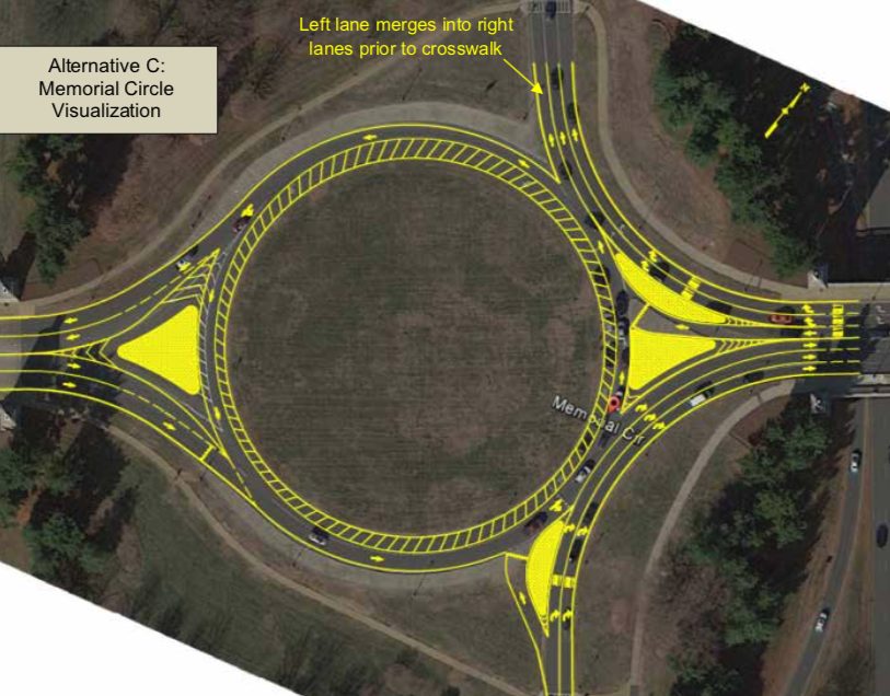
Perhaps the most substantial change park officials are proposing would be cutting back on one lane of traffic in the circle, in order to “allow the circle to function more like a modern roundabout,” the NPS wrote. That means that drivers in the circle would have the right of way, and anyone entering the circle would need to yield to them.

The NPS also plans to split up an island on the east side of the circle, near where it meets the Memorial Bridge, allowing two westbound lanes coming from the bridge to “bypass the circle and head north onto S. Arlington Boulevard” and one lane of traffic to proceed and enter the circle.

For roads north of the circle, officials are proposing some improved signage at the various intersections, including “fluorescent yellow advance pedestrian crossing warning signs” at some and “rapid flashing beacon” signs at others.

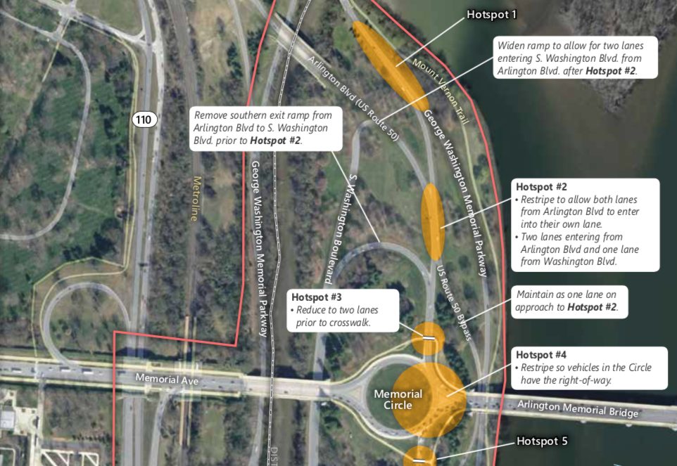
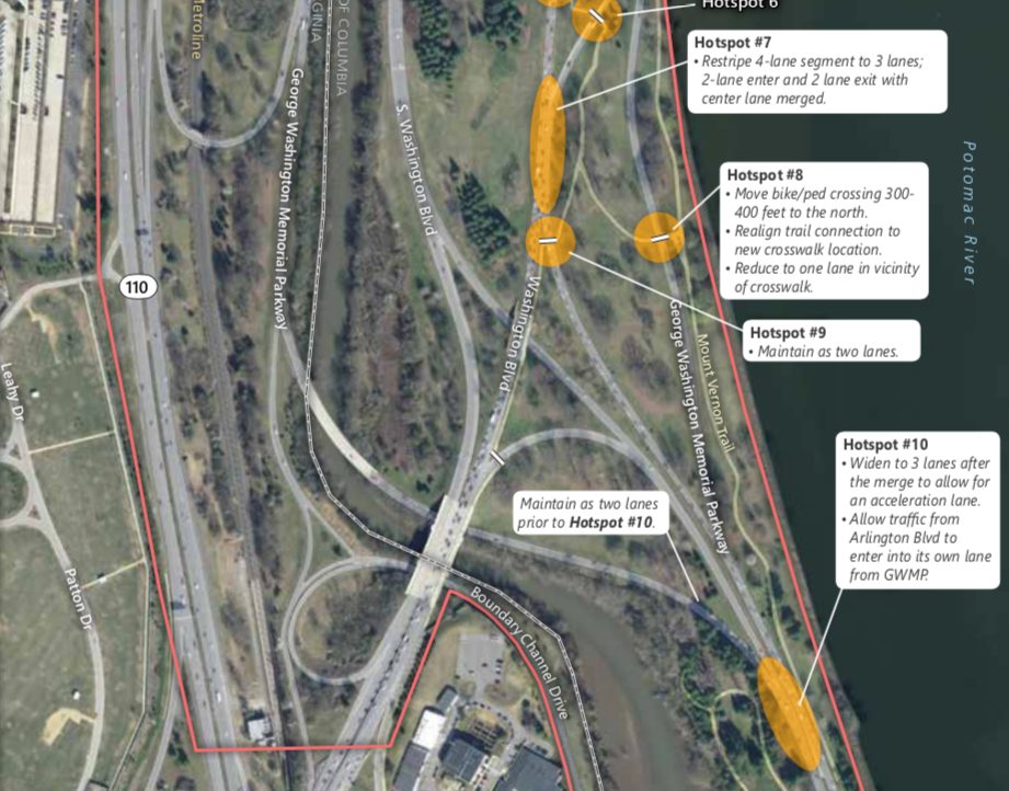
But they’re also envisioning more dramatic improvements, like reducing Washington Blvd down to one lane, and removing both the “existing southern exit ramp connecting S. Arlington Blvd and S. Washington Blvd” and “the existing far left exit lane of S. Arlington Blvd.”

As S. Arlington Blvd exits the circle, the NPS also envisions reducing the road from three lanes down to two leading up to the crosswalk. The existing far left lane leading onto a ramp to S. Washington Blvd is slated to be removed, as is the exit ramp itself.

The NPS is planning similar pedestrian sign improvements for intersections south of the circle, as well as other lane reductions.

One major change would be the construction of a new concrete island where Washington Blvd enters the circle to its south, allowing two lanes of the road to bypass the circle and reach the Memorial Bridge, and one lane to enter the circle. That would require a slightly widening of the road in the area, the NPS wrote.

The plans also call for Washington Blvd to be reduced from four lanes to three south of the circle “in order to simplify merging patterns,” while the G.W. Parkway would be widened “to add an acceleration lane allowing traffic from Arlington Blvd to enter the parkway in its own dedicated lane before merging onto the two-lane parkway.”

Additionally, the NPS envisions relocating two bike and pedestrians crossings south of the circle. One, located as a trail crossing Washington Blvd, “would be relocated closer to the Circle, to allow pedestrians and bicyclists to cross where vehicle speeds are slower and where drivers are anticipating conflicts.” The other, designed to help people cross the parkway to the southeast of the circle, would be moved slightly further north of the parkway.

The NPS traffic analysis of these proposed changes suggest they’d generate “an overall improvement” in congestion on the roads, in addition to substantial safety upgrades.

People in the bicycling community are pretty skeptical of the latter assertion, however.

The NPS is accepting comments on the plans through Dec. 29.


A woman was struck by a car and suffered serious injuries as she crossed the street in Westover earlier this month, convincing neighbors of the urgent need for safety improvements in the area.

County police spokeswoman Ashley Savage told ARLnow that a pedestrian was in the middle of a crosswalk along the 5900 block of Washington Boulevard around 6:30 p.m. on Nov. 10, when a vehicle ran into her. The area is home popular businesses like the Westover Beer Garden and the Italian Store.

Savage says the woman was “transported to an area hospital with serious but non-life threatening injuries.” Police also issued a warning summons to the driver “for failure to yield the pedestrian right-of-way,” but otherwise didn’t pursue criminal charges.

Stephanie Gordon, who lives right behind the scene of the incident on N. Lancaster Street, says she remembers seeing the immediate aftermath of the crash. She subsequently learned that the woman who was struck is one of her neighbors: Virginia Fairbrother, a 30-year Westover resident.

Fortunately, Gordon says she’s since heard that Fairbrother has been released from the hospital and is recovering from her injuries. But the crash only underscores her conviction that the Westover area desperately needs some traffic and pedestrian safety changes.

“Westover is a bit of a valley, so cars can pick up speed either way as they’re driving,” Gordon said. “I feel bad for both drivers and pedestrians, because I don’t think drivers, even if they want to stop, are aware of a crosswalk there. A lot of times cars just speed through and won’t even see you.”

Gordon says her father, another Westover resident, brought some of these concerns to the county more than a year ago, but the neighborhood still hasn’t seen many changes.

She’d much rather see more reflective crosswalks installed on Washington Boulevard, or perhaps improvements to the “dinky little signs” marking the pedestrian crossings. The county is currently planning on some improvements as the road runs between Westover and East Falls Church, including some new bike lanes, additional pedestrian crossings and clearer markings for existing crossings. Transportation officials have spent the past year collecting traffic data on the area, with plans to implement those in the coming months.

Gordon would also be in favor of the county dropping the speed limit to 25 miles per hour down from the current 30, and hopes that this latest crash will spur Arlington officials to examine that possibility in particular.

“My neighbors and I have been saying for a while that it was just a matter of time before someone was hit by a car crossing Washington Blvd,” Gordon said. “It’s just crazy that it’s so fast, when people are frequently walking across the street.”

Photo via Google Maps


County officials are planning some improvements along Fairfax Drive and 10th Street N. as the roads run from Ballston to Clarendon, with a special focus on ways to make the corridor safer for drivers, pedestrians and cyclists alike.

Arlington transportation planners are circulating a survey seeking feedback on how the roads should change, as the county weighs a series of modest improvements over the next few months. In all, the study area stretches from Fairfax Drive’s intersection with N. Glebe Road in Ballston to 10th Street N.’s intersection with N. Barton Street in Lyon Park.

The county is envisioning changes along the 1.5-mile-long stretch of road as “short-term, quick-build projects to enhance safety and mobility on the corridor.” Officials hope to eventually commission more expansive changes, after it took over management of the roads from the state this summer, but the county’s budget crunch means that options are limited, for now.

But, in the near term, the county plans to examine “multimodal traffic volume data, curbspace use, crash data, and transit service data” in addition to the community’s feedback to chart out small-scale changes, according to a project webpage.

The advocates with the group Sustainable Mobility for Arlington County certainly have some suggestions for the corridor. The group sent an email to its members urging them to advocate for the transformation of Fairfax Drive into a “low-stress biking corridor, even if it requires re-purposing space from motor vehicles,” in addition to other cycling improvements.

“The existing Fairfax Drive bike lanes are narrow, frequently blocked, and fail to be low-stress due to fast-moving traffic,” the advocates wrote. “The existing, short two-way protected bike lane should be extended all the way from Glebe Road to Clarendon Circle.”

The group also argues that 10th Street N. and Fairfax Drive both lack safe road crossings, particularly as the corridor runs from N. Barton Street in Lyon Park to N. Monroe Street in Virginia Square.

“This makes the corridor a barrier,” they wrote. “Additional safe crossings should be provided and these crossings must be simple and easy to use for cyclists as well as pedestrians.”

The county survey on road improvements will be open for submissions through Dec. 16. Officials hope to have short-term recommendations ready by sometime early next year, then install those by the spring or summer of 2019.

Photo via Arlington County


Virginia Hospital Center executives believe they’ve satisfied all the demands of Arlington officials in drawing up revised plans for the facility’s $250 million expansion, setting the stage for the project to move ahead as soon as this week.

The County Board is set to consider the matter once again tomorrow (Tuesday), after delaying a decision on the hospital’s expansion back in September. The Board laid out a series of specific changes it hoped to see from the hospital as it embarks on the project, which is designed to add 101 hospital beds and a new outpatient facility to match rising demand in the county, and urged VHC leaders to smooth over its rocky relationship with some people living near the existing campus at 1701 N. George Mason Drive.

The Board initially envisioned taking up the matter next month, but VHC leaders were enthusiastic enough about their progress that they pushed for a vote at Tuesday’s meeting instead.

Adrian Stanton, the hospital’s vice president for business development and community relations, says VHC officials have spent last few months convening “a series of public meetings with community members, as well as with neighborhood civic associations adjacent to the hospital,” to craft new designs for the expansion, leading to his renewed optimism for the project’s prospects.

“These discussions have been open, honest, and productive,” Stanton wrote in a statement. “As a result of this progress, we asked to present a revised plan to the Board during its scheduled Nov. 27 meeting. We are grateful that we have been granted that opportunity, and remain hopeful that we will be presenting a plan that is acceptable to all parties involved.”

The chief concern of the hospital’s neighborhoods, county planners and Board members alike is how the VHC’s new buildings will fit into the community. The hospital is hoping to add a 230,000-square-foot, seven-story outpatient facility and a 10-story parking garage, and critics of the original design worried those additions would effectively wall off the hospital from the single-family homes surrounding it.

Accordingly, the Board’s requests for changes centered around improving the facade of the garage and adding more pedestrian connections to (and through) the site, to make it feel more accessible. And, per details laid out in a new report prepared by county staff, the hospital seems to have made all the tweaks the Board was envisioning.

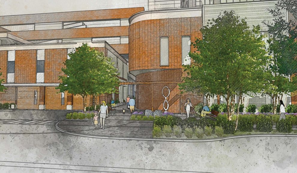
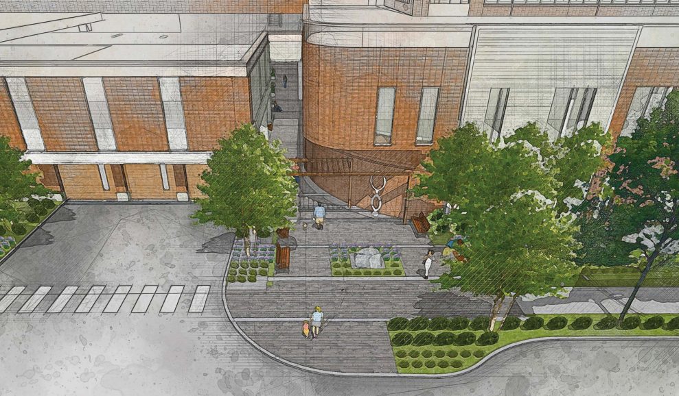
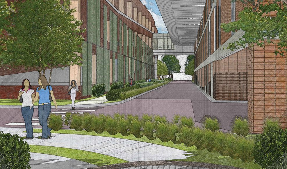
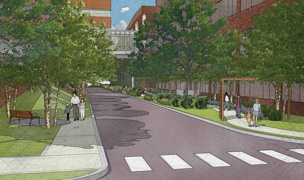
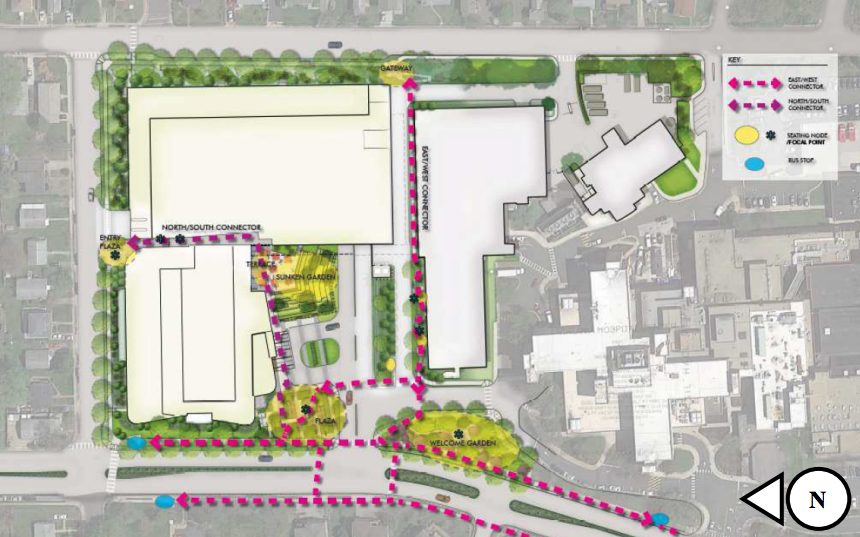
For the new parking garage, the hospital now plans to add “vertical mesh screens” and vary its “brick colors and pattern to provide visual interest,” the report says. The hospital also will eliminate one of the garage’s entrances from along a service road running horizontally through the property, and relocate a sidewalk to the south side of that road to provide a more accessible “east-west” connection through the site.

VHC officials also hope to provide a better north-south pedestrian walkway through the property, creating a corridor that runs from 19th Street N. to connect to both the garage and the new outpatient building. In tandem with that change, the hospital proposes “rounding the corner of the outpatient building to improve sight lines for pedestrians and to soften the edge of the building” so that there’s “no longer a continuous line of buildings for the entire length of 19th Street N.,” staff wrote.

According to the report, representatives with the John M. Langston Citizens Association initially expressed some concern that the walkway revisions still weren’t quite what the Board had requested, but the hospital altered its plans slightly to meet those worries.

Additionally, the hospital will add other features neighbors requested over the last few months of meetings, including new pedestrian safety devices like a rapid flashing beacon at the intersection of N. George Mason Drive and 19th Street N.

All of the hospital’s proposed changes will slightly reduce the capacity of the new parking garage, however, after it already agreed to a hefty cutback in spaces in a bid to ease the concerns of transit advocates. In all, the garage is set to see a reduction about 46 spaces if the Board signs off on these changes, for a total of about 1,694 spaces.

While the design changes may well meet the Board’s standards, they’re unlikely to satisfy all the hospital’s critics. Many neighbors remain concerned about the height of the new buildings, and county planners have urged the Board to require the hospital to adhere to a more robust long-range planning process — the hospital is planning a full redevelopment of its campus in the long term, but can only kick off those plans once it executes this expansion.

The Board will get a chance to have its final say on the matter Tuesday — the public hearing on the issue is closed, setting the stage for an up-or-down vote. Should the Board approve the plans, at long last, the county will sign over a parcel of land along N. Edison Street to power the expansion, and receive a coveted property on S. Carlin Springs Road from the hospital.

The Board will also review a $500,000 grant to set up a new pilot program and expand mental health services at the hospital. The program would empower a new specialist to divert kids and teens arriving at the hospital with behavioral health issues into treatment programs, in order to prevent them from experiencing more serious problems in the future or getting caught up in the criminal justice system.


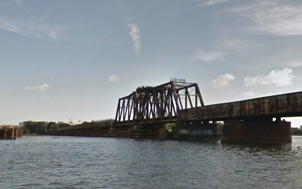
A coalition of businesses, neighborhood groups and transportation advocates are urging planners to include a bike and pedestrian trail along the long-planned replacement for the Long Bridge, a key railroad connection from Virginia into D.C.

A total of 15 organizations from Arlington, the District and the rest of the metropolitan Washington region penned a new letter last Thursday (Nov. 1) to both local and federal transportation officials working on the project, calling the inclusion of a trail alongside the bridge part of “a once in a generation opportunity to transform our regional transportation network.”

Planners are still sorting out exactly what the new bridge might look like. The original structure, which runs from near the Pentagon in Arlington to Southwest D.C., was built back in 1904, and officials from around the region have viewed replacing it as a necessary step for improving freight and passenger rail service between D.C. and Northern Virginia.

However, the prospect of including a trail alongside the new Long Bridge was not formally included in the various assessments of potential designs of the project. Accordingly, the group penning the letter sought to emphasize the benefits such a trail could have for the region’s commuters, and its economy.

The organizations — which include the Crystal City Civic Association, Friends of Long Bridge Park, the Washington Area Bicyclist Association, and Greater Greater Washington — stressed that any new trail crossing the Potomac River would provide “crucial links to several important regional trails.” The current crossing along the 14th Street Bridge does not offer a connection to the regional trail network on the D.C. side. of the bridge, and the friends group supporting the Mt. Vernon Trail co-signed the letter.

The groups also stressed that such a trail would spur economic development “by linking two key activity nodes in Southwest D.C. and Crystal City.” That goes doubly so if officials also follow the groups’ recommendation that the trail “connect to the esplanade in Long Bridge Park” and “extend as far towards L’Enfant Plaza as physically possible” on the D.C. side.

Perhaps most importantly, the letter urges that the trail “be funded and constructed concurrently with the rail component of the Long Bridge project,” and that it “should be incorporated into the design of the broader project in a way that optimizes the achievability of the project with regard to cost and complexity.”

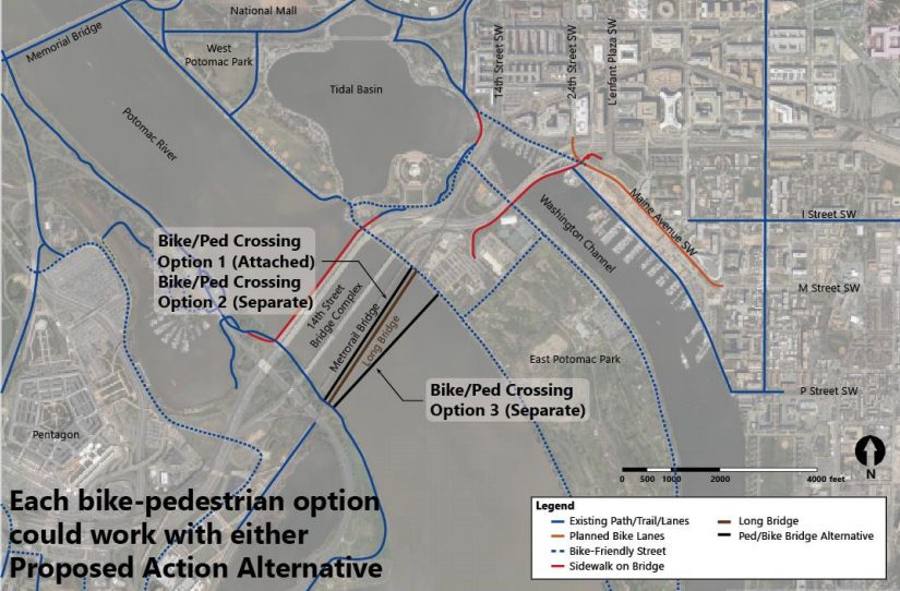
In a draft of an environmental impact statement prepared in late June, federal and local planners stress that any trail is “not part of the purpose and need” of the project. Even still, they agreed to include the study of four potential trail crossings in more detailed studies of the project to be completed over the coming months.

Planners have so far narrowed potential designs of the bridge replacement down to two options; both involve building a new, two-track bridge alongside the existing structure, but one alternative calls for the current bridge to stay in place and the other would involve fully replacing it.

Two of the trail designs call for building the crossing alongside the new bridge. Two others call for building the trail along its own, independent bridge: one proposal envisions it being upstream of the new two-track bridge, another would be downstream.

The transit advocates at Greater Greater Washington have expressed doubts about these proposals in the past, arguing that the designs “do the bare minimum” and represent a missed opportunity for planners. However, officials did agree to examine trail crossings over the Long Bridge Park side of the G.W. Parkway, “with an evaluation of connections to the Mount Vernon Trail and Ohio Drive S.W.,” two features that were previously championed by Greater Greater Washington.

Even still, there remains no guarantee that the trail will indeed be included in the project — the June report notes that Virginia rail officials noted “noted that the primary focus of the project is increasing rail capacity, and expressed significant concerns regarding safety and constructability of any combined-mode structure.”

Planners are still a long ways off from finalizing designs, however. The first step is settling on a single “preferred alternative” to examine in more detail, which planners hope to do within the next two months.

Officials then hope to have engineering and environmental analyses drawn up by summer 2019, and the project still needs additional funding. Virginia officials and the rail company CSX, which owns the bridge, have committed to chip in a total of $30 million for the effort, though there’s no telling just how much the bridge replacement might ultimately cost.


View More Stories